Talking about (poor) connectivity at ITA17

I just got back from a trip to Glyndwr University in Wrexham where I gave a keynote talk “Communicating in Wales: design and architecture for mobile applications over poor connectivity” at the Internet Technology and Applications conference (ITA17).

This was primarily about the ways that developers can design applications so that they avoid some of the worst user experience problems in areas of low or broken connectivity … which includes most of the coast of Wales, and indeed remote, or poor areas across the country.

However, this is only necessary because there is poor connectivity in the first place, a situation visitors from many other countries cannot understand.  In the UK we have decided that mobile and land-based internet access is largely a matter of market forces, with token gestures at helping rural areas.  Even though things have improved over the years, the gap between the access available in major urban areas vs that available in rural areas, or even poorer parts of cities is still large.

As I was quoted in a press release:

“It is unbelievable that in a country whose future success in the world depends on being a high-value knowledge economy, we regard internet access as a privilege of the rich.”

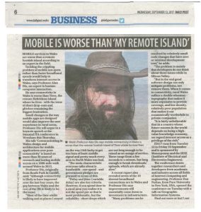
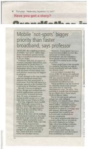
This key public policy issue was picked up in the press (Daily Post and The Leader):


I was also interviewed for BBC Radio Wales on the Good Morning Wales programme:

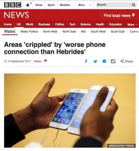
and there is an article based on this on BBC News website:

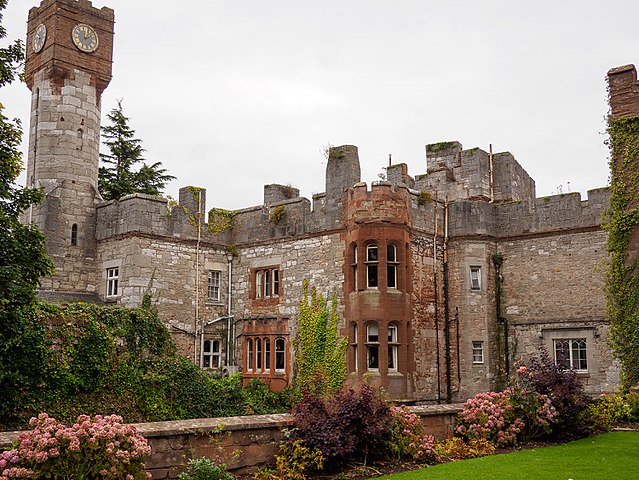
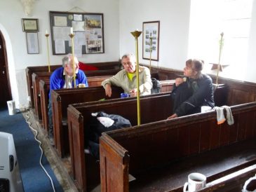
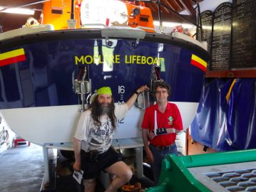
It wasn’t all academic talks and media interviews!  The conference included social events in order to better get to know the delegates that came from as far afield as the US, Pakistan, Russia and Kurdistan.  The social programme included a walking tour around Chester with its unique double-decker streets – sort of 16th century shopping mall; and an amazing Mediaeval banquet at Ruthin Castle, were I got to preside as Baron Alan!

photo by Neil Parley

Grounding walking

The latest paper based on Alan Walks Wales data has been published in Interacting with Computers at Oxford University Press.

The paper Walking: A Grounded Theory of Social Engagement and Experience is based principally on Stavros Asimakopoulos’ grounded theory analysis of theAlan Walks Wales blogs and is focused on the emerging themes about social engagement and social navigation.

Grounded theory is an analysis technique with roots in the social sciences, and Stavros has used it for many years to study domains from university web sites to sales forecasting, and, in this case, me walking!   Grounded theory tries to start by assuming nothing, taking the data (in this case my blogs) at face value, building concepts from them, and then organising them into overarching theoretical themes.


Stavros’ analysis found the following high level themes: accuracy of social judgements, need for decision accountability, enhancing self-esteem and satisfaction of intrinsic motivation goals. All were related to social engagement.

The thing that was initially most surprising for me was that social engagement came out so strongly given the majority of the time I was alone, indeed some days I only met two or three people during the whole day.  However, the blogs told a different story.  When I wrote these social interactions took up a disproportionate amount of words: in strict time terms I was usually alone, and yet as I recalled each day social contacts took up much of my memoirs.

Last day – champagne outside the Senedd

Having realised this I then did an exercise thinking of all the people who were in some way connected to the walk.  My initial list that I shared with Stavros had 23 different kinds of people from people I knew before the walk, but in some way supported or interested, to those I met on the way or was introduced to because I was walking.

As we analysed these 23 groups using a combination of Stavro’s third-person looking in at the blogs and my first-person experience, we came up with various categories and ways of looking at the various forms of social encounter.  One of my favourites is the coining of the term tribocentrc (from Greek ‘tribos’ for path) – people of the way.

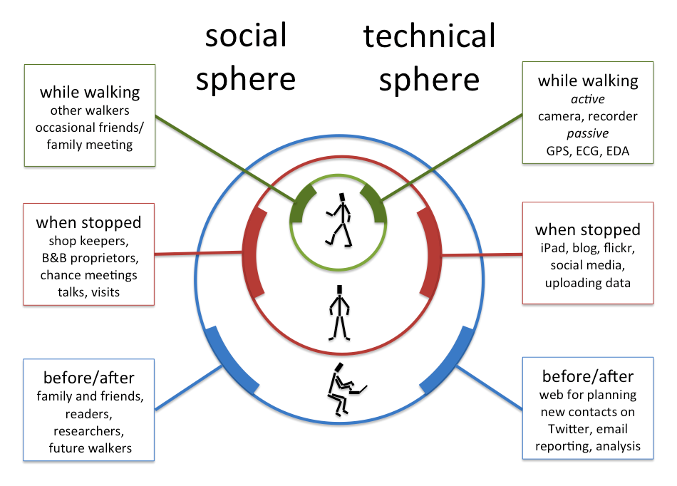
The paper also crystallised ideas of an onion skin model of experience that had begin with previous analysis of technology use.  Just like social interaction, my instant impression of technology use whilst walking was I didn’t really use it much.  However, also like social interaction, this was only if you look at the time I was actually walking, when really all I used was my camera, voice recorder and things that were passively tracking or monitoring me.  However, if you zoom out to the day as a whole, or the whole project of the walk with its planning, reporting (such as this blog!), then both technology and social interaction were woven through it all.

An onion skin view of social and technical influences o experience

Walking in the US: Technology on the Trail

A couple of weeks ago I was in Blacksburg, Virginia for a workshop called “Technology on the Trail“. CHCI, the Centre for Human Computer Interaction at Virginia Tech have an initiative of the same name and this workshop brought together academics and students at Virginia Tech. who have been working on the topic and four guest speakers from further afield including myself. Scott McCrickard was the organiser, but many others at VT led sessions, organised parts of the event or took part.

I was, of course, talking about the Wales walk, “Getting nowhere slowly: learning from a thousand miles at walking pace“, with a special slant on the tension between academic analysis of different themes and issues, and retaining a sense of the overall experience.

Amongst the other guests was Ellie Harmon. I was particularly excited to meet Ellie as she had been walking the Pacific Crest Trail at the same time as I was walking round Wales. Some years earlier she had also walked the Appalachian Trail. Her PCT walk was part of her PhD, which was an ethnographic study of the use of technology by long-distance walkers on the trail. I was particularly fascinated by the differences between the US long distance trails which are both substantially longer than the round Wales path (AT 2000 miles, PCT 2600 miles, compared to just over 1000 miles for Wales Coast Path + Offa’s Dyke), and also far wilder, with often several days between road crossings, and then some way down these to towns for resupply. However, they do seem far better way marked and constructed than large swathes of the WCP!

The third guest was Allison Druin, who I know from her work on co-design with children, but is currently part way through a two-year secondment to the US National Park Service as Special Advisor for National Digital Strategy. She has been applying similar co-design practices to the entire NPS! The NPS is not just responsible for the large ‘wild’ National Park’s themselves, but also swathes of land in cities, including the Lincoln Memorial. She described the way every national park has its own app, and her efforts to ensure that there are common platforms as well as more engaging experiences on them.

The final guest was Norman Su, who I’d not met before. He is at Indiana University, but is originally a city boy. His work from his PhD on has been on subcultures, so in Indiana he decided to look at hunters including learning to hunt himself, typically alongside children who were at a similar novice level. The hunters often feel quite culturally alienated by those from urban areas who find shooting game distasteful (albeit often happily digging into an intensively farmed steak).  However, there are multiple sub-cultures within hunting itself, often defined by the technology they use, from those who use the most advanced weapons available, to those who use simple bow and arrow, or muzzle loading rifles. A key feature that emerged from his analysis is the idea of rules of a ‘fair chase’: pitting the skill of the hunter not just the raw technology against the animal, and also ensuring that any kill is a clean kill: one bullet — one carcass.

As well as talks by the guests, we had a number of workshop activity sessions including a role play taking a walk to the university duck pond as if it were a hike, and various design/brainstorming sessions looking at the synergies and conflicts between different stakeholders and potential technologies for use on the trail.

My chosen technology would be a small device with physical buttons (not touch screen!) and GPS, possibly integrated into a voice recorder. The buttons could be colour coded and allow you to simply tag a spot from a small pre-determined set (bad path, view, etc.) and perhaps leave a voice note. Later one can go back and add details, but while walking I’d like to just say “this is an interesting spot”, and move on.

One evening there was a small reception where students showed some of the projects they had been doing around the theme. This included cultural probes, text analysis of tweets about various long distance trails in comparison with their mission statements and a touch screen system to explore Ellis and my blogs about our walks.

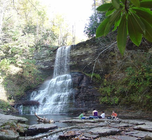
The workshop concluded with a short walk to he t66 foot Cascades waterfall, where the white foam of the falls was beautifully framed by white ice sheets across the rock face.  The photo below from virginia.org is clearly at a warmer time of year!
Reminders

There were so many conversations from things highly germane to the trail, to those more peripheral: Blacksburg’s single-screen, volunteer-run cinema’s Oscar nominee series, the nature of the Red Neck, the American Independence and Civil Wars (in the South, not utterly forgotten), and campaigning in the area at the last presidential election. Of course the latter things are not utterly independent of the workshop topic, as urban ideas of nature as object of preservation and leisure can often stand in conflict to more pragmatic rural connections to the land.

Aside from politics, there were two things I found myself mentioning repeatedly.
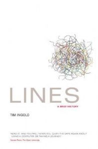
The first is Tim Ingold’s book Lines: A Brief History . Ingold’s thesis is that we have privileged the point or place in modern thought, seeing the connection as merely the means of getting from A to B. Ingold is an anthropologist and spent time studying reindeer herders. Their way of life is to follow the herds as they make seasonal migrations; for the tribes following the herds it is the way they follow, the path, the line, which is primary. Ingold has also edited a collection, Ways of Walking.

The other was MonmouthpediA.

Monmouth is a small county town on the border between Wales and England, but in 2012 it became “the world’s first Wikipedia town”. I am amazed at how few people in academia have heard of the project, indeed I probably would not have myself if it were not for the walk.
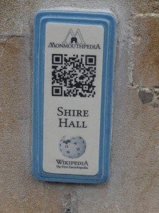
MonmouthpediA was a joint project between WikiMedia and various local councils and agencies, which included creating a special area on Wikipedia with entries for pretty much every building ad location in the town, free WiFi over parts of Monmouth, and, most significantly, small plaques with QR codes everywhere in the town linking to their MonmouthpediA pages.

With the benefit of hindsight I think it would have been better if they had used an intermediary URL, rather like tinyurl, this would have the made it easier to remap codes to content, including, for logged in users, contextually (e.g. children’s content, treasure hunts). However, for it’s time it is truly innovative and I’ve not heard of anything similar elsewhere since.

As far as I know there is not yet a world’s first Wikipedia trail!

Issues and Themes

Reflecting on the various presentations, group workshop discussions and informal talks during the visit, a number of themes emerged for me.

Marks

Part of the Wales Coast Path publicity was that it was “Way Marked”, hence as a rule (see also below) of my walking I followed these first and only consulted the route on a map (another marking) when I got lost from the markers.

Several more experienced walkers I met on the way had walked US trails, or Camino de Santiago in Spain remarked (sic) on the different quality of marking.

Things Ellie said and discussions during the Saturday Cascades walk, emphasised different natures of the laid out, or beaten path on the ground.

Marked and Unmarked Lines
(photo Wikipedia)

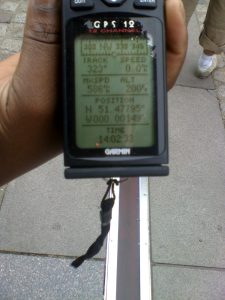
In the UK some long distance paths are waymarked, others deliberately not – you need to navigate to follow them … virtual paths. On Saturday Scott drove us “across the state line” (a phrase repeated so often in films) into West Virginia … a virtual line on the map, but also the road visible changed it’s character. We chatted on the walk about crossing the Equator and Arctic Circle – virtual lines, but ones with some physical identity, and the Greenwich Meridian, a purely arbitrary human line, but in Greenwich marked in the pavement.

The photo shows the Greenwich Meridian – marked on the ground and measured virtually with a GPS.   However, the two differ as UK longitude-latitude is slightly different from GPS long-lat indeed about 100 yards different at Greenwich … measuring where you are on a curvy earth is not straightforward.

Classes/kinds of marks

  • On the ground constructed – blaze, WCP roundels, direction signs, made paths
  • On the ground accidental – worn paths, signs of previous fires, litter, natural landmarks
  • On the map – lines or waypoints
  • Guide books, etc – often through geographic coordinates (remembering that even long/lat have multiple definitions differing by up to a hundred yards on the ground … that’s over a cliff!), but also place names, and landmarks

The latter connects to a chapter I’ve been recently writing about the ways physical and digital (or read more generally imaginary/virtual) worlds are connected (QR codes, etc.).

Absence of marks and knowing you have gone wrong

One thing I noted early while walking was the importance of cues to tell you when you are not on the path. This also has parallels in information systems design – error detection is as important as error recovery, indeed arguably more important as you cannot recover if you don’t know you have gone wrong … lots of links here to undo and things.

Ellie mentioned the frequent white blazes on the trees on the Appalachian Trail, and so, when she accidentally went off trail, she noticed quite quickly because there were no white blazes on the trees.

Note that this relied on the reliability of the waymarks, so that their absence was actually a sign in itself (rather like silence in speech). The lack of this reliability was, in contrast, a major problem on WCP, where they only seem to mark the ‘significant’ points (e.g. where the path exited a large open space), and, in some areas, even these erratically!
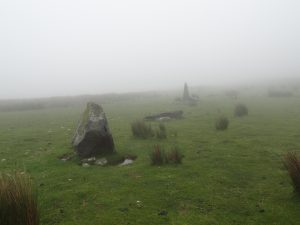
I recall one occasion (on the hillside about Fairbourne), where I was following a farm track and came to a gate. Straight onwards the path led beside a wall, but the farm track led through the gate. There was no WCP roundel on the gate, so I inferred that it was not the way to go … a big mistake that led to an hour or so wandering through thick mist on open moorland, criss-crossed with stone walls, that eventually led me round in an enormous circle! (N.B. climbing the walls would damage them, in most of the UK it is this kind of thing, not natural features, which limit navigation)

Hidden markers
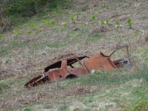
One reason the WCP markers were so small was, I think, so that they did not ‘mess up’ the countryside. Indeed, while I was walking, the Chair of the Long Distance Walkers Association, wrote a letter to members decrying the fact that on a couple of long distance paths, there had been incidents where someone had painted arrows on rocks to help guide walkers. As well as being criminal damage (remembering that there is little truly public land in the UK, only private land with rights of way), it also gave walkers a bad name. Although this was all perfectly correct, it was a point I pondered often as I struggled to find a 3 inch roundel across the far side of a field in the dusk or rain. The countryside is often far from ‘tidy’, full of fragments of baler plastic, discarded farm machinery, just about anything turned into feeders and water containers, and yet many in Britain have an image of the unspoilt rural idyll.

There are also good reasons for hiddenness. When the WCP crossed through built up areas roundels were attached to existing sign posts, but were rightly small as they are not relevant for the majority of people using the place (see meta-semiotics and Stanstead below). Indeed in some places, the normal 3 inch roundels, were reduced to small one inch ceramic disks and embedded into the pavement, very hard to spot even when you know they were there, but deliberately to be overlooked by those for whom they were not relevant … and also hard to vandalise.

I’m reminded too of Gypsy patrins (or patterans) and Hobo signs, which showed whether a house was a good one to beg at, or where other members of your group had gone, but were simple arrangements of stones or sticks that others would miss. The open WiFi chalk marks that sprung up in the late 1990s / early 2000s a similar example.

Rules

Norman’s hunters’ ideas of fair chase meant they created their own sets of rules about what was, or was not reasonable hunting practice. Ellie mentioned how some thru-hikers would not take a short cut when the path meandered up a mountain, or take alternative more scenic routes. I also had internal rules about conditions when I felt it OK to deviate from the set path: when I could get closer to the sea, or when I had got lost and it was ‘their’ fault (as in the WCP developers).

Information (in/about the land)

Rather like the marks for the path, information may be embedded in the land (e.g. the information board on the Saturday walk that told us about the old logging engine), or linked to it and presented elsewhere (guidebooks).

There are of course, digital versions of both these: public displays in location and smartphone apps, etc. linking from elsewhere.

I’ve a draft chapter about this for TouchIT (this chapter not yet online) about the different forms of linking (names, descriptions, QR codes, etc.)

Interestingly one of the distinctions for this is whether the points of linkage are physically inscribed in the land (e.g. QR codes for MonmouthpediA) or external to it (e.g. the PCT Halfmile waypoints).

In a project about ‘non-places’ (French philosopher Auge’s term), we had a meeting at Stanstead airport, and I became fascinated by the way signage sort of told you whether to there to read it or not, the meta-semiotics, of how to read a sign, who was intended to read it or not (see “not for itself: insider/outsider orientation of place and signage and systolic flows” ).

Names of places

This came up multiple times, not least whether a place having a name made it more significant.   … interesting connections to place/space

Flows

Another issue I first really became aware of in the non-places project, is about different flows human and material (I still have the photos of the back of a DIY store where we had another meeting).

As human flows are in space and time, for unconstrained 2D movements, you may never encounter those whose paths cross yours, but linear trails change this relationship. Passing people going the same way as you are, walking with them for a while, meeting people going the opposite direction, and those who live on the way (shop keepers, campsite owners, park rangers). There are also people who have walked the way before: flows along the same path, but at different times, leaving marks in the wear of feet, log books, guides, and even major motion pictures. This connects to another theme in my past work ‘absent presence’ the ways to be aware of others at the same place but different times.

People

One of the questions asked by a working group was “what are people”, and indeed we later had a workshop session focused laregely on identifying different stakeholder groups with interests about trails.

Here is one distinction (amongst others) that emerged from personal reflection prompted by Stavros Asimakopoulos’ grounded theory analysis of my blogs:

Egocentric/ people of life – These are the walker’s own individual community, linked to his personal existence. They are stable and long-standing, and largely geographically stationary but widely distributed.

Geocentric/ people of the land – These are the local community, people who live in the towns and places along the way. They are linked to a specific place. The relationships are typically fleeting, but the people themselves are largely geographically stationary and localized to the route of the path.

Tribocentric  / people of the way – The walking community, who are connected to the path, not any particular place along it. The meetings are fleeting and the people themselves geographically dynamic. (Note: this is from Greek ‘tribos‘ – a beaten track or path. )


Reflections on ‘Making There’, Bidwell and Browning

I have just read Nic Bidwell and David Browning’s  paper “Making There: Methods To Uncover Egocentric Experience in a Dialogic of Natural Places” (OZCHI ’06, pp.229-236, doi: 10.1145/1228175.1228216).  It discusses two studies focused on the phenomenological experience of natural places, and in particular while walking in those places.  Nic pointed me to this paper after I finished my notes of the APCHI / India HCI keynote, and I am sure it will influence further reflections on the Wales walk.

Reading it I cannot help but compare to my own experiences as walker, but of a very different kind, the vista of the long-distance voyeur rather than the familiarity of the local.  Nature is personal and social, and yet impersonal and uncaring, place and non-place, parochial and universal.

Starting with the paper itself; the first study in the paper involved giving walkers head-mounted cameras during a woodland walk.  Now-a-days there are off-the-shelf products, but at that point, 2006, they had to hack up their own Heath Robinson-like assembly of spy-cam, microphone and video recorders in a rucksack, typical of ubicomp research at the time.  The second study asked attendees at an art in the forest event to gather an object during a short walk and then describe its meaning.

the alterity of place

The paper makes frequent reference to notions of ‘place’, developed in human geography and brought by Harrison and Dourish into HCI1.  That is not simply cartographic ‘space’, Cartesian points on a map, but areas vested with social significance.

This was certainly relevant to the data from the first study where participants reminiscences were triggered by landmarks, some obvious to the eye and others more personal.   However, this was specifically aimed at understanding ‘belonging to a community through its natural landscape’; the site for the walk was chosen ‘based on proximity, and familiarity with all participants.

Harrison and Dourish’s concept of place was influenced by Yi-Fu Tuan’s “Space and Place. The Perspective of Experience“, (University of Minnesota Press, 1977).  He says:

“Place can be defined in a variety of ways. Among them is this: place is whatever stable object catches our attention. As we look at a panoramic scene our eyes pause at points of interest. Each pause is time enough to create an image of place that looms large momentarily in our view.” (p.161)

One of Bidwell and Browning’s participants was surprised that a major landmark, which appeared large in his mental image, looked “not much more than a pimple” in the video footage (p,233/234).  The subjective ‘looming large’, is not captured by the ‘egocentric Point-of-View’ camera; the technological ‘infinite archive’2 captures sensation, but not perception.

115-1569_IMGIt is interesting that some of the markers that give us a sense of place are remote: the Eiffel Tower in Paris, the Empire State Building in New York, Tower Bridge or Buckingham Palace in London.  I have taken the lift to the very top of the Empire State building, but only stood underneath the Eiffel Tower, and yet each has significance to my notions of New York an Paris as place.  Similarly in London I have only in the last month crossed, or even been close to, Tower Bridge, and I have never been inside Buckingham Palace, and yet these are central to my personal concept of London.  There is surely some weird alterity here in that we often define a place by the landmarks seen from it, rather than the ground beneath our feet.

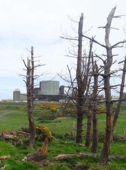
Walking the north east coast of Anglesey, Wylfa Nuclear Power Station dominates the view for miles in each direction, its remorseless concrete cube casting a palid glow on rocks, sea, gravestone, and dead-fir copse (see day 33 and day 35).  And yet close by, it becomes invisible, a double fence of razor wire, the hum of transformers, and a nature walk.  To see it close to, you must enter the visitor centre, as if, like the nuclear fires within, its outer shape can only be seen in simulacrum, and yet the visitor centre is closed to those with muddy boots, the walker in the land is excluded and only those who come by car from afar welcome.

forgotten places

The quote from Tuan is at the beginning of a chapter entitled “Visibiity: the Creation of Place”. Bidwell and Browning’s  paper’s title starts “Making There”, both emphasising the conceptual construction of a sense of place.  In one of Tuan’s examples (p.169–171), Boston’s West End is to be demolished and yet the activists speaking up for it were “artists and intellectuals” as the idea of the neighbourhood of the West End was foreign to most of its residents.  Each felt passionately about their particular street, but had no concept of the larger area.  It was only through the campaign that it became, metaphorically, ‘visible’ and so the idea of the neighbourhood and the ‘place’ were created.

But, if place is constructed, what of its dissolution?

When walking, I sometimes became a little blasé to beauty, “another cove, another headland, another craggy cliff face.”  I have spent my whole life wishing to get away from the built environment, a Rousseau-esque idea of the noble savage almost before I could read.  And yet, in my own walking, it was the points of human habitation and intervention that were the points of growth.  This is partly the obvious ‘places’, seaside towns and villages where, as passer-by and dilettante, I sought to make sense of locality and community.  However, there are also the forgotten places, the remnants, the ruins, the abandoned workings and redundant factories.

To be honest I enjoy these sites purely for the joy of abandonment, the aesthetic of desolation.  However, there is also a desire to know more or simply fantasize about the people who lived and worked here before leaving their homes and work places, like their own bodies, to decay and dust.

Many of these sites had information boards telling stories of the past and on Tiree I’ve been involved in efforts to make the extensive local archive available online in mobile app Frasan (meaning ‘seeds’ or ‘shower’ in Gaelic).  We cling to the memories of the past even when they are not our own.

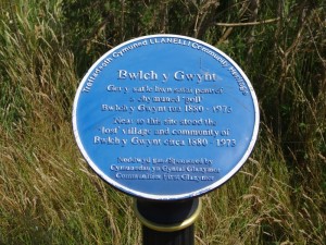
2013-07-11 12.29.23Walking east from Llanelli (see day 85) I passed a plaque to the ‘lost’ village of Bwlch y Gwynt, “circa 1880–1973“, a community that dissolved after the closing of the tinplate works that had dominated the landscape and economy for more than a century.  It seems odd that a community can get ‘lost’ in my own lifetime, and yet that sense of loss has moved others to form an ‘Abandoned Communities‘ web site.

I have also been reading Bell’s analysis of the ‘infinite archive’, alluded to earlier, and a recurrent theme in digital humanities.  Bell’s article starts with Derrida’s “Mal d’archive” (1995) and Nora’s vast ‘Lieux de Mémoire‘, project, which sought to document exhaustively the ‘sites of memory’ in France.  Bell, interpreting Derrida, sees the focus on the ‘archive’ as symptomatic of a fear of loss, and according to Nancy Wood, another commentator, Nora saw the “lieux de memoire” as “themselves the impoverished substitutes of the “milieux de memoire,” “environments of memory,” which have all but disappeared3.  Is the love of heritage and desire to record no more than a clawing at our graves, fighting the inevitable progress to death symbolised by the burial of our own memory?

wilderness and self

The participants in Bidwell and Browning’s first study were at a place of familiarity, but there is also a tradition of seeking true wilderness, places without memories, or at least without our own memories.

We often talk of people ‘being alone with themselves’ in nature, and there is a truth in this, a time to ponder, to contemplate, almost easier in places not too replete with memories to intrude or direct.

Nora, in an apologetic for the ‘ Lieux de Mémoire’ project says that4:

“Modern memory is, above all, archival. It relies entirely on the materiality of the trace, the immediacy of the recording, the visibility of the image. What began as writing ends as high fidelity and tape recording. The less memory is experienced from the inside the more it exists only through its exterior scaffolding and outward sign” (p.13)

In the wilderness, in the absence of this external scaffolding we are free to experience memory more directly, more starkly, supported only by our own non-archival minds; for once experienced ‘from the inside’.

Or perhaps not?

In a way wilderness, places without personal significance, places that are place-less to you, open space; these places, in taking away the external props, can lead you not to be alone with yourself, but to be alone without oneself.  To the extent that our notion of self is a construct of our own personal histories, in these spaces without ‘lieux de mémoire’ we are in some sense cast adrift or perhaps cut loose.

Bidwell and Browning’s studies are set in Queensland, Australia, a land where land and culture are deeply entwined, for the aboriginal inhabitants, but, in large part, apparently trackless and empty to Western eyes.

I recall my first visit to Australia many years ago, to Melbourne in the South.  After several heavy days of meetings we had a day off before the flight back to the UK. My colleagues wanted to go shopping, so I got the hire car to myself and set off to see Hanging Rock to the north and the apparently endless beach to the south west of the city.

As I walked the ground I felt the age of the rocks, rooted deeply into the fabric of the land, calling me, as if, when I stood still, the rock were creeping up my legs, so that I could become one with the land itself.  I recall the spirits of the land in Patricia Wrightson’s Song of Wirrun trilogy; creatures of the rock, slowly moving, ageless.  It were as if I could become like them transient flesh to eternal stone, and yet, in their age and primitive wisdom, did they lose something of the contingency and compassion of mortality?

But as well as that more transcendent yet earthy desire to lose myself in the land itself, I felt a more earthly temptation to abandon hire car and passport, to simply walk, a hobo traversing the empty places.

Of course, it is not just in nature that we can find such wilderness.  Films and books return repeatedly to the trope of the urban wilderness, the allure of anonymity in the crowd, the desire to cut oneself off from the archive, authority and past.   In anther recently read book, ‘All Things Betray Thee‘, the inhabitants of Moonlea long to destroy the hall that contains the records of their debts, although it is jealously guarded by clerk, Yeomanry and priest; the latter forgetting the one who battered down the gates of hell to wipe clean the debts of all.  The record of things past can be a heavy weight.

Augé’s Non-places considers malls and airports, vanilla spaces without the social history to make them places.  Yet maybe it is this that is part of their appeal, satisfying for the modern consumer the same urge that led the inhabitants of Moonlea to throw themselves vainly and bloodily into the Yeomanry’s musket fire or that led the heroes of spaghetti westerns into the desert.

the universality of the particular

Bidwell and Browning’s second study was also with people local to the area.  However they were at an event and in particular an arts workshop, which will have changed their perspective.  The data gathering was also focused around found objects, what Bidwell and Browning call nature probes’.

It maybe the object-centric, event-based or arts-focused nature of the study, or some combination of all, however, whatever the cause, in addition to very situated comments, there were also more personal and crucially less-site specific ones:

“… a participant compared the unobtrusive slender leaf to herself “during in the week” but its dazzling, coloured tip to herself “at a party”.” (p.234)

The leaf could have been a leaf anywhere.

I walked on a number of long beaches: Hells Mouth in the Lleyn Peninsula, the endless sands north of Aberdyfi, and more.  Most I have never been to before, and yet there was always a sense of nostalgia, and déjà vu, of coming home.  I think they conjured up remembered and half-remembered feelings of childhood seaside holidays, even though the beaches I actually visited as a child often evoked less visceral feelings.  Perhaps the idea is more solid than reality.

Indeed, there is something about the universality of the particular: each tree becomes every tree, each leaf, every leaf.

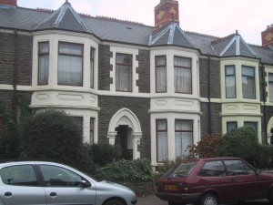
142_4272Some years ago, when giving a keynote at a workshop of Space and Spatiality, I used my own childhood memories of growing up in Cardiff, the way my infant mind gradually joined together the scattered jigsaw pieces of experience, threaded them like a toy necklace, and eventually laid them flat in mental maps5.

I had feared that this personal reminiscence would be too self-indulgent, and yet quite the opposite, so many people were touched — my own, very personal story struck chords in others, reconnecting them each to their own childhood.

And this is some of the power of the wilderness, bereft of particular memories, it becomes all our memories.

  1. Harrison, S. and Dourish, P. 1996. ‘Re-Place-ing Space: The Roles of Space and Place in Collaborative Systems’. CSCW’96, ACM. doi:  10.1145/240080.240193.       Dourish, P. ‘Re-space-ing place: “place” and “space” ten years on’, Proceedings of the 2006 20th anniversary conference on Computer supported cooperative work, November 04-08, 2006, Banff, Alberta, Canada. doi: 10.1145/1180875.1180921.[back]
  2. See David F. Bell, ‘Infinite Archives’, SubStance, Issue 105 (Volume 33, Number 3), 2004. pp. 148-161, doi: 10.1353/sub.2004.0034[back]
  3. Nancy Wood. ‘Memory’s Remains: Les lieux de mémoire’.  History and Memory. Vol. 6, No. 1 (Spring – Summer, 1994), pp. 123-149. Indiana University Press   http://www.jstor.org/stable/25618664[back]
  4. Nora, P. (1989) ‘Between Memory and History: Les Lieux de Mémoire’, Representations 26, 7–25. http://www.history.ucsb.edu/faculty/marcuse/classes/201/articles/89NoraLieuxIntroRepresentations.pdf[back]
  5. A. Dix (2004). Paths and Patches – patterns of geognosy and gnosis. In Spaces, Spatiality and Technology. Napier University Edinburgh.  http://www.hcibook.com/alan/papers/space2-2004/[back]

day 11 – in Paris and wishing I were in Wales

Yesterday had a great day at the GeoHCI workshop, lots about mobile maps, and sense of place. I talked a bit about Frasan, the mobile app in Tiree and a bit about the Wales walk including the Monmouth campsite community, which I wrote about in previous posts (days 4, 8, 9), and which is interesting in being local and yet not local, permanent and yet transient.

This morning Clare Hooper shared a link on Twitter to an Atlantic Monthly article "How the Internet Reinforces Inequality in the Real World", which discusses how both Google and Wikipedia, whilst ‘open’, effectively reinforce the strength of voices of countries who have traditionally held power, while the poor and marginal are digitally silent and unseen.  So different from the facile article in Friday’s Times "Maps are no longer controlled by the mighty", which saw Iran‘s intention to create an alternative to Google maps, an "Islamic Google Earth", as reactionary compared to the ‘neutral’ nature of Google. While not decrying Google‘s attempts to maintain a level of neutrality, the idea that any representation is without bias and viewpoint is at best naïve and at worst dangerous from someone who is a regular Times columnist.

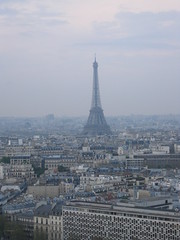
Eiffel Tower from hotel window

Despite feeling buoyed by the workshop yesterday, this morning I woke feeling miserable.  I’d kept waking in the night (maybe a phone is beeping occasionally, I thought I’d turned them off), and this morning realised I couldn’t find the fine tipped pen I use for writing in my new Moleskine. The pen is not expensive, just an ordinary roller ball, but was just right for writing in the small notebook.  I must have left it in the workshop room yesterday.  It added to my general dislike of being in a big conference hotel, and having five more days of conference.  I wished I had a flight back tomorrow after award dinner this evening, and could get back on the road walking.

Going down for breakfast, I sat down to read Rachel Joyce‘s "The Unlikely Pilgrimage of Harold Fry".  I had heard an extract from it on the radio some time ago, and then someone recommended I read it. Only a short while in, reading Joyce‘s accounts of ordinary yet poignant lives, I suddenly felt the stupidity of feeling sorry for myself for being in Paris (where everyone else wants to be), and an overwhelming urge to pray for all those with deep pains and regrets, that are often invisible and yet so mar lives.  I found myself with head bowed over my bowl of half-eaten fruit in the midst of a crowded breakfast room. We notice disasters and wars, illness and death, but can forget the day-to-day misery that lies behind so many people’s eyes.

Harold Fry is about an unexpected walk, literally setting off to post a letter and then simply keeping going. It makes me feel positively well prepared! However, whilst better shod, I recognised the blisters and stinging nettle burns, and sudden realisation of thirst and hunger.

I was struck particularly by a sentence on page 107, "As a passer-by, he was in a place where everything, not only the land, was open."  While in a way the Monmouth campsite community is interstitial, in the gaps, as walker and traveller I am much more so, whether walking along the chain-fenced path between industrial buildings and quarry side on the approach to Chepstow, the alleyway between estate houses, or the green lane level behind gardens, and bitumen-blackend rooftops.  And no less in the meetings with people, slipping not so much between their lives, but touching them briefly.

At Monmouth they asked whether I would be back, and I did not know.  And so many times already people have said they were jealous of me, or how they wished that they could do or had done something similar. I am struck by the privilege of this journey, and also the strangeness that people now look at me as one of those people that "do something", whereas I always thought that was others.

February travels

I am back at home now after two weeks travelling up and down the country (see talking about Wales from south to north).  Gave five talks, visited seven cities in three countries; some fantastic conversations with old friends and new.

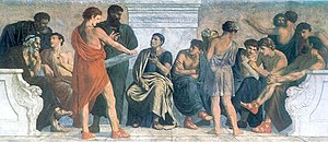
At Birmingham I was taking principally to MSc students.  At the end of the talk the questions were mainly from one of the academics, but afterwards as we walked across the campus, then the questions came and ideas flowed.  The Aristotelian school of philosophy is also called The Peripatetic as they pondered and taught while walking round the colonnades of the Lyceum in Athens.  There is something about walking …

At Brunel in West London I went to an Italian restaurant … in the UK with an Italian!  High praise indeed.  I forget the name, but ask Alessio!  They have an enormous indoor running track and athletics centre where Usain Bolt trains.

At Cardiff I had no talks, but lots of talking!  In the morning I was able to visit Ramblers Cymru, tucked down behind the station towards Butetown … I had never been in that part of Cardiff before.  Gwenda and Elly gave me a warm welcome with cups of tea and while I was there @jacswork rang Gwenda and she passed him over to chat about SeenSend.  Due to familiy and work commitments, he can’t get out to the hills so has become a virtual walker: he invites others to post photos of places they are walking and he chooses some as inspiration for paintings.  SeenSend is looking for more artists to join in, so if you are a walker and want to inspire or an artists and want your own virtual tours, check it out!

As I walked through Cardiff city centre (familiar and yet so different), I dropped off at the tourist information to get some of the Wales Coast path leaflets (you can download the PDFs, but the long multi-folds print too small to be readable) and also into St David’s Hall to see the Short Memory Stick (Ffoncof Fer) part of the Triad exhibition by Gareth, Morgan and Ioan Griffith.

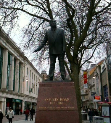
Aneurin Bevan (1897 - 1960)

Aneurin Bevan (1897 – 1960)

Chatting to a Big Issue seller while his oh so patient (and well wrapped up against the cold) dog rolled over inviting passers-by to stop and tickle, I remembered that many in the UK and across the world walk and sleep out not through choice.  After Christmas when I wrote about Epiphany, I was focused on the journey of the magi, but after the Magi leave in the Christmas story there is the long journey into Egypt to flee Herod, the tiny baby Jesus a refugee, asylum seeker.  Then as you turn into Queen Street the statue of Aneurin Bevan, architect of the National Health Service, one of the glories of Great Britain … all from a Welshman brought up in mining family in the valleys.

The city centre campus of Cardiff Metropolitan University is set in Howard Gardens … on the site I think where my mum went to school in the 1920s.  Steve Gill showed me round, always so many interesting things lying around in a product design department, before lunch with Olivia Kotsifa, who runs the FabLab at Cardiff, to talk about the potential for a mobile FabLab to tour Wales, rather like the FabLab Truck in the Netherlands.  Also talked to Claire Haven-Tang about digital tourism and she gave me so many contacts, that I have still to follow up.

Monday saw me down in Southampton (deep semantic web territory) visiting Claire Hooper and mc shraefel and others.  Talked technology and education with Mike Wald and Yvonne Howard and technology for walking wales with Hugh Glaser (creator of sameAs.org) and Andy Sanford-Clark (creator of the house the twitters) — loads of ideas … just need another six months to prepare … but yikes, six weeks :-/

Wednesday and Thursday had successive talks in Horizon (Nottingham) and dot.rural (Aberdeen), two of the EPSRC funded Digital Economy hubs … just a bit of a long drive apart.  The long drive was broken by a night at Annandale Water Days Inn as lovely a view to wake up to as Killington Lake on the way down, and even a little balcony.  Days Inn certainly know how to pick good motorway service stations!

At both, especially dot.rural I felt I was preaching a little to the converted as I discussed issues of physical, social and economic marginality and the way this is often exacerbated by digital exclusion.  As with other places a mixture of rich conversations with old friends including Genovefa, Tom, Steve and Alan at Nottingham and Konstantinos at Aberdeen, but also met so many people and learnt a lot including serendipitously someone at Notts who did her first degree in Aberystwyth.  I know the work at Nottingham well, but not dot.rural and realise there are so many points of connection, both for the Wales walk and also projects on Tiree.

Finally on Friday I met Philomena de Lima in Inverness to hear about to some of the work  at UHI on social and policy issues for the rural economy at UHI Centre for Remote and Rural Studies.  And after leaving Inverness then a beautiful drive down the Great Glen back to Fort William and Oban … But what was that thing like giant hippopotamus in the water?  I guess just normal highland wildlife.

award for art of cartography

The Ordnance Survey in collaboration with the British Cartography Society, have announced an award, the OS OpenData award, for work that spans art and cartography, using the hard data supplied in OS OpenData but combined with the flair of the creative individual.

The award celebrates the fact that “The creation of maps is a fusion of art, design, science and IT …”, reflecting some of the issues I’ve raised myself in recent posts such as “flowing cities – beauty in bits and buildings“, “maps in textiles“, and “Stilgoe on why precision is not always best” as well as general awareness of the importance of non-standard maps.

talking about Wales from south to north

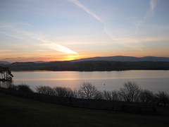
Killington ReservoirI’m heading down south, for last trip before the walk, taking in five talks about the walk, from Southampton to Aberdeen, with Birmingham, Brunel and Birmingham between! I’ve also got meetings discussing it at Cardiff and Inverness, not to mention time at Talis and my future sun-in-law’s stag do!
Last night I stayed at the Days Inn at Killington Lake, near Kendal on the M6. It is rather cheaper than the hotel at Westmorland Services near Tebay (definitely the best motorway services in the country!), but as a view to wake up to may actually beat it.

Talk timetable

The talks are  all called ‘Treading Technology” with similar abstract to the first talk I gave in Swansea last autumn … although updating the slides a bit.

Mon, 18 Feb, 3pm, HCI Centre, University of Birmingham, (location G26 in Mech. Eng.)

Thurs. 21st Feb, DISC, Brunel University, London

Mon, 25th Feb, EECS, Uni. of Southampton

Wed, 27th Feb, Horizon, University of Nottingham

Thurs, 28th Feb, dot.rural, University of Aberdeen

I’ll also call into Ramblers Cymru and Cardiff School of Art and Design on Friday 22nd and University of Highlands and Islands on Friday 1st March, so if you are near any of these locations and fancy a chat, or dropping into one of the talks, give me a shout.

flowing cities – beauty in bits and buildings

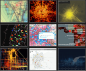
Flowing CityI have written quite a lot about the use of local maps that emphasise the identity of an individual or of a place.  However, there are also incredibly creative uses of maps that are more in the Cartesian tradition, combining geospatial data and digital mapping to creative visualisations that may be informative, subversive, beautiful and, at their best, all three at once.

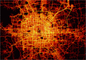
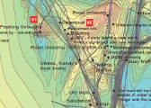
As part of her master’s studies Margarida Fonseca has created Flowing City,  a stunning collection of visualisations of urban data1. From routes of Beijing cabbies, to galvanic skin response in Greenwich, and social network language in Milan, the examples Margarida has collected show the amazing ways different projects and individuals are remixing their own data, or publicly available data in order to make the often unseen patterns around us visible.

Urban computing with taxicabsGreenwich Emotion MapMaps of Babel

Many of the projects are by university research groups, but I’m also aware of many basic, but often transformative uses of data by simply mixing open data with Google maps or other similar technologies.  I’m wondering what it would be like if visualisations such as those found in Flowing City could be in the hands of every community group, urban or rural: campaigning for better transport, understanding education needs, preparing for floods.  But while pondering that I have downloaded a copy of Margarida’s thesis.

So, just browse the Flowing City site, compare with the Maps in Textiles I posted about a week ago: art and technology, the Cartesian and the idiosyncratic, may be not so far apart.

  1. Thanks @aquigley for sharing this link on Twitter. [back]

roots – how do we see ourselves spatially

I was looking through my blog and came upon the following post from 2011, which I’d forgotten about.  It seemed particularly relevant given my focus on both local maps and more personal maps such as Esther’s map in “maps of the imagination“. So I’ve reproduced it here.

Copy of “roots – how we see ourselves spatially” original post on my personal blog 2/11/2013

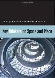
I was just reading the chapter on Benedict Anderson in “Key Thinkers on Space and Place1. Anderson forged the concept of a national imagination, the way nations are as much, or more, a construct of socio-cultural imaginings than physical topography or legal/political sovereignty.

However, this made me wonder whether this conception itself was very culturally specific, to what extent do people relate to nation as opposed to other areas.

I was reminded particularly of a conversation with, the much missed, Pierro Mussio. He explained to me the distinct nature of Italian cultural identity, which tends to focus on regional and local identity before national identity, partly because Italy itself is quite young as a nation state (a mere 150 years in a country which sees itself in terms of millennia). There is even a word “campanilismo”, which is literally relating to the “bell tower” (campanile) in a town, meaning one’s primary loyalties lie to that bell tower, that town, that community.

How do you see yourself? Are you British or Geordie, French or Parisian, American or New Yorker?

I know I see myself as ‘Welsh’. Wales is part of Britain, but my Britishness is secondary to Welshness. I was born and brought up in Bangor Street, Roath Park, Cardiff, but again while the street, area and city are foci of nostalgia, it is the Welshness which seems central. For Fiona she is Cumbrian (rather than Wetheral, English or British), Steve who is visiting is British, but says his brother would say Scottish, despite both having spent equal amounts of time in Scotland whilst growing up and since.

I asked people on Twitter and got a variety of answers2, most quite broad:

“I always think English rather than British but I don’t have a more specific area to identify with.”

“I think I primarily think of myself as both “Brit” & “northerner”. Lancastrian when differentiating myself from Yorkshire lot!”

“in decreasing granularity I’m a Devoner (south, of course!), west country-er, English, British, European, World-ean.”

Some less clear:

“I’m confused specially. I am Coloradan and American by birth, but feel more at home in England, and miss Scotland.”

“ooh, complicated. I’m British but not English. that’s as specific as I get.”

The last perhaps particularly interesting in its focus on what he is not!

Obviously the way we see ourselves varies.

The choice of a ‘level of granularity’ for location reminds me a little of the way in which we have some sort of typical level in a classification hierarchy (I think Lakoff writes about this); for example you can say “look at that bird”, but not “look at that mammal”, you have to say “look at that dog” or “look at that cat”. This also varies culturally including subcultures such as dog breeders – saying “look at that dog” in Crufts would hardy sound natural.

Some cities have specific words to refer to their natives: Glaswegian, Geordie, Londoner; others do not – I was brought up in Cardiff, but Cardiffian sounds odd. Does the presence of a word (Cumbrian, Welsh) make you more likely to see yourselves in those terms, or is it more that it is that, where cities have forged a strong sense of belonging, words naturally emerge … I sense a Sapir-Whorf moment!

Now-a-days this is even more contested as loyalties and identities can be part of networked communities that cut across national and topographical boundaries. In some way these new patterns of connection reinforce those focusing on human relations rather than physical space as defining countries and communities, but of course in far newer ways.

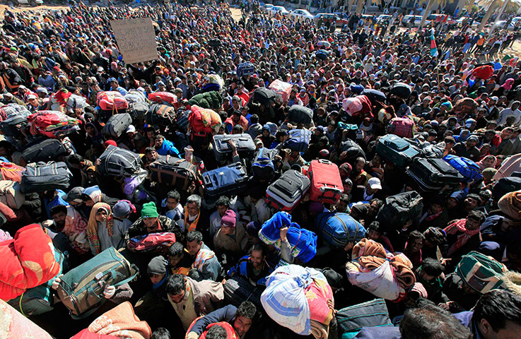
However, it also made me think of those parts of the world where there are large numbers of people with problematic statehood. There is how we see ourselves and how states see us. We tend to define democracy in terms of citizenship, and laud attempts, such as the Arab Spring, that give power to the people … but where ‘people’ means citizens. In Bahrain the Shite majority are citizens and therefore their views should be considered in terms of democracy, whereas the migrant workers in Libya fleeing the rebels in the early days of the recent Libyan war, or the Palestinians in Kuwait during the first Gulf War were not citizens and therefore marginalised.

Defining citizenship then becomes one of the most powerful methods of control. This has been used to powerful effect in Estonia leaving some who had lived the country for fifty years effectively stateless, and, while not leaving people stateless, in the UK new rules for electoral registration could leave up to 10 million, principally the young and the poor, voteless.

In the days of the nation state those with loyalties not tied to geography have always been problematic: Gypsies, Jews before the establishment of Israel, the various Saharan nomad trades. Many of these have been persecuted and continue to suffer across the world, and yet paradoxically in a networked world it seems possible that pan-national identity may one day become the norm.

  1. I’ve got 1st edition, but 2nd edition recently come out.[back]
  2. Many thanks for those who Tweeted responses.[back]