
 I had planned the day with military precision. It was my first Sunday on the path and before I’d left I’d looked up the Monmouth Churches Together web page for Llandogo; there were two services, a Eucharist at St Odoceus, the old Parish Church, at 9am and a family service at the village hall at 11am. In my armchair enthusiasm I planned to get breakfast at 8am, go to the Eucharist, then return to the B&B, pick up my things before going to the service in the community hall before setting off. I was due to meet Baronne in Monmouth for coffee at 3pm, but thought, "10 miles, 3 hours, easy".
Before leaving I’d not walked any distance since I was eighteen. At that age I used to use dead reckoning to work out where I was on a long walk and always used 4 miles an hour as normal walking pace. In the couple of weeks before I left I managed my first practice walks on Tiree, and, at a purposeful, but relaxed pace I still found it was 4 mph, almost exactly. I found I could easily do 10 miles before breakfast, a whole day’s work and then another 10 miles at the end of the day.
However, I neglected to factor in a few things. At eighteen I was, well, thirty-five years younger. Also I was often walking mainly on roads as there was almost always a lot of road walking to get in or out of the city. On my Tiree practice walks I was on the flat (there is little that is not flat on Tiree!), beach and road, knew where I was going and, critically, was not taking photographs.
Andrew and the Ramblers had told me two, maybe two and half miles an hour tops, but did I listen to the experts … ?
In these first three days I’d realised that they were exactly right.
So, even with the small experience I’d gathered so far, I had abandoned the idea of attending the family service, although sadly, as Tiree Baptist Church also meets in An Talla, the community hall on the island. However, I had also arranged to meet Janet en route.
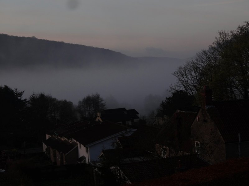
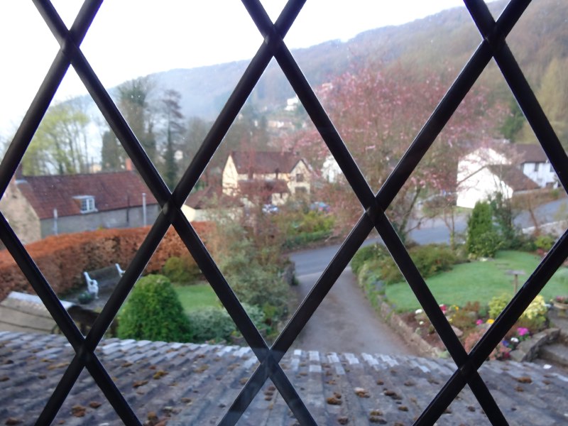 After ten and a half hours walking the day before, sore footed and tired, I also abandoned the idea of an early breakfast and Eucharist at St Odoceus. Instead, when I woke, I simply sorted out my kit and tended my sore feet, and then set off after a lovely breakfast. I did try to connect into the WiFi and Rosemary had given me a slip which she thought was the access code, "my son set it up", she said. The code turned out to be the admin access to the router, so, with Llandogo in a valley and with minimal mobile signal, not for the first time, I had to abandon any idea of ‘start the day’ tweets or blogging.
Over breakfast I learnt that I was only the second guest that season, the recession and Easter snows had cut severely into Rosemary‘s business. She also told me how a local business development person had told them they needed to use the web and social media more, hard for a small B&B owner. I’d found the Old Farmhouse B&B across the road more prominent on the web and originally contacted Elaine there, but she had been full and passed me on to Rosemary. I wondered if the better web presence was helping the Old Farmhouse weather the recession better, but no, Rosemary explained that Elaine had also found the season very slow, the "fully booked" was actually because she was away, and evidently prospective guests do not like being told that the landlady also likes to take a holiday sometime.
Rosemary also told me about her daughter who works at the National Museum in Cardiff. Evidently there has been a lot of ‘rationalisation’ with departments closing down and people being redeployed, often outside their specialist area. This will be partly a result of ‘austerity’ and partly because of changing ideas of scale and culture. Years ago you would only have one museum in easy reach, whether a big one like Cardiff or a small town museum. Each museum had a bit of everything and it was exciting to see stuffed wild animals, pieces of lava or a dinosaur bone. Now it is so easy to travel, and the competition from both media and ‘attractions’ is strong, so museums have to specialise, be master of something rather than Jack of all trades.
Eventually, well fed and with feet surprisingly fit, I set off.
First of all about a mile back down the road to Bigsweir to rejoin Offa’s Dyke Path. At the bridge I met a couple, Peter and Cathy, out walking for the day. They were on holiday, but Cathy was originally a Forest of Dean lass. I have sadly forgotten most of the conversation – however I do recall that they told me of a photo of a relative outside a works1 and we pondered on the idea of the factory or shop photo, rather like a school photo, with everyone lined up, and I guess the manager in the middle. Nowadays this is more likely to happen at an office party. The one exception I know is Daniel Keim‘s Data Analysis and Visualization group in Konstantz who take a photo of everyone (with Daniel in the centre!) each year at their summer retreat.
From Bigsweir the path follows the road uphill for a very short way, and then enters a woodland area. There is a post absolutely covered with markers for different named footpaths. There are two paths, one smaller path going further uphill, the other a large forest path tracking the contour of the hill. The post with the markers was nearer the small path, and nearly all the markers were on the side of the post pointing up along the path. However there was one, the Offa’s Dyke Path marker, that was on a different side of the post, which seemed to suggest that it was a different direction. I knew I was uncertain, and of course I should have checked the map at this point, but did not and followed the large forest path.
The way was pleasant enough and easy underfoot, edging ever so slightly downhill, until eventually it was not far from the road that runs along the west side of the Wye at this point. I can’t recall what made me wonder, but at some point I felt things were not right. I looked at the map and realised I should be far further up the valley side, it was the same path as all the rest, the side of the post with the many markers must simply have been too full.
I had come at least a mile along this wrong route, and did not want to backtrack all the way, so instead looked for a clear path in the woods and set off up hill. The trees were happily widely spaced and it was not too far up the hill before I found a path cutting diagonally uphill which I could follow until I eventually found myself on the right path again.

One thing I recall noticing the day before was that if a tree fell, it seemed to always fall path-side down, so you had to scramble over, under or round. Part of this will be that you only notice the ones that have fallen in your way, but there may be some truth in this walker’s version of Sod’s Law as the gap of the path will mean that trees are slightly less well supported on this side and so more likely to fall and block your way. At one point during this part of the walk I had a particularly large example, which was too large to easily climb over and had some sort of fence or embankment making it hard to get round. I found myself face down, pushing my rucksack in front of me like at an army assault course. Happily at that point the path was on grass, not mud.
 Once I was on the right path the way was quite quick, following the contour, but far higher up the valley side, perhaps 250-300 feet above the Wye. Eventually the path dives down towards Lower Redbrook where I was to meet Janet. I could see that there had been a missed call on my mobile, but when I tried to ring back I couldn’t get through, but I wondered if she might even see me wending my way side-to-side, slalom-like, down a steep grassy field, trying to reduce the strain on my knees from a straight descent.
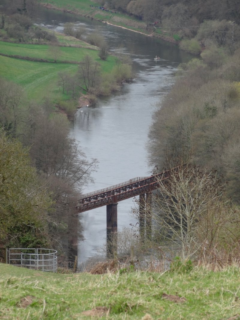
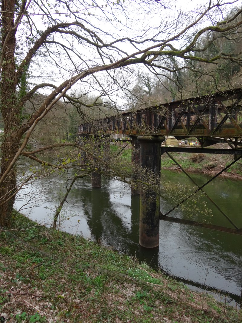
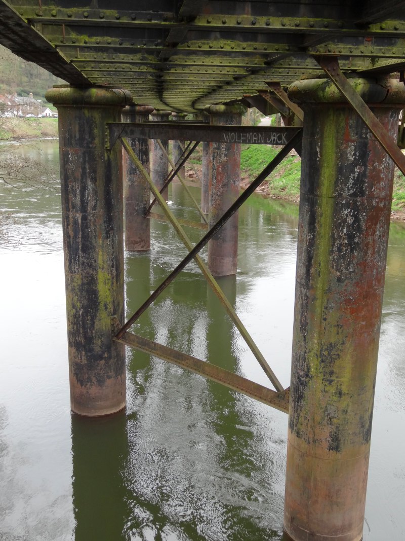
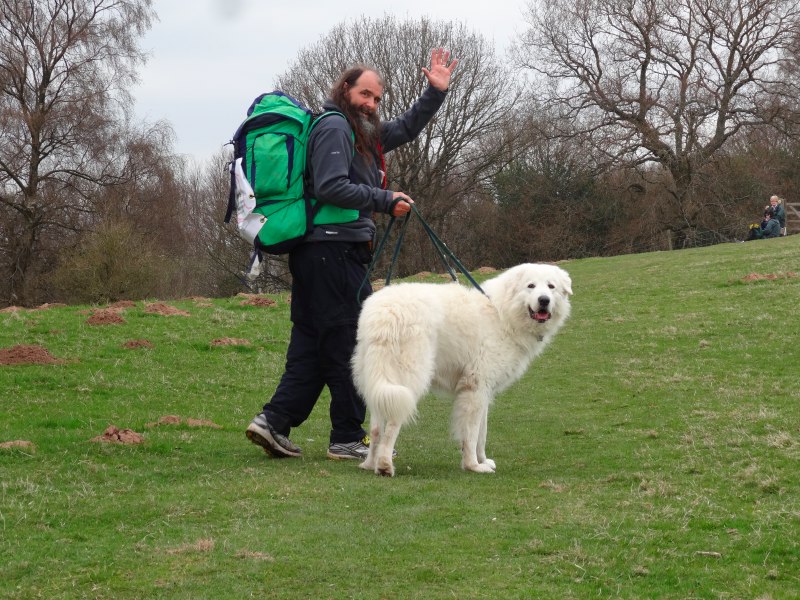
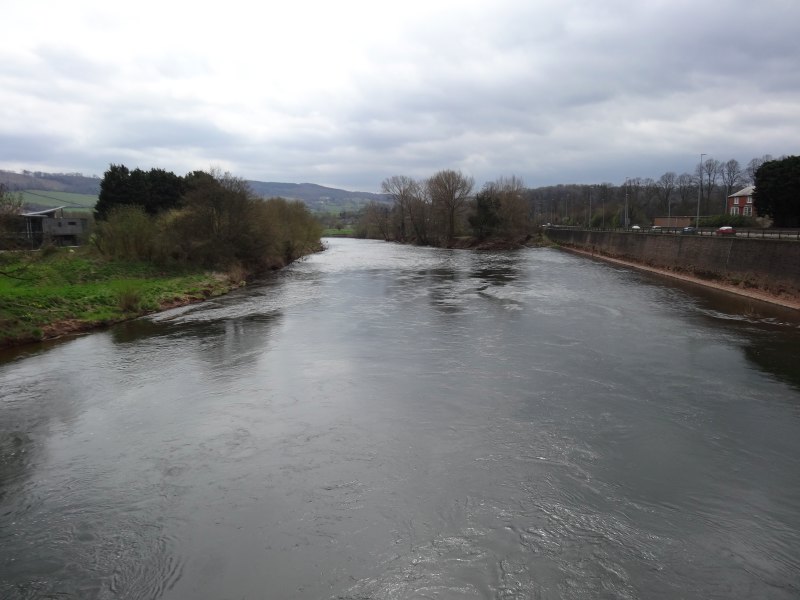
When I got into Lower Redbrook, there was a large car park in the centre, but no sign of Janet and Lewys, her rather large white Maremma. I looked at all the cars, but none looked like hers, so I wandered a little. There is the most wonderful derelict railway bridge crossing the river, one of the last signs of a rich industrial past. The village now seems to be the epitome of rural peace, but it used to be at the heart of metal production, originally producing iron (hence the rust-red of its name), then copper, and the highest quality tin plate in the world. The tin works only closed in the early 1960s, and evidently it also used to host three breweries. I think this used to be the highest point that tidal boats could navigate upriver.

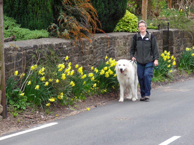
With mobile phones clearly not connecting I was beginning to wonder what to do, when down the road I saw a large white dog with Janet in tow. I should explain that Maremmas are always large, but Lewys particularly so; when he stands in a room it feels as if you are surrounded by doll’s house furniture. Maremmas are Italian sheepdogs, but unlike British sheepdogs that are constantly under the control of the farmer mainly to herd the sheep, Maremmas are left to roam wild with the sheep mainly to protect them – they are bred to fight off bears.
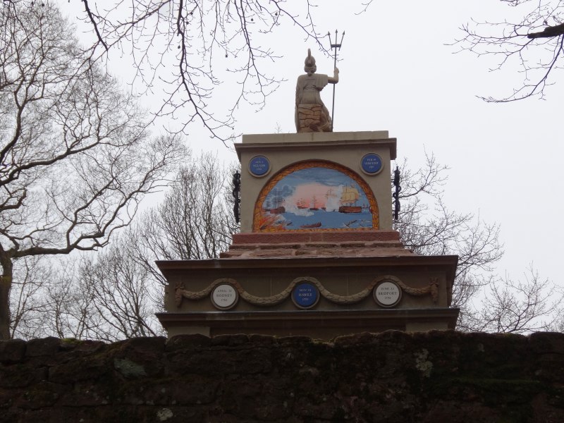
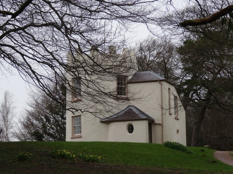
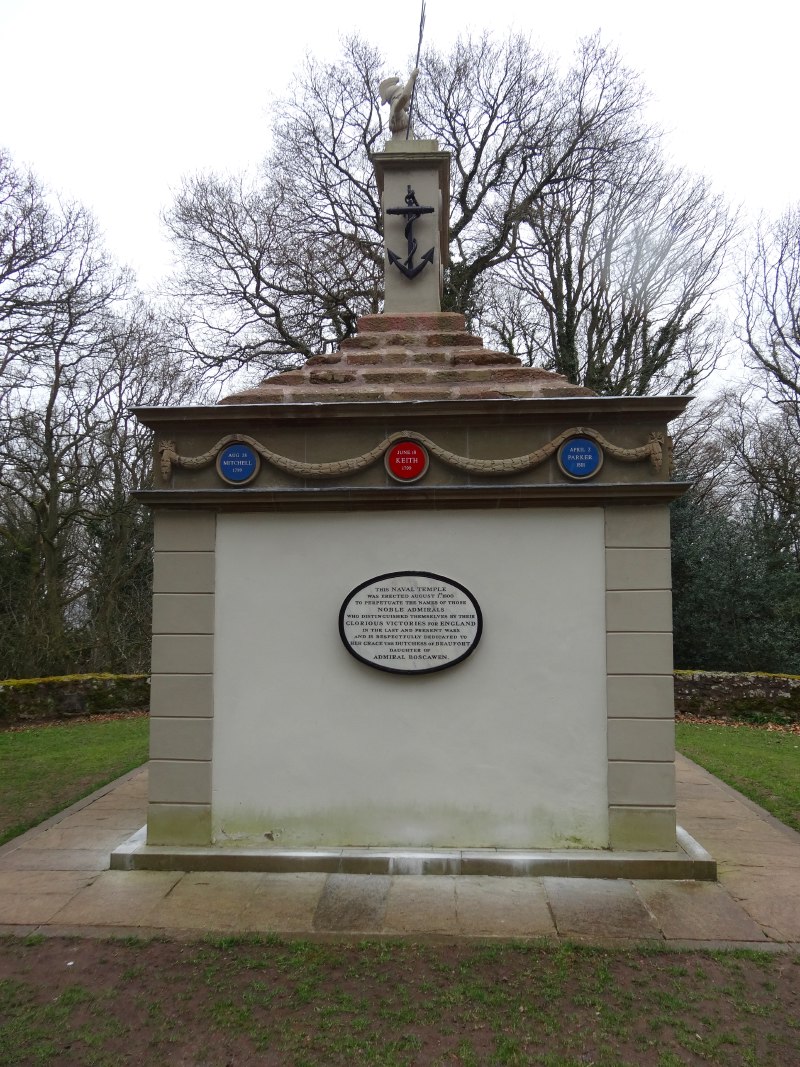
The path from Redbrook initially follows the road uphill for half a mile before turning off and cutting up the open hillside. It is sometimes more level, and sometimes steeper, but gradually makes its way to the top of The Kymin, a hill standing near 800 feet above the valley bottom looking out over Monmouth. On top of The Kymin is the Naval Temple a monument built by public subscription in 1800 to commemorate the famous admirals and naval heroes (maybe a lot of ex sea captains retired to Monmouth), and also the Round House, a small tower that was built as a Jane Austen-style picnic venue.
The National Trust owns the monuments and out of a small window at the side of the Round House teas and cakes are being served. The weather had threatened rain, but was now clear, and so a cup of tea and a home-made bake looking out over the view was most welcome. We did not realise at first how fortunate we were; although the Round House is always open with a National Trust guide, the tea and cakes was a one-off event.
The way back down was uneventful, cutting steeply down the hillside, sometimes through open ground, sometimes through woods, and, at the end, along a small road. Eventually we are at the edge of the town, passing by the suburbs on the east side of the river, and perhaps more significantly the east side of the A40.
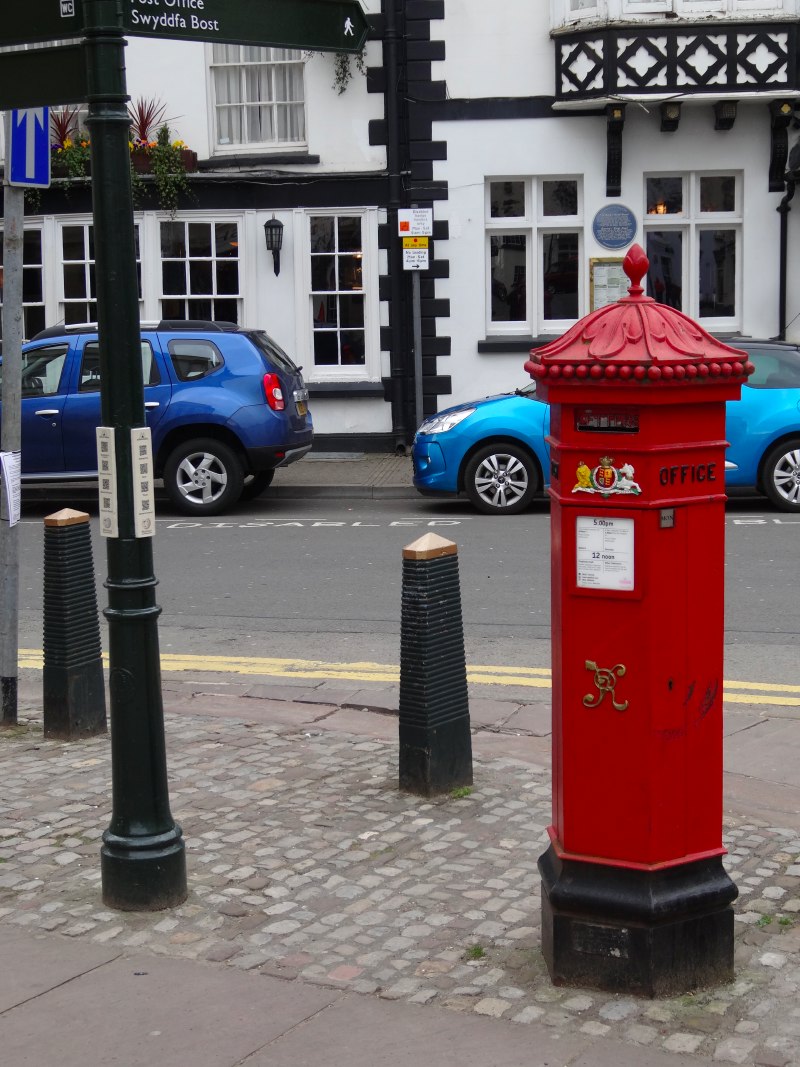
Monmouth is a walled town in the gap between the River Wye and the smaller Monnow. The waters acted in part as defence and are an integral part of the town. However, when the A40 was upgraded to a dual carriageway, it effectively cut the town off from the Wye. From the east you now cross the Wye on a road bridge and then take an underpass beneath the A40, coming out beside Monmouth School, an old public school that I know about mainly because my sister once dated a boy who had once studied there, if I recall a soft-spoken boy, the son of a Methodist minister, whose musical taste was centred on punk and the Sex Pistols.
Janet and I parted ways, I to go into town to find Coffeewhere I was to meet Baronne, and she and Lewys to follow the river bank path back along to Redbrook. It had been lovely having her to walk with and this day felt so much better than the day before, although also helped no doubt by being only half the miles.
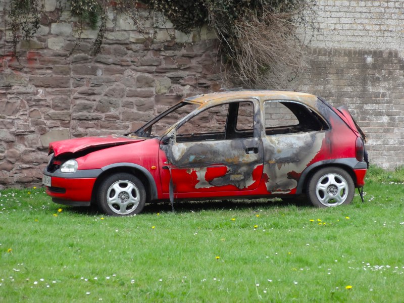
As I came out from the underpass, on some grass beneath fragments of medieval town wall and opposite the genteel red brick walls of Monmouth School a burnt out hatchback sat, heat greyed steel, bright red paint, meeting in a lichen-like boundary of black char.
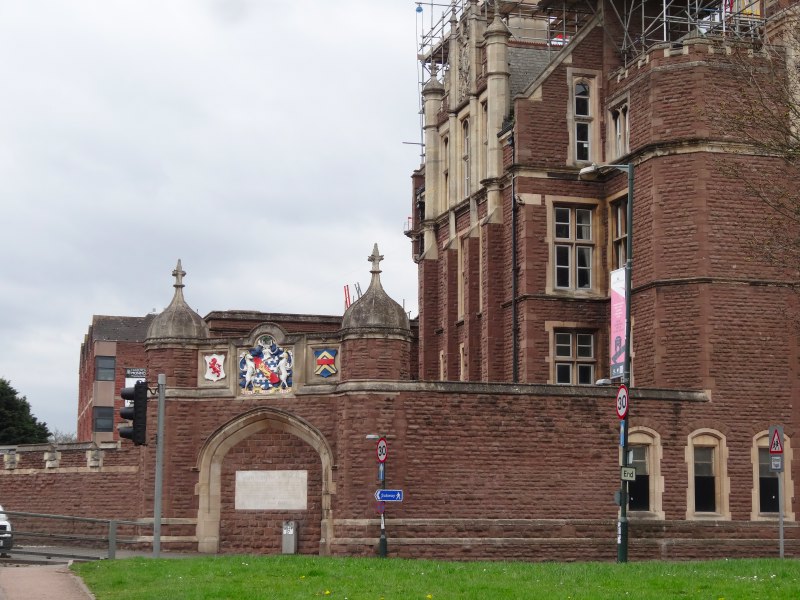
I wasn’t sure which way to go to get to the town centre, so followed what looked like the largest road (well, excepting the A40), which actually slightly runs round the town, I guess concentric roads may be the legacy of being a walled town. Eventually I got to an open area with a large church in the middle, St Mary’s Priory Church.
 I think I would have found my way from there, but when I checked with a man who was passing he walked with me for a bit, guiding me towards the centre. He was called John Evans, a good Welsh name. I asked him about MonmouthpediA, how aware he was of it. It seemed to have been rather low key in the town, but he was going to ask his sons, one living in the US, one in Australia, to see if the news of it had got that far. He also told me to look out for the Savoy Theatre, an Elizabethan building and the oldest theatre in Wales.
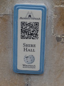
Just after I left John I passed a lamppost with my first MonmouthpediA QR code. It was set in a lovely ceramic plate. I soon saw others. I think these were part of the town trail that Baronne had told me about when we met on the second day of walking. As I entered the town centre proper there were more and more, on public buildings and shops as well as the odd lamppost.
 I found Coffee and met Baronne. We talked about MonmouthpediA, initially in the café and then walking through the streets, looking at them in context. While the QR codes themselves are the visible side of the project, the provision of WiFi had been critical, as otherwise few people would have accessed them. It is a project that will probably take time to grow into itself; while QR codes are ubiquitous in magazines and posters, many people still have little idea how to use them. More problematic still is the fact that the QR codes effectively link physical and digital worlds, but for small businesses there may be no ‘virtual’ equivalent. Shops were asked to say what they would like the codes to be placed outside their shops to point to. I saw a fish and chip shop, where the QR code pointed to a Wikipedia page about fish.
One thing I had considered was to drop off QR codes myself as I walked. Waterproof tiles to stick to every Wales Coast Path or Offas Dyke signpost along the way. It was a nice idea, but the combination of the logistics to make them and the need to get permissions meant it was one idea that was put aside … maybe for a future project.
My plan had been to create QR codes that pointed to uniquely numbered URLs that meant nothing, a bit like TinyURL or other URL shortening services. Once a code had been stuck on I would photograph it in situ with GPS tag so that at that point the QR code would get bound to the place, whether simply the location or something at that place such as a café or historic site. Just like with TinyURL, when you subsequently captured the QR code the unique URL would redirect to some information at the point of interest.
While TinyURL uses these arbitrary names (e.g. http://tinyurl.com/kytrlo8) to make long URLs shorter, here the aim is to make the binding of QR code to URL more flexible. This would partly make it easy to produce QR codes without knowing in advance what would need to be tagged, but also partly because the resulting codes. However, it would also mean that this binding could be changed at a later time.
I imagined what MonmouthpediA would be like using such a schema. If you clicked the codes normally you would get the ‘vanilla’ information (e.g. Wikipedia Fish), but if there were some art or special festival, this might change to reflect it, for example, poetry related to a spot. Even better, if you logged into the site, the content could be personalised, I could imagine families following a treasure hunt around the town.
As well as discussing MonmouthpediA, Baronne told me about his plans for BBQsrc. The idea is to have an outdoor web festival, rather like a music festival, but slightly more HTML than heavy metal. The idea is to hold it on the big field that is already used for other festivals, with marquees for workshops and sessions. It will take a lot of work to get it off the ground, but I’m looking forward to when it does.
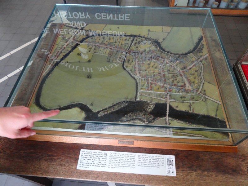
Part of my military planning had also been to meet Jonathan, the Baptist minister, to chat about the church and the community in Monmouth. We had arranged to meet at the Baptist Church at 5pm, so Baronne showed me the way, stopping off at the small museum on the way to show me the historic 3D model of the town, and get me a facsimile map of Monmouthshire also.
When we got to the church all the doors seemed to be shut, we tried the first door, the side door, and assumed that Jonathan hadn’t arrived yet. We sheltered under a nearby shop front when a rain shower came and then tried again. Later when we were in touch by email it transpire that Jonathan was there and waiting, so I’m still not sure whether it was just that there was some other door we did not find, or if he had forgotten to leave a door unlocked.
However, it meant that Baronne and I talked for another hour before he had to make his way home and I set off for Monmouth Caravan Park where I had left the camper van six days before. The van was safe and it felt like ‘home’.
My first task was phoning a taxi service. As I was finding the going tough the day before and realising that my schedule had been slightly unrealistic, I had been trying to work out what I could do to make it easier. The distance and the timeframe were both fixed. I can’t recall if someone else suggested it, or whether it simply came to mind, but I realised it was common, albeit not cheap, to send bags on each day so that I would only need to carry a day pack. This would have the added advantage that I would be able to send more kit, allowing more flexibility for clothing, and also include the little PC laptop that I needed to upload the data from the ECG monitor I was wearing.
This done, I made a cup of tea (what else), and began the task of uploading, recharging and generally ‘tending technology’, a regular task that typically took me an hour each day.
I had been planning to either go into the town and eat or bring a takeaway back to the van. However, I noticed that the Park club house was open and served food, so decided to go there.
Sometimes small decisions make a big difference, this was to be one of the high spots of the walk.
At first I felt a little awkward. Some people can simply walk into a pub and start chatting to people, but I’m not like that. Once I start talking it is hard to stop me, but I find it really hard to make ‘first contact’; in fact one of the reasons I kept the rucksack with the banner with me at all times was to be an ice breaker.
Apart from myself, sitting with computer for company, there was, I think, just one other group, which grew and shrunk from half a dozen to eight, who clearly all knew one another and the proprietors well, mainly drinking, I assume having eaten in their caravans earlier.
There was a small ‘pub food’ style menu, and I chose faggots and gravy. I had last eaten faggots as a child. We did not have them often, maybe this was because we always had half-board guests and Mum knew they were not a universal taste. However, occasionally, she would spot them in a butcher, and bring them home as a ‘special treat’. Thinking back, I think always times when it was just the three of us. I’m not sure about Jacqui, but I never liked them. I’m not sure if it was their liverishness, I never liked it much when we had liver and bacon either, although the latter was always rescued by the fact we had them with my Mum‘s unsurpassed chips. I think Mum‘s love of faggots will have come from the war years when meat was in short supply and faggots became popular.
Anyway, having chosen the faggots for a mixture of nostalgia and wanting to have the most ‘local’ food, it was lovely – whether my tastes have changed, or there are different kinds of faggots, but if you are in Monmouth and want a treat …
I finished my faggots and then, I’m not sure how, I think maybe someone asked me something because I’d left a few leaflets at the site office, but suddenly I was chatting and before long was welcomed into the group as though I had always been part of their circle.
When I dropped the van off I had noticed that the site was all smaller caravans, real ‘touring’ ones, no static caravans nor even the enormous caravans that you sometimes see. However, many of them clearly had small ‘gardens’ around them and must be seasonal pitches. Some of these will be people who visit regularly at weekends or for odd weeks, but some are clearly semi-permanent residents, and it was some of these I had found myself welcomed into the heart of.
Everyone had other ‘homes’, but they would spend four or five days a week or maybe stay for weeks at a time. The owners of the site lived in a house at the edge of the site, but the day-to-day management was left to two residents who shared the job. One was there and told me how she went ‘home’ by bus to Abergavenny for a couple of nights each week. The couple who ran the bar and food in the club house were also residents, spending regular days at the campsite, and then closing the club house for a couple of nights while they too went ‘home’.
Another lady told me how she needed to go ‘home’ soon for a visit as the laundry was building up. The caravans had virtually all that you need, but not a washing machine, and she said the launderette in the town was too expensive.
I keep writing ‘home’ in quotes, as the idea of ‘home’ seemed problematic. While they still saw their permanent house as being ‘home’, they spent more time, certainly during the summer months, here. They will have had family and friends at ‘home’, but clearly an intimate and open community here also
When I had been writing in the run up to The Walk I had been using the words ‘community’ and ‘locality’ almost interchangeably. It is not that I equated the two: clearly in urban areas I expect there to be different communities living side by side in the same geographic area; on the internet I am used to ‘virtual communities’ and ‘online communities’, and in social analysis the idea of ‘communities of practice’. And yet, still there was clearly a part of me that held on to a simplistic model of geography = community.
This is a community that is in a sense defined strongly by locality, the caravan site extends no more than a few hundred yards in each direction. Yet it is very separate from the geographic ‘community’ of Monmouth town, even though the two are geographically overlaid. In some ways it is the accidental community of a street party, simply living close by one another, and yet also by the nature of those who choose this lifestyle, with common features, not least most were semi-retired.
I wonder too at that connection between their ‘home’ communities and the community here, how do their lives differ? Of course in my own life I have often travelled to work, living during the weeks in one town and then returning to my family and home for long weekends. Transhumance is no new phenomenon.
They made me a bacon butty ready for the morning, as I would be gone before breakfast time, and I paid my bill as everyone started to leave, but John, the proprietor, and I were still chatting, so, with barman’s privilege, he continued to pour us pints (note to exciseman, no money changing hands!) until the early hours of the morning.
Eventually, mindful of an early morning start, I went to bed for at least a few hours sleep, and replete with that wonderful sense of welcome, which made me feel, however fleeting my visit and whatever this ‘community’ is, that I had been made part of it.
- I can’t recall what, but related to local industry[back]