Day 34 – MHA in Rhos-on-Sea and Colwyn Bay

A tale of two visits, from independence to dependence a path we all take, redefining ageing, and challenging spirituality.

As the day started with pouring rain, I was not disappointed to miss a day’s walking. Keith Albans picked me up and we headed to Rhos-on-Sea for breakfast at an ice cream shop and café opposite the sea front (but no ice cream with breakfast). Keith is chief chaplain at the MHA, which is one of the charities I am supporting through the walk.

Originally MHA was an acronym for ‘Methodist Homes for the Aged‘, but now, like BP and ICI, it is simply ‘MHA‘. The original name became inappropriate as, over the years, it has taken on homes and schemes that do not have Methodist roots, and residents have many denominational, non-denominational or non-religious backgrounds. However, the MHA ethos still includes a belief in spiritual as well as practical and social care, hence an active chaplaincy throughout all homes.

MHA has facilities varying from high-dependency homes for those with advanced states of dementia who can no longer live independently, to schemes to help the elderly remain in their own homes. We visited two quite different places at near opposite ends of this dimension.

The first, Adlington House, consists of apartments for fully independent living, some rented, but mostly owned by residents. However, the fees include a ‘care package’ with a full-time staffed office as well as communal lounge and bistro (also open to the public), where we later ate lunch (I had local Conwy sausage and mash!)

Chloe, the manager, welcomed us and took us to meet three of the residents. We talked a bit about the walk and why I’m doing it, and also some of the tracking technology I’m carrying in the light of the way various kinds of monitoring and tracking are being trialled for elderly people.

I recalled the story I heard once in Dundee, about an elderly lady whose children began to feel worried as she became withdrawn and confused. The problem, it turned out, was technological, not mental. There were sensors in the flat that ‘spoke’ based on rules, "Are you OK, Mrs Jones?", "Pull the cord if you need help." … In order to make them more ‘user friendly’, the automated system used words recorded by members of the family. However, the system only came into operation at night. I’m sure this was explained at some stage, but I’d guess at the same time as many other features in the accommodation. So, the lady would wake in the night, get up to go to the toilet, and start to hear the voices of her children. She thought she was getting the first signs of Alzheimer’s and hence her depression. The technology was explained again and the problem went away.

The residents had very different approaches to technology. Two were resistant to all technology, except mobile phones, but the third used Skype heavily to keep in contact with family. The common feature, as found by others when studying technology use by older people, is that it is used if it is perceived to be useful, but not for its own sake. Of course this usefulness is fast becoming necessity, and over lunch we wondered whether, in the future, there may be a need for local technology experts, like the Skype-lady, who can help others. I was also reminded of my old idea of the electronic village shop, where the shopkeeper can help customers find their way round the online world, ‘Mrs Goggins as information scientist’.

The residents of Adlington House vary from early 60s to late 80s, but are mostly, at this point, fully able to look after themselves. Over lunch we discussed some of the changes that will happen over the next five to ten years. On the one hand residents will age and care needs change, although the term ‘care’ itself is problematic; but also there will be an increasing expectation or desire for working life to extend into late 60s or 70s. Should dedicated housing schemes like this consider work as part of the support package, maybe supplying hot-desking, or perhaps attempting to create employment opportunities?

We also talked about the way this housing facility fitted into the larger MHA portfolio. MHA is a charity whose mission is to support all as they age, but it also has to be financially sustainable, not all of which can come from charitable collecting as I am doing during the walk. So, like housing associations, the rents or, in the case of leasehold apartments like those at Adlington House, purchase prices, have to reflect costs.

MHA, like similar charities and not-for-profit organisations, are faced with a tension. On the one hand they need to be financially sustainable in order to expand their provision for an ageing population; on the other they wish to maintain access for all. While some of this is helped by government in the form of housing benefits and other allowances, these benefits are also under pressure. One of the residents showed Keith and me her apartment, which included a spare room for when her children visit. If she wished to claim housing benefit, she would be penalised for having the extra room, the so-called ‘bedroom tax’.

Hopefully, charitable donations, such as those related to this walk (have you given yet?) can help ease some of this tension, but, as demand grows and state support shrinks, the need can only increase.

2013-05-21 15.24.23 2013-05-21 15.25.09  2013-05-21 15.25.27

After lunch, we visited Coed Craig in Colwyn Bay. This is on the heavy dependency side of MHA‘s activities, catering for severe dementia. Given this, it was not appropriate to talk with residents; however, it turned out that there was a meeting in progress for MHA chaplains in the region. For a while Keith and I simply sat in while they talked about resident satisfaction surveys and values assessments, but then the discussion turned to the walk.

We talked partly about church buildings, the many I have passed that have closed, but also the churches up Offa’s Dyke that offer free refreshments to walkers, the ministry of hospitality. One of them asks me whether the walk has a spiritual dimension. I fudge a little; there is definitely a sense of pilgrimage, but where the pilgrimage of Welsh identity and the pilgrimage of personal spirituality start and stop is hard to define. But on the table of my campervan is my copy of the Methodist Hymn Book, inscribed within in my Mum‘s handwriting:

Alan John Dix
Christmas 1967
"Oh Come, Let us sing
unto the Lord"

Strangely, as a bookmark in the hymn book, I find the 1979–80 programme card of the Trinity Mathematical Society. There is no clean separation between Welshness and hymn singing (in my head I hear the rich bass tones of ‘Bread of heaven‘), between spirituality and mathematics.

But do I fudge my language, just as the simple statement of the missionary, "simply the Holy Spirit", challenged my more woolly, "happenstance or providence", when talking about the statistically improbable meetings I have had along the way? Should I be more direct in my words?

Over the years I have, on the one hand, become much more theologically ‘conservative’, in the sense that I have no doubt of the absolute, universal, and unique centrality of Jesus as saviour of all, and yet, on the other hand, much more ready to accept that there are many ways in which Jesus finds each separate person. But, in my desire to avoid offence, do I miss words that would help others in their own path to the One who welcomes all?

2013-05-21 15.27.06

Day 33 – Amlwch to Cemaes

overlooking brickworks and approaching Yr Wylfa; a signal man, a station environment officer, and a youth in black

miles walked: 8
miles completed: 346.3
miles to go: 714

I expected the day to be largely about simply walking as there was only one seaside village between Amlwch and Cemaes, a day purely of natural environment and bodily effort, but instead it has been a day with so many points of encouragement from human encounters.

The path west out of Amlwch skirts inland of the chemical works. I assume the substantial council house estates were built to house the workers.  In architecture, Amlwch feels more like the housing estates you get at the edge of every city, and the estates through which I walked to and from the bus stop are so like Tang Hall in York where we lived for several years.  However, and I can’t put my finger on what it was that gave the impression, there was none of the sense of heaviness that often pervades such estates.

Out of Amlwch Port, the path is signposted up steps, but then leaves you on your own (keep as far seaward as possible), until a post points you across a recreation field; at the far side a pathway runs beside a large mud-banked ditch, along which flows a stream of foul red-brown liquid, foam patches floating or clinging to the banks.  I assume this either flows out of Parys Mountain itself, or perhaps a closer area where copper ore was dumped while waiting to be shipped to the smelting works of ‘Copperopolis‘ at Swansea.

2013-05-20 12.21.15 2013-05-20 12.26.57 2013-05-20 12.29.31

Parys Mountain ore smelted using South Wales coal provided copper for the world.  But now Parys Mountain is left a barren lunar landscape.  So far I have not seen images, but a lady I talked to the previous day said it was definitely impressive and worth visiting, "utterly lifeless, no plants, no birds, eerie", she said.

Passing on, I cross an old railway line and a field of horses before coming back to the sea and grassy clifftop path. All through Anglesey I’ve been amazed at the range of flowers growing on the cliffs, even just above the tideline, and the sheep-grazed fields awash with pale-yellow primroses.  The rocks too are thick with lichens, some soft-edged and velvet like, some hugging close to the surface, like cracked paint, one a heart with a smiling face inside.

2013-05-20 12.46.27 2013-05-20 13.11.23 2013-05-20 13.15.06

As the clifftop path approaches Porth Llechog, just as yesterday in the approach to Amlwch, it becomes quite boggy in places.  No problem for boots, but this day I was wearing sandals, great for the beach walking, but leaving me with mud-spa treatment for my toes. Porth Llechog is also known as Bull Bay, after a nearby cove “Pwyl y Tarw” (‘tarw’ is ‘bull’ in Welsh).  I learn this from a faded information board, which also tells you about the brickworks and china clay works that are further along the coast.  The shiny modern board, like others around Anglesey, says little apart from local by-laws and beaches where dogs are forbidden.  Why create such expensive-looking boards that say so little, especially when the information to say something more useful is already there to hand?

I was looking forward to visiting the café just across from the shore.  When I first planned the walk, Fiona collected a YouTube playlist of traditional and contemporary Welsh singing.  One particularly lovely song was Siglo dy Sail, sung by Meinir Gwilym, and the YouTube video was shot at Caffi Wendon, Benllech.  By looking at Google Street View I’d managed to work out that it was actually at the west end of Porth Llechog.

As I walk along the promenade there are houses to the left, each with well-kept gardens, but more unusual, to the right from the roadside to the cliff edge are cultivated gardens.  It is odd, I love wild things, windswept seascapes, and vegetation-invaded ruins.  Yet this suburban profusion of order, which I would dismiss or ignore in an urban setting, is somehow refreshing in this area of endless wildflower-carpeted cliff sides. Maybe it is the contrasts that appeal to me: enclaves of wilderness in the city and seams of order in the wilderness.

2013-05-20 13.16.02 flower-boat-and-sign-2013-05-20 13.43.26-cropped

However, I am getting increasingly uneasy, as I look ahead, the line of buildings that I took to be where the beach café is has no notice or chairs, or any of the signs of being anything but more houses. Have I missed it somehow?

A lady is in her front garden, so I ask her, and the answer is not good.  The café has closed.  It was evidently not there long, just a year or two, but they never made a go of it. It seems surprising, the coastline is hardly scattered with eating places.  Maybe Porth Llechog is simply not on the car circuit, it has no large beach, no surf, and I guess is more retirement village than seaside town.

Sensing my disappointment, she asks, "would you like a cup of tea".

With my natural reticence, that very ‘British‘ sense of not waiting to impose even when help is offered, I almost said no, but I was the ‘walking man’, not simply Alan.

"That would be lovely, thank you."

Why is it so hard to accept an offered hand?

She took me round to a table on the back patio where her husband was doing back garden chores and a few minutes later came back with a tray of tea and biscuits.

She and her husband continue to garden as I drink my tea, and every so often chat a little. They explain the cliffside gardens.  Evidently each house owns not just their front garden, but also a strip across the road down to the sea, and they garden their patch in various ways.

The day then becomes one of almost endless cliffside walks, with one narrow inlet after another cutting into the dark cliffs, some more like wide fissures, where, I assume, some ancient intrusion or fault sliced through the solid rock.

2013-05-20 14.02.26 2013-05-20 14.06.29 2013-05-20 14.39.45

Eventually, far ahead, I catch sight of the first of the brickworks that I had read about on the (faded) information board at Porth Llechog.  For half an hour it draws closer as I make my way round the small bay of Porth Wen.  It is a surreal picture, strange brick domes that could have come from a Star Wars set, and tall Victorian chimneys.  The footpath cuts above the works as they are closed for safety reasons.  The day has turned cloudy and my photographs are washed out, but I imagine walking amongst these ruins on a good day, the chimneys towering above, and entering under the arched Pantheon-like roofs of the old brick kilns.

On the hillside above the brickworks is winding gear that I assume brought raw materials down to the works.  The bricks themselves would have left by sea from the brickworks’ own quayside.

2013-05-20 14.38.40 2013-05-20 14.42.31 2013-05-20 14.53.27

Beyond the brickworks more grassy hillside, cliffside paths ana rock that looked like giant pebbledash.

Between two headlands, Hell’s Mouth seems peaceful on this early summer day, a stretch of rocky coast and small inlet, but in a north-easterly there would be no shelter and no escape.  But above there is an area that is part Shangri-La, part Avalon, flat raised valley filled with shifting brown rushes between almost emerald green grasslands.

2013-05-20 15.09.25 2013-05-20 15.26.53 2013-05-20 15.10.50

An old wartime watch point guards a headland and then, looking down into the bay of Porth Llanlleiana, there is a grassy sward and castle-like half-round walls, eroding the approach to land.

It is the second works, a much smaller set of buildings, I think ceramics rather than bricks. Ruinous walls rise from the flat grass and a chimney sits part way up the hillside.  I feel there must be some buried flue that connects building to chimney.

This area is only reachable by foot, but there are picnic tables and an abandoned child’s balloon suggest that this is close enough for family afternoon walks from Cemaes, or maybe a walk across fields from the road half a mile or so away.

The first sight of the works had been from far above and the way down a steep, but well-made, staircase cutting down the valley side; on the western side an equally steep path cuts back up the cliffside.  Passing a cushion-like hummock of primrose I climb.

Having put the old industry behind, the ground rises again up and atop a small headland, the island of the ‘Middle Mouse‘ to seaward, ahead, framed by a barbed wire fence, I catch my first glimpse of Wylfa nuclear power station.  I think of the 19th century works, now dangerous only because of the risk of falling masonry, of Parys Mountain, a dead ground still after a hundred years, but walkable on, and then the nuclear industry, how long?  A thousand years, ten thousand years, before the land will be treadable with safety? I think of the Iron Age hill forts and megalithic tombs that scatter the Anglesey landscape.  What would the landscape be like after 10,000 years of nuclear power?

2013-05-20 16.07.04I know many environmental activists have espoused nuclear power as a less bad alternative to the carbon-hungry power that is bringing global warming and inundation.  And I can see this as a temporary alternative, maybe a way to wean ourselves before creating a new way of living within our power means.  But it is simply not sustainable, the effects last too long, I imagine those 10,000 years of nuclear power, how much land would be usable?  Two hundred and fifty cordoned off Wylfa sites, death to enter?

From there on Wylfa becomes the icon of the journey, appearing and then disappearing as the path wends in and out the folds of the cliffside paths.

Directly across Cemaes Bay from Wylfa is the church at Ty’n-llan.  The concrete of the power station hangs ominously over the tombstones, and outside the graveyard walls a small bunch of artificial red carnations and a single white rose are placed.  Have they blown over the wall from one of the graves within?  But they look too well placed.  Maybe this is the last resting place of one shut out from sanctified ground: maybe a distant ancestor who committed suicide and was buried outside the graveyard walls, or maybe a young unmarried girl placing a still-born child under the turf in the deaths of night when none would see.   How is it that we manage to make so many feel excluded from the church of the one who welcomed all?

There is a short alternative route along the lane, but I take the slightly longer way around Llanbadrig Point.  ‘Llanbadrig‘ is the place or church of St Patrick, and later I learn that this is the only church dedicated to St Patrick in Wales.  It is where he came temporarily to land en route back to Ireland from Iona where he had been visiting St Columba.  He may have cast snakes from Ireland, but nothing could protect him from the storms that crash into the north Anglesey coast , and he came to ground here, although not suffering the fate of the Royal Charter. The great advantage of a vow of poverty is that you have no belt of gold to drag you into the depths.

I meet Raymond and Vinney, a railway signalman and station environmental officer from Holyhead who often walk together, we chat for ages and they tell me that I can cut across the beach towards the last headland before Cemaes. The earthy cliffs are cut with treacherous caves and overhangs, and the beach studded with oddly shaped and coloured rocks, the latter I assume the result of mineral rich seams. I spot a mermaid, not out at sea, but printed on a deflated helium balloon; and I set my hand in concrete hand prints, but now, looking at the photographs, I cannot work out why there was concrete on the beach at all.

Cemaes itself is set in a bay within a bay, a natural harbour, with its breakwater creating yet another bay within the bay in the bay.  On the land side of the quay boats are drawn up on the shingle and a small river runs out from a culvert with a parallel tunnel to let the walker through into a small semi-wooded parkland beside the water, and then up the far side into the town.

The bus stop is opposite Cemaes Menter y Pentre (Village Venture).  It is half past five and so it is shut, but it seems to be a sort of multi-use community shop.  I am waiting for the bus to Amlwch, the first of three buses to take me back to Llanfairfechan.  I shelter from the drizzle under a shop doorway and for a short while a lady also shelters and chats before moving on.

Waiting for the next bus at Amlwch was Rhys, his fair, or maybe bleached, hair, in sharp contrast to his black leather jacket and platform boots. He saw my banner, asked abut the walk and gave me a donation, but above all was so excited about the idea, not least the millions of footfalls: yet another lift to end the day.

Day 32 – Benllech to Amlwch

the lifeboatman mapmaker, Anglo-French connections, deadman's gold and animal rescue

miles walked: 15
miles completed: 338.3
miles to go: 722

2013-05-19 10.43.55The common notion is that women talk, but in my experience of B&B proprietors, it is the men who are the talkers. Maybe ‘talker’ is precisely the right word, as, true to stereotypes, the men seem to be collectors of facts and information and are willing to share it with minimal encouragement.

Certainly I learnt much from Keith over a relaxed breakfast.

The best place to catch the Royals is evidently the Menai Bridge Waitrose where Kate pushes her trolley along the aisles with a lack of airs that has made the couple popular on the island.

I recall the investiture of Prince Charles as ‘Prince of Wales‘ in 1969 when I was in junior school. I am by nature a romantic and took it at face value as part of Welsh national pride. However, I did not know the history of the title. In 1301 Edward I, after a series of bloody campaigns to subdue Wales when he had asserted his and England‘s control1. In Caernarfon Castle he stood on a high balcony and addressed the people.

[sem ]Edward II[/sem] being invested as ‘[sem ]Prince of Wales[/sem]‘ by his father.

"Do you want a Prince of Wales?", he asked.

"Yes", the crowd shouted, thinking they were to be offered back at least some semblance of a vassal state.

"I give you your Prince", he cried, their momentary hope destroyed as he held up his infant son.

Thenceforth each successor to the throne has been given the title ‘Prince of Wales‘, historically a sign of Welsh humiliation, not pride.

I knew nothing of this as a child, but as I treasured my Investiture Mug, given to all school children, and watched the pomp on black and white television, the Free Wales Army, in typical amateurish defiance, attempted to disrupt the ceremony with makeshift bombs, one of which injured a child slightly when the police ignored the telephone warning of where to find the bomb; the only blood, save scuffed knuckles, in the last armed Welsh uprising.

Where paramilitaries failed, successive years of non-violent resistance and slow political pressure have afforded a growing independence. Given William and Kate‘s obvious popularity and natural ease, I wonder if, by the time William, in turn, takes on the title ‘Prince of Wales‘, it may be as the constitutional head of state of an independent nation.

I have been fascinated by the micro-communities of the caravan sites ever since the wonderful welcome I received at Monmouth Caravan Site. I learnt that far from being quiet out of season, the B&B stayed busy throughout the year. One source of customers was Wylfa, the nuclear power station, where temporary construction or maintenance workers would seek accommodation even this far afield. However, the other was a sort of overflow from the static caravan sites that surrounded Benllech.

The caravans are mostly owned by retirees who spend nearly their whole year here. During the summer, when family visit, they are often put up in the B&Bs either because there is no room in the caravan, or because they prefer respite from small children overnight. During the winter the caravan sites close for two months, a statutory requirement to show they are ‘temporary’ not permanent housing. But for many, this is their home, and even if they have a house somewhere else they would prefer to stay close, maybe visiting their caravan during the day even if the electricity and services are cut off. So they stay, flotsam of the winter gales, in the shelter of Benllech B&Bs.

The Coast Path out of Benllech runs along the wooded cliffside. The path is narrow in places, and sometimes quite steep down to the sea, but usually wider and well levelled where the cliff is steep.  I find myself catching up with a group strung out along the path ahead, and decide that I will need to simply relax and take my time behind them, but then come to a slight opening with a bench where they stop for rest.

2013-05-19 11.02.20 2013-05-19 11.53.20 2013-05-19 10.55.42

They explain that they are an Anglo-French walking group who converse electronically during the year and then get together once a year for a walking and language week. Alternate days they speak English or French. I’m not sure if I was lucky to catch them on an English day, or whether they took pity on me and spoke English.

"This is nothing", one of them said, looking at the narrow cliffside path; "last year in France the path was this wide", her hands just inches apart, "and a hundred feet sheer down to the sea.". They are clearly experienced walkers as well as linguists.

Pleasure yachts and an RNLI lifeboat bob in sun-drenched waters.  The village of Moelfra sits on a bay with dinghies and tenders pulled up on the shingle beside the quay.  It is nearly noon, and I have a cup of tea at a quayside kiosk and put on suncream before the day gets even hotter.

The lifeboat is at the heart of the village, there is a statue of a lifeboatman and a monument commemorating the loss of the Royal Charter in 1859.

The Royal Charter was the fastest ship in the Australia run in the midst of the gold rush. She was on her way back filled with returning miners, their pockets full of gold nuggets, having made their fortune and looking forward to life of ease in their homeland.

Their journey was almost at an end, and within sight of the shore a Force 12 hurricane struck.  Along with 133 other ships along the western coasts of Britain, the Royal Charter foundered, and of 500 on board only 40 made it to land, the rest, with their gold, sunk in the depths of the Irish Sea.  As part of the rescue 28 Moelfra men made a human chain out to sea to help the survivors to land.

2013-05-19 13.05.31 2013-05-19 12.55.29 2013-05-19 12.55.55

Soon after, the first Moelfra lifeboat was launched and has saved countless lives, including the full complement of the Hindlea, which foundered almost a hundred years to the day after the Royal Charter, in winds of over 100 miles an hour.  With the propellor of the storm-tossed Hindlea spinning above the heads of the lifeboat crew, they managed to come alongside ten times, rescuing the entire crew of the Hindlea, and earning themselves medals for bravery.  And all of them, and indeed all {{RNLI} crews, volunteers, their only reward to know they keep safe the seas and the thanks of those they help.

There is a RNLI museum and a short way along Moelfra Lifeboat Station.

2013-05-19 13.13.23One of the crew is standing outside and starts to tell me some of the stories of the boats and crews who served the coast for so many years.  He invites me in and offers me a cup of tea … well can I say "no"?

The lifeboat station is due to be rebuilt with space for a viewing gallery, so that visitors can see the boat without interfering with its work, even when it is being launched.  The building of the new lifeboat station is however being prompted by the new lifeboat which had just come into commission and is too large to be brought fully inside.

As I leave he suggests I stop for a meal at the Pilot Boat in Dulas and tell them that he has recommended them; he reckons they may give him the odd free pint for his PR efforts.

The way beyond Moelfra is more open and the cliffs low to the water.  I pass the stone monument where the Royal Charter sank. It looks so peaceful, the odd walker, sun glinting on the sea, and a diving boat in the water, maybe seeking dead men’s gold.

I come to the next bay and see a group of older people on the beach ahead.  At first I think that the Anglo-French group overtook me whilst I was seeing the museum and lifeboat station in Moelfra, but then discover they are a group of amateur geologists investigating the rocks.

The sun beats hotter and swirls of smoke-like mist rise from the damp sands as I cut directly across to the far side, wading the shallow water along the way.  I mistakenly think this is Traeth Dulas, a deep inlet and am pleased as I get to the other side as I think I have cut off a mile of walking up and down the estuary … but then realise this was just Traeth Lligwy, a shallower bay.

sun-mist-2013-05-19 14.11.13-cropped

Traeth Dulas is a minor estuary and the path cuts along one side, on the green hills above the steep wooded cliff, then down a small lane until ahead is an old, brightly painted double decker bus.  It is the Pilot Boat and its children’s ‘Fun Bus’.

Following the lifeboatman’s advice I have a meal there and a pint, a very belated 4 o’clock lunch, and then set off again across a small bridge and then onto the old road that crosses the water at a ford.

Rather than skirting the full muddy length of the estuary edge, the path cuts inland and up, past the tiny hamlet named ‘Dulas‘ on the map (the very slightly larger scattering near the Pilot Boat is strictly ‘City Dulas‘) and the church of St Gwenllwyfo and then back down past farm and fields of sheep to the grassy cliff tops again.

I can’t recall if I first heard or saw the lamb struggling by the cliff edge.  A fence protected the edge, but a lamb had its head stuck firmly through the four-inch square mesh of the pig netting.  As I approached it became more agitated and I was worried I would do more harm than good, but as I touched it, it instantly stilled, and slowly, I shifted its head, the firm wool coat soft under my fingers, rotating it until it slipped free and it skipped carelessly back up the field to find its mother.

lambs-2013-05-19 17.16.42-cropped

island-tower-2013-05-19 17.15.09-cropped

To sea there is a low island, or simply rocky shelf, on which is a tower looking not unlike the tops of the tall monastery bell towers you see in Ireland.  On the map I see it is called Ynys Dulas and it simply says ‘tower’.  At the time, I wonder whether it is the home of a hermit, like the island below the Severn Bridge, or a warning for ships, a lightless lighthouse, but having now checked online, I find that rather (or as well as) warning mariners off the rocks, it was built in 1821 as a shelter for those already shipwrecked and finding their way to this forlorn rock.

It is after five o’clock and I still have several miles to go.  The scenery is beautiful but I am glad when Port Amlwch gradually comes into view and I  walk past the museum of the copper industry and the deep docks into the town.  The wait for the bus is not long and soon I am on the long journey back to the campervan still at Llanfairfechan.

  1. He was no more kind north of the border where he was known as the ‘Hammer of the Scots‘[back]

Day 31 Menai Bridge to Benllech

onto Anglesey, island of druid and prayer; a missing cafe, a priory dovecote, a wave-lashed lighthouse and a blocked path

miles walked: 21
miles completed: 323.3
miles to go: 737

I arrived at Menai Bridge by bus and started the route where I had finished it the previous night outside The Bridge Inn on the Anglesey end of the bridge.  There is a tiny garden here with a seat and a plaque; it was made to commemorate the children who died in the Aberfan in 1966.

Menai Bridge is definitely not down at heel.  No boarded up shops, but an interior design studio, art gallery, and posh restaurants.  The Coast Path follows small streets through the town, with occasional small grassed areas overlooking the Menai Straits.

Looking back to the bridge, it is an amazing feat of engineering, but maybe more amazing are the bus drivers who go across it day by day. Each carriageway goes under its own arch, and when I say ‘carriageway’ of course when Telford designed it it was for carriages. A modern bus is a lot wider than a 19th-century horse-drawn carriage. To get through the arch the bus has to first come to a complete stop; I think this must be to allow the normal slight side-to-side swaying to decay. The traffic builds up behind. Then, very slowly it inches forward, the wing mirrors nearly scraping the stone, then, like a snake wriggling from its skin, once the wing mirrors are through the driver speeds up, until the bus reaches the second tower and the process starts again.

The Coast Path follows the main road towards Beaumaris.  The road has few cars and is pleasant, with views across the straits, so much so that when the Coast Path takes a more minor road inland, I wonder why, given it normally hugs the coast so closely.  However, I can imagine that in summer the now tolerably busy coast road will be tail-to-tail with cars.

For a while, the small road leads through semi-suburban-style village, with houses or close hedgerow on both sides, adding to my wonder as to why the path ever left the coast road with its open views up and down straits and across to Snowdonia.  But then, the houses on the seaward side ended and gave way to open fields and open stunning panorama, from the Great Orme to the valleys cutting into the mountains, and I decided the path planners perhaps did know what they were doing.

For a short while the path leads off the road past bluebell woods and then into a veritable Hampton Court Maze of gorse land. Instead of neatly cut hedges the gorse branches near meet across the way, pulling and tearing at you like a Sleeping Beauty forest, and underfoot, instead of manicured grass, sinking boot-churned mud that threatens to swallow you. I have been wearing sandals instead of boots since the day from Mostyn to Abergele when my ankles swelled, and for the first time since then I thought that maybe boots had their advantages.

Unlike the ancient unicursal mazes and spirals, this is a land of crossing pathways, and instead of an Ariadne thread, occasional (too occasional) marker posts to tell you that this is the right clinging narrow track amongst many.  In short, although maybe half a mile across or less, the sort of place that as a child I would have died for.

Coming down into Beaumaris (Biwmares) the road passes fern-lined under a railway bridge and I am struck again that while the camera can ‘capture’ sights and the recorder sounds, the smells are still held only in your memory, and so hard to express unless you have experienced them yourself: the dark dank earth smell of the fern; the almost sickly rich, honey-sweet gorse; the sharp aromatic wild garlic; and even, a few days before, along the A55 leading from Conwy to Penmaenmawr, the pungent peaty sweat-sour rubber on tarmac.

I find it hard to bring a smell to mind, in the way I can a sight or sound, as if my own memories are as limited as tape and celluloid, but when you smell one again – the sheer emotional force… In psychological terms, recall is poor, but recognition instant. Smell is very old, pre-dating trilobites with their early eyes. Smell links directly to ancient parts of our brains, that we share even with reptiles; a dinosaur in our minds. Yet, perhaps because so primitive, hard to explicitly grasp.

I have noticed too that while in dreams I see and hear, I do not smell or taste.  Perhaps these are too deeply buried; do dinosaurs dream?

I guess perfumers have a vocabulary for scents, as wine lovers do for taste. Does this help with recall, as having more colour names does for recall of colours? Do cultures that have fewer colour words dream in monochrome and do perfumers dream in scent?

Beaumaris culture sits low on the north eastern edge of town, out of sight in the first approach.  Multicoloured houses across the water remind me of Tobermory.  I am hungry by now and looking forward to revisiting the seaside café with its own tide-filled crab pool. When the girls were little we camped on Anglesey in our old Type 2 VW campervan, and visited Beaumaris.  The café hired out crab lines, bait and pails, so that children could go crabbing, before emptying the crabs back into the water for the next child.

So I pass by inviting beach front bistros, and press on to the far side of town beyond the large car parks in front of the castle, only to find the café fenced off, its roof tiles missing and the pool drained. Maybe the bottom had fallen out of the crabbing market, maybe it was too far from the centre of Beaumaris, maybe simply not the style of establishment that is attractive to heritage visitors.

So instead I have lunch at ‘Simply Snacks‘, nearly opposite the castle entrance, simple but beautifully decorated, with basic but well-prepared food, definitely café not ‘caf’.  I love them all, from the chintz ‘ye olde tea room’, to  wine-bar-style glass and steel, or natural wood and organic carrot cake establishments, but I fear the Formica-tabled traditional sea-front café may soon be a thing of the past.  Strange, in Italy, it is expected to find the best food in the most basic surroundings, yet in Britain, while not as focused on the ‘experience’ as the French, still ‘appearances matter’.

This makes me think about Apple. In the early days Apple combined strength of design at all levels (well nearly all, the early Apple mouse was always an ergonomic disaster), innovative appearance with the best user interface.  Perhaps even then the latter was inherited from their licensing of Xerox Star design.  Certainly of latter years, not helped when they sacked nearly all their UI research team more than ten years back, and rather like ‘French‘ cuisine (not regional French cooking) has lost sight of the food in search of ambience, Apple have lost sight that this is a computer, which needs to be used to do things, not just an ‘experience’ and a brand.

This is certainly very relevant currently.  If I walk for any period of time, in classic fashion, with hands pushed into rucksack straps, a spot behind my shoulder blade seizes in a knot. The same thing happens when I drive.  It is the long-term impact of the ergonomically disastrous Apple trackpad, sadly emulated by others, which ignores the basic fact that we have an opposable thumb.

Passing Beaumaris Castle, I note that the green area below its walls, which would once have been the killing fields where attackers would fall cut down by arrows from both sides, is now a children’s playground – swords to ploughshares albeit after 800 years.

*****   TBC   *******

Beyond Beaumaris the path keeps close to the coast, along grassy fields or pebble and sand beaches below red earth banks, passing the occasional cottage, farm and dilapidated boat house. The earth banks are scoured by the powerful tide race of the Straits, sometimes cut into caves or even a sugar loaf hummock stranded on the shoreline.

A quarry and long abandoned works blocks the way along the shore, chimney and walls still standing, remnants of past industry. The Coast Path cuts inland towards Penman Priory, ruins dating back to the 13th century when the Augustinian Priory was built on the site of an older Celtic institution. The Christian roots lie deep alongside older settlements and chambered tombs, the island where Roman legions slaughtered druids amongst the oak groves.

At Bangor Cathedral the day before I’d seen a notice about a prayer walk all around Anglesey. It was to be done on a single day with different groups tackling different sections, so that prayer would surround the whole island. I’d mistaken the dates and emailed the contact thinking I’d be passing a group during the day, only to find that I was out by a month, I’d looked at dates, but not month!

The most impressive part of the Priory ruins is the largely intact dovecot, a corbeled roof structure, its internal walls Swiss cheese punctured by innumerable nesting niches. Directly below the circular light from the roof apex, a strange-stepped pillar in the centre rises, from which a ladder could be used to bring in the white-breasted harvest.

The Path leads along a lane north, back towards the sea and the Trwyn Du lighthouse, ‘No Passing Landward’ written on its side, with another red buoy-shaped structure nearby marking more treacherous undersea rocks. The seas break over the latter as I watch, but photos inside the small café at the point show wild waves breaking almost the height of the light itself.

There are a young girl and man inside who are interested in the walk and who, happily, are more observant than me, as I almost left my bag with money, cards, etc., as I left.

After this there is an inland section running initially almost back the way I’d come, sometimes along small lanes, and sometimes footpaths across moorland, through woods and across fields. Looking back the tip of Trwyn Du is visible for some time peeking above cliff top and hedgerow, before it eventually drops out of sight.

I pass signs for a secluded yurt holiday, and telling me that Ramblers have improved the path. To sea large tankers stand nearly motionless. I later learn that they weigh anchor there as it is cheaper than berthing at Liverpool. The crews, from all over the world, sometimes come ashore in the villages further along the North Anglesey coast. Thinking back, I guess this may not always be strictly legal, as not all will have entry visas.

Along the paths I notice that a light turquoise is a popular colour for metal work and even the rope holding rocks to close gates. Much of the land is part of Plas Newydd, maybe it is a favourite colour of the owner.

I think the frequent alternation of path and lane confused my sense of progress. I knew that ahead was Bwrdd Arthur (Arthur’s table), a hill with an old fort on top, and was sure that I was almost there, only to realise it had been another hill and I still had far to go. When eventually I did pass it, I had a moment of confusion as the Path leads through a farmyard with no indication of the way to go. After eventually deciding from the map that this was definitely right, I found, a short way on, a footpath sign, and also, somewhat weirdly, found the hillside was ‘Bryn Offa‘, as if a flashback to two weeks ago.

So all good, and I was on nearly the last stretch down towards Red Wharf Bay, when, disaster, the way ahead is blocked by red plastic fencing and a sign ‘Danger Keep Out’, ‘Footpath Closed’ – there had been a landslip and the way ahead was blocked.

The way back to the last major road was a long way, so I took the only path that seemed possible, a small footpath that led up across the hillside. The way narrowed as it entered woods, and brambles and nettles began to crowd close. It became increasingly difficult, brambles began to cut my bare legs, but I was committed, and then … another small sign perched in a bucket, ‘no public footpath, go back’.

I could see that the way beyond became even more choked, but I had come so far and the time was getting late, so I ignored the sign and pressed on. Now there was no protection, nettles stung and brambles tore, until, at last, it broke free into a small field. The field was fenced all around, except for one gate that led into a small yard, which itself led out onto the road.

I came into the yard and was greeted by a middle-aged couple, "You can’t come through here; there’s a sign; go back".


*************************************************


I had been told not to expect much of signage in North East Wales as tourism was seen as an irrelevant distraction in an industrial or post-industrial area. However, while the signage for the actual path could sometimes be sketchy, the local history signage in the North East had been exemplary, beautifully shaped metal signs with often unexpected glimpses of past times. The waterside walks, designed less for the long distance walker and more for the resident, were also well laid out.

I was now in Anglesey, where tourism is a major facet of the economy, with, since the closing of the Holyhead aluminium smelting plant, only the air force base as a rival.

At Red Wharf Bay I saw the first of the many beach information signs around the coast of Anglesey. I guess there was probably one at Beaumaris too, but I’d missed it amongst the crowds. Here, at the car park on the east end of Red Wharf Bay it was unmissable, a blue metal, three-sided sign rising above the cars.

Each side had an upper and a lower section. On one side was a map of all of Anglesey, useful, I guess, to get an overview, with information about Anglesey in general. Another had a map of Red Wharf Bay itself, dedicated solely to telling you where you were NOT allowed to walk a dog, and also a copy of the local beach by-laws. The final side had a large photograph of Red Wharf Bay, which of course I could see by turning round. The production values were excellent, it had clearly not been cheap; but absolutely nothing about the nature, history or culture, just prohibitions and a superfluous photograph.

Throughout the walk I had been assiduously photographing the signage I saw on the way, and I similarly photographed this sign, but it was the last of these beach signs that I bothered to take as all were effectively identical. It felt such a waste, impressive I’m sure when they were launched, but utterly useless.

The Coast Path leads round the bay, and I was walking along the sands. However, the tide was out and the whole bay a wide expanse of sand. So instead of skirting the shoreline I set out directly across the bay, which appeared, from the map and from what I could see to be firm sand except for a small channel that ran across the middle of the bay. I knew I might have to trace it back to the shoreline if it was impassable, but thought it was worth a try as I was late and it would save me some time, and also because it is just lovely to march out across the sand.

I was so glad that I was walking in sandals not boots. Although I could have taken boots off and walked barefoot, it was so easy to just wade through the shallow channel with sandals and shorts, the water coming barely above my knees.

On the far side of the bay it was just a short way around the back of a small static caravan site, round a headland, and into Benllech, where the Sea View Guest House sat on the small sea front. Keith (I think) directed me across the road to the Bay Café, a lovely restaurant with picture windows overlooking the sea.

I was just staying one night in this B&B and then taking the bus back to Llanfairfechan the next evening from Amlwch, so I needed only a change of clothes and a toothbrush in my day bag to make it an overnight one. Although with chargers, iPad, and the large, albeit light, recording box for the dot.rural narrative project, my rucksack was far from minimal, still there is something satisfying in having all you need in a small rucksack.

Day 30 – Llanfairfechan to Menai Bridge

Along the coastal nature reserves leading to Bangor, City of Learning and first steps on Anglesey. A labyrinth, an unplanned tour of an industrial estate, and an unplanned sausage and bacon bun.

miles walked: 13
miles completed: 302.3
miles to go: 758

The day starts at the crossroads in the centre of Llanfairfechan, following the main street down towards the sea. But take a moment to look back as several streets join at acute angles leaving strangely thin-ended shop ends at their cusp. They remind me of the Point Hotel in Edinburgh, only on a smaller scale.

The seaside area is quiet, but neat, with a large pond and grassy park. The Llanfairfechan information board says, ‘Welcome to the Quarry Villages’, and like Penmaenmawr yesterday, I wonder at what makes one post-industrial community thrive and others fail. The environment must help, estuary mud vs. open seas, and the fact that quarrying or coal mining, while dangerous, are less noxious to the community as a whole than the chemical industry of Flint. However, when I think of the coal tips of the South Wales valleys and the Aberfan disaster, that is not a compelling argument. Part of me wonders, although it may be a poetic rather than practical explanation, whether the act of digging rock from the ground, like that of farming, forges a connection between a people and their land that fosters a sense of belonging to the shared earth and each other.

Stretched out between Llanfairfechan and Bangor are a series of nature reserves making up the Traeth Lavan reserve. The tidal mudflats stretch nearly across to Anglesey, and indeed there are local stories of when there was solid ground all the way across to Anglesey, a lost kingdom drowned in a catastrophic inundation. Certainly the remains of drowned forests are visible here at low tides, just as they are in Cardigan Bay. Today it is the sea birds and waders who pick shellfish and worms where the legendary palaces stood.

The Coast Path largely skirts the nature reserves, presumably to avoid damage, although with the volume of walkers I have met, this seems over cautious. Because of this at one stage I took a path along a dyke, slightly closer to the sea than the official route, and there, seen only by passing dog walkers and grazing sheep, is a maze. Not a deep hedged puzzle maze like Hampton Court, but laid out in stones on the ground. It is a traditional unicursal maze, or labyrinth, that is a single path, no choices or branches, but the path folded back and forth on itself, like a twisted swiss-roll. The aim is not to ‘solve’ it, but simply to follow it, sometimes getting closer to our goal, sometimes further away, like navigating a one-way system.

I follow it all the way to the centre, where votive offerings of seashells and sheep dung show that nature has its own ways of marking, and then back along the same path out again.

The unicursal maze seems, to a modern eye, senseless, no challenge, leading nowhere but back to where you started; you could even step over the stones and ignore the path … but you don’t. Just like my walk, starting and ending at the same point, occasionally the line of the path means that path distance and world distance are at odds, such as at Milford Haven where less than 2 miles across the bay is more like 20 miles walking inland to a crossing point.

However, the point of the traditional maze is not the getting to the place where it ends, but the act of following it, and in doing so both we and the place are changed.

We shall not cease from exploration
And the end of all our exploring
Will be to arrive where we started
And know the place for the first time.
T. S. Eliot, Four Quartets

During the 10 miles from Llanfairfechan to Bangor the environment changes. The lushness that was already apparent in the semi-Mediterranean plants the previous day intensifies as the land passes into the protection of Anglesey, all the warmth of the Gulf Stream, but without the full intensity of sea winds. And passing a small woodland, I catch a smell familiar and yet half-forgotten; it is wild garlic, the first since the southern part of Offa’s Dyke.

The quarries of the hinterland also shift from limestone to slate, and while the quarries themselves are well inland, the field boundaries are marked not by hedgerow or stone wall, but slate fences, thin upright slabs, like planks, about one inch thick and eight inches wide, their feet buried in the ground and tops bound together with wire. I have seen slate fencing in the Lake District, but there larger slabs are used, simply buried in the ground, their edges lapping, like close fitting megaliths. This finer, picket-fence-like North West Wales design depends crucially on metal wire, which, I believe, was only made in quantity in the late 19th century, so did this kind of fencing evolve since then, or maybe it is older, but relying on burying more of the slate.

Penrhyn Castle is the focus for much of the journey, gradually appearing and getting closer. The path does not run past the castle itself as it is set on an island amid the estuary of the River Ogwen, reached by a meandering causeway. While Harlech Castle is defended by being set on a high cliff, Penrhyn Castle is defended by mud.

At one point the path appears to disappear completely, the sea-edge lane stopping abruptly. Clambering down the hazardous loose rocks to the clinging high-tide mud I thought I must have made a mistake, until, little more than a hundred yards later, the path re-appears along a grassy dyke. Later, however, I really did go wrong: instead of following the scenic route into Bangor, I found myself in the middle of an industrial estate. But maybe there are no wrong turns, merely wrong ways of seeing the opportunities of the unexpected; in the industrial estate was a sausage and burger van :-).

I have arranged to meet Eban at the Clock Tower. The Coast Path leads round the north-west side of the city, so I have to cut over and down the hill that rises in the centre of Bangor, the old University building at its top. The sign entering Bangor says ‘City of Learning’, and even the football club is sponsored by ‘Studentopia‘ and has a ‘BookPeople‘ stadium.

The way to the Clock Tower passes the tiny cathedral. I poke my head through the doors to take a quick peek, but am captivated, a scene of activity and colour. I have been on the road for many weeks now and had lost track of the time, it is Pentecost, Whitsun, and the pillars are being hung with banners of flame remembering the wind that shook the building and fire that hung over the heads of the disciples as the Holy Spirit, like a defibrillator in hospital, shocks life into the nascent Jerusalem church.

I am pleased also to see large posters about food distribution at the cathedral, so important now that many are dependent on food banks to survive. I recall with tenderness and admiration St Augustine’s church in Halifax, who 30 years ago decided that they could do without their building and instead focused on building their support for the community around. It is a tiny congregation and yet has an impact so far beyond its size, one of the more recent projects being food distribution bringing together churches across Halifax, which includes some of the most deprived areas of the UK.

Slightly late due to the unplanned ecclesiastical excursion, I meet Eban, a lecturer in film, digital media and communications at Bangor University, and have a wonderful conversation in the Blue Sky Café, which I had previously visited for a lovely breakfast with Thora (also at Bangor University), back in January.

Although Thora and Eban both worked at Bangor, they were in different departments and so did not know they had overlapping interests. It was great to be able to introduce them, especially as I had only come into contact with them both through introductions from others as I planned the walk. Rebecca Solnit talks about the way walking, almost like a sewing thread, binds together, and so there is something symbolic about the way connections are made even by the planning of walking.

In his youth Eban walked the Appalachian trail, four months, 2000 miles, and issues of space and folklore are a significant part of his research as well as the nature and future of bookshops; well, you can’t get better than that! We talked about community, the memories of community, and the dying of village shops as well as about feet, backpacks and hydration.

To end the day I walked the final few miles from Bangor across the Menai Suspension Bridge and onto Anglesey – the next stage. It was interesting to note that the longstanding need for a safer and faster route across the Menai Straits was kicked into action by the 1801Act of Union‘ (bringing Ireland into the UK). Was this purely about increased trade, or also to be able to move troops out there more quickly should the need arise?

Day 29 – Conwy to Llanfairfechan

While yesterday was supposed to be a short day and turned out to be a long one, today was intended to be a long one, from Conway to Bangor, but turned out to be shorter. Sand, roads, railways and a message from Buzz.

miles walked: 8
miles completed: 289.3
miles to go: 771

train-on-time-2013-05-16 10.09.25-croppedAfter starting the day with some writing, I took the 10:09 train, which rolled in exactly to time. You could set your watch by the eastward North Wales service.  By the time I found somewhere for breakfast in Conwy and ate it, it was after eleven. The night before I had come over the bridge below the castle.  This was one of the string of castles built in the 12th century to subdue the Welsh. As well as the castle itself, the town wall is remarkably intact, and it is a World Heritage Site. Such was the fear of the Welsh that only English people were allowed inside the walled town until 1487 when Henry Tudor came to the throne.

I rejoin the Coast Path along the quayside, passing a sculpture of mussels, and (somewhere nearby but I missed) the Mussel Museum.  Mussels were originally gathered for pearls, but later became a culinary export for the town. On the quayside is also the hull of a boat, an old ‘nobby‘ in the midst of repair. The project is similar to the Tiree Maritime Trust, except nobbies are far larger than traditional Tiree boats.

A little further on is ‘The Smallest House in Britain‘, originally fitted into a tiny gap between two existing buildings, one of which has since been demolished. As a campervan owner, I appreciated the care in the layout, everything has its place and where possible multipurpose.  The house itself is barely six foot by five, and the last occupant, at 6 foot 3, used to sleep with his feet sticking out of the window.

2013-05-16 11.20.33 2013-05-16 11.26.35 2013-05-16 11.27.28

Only a few hundred yards into walking properly I looked at my phone to check the time and realised there was a series of missed calls and voicemails from Robert Thomas of Radio Wales News wanting to interview me on the move. So, back to Conwy to meet up, starting the interview by the waterside and then walking together and answering questions on the move.  For this interview, Robert was principally interested in the technology aspects and issues of poor or intermittent connectivity.  It is an issue that comes up a lot in listeners’ letters and that Robert suffered from himself when trying to upload short news summaries using a phone app.  For him it was reliability that was key.

During the interview I said that a lot of the problems were due to hardware and software developers in Silicon Valley simply not realising what real-world connectivity is like, even in major cities, let alone rural areas.  Flickr Uploader is one application that annoys me, as any glitch in the internet causes it to freeze with uploaded but not tagged ‘zombie’ images.  It is not hard to avoid this kind of behaviour; it just requires effort.  However, deeper levels of software and hardware also can make it difficult to get the best performance even when application developers are trying their best; the rot goes all the way down the protocol stack.  For example, TCP,  the basic protocol of the internet, is designed to cope with nuclear blasts taking out whole swathes of the internet and adapts accordingly.  However, the TCP adaptation behaviour works really badly with changes in network behaviour over seconds or minutes, just what you see in congested networks at the end of the school day when everyone starts streaming movies!

2013-05-16 11.18.54 2013-05-16 11.19.22 2013-05-16 11.29.31

Musing on this afterwards I realise I should write some sort of guide to designing software for poor networks.  I have user interface guidelines in old papers including my "Seven Years On" paper about time in general and "Cooperation without (reliable) Communication" (I believe the first journal paper on HCI issues of mobile systems).  However, this could do with the next level of guidance as to the underlying implementation infrastructures required for building robust applications.

After saying farewell to Robert I continued past the Conwy marina.  I realised that given the time I should simply go as far as Llanfairfechan and do the stretch to Bangor another day, so the day becomes instantly more relaxed.

2013-05-16 12.00.52 2013-05-16 13.03.54 2013-05-16 13.04.11 2013-05-16 13.12.22

I took a slightly longer route along the sandy headland beyond the marina than the Coast Path‘s official route.  I assume that they were not able to negotiate formal access even though it is clearly possible, or maybe it is not suitable at high tides.  Whatever the reasons, it was on this stretch that I met a man and his dog, BarneyBarney is a rescue dog (don’t ask me what kind), small, brown and with his nose and throat scarred from badger baiting.  However, in the loving hands of his new owner, he is healthy and his short coat, which when he was rescued was all but bald, now rich and glossy.

2013-05-16 13.22.04 2013-05-16 13.25.52 2013-05-16 14.18.28

Having been mainly discussing the negative issues of technology with Robert, it was good to see some more positive stories.  While Howard, Barney‘s owner, did suffer problems of rural connectivity back up in Lancashire where he lives, he also told me how his housebound wife’s life was transformed when a new computer allowed her to connect with others in similar and different situations.

It turned out that Howard‘s wife’s problem was ‘pernicious anaemia‘, or chronic B12 deficiency.  This is the same thing that Andrea on Tiree suffers from; and she, like Andrea, was not diagnosed for many years, so long that the level of irreversible nerve damage is severe.  Happily Andrea has had some respite, but because she worked out what was wrong with her through looking up symptoms on the internet.

While it must be annoying as a GP when patients turn up convinced they have rare and unlikely diseases, still there are cases like this when the ability to double and triple check things online allows diagnoses that were previously impossible, especially for rare conditions that primary and even specialist doctors may never have seen.

There are two routes for the Wales Coast Path as you travel beyond Conwy, one leads up the hills for a route more distant from the sea, but offering commanding views.  The other sticks closer to the sea, but for a considerable time lies beside and sometimes between the busy A55 and the railway, both of which hug the coast.  If I was on holiday I think I would choose the upper route, but with the view of the Coast Path as a ‘transect’ of modern Wales, I decided to take the ‘warts and all’ route beside the sea (or at least beside the railway beside the sea).

2013-05-16 15.18.35 2013-05-16 14.38.10 2013-05-16 15.26.00

While there are boring bits where you walk for a mile or more in a straight line sandwiched between road and rail, still there are high spots: the grandeur of both Telford‘s original coast road and modern engineering, Mediterranean-like vegetation, and guerrilla art, spray stencilled on the dirty concrete wall:

“No dream is too high
for those with their
eyes in the sky.”
          – Buzz Aldrin

Just earlier Robert and I had talked about the way town centres all look the same, with the same chain stores, and often identical window displays.  But, if you look up, beyond the plate glass windows, the variations in architecture are amazing.

However, it is not just when you look to the sky that you see wonders.  In the same city street, look down, the range of ironmongery in Victorian drains and manhole covers shows that there can be pride and beauty in the most mundane things … and in Flintshire if you don’t look down occasionally you probably miss the little buttons that are your only guide!

And if you take the high route, the obvious route, you also miss PenmaenmawrPenmaenmawr (the big top rock) grew, like so many of the villages along the coast, with the limestone quarries that rise above it, the works clock, high on the hillside, making sure none could claim ignorance for lateness.  The sea was a crucial part of this industry as the stone was shipped down long piers to waiting ships, but now the village is severed from the sea by the railway and A55 North Wales Expressway.

2013-05-16 15.37.53 beach-cafe-open-2013-05-16 16.53.31-cropped 2013-05-16 16.51.59

Yet despite this it has a small, but clearly well looked after … well you can hardly call it a promenade, but a paved beach area.  The beach is composed of large pebbles and the route to the village is through tunnels under first railway and then road, both enlivened by graffiti-like community painting projects.  There is a skateboard area and the walls around the Penmaenmawr Beach Café are decorated with local children’s paintings.  There is even a brand new beach loo with a large open area, which I guess is for changing in; that is if you haven’t hired one of the beach huts on the not-quite-prom.  The Café itself is light and airy, with local history books to read while eating and a specials board, which included ‘black and blue burger’ (read Stilton cheeseburger!).

It turned out that Wendy, who serves at the café, used to work for the MHA some years ago at one of their non-residential projects in Leeds, helping older people live in their own homes and communities as long as possible.  I was reminded again of happenstance vs. providence.

Two of the local history books were by Margaret Roberts drawing on her own family memories and stories and partly those of others.  Here are a few things that caught my eye in one of them, ‘Through Thick and Thin‘,

On page 21:

‘… the National School was opened (1847) and the Welsh Not was brought into force. The children were not allowed to speak Welsh in school and if they were caught the punishment was to wear a square piece of wood hanging around their neck which was to be passed on to the next offender that was caught and when Friday came watch out! For then, the child with the dreaded plaque would be dealt with severely.’

I believe this kind of practice continued into the 1920s.  I’d not come across the term ‘Welsh Not‘ before, but know that there were a series of Acts of Parliament, the latest at the turn of the 20th century, which deliberately sought to eradicate the Welsh language, which the English believed uncouth, unlearned and likely to corrupt morals.

2013-05-16 17.26.10A story a little further on at page 29, ‘The danger of the sea‘, describes how Idris and Eddie were best friends, Idris working at a smithy and Eddie a bakery, both hot jobs. One day Eddie sets off to swim after work and gets cramp, Idris jumps in after him.  Both are drowned, but when the bodies are found they still have their arms wrapped round each other.

Along the coast I see signs warning of dangers to children and memorials to lost fishermen and lifeboatmen.  The sea has been a major source of wealth for North Wales: laden stone transports, fishing and, in the days before good roads, much travel along the coast.  However, the sea exacts her tithe of lives, whether in the clinging mud of the Dee estuary or the tidal surge through the Menai Straits.

Finally on page 30:

‘It isn’t possible for me to write merely about my family long ago there’s always something happening that I want to tell you about. It’s 11:30pm on April 1st, 2003. The war in Iraq is getting worse; women and children are getting killed there. Young men are losing their lives; fighting for who knows what. I hop that somehow, it’s all going to be worth it. It seems to me that there should be other ways in which so-called civilised people sort out their differences.”

I could not help but recall that plaque from the previous day commemorating 50 years of peace.

The last stretch of the day is just a few miles around another headland into Llanfairfechan (little church of Mary).  The current walkway, which cuts back and forth across the A55 and railway, was only constructed in 2007.  Before that it looks as if there was simply a small pavement beside the speeding traffic.

[added April 2014]

On the road into Llanfairfechan I pass a bright blue corrugated iron church, the ‘English Methodist Church‘.  Looking at a scan of circuit records at the National Archive there was a separate English Methodist Circuit based in Bangor from at least 1832.  I assume this would have been established for migrant workers at the nearby quarries in Penmaenmawr; during the Welsh Revival in 1904 reports say that "all the chapels had special prayer-meetings" and also, "The workmen also are having prayer meetings in the Penmaur Quarries at the dinner hour." However the English services must have become increasingly important as the Victorian love of seaside holidays grew; certainly letters in the records suggest the English circuit was important for visitors in the 1920s and 1930s when it clearly was under (unwelcome) pressure to merge with the Welsh circuit.

The tin church reminds me of my childhood church, Roath Park Methodist Church in Cardiff.  It was an enormous stone building capable of holding 1500 people, but had originally been a corrugated iron building, affectionately known as the ‘tin tabernacle’, before the current building was built in the early years of the 20th century.  However, that massive stone building is now closed and this plain blue corrugated iron building still open.

Although reminded of my Methodist roots, on this day these did not extend as far as temperance, and so I stopped off at the Village Inn for a local pint before heading back to the van.  I saw that they served food and thought about returning later for dinner if they also had internet.

"Do you have WiFi", I asked at the bar.

Looking me straight in the eye, without a hint of sarcasm, "Oh we’re not that modern."

2013-05-16 17.52.57 2013-05-16 17.55.24 2013-05-16 17.56.19

Day 28 – Abergele to Conwy

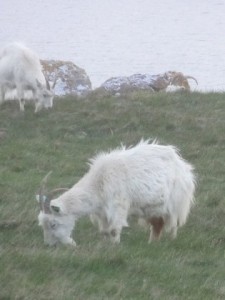
Meeting a missionary in a Llanfairfechan cafe and mistaken for a druid on Great Orm, St Trillio’s by the sea and Conwy by night.

miles walked: 21
miles completed: 281.3
miles to go: 779

This was an uplifting day in so many ways, especially after the previous day, which had seemed such a hard slog.  My ankle continued to hurt, but did not get significantly worse despite a very long day’s walking. I walked in sandals this day whereas the previous day had been boots; maybe the sandals are easier on the flat surfaces, or maybe it was the effect of the scenery, or maybe just my spirits were high and that helps everything!

2013-05-15 20.50.13This was due to be a short day, just 12 miles from Abergele to Llandudno, as, before I set off for the day, I wanted to spend time using the WiFi at the Beach Hut café in Llanfairfechan.  I wrote for a few hours before the Beach Hut opened, looking forward to my breakfast. However, when I got there, only one person was on duty and so could not do a full breakfast, just a bacon bun 🙁  Somehow, I lived through that minor disaster, sat down, munched my bacon butty, started uploading to Flickr (painful), syncing Dropbox files (joy), and writing more of the previous day’s blog.

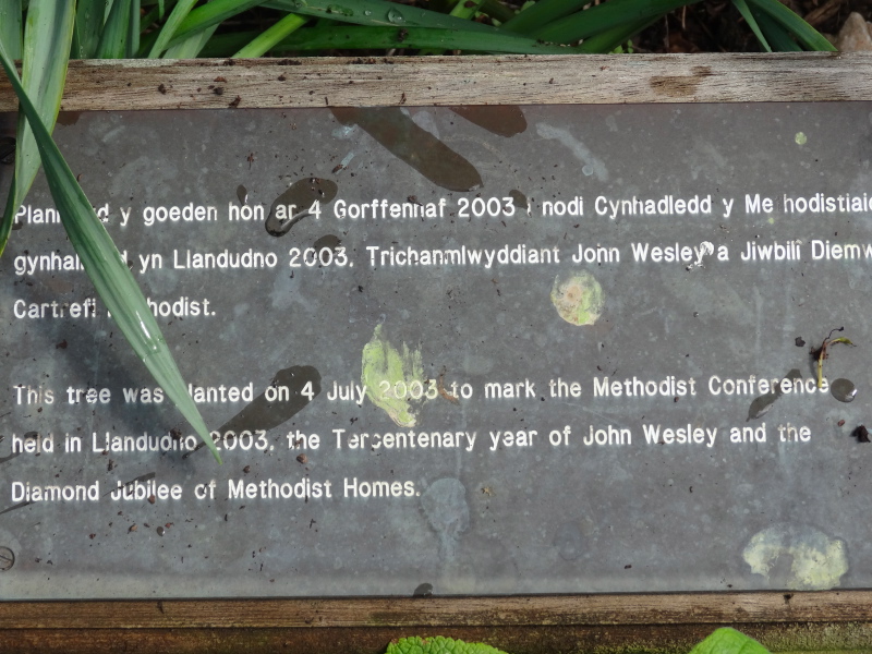
At the next table a group of three people were chatting and suddenly I heard them say, “the Methodist place”, and realised they were talking about one of the MHA homes where one of them was hoping a relative would be placed, quite possibly the home I would be visiting in Colwyn Bay the next week.  A short while later, the group left and a couple came in, sat at the same table and pulled out a laptop.  After a few minutes their computer announced loudly, "you’ve got mail!", just like in the movie.

2013-05-15 20.36.23
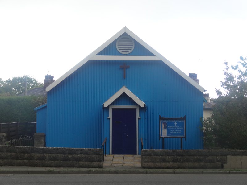
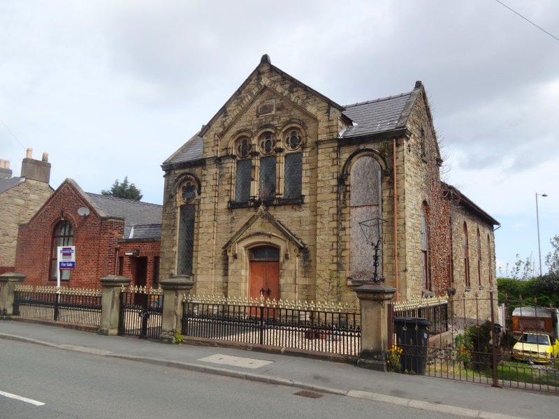
The lady, Joy, noticed my banner and asked about the walk, and when I mentioned MHA she said in fact she was a Methodist ministerJoy spent much of her time in India working with people with leprosy and diabetes, but was currently temporarily looking after the local church as the minister had recently died. We talked about the closed chapels and the way some parts of the church were getting older and literally dying away, whereas others, like the church Esther attends in Liverpool, are growing and thriving. She also told me about a friend from theological college who was a walker and poet.

As she left (my laptop still hard at work uploading files … albeit with power dropping very low) I said how good it had been to chat, and how often during the journey there had been chance yet rich meetings.  "It may be happenstance, or maybe providence", I said.  Joy opened her arms, "simply the Holy Spirit".

abergele-station-2013-05-15 14.07.42-cropped

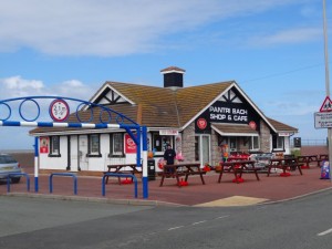
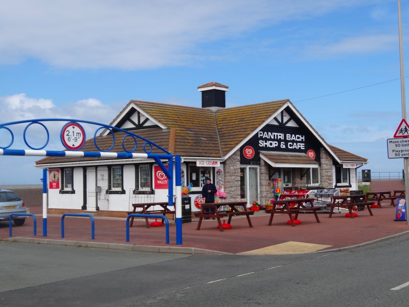
By the time I finished off, prompted by the dead laptop battery, and got the train, it was 2:30pm when I started from Abergele.  The beach front cafe ‘Pantri Bach‘ was open, and with a name like that I had to stop by, albeit, sadly, skipping their sit down ‘all day breakfast’, and just grabbing a tea in a polystyrene cup and a sausage sandwich to eat on the move.

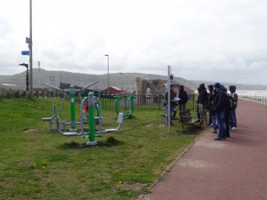
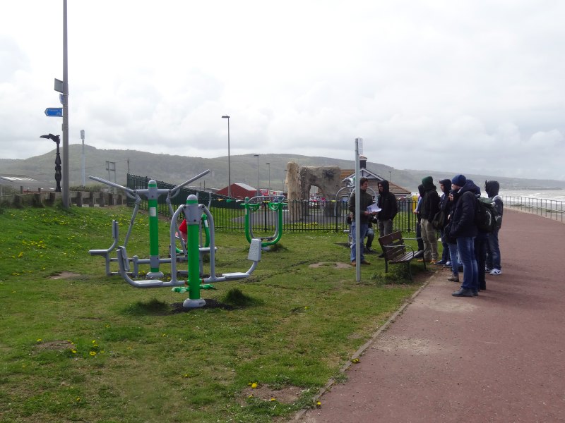
A group of young people led by a man with a clipboard stopped by an open air exercise area.  I’d seen a larger one of these at an earlier resort, it almost feels like Los Angeles.  I don’t know whether this was a sixth form geography lesson looking at seaside regeneration, or maybe an apprenticeship scheme for outdoor recreation, and I don’t know whether they were impressed, but certainly Abergele felt a lot more ‘open for business’ than some of the places I’d been through where everything seemed to be closed.  As well as the exercise area I loved the Charlotte’s Web children’s climbing net.

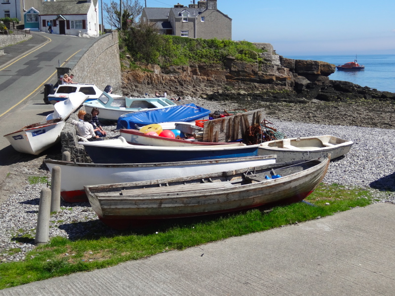
It is early in the season, so not all the seaside stalls are open, but I spot a bait shop; there are many fisherman out already, and I assume even more as the season progresses.  Also there is a pet-grooming stall.  I can’t work out if this is just a convenient place for it, or if it is for all those pet owners who want the sand and seaweed shampooed from their pooch before letting it in the car.

2013-05-15 14.14.39 2013-05-15 14.11.02 2013-05-15 14.36.11

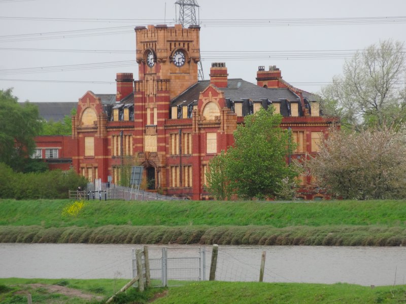
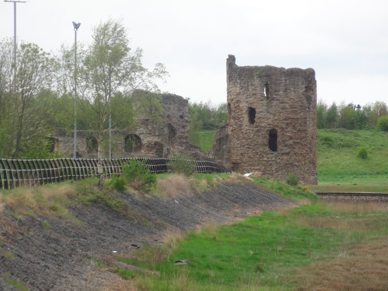
At the far end of Abergele bay is an impressive castle on the hill that I have seen many times from the A55.  I have assumed it is a Victorian folly constructed by a local businessman made rich on the limestone quarries rather than a Norman defence, but need to check it sometime.  However, defence or conceit, it is impressive hanging on the hillside.

Further along the promenade is a large boulder, a memorial in 1995 to fifty years’ peace and dedicated to the heroism of those who died in the 1939–1945 war.  While the latter is unquestionable, the idea of fifty years’ peace between 1945 and 1995 seems odd, given those who lost their lives in Korea, The Falklands and elsewhere.

The caravan parks I had passed so far had all been like municipal car parks, packed closely, I assume the legal minimum distance apart for fire prevention.  In one case I saw a caravan with outward opening French windows, but so close to the fence that they would never be able to be opened.  In contrast, the site at the west end of Abergele is well spaced, often just one caravan deep facing the sea, and, where two deep, staggered rather than in rows, so that the caravans behind can also see the sea.  Admittedly the A55 behind may mean night-time noise, but if I was going to choose a caravan site along this part of the coast, this would get my vote.

I am trying to put my finger on the difference. This town is definitely down at heel, as virtually all seaside towns are, but still pleasant, safe, alive although quiet.

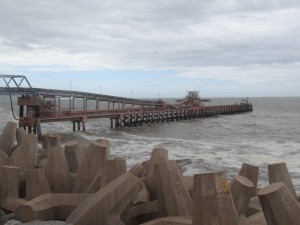
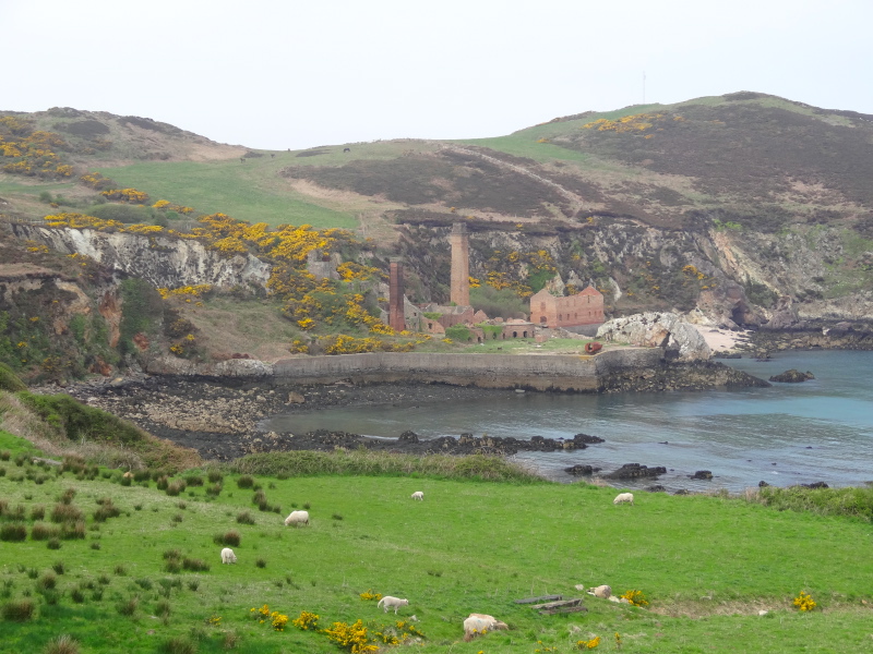
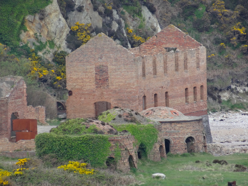
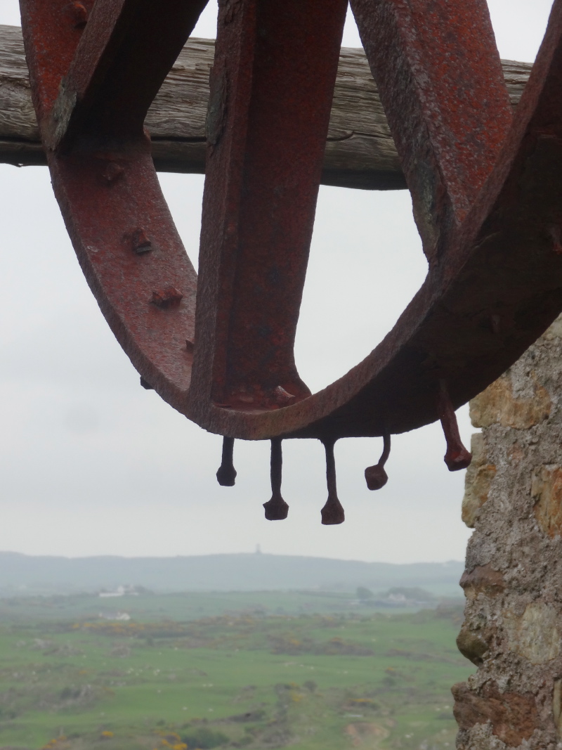
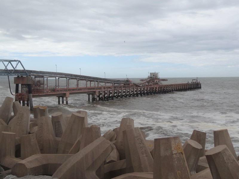
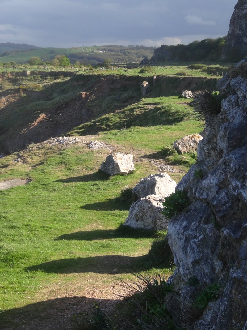
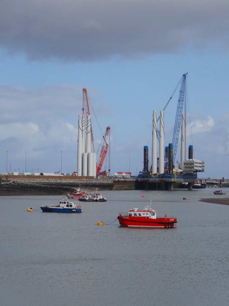
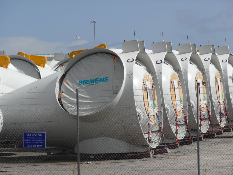
Further along the coast, the other side of LLandulas, the hillsides above the sea are cut with limestone quarries with vast conveyor belts taking the rock out along a pier to load ships.  For heavy or awkward goods, whether stone or Airbus wings, there are advantages still to water transport.

An information board describes the growth of this industry going back hundreds of years, but also describes the strength of community fostered by it.  What is it that makes industrialisation and its dissolution strengthen communities rather than lead to social dissolution?  I don’t know whether the workers here were well treated by the quarry owners, but even if not, the South Wales valleys show that resistance against hardship can also be community strengthening.  In contrast, in Flint, the chemical industry seemed to poison the hearts of generations as noxiously as it polluted the air and water.

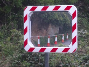
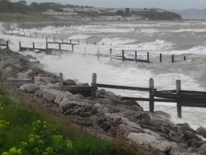
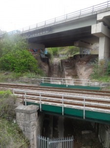
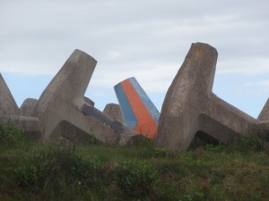
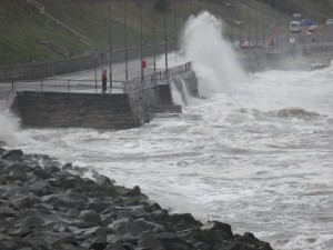
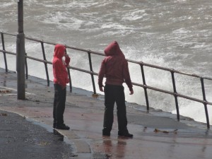
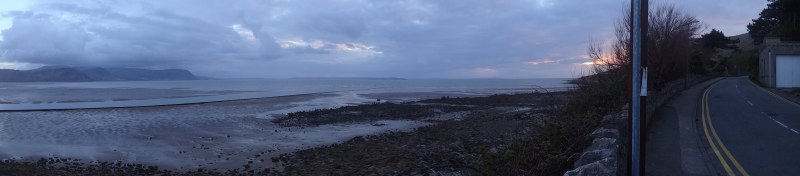
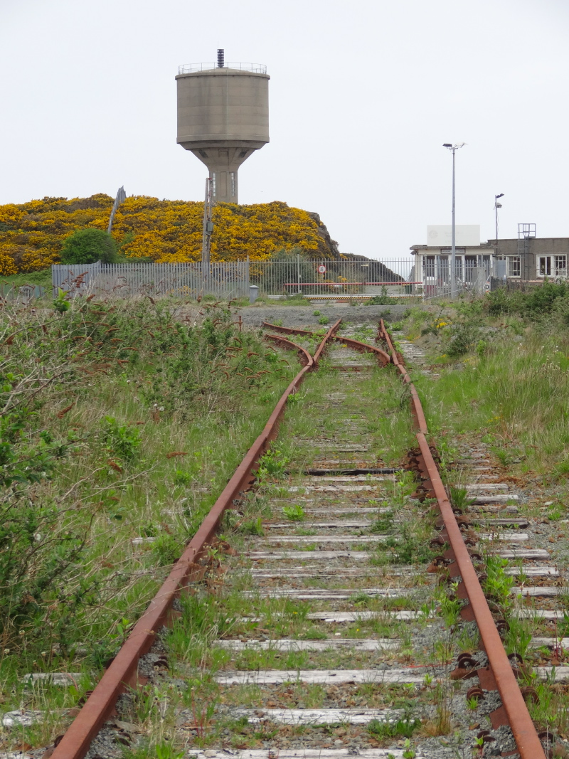
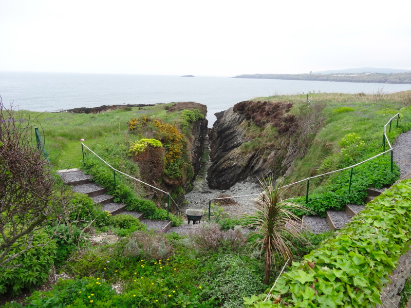
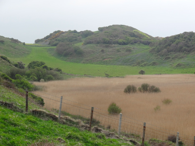
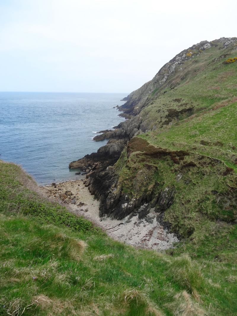
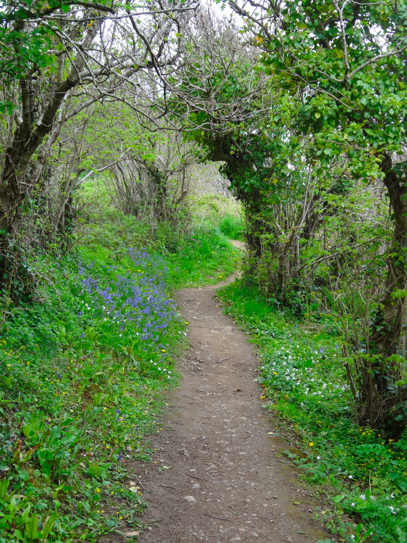
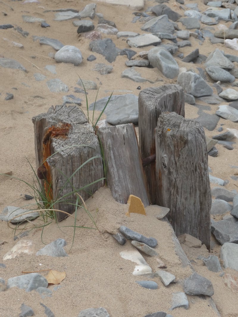
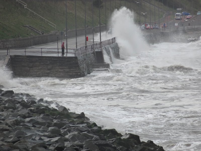
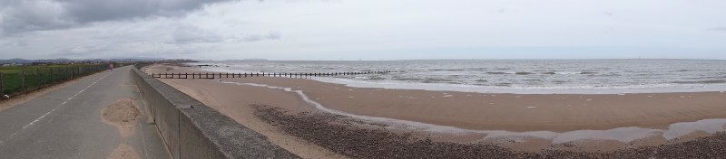
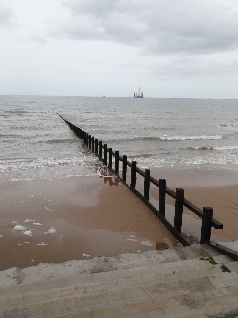
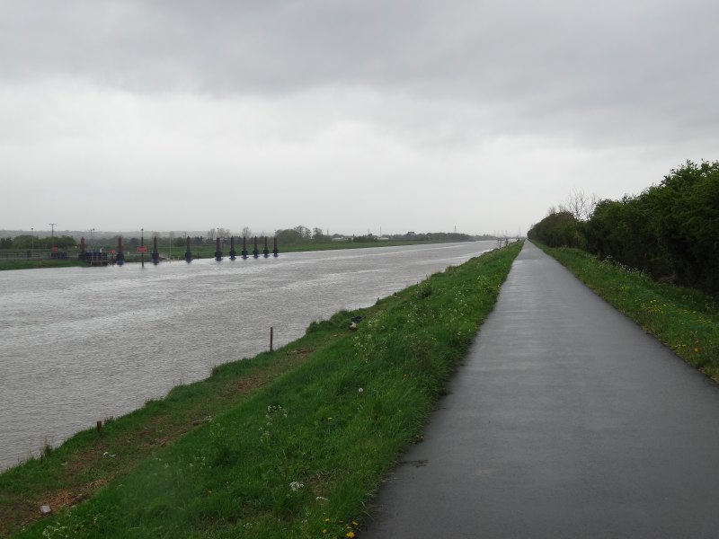
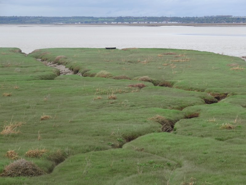
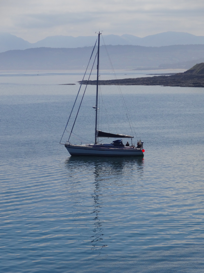
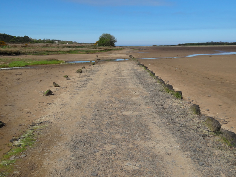
Although there is occasional marsh land or open sands, for a lot of the day the path runs behind or on top of sea defences, sometimes rotting timber groynes, sometimes large boulders, sometimes anchor-like moulded concrete pieces, each arm the height of a man. Along this coast, railway and road often run between the villages and the sea, but the entire strip of land is narrow, constantly threatened by the waves. On a wild day like this, I wonder at the cost of maintaining the defences and whether they would be abandoned and the community sacrificed to the sea were it not for the road and railway.

2013-05-15 14.50.55 2013-05-15 14.49.18 2013-05-15 15.28.42

[completed April 2014]

Llandulas itself is mainly visible on the coast path due to its beach caravan park and ‘Tides Café and Bistro‘; the road comes to the sea through a tunnel under the railway track and I assume the town itself behind.  The road tunnel does not need to dip as the railway embankment is set high to avoid, I assume, being washed over by waves and tide, well above the roof level of the caravans that face the sea.

Although there have been many signs of man’s despoliation of the environment and the harsh elements’ destruction of the land, there are occasional signs of hope.  A notice board describes the honeycomb reef worm, which has returned to these waters after 60 years, a sign of reducing pollution.

A half mile further is the main Llandulas connection to the sea, a near empty car park, public toilet and piles of those giant anchor-shaped concrete blocks, then another quarter mile behind, the vast conveyor belts that cross to the sea, some apparently disused, others still active.

2013-05-15 15.40.272013-05-15 15.49.062013-05-15 15.50.22

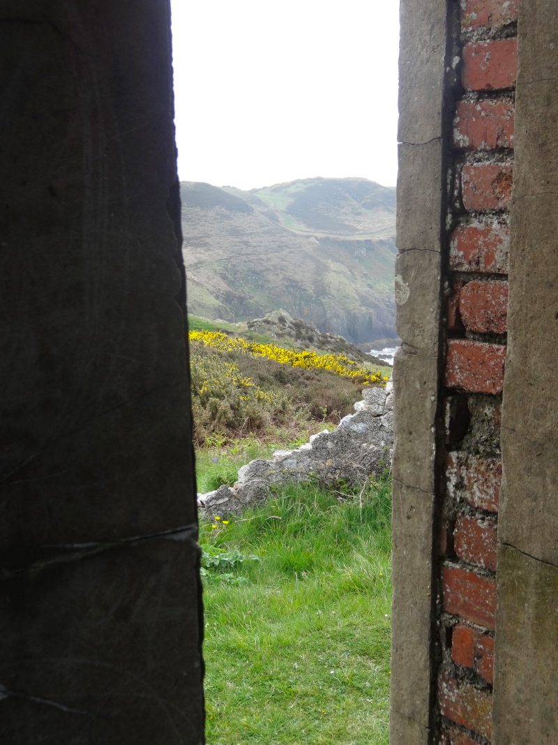
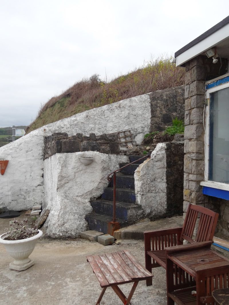
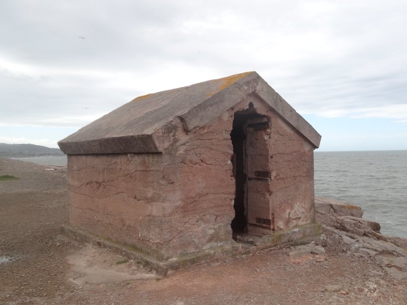
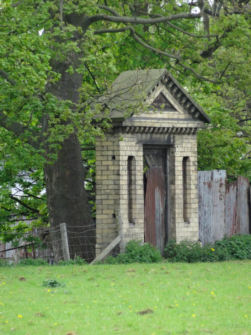
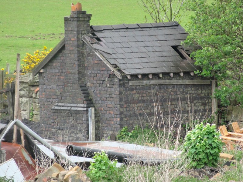
A headland separated Llandulas from Colwyn Bay and on the Llandulas side of the headland is a crude squat stone and concrete hut, its walls a foot and a half thick, an abandoned explosives shed for the quarry, set as far away from quarry and human habitation as possible.

A road joins the footpath at the eastern edge of Colwyn Bay, and the waves break over the sea wall, flooding the road.  The footpath and prom is above the road, so you can stand relatively dry watching the few cars that brave this stretch of road as they time themselves to drive in both directions on the coast side of the road.  I can see sea-thrown pebbles on the road that would smash a windscreen.

2013-05-15 16.00.292013-05-15 16.04.492013-05-15 16.19.20

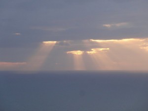
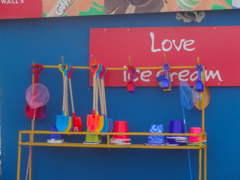
Despite the waves, the weather starts to improve, the cloud bank of the earlier part of the day gradually clearing and blue skies and sun peeking through. The stall selling brightly coloured buckets and spades makes it really feel like the seaside. And, yes, stalls open for business, so I can get myself another polystyrene-cupped tea to nurse along the way.

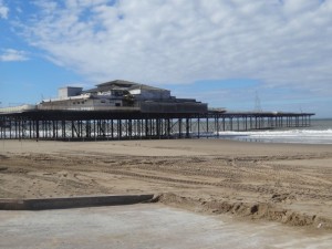
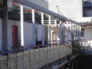
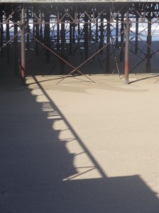
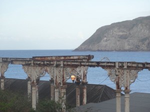
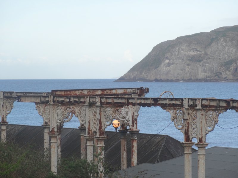
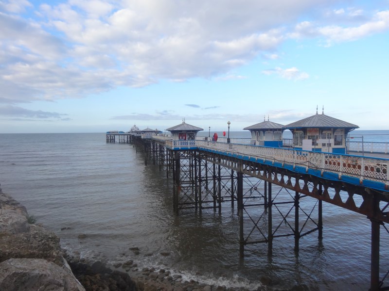
There is a new steel wood and glass building being constructed on the sea front, I assume an information centre, maybe café, complete with its own small vertical axis and turbine.  Further along the Victorian pier still stands, civic building of a different age albeit now derelict and home to buddleia rather than boater-hatted men in striped summer suits and wedding-cake-dress women with parasols.

2013-05-15 16.43.55 2013-05-15 16.46.06 2013-05-15 16.46.20

The prom continues, but a sign tells you that you have now entered Rhos-on-Sea.

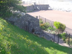
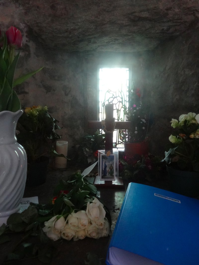
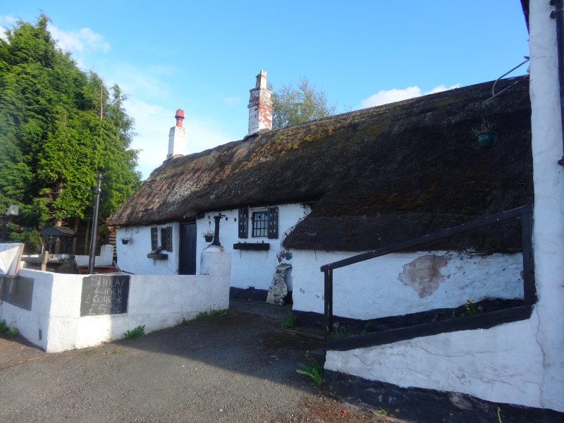
A tourist information board had shown various local sites including the smallest church in Wales, which was clearly on the coast road.  Going round the headland at Rhos-on-Sea, the road is about ten foot higher than the prom, so I walk on the pavement rather than down on the prom to avoid missing one of the few coast-side sights.  And so almost do.

I had been expecting it to be standing on the road side facing across the road, or maybe up one of the side streets running away from the sea, but instead, and I might easily have missed it, I see the roof of a tiny building down beside the footpath, the ridge of its roofline below the level of the road.

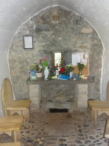
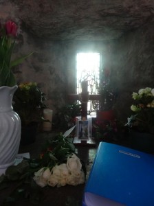
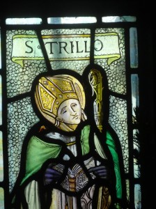
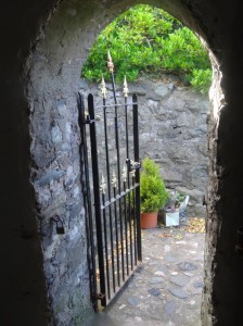
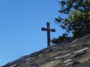
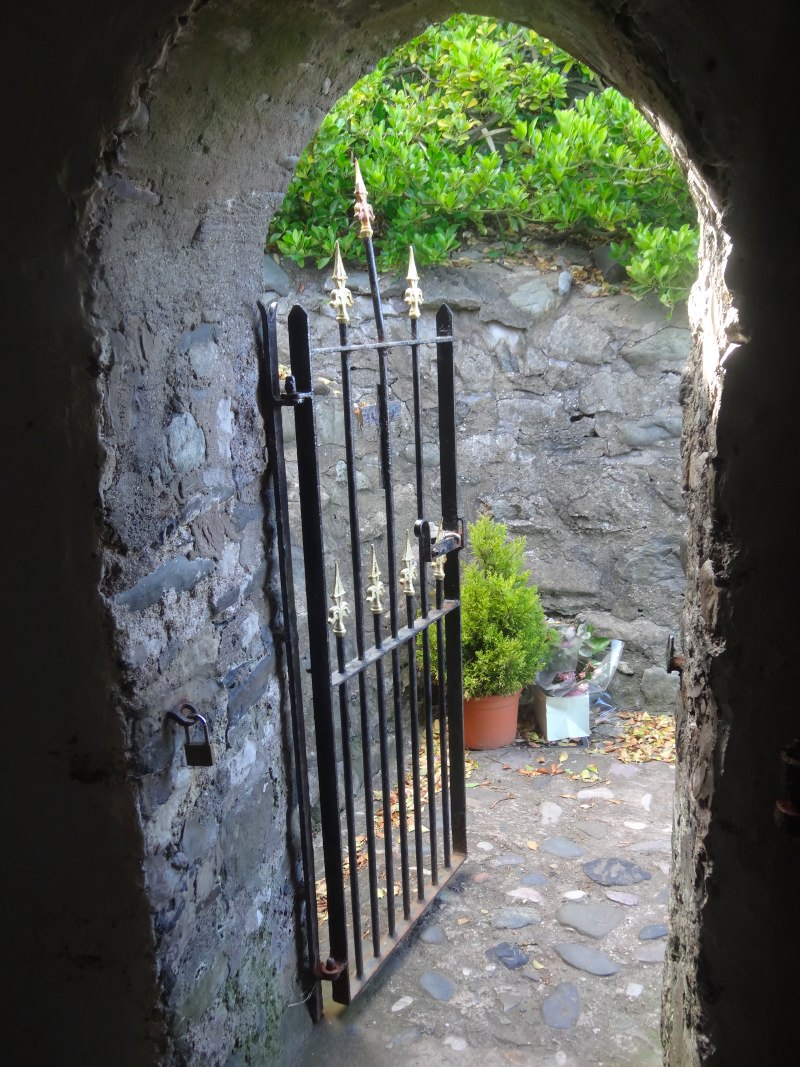
It is St Trillo’s church and one of my personal list of wonders of Wales.

It is stone walled and roofed, almost blending into the rocks behind, with a small plain cross on the peak of its low gable end. Inside, it is barely the size of a living room, with six chairs arranged either side of a small altar above a grating, the site of an old holy well.

It is plain, peaceful, a jewel and a haven.

2013-05-15 17.25.06 2013-05-15 17.26.37 2013-05-15 17.27.02
2013-05-15 17.28.282013-05-15 17.31.112013-05-15 17.31.28

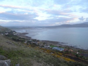
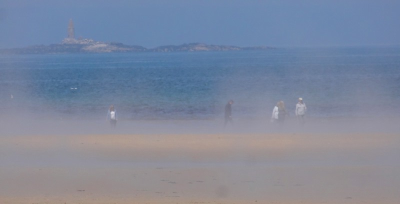
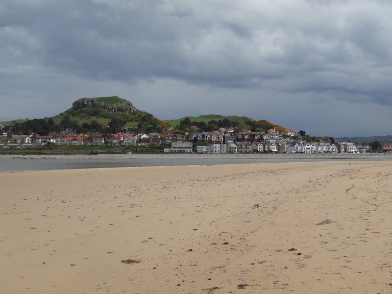
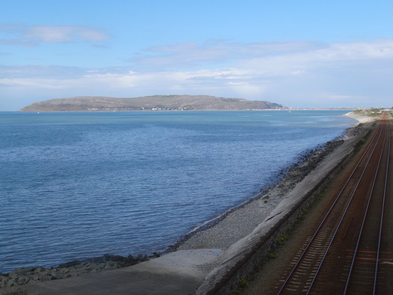
Beyond Rhos-on-Sea I could see another seaside town ahead and a headland beyond.  For a moment I thought this was Llandudno with the Great Orme beyond.  However, as I drew closer I realised it was just the Little Orme I was seeing, what appears on the map as more like a wiggle in the coastline and before it Penrhyn Bay.  Penrhyn is a sleepy town beside the sea, rather than a seaside town; I would guess a retirement rather than holiday destination, maybe the road sign that said, “Beach Drive (no access to beach)”, says it all.

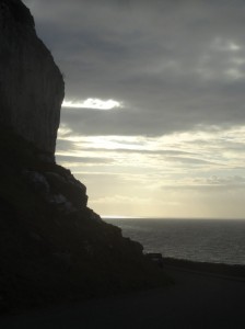
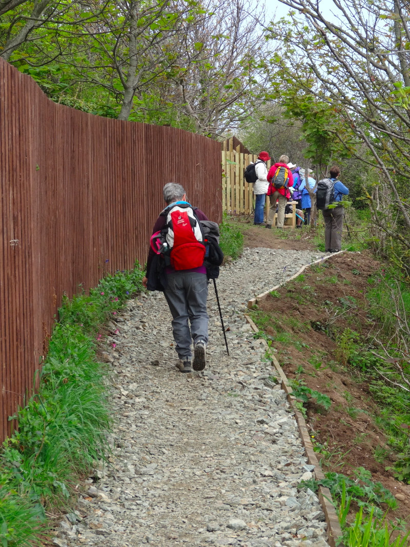
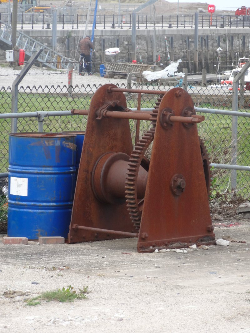
The way to Little Orme leads through a small maze of bungalow estate, but then opens out into quarried layers with many dog walkers amongst the remains of abandoned working gear.

2013-05-15 18.24.05 2013-05-15 18.11.34 2013-05-15 18.44.28

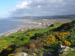
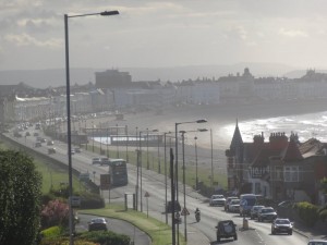
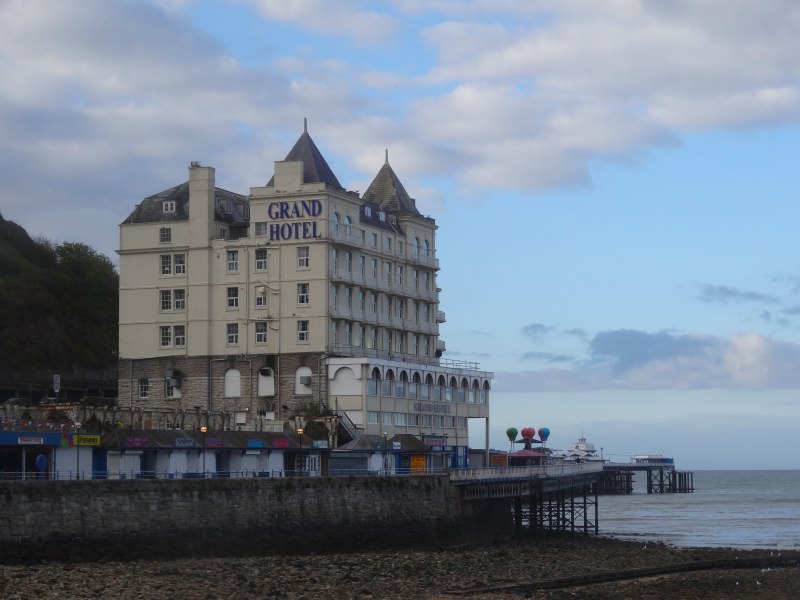
From the top of the Little Orme the views stretch back along the coast and over my day’s walking.  Then, after a short walk through woodland and grassy scrubland, I join the road that breaches the hill and looks down upon the evening-hazed grandeur of Victorian seaside landscaping at its prime, the arch of sea leading past tall sea-front terraces and leading the eye to the Grand Pier and Great Orme itself beyond; wilderness both framed and tamed.

As I come closer I see that the hotels have grand names, the ‘Dorchester‘, the ‘Washington‘, the ‘Hydro‘; the last a reminder that the sea was at first as much a health cure as a holiday.

While there are the occasional signs of distress, on the whole Llandudno seems to have survived the 20th century and is thriving.  It looks as if it never had quite the flood of amusement arcades and fun fairs of the 1950s and 1960s, and so, in its late Victorian charm, is better suited to serve a new form of seaside holiday that is less threatened by Majorca or Ibiza.

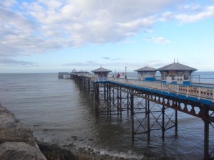
The distances are deceptive, a good mile and half along the prom. The pier is still very much alive, but I cannot see a fish and chip shop, and I was finding myself hungry again.

2013-05-15 19.17.042013-05-15 19.18.542013-05-15 19.22.39

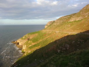
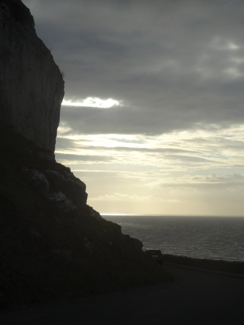
I had accomplished my day’s walking, and done plenty given my afternoon start, so I could walk up into the town, find the railway station, and maybe get some food while I waited for the next train.  But I felt strong, my sandalled feet so much better than the previous booted day.  So I kept on around the Great Orme.  It looks deceptively small on the map, and indeed is just a mile across at its neck, but more like five or six miles to go round.

I would like to return, as deep in its heart is an extensive Bronze Age copper mine, only discovered in 1987. Its size, and the geographic spread of the copper mined here, speak compellingly of the complexity of trade and civilisation that was here 4000 years ago. In the Bronze Age as in the 19th century, Wales was at the heart of global industrial expansion.

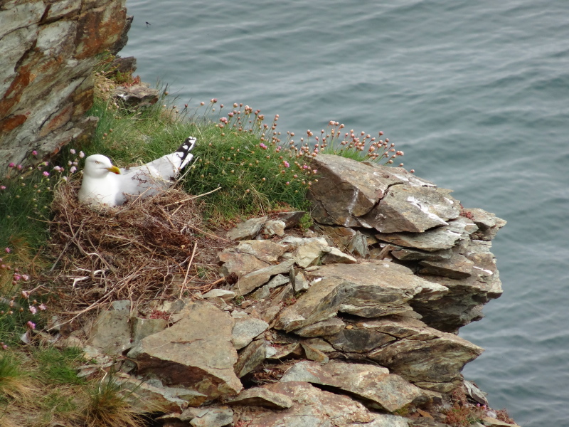
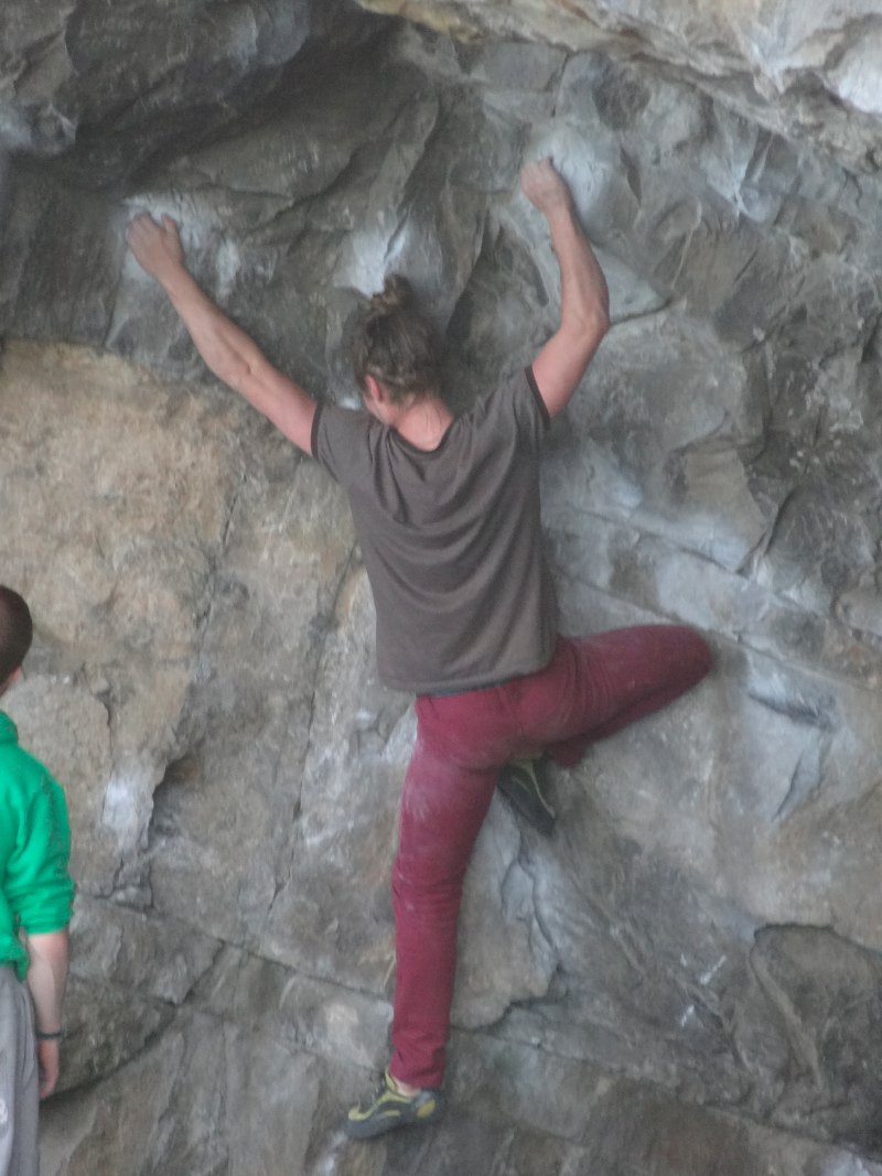
It is a lovely walk, at first rising above Llandudno Pier and the Grand Hotel and looking back towards the town, then gradually climbing further past rock climbers and nesting birds.  In the daytime there is a small café, but at night, once I am a short way out of the town, there are few cars and only one walker, me.

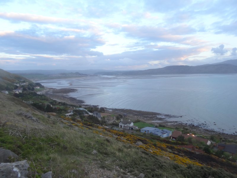
At the furthest point the views stretch along the coast both far back along the way I have come and also onwards to the west,  to Anglesey and Snowdonia.

2013-05-15 20.43.30 2013-05-15 19.57.05 2013-05-15 19.30.08

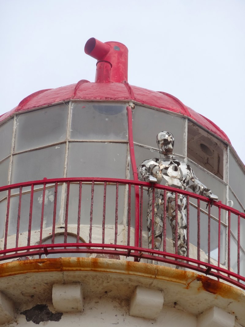
I don’t recall how we started talking, maybe she just stopped to see if I wanted a lift, but I start to chat to a lady passing in a car.  When she had first seen me she had, for a moment, mistaken me for a friend of hers, a druid and a walker.  I guess in long hair and sandals I only need a staff and hair shirt to complete the picture.  She is fascinated by the spiritual sites of the area, both Christian and pagan.

It is often said that we are an increasingly secular nation, and indeed in many ways that is true, but also there is a great thirst for spirituality.  As creatures we are made for a relationship with God, so it is no wonder that despite a culture of materialism there is that deep unfulfilled longing within. I despair sometimes that the church seems largely unable to connect to this seeking for meaning.

2013-05-15 20.03.41 goats-2013-05-15 20.32.30-cropped 2013-05-15 19.38.30 

The Celtic church had no such problems building from the local pre-Christian understandings as well as challenging aspects of them. This was, and can be no crude 1960s syncretism, but instead both an openness to value the many true and rich things in varied beliefs, whilst holding on to a fuller truth, and a willingness to meet people where they are, whilst pointing a route onwards, a pilgrimage to follow together.

We must have talked for half an hour and the dusk was drawing in when we bade farewell and she drove on her way.

For a mile or so I trot gently back down towards the far side of Llandudno.

2013-05-15 20.53.16

Llandudno spans the neck of the Great Orme, but this south-western part, overlooking the Conwy estuary, is a quieter place than the seaward facing side.  There is a café, but of course closed as it is now 9pm.  I had hoped maybe a fish and chip shop, but all is silent in the dimming light.

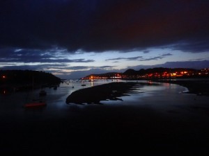
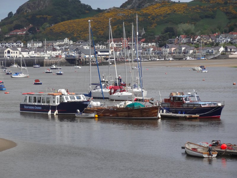
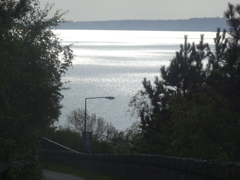
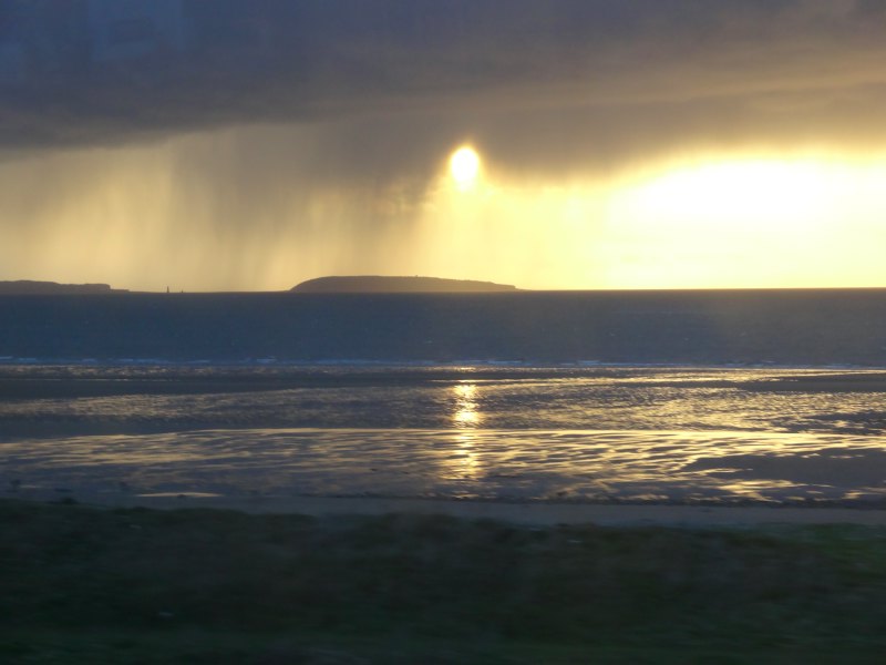
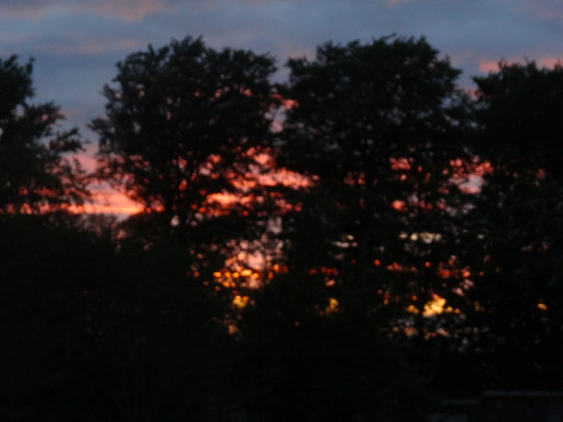
I go on along sand and sea-edge path to Deganwy where there is a halt, but sadly again no fish and chips.  It is now properly dark, and as I walk the last miles along the road past Tywyn toward the Conwy Bridge, the last light fades in the west, so, as I cross the bridge, Conwy Castle is lit ahead and Llandudno shines across the water.

I knew I would be too late for the last train, it is well after 10pm, so I look for a taxi, but come to a pub first, so go in, order a half pint and ask for a taxi number, I am hungry, and tired, but have accomplished far more than I planned.

It had been a day of unexpected joy,  chance yet rich meetings – happenstance, providence or simply the Holy Spirit.

2013-05-15 22.09.14

Day 27 – Mostyn to Abergele

Political images on the Duke of Lancaster, a wind farm farm, a gas terminal and a lighthouse, dunes and promenade, more promenade, and more, slightly dingy, promenade, and a sea of caravans.

miles walked: 18
miles completed: 260.3
miles to go: 800

I would like to say it was an exciting day, that I had found fresh insights amongst the mundane, and in fact there are some lovely parts, such as the dunes at Point of Ayr, but the reality was hard going.  My feet, which seemed to grow stronger as I walked Offa’s Dyke, which took each new hill with fresh vigour, fail against the monotonous flatness of the Dee and North Wales coast.  My ankles, the tendons across the front that lift the toe-end of your feet, were painful at the beginning of the day, screamed by the end and still hobbling-sore the morning after.  I had thought this would be an easy stretch after Offa’s Dyke, where I would make up time and distance, and maybe it is just the fatigue of daily walking catching up with me, especially the long day from Ruthin to the coast.

2013-05-14 09.48.19

Duke of Lancaster

The day started where the last day ended, at the Duke of Lancaster at the far east end of Mostyn.  Whereas yesterday had been the port side of the Duke, this morning it was the starboard side.  Instead of the blue Transformer breaking out of the hull, this side was more a canvas of images, several with strong political overtones, on money and wealth.  It is worth visiting on its own.  Watch out for the blue and white ‘Funship Market‘ and the pub opposite, another ‘Old Tavern Inn‘, is open for food, but you have to go round the back, to the car park side, to get in, all the front doors are locked.

2013-05-14 09.49.57From there, the path follows the coast with mudflat to the right and ahead Mostyn Dock, where cranes are constructing wind turbine towers.  From the train I have seen the turbine parts lying in endless lines in a vast fenced area on the foreshore, but on the dock itself are the towering cranes, one blue, one orange, to assemble the turbine sections, I assume to take out to sea and ‘drop’ into place.  In the offshore wind farms in this area (small and far out to sea compared with the one planned for Tiree), the turbines are supported on piles driven deep into the sand and mud that flows for miles out to sea from the Dee and the Mersey.

On this piece of path the two points of excitement are a discarded tape measure and a Coast Path sign, shot through as air gun practice.  I hope the marksman keeps a lookout for walkers, or rather I hope the marksman keeps a lookout and seeks to avoid hitting walkers.

In a tiny inlet before the harbour itself, maybe even the original Mostyn harbour, lie small fishing boats, in blue and orange to match the cranes behind, and then on the path broken plastic, also in blue and orange, as if the landscape had been painted in a limited palette or the Mostyn football strip.

The path comes away from the foreshore where Mostyn Dock blocks the way and follows the roadside, sometimes along the pavement, sometimes a few yards away.  There is an alternative path that takes you a sightly longer, and I assume more scenic route through old Rhewl Mostyn village to Ffynnongroyw, but I stick to the road route as I want to see the turbine field close to.

2013-05-14 10.00.12 2013-05-14 10.05.34 2013-05-14 10.13.11

Just where the path joins the road is a pub, The Llaety Arms (originally called in 1699The Honest Man‘), which is, miraculously, open, but I decide to press on as I assume there will be beach caf&ecute;s later.  However, only a short while on, opposite Mostyn Dock, I find Anwen’s Grill Bar – now a pub, café or Egon Ronay restaurant I can pass by, but there is something about a road-side van, seeing the food cooked freshly in front of you, it is the ultimate cuisine.

anwen-van-2013-05-14 10.20.16-croppedAs I eat one of Anwen‘s breakfast baps (sausage, bacon, egg and black pudding) and drink my tea, I sit with some electricity board workers about to replace wiring where copper cabling has been stolen, a growing problem across the country in recent years.  One of them chats a little about the walk, and the others talk about mountain biking along some of the trails at Llandegla and downhill tracks amongst the flint hills to the west.

After Mostyn docks, the road leads to Ffynnongroyw, the ‘clear well’, where the well used to serve the village until the 1930s and was only shut off completely in 1980.  I pass one Anglican church and at least four non-conformist churches, all closed and residential or for sale.  I note that one of them had an annexe, clearly built relatively recently, probably the last 20 years.  I think of church repair and re-building discussions at my home in Tiree, and think again that the only church building that matters is the body of people, without them the remains are not holy, but simply empty.

2013-05-14 10.47.162013-05-14 10.53.402013-05-14 11.14.15

Beyond Ffynnongroyw, the next high point is the gas terminal at Talacre.  The path takes a v-shaped path around a piece of empty ex-industrial land that I assume the Flintshire path officer failed to negotiate access to, although the wording of signs suggest that this is work in progress, so maybe one day it will take a more direct route.

Although this part of the coast is not replete with obvious beauty spots, Flintshire Council have worked hard installing well-designed cut metal information boards, exposing some of the long industrial and natural heritage of the area.

2013-05-14 11.57.24 2013-05-14 11.42.45 flag-2013-05-14 12.11.39-cropped

Rounding the hydra-like steel pipework of the gas terminal and set well away from the main complex, a tall tower with the distant roar of a pressure relief flame, the coast stretches due north through Point of Ayr nature reserve, past my first beach café (passed by as I was still full after Anwen‘s breakfast), the tattered flag flying iconic of the decay of the great British seaside, and then on to Point of Ayr itself.  This is a turning point, both literally and because it signals the end of the Dee Estuary and the start of the open sea.

2013-05-14 12.28.31The lighthouse on the point lies on a caldera-like cone of concrete far out on the sands, there being no rocks to sea on which to place it.  It lies slightly to the west of the current Point of Ayr, I assume where the land has shifted over the years. As I draw closer across the sand I realise that there is a figure looking out from near the light high on the tower, an iron man, C3PO, Cyberman, watching out to the east, or maybe towards the English.

I follow the path along the top of the beach, below the dunes of the nature reserve where endangered natterjack toads have been reintroduced, their breeding ponds protected by fences.  ‘Endangered Predator’, the signs say, and I wonder about Arnold Schwarzenegger and whether he considered the environmental loss as he slaughtered a unique species.

Shortly after passing Presthaven Sands Holiday Park, which merits its own special bus stop, there is a sign announcing "Croeso, Welcome", to "The resort town of Prestatyn", although clearly the administrative edge of Prestatyn, the town itself still far distant, the cliffs above, where I had walked three days ago, now beginning to loom and around the sea edge of the dunes, a red-roofed building occasionally appearing.  The path through the dunes here is unclear at times, and I was trying to follow it rather than erode other parts of the sensitive environment, but eventually decided that if it were a problem they would sign more often, so just took a combination of the slightly more difficult (soft sand) path right by the sea edge, where waves broke against stone sea defences (the dunes would clearly like to move eastward towards the Point of Ayr), and easier trodden grass between the dunes.  I saw no toads, but I think this area was pond-less and they are largely nocturnal.

Finally, the dunes and the once distant red-bricked building mark the east end of the long Prestatyn promenade, which runs onwards into Rhyl and Abergele.  The building is a hotel, and I see a man pulling a wheelie suitcase and a sour-faced woman realising that the seafront hotel they had chosen is in fact a good mile from the centre of the town.

2013-05-14 13.50.13A man sits fishing, an image of patience, and I chat to a gentleman about cameras, walking and, after I mention that I am collecting partly for Tenovus, cancer. He and his wife had lost two members of their family in the last year.  Without rancour or self-pity he described weeks spent at the hospital waiting for the end, the simple courage of everyday people.

[completed April 2014]

After about half a mile of prom I get to the end of Offa’s Dyke Path where I had been just a few evenings before. I take some more photographs with the better light, but no selfies this time. It was after two and Anwen‘s breakfast had begun to bed down, so I went into ‘Offa’s Restaurant‘, which seems appropriate.

Between Prestatyn and Rhyl the prom just continues.

2013-05-14 15.35.36

One of the floating cranes I had seen yesterday passes out at sea, looking rather like a powered oil rig, sections of wind turbines are stacked vertically ready to be lifted into place.

On the shore, on the outskirts of Rhyl, there is an estate of those pitch-roofed pre-fabricated constructions that are midway between static caravan and bungalow.  There is a four-foot wall to the same side and, where the tarmac prom path turns into the estate, huge metal gates to keep the sea water at bay.  Nearby there is a sign entitled ‘Coedwig Dan Y More” (the wood beneath the sea), about a drowned forest in the sea here.

2013-05-14 15.36.10 2013-05-14 15.51.10 2013-05-14 15.52.03

The encroaching elements are not a new phenomenon, albeit accelerated by climate change.  The lost land, the hoses struggling to protect themselves now, and the new turbines that will soon surround the coast, all linked.

I pass lidos and funfair rides, kiosks and cafés, but it is mid-May, well out of season for Rhyl, and everything is closed.

2013-05-14 16.08.50 hyl-cafe-2013-05-14 16.14.42-cropped 2013-05-14 16.26.59

Set back from the seafront are the lines of small hotels, B&Bs and apartments, many of which will be where the Liverpool cast-outs have been placed.  In the wide open I do not feel ill at ease, despite the warning I had been given, but I assume it is a few streets back, in the residential part of the town, where the streets are less safe.

However, Rhyl is trying to regenerate; at the far west end of town is the harbour and there is construction underway for a new marina and waterside apartments.  Gentrification even for Rhyl.  Right next to the sign showing the new apartments under construction is one announcing the West Rhyl Coastal Defence Scheme.  According to the web site it is not just the estate to the east which is at risk, but later parts of Rhyl are below high tide level and depend on ageing sea defences.  I’m not sure if this would give me confidence to buy a harbour view here.

2013-05-14 16.37.50 2013-05-14 16.38.59 2013-05-14 16.41.14

The works on the harbour mean there is a small detour of the path, but soon I am back on, not really prom, but a concrete coastal path, with a substantial wall to stop the sea from flooding it.  The tide is out and there is a wide sandy beach, so I walk along that for while, not entirely unconnected to a group of youths on the path and the warnings still at the back of my head.

Coming into Abergele the first sight is acres of static caravans, all clearly below sea level. Through the fence at the edge of the site I see a tiny children’s fun fair, dragon and pirate silent in the evening air.

2013-05-14 17.11.45 2013-05-14 17.18.42 2013-05-14 17.18.50

Although the map shows the path continuing along the seashore, the guide arrows send me crossing the railway line and across through the caravan site, so I enter Abergele along the main road.  It is clearly run down as some seaside areas are, but with a different air.  It was evidently never a big funfairs and B&Bs holiday resort, and caravan sites have stood the test of time better than seaside guest houses.

I arrive at the station ‘Abergele and Pensarn‘ just in time for the 18:05; if I had missed it there would have been an hour and half to wait and I would have been forced to have a pint or two in the local pub, which would have been tough.

2013-05-14 17.32.18 2013-05-14 17.37.07 2013-05-14 18.04.35

Day 26 – Flint to Mostyn

Eighteenth century immigration and pollution, gunshots across the marches, and one of the modern wonders of Wales.

miles walked: 8
miles completed: 242.3
miles to go: 818

The day had been forecast for rain, and so, given that, a few exhausting days before, and a backlog of writing and other work, I decided to have a day with no walking and lots of typing. However, by 2pm I found I had lots of writing under my belt and the promised rain was instead sunshine and blue skies, so I decided to add a few miles walking to the writing and set off on the 15:09 train to Flint.

I spent a short while on the shopping street by the station as I needed to get lithium batteries for the SPOT tracker. I had been told that there was a large Polish population and sure enough, amongst a relatively small number of shops was a Polish grocer and Polish off-licence. I’m not sure what brings the Polish population here, perhaps cheap housing and easy access to Liverpool for jobs. I recall my surprise some years ago, when I realised that the signs in Liverpool Airport were all in dual language: English and Polish.

Flint is not new to immigrant population. During the potato famine, there were so many emigrées in Flint that the area between railway and river was known as ‘Little Ireland‘ and became a no-go area, even in the 1930s, the only person who dared enter was the Catholic priest.

Flint has a long industrial history, originally smelting lead ores from the hills above and then later the home of cesspit chemical industries that were deemed too dirty for Liverpool. The air and sea were foul then, choking Welsh and Irish alike. It seems that even in the 19th century, Liverpool‘s most difficult problems were exported to North Wales. The chemical industry continued, although with increasingly less filth, until Courtaulds closed its doors in the 1970s. So now Flint is cleaner, but with no jobs and no prospects for the young.

The Coast Path takes you past the castle, one of the Norman marcher lords‘ castles, but destroyed by Parliament after the Civil War. The path then hugs the coast, sometimes along sea wall, sometimes areas where the bedrock is broken slag from age-old smelting. I am glad of the recent rain as I was told some of the earth here is so polluted the blown dust is noxious. In fact, the only time I smell noxious fumes, it turns out to be that I am passing a sewerage farm.

There are a number of inlets where small fishing boats lie tide-stranded on the grey mud. Some of these inlets were once major ports, shipping ores and passengers, but now silt-choked, tree-like channels cut across their soap-sheen surface.

I pass the odd dog walker, and see a group of youths heading across the salt marsh, carefully stepping over the channels. Remembering the things I’ve been told about Flint, I am glad they are not on the path, and I notice myself taking photos half from the hip, so as not to flaunt the camera. The sense of paranoia distorts the most innocent of things and, as I see a man ahead taking his fishing rod from a case, I half imagine that it is a gun. Only, when I get closer I see that it is a gun, a powerful air-rifle, which he proceeds to fire across the marsh, I think aiming at birds. As I take photographs of the inlet, he looks at me suspiciously; I guess he does not have permission to use the gun in this way, so I do not take a photo of him, and move on my way.

After a short while beyond the business parks of ‘Greenfield‘, the path heads along a sea wall, protecting the fields to landward, which lie well below the high tide level. On the ground are occasional pieces of almost jet-black rock, with a slightly metallic sheen, I assume discarded remains of old ore workings. The wall stretches out with the cranes of Mostyn docks in the far distance, but between them and me, the object I had been looking forward to since the first train journey to Chester on Sunday, one of the modern wonders of Wales, urban art in the middle of nowhere, the Duke of Lancaster, a large ship stranded on the mud, its sides covered in Graffiti, a blue Transformer bursting out of its starboard side.

2013-05-13 18.52.30 2013-05-13 19.36.24 2013-05-13 18.59.50

John on the train on Sunday said that it had been washed ashore after drifting and threatening the A55 and railway. However, when I popped into the Old Tavern Inn (another ‘Tavern‘), to wait for the bus, I found that in fact he had been conflating two stories. The Duke of Lancaster has been there since 1978 and at one stage was going to be turned into a casino; the ship that had been adrift was one carrying Airbus parts from Mostyn docks.

After getting the bus back to Rhyl station, I just catch the Llanfairfechan train, and on the way back, over Puffin Island off the north-east tip of Anglesey, the sun shines through jellyfish tentacles of rainfall.

2013-05-13 20.37.01

Day 25 – Chester to Flint

The northern start of the Welsh Coast Path … if you can find it. A day starting with a long walk along the straight canal-like Dee and ending with a castle dwarfed by towers. Power station and Airbus wing, tide-swept flotsam and rain-drenched walking.

miles walked: 11
miles completed: 234.3
miles to go: 826

2013-05-12 08.11.00The day started with me in a Travelodge a little north of Flint on the A55 where I’d stopped after the long previous day.  As I left, the panorama was one mainly of industry and city, the next few days’ walking will take me through some of the most deprived areas of Wales. And the weather forecast is for cloud and rain – pathetic fallacy?

I drive along the coast road to Llanfairfechan where I’m staying for a few days while I walk the Coast Path using the reasonably frequent train service from Holyhead.  It is strange again driving in less than an hour several days’ journey ahead.

I said the service is frequent, but (i) it is less frequent at Llanfairfechan, a minor stop, than other places, and (ii) even less frequent on Sundays.  The first train of the day is at 11:08, but if you miss that the next is not until four o’clock.  I have just enough time to nip down to the Beach Hut café for a breakfast and free WiFi (open Tues–Sun, 10am–5pm).

A little paranoid about missing the train, I rush my breakfast (maybe a more leisurely one another day), and half trot back up to the station, arriving there with still 15 minutes to spare.  There is one other passenger, an older woman relaxed under the shelter, reading while I peer anxiously down the track.  Llanfairfechan is not only a minor station, it is also one of the many ‘request stops’ along the North Wales line.  If you are on the train you need to tell the conductor that you want to alight, and if you are on the platform, you need to ‘make clear’ to the driver that you want to board the train.

I am waiting ready to throw out my hand, hitch-hiker style, or like hailing a London cab, but then, about five minutes before the train is due, other people start to arrive, and with a small crowd on the platform I relax and sit on the bench near the lady.  I then realise that she had left her small suitcase on the platform, so that it was obvious there was a passenger waiting.  It also transpired she set her alarm, just in case there were no other passengers.

It turned out she was a seasoned backpacker, although not walker, recommended couch-surfing and told me about a night sleeping in the back of a car in a ‘no overnight’ car park.  I feel positively un-intrepid.  She also strategically plans the use of her free bus pass, planning to only travel to Warrington on the train and then on to Manchester by bus as this works out cheaper and only an hour or so slower.  She trades time for money, having, as a pensioner, plenty of the former, but little of the latter.

2013-05-12 11.02.10When we are on the train and the conductor comes, she pulls out a wodge of cards and tickets, wrapped in a plastic bag (to reduce weight in her rucksack, purses and wallets take up precious ounces – I think of my heavy bumbag).  This includes multiple return halves of tickets, where she has gone one direction by train and the return by bus, but will then do the opposite at another time.  It reminded me of an academic I knew who lived in Milton Keynes, but worked in Amsterdam, commuting on a weekly basis through Heathrow.  Return flights without a Saturday stay cost a lot more (a way to single out business travellers), so he would buy combinations of monthly returns in both directions and alternate use of outwards and return sections.

The conductor suggests she moves further up the carriage where there are unbooked seats, so at Llandudno Junction the seat opposite is free and a wiry man sits down; he pulls out an envelope with a combination of train tickets and football tickets – double checking he has everything for the day.  His name is John, and he is off to see the ‘Hammers‘ play at Everton ground.  He notices my jacket is a Berghaus, and he explains that he has deliberately put on a warm fleece-lined hoodie, partly in case the expected rain and wind penetrates the stands, and partly because it does not look expensive and steal-able, "they are animals there", he says.

John has lived in North Wales for over 10 years, moving from the East End of London, via prison.  "The only way to get accommodation is to do time," he says.  As a single person it is almost impossible to get any form of local authority or housing association flat, but when you come out of prison you are instantly put into temporary accommodation and after that a flat.  From a life of drugs and petty crime, he has turned his life around, although he regrets that it is has taken him into his forties to do so.  He is grateful for his life now, living between sea and mountains, "what more could you want", he says, wondering how some of those who have lived in the area for their whole lives do not notice the grandeur around them.

He tells me about the line of rehab units along this coast, and a friend, who had recently, after ‘doing time’, got a flat in Conwy overlooking the harbour, and is now, like John, on a path to a new life.  But he also regrets the wasted years, and we wonder at the system that makes life so hard that it is only after hitting rock bottom in prison that help comes, but he praises the Welsh prison service, which he says really helps to rehabilitate, compared with London.

With recent benefit changes, things will get worse.  John tells me about a woman who recently hung herself, leaving a note to her children, saying it was nothing to do with them or anyone else, but the new ‘bedroom tax’ that had reduced her to despair.  If you are on housing benefit and your house has more bedrooms than the occupants demand, then your benefits are reduced, irrespective of personal circumstances or whether there is smaller housing available in the area.  In the case of parents with grown-up children, this will often mean it is impossible to accommodate them on visits, cutting families apart.  For MPs in Westminster who may stay in a hotel while visiting parents, this is presumably not a problem.

My own Mum lived for many years in a large double-fronted Victorian house in Cardiff.  Although she had some lodgers to offset costs, eventually the cost and worry of upkeep became too much and she sold it and moved into a purpose-built housing association flat.  In those days, my own income barely covered family expenses.  We had used to visit for a week at a time, staying in Mum‘s house, taking occasional trips out, sometimes leaving the children with Mum for the afternoon and visiting town.  After the move to the single-bedroomed flat, we would visit for one, maybe two nights at most, staying at a Travelodge, where we could stay as a whole family in one room.  But we had an income, and a car, and although it was a substantial cost, we could bear it several times a year.  If I had had no income, what then, maybe once a year at Christmas and letters in between?

Chester itself is comparatively affluent, as much as any area in these straitened times.  At the station I am met by David, a lecturer in building at Glyndŵr University, who was at the talk I’d given a few days earlier.  David gave me a lift to the start of the Wales Coast Path in Chester.  Not the most easy place to find, as the closest approach is the car park of Chester Football Club at the back of an industrial estate, still a mile’s walk from the path start.  The path runs along a long cycleway, so maybe there is a better place to join it closer to the centre of Chester.

2013-05-12 13.12.41 2013-05-12 13.13.53 2013-05-12 13.14.23

So, we walk back along the cycle path along the long artificially straightened banks of the Dee and almost miss the start of the Wales Coast Path.  Well, to tell the truth, we do miss it, and it is only when we see the back of a sign saying ‘Welcome to Wales, Croeso i Gymru‘ (there was no corresponding sign the other side saying ‘Welcome to England‘), that we realise the two upright stones we had passed, framing the path, were in fact the border, and start of the Wales Coast Path.  Even going back and looking closely, the only indication is some boot marks carved into the stone.  Compared to the roundel and obelisks in Chepstow, this is very low key, almost apologetic, as if the industrial northern border crossing were a lesser sibling, kept in the shadows, while the star of the family is shown off to relatives.

After a few photos, we set off, David and his black Cocker Spaniel, accompanying me for the first mile or two.  He explains some of the background to Rhyl, the most deprived ward in the whole of Wales.  Some years before, when there was insufficient housing in Liverpool, and, as in many decaying seaside towns, an excess in Rhyl, the local authority moved all the ‘problem families’ from Liverpool to Rhyl, instantly creating a perfect storm of a community.

The path itself runs perfectly straight for several miles along the canal-like Dee, still tidal, flotsam floats upstream, mostly logs with the occasional car tyre to add variety.  The land to the north side is artificially drained and reclaimed, ‘Sealand‘, a miniature Holland.  Environmental impact and carbon footprint are a central part of building education today, and as part of his teaching, David uses simulations that show how sea level rises will affect different areas. "I wouldn’t buy a house in Sealand", he says, and explains how every few years, the dyke top along which we walk has had to be raised, and how in Chester the weir is for the first time being overtopped and salt water leaking upstream.

2013-05-12 13.16.292013-05-12 13.51.352013-05-12 13.53.46

The view ahead points directly to Connah’s Quay Power Station and the remains of the steel works that once gave 12,000 jobs to the area, where David‘s grandfather, father and brother worked until it shrank, the steel-making equipment shipped to India, and now only a small research facility remaining.

After David turns back, I am alone again, with a long walk in intermittent rain.  Across the water I see a strange wrapped thing, full of unidentifiable bulges.  If it were in the city centre, or along a major roadside, I would assume it was a piece of installation art, like Knighton Supercar, but here, as I pass by its shape becomes slightly more clear, more like a huge aircraft wing.  Sure enough, a short while later a large, low, flat barge, the ‘Afon Dyfrdwy‘ chugs slowly upriver, on its side ‘Airbus A380 on board’.

The path eventually crosses the river toward the end of its cut path, over a beautifully engineered blue-painted, riveted-girder rising bridge.  The riverside now becomes more varied, the occasional timber remains of old quays and Second World War pill boxes, as there were in the earlier straight section, but also boats on the river banks, old buildings or fragments of buildings that give a hint of a prosperous past.

2013-05-12 14.57.07 2013-05-12 14.59.50 2013-05-12 15.05.29

None of that prosperity remains in Connah’s Quay.  The path cuts inland and along what appears to be a vestigial high street.  The signage here is a little spare, and I found myself following the more clearly signed cycle route, although I realise that there are coast path ‘buttons’ set into the tarmac, so maybe it is just that the planners assume that when going through this part of the world you will be walking head bent, Lowry-style, to be in keeping with the environment.  I had been told earlier in the walk that investment and interest in the Coast Path was minimal in this area, as the local council sees industry rather than tourism as crucial.  To be honest, despite the occasional points of slightly obscure interest, selling this as a tourist area would be an uphill struggle, it is probably only the compulsive Coast Path collector who will want to ‘bag’ this section. This said, the final ‘Riverside Walk‘ leading into Connah’s Quay has both extensive information signs and interesting wooden and metal sculptures.

2013-05-12 17.09.37 2013-05-12 15.37.45 2013-05-12 15.38.50

Turning into Connah’s Quay itself, I am getting hungry.  I plan to stop for half an hour and get a quick snack here.  I first pass a sign ‘Yvonne’s Café, Eat In/Take Out’, beside an green old ‘NE Mostyn light buoy’, beached on a small tarmac car park.  This looked perfect, a solid workers’ ‘caf’, but sadly, it’s closed on Sundays.  A few yards further on is the ‘Old Quay House‘, established 1787, but now, clearly in just the last few years, closed.  As I turn into Connah’s Quay itself, another pub also closed and boarded up.  When even the pubs close down it is a real sign of an area in freefall.

At the point of despair of whether I would find any food before Flint, there is a petrol station and small Spar where I get a sandwich and pie.  The lady behind the counter is friendly and mentions the wet sympathetically, but I get the feeling she is happy when I leave and take my dripping, muddy clothes outside.  Only yards beyond, but hidden by the garage as I approached, is the ‘Halfway‘ pub, which clearly is open, although given the atmosphere of the area, I feel I might have felt out of place, like the hush when the outsider comes into the bar in an old western.

2013-05-12 16.27.00 daffodils-closeup-2013-05-12 16.43.06-cropped wooden-bridge-2013-05-12 17.01.21-cropped

After this, I follow again the cycle route signs under the A55 intersection, along a small lane and then onto the side of the A55 which, quite quickly, takes you to the outskirts of Flint, where a sign declares it ‘historic market town’.  I note I only have just 20 minutes until the last train to LLanfairfechan for 2 hours.  Given the stories I’d heard of Flint, I thought there might be better places to spend two hours, so hurried along, as the path cuts around the town through marshes, with wooden boarded bridges over the (very) worst parts.  No matter the three fifteen-storey tower blocks rising above the town to the south, the approach along the salt-marsh estuary side towards Flint Castle is impressive.  Promising myself a close look at the castle when I rejoin the path at Flint another day, I pass quickly through a car park, where parents help children take off muddy boots after a just-finished football match, past a RNLI station, and along the road to the train station with its giant foot sculpture, where I arrived literally as the train arrived.

2013-05-12 17.06.24 2013-05-12 17.16.34 2013-05-12 17.07.00

Whether it was the wet, the late walking the previous day, sore wet feet, or the general depression of the areas through which I’d travelled, but I felt my own spirits low.  However, a curry from the Indian takeaway, and the promise to myself to take the next day off to write and catch up with university work, lightened my spirits as I snuggled, for the first time for a week, into the cosy van bed.

2013-05-12 21.00.27