Day 24 – Ruthin to Prestatyn

A long day, over high mist-swathed moorland, through horizontal stinging hail, across rolling farmland, and honey-sweet gorse hills, passing pack-laden school parties and meeting walkers from Colwyn Bay, before eventually skirting the escarpement high above Prestatyn and, with the falling sun, to the sea and the northern tip of Offa’s Dyke path.

miles walked: 20.7
miles completed: 223.3
miles to go: 837

2013-05-11 07.43.45
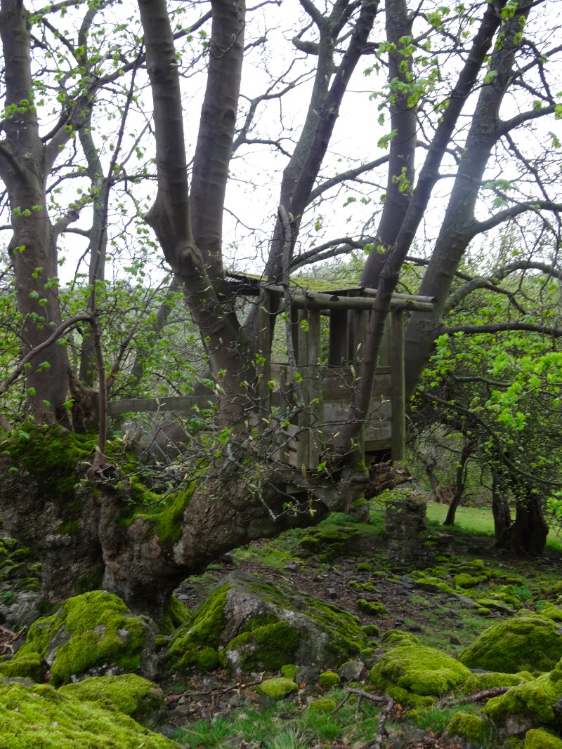
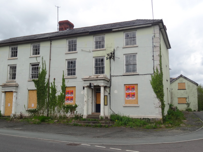
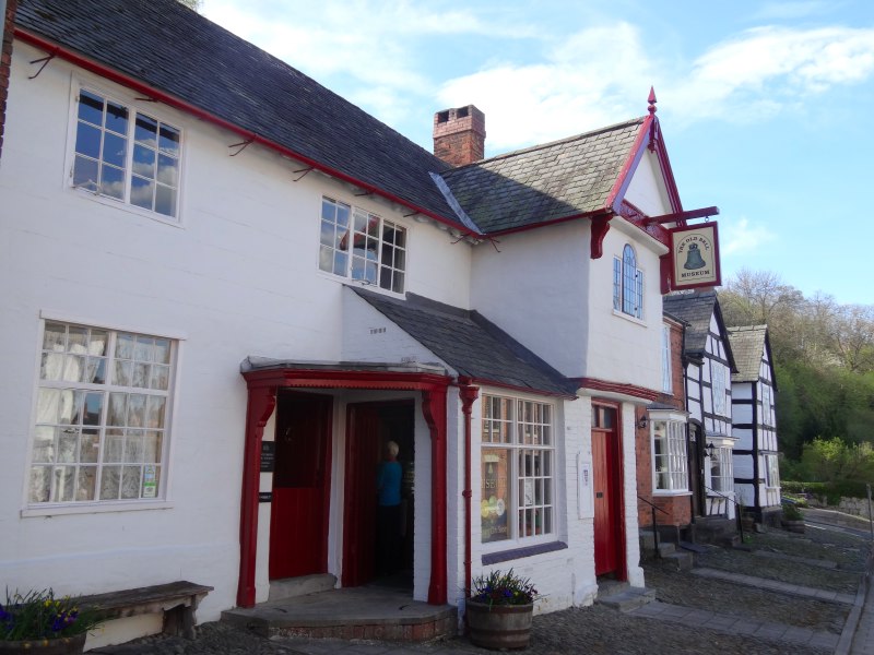
It was a late start to what became a long day.  Breakfast was at Wetherspoons Crown Hotel where I’d spent the night. Although it is a chain, Wetherspoons has done a good job here, spending two and half million restoring the hotel, with wooden panelling, William Morris wallpapers and walls decorated with historic plaques and paintings by local schoolchildren.   The centrepiece is a towering eight-foot statue of Owain Glyndŵr.  I was typing over breakfast and so late to get finished, and then had a wait for the taxi to take me to the start, the car park below Moel Famau where I finished last night and where the planned shepherd’s hut would be sited.

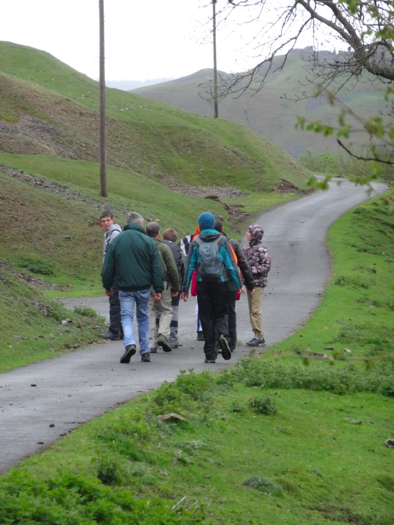
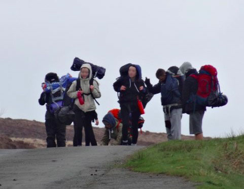
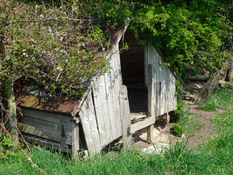
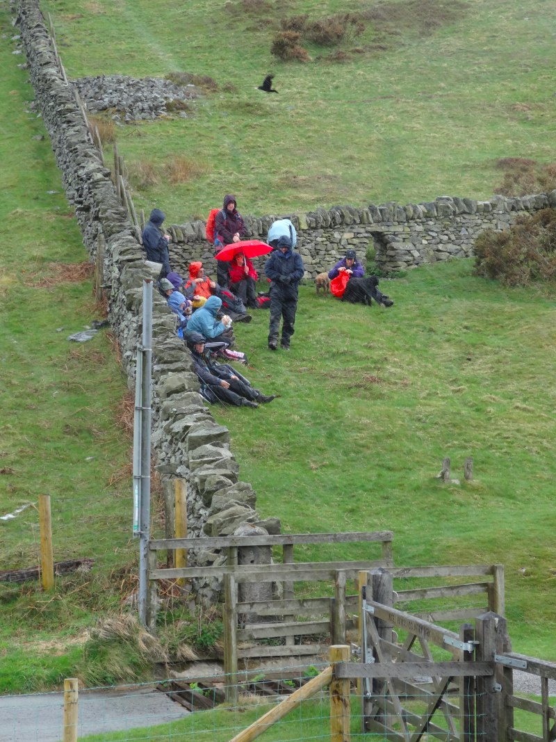
I’m sure the hut would have done good service this morning as the car park was full of teenagers, clustered around a couple of minibuses, the tinny sound of pop music half drowned by excited chatter. As I climbed up the path to Moel Famau I passed what I took to be some of their teachers from the mentions of ‘school’ and ‘DofE‘ that I heard as I passed.

I realised too, in passing them, that I had adopted a long-legged loping stride even going uphill.  "I’m becoming one of those annoying people who make hill walking look so effortless", I thought, "but if only they could see me at the end of the day!"

2013-05-11 11.19.47
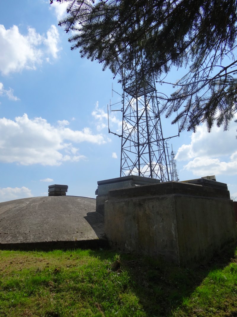
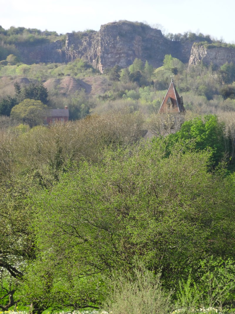
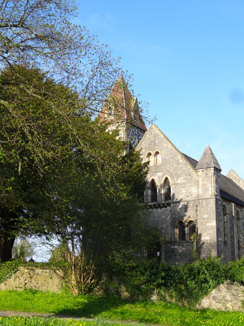
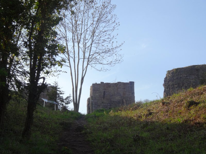
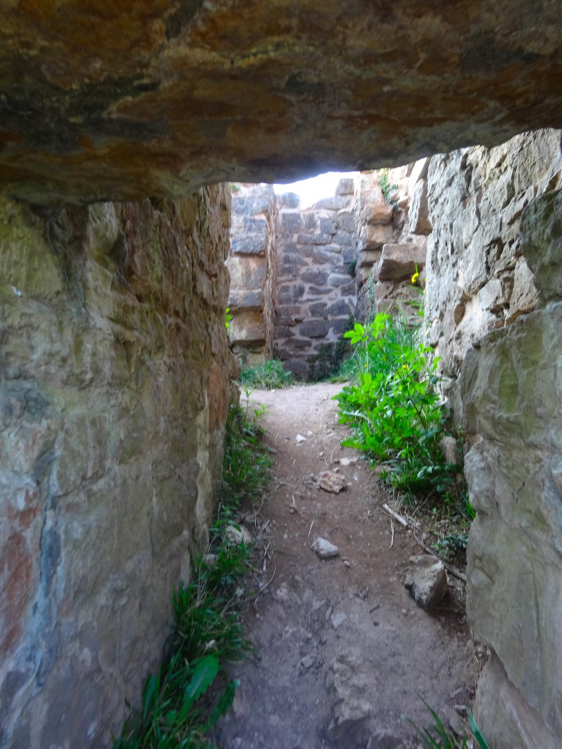
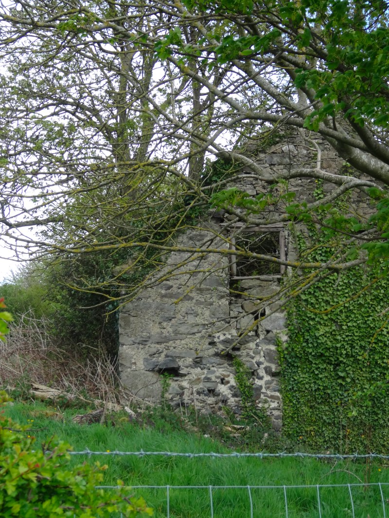
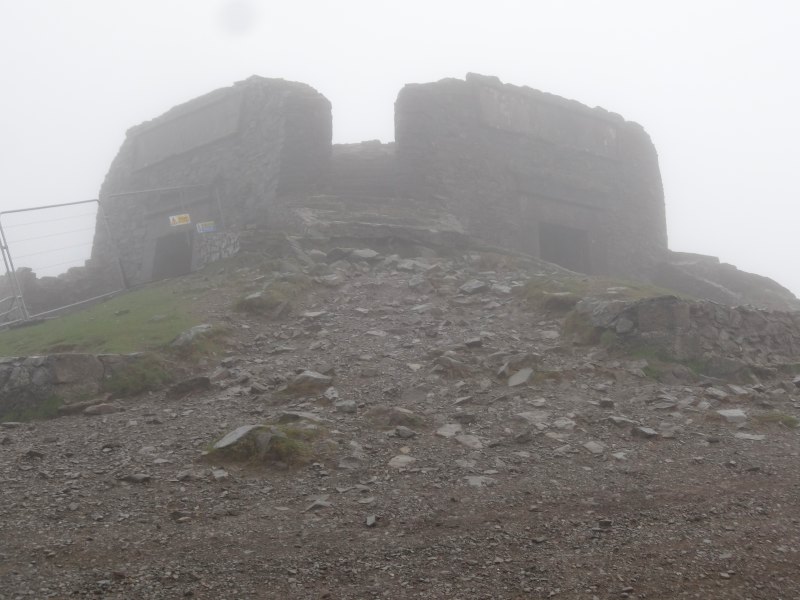
At the top of Moel Famau, the Jubilee Tower was shrouded in mists. The Tower was built in 1820 by the Prince of Wales on the Jubilee of his father – as Talentog put it, "one of the mad kings". The tower had a square base, with high lintel-topped openings on each side, like giant doorways, and an obelisk-like tower atop.  The latter fell down in a storm and the tower fell into disrepair, being half buried until Lottery-funded restoration work began in the last year. The work is not finished, but the lintelled openings have been cleared and I headed for the lee-side one to get some respite from wind-lashed rain. A group of DofE-ers were already there, gathering themselves ready to brave the elements again.

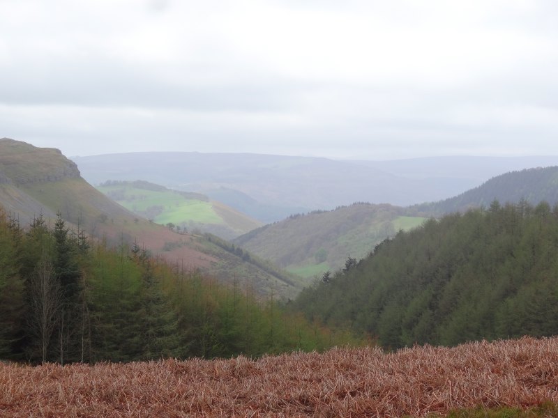
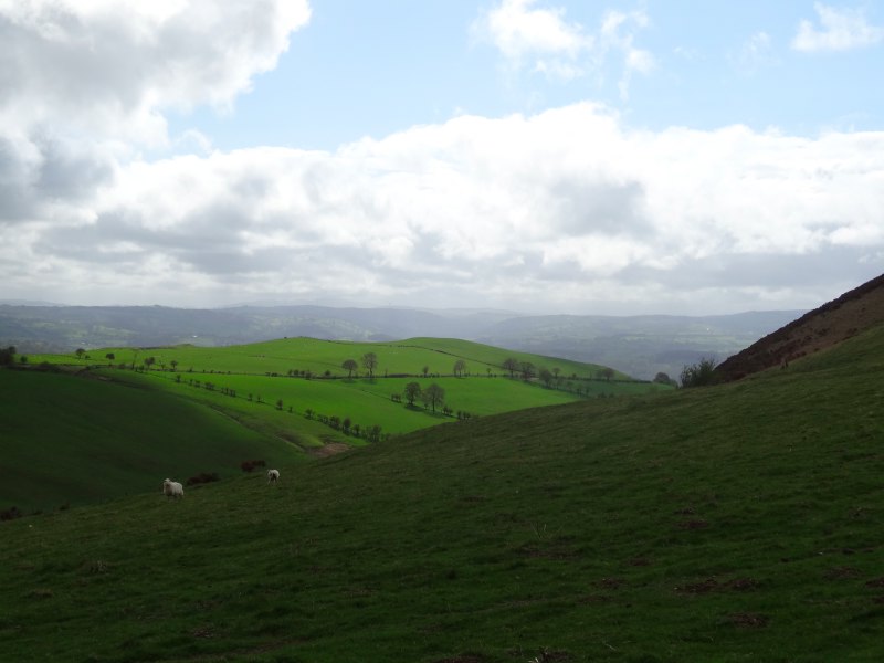
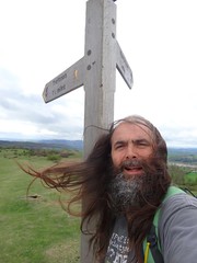
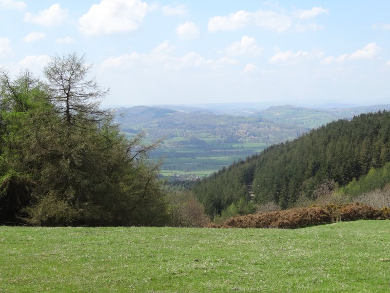
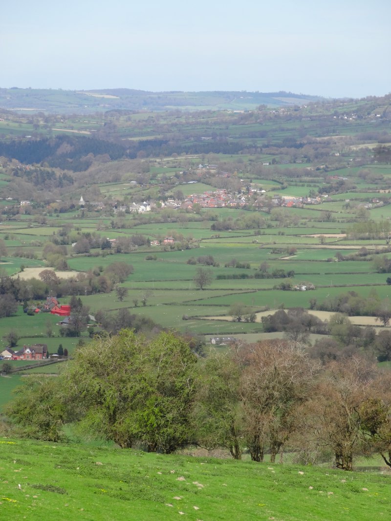
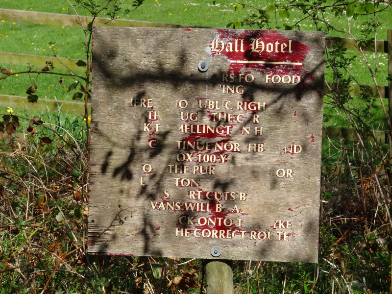
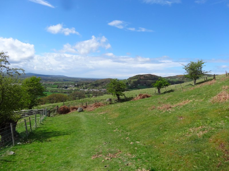
Heading back out myself, as I wandered down from the summit, the mists and rain cleared, looking back the Jubilee Tower was cut sharp against the skyline. I meet another group of DofE-ers climbing Moel Famau from the north; one of them noticed my banner and quizzed me about the walk, "one day is hard enough", she said, "and I’m fifteen".  They were glad that they were nearly done for the day, their end point the car park where I’d started, but seemed happy despite the weather, the first wet day I’ve had. Further on another group of teachers explain that there are several school DofE groups out that day, going in different directions, and for their group, it’s the first time on the hills.  I can see why they bring them here, it is hard to go wrong as the paths are wide and clear, yet it is high enough to give a real sense of achievement, and, when the mists clear, stunning views from Snowdonia‘s mountains to the sea.

2013-05-11 12.13.51 2013-05-11 12.41.37 2013-05-11 12.45.51

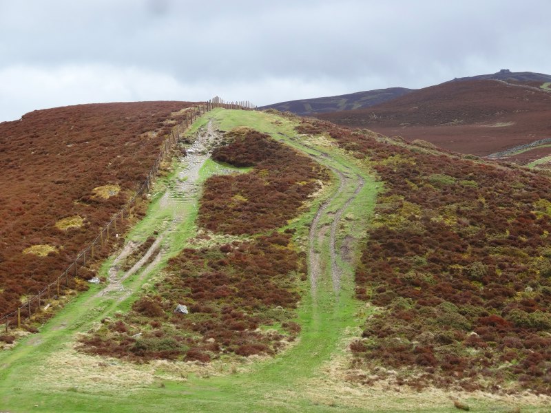
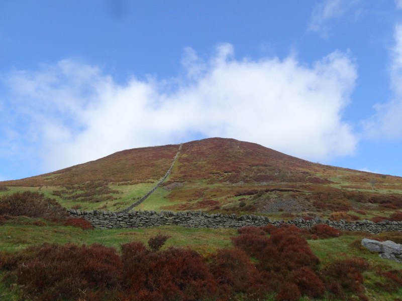
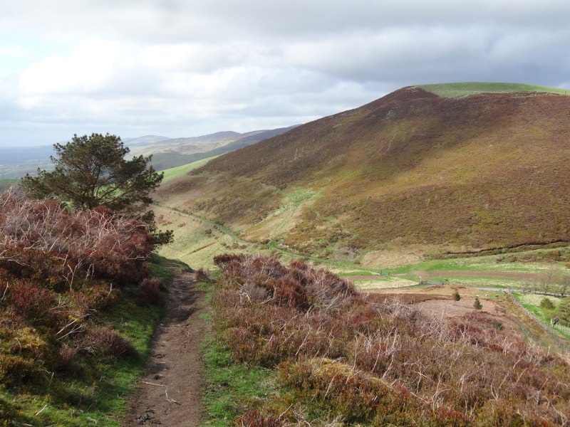
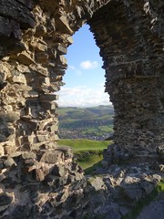
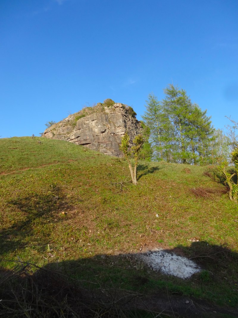
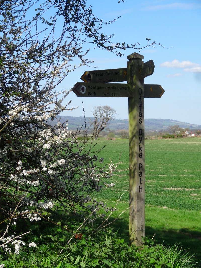
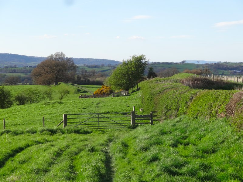
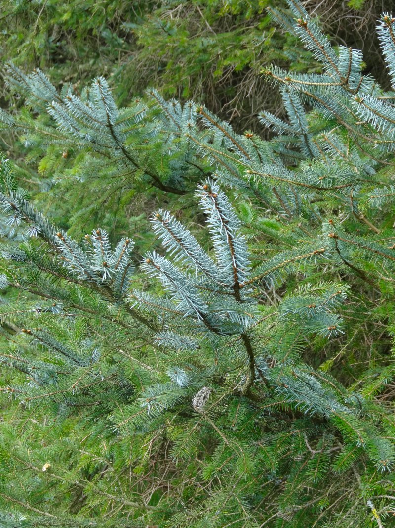
The official Offa’s Dyke route skirts the side of Moel Arthur, another Iron Age hill fort, but I diverted off the path over its top, no gently meandering climb, but straight up.  As I reached the outer ring the hail started, and coming over the top the wind and hail were thrown straight in my face.  The hailstones were small, but driven at speed, as if someone were taking pot-shots with an air-pistol. To protect my eyes I walked half sideways, my left shoulder hunched towards the wind, but still the icy buckshot stung my nose and left cheek.

2013-05-11 14.08.50
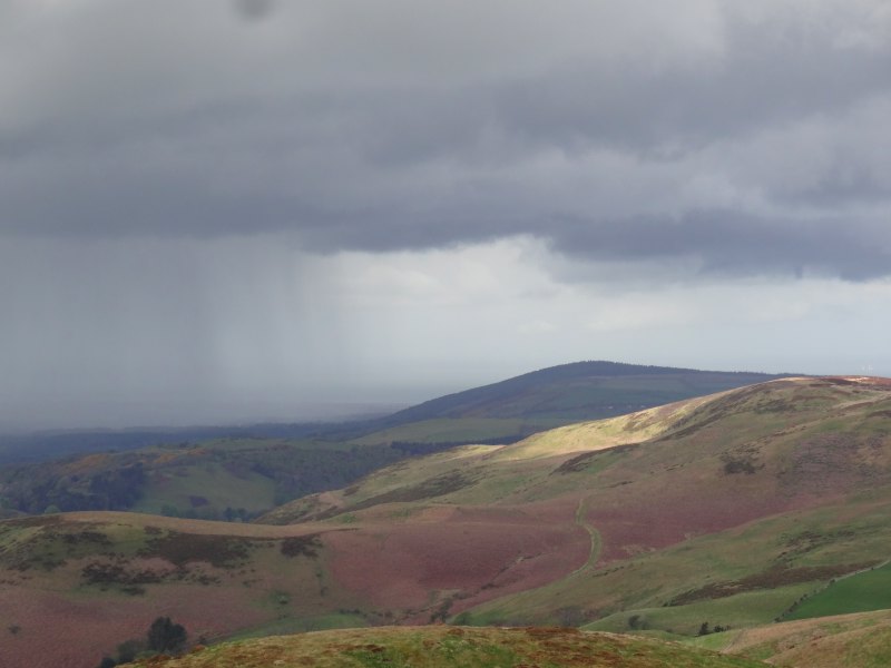
Just as suddenly, descending the hillside, the hail stopped and skies cleared again, this time to glorious blue-skied, cloud-dappled sunshine, although to the west dark swathes of further rain could be seen cutting across the countryside.

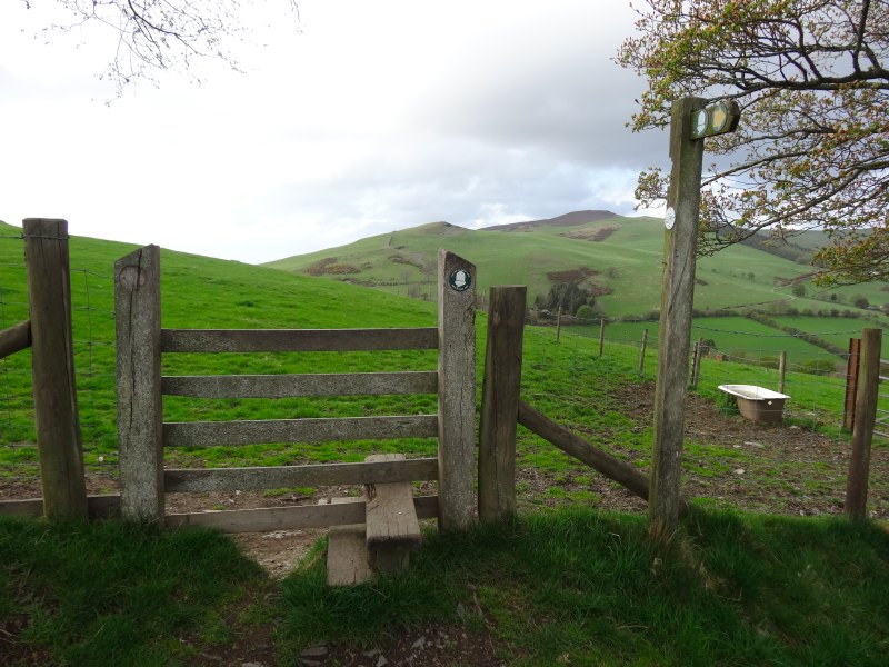
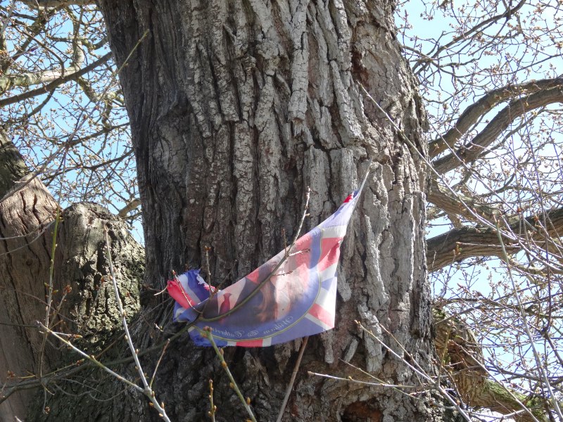
From here on the ridge gradually descends and ahead I could see a group with whom I was gradually catching up.  As I drew near the group split, the larger part branching further along the descending ridgeline to the north, and three of them, with two dogs, following the Offa’s Dyke downward route towards Bodfari.  I greeted them as I passed and then one of them said, "are you Alan?" I thought they’d just seen the banner on my back, but it was not just that, "I saw about you on the TV", he said.  I’d given a couple of radio interviews early in the walk, but not spoken to anyone on TV, so they must have just reported using still images, I guess on the local news.

2013-05-11 14.30.00
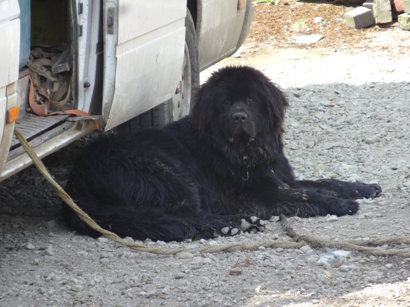
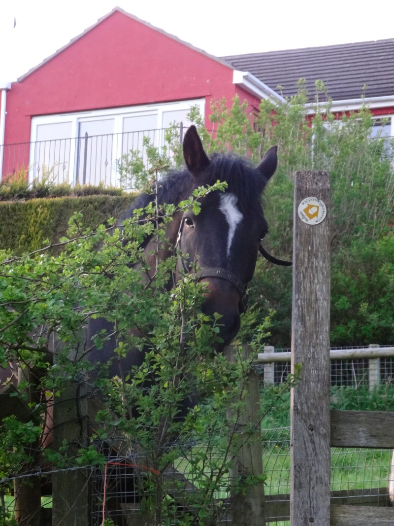
The group came from Colwyn Bay, and I think they said a rehab group, but wasn’t sure if I’d heard right.  However, I later learn that there are many rehab centres along the North Wales coast, taking advantage of cheap accommodation and natural environment.  We walked the rest of the way to Bodfari together, hoisting dogs over the stiles on the way; one a little Jack Russell, virtually hoisted by its lead and harness, the other, some sort of bull terrier, tough looking, but friendly, needing a bit more lugging.  As his owner put him down, "I don’t think he’d let anyone else do that", he said.

2013-05-11 14.49.22I was reminded of Teasel, our Bernese Mountain Dog, who died some years ago.  She was too heavily built to jump over stiles as a collie would do, but did not like being carried.  Although she was heavy, I could pick her up, one arm behind her back lags, the other under her breast bone, and could even step up the stile, but with no hands to hold on … and then, as I stood precariously astride the stile, she would start to struggle, kicking her legs to get away. Imagine holding on to a half-hundredweight sack of potatoes that starts to wriggle in your arms.

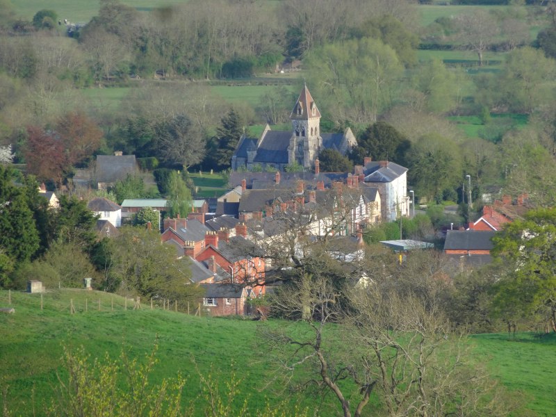
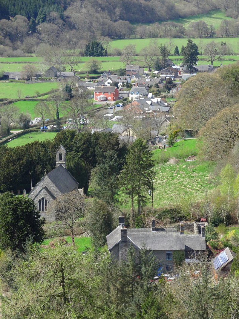
I had intended to stop at the pub at Bodfari, get a quick late lunch, and ring Stuart, who was going to give me a lift back to Wrexham after a family day on the coast, to work out where and when to meet.  The group’s minibus was in a car park right next to the pub, but, not being sure if they had said ‘rehab’, and if so, rehab for what, I decided to skip the pub and press on to Rhuallt, three or four miles further on where there was another pub marked.

2013-05-11 15.51.30 2013-05-11 15.53.47 2013-05-11 16.07.16

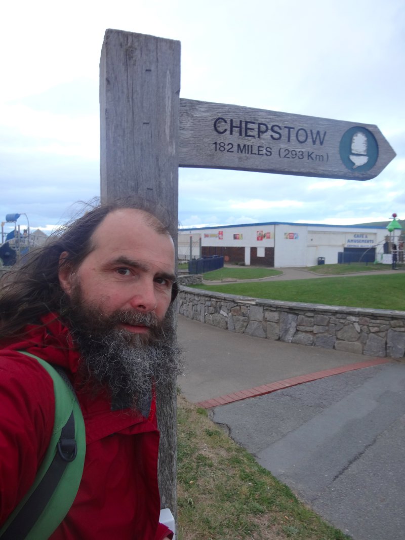
One last (I thought) climb up small lanes and mostly clear paths, to see views towards the sea ahead and Prestatyn appearing in the distance.  It seemed so close, only seven miles as the crow flies, but a lot further by the meandering Offa’s Dyke Path.  I felt on a roll, and wondered if I would be able to make it all the way to the coast, otherwise I’d have a bit of the Dyke path to ‘finish off’ in the next week.  I wonder now whether low blood sugar was already clouding my judgement slightly.

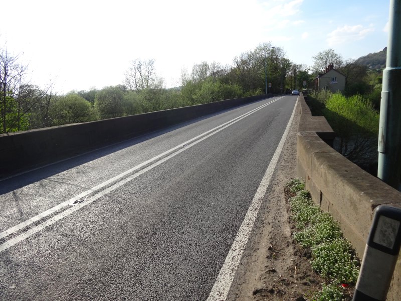
The path has to take a circuitous route to cross the busy A55 North Wales Expressway, and drops into Rhuallt.  From the map it looks as thought I will pass by the pub in Rhuallt for much needed, and, by that stage, very late lunch (near to 5pm), and ring Stuart from there, but as I pass through, expecting maybe to find the pub at the edge of the village, I never pass it.  I assume the icon on the map was indicative that there was food in the village, but not where!

2013-05-11 17.10.44 2013-05-11 17.14.57 2013-05-11 17.27.20

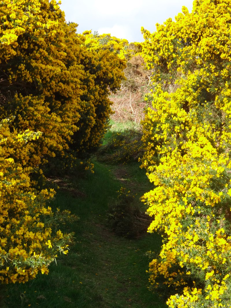
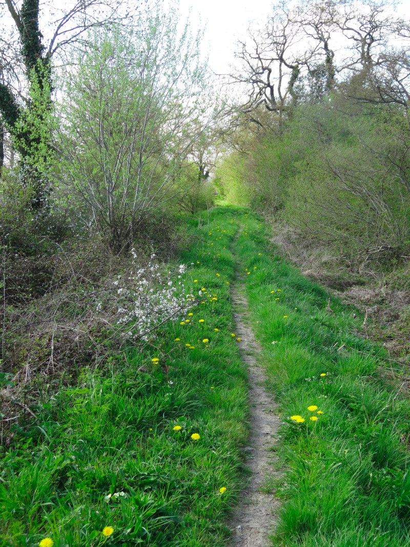
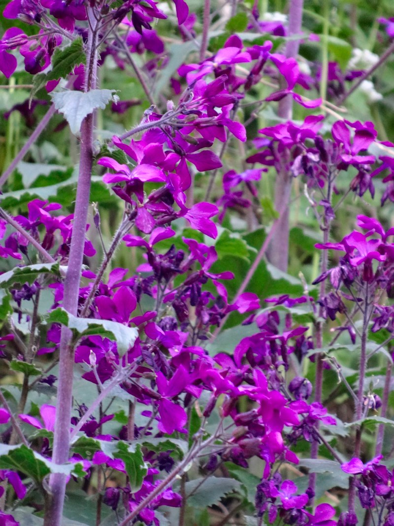
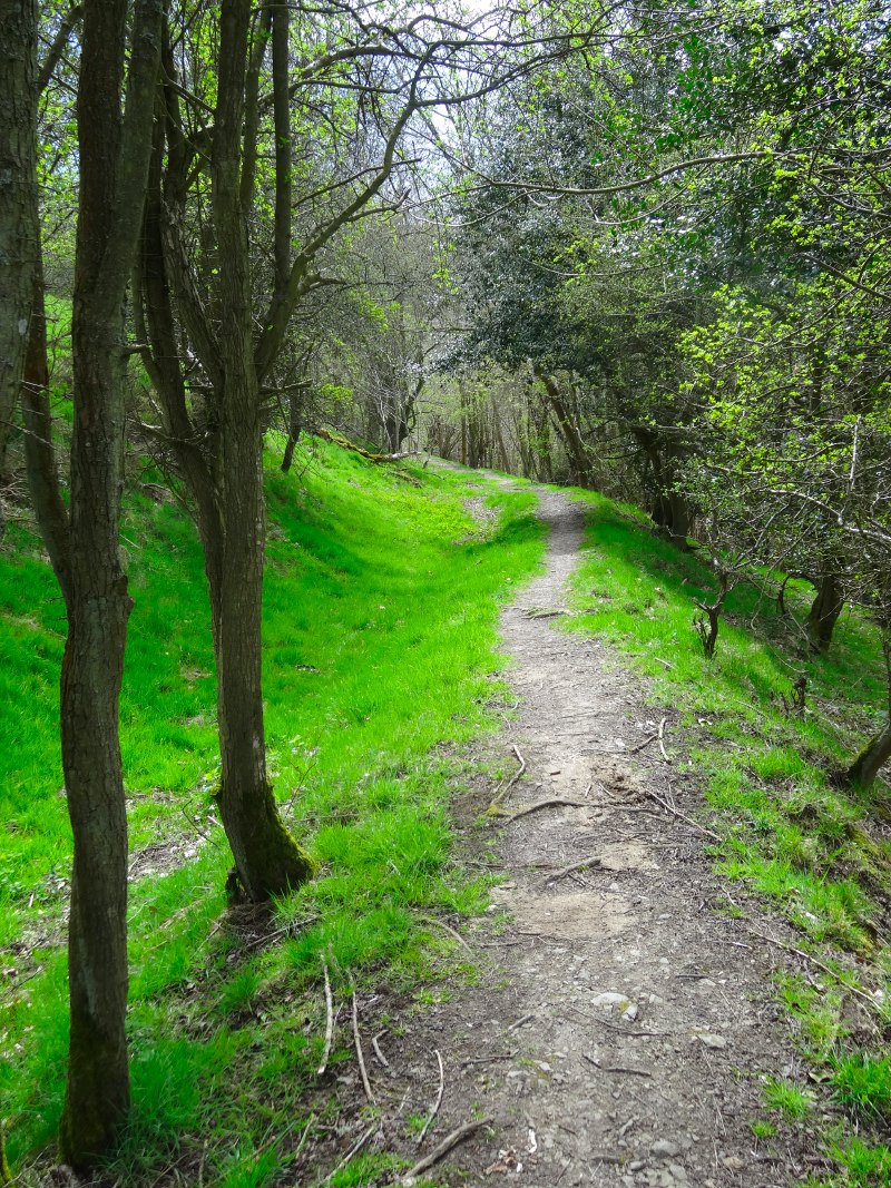
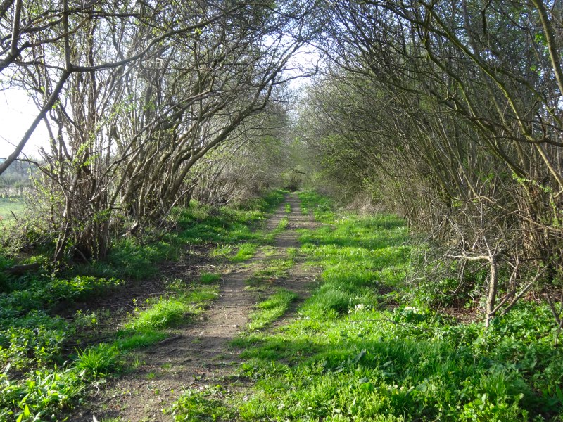
I kept thinking that the path would be ‘downhill all the way to the sea’, but in fact, out of Rhuallt, as if as a reminder of all those climbs in the mountains you have passed, the path cuts directly across the contours up a small, but very sharp, hillside, into first tree cover and then golden gorse, growing so close around the path that you are pushing through, your nose inches from the heavy sweet flowers, and the prickly branches catching on your clothes.

I should have rung as soon as I got to the edge of Rhuallt, but again, I think I wasn’t thinking entirely straight, and simply putting one foot in front of the other.  Eventually, in a tiny village with a Mt Hermon chapel, there is a seat, and on auto-pilot I sit down, get out the phone, see that there are messages, and belatedly ring, knowing I am already far too late for the lift, but to apologise for not ringing earlier.  I stuff myself with cereal bar and chocolate, drink plenty and continue the final few hours down (!) to Prestatyn.

2013-05-11 17.36.502013-05-11 18.16.362013-05-11 17.59.55

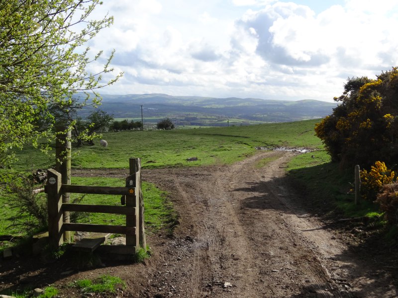
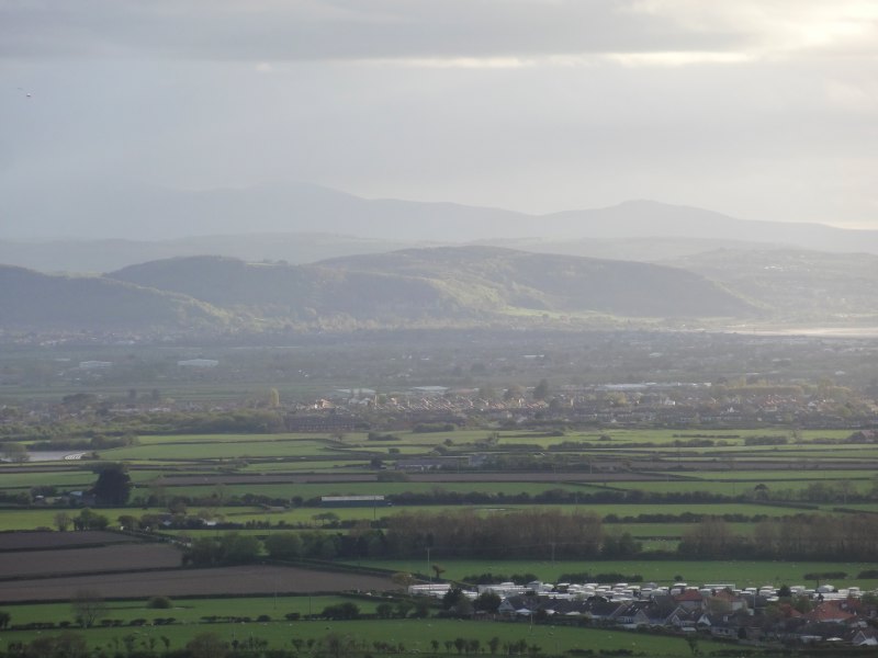
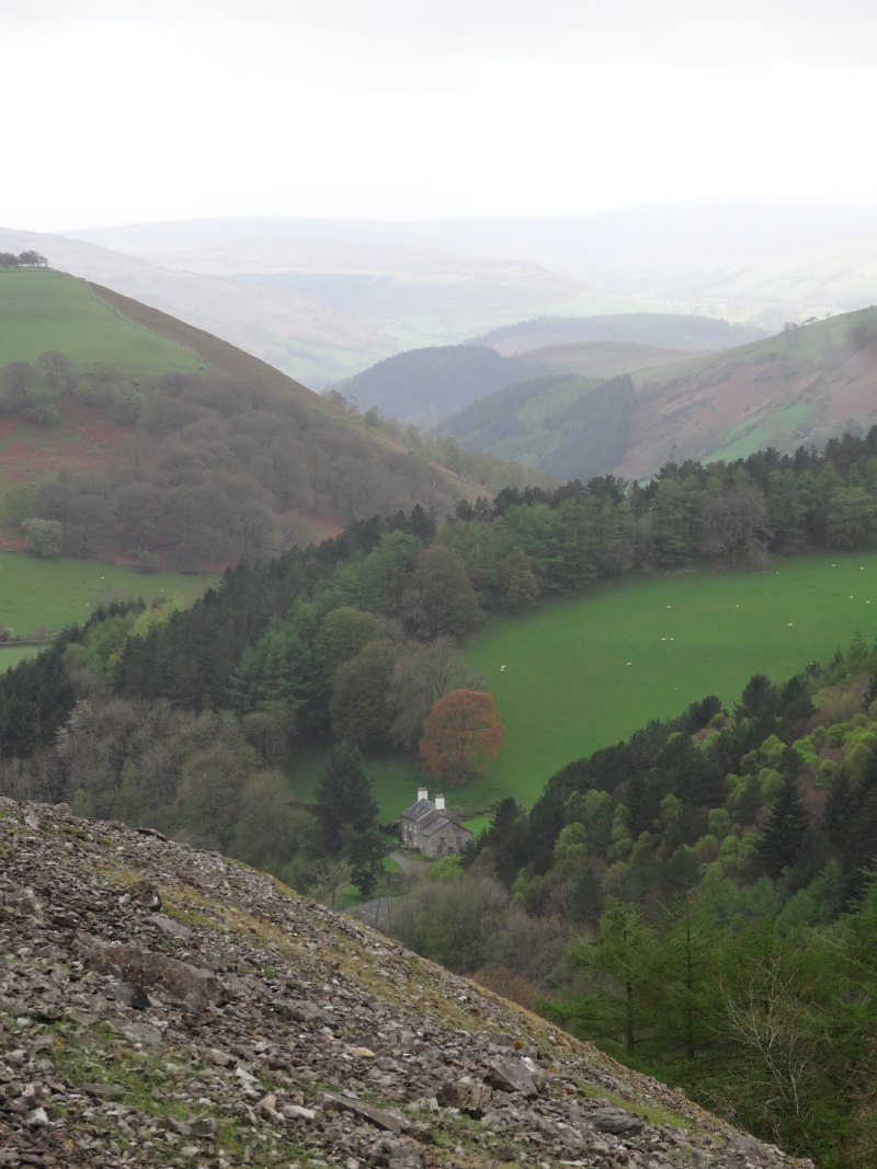
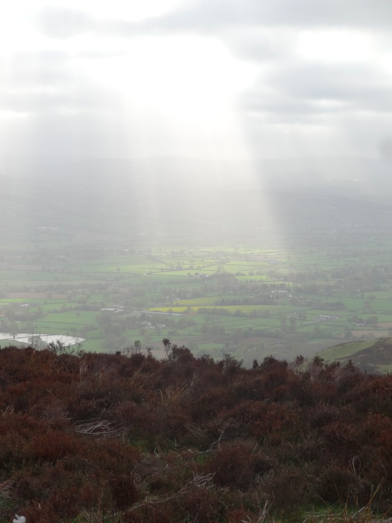
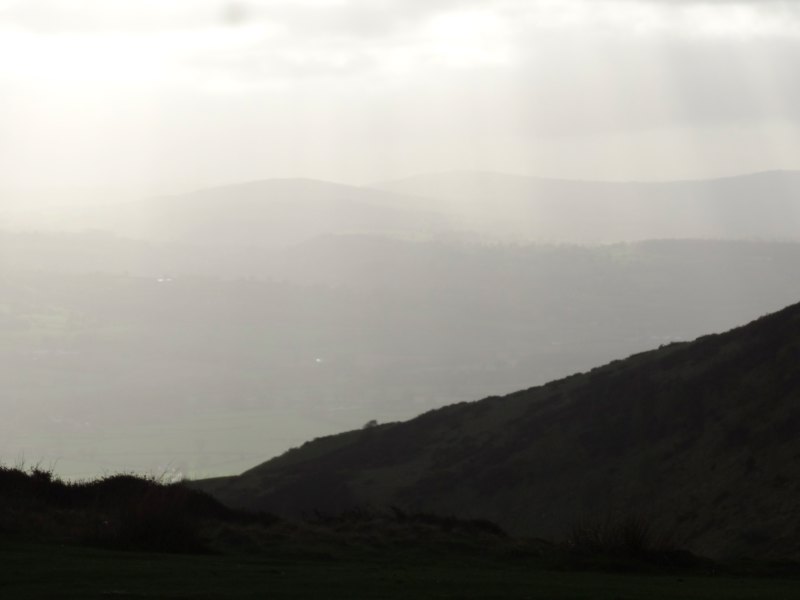
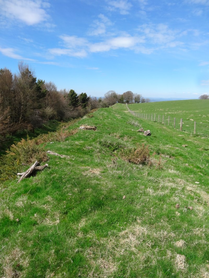
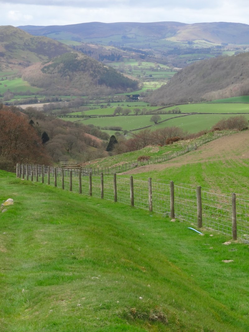
There are various roads directly to Prestatyn, but the footpath wends its way, taking country routes where possible and skirting the back of the long escarpment that lies above the town.  After occasional tantalising glimpses of parts of Prestatyn and the sea, through gaps in the hillsides, eventually the ground falls away and you are on the top of the old ancient sea cliff looking down on the flat land that would once have been beneath the waves, now filled with lush farmland and packed housing.

Rather than dropping straight down, the path follows the line of the escarpment, usually just below the actual ridgeline, a meandering cliff-side walk that I guess will be typical of many in weeks to come, except not crashing waves below, but an undulating sea of roof tops, breaking against the green scrub-clothed cliff base.

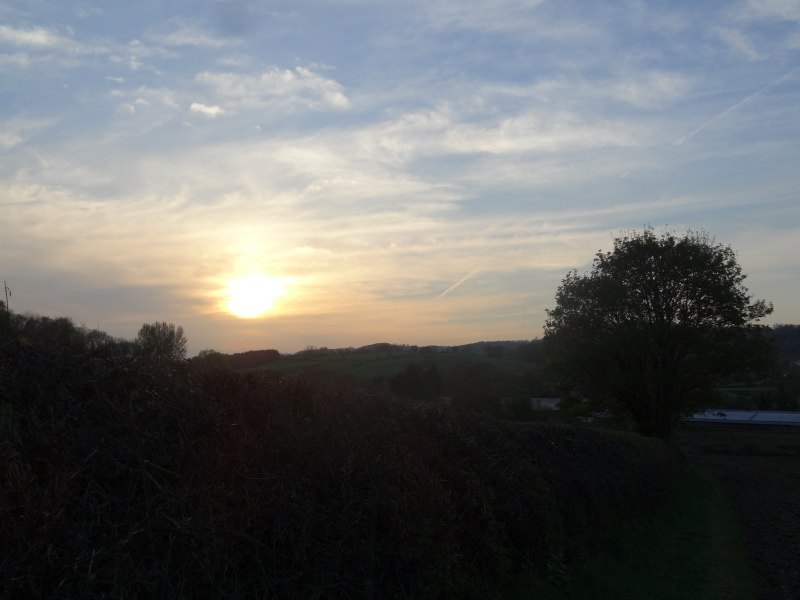
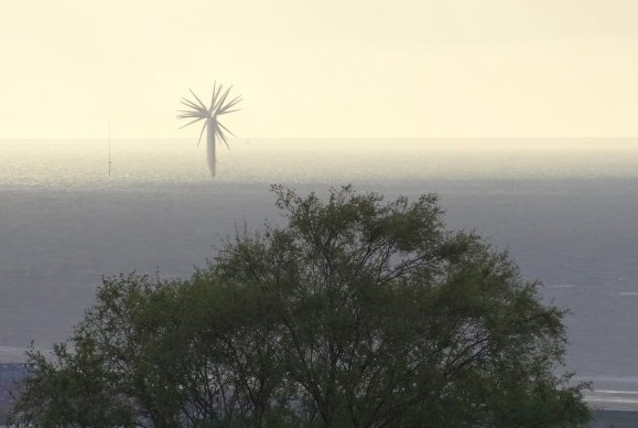
I knew that the path would eventually cut down from the escarpment for the last mile or so through the main street of Prestatyn and to the end of Offa’s Dyke Path where it meets the sea.  Tantalisingly the path would dip down, "ah I’m there", I would think, only to rise again as I passed some dip in the land.  But, at long last, as the sun dipped towards the wind-farm speckled sea, the path did drop into the town below, through a few streets of housing, and then the long road to the sea.  I stopped at the first fish and chip shop I passed and found they were about to close, but got what they had left, a sad sausage and overcooked chips, soggy, not crisp.  Later the taxi driver told me that there were far better fish shops than this one, but it was the first I saw and I was very hungry.

2013-05-11 19.28.43windmills-at-sea-2013-05-11 19.24.20-cropped2013-05-11 19.51.13

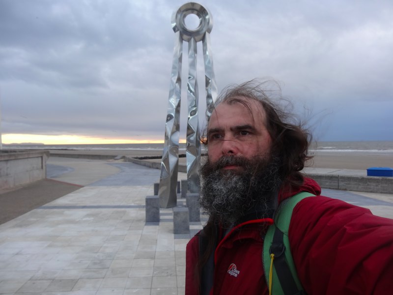
It was cold and dusk was falling as I got to the path’s end by the sea, a tall silver comet-tail sculpture marking the end, and an information centre that was obviously closed then (8:30pm), but was still closed when I next passed three days later at lunch-time.

After such a long day, I sort of expected fanfares, but have merely dim photos, the camera held at arm’s length to see me next to the end-markers, and then ringing for a taxi to Wrexham (a long and expensive journey) and drive down to the Halkyn Travelodge on the A55 near Flint as I was too late to go to the campsite.

2013-05-11 20.31.12 2013-05-11 19.53.24 2013-05-11 20.32.50

Day 23 – Llangollen to Ruthin

A day that starts with a journey to World’s End and finishes at Weatherspoons, taking in an Iron Age fort, Heathcliff moorland, and, guided by a gaping socket led eventually to the future site of a 21st century shepherd’s hut.

miles walked: 15.6
miles completed: 202.6
miles to go: 857.7

2013-05-10 09.26.30Richard Picking set me well on my journey, taking me from my hotel, The Lemon Tree, in Wrexham and dropping me where I’d left the path on Wednesday evening, already high above Llangollen, with Dinas Bran rising to the south. The path follows a road for several miles, and for those who do not want to walk, a drive along this is well worth while, with views the length of the Dee Valley.

Barely a half mile in, a car slowed as it passed and I heard a voice, "Hello Alan". At first I thought this was someone else who had found me on my way, but then realised that they had simply read the banner on my back.

The car contained two women, one who had just moved to the area, and the other her visitor from further afield, taking a day out together and enthralled by this road with its aptly named ‘Panorama Cottages‘ and leading to ‘World’s End‘. As we chatted we realised I had walked only a short way above her house on the way out of Trevor two days before. I hope it takes less time to become a ‘local’ in Trevor than Kington.

The road continues to gain height slowly, wending its way beneath the escarpment of ‘Craigiau Eglwyseg‘ or ‘Trevor Rocks‘. The former is named after the mountain beyond, and must mean something to do with ‘church’ as ‘eglwys’ means church in Welsh, but I will have to look up what the ‘eg’ ending means.

2013-05-10 10.57.44 2013-05-10 11.11.11 2013-05-10 11.17.35

Eventually the road drops to the valley floor, but the path continues to maintain height (phew) as it cuts along the scree slopes below the scarp, passing a few farms, and just up the slope two trees that have small walls around them, almost as if they were some sort of Capability Brown parkland amongst the scree. I assume the walls came first, and the trees simply took root in one of the few stable places in a shifting hillside, but I could not work out a purpose for the walls themselves.

2013-05-10 11.12.13 2013-05-10 11.18.34 2013-05-10 11.25.01

Across the valley is a forestry plantation on a long low hill. The hill appears almost perfectly rectangular with a triangular cross section, as if it were a flow bed or grave.

Bran was said to be a giant, and while the ships of the Welsh sailed across the Irish Sea to rescue Bronwen, Bran had to wade across as no ship was big enough for him. The reports came to the king of the Irish,

"A forest is approaching across the sea, and in the midst of the forest a mountain with a sharp ridge and two lakes either side, with beacon fires burning in each lake."

The king sends a message to Bronwen,

"What is this approaching from Wales?"

"Ah," she replies, "the forests are the sails of the armies of Wales and the mountain rising between them my brother Bran come to rescue me from my disgrace at your hands. The ridge is his nose and the two lakes his eyes each side, but, woe to you and all Ireland, the beacons are the fire of vengeance burning in Bran‘s eyes."

So the bloody Celtic battle began, the Welsh took the advantage, but one of the gifts that Bran had given when the King of Ireland first took Bronwen for his wife, was a cauldron that had the property that when a dead body was thrown in, it would awake again to life, except dumb.

As the living armies perished at each others’ hands, the Irish zombie army grew, and it seemed as if the Welsh would be slaughtered against the shoreline. At the moment of despair, Bran‘s brother, whose pride had initially caused the troubles (a long story, involving horses tails), threw himself down amongst the Irish dead, and when when he was cast into the magic cauldron, pushed, Samson-like, against its side, bursting the cauldron, and his own heart.

Robbed of their army of living dead, the Irish forces collapsed until all that stood upon the blood-soaked mud were a dozen of Bran‘s closest companions, and Bran himself, mortally wounded. It was then, when Bran died, that his head was cut off and taken to spend a year and day of feasting with his remaining companions, before its interment in London.

But of his body, the legends say nothing, except here, in sight of Dinas Bran, a giant grave mound.

2013-05-10 11.34.51 2013-05-10 11.36.34 2013-05-10 11.45.00

Eventually the path leads to the valley head, and switch-backs across a slippery concreted ford. In a clearing a large group of anorak-clad youngsters are gathered and eating early lunch with laden rucksacks scattered around. Older leaders shift cars around, either having just dropped them off, or simply met them midway to ensure none have been lost. I assume it is Duke of Edinburgh’s Award or something similar. I notice one group clustered, heads bent over an iPad.

2013-05-10 12.16.16young-walkers-2013-05-10 12.19.23-cropped2013-05-10 12.19.45

I recall starting DofE at my own high school, and finished everything except ‘hobby’. I was never a collector (didn’t have the attention span!), and couldn’t do after school activities as Mum was caretaker at the church and so every day after school I shifted chairs, washed dishes and brushed floors. My free time was spent walking through the bushes in the local park imagining myself in a distant jungle, other games of imagination (usually involving things going ‘bang’), and reading late into the night.

Thinking back, I could easily have had Scouting as hobby, but the only thing I thought of was reading, so was tasked with keeping a reading diary for my English teacher. The combination of my slow and unreadable handwriting and forgetfulness for anything regular meant it never happened. I would lie to say I have better self-discipline today, but…

2013-05-10 12.35.58I had confused World’s End with the spectacular Horseshoe Pass (I think where the opening scene of ‘Very Annie Mary‘ was filmed). In fact World’s End seems to refer more to the way the lush long valley gives way to Brontë-esque ‘blasted heath’, black bog covered in still-brown heather, with a pathway in places made by pairs of parallel eight-inch planks. As I get to the end of the bog towards the forest, mountain bikers pass peddling hard uphill. Richard had told me this was mountain bike territory and how he had once tried to ride across the boardways, at risk alternatively of getting stuck in the gap between boards, or cast off from the sloping boards into black oil-slicked bog to either side.

The way down to Llandegla was uneventful, a long descent through forest and woodland. Partway up I meet three women, in accidentally matching cerise/purple walking gear, who were wondering about the right path up until they saw me coming down.

2013-05-10 12.40.37 2013-05-10 12.54.04 2013-05-10 12.57.21

The Crown Inn in Llandegla says it is under new management and is open for food including “kick a***” all day breakfast, but the doors are locked and the lights off. Happily the Willows Café across the green is open and I eat a toasted sarnie, while using their free … and working … WiFi.

Llandegla is tiny but manages two old chapels and an Anglican church, reminder of the long rivalry between dissenters and established church that Borrow writes about repeatedly. The church says outside that it has refreshments, and the post office too has a small table for occasional teas, so a hamlet of culinary choice. Next door to the post office is an old cottage with a large black anvil outside. A man in his garden across the road shouts across to explain that this used to be the old forge and that the street name means ‘free street’ in Welsh, so it must have been a blacksmith going back many years.

2013-05-10 13.59.57 2013-05-10 14.52.00 2013-05-10 14.52.24

Leaving Llandegla, the path cuts across open farmland, towards the hill range that will form the next day and a half of travel. However, soon the signs become less and less legible, with the circle where they belong still incised in the fence post. This could simply be wear and tear; however, each round sign is held by three small steel or brass screws; the screw holes are clearly visible, but there are no rusty remains, each hole is clean and open, suggesting unscrewing. I know some landowners resent walkers crossing their fields, but if it is deliberate obstruction, it is short-sighted. All it means is walkers wandering over more of the their land trying to work out the way, rather than sticking to the footpaths.

After a short unscheduled detour due to the damaged signage, I re-find the path and start the slow ascent of the first foothills of the long ridge of the Clwydian Range. The path breaks clear of farmland and rises past a radio mast and signs to fishing and teas and cakes. Later I meet the owner of (one of) the fish lakes and discover that what I took to be signs for a single lake were in fact for two lakes. Originally the lakes served different markets, one was coarse fishing and the other trout, but then the other one changed from trout to be coarse fishing too, leading to just a little rivalry.

2013-05-10 16.07.51 2013-05-10 16.13.42 2013-05-10 16.22.59

I also learnt about the BROWN SIGN. Anyone who has driven in the UK will recognise the brown tourist signs pointing to historic sites, accommodation and tourist venues. I had thought that these were placed and chosen purely on amenity grounds, but I discover that individual venues have to apply, going through a long bureaucratic process, and then have to pay the county sign writers exorbitant fees to make the signs. Authorities differ in their rules, some allowing brown signs on main roads (where passing tourists will actually see them), whilst others do not want to clutter principal routes with excessive signage and restrict brown signs to minor roads. … and I just thought they were signs.

Earlier in the trip I had discovered that the whole northern section of the Offa’s Dyke Path is an invention, based not on the most likely route of the Dyke, but on the criteria for a ‘National Trail‘. Given there is therefore no need to actually ascend the Clwydian Hills at all, it seems strange that, at several points along the range, the path rises nearly to the top of several hills and then does not rise quite to the top, especially when the top is a hill fort. So, at several places including Moel Fenlli this day and Moel Arthur the next, I took short diversions from the formal route, which was skirting a contour line, to go over the top, and so see views across to Snowdonia in the west and, eventually, the sea in the north.

2013-05-10 16.39.07 2013-05-10 17.08.53 2013-05-10 17.18.58

At Clwyd Gate, the main pass over the Clwydian Hills into Ruthin, there is a substantial café/restaurant, which is currently closed and for sale. I later learn it has been on the market for 18 months, a sign of hard economic times.

Eventually, after another ascent and descent, I get to the Blwyd Penbarra car park where @talentog007 meets me to drive me down into Ruthin and to chat about the Moel Famau hut. Around 350,000 people stop at the Penbarra car park each year, and the idea is to place a kiosk there, in the style of an old shepherd’s hut. The idea is that it would be an amenity to tourists in the area and also act as employment for young people in an area that has few prospects after school. The project is still gathering funding, but Talentog used to work for the council, so knows her way round the funding systems. Look out for the hut late this summer.

2013-05-10 18.38.42 2013-05-10 18.48.05

Walk Q & A

As part of the publicity for the talk at Wrexham (see “day 22 – travel and talking“), Andrew Price at Glyndŵr University asked me to answer some questions.  These are my answers:

Where did the idea for your walk come from? What was the primary motivation?

I was on the mainland and ‘down south’ around March/April time last year and heard a radio report on the opening in May 2012 of the Wales Coast Path, it also mentioned that with Offa’s Dyke Path it formed a complete circuit round Wales.   When I heard it I just knew I had to do it.

At that point it was simply a compelling feeling, but as I thought more it became obvious that this project, in many ways, linked with areas of my research going back over at least 20 years as well as more recent community focused projects on Tiree (the little Scottish island where I live).

… and as a tiny child I used to look at the world and imagine walking round it … well, so not the world, but at least Wales, which is the bit that matters most 😉

Which towns have you visited so far? How has the journey been so far?

I started in Cardiff, and been through Newport (mainly the industrial/commercial area), Chepstow (with a 5-mile excursion back and forth over the (old) Severn Bridge, a wonderful walk), Llandogo, Monmouth, Pandy, Hay-on-Wye and Kington.

I was finding the pace quite heavy in terms of daily mileage (which seasoned ramblers said it was!), so am now sending bags on between B&Bs so I just have a day-pack … sooooo much better.  The odd ache and pain in legs and feet, but so far the worst problem has been getting too hot and catching sunburn on the top of my head (yep, sunburn in April).

I have already made so many new friends along the way, and seen the strangest things, from a tree-trunk doorway in Monmouth to a set of steps going down into the earth in the middle of a field. I am struggling to keep up with writing about it all!

What are the technological challenges that a walker faces (your thoughts on this before you set off…) and what would you say the technology challenges are for rural communities?

Because I am doing this with a research project I have a little more technology than the average walker (!). This means I end up carrying a lot of weight in terms of devices and power supplies, and also tend to take quite a bit of time each evening ‘tending’ my technology, transferring data, uploading stuff to the web, etc.

Because I have some quite critical apps running on my phones, I have become obsessed with battery life (some days the power has run out before the end of the day), and then paranoid about actually using them for anything, for fear of using up power!

One of the key issues is that even when in a fixed place, access to phone and internet is patchy: occasionally in unexpected places everything works wonderfully, but at other times you feel as if the internet, like the buildings, has reverted to the 16th century.

This is, of course, one of the problems for communities also, dealing with network connections vastly slower and less reliable than those in major cites … that is when there is any connection at all!  This then compounds existing problems of lack of resources in rural areas, not to mention often relatively low incomes, and higher proportions of older people, all leading to the danger of rural communities being marginalised in an increasing digital age.  This is exemplified particularly in the new Universal Credit which is predicated on easy access to the internet.

On a positive note, technology can be used to connect rural communities both internally within the community and externally with other communities with similar issues.  For example, I have been involved in a project on Tiree to help the youth worker connect with youngsters using a combination of web, social networking and SMS.

What technology equipment have you been armed with during your walk?

I have several mobile phones, mini-tablets and laptops of different kinds (happily not all being carried at the same time!). The phones run a variety of standard apps, including the navigation app, ViewRanger. The ViewRanger team kindly supported me by providing detailed digital maps. The phones also run some research apps, including one that allows family and other supporters to see my current heart rate and give me virtual ‘cheers’.

I also have some recording tools: a compact camera and voice recorder (so far I have been taking 100–200 photos a day plus around 30–40 audio ‘posts’ that I record while actually walking); a Garmin GPS reader and recorder (to create a full trace of where I have been, speed, altitude, etc.); and a ‘SPOT‘ device which uses GPS like the Garmin, but instead of recording it sends a ‘ping’ to a satellite every few minutes and has an ‘SOS’ button that can use the satellite link to call emergency services no matter where I am.

Finally I have a number of bio-seonsors: one hobbyist/sports heart rate monitor, a medical grade ECG monitor (the full blippty blip you see on Casualty!) and a wrist monitor for skin conductivity (like a i.e. detector!) and skin temperature.

How have you been going about exploring what the IT needs of walkers and rural communities are on a practical, day-to-day level?

For the walker first there is a very practical experience of using these things (or failing to!) on a day-to-day basis. And I even have apps that watch other apps to record what I am doing with some of the devices!

I am also observing the ways other walkers use or do not use technology.  For example, getting the SPOT device was prompted partly by the story of a young local man who had got lost with friends on a short walk in their own area and had to call out the emergency services by mobile phone, which thankfully had signal.

For the local communities I have some meetings pre-arranged (for example someone connected with the MonmouthpediA project that made Monmouth the ‘world’s first Wikipedia town’.  But also many chance meetings, such as one in Hay-on-Wye where I found that the man selling me batteries was the chair of a local organisation seeking to buy the fishing rights of the Wye near Hay for the community.

What do you hope to achieve from the journey?

Many things and nothing.

The many things … I have aims in terms of writing about locality and the thread of paths through them; making connections to enable practical things to help communities, understanding better issues of poor connectivity, creating data for academic colleagues to use in their own research.

… and nothing: the most exciting things are the things I cannot think of now, the things I learn from chance encounters on the the way, the unexpected and unplanned.

Why did you choose Wales – what is your personal connection to the area?

I was born and brought up in Cardiff and spent my first 18 years in the house where I was born.  However, I have not lived in Wales now for 35 years, so there is a big sense of re-connection with my roots.

Any other thoughts or interesting points about your trip to date

I am a person who is paranoid about being bored, having ‘nothing to do’, and yet in my walking so far, I have not been bored for a single moment.

It is really weird to change from being one of those people who looks on at other people who ‘do something’ unusual to find myself just one of those other people!

I could have done with a little more training :-/  Not walking for 35 years and then doing 1000 miles is maybe just a little crazy 🙂

day 22 – travel and talking

No walking today, just travel day back to Kington to pick up the van and then talk in the evening at Glyndwr University in Wrexham.

Awakening to the view of the Llangollen taxidermist, a relaxed morning writing in bed before breakfast, trying to capture the highs and lows of the day before (see “day 21 – Porth-y-Waen to Llangollen“).  Richard Picking picked me up at 10am and we meandered our way down the roads to Kington … and there is little alternative to meandering when going north–south along the Offa’s Dyke route. Just as the Dyke cuts across old drainage patterns, it still cuts across modern transport links. It is relatively easy to get to or from the Dyke, but so hard to move along it.

Lunch at the Oxford Arms, another one of the once 27 old inns in Kington, and then I picked up the camper van from Fleece Meadow Caravan Site (facilities basic but clean, very reasonable prices) and drove in convoy back to Wrexham.  It was odd driving so quickly past places that I had taken days to cover on foot.  Also often hard to make out the landscape, seeing hills from different angles from the road.

In the evening I gave a public lecture at Glyndŵr University. Amongst the audience was a lady, Cleopatra, who has two artificial knees and later this year is walking around the entire coast of the Isle of Man.  On seeing a photo of me standing by an Offa’s Dyke sign, Peter Excell was reminded that ‘BlueTooth‘, the wireless communication protocol, is named after a Norse king Harald ‘Bluetooth’ Gormsson … why he made the association??

I had thought of Glyndŵr as one of the ‘new universities’, but in fact Wrexham has a long university history.  A government report in the late 19th century suggested two Welsh universities should be founded.  However, when Wrexham (historically the largest town in Wales) was not chosen as one of the sites, the people of the town decided to set up their own by pubic subscription.  Without royal charter the Wrexham School of Science and Art could not award its own degrees, until over 120 years later, in 2008, it was eventually granted official university status.  … a real story of patience!

day 21 – Porth-y-Waen to Llangollen

A day of three castles, one that was not, one that was missed and one of a king who will come again. A day of lows, but ending on top of the world.

miles walked: 19.5
miles completed: 187
miles to go: 873.3

I knew it would be a tough day, sixteen and half miles from Porth-y-Waen to Trevor and then another four from there to Llangollen.  I’d decided that if I didn’t get to Trevor early enough I’d just take a taxi on to Llangollen, but really didn’t want to do that otherwise I would get more behind for next week.

The day started fairly leisurely, along lanes into Nant-mawr and up over the first hill of the day towards Trefonen.  The ascent passes through Jones’ Rough, old yew woodland, with a thick darkness below, and then into more ordinary woodland before breaking the treeline onto the top of Moelydd, just 285 metres (800 feet), but one of the highest points for many miles, with a panoramic view that takes in the Wrekin and Long Mynd on one side and on a clear day even Cader Idris and Snowdonia.  I forget sometimes just how narrow this part of Wales is. I am still standing in Shropshire, indeed far enough from the border that it does not appear on the Harvey strip map, but no more than 40 miles to the coast.  There is one of those round plaques showing the landscape silhouette and allowing me to identify the peaks I see.  Almost due north it says ‘Liverpool‘ – I wave to Esther and go on.

The hillside soil here is the colour of old red sandstone.  I’ve not noticed any outcrops, so assume it is more that the same processes that produced old red sandstone work here, probably simply iron salts.  The path across the last long field into Trefonen follows a wide shallow tree-dotted ditch, according to the map not part of Offa’s Dyke, but maybe simply just an old trackway out of the village.

I have a moment of confusion at the end of the field as I’d been walking the right hand side of the ditch and from there the stile ahead is hidden by hedgerow, but as I cross the ditch the way ahead is clear and I meet another walker, going in the same direction, but only as far as Chirk, where I am hoping for mid-afternoon tea at the castle café.  He is an experienced walker including many of the Scottish long-distance walks, and has a backpack, little larger than my day pack, but it’s his complete kit … I have much to learn.

At Trefonen I pop into the small post office to get provisions for the day and see signs for the walking festival that I’d been told about over breakfast. I was also told something in the Forden pub about a brewery here, and maybe later in the day would have sought out a quick afternoon half-pint of their brew, but as it was the closest I get is walking down a road called ‘Malthouse Lane‘.

The path then cuts across farmland through the tiny hamlet of Tyn-y-Coed, where the windowsills of a shed are decorated with ceramic heads, the result of a school project some years earlier.  The dyke rises steeply through woods, before levelling, tracking the ridge line for a mile or two.  When the path next breaks out of the trees it is into a large grassy clearing with stone work 100 yards or so ahead; the ruins, I assume of yet another Marches castle.

Before the ruins lies a sculpture, two horses’ heads with a saddle between where their necks should have been, a sort of extreme equine push-me-pull-you.  There is no plaque of explanation.  However, making my way across the grass, I find the castle-like ruins are in fact the remains of the grandstand for the old Oswestry racecourse which encircled the hilltop.  I don’t know the age of this, but I imagine Jane Austen-like characters, coming up the steep road from Oswestry in their carriages, to watch top-hatted riders gallop high above the surrounding land, as if they were racing round the very horizon itself.  Nowadays the hilltop is almost entirely surrounded by trees with scrub-trees on the racecourse common, so only another panorama plaque gives a hint as to the Regency and Victorian vistas.

Following the line of the racecourse, I took care, as I’d been warned, not to follow the footpath sign that turns right and the road, which would ultimately lead back to the grandstand, but straight on, past the second part of the racecourse, which has an almost figure of eight plan narrowing in the middle, to follow the lines of a slight double hilltop.

The route cuts down the hill and then follows the Dyke straight to Craignant, but before doing so rises up once more over what I only notice later is a much higher hill, Selattyn Hill, at 375 metres (a mountain in old money).

By this stage I am tired, following the top of Offa’s Dyke gives a great sense of connection to the past, but, like the woodland paths, the tree roots and stones make it hard going, your feet twisting at each step, my little toes that constantly have small blisters, suffer each time my foot catches on a root or rock and somewhere along the way a small stone is under the ball of my foot that for some reason I didn’t manage to shift when I shook my boots out at the grandstand.

I promise myself I will shake out my boots at Chirk, just the other side of Craignant, get tea, food, so just have to keep on going one steep drop into Craignant and the climb beyond.

Then I fell.

Nothing spectacular, just caught my right foot on a protruding rock and tipped head over heels along the dyke top.  Dusting myself off and happily with no harm to show except a few grazes and a bruised pride, I sit myself down and realise my clumsiness and fatigue are partly due to dropping blood sugar and, as important, not drinking enough.  I never notice myself getting hungry, but need to look out for that slight clumsiness that means I should eat and drink.

I empty my boots again and discover the small stone in my boot is no stone, but my foot, a small hard swollen blister.  I also refold the map, a symbolic moment, as this is now on the last quarter of the Harvey map for Offa’s Dyke.  However, I also realise that I’d lost track of which village is which, that Chirk Castle is not immediately beyond Craignant, but a whole hillside and valley beyond.  A Marathon bar and drink of water help, but suddenly the day seems longer.

I skip the opportunity to take a diversion to see a small hillfort and tower, pressing on as time is short and I have many miles to go, down past Craignant and steeply up, up the hillside beyond, at that point where I think it would be good, like the gentleman I passed earlier, to be ending my day at Chirk, and start to re-plan assuming I will get no further than Trevor.  The day becomes one of survival, even getting that far.

Over the rise of the 361-metre hill beyond Craignant I catch my first glimpse of Chirk Castle.  I had imagined seeing a few tattered battlements, but it looks large and imposing still, guarding over the Ceiriog valley, the rich farmland beyond and the route north–south.  Today the floodplain of the Ceiriog is home to a large works belching out white smoke, but, more picturesque, a canal aqueduct and train viaduct cut across the valley in the distance, and beyond them the bridge of the modern road, three generations of transport.

Dropping down and across the River Ceiriog I follow the Offa’s Dyke footpath signs back up a steep road past forest to the right, and only too late realise I am following the year-long path, but it is the summer-only route that I meant to follow, up through the parklands to Chirk Castle, so no tea and cake below the battlements for me.  At the top I instead take my second Marathon bar, another sip of water and start to plod painfully down towards the built up areas of Froncysyllte and Trevor below, with the estates of Cefn Mawr most apparent sprawling across the hillside opposite.

It feels late already, the day had been cloud covered for many hours, and darkening as the clouds thickened, the occasional stray droplet of rain and dark edges suggesting that tomorrow’s gales and rain may start tonight.  I pass a pair of walkers putting waterproof covers over their rucksacks.

At the base of the hill the path crosses the main road and then over a small canal bridge to join the canal towpath for the rest of the way past Froncysyllte into Trevor … but, on the map, I can see an ominous steep descent to the valley base and rise between the two.  The towpath is metalled and level, and I find that, sore feet not withstanding, I still walk far faster than a canal boat.  After a mile or so there are two Offa’s Dyke arrows.  One points across the canal to the left, but the other continues along it and says ‘Pontcysyllte Aqueduct‘.  On the map I couldn’t see the path crossing the aqueduct, but assumed there must be a way ahead, maybe dropping down just before it to rejoin the other path.  However, joy of joys, when I got to the aqueduct, indeed one can walk across … on the level … all the way to Trevor.

This is probably not a route for the nervous.  The footpath side of the aqueduct has a balustrade, but is narrow, with the canal beside you, yet not so narrow that some cyclists ride across, only dismounting at the last moment before they pass you.  I find that even when I stop to take a photograph and turn, I have a moment when my eyes and feet try to make sense of the lack of ground-line.

However, it is to the canal side it is most dramatic.  The other side of the six feet of water is a small, galvanised lip, maybe a foot above the water level, and then, nothing.  The narrow-boat sides will be way higher than this, so to go across by canal and look upstream it will be as if the canal is floating above the valley floor.  But the thought of crossing on a boat with a child or dog on board, I think I would lock them securely inside.

On the far side is a basin with tea shops and pub.  A lovely place to spend an hour relaxing, but I feel it must already be well on its way to seven o’clock and I need to get to the far side of Trevor where the path sets off along the hillside, find the pub there, order a half and a taxi (in order) to get to Llangollen and eat.  So I follow the pathway under the canal (a different view of the aqueduct), and along the Llangollen branch of the canal for a short bit further before crossing a lovely worn stone canal bridge and past some friendly horses and the road leading out of Trevor.

For the first time this day I dare to look at the time on my phone in the rucksack (I am so paranoid about battery use, I still just keep them there and do not touch them unless I have to).  With trepidation I press the button to wake up the phone, my time estimation is always optimistic, I am always saying (Fiona will attest), "it can’t be that time already".  But, when I look, oh joy of joy again, the time is quarter to five.

I had set 5pm at Trevor as the deadline when I would opt for a taxi from there to Llangollen, but my slow progress over the broken pathways meant I had long given up that thought.  I was a full two hours earlier than I had imagined.  I think a combination of my own fatigue and the cloud coldened sky had fooled my normal temporal optimism.

Elation at discovering the true time and a bite of Wispa bar, and my fatigue fell off me, even the pain in my feet felt less bad as I set off up the hill out of Trevor.  On the whole the path makes a gradual ascent diagonally uphill along the valley side, but I missed one sign and followed the road almost straight up the hillside for a short while before realising my mistake and backtracking.  I notice that many of the path signs are missing, the posts are there, but empty circular depressions where the signs should be.  This could just be age, but I wonder whether a local landowner has deliberately removed signs to discourage walkers.  However, I had no such excuse, the turn-off was well marked, just down a private road, so I probably just passed that by without looking.  Even an unnecessary climb did not quell my sprits, and they lifted yet further as I first glimpsed Dinas Bran ahead.

Bran is a semi-mythical figure, demi-god, king of Wales who defeated the Irish over the honour of his sister, Bronwen, perished in the attempt, but whose head spent a pleasant year still conversing with his retainers, before it was buried at Tower Hill in London.  It is said that while Bran‘s head was there Britain would never be invaded, but that Arthur dug it up as he thought the brave men of Britain could defend themselves without the aid of legends.  Maybe he would have been better to have left it in place.

The hill in which it is placed rises sheer above the valley, a cone topped with the rings of an Iron Age hillfort and the broken remains of a Norman castle.  An unparalleled command of the valley below and one of the major routes to West Wales.

The forest and then hillside path eventually joins a small mountain road cutting below the limestone escarpment, and the evening sky clears into occasional sheep-wool clouds and glorious low sunshine, now clear, now broken, that slices the valley with alternate gold-glow grass and sharp cut shadows.

And I decide.

I decide that I cannot pass the foot of Dinas Bran.

So, where a small lane drops its way towards Llangollen off the contour-hugging mountain road, I follow it for just a hundred yards before turning towards Dinas Bran.  The climb is steep and sharp, but well managed, snaking back and forth up the hillside, a pleasant and exhilarating evening walk if you are staying in the town.  But at the top, it is hard to find words, especially if you are out of breath.

And it is breathtaking, even when you have recovered your breath.  The Iron Age ramparts cut through solid rock and the tattered Norman remains frame the distant valley and mountain views to all sides.  It would be stunning at any time, but the combination of the light on the hillsides, sense of achievement at the day’s travel, and fact that in every direction I looked out and down meant I literally felt on top of the world … and there was even mobile phone signal to ring home at last.

As I’d climbed I’d noticed strips of plastic ribbon between posts that I’d thought were to encourage walkers to use the made-up paths rather than erode the grassy slopes.  However, coming down I began to meet marshals for the annual fell race that takes the runners up Dinas Bran, not once but twice, before descending again to Llangollen.  I met three, one after another, and each, from the oldest to the youngest, a teacher in the school, said that when they had been walking up the hill earlier in the day to lay out the route, walking itself had been exhausting enough let alone running.  I told one about Arry and her multi-marathon run, and he gave me what change he had in his pockets for the charities I’m collecting for.

And then finally into Llangollen, the road down coming into the town round the back of the Bridge End Hotel where I am staying for the night, where I am shown to my room that overlooks both the river bridge to one side and the mini-steeples of the taxidermist next door on the other.  I have visions of inebriated drinkers from the Bridge End, accidentally taking the wrong door and ending up, their skins already half tanned with alcohol, stuffed heads in the taxidermist window.

The Bridge End kitchen is closed on Wednesdays, so the day ends with the image of a tattered traveller, like a Chaucerian pilgrim, his worn boots swapped for sandals, straggling hair falling from his shoulders, making his way slowly and hesitantly from foot to foot, across the bridge in search of long-awaited food.

Day 20 – Forden to Porth-y-Waen

A longish, but easy day cutting across the flood plains of the Severn. Passing the birthplace of the now ubiquitous Leylandii, a dry dam and a possible nuclear bunker.

miles walked: 20.1
miles completed: 167.5
miles to go: 892.8

The day started slowly, I woke at 5:20 to the sound of a cockerel, and spent several hours writing before going down for breakfast. During a very leisurely breakfast I chatted for over two hours to John and Mary.

2013-05-07 11.00.02Both had been to ‘dame schools’, which I associate more with the time of Jane Austen, but in this area were small private schools, run principally by the wives of schoolteachers, catering, it appears, for those seeking a slightly better education than the state primary schools, the children of doctors, prosperous farmers, etc. The covered topics seemed to vary with the interests of the proprietor. John‘s first school focused strongly on arithmetic, ignoring writing and spelling, but this then utterly reversed when he later joined the same school as Mary, where language and drama were the heart of the curriculum, with amateur dramatics a high point of the year.

As we talked I recalled the book: ‘School without Tears‘ by Mollie Jenkins, the wife of David Jenkins the (in)famous ‘Bishop of Durham‘ of the early 1980s, for whose ‘blasphemy’ (doubting the virgin birth) some blamed the lightning strike on York Minster, which destroyed the Rose Window.  In 1984Mollie Jenkins ran a small private school in Durham where her philosophy was very much about letting children grow as children.

The most fascinating point in the morning was when John brought out an old book1:

From John O’Groats to Lands End
Or 1372 Miles on Foot

A Book of Days and Chronicle of Adventures BY Two Pedestrians on Foot

The local landowner in the late Victorian era, John Naylor, instituted many modernisations on the estate, including a gas works and a failed dam, which I would see later in the day. Not content with this, John and his brother Robert took what must have been one of the earliest north–south walks. The book, a limited edition with just one thousand copies printed by the Caxton Press in 1916, tells how, in 1871, they walked from John O’Groats to Land’s End, criss-crossing the country from east to west as they visited interesting places, and without any maps, which were too heavy at the time, instead relying on their general knowledge and people they asked on the way.

They travelled light, having fresh clothing sent on from the estate to local rail stations along the way and sending dirty washing back the same way, and followed a set of rules: no wheeled transport, no animal transport, no water transport, and no alcohol. So far I have managed three of those.

2013-05-07 11.16.27  2013-05-07 11.16.36  2013-05-07 11.16.51

The Offa’s Dyke Path passes the back of Heath Cottage and I pick it up as it passes behind gardens on its way from the village. For a while it follows the lane up the hill that lies between Forden and Buttington. I pass one tree that at first looks as if a small wall has been built among its roots, until I realise it is the naturally fissured rock; and then further on real signs of construction, where a small tree that bends naturally over in a depression in the bank of the lane-side has been filled in with a basket-like weave of smaller and larger sticks, making a bivouac shelter. Maybe it is a traveller like Jacob from the previous day who did not find a place to sleep, so made one here on the roadside.

2013-05-07 11.29.11 2013-05-07 11.31.29 2013-05-07 11.40.17

Later the path cuts through forestry tracks and I almost miss that above my head is another monkey puzzle tree, indeed a whole line of them follow along the track side. John had told me that there were specimen trees in the wood, but I had forgotten. More signs of Naylor‘s modernisations. Later I pass the site of the dry dam, impressive if ineffectual, and then further on again, one of those small QR coded plaques announcing that this was the ‘Birthplace of Leylandii‘. These fast-growing ‘hedging’ trees were beloved plants in the late seventies, growing several feet a year, wonderful to make a quick screen between neighbours, but before long turning your garden into a forest clearing.

2013-05-07 11.55.40 2013-05-07 12.04.34 2013-05-07 12.15.39

I recall in our house in Tang Hall in York, a narrow 100-foot garden with Leylandii all round, the annual job of lopping them off with a bush saw perched perilously on a ladder leaning on their swaying trunks; piles upon piles of six foot tree tops. One year we could not afford a Christmas tree, so a Leylandii top sat in the corner of our living room with its late 1970s stone fire surround and polyurethane mahogany varnished plywood television nook in the alcove. We had no television, but the Leylandii seemed a fitting replacement.

[this section written April 2014]

The path crosses a small road that leads down to Welshpool, stretched below, but the path onwards leads once more along forest tracks until it mounts the ridge towards the top of the hill, Beacon Ring.  The ‘Ring’ is because the hill is topped with an Iron Age fort, although the first sight is a large mobile phone mast, I guess the modern equivalent of the beacon.  However, I note that my photo of it was carefully posed so that a tree masks the mast.

2013-05-07 12.29.26 2013-05-07 12.46.54 2013-05-07 12.51.15

The ring is filled with a small wood, which is evidently causing some controversy.  It was planted in 1953 for the Queen’s Coronation, and the combination of pine and beech spell out ‘E II R‘ from the air.  In 2008 the Clwyd-Powys Archaeological Trust acquired it and are planning to improve the site, including removing the trees, which both hide the shape of the site and also, I assume, cause potential archaeological damage with their roots.  However, not everyone is in favour!

The wood within is quite a magical place, with wild flowers and a welcome shade from the hot sun.  Someone has left a contraption of bright orange twine and pieces of wood that seems somewhere between man-trap and monkey swing and a small stone, like a gravestone, commemorates the planting.  Both ancient fortifications and copses are often seen as the haunt of fairies, and maybe because of this I find myself losing sense of direction, with the trees and bank ring apparently uniform in all directions.  I half feel that, like Oisín or Rip van Winkle, I may get lost in time and emerge years later to a world… well who knows… I take the shortest route out.

2013-05-07 12.52.30 2013-05-07 12.56.07 2013-05-07 13.00.03

Certainly the Iron Age awakener would have been bemused to look up at the mobile phone mast, but I was equally bemused as I skirted the rest of the ring fort from the outside and came to a separate, smaller signal tower but with a low concrete dome beside.  The shape of the roof looked as though it was larger below ground than above. The fairy folk often inhabit hollow hills, but my guess is this was for no fairy folk, but instead a cold war bunker and signal station, the same site built for fortification 2500 years before with similar purpose today.  Maybe our Rip van Winkle would find less changed in human nature than in human construction.

2013-05-07 13.02.54 2013-05-07 13.03.37 2013-05-07 13.10.02

The path leads down a grassy hill, Welshpool and the Severn plain opening ahead. A small stile-shaped seat has the words:

There was a crooked man
who walked a crooked mile
he found a crooked sixpence
upon a crooked stile.

And a notice on it with a photograph of a collie dog:

If you see this dog on the path please be very firm and tell her to "Get Off Home". She is very friendly and if allowed will follow you all the way to Forden or Buttington. Thank You.

I never saw the collie, so could never test how sternly I could say "Get Off Home", but at a small farm a different dog, I think a Newfoundland, sits in the shade of a car, its thick fur not well suited for the intense heat of the day.  Beyond that onto small lanes and the road into Buttington to get a very welcome sandwich and beer at the Green Dragon.

2013-05-07 13.36.07 2013-05-07 13.42.55 2013-05-07 13.44.22

At one point I had thought of staying the night at Buttington as it seemed ‘not far’, but, although it is only four miles straight down the B-road, the route over the hill is six curly miles and about an 800 foot climb – it would have been a very late night.  However, today, not starting until half past eleven, I had 14 miles still ahead of me and it was already after 2pm.  I had a relaxing, but quick lunch and set off again.

At the end of the 10th century, the Anglo-Saxons and Welsh were on the same side, fighting the Vikings.   The Battle of Buttington in 893 AD temporarily halted the Vikings, but only for them to return in later years in greater numbers.

2013-05-07 14.06.58 2013-05-07 14.52.41 2013-05-07 14.58.28

Today the only battle at Buttington is to cross the bridge over the Severn, which has no footpath, but carries the busy A458 as well as the Offa’s Dyke Path.  The crossing merits a rare warning symbol on the map. The bridge is short and I can see some way in each direction, so I try to time my crossing to minimise traffic, but still one is squashed to the side as large trucks pass.  The worst are caravans, the owners give you a reasonable berth with their cars, but fail to account for the fact that the caravan sticks out several more inches behind.

2013-05-07 15.09.47

There follows a mile across riverside fields and then a very pleasant mile along the tow path of the Shropshire Union Canal.  I am a little worried whether it will be obvious where to rejoin and cross the road, but Pool Quay is very clear on the ground as well as on the map, so I leave the ducks, locks, wildflowers and shade (the latter sadly missed) and cross the A483 to follow the side of the Severn for the next three or four miles.

2013-05-07 15.21.35 2013-05-07 15.24.52 2013-05-07 15.36.58

After having spoken to the chair of the committee looking at community buy out fishing rights at Hay-on-Wye, I have been more aware of signs about fishing.   net that a stretch of the canal had a sign saying it is for Montgomery Fishing Club, which is close at hand, but I was a little more surprised to see a sign on the Severn saying:

Birmingham Anglers Association
Members Only – Private Fishing

For some of the way the path hugs the river bank closely, but sometimes cuts off the bends following along a bank, not Offa’s Dyke, but flood banks.  I assume there will have been no need for the Dyke along the section as the river forms the natural boundary.

2013-05-07 15.45.06 2013-05-07 15.47.04 2013-05-07 15.54.27

The section was flat and I walked it quite quickly, only about an hour and ten minutes in total, but it did feel rather interminable as I was aware that I was running very late again.  To  the east, quarries cut into the flank of the ‘Long Mountain‘ (not to be confused with Long Mynd further east), and at one point I thought I was nearly at the end as there was a large house coming up on the opposite side of the river, which I knew would be at the next turning point, but in fact it was another house only half-way along.

2013-05-07 16.03.50 2013-05-07 16.30.26 2013-05-07 16.35.08

However, eventually I came to the point where the ‘New Cut‘, a large drainage channel, meets the Severn near a giant sluice gate. The gate stands dry, well away from the river, but I assume is there to open should the Severn be high and it is decided to flood the farmland to save towns downstream.

2013-05-07 16.46.49 2013-05-07 16.57.43 2013-05-07 17.02.02

From here it is just another couple of miles into Four Crosses.  Four major roads and several minor roads converge here, the large roads crossing each other like hands crossing to make a fireman’s chair, creating a triangle of roads around the village centre.  This picture is made more complex now as a by-pass has been built to the west of the village taking the heavy A483 trunk road.  Unfortunately this was not marked on my map. The path on the map followed the A483 for a short time before turning down a lane westwards towards the Montgomery Canal.  What was unclear on the ground was whether this turning was before or after the bypass rejoined the old road.

There was a small pedestrian underpass just before the joining point and I wondered if that might be the way, but there was no signage, and in general Offa’s Dyke Path is very well signed, so I decided it must be further on.  There was a group of houses and a church just across the road, so I braved the traffic, and looked to see if the path left there, but nothing.  I tried to get any of my electronic gear to tell me exactly where I was, but to no avail as nothing could find sufficient signal – so much for technology!

In the end I went on along the road hoping to find the turn-off, but eventually realised it must have been through the underpass, the road construction was just too recent and the way had not been re-marked.  By this time I was a fair way down the A483 towards Llanymynech, so decided to press on and miss the loop along the canalside, which would have been a far more pleasant way, but would have involved a significant backtrack.

The road has a wide grass verge, but the grass was quite long, so I would walk on the road itself, and then jump up onto the verge when cars or lorries came.  It was fast, which was valuable given how late it was, but not at all the most pleasant walk.

[back to 2013 writing]

Coming into Llanymynech along the main road you find an old and lovely bridge across the River Vyrnwy. However, appreciation of its beauty and the peaceful flow of the river is somewhat marred by the imminent danger to life and limb as, like the earlier bridge over the Severn at Buttington, one crosses its short length clinging closely to the stone balustrade while an endless stream of lorries skim inches away. The bridge is narrow, so there is not only no room for a walkway, but the cars have little leeway to give you berth.

2013-05-07 17.56.53 2013-05-07 17.57.19 2013-05-07 17.57.40

As I get across I see a large banner:

15,000 Vehicles Daily
WE NEED A BYPASS

The house owner and his daughter were just coming out and watching tentatively up and down the road ready to cross, and when I said I’d just photographed the sign he and his daughter, who had already successfully managed the traverse and so had to make their way back across, told me the whole story.

Some years ago the road has been re-designated as a trunk road. Ever since various locals have been trying to get the council, not only to build a bypass, like that of the neighbouring Four Crosses, but at least to provide a footpath. Given the costs of road construction, it seemed such a slight extra, and at one stage a neighbour, the far side of the river, appeared to have almost won the argument with the planning official … at which point the official was moved to a post elsewhere, and so the discussion started all over again with a new official. The current footpath ends about thirty yards away from the bridge, so the man and the daughter described, with feeling, how getting to school each day required walking that thirty yards squashed into the scrubby hedgerow, on a blind corner.

Compared to the cost of the road, a footpath seems minor, but I guess if the council built a footpath, they might then have little alternative but to also build a footbridge, which I can see would be more expensive, though surely not prohibitive.

The house is itself set on marginal ground, what was once a small island, the current river course forming one side, and a now dry channel the other. The river formed the main boundary between Wales and England, and the man pointed out a line of fence posts set in the old channel, which had marked the separation. The boundary then roughly follows the existing roadline, but zig-zagging across to take in a holy well. This house was in Wales, but the neighbours either side in England. In addition the postal address for the house has no street name, as the street from the south finished at the current bridge, the street out of Llanymynech ended at the north side of the old channel, and the road across the island had no street name, an in-between place, a place where, maybe, all rules end … and certainly where the footpath ends.

As we make our way back across the road, so that they can continue their way to visit the next door neighbour (now there’s neighbourliness, a life-risking 40-yard journey), they tell me about a festival of music and storytelling in August. In particular how this will celebrate the mixed-up interchanges of a village caught between countries and counties, where the border, zipper-like, sees next-door properties fall one side or another. A place where, I later learn, the Welsh vet, whose surgery was strictly in Shropshire, still insisted on all correspondence being addressed to ‘Llanymynech, WALES‘, even though post then took a day longer.

2013-05-07 18.08.08 2013-05-07 18.19.19 2013-05-24 14.02.35

Saying my goodbyes, I pass up the road past the now closed hotel, where the border actually passes through the middle of the premises leaving one bar in Wales and one in England. In the days when there were different licensing laws in England and Wales, customers would periodically swap bars, all squashing into a single room when it got to closing time one side of the border, or on Sundays, when only one bar was open. I wonder whether there were any houses with a double bed, one side in England, one in Wales, where if you rolled over in the night you might find yourself waking in a different country from where you fell asleep the night before.

Llanymynech is the take-away Mecca of the area, two Indians, a Chinese, a lunchtime sandwich and teashop, and, literally opened in the last few weeks, a general kebab/burger/pizza takeaway. Knowing I will be late to eat when I get to Porth-y-Waen, I grab a kebab to eat on my last few miles across the quarry-torn hillside to the north.

2013-05-07 18.24.43 2013-05-07 18.25.26 2013-05-07 18.36.24

The ascent begins on roadway that passes houses perched above the village, and eventually turns into woodland and cuts directly up the hillside following the path of the old gravity funicular. Now it is largely just earth and rough broken stone, but occasionally you see a larger age-smoothed rock, with the marks where old rails ran the height of the hill, laden trucks rolling down tugging their empty cousins back up to be filled in turn.

Breaking the brow of the hill it is as if a medieval castle guards the hilltop, two stone watchtowers rise, a narrow gateway between, and beyond them, a natural keep of blasted rock, its shattered top like battlements. In fact the stone watchtowers are the brake-house, where the cable held back the rock-filled trucks from careering, precipitously and briefly, onto the waiting workers below. Often a small boy would be responsible for pulling on the lever that regulated the downward speed. There must have been many such funiculars and I’m sure not an infrequent accident.

2013-05-07 18.49.24 2013-05-07 18.51.14 2013-05-07 18.51.28

Now the crack of explosive, the grunts of workmen and the rumble of the descending trucks is replaced with the gentle rustle of wind-moved trees and occasional bird cries. The scene of Blake-esque industry, the lime-kiln chimneys, belching choking smoke below, is now a peaceful wooded heritage park, and the quarry itself a nature preservation site.

The final stages of the route to Porth-y-Waen pass yet another golf club (I am sure I will lose count of these once I hit the coast), and as I start my descent I meet members of the Border Outdoor Dabblers (BODs), who are out for an evening ramble.

2013-05-07 19.02.15 2013-05-07 19.58.28 2013-05-07 20.14.08

This part of Porth-y-Waen is almost all new build, the old village with church and pub about a mile further down the valley, and I have a moment’s doubt as to which road to take in the village, but then see Sue, my hostess for the night, beckoning as she and Andrew had seen me descending the ploughed field on the hillside opposite and were out to bring me in.

So, over a cup of tea in their conservatory overlooking the valley, we chat about Birmingham connections, how Andrew studied partly at the University and Sue‘s grandfather was an economics professor there, and how, further back, her family, the Martineaus, were cutlers and mayors of the city.

2013-05-07 20.03.05

  1. See full transcript on Project Gutenberg.[back]

Day 19 – Newcastle to Forden

The day from Newcastle to Forden started with a 'switch back' over hills and valleys, which give way to long flat stretches of the Severn Flood plain, with an unexpected meeting on the way, images of imagination and feet that ran across Jura.

miles walked: 13.2
miles completed: 147.4
miles to go: 912.9

Knighton has the Offa’s Dyke Visitor Centre and describes itself as the mid-point of the long-distance path.  However, Michelle has told me that Newcastle was the real mid-point.  Sure enough, as I walked up the hill (the first of many), looking back occasionally at the glorious morning views over Newcastle and a fish pond that nestled at the foot of the hill, there was a wooden sign post declaring in one direction:

Prestatyn
88 1/2 miles

and in the other:

Chepstow
88 1/2 miles

I was half-way.

2013-05-06 10.56.09 2013-05-06 11.00.45 2013-05-06 11.02.14

As Jacob had told me, the first part of the day the Offa’s Dyke Path rises and falls as it cuts across valleys and hills between.  Early in the day’s walk I met a young woman and an older gentleman, I think her grandfather, a retired sheep farmer from Oswestry.  They called this section ‘the switchback‘. They were doing the Dyke in parts, the odd day’s walk at a time. something the gentleman could not contemplate when working full-time in his youth; unlike the 9–5 of the city, farming really is a full time job.

I have written before about the way open plains, with no natural boundaries, become contested, and problematic; wars are fought and lives lost. This land is not level, but the natural drainage patterns fall west to east and hence the natural boundaries separate north–south, whereas the political differences, between Saxon and Welsh ({{British}) lay east–west.  So, while not level, still the natural boundaries do not help settle the political boundaries, hence centuries of strife. Indeed, even in the seventeenth century Montgomery, which I visited later in the day, was the site of one of the Civil War‘s bloodiest battles with 500 Royalists killed, and although this would have still meant I walked north–south across the borders, I would

In America, the 52nd parallel and the boundaries between the mid-west US states, were drawn with a line on a map. Here, Offa wrote directly on the land, a bold stroke, separating Saxon and Briton, English and Welsh, a line that still defines this country today.

The path climbs one hillside, then drops into a valley, then climbs again, but often with the dyke very clearly visible.  It really makes a difference knowing you are actually following the dyke, rather some guessed line for it with nothing on the land.  I would find the same later in the walk on the coast, it would always be the diversions inland that I found hardest.

2013-05-06 11.27.43 2013-05-06 11.33.43 2013-05-06 11.41.33

Nestled in the first of these valleys north of Newcastle, was a farmhouse with another near-rectangular fishing pond.  I wondered whether this was medieval in origin, but next to it, definitely not medieval, was a bank of solar panels.  Self-sufficiency in food, and self-sufficiency in energy linked, albeit 500 years apart.

Signs of spring were everywhere: budding tree branch tips and primrose carpeted woodland, albeit with the occasional bleached sheep skeleton to remind us of the harsh lash this last winter gave in its tail.

2013-05-06 11.50.54 2013-05-06 12.05.32 2013-05-06 12.05.51

Another hill, another valley, another hill … I was still suffering from a cold that I’d caught in Paris and I’d noticed the day before that my legs were more sluggish and my breath more strained when I climbed than they had been in the days before I left the trail.  If my schedule had been more relaxed, I should have taken a day off at some stage.

But despite that, I didn’t find the going as hard as I’d expected from Jacob‘s account; however the difference is that I was doing this at the beginning of the day, not the end.  Indeed everyone seems to say that the south–north direction is a lot easier than walking north to south.

I dropped down into the wooded valley of Cwm Ffrydd.  At the bottom is the church of St John the Baptist, Mainstone.  The current village of Mainstone is about 3/4 mile down the valley, but the church is in what is now called (logically) ‘Churchtown‘.  I’m not sure of the history of this, maybe the centre of gravity of the population moved over time.

2013-05-06 12.17.00 2013-05-06 12.32.12 2013-05-06 12.44.54

I met a man who told me a little of the area. I would be cutting north up over the top to the next valley, but if instead I were to follow Cwm Ffrydd upstream I would find a pack of wolves in the valley head1.  At night, even here in Churchtown, you can hear them howl.

It is not only wolves that are made welcome in this valley. In the church porch, as well as a lively noticeboard offering activities for human spiritual refreshment, and a big photo of Reverend Stephanie, there is a notice that reads:

The churchyard is a living sanctuary for plants and animals.

… but no wolves in it.

2013-05-06 12.45.24 2013-05-06 12.47.00 2013-05-06 12.47.34

I had in fact met a wolf not long before.  The Talis offices in Birmingham were on the third floor of a small office building.  As I went down the stairs one day a man came out of the offices on the second floor.  With him was a large grey-white dog, a beautiful animal.  It reminded me a little of Janet‘s Maremmas, but more ‘rangy’, I thought maybe a Husky.

I dropped down to a squat and it came up to me and touched noses, I gave its short velvet years a small cuddle.

Now I should explain that I am the dog hater amongst a family of dog lovers.  I tolerated our own, because they were part of our family, and tolerate Janet‘s because she is family. So when I talk to random dogs I meet along the way, it should not to be taken to represent any deep significance. I would hate to destroy my reputation.

So, with the understanding that this was merely me greeting a fellow animal, not representing any affection; I squatted there nose to nose, eye to eye, admiring the two-tone coat, slightly coarser hairs of silvery grey intermingled with fine hairs of almost pure white, I looked up to the owner and asked.

“Is it a Husky?”, I asked.  He said something about “a wolf”, which I at first took to mean it was a primitive breed like a wolf, as indeed I might describe Maremmas.  This was not what he meant.  He was an animal psychologist and this was a tame male wolf.  If I had known that at the start I might not have squatted nose to nose, my face inches from its teeth,

The Shropshire Way meets Offa’s Dyke Path at Churchtown, and other paths as well.  I should have known better from the day before, but again I went slightly wrong as I came out of Churchtown, following the wrong footpath arrows.  However, I noticed quite quickly and the wrong direction had merely been skirting the contour round the bottom of a hill rather than going up and over it. I retraced my steps and set off again steeply uphill clearly following the course of the dyke itself.

2013-05-06 13.24.09 2013-05-06 13.46.48 2013-05-06 14.00.23 2013-05-06 14.01.40

Another valley, another hill and the countryside opens up ahead, I can see the rest of the day’s route ahead: lower lying land and gently undulating open farmland between the Caebitra and Camlad rivers.

The path joins a small road for a while through the hamlet of Cwm.  On the side of a pebbledash bungalow is a small sign that says, “1026“, beneath three lion faces, neither the house number nor its date, maybe the date of the founding of the family, or the number of cats inside.  In Cwm also is a small converted chapel, its date stone says “1897“, I think more accurate.

2013-05-06 14.15.461026-sign-2013-05-06 14.18.23-cropped2013-05-06 14.26.40

After this the road hits a T-junction, but the dyke continues straight on, its rabbit-hole-punctured and root-twisted top, dry red earth beneath the cover of trees, past a static caravan site and Mellington Hall.  I notice this in other places.  My guess is that the current footpath was once a more substantial foot route and Cwm lay on a crossroads, but as patterns of movement and settlement changed, only some of these routes became modern roads, so the once crossroads became a T-junction, with only the footpath revealing its past … well that’s my story.

Mellington Hall appears to have a mixed approach to walkers.  Near where the path entered its estates, there was an old sign, its paint near worn away with age, but the words "no public right of way" still visible.  I think this may have been simply to say "not through the caravan site".  Further on, though there is another sign saying:

WALKERS WELCOME
For
Accommodation
Morning Coffee
Lunches
Evening Meals

It was very tempting and one of the few times in all my journeys that I saw explicit signs for ‘off path destinations’.  I was certainly in need of food as it was after half past two, but it sounded as if it might be a little upmarket and also I really wanted to pop into Montgomery, and although this would have still meant I walked north-south across the borders, I would as I passed.

2013-05-06 14.30.33 2013-05-06 14.33.56 2013-05-06 14.37.59

The path rejoins the road, or maybe the road rejoins the path, for the bridge across the Caebrita.  The far side of the bridge the route crosses the A489, this time at a modern crossroads, with the road crossing towards Montgomery, and although this would have still meant I walked north-south across the borders, I would.  On the corner is the Blue Bell Hotel, its blue bell prominent outside.  The sign proclaims "Freedom for Brompton".  I’ve not been able to find any ‘Brompton liberation army’ posts on the web, but maybe this is connected to the fact that Brompton is almost an enclave.  The Welsh–English border meanders back and forth here, driven this way and that by the east–west topography.

An old, gnarled, half hollow tree, one of its hollows half filled with stones as if to shore it up for anther hundred years, stands beside the Blue Bell. High on its trunk the faded remains of red, white and blue recall the wedding of William and Kate two years before.

2013-05-06 14.59.45 2013-05-06 15.00.01 2013-05-06 15.01.13

Under the tree are two rusty petrol pumps, looking almost as ancient as the tree itself.  At the crossroads it is an obvious site, and clearly also the reason for an inn.  But I wonder if this goes back further, was there a blacksmith’s anvil once set here also beneath the tree so that the inn’s farrier could re-shoe the horses of guests.

old-car-2013-05-06 14.47.25-cropped 2013-05-06 15.01.30 2013-05-06 15.01.54


By this time I was hungry and thirsty, and a pint and sandwich would have been most welcome, but the {{Blue Bell} sadly was closed ((It does not look shut down, but I found a mention of it on another Offa’s Dyke walker’s blog, who also found it closed.)).

While the road goes more north&en-dash;west to Montgomery, and although this would have still meant I walked north&en-dash;south across the borders, I would, the dyke continues nearly due north cutting across the little tongue of Shropshire that includes Brompton, before the border and dyke join, and modern and past boundaries follow one another for several miles straight across the rich flattish farmland guarded by Montgomery Castle.

After a while the path passes (indeed passes through the garden of) a substantial farmhouse called ‘The Ditches‘, I guess after the dyke.  On the timbered barn is a ragged Welsh flag, and above a flat roof on the house itself a metal sculpture of a Welsh dragon.  When I checked my map, I realised that this was still on the English side of the border, indeed in the centre of the little tongue of Shropshire.  Whilst in the US it is common to see the Stars and Stripes flying everywhere, in general in Britain we are less strident, indeed I recall no other house in Wales with such a prominent display of Welsh nationality.  I am guessing it is precisely because we are in the borderlands, where the natural boundaries of the land are less strong, that people feel it important to assert their identity.

welsh-farm-in-england-2013-05-06 15.14.09-cropped2013-05-06 15.14.192013-05-06 15.15.34

Whether it is Celtic camaraderie, or simply whimsy, where the path crossed the track to the farm a sign post said “Clonakilty“.

Soon after, I actually crossed the tiny stream that took me into Wales, or at least along the line of the border.  I met a small family group, mother and I think son and daughter-in-law.  Like the gentleman and his grand-daughter earlier in the day, she too had been walking Offa’s Dyke in parts over a number of years.  She had in fact walked this section some years before, but had been tired, so she had stayed in Montgomery drinking tea while her husband and a companion walked the few miles from Montgomery to Brompton.  Although it was just a short section, the fact that she had missed it had preyed on her.  She and her husband were due to do the final sections of Offa’s Dyke down the Wye Valley to Chepstow, but she felt she needed to fill in this section, to do it properly, not to cheat.

2013-05-06 15.22.09 2013-05-06 15.44.30 2013-05-06 15.47.13

I had very nearly taken the road directly into Montgomery, and although this would have still meant I walked north&endash;south across the borders, I would not have followed the ‘proper’ path, so would also have felt I cheated.  Here the path does follow the actual route of Offa’s Dyke closely, so there was good reason for it to pass Montgomery by.

However, I wanted to visit it, and also get some food!  I can’t recall what I had that day, but very little since (a very good) breakfast as there were no shops, so it will have only been what I had in my rucksack already.

Offa’s Dyke misses Montgomery by about a mile, but there is a footpath into the centre where a driveway to a country house crosses the dyke.  A finger post gives all four directions, and I turn left into Montgomery.  The drive passes the local football club, and also a walled farm.  The walls seems incredibly thick, and I wondered if they had once been a minor fortification.

2013-05-06 15.54.39 2013-05-06 16.01.58 2013-05-06 16.10.34

Coming into the the town centre, one of those crossroads that come out into a market square, I noticed Ivy House Café, which had Welsh language books in its window. But it looked as if it might only do cake, so I went for a small wander first to scout.  There is a small hotel, but peeking at the menu I realised it was very posh indeed, definitely not bar meals for walkers.  Across the road I saw a sign for an exhibition in a tiny gallery, with various art and gift items downstairs and gallery space above.  Leaving my rucksack, I went up to an exhibition inspired by myth and folklore.

The lady in the gallery said I really should visit the Old Bell Museum, which is small, but has an excellent selection of both ‘folk museum’ reconstruction and local archival items.  I asked about the farm I had passed.  She thought it had always been a farm, but said that nearby had been the old house of the landed gentry of the area, but that it had burnt down in a fire. However it is not unlikely that there are castle stones in the farmyard walls as the castle has been ‘quarried’ extensively over the years for local building.

2013-05-06 16.16.32 2013-05-06 16.20.21 2013-05-06 16.59.56

By now I was hungry enough for anything, so went back to the Ivy House, which was as lovely inside as it looked from without, including, as I discover later, the most amazingly decorated toilet.  At first I thought it was too full, but the lady there said there was room upstairs, so I ordered a cup of tea, cake and ice cream … and went up.  There was no-one else there except one other man, so I sat on an enormous table on my own.

We got talking.

2013-05-06 17.34.43 2013-05-06 17.36.59 2013-05-06 17.45.19

His name was Rupert and he lived locally, driving for a local agricultural haulage business.  I told him about the walk, and then mentioned I was from Tiree.  Normally, this leads either to a blank look, or "oh yes, like on the shipping news", but Rupert did neither of these, "I used to go there regularly nine years ago", he said.

It turned out Rupert had fallen for a Tiree girl.  I wasn’t sure whether she felt the same way, but certainly he returned there frequently until for some reason, nine years ago, his visits stopped.  I had a feeling that something had happened to the young woman, as it sounded as if Rupert had continued to visit for a while after she was no longer there, but I did not like to pry.

While Rupert clearly had a life here in Montgomery, as we talked he asked about the best ways to get there now by sea and air, and clearly hearing about Tiree had awakened many memories.  It felt such a special moment to make a connection that seemed so unlikely, so random and yet so meant.

Rupert offered me a lift back to where I’d left the path, and so went to get his car.  I finished my food and then went outside to wait in the last afternoon sunshine.  When he came he’d been asking someone about the driveway and evidently the owner did not take kindly to people driving up it, so instead he had to drop me where Offa’s Dyke crossed the B-road leading east out of Montgomery.

I could have started from that point, but, like the lady earlier, I did not want to ‘cheat’, so had to go back a mile or so southwards along the course of Offa’s Dyke until I got to the place where I’d turned into Montgomery,  I walked as quickly as I could and then turned round again and set off back north at near marching pace across the flat farmland as the time was now getting late and I would still need to find my B&B and somewhere to eat.

2013-05-06 18.07.072013-05-06 18.20.142013-05-06 18.40.53

It was a lovely evening, and the few miles across the flatlands fell away quickly, but I also saw ahead that I had one last small rise to climb, ominously called ‘The Bank‘.  I cross the Camlad and pass bluebell woods and a sign that tells of the bloody battle fought here during the Civil War, before climbing The Bank, happily not too steep or long, and onto the straight path running along or parallel to the road for the last couple of miles.

I was staying at Heath Cottage a small B&B at ‘Forden‘.  Mary, the proprietor, had given me instructions, "The path goes behind the village and our back garden opens straight onto the path, you can’t miss it."

2013-05-06 19.05.45I could see that Forden is clearly marked on the Harvey Offa’s Dyke map, and sure enough the path does run behind what looked like a small clump of houses on the map, but when I got to the top of The Bank, there was no sign of anything that looked as Mary had described.  In fact the only thing of note was that, still in the middle of farmland, beside the path, there was a pile of metal beer barrels. I went on and cut onto the road through Forden to make sure I didn’t miss it.  I passed the turn-off to the school, and still no sign, I looked back and was sure I’d not missed it, so went on, thinking perhaps it was on its own out of the village proper.

After a while the path was on the roadside anyway and although I was sure I’d not passed it, still there were no houses for a long way ahead.  The next place on the path was marked ‘Kingswood‘ about a mile or so beyond Forden.  I was already half-way there and there was a pub marked on the map, so I thought I might as well go on there and ask directions.

As I drew within sight of Kingswood there was a sign beside the road, "Forden", it said.

heath-cottage-2013-05-07 11.28.33-croppedSomewhat encouraged by this I then saw things that corresponded to the instructions I was given. I took the path that is bypassing the village, and sure enough, a little gate and a sign saying, "Heath Cottage".

It was now eight o’clock, so after being shown to my room, I quickly went across the road to The Cock Hotel.  They were not serving food properly, but they said they could do something ‘from the freezer’, I can’t recall what it was, but I didn’t really care so long as it was food.  So I sat, ate, and drank a pint of the local beer.  After a bit a group of local men came in, who proceeded to call me ‘Jesus‘ for the rest of the evening.  It was Bank Holiday Monday and they had been on a tour of local golf clubs, or at least this was the story they told their wives, most critically it transpired was that the golf clubs had club houses and the club houses had bars.

I can’t recall now whether it was one of them, the barman, or John and Mary at Heath Cottage who explained the mystery of ‘Forden‘ to me.  Evidently Forden is the complete parish consisting of  number of several smaller settlements, principally the ones called ‘Forden‘ and ‘Kingswood‘ on the map, and the small village of Fron further along the A490 to the north west.  If you ask a local, and clearly the person who puts up the road signs, ‘Forden‘ is what is called ‘Kingswood‘ on the maps.  I hope that makes everything clear :-/

  1. I cannot find any direct information about this wolf sanctuary, but I found a photo of one of the wolves, Madadh in a blog about someone’s Christmas holiday in Cwm Ffrydd.[back]

day 18 – Knighton to Newcastle

No, not Newcastle upon Tyne (that would be a long day), but Newcastle upon Clun, only a short seven and a half mile walk over low hills and farmland, nearly due north from Knighton, wth Offa’s Dyke clearly running beside the path for nearly all of the day and my first red kite.

miles walked: 7.2
miles completed: 134.2
miles to go: 926.1

I had, at one stage, thought of taking a whole day in Knighton, but the combination of having just had a long break at the CHI conference and trying to avoid excessive days in some of the future sections made me opt for a half day.

However, this did mean a relaxed morning, starting with a long breakfast at the George and Dragon.  I knew that this weekend was the AGM of the Offa’s Dyke Association, but it was only after the other guests had left their tables and I was chatting to Justin, the landlord, about my plans for the day, that I found that two of the guests had been stalwarts of the association, living in the Barbican in London, but coming up every year for this weekend. He also told me that he had known another chap like me a few years ago, his laptop out at dinner and breakfast. Justin had asked him what he was doing, "writing Tony Blair‘s memoirs", he answered.  So, not sure if that puts me in good company?

Knighton‘s architecture is more varied than Kington‘s, with a lot of Victorian as well as Tudor buildings, including numerous chapels, I guess a result of the greater access due to the through train line, compared to Kington, which, even when its railway was open, was very much the end of the line.  There is a clock tower in the centre of the town at a Y-junction with ‘Broad Street‘ running away from it and one arm up the ‘narrows’, a definitely medieval-width street.  At the top end had been the old ‘Butter Cross‘ and open sided market hall where local farmers sold their produce, mostly butter, and I assume heavily salted to preserve it for long journeys in the days before refrigerators.

I looked around for an old market cross wondering if there was any reason for the name ‘Weeping Cross‘, which, Fiona informs me, is what Mary Webb calls Knighton in her books about Shropshire and the Marches.  However, if there was once a cross, the Victorian clock tower probably replaced it.  Neither Justin the Landlord, nor Janet at the Offa’s Dyke Centre knew the reason for the name. I was told that the town crier might know, but I still don’t have the nerve to just knock on his door to ask, maybe by the end of this journey …

My plan was to visit the Offa’s Dyke Centre, run by the Offa’s Dyke Association, before taking a cup of tea at one of the cafés and then setting off, although by the time I had finished my (very) leisurely breakfast and got going it was almost eleven o’clock.  The Offa’s Dyke Centre lies at the upper end of the town, the path exiting the town through the park to its back.

I sauntered up the hill, photographing occasional interesting buildings, dodging traffic as I swapped back and forth across the road to get better views. Almost at the Centre, you pass a building that looks as if it might have once been a schoolhouse, and there in the yard, half hidden behind an old bus, for all the world as if Gerry Anderson‘s Supercar had landed, a silver painted, metal and glass-sided, bulbous aerial-nosed vehicle.  The four wheels below looked terrestrial, but everything else suggested it would take off at any moment, and not necessarily stay within the atmosphere.  Not being sufficiently surreal in itself, jammed between van, Supercar and schoolhouse wall was another smaller, white bullet-shaped vehicle with the teeth of a shark panted on its pointed nose.

Janet, who shares the running of the Offa’s Dyke Centre and is a fount of knowledge, said that I shouldn’t expect space-suit clad figures to come out of the schoolhouse, nor Thunderbirds-like puppets bouncing their way up the street, this was the work of an installation artist Andy Hazel. The non-terrestrial appearance of his creations was no accident, the silver Supercar was actually made from the body of an old military helicopter, which he had bought online, and then attached to the chassis of an old DAF van.  It would take part in light parades, when its silvered body would shine with  hundreds of embedded LEDs.  When Andy Hazel went to collect his helicopter (sans engine, air-to-air missiles, etc.), the vendor said, "and do you have any use for these?"  So, he came away not only with a helicopter cockpit, but also four sonar-buoys, which are dragged behind a war ship as practice targets during live-firing exercises. One of these, fixed to a golf buggy, had become the shark-faced vehicle on top of which Andy would attach a horse saddle and ride, space-cowboy style.

Greeting you at the door of the Offa’s Dyke Centre is Offa himself, sat thinker-style, contemplating cutting nearly 200 miles of dyke, ditch and palisade across the countryside, and treading in the footsteps of Hadrian, Alexander and the Emperor of China.  In an age of massive civil engineering exercises, and the reshaping of the Dubai coastline, still this seems a massive undertaking, this is not building-scale, nor even city-scale, but a country-scale endeavour.  In the couple of years before moving to Tiree, I had shifted, by hand, approximately ten cubic metres of soil up the back garden of our house in Kendal (originally intended to be a narrow channel to stop damp in the garden shed, but it grew!).  I spent nearly every spare moment doing this, in early mornings before work and weekends, and still it took me two years. I would guess nearly one thousand times this would be needed for each mile of the Dyke.  To cap it all, I heard at some point that the whole exercise was completed in just four years.

I asked Janet at the Centre about the post-war growth of the town, but there was no substantial local industry, or other reason of which she was aware.  The most likely explanation for the estates to the south of the town seemed to be simply commuting to neighbouring areas.  Newtown to the west has local government offices, and there are good communications to the east to Hereford, Shrewsbury, etc.  In the early days this would, I imagine, have been based around the railway, and later more car-based.

As well as chatting to Janet, I perused the various display stands and slowly built a pile of leaflets and books, limited only by the knowledge that anything I purchased, I had to carry on my back all day.  Amongst these were ‘Special Offa‘ (ouch) a travelogue of the path by Bob Bibby, and ‘Earth Works‘ an anthology published by the Anglo~Welsh Poetry Society, but sadly I had to forego the glorious photographic journey along the Dyke written by Janet‘s fellow manager to accompany a BBC series some years ago.

In Earth Works, Kevin Bamford‘s ‘Offa’s Dyke’ begins:

He scrawled
his message of power
across the uneven landscape.

Later that day, while recording, I accidentally found myself saying ‘typography’ rather than ‘topography’, but then thinking, just like Bamford, that the Dyke was precisely a work of massive calligraphy, written by earth and sweat upon the land rather than pen and ink upon paper.

Having made my choices and about to leave, Janet went to fill my water bottles and in those few moments I noticed another title, and so added yet another small booklet to my load for the day, ‘Gwenllan: The Welsh Warrior Princess‘ by Peter Newton.  Born in the early days after the Norman Conquest, she was a critical part of the Welsh resistance to the massive Norman military machine.  I had never even heard of her, but also had been mortified when I listened to the BBC series ‘Story of Wales‘, at how little I knew of Welsh history. Newton talks about:

the dark days of history education in Wales when children and young people were taught little more than the lives of countless English, Russian, Prussian and French kings and queens as well as a prime minister and president or two, without mention of the proud history of their own country (Gwenllan, p.13)

Although happily escaping the ‘Russian, Prussian and French‘, in my own Cardiff education I recall a little about Llewelyn and the story of Gelert (albeit that I misnamed him ‘Rover’ when re-writing the story from memory), but of other kings and heroes nothing, merely the names of the houses in my primary school: Glyndwr, Howell, Powel.  This can only have got worse in the early days of the National Curriculum, but I believe has now improved as has Welsh language education.  It is still a great regret that I was not allowed to continue learning Welsh beyond 13, being forced instead to take French O’ level … which I went on to fail three times, before eventually passing with the help of a retired teacher who came in especially to give me additional, free tuition.

As I’ve said, the Offa’s Dyke Path cuts out the back of the Offa’s Dyke Centre, and then crosses the single track railway line, before a long slow ascent of the hillside beyond.  The trail follows closely the line of the old dyke for much of the day, this being one of the areas where it has survived the years.  I had learnt from Janet that while the path followed the actual dyke where it was still extant (about 70 miles in total), in other parts the reasons for the placement of the path were not always about closeness to the supposed dyke route.  The criteria to be a ‘National Trail‘ include maximising off-road stretches and taking in views (although clearly not historical centres, or places to catch a cup of tea).  Indeed, in the north, the stretch over the Clwyddian hills near Ruthin has nothing to do with the actual route of the dyke, which instead is thought to have cut nearer Wrexham and Chester … and would have connected much better with the northern start of the Wales Coast Path.

The area north of Knighton is criss-crossed with numerous footpaths and waymarked trails.  Offa’s Dyke is a mini-industry in Knighton and although few walk its full length, they are encouraging visitors to take short circular walks including parts of the dyke.  There are small yellow signs with a kings head saying “walk with Offa“, which I took to be informal, child friendly, versions of the Offa’s Dyke Path signs, as there have certainly been a number of variants over the years before the current acorn symbol.

I felt some unease as the path took a turn eastward that was not marked on the map, but took it first for a small dog-leg before returning to a northerly route, and then maybe a permanent path change since the map’s last reprint.  I was reassured by further “walk with Offa” signs I passed, but as the route took me further and further west, and down the far side of the hill along which the dyke passed, I came the realisation that I had done something seriously wrong.  I met a family on a circular walk at the bottom of the valley coming in my direction, and asked them if they knew where we were. They asked the youngest member of the group, and she showed me on their OS map and it confirmed my fears. Oh, why didn’t I take up Ramblers Cymru‘s offer to lend me the 2 1/2 inch OS maps along the path!  So, nearly a mile off course, I had to re-climb the hillside I had just come down and found that at the point I had been confused, there was a ‘cross roads’ finger post …. only coming straight along the path towards it only the left and right arms would have been visible.  I should have learnt by now, if at all uncertain, look twice!

When I got to The Quarry House later that evening, Michelle and Simon told me this was a frequent mistake, that they had reported the year before and had been promised would be clarified in signage … but this year I was already the third walker who had been led astray by those jolly and appealing king faces.  As with previous problematic decision points, it would be so useful to have small signs a short way along potentially incorrect routes saying "NOT Offa’s Dyke"!

During this section of the walk the meandering River Teme and railway viaduct at Knucklas are constant companions, opening in slightly different vistas on each turn of the path, and a reminder of the Victorian engineering feats that were often, just like Offa’s Dyke, worked mainly by human labour rather than JCBs as nowadays.  I don’t know the statistics for these railway lines, but I know that the Settle Line through the Pennines cost many lives for every mile of its length.

A few miles along I saw my first red kite, and for the next hour it would periodically appear, soaring over the hillside and above the tree line, occasionally swooping to the ground in search of prey.  White blazes clearly shot across the rich red-brown plumage, it was magnificent to see, and later joined by a companion, they would sweep first together, then separate and rejoin.

The rest of the way was uneventful, the dyke-line swooping down a valley side beneath a crow’s nest in a low tree, which must have little crow-lets within by the density of guano (I stepped under quickly for fear of being similarly bespattered), then back up and after a few more relatively gentle undulations joining the road for a while below Llanfair Hill, before coming to the valley overlooking Newcastle-upon-Clun.  The path passes about half a mile from Newcastle, but my accommodation for the night, The Quarry House, lies across the valley, less than ten yards from the path, tucked behind a half-timbered farmhouse.  On the southern valley side the path cuts down from outside Springhill Farm, where an old three-legged dog barks at me, and which sports an inviting bed and breakfast sign, which I later learn is inaccurate.

2013-05-05 17.11.24Both Springhill Farm on the south side of the valley and the half-timbered house on the far side are exactly on the line of the dyke.  According to Michelle and Simon this is not uncommon.  Although making a building near the dyke has some advantages as a source of pre-cut stone, actually having it inline means more work levelling the dyke and ditch, so this seems an odd choice of location. I recall that in the Offa’s Dyke Centre it says that they have found no remains of any entrance ways to allow access through the dyke, but part of me wonders whether these farms are precisely the sites of such entrance-ways, perhaps small fortlets as on Hadrian’s Wall, which have then transmuted over the intervening millennium, burying or destroying any remains.

Having arrived at The Quarry House (a very superior B&B with walk-in shower) I sat down to eat one of Michelle‘s deservedly well-known meals. After a starter of a salad and tartlet with a red pepper dip, Simon joined me for the main course of chicken breast wrapped in Parma ham, in a creamy white wine sauce.  Part way through he noticed another walker coming towards the house, a few moments later Michelle came in with Jacob, an Israeli walker, who could hardly speak from exhaustion.

That evening and in the morning over breakfast, when he had got his breath back, I learnt that he had walked much over the years, including the long distance trail that runs 500 miles north–south, the length of Israel, the path shifting over time for ‘security reasons’ (I assume sniper and rocket fire).  The trail ends up in the southern desert, where he was used to sleeping and where the only things around, he said, were "snakes and scorpions".  The day before he had taken the opposite route to my next day’s travel, which for him started flat, but then in the latter part of the day was "ups and downs".  He had contemplated sleeping in a field, but had pressed on "while it is light" and come to The Quarry House.

I likened him to his namesake sleeping with a rock for a pillow. "Ah, the ladder", said Jacob, but no visions of angels ascending and descending from heaven, "I do not dream", he said.  Later he described how he was not religious and deliberately described himself as Israeli rather than Jewish (although he knew the story of his namesake), bemoaning the attitudes of the religious in his country.  I later considered his dreamless sleep, curse or blessing?  Why is it that when the religious dream it is more often daemons rather than angels that speak to them?

Jacob was lucky this night, Michelle and Simon had one room free, which Michelle rapidly made up for him.  This was the weekend of the Clun Green Man Festival when thousands descend on the small town for a weekend of flowers and frivolity with roots in pre-Christian times ritual.  When booking before Easter, I had first rung the pub in Newcastle itself, which was full then, before contacting Quarry House (although the latter was very definitely a happy destination).  If the room had been full at Quarry House, the next accommodation would have been in Knighton seven and half miles away; Jacob would have slept under the stars.

There used to be four B&Bs at Newcastle, one proprietor died, and the owner of the Springhill Farm had been ill, leaving just two in the valley.  This reminded me of similar fragility on Tiree where illness or someone moving can radically cut or entirely lose some service.  For those walking the length of the Dyke, there are often few obvious stopping places.  The strength of a chain depends on its weakest link, and the ability to traverse the entire Offa’s Dyke National Trail depends crucially on a small number of strategic B&Bs like this.

day 17 – Kington to Knighton

A day that starts and ends with two cafes and two golf courses, with rolling sheep-filled hillsides between. Flock art, unexplained turkey legs and a monument to a Victorian railway baron.

miles walked: 13.5
miles completed: 127
miles to go: 933.3

The day began at the Regency Café for another one of their magnificent breakfasts. By the time I’ve finished eating and a little writing as I eat, it is already almost 10 o’clock, but as I resolve to make some progress for the day, I spot footprints on the wall in the old covered market.  Going in I found a display for the Kington Walking Festival, and also there is another wall display of development plans for the town, starting with a risk assessment of the High Street (narrow pavements and dangerous crossing points), with a series of options from one-way streets to complete pedestrianisation.  If they opt for the latter I sincerely hope that they do not end up with those soulless ersatz red flooring bricks, but something in keeping with the area … it could even end up even more like a 16th century street, although possibly dispensing with dodging slop buckets from overhanging upper storeys.

There is also a stall for the Kington Historical Society including maps for sale – copies of beautiful hand-drawn maps of Kington and a number of nearby places.  I cannot resist, although it breaks my heart, and that of the lady selling them, to fold them to put them in my rucksack for the day.  However, the other one of the two ladies at the stall gives me a tip: put them between sheets of greaseproof paper she says, then iron them.  It is a trick she has used herself when re-using old Christmas wrapping paper.

I buy a number of their booklets, including one about the old tramways that I’d heard about the night before at The Tavern.  Later in the day I find some tram tracks crossing the road outside Old Byrfa – apparently coming from nowhere, leading nowhere.  One of the booklets is about Kington people, each vignette written by a different person.  I notice the authors sometimes share surnames with the historical figure they write about; families of the area, undoubtedly a few going back as far as the wood-framed buildings in the town.

The path cuts north past the old town cross. I see a woman cradling a baby; a building, now a house, with ‘National School’ in faded lettering cut into its gable; a different woman searching for her lost black Labrador; and, as the way begins to cut across grass paths between the scattered outlying houses of Kington, a small ivy covered shed window with two old lamps as if they were there to light travellers along the way.

Leaving the last straggling houses behind I see a warning sign ahead, at first I wonder whether some part of the Brecon firing ranges extends out to here, but then realise it is the Kington golf course and the danger is from flying golf balls, not incoming missiles. However, as I cross the golf course there is a black metal sign with a large yellow circle painted on it, pock marked by air-gun pellets … I try to work out whether this is its purpose, or whether it is for something else entirely and the shooting practice the result of a drunken night out by local youths.

Offa’s Dyke is more evident this day than many others, a lot of the time either following along its top, or beside it, taking a meandering path, usually passing just below hilltops, except once, towards the end of the day, marching straight across the top of the impressively named hillock "Pen Offa" (Offa‘s head or Offa‘s hill top).

2013-05-04 11.32.45 2013-05-04 11.14.38 2013-05-04 11.18.49 violet-2013-05-04 12.02.04-cropped

During the day it was also clear that spring has belatedly come!  As well as the ubiquitous Welsh daffodil, I see the grey-blue new growth on tips of fir trees as if spray-painted on the dull dark green of their old growth, beneath one tree I hear the hum of bees, and, later, spot a sole bee drunkenly drinking at a celandine.  In Llandogo the landlady regretted that I had not seen the Wye Valley woods filled with bluebells, but now, two weeks later the bluebells are out along the path-side, and although most of the deciduous trees are still bare, the odd bronze-brown leaf is breaking through.  I will see the flow of the seasons in a way I have probably never done before.

2013-05-04 12.23.31Not all nature was perspicuous, from a distant hillside I saw a flock of sheep in a field form a perfect ‘C’ shape. It seemed like they were forming messages for extra-terrestrials, or perhaps a sheep deity, but I guess more likely that the farmer had driven in a rough semi-circle when distributing food. More confusing were two turkey feet, entirely stripped of flesh, a few yards apart.  I know that chickens can sometimes run around after their head has been severed, so I wondered if this were an extreme example, two disembodied (as in chopped off from their body!) turkey legs running across the fields, until, over a mile from the nearest farm, the toes suddenly realise there is no body or blood and finally keel over.  More prosaically, I guess a carrion bird could have been raiding a kitchen bin.

It was also a day of old farm machinery or at least my photographs are full of them: abandoned harrows with their repeating geometry, the near final remains of a broken and rotted wooden cart, its wheels barely more than hubs with a few radiating spokes, a Fergie tractor in a shed, with oil-shiny engine, and clearly still in use, and an abandoned X-reg Renault, its paint still shining in a dark turquoise green, although its glass is broken and tyres decayed.  Also old buildings, some classic picturesque stone barns, but also ramshackle corrugated iron sheds that look as if they would crash down in the next puff of wind, and one that clearly had already.


So, the picturesque stone barn and 1950s harrow would be seen universally as beautiful, possibly the ramshackle barn, but probably not the old Renault.  But the rusty harrows were once shiny painted, maybe an eyesore when first abandoned.  The countryside is by its nature untidy, feed sacks and oily engines as much as bracken and bird song. And, on the stony path at the edge of Kington Golf Club, an old rubber gasket lies in the shape of a heart.

Perhaps there is a difference though. In the past a harrow would have done far more years’ service than the now rusting Renault, the weight of waste of modern life is far heavier than in days gone by.  In the Antarctic, expeditions have to carefully pack up all their waste and return it by boat when the sea-lanes are open.  Maybe we should do the same, maybe fill our graves with all the things abandoned during our lives, rather like the ship burials where they took goods for the life to come in Valhalla, the life we have left should follow us.

The Tavern in Kington was the old railway tavern, but before that served the tramways, and further back simply an inn.  The things that seem solid of iron and steel, the icons of their day, pass so quickly.  Just before the final approach into Knighton, perhaps 30 yards from the path, is a small obelisk on the hillside.  Drawing closer I see it is a memorial to Richard Green Price, a Victorian railway baron (indeed actually made a Baronet), who built the railway to Knighton amongst others. I later learnt that this was predominantly about getting agricultural produce to the Midlands markets, and that Price had launched and managed a public subscription to get the railway built for the benefit of local business.

Unlike Kington, Knighton Station survived Beecham, and is a lifeline for the town, with trains to Craven Arms and links to the mainline in one direction and all the way down to Swansea in the other.  The Kington station is sorely missed, buses are infrequent in this part of the world, if you have no car you have few options. Even in Knighton, I was told that villages just outside the town may have only one bus a week, rather like when my family and I lived in Skirwith on the edge of the Cumbrian Pennines.  We had a car, but for those that did not there was a once-weekly bus that gave you two hours in Penrith, or a three-mile walk to the next village.

Mirroring the start of the day, the last stretch takes you between woods to the left and the Knighton golf club to the right, the greens built improbably level against the sloping hillside with high railway sleeper retaining walls.  Then, through the woods, you catch the first glimpse of Knighton through the trees.

Whereas entering Kington takes you back 500 years, the edges of Knighton are more like green suburbs of any city, post-war and recent estate housing.  As a town it must have grown substantially in recent years, but it is not clear what industry drove this, maybe commuter belt to larger towns to the east.  However, beyond the modern estates the old church and market clock are visible and beyond them the steep wooded hillside (tomorrow’s journey) rises dark and somewhat forbidding beyond, like a dark dream, held back by the stone bastion of the old town, but reminding the modern semis that they, like the railways and tramways before, are ephemeral.

I thought the day was nearly over as I came into Knighton town centre, through the back of the Knighton Hotel, under its old coach archway into the main street.  The George and Dragon, where I was staying, was only fifty yards to the left, but, as I walked up the street, I glanced into a passing tea shop window and saw walls piled high with books, higgledy piggledy, on shelves, in piles. I had to go in.

Barclay’s Coffee House and Gifts is run by Jo, originally from the Philippines, and Richard from South Africa (at least I think he is Richard, there were so many jokes about names and family, I lost track).  It turned out Richard is an ex-chef, and when they first came to the area they had worked together for a local dame (I forget her name, which is just as well), who faulted everything they did.  The job included accommodation, which was good, but after a while the constant criticism got too much and so around a year ago they started the café.

The stories of life sort of ‘below stairs’ reminded me of Elizabeth West‘s ‘Garden in the Hills‘, follow on to ‘Hovel in the Hills‘, which tells about a couple who left their jobs in Bristol to buy a tiny Welsh hill cottage.  At one stage money got tight and so, for a period, they would answer ads for live-in cooking, cleaning and handyman duties, even though that took them away from their beloved cottage and garden. They are books I have read and re-read as I longed to do the same, but have not read for some years now … however, they are in my camper van library!

The premises had once been a caf&eacute, but then, for some years, it had been a charity shop until Richard and Jo took it over.  The decoration is eclectic, hops hung over the windows and archway, fairylights and bric-a-brac … and of course second-hand books.  The books are mostly popular novels, sold on a buy it, but sell back for half price, a sort of library model.  There were ones that caught my eye, but I loved just sitting and drinking a pot of tea with so many books around.

When I first went into the shop, I started talking to a lady on the next table about walking, and then onto my walk.  I could see another lady on the table beyond half leaning to hear, so when the first lady left, a fresh conversation started with the next lady, who it turned out is a close friend of the youth hostel manager at Kington. Finally I ended up chatting to Richard, Jo and a number of regulars in what became a sort of evening soirée.  The café isn’t licensed, but every so often someone popped across to the supermarket for a four pack.  After a while Jo disappeared into the café kitchen, there was a sizzling sound and a short while after she re-emerged with sort of open-toasted-sandwich-cheese-burgers … delicious.

After two hours of discussion ranging from the local domino circle to Philippino IT education, and three cans of beer, I eventually finished my 20-yard journey to the George and Dragon.

day 16 – return to the trail

No walking this day, just a drive from Manchester Airport back to Kington, where I eventually visit the Tavern and muse on the future for a town in a time warp.

As I first came into Kington a week ago, Yvonne, the lady who did not regard herself as ‘local’ living a mere 20 years in the town, told me that ‘The Tavern‘ was the place to go. The youth hostel warden said the same, a small CAMRA pub, and a place to get a sense of real locals.

2013-05-03 20.44.13The Tavern is right at the edge of town, and looks more like a small late Victorian, or maybe 1920s villa, with double bay windows in brick. The sign declares it is a pub, but without it, I would have thought it a genteel residence.

In fact The Tavern‘s bays were added in 1899 and the original builder’s bill is framed inside. The original building dates back to 1765, and is one of the oldest of the many pubs and inns in the town. I was told there were once twenty-seven, I guess as many per head of population as coffee shops in Italy or churches in a Greek village.

When the bays were added it was known as ‘The Railway Tavern‘, serving the railway that once led on to the quarries in the hillside to the south west. One of the locals (lived there all his life!) said that there had been a horse- drawn tramway before the railway, taking limestone away and bringing loads of coal up from South Wales. The railway was closed in 1963 as part of the Beeching cuts.

I noticed that The Tavern had won best small pub from CAMRA and clearly had its own sense of community, with ‘outings’ including a recent green bowling day.

Kington seems caught between two worlds; there is the sense that things have hardly changed since the 1950s, with small bric-a-brac shops and shop fronts that feel they belong to a sepia photograph, but also signs of the new century: a delicatessen, a sign announcing the coming of a new arts café. Just opposite is the Regency (aka "Dot’s") where I had two amazing breakfasts, but which has a ‘For Sale’ sign hung outside. I asked Dot the next morning and found she is retiring, and hoping that it will be bought as an ongoing business, but it’s a reminder that even local institutions can change.

2013-05-03 19.54.42  woodcraft-2013-04-25 08.57.14-cropped  foot-2013-05-03 20.01.41-cropped