Day 28 – Abergele to Conwy

Meeting a missionary in a Llanfairfechan cafe and mistaken for a druid on Great Orm, St Trillio’s by the sea and Conwy by night.

miles walked: 21
miles completed: 281.3
miles to go: 779

This was an uplifting day in so many ways, especially after the previous day, which had seemed such a hard slog.  My ankle continued to hurt, but did not get significantly worse despite a very long day’s walking. I walked in sandals this day whereas the previous day had been boots; maybe the sandals are easier on the flat surfaces, or maybe it was the effect of the scenery, or maybe just my spirits were high and that helps everything!
2013-05-15 20.50.13This was due to be a short day, just 12 miles from Abergele to Llandudno, as, before I set off for the day, I wanted to spend time using the WiFi at the Beach Hut café in Llanfairfechan.  I wrote for a few hours before the Beach Hut opened, looking forward to my breakfast. However, when I got there, only one person was on duty and so could not do a full breakfast, just a bacon bun 🙁  Somehow, I lived through that minor disaster, sat down, munched my bacon butty, started uploading to Flickr (painful), syncing Dropbox files (joy), and writing more of the previous day’s blog.

At the next table a group of three people were chatting and suddenly I heard them say, “the Methodist place”, and realised they were talking about one of the MHA homes where one of them was hoping a relative would be placed, quite possibly the home I would be visiting in Colwyn Bay the next week.  A short while later, the group left and a couple came in, sat at the same table and pulled out a laptop.  After a few minutes their computer announced loudly, "you’ve got mail!", just like in the movie.
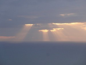
2013-05-15 20.36.23The lady, Joy, noticed my banner and asked about the walk, and when I mentioned MHA she said in fact she was a Methodist ministerJoy spent much of her time in India working with people with leprosy and diabetes, but was currently temporarily looking after the local church as the minister had recently died. We talked about the closed chapels and the way some parts of the church were getting older and literally dying away, whereas others, like the church Esther attends in Liverpool, are growing and thriving. She also told me about a friend from theological college who was a walker and poet.

As she left (my laptop still hard at work uploading files … albeit with power dropping very low) I said how good it had been to chat, and how often during the journey there had been chance yet rich meetings.  "It may be happenstance, or maybe providence", I said.  Joy opened her arms, "simply the Holy Spirit".

abergele-station-2013-05-15 14.07.42-cropped

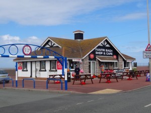
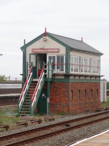
By the time I finished off, prompted by the dead laptop battery, and got the train, it was 2:30pm when I started from Abergele.  The beach front cafe ‘Pantri Bach‘ was open, and with a name like that I had to stop by, albeit, sadly, skipping their sit down ‘all day breakfast’, and just grabbing a tea in a polystyrene cup and a sausage sandwich to eat on the move.

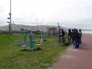
A group of young people led by a man with a clipboard stopped by an open air exercise area.  I’d seen a larger one of these at an earlier resort, it almost feels like Los Angeles.  I don’t know whether this was a sixth form geography lesson looking at seaside regeneration, or maybe an apprenticeship scheme for outdoor recreation, and I don’t know whether they were impressed, but certainly Abergele felt a lot more ‘open for business’ than some of the places I’d been through where everything seemed to be closed.  As well as the exercise area I loved the Charlotte’s Web children’s climbing net.

It is early in the season, so not all the seaside stalls are open, but I spot a bait shop; there are many fisherman out already, and I assume even more as the season progresses.  Also there is a pet-grooming stall.  I can’t work out if this is just a convenient place for it, or if it is for all those pet owners who want the sand and seaweed shampooed from their pooch before letting it in the car.

2013-05-15 14.14.39 2013-05-15 14.11.02 2013-05-15 14.36.11

At the far end of Abergele bay is an impressive castle on the hill that I have seen many times from the A55.  I have assumed it is a Victorian folly constructed by a local businessman made rich on the limestone quarries rather than a Norman defence, but need to check it sometime.  However, defence or conceit, it is impressive hanging on the hillside.

Further along the promenade is a large boulder, a memorial in 1995 to fifty years’ peace and dedicated to the heroism of those who died in the 1939–1945 war.  While the latter is unquestionable, the idea of fifty years’ peace between 1945 and 1995 seems odd, given those who lost their lives in Korea, The Falklands and elsewhere.

The caravan parks I had passed so far had all been like municipal car parks, packed closely, I assume the legal minimum distance apart for fire prevention.  In one case I saw a caravan with outward opening French windows, but so close to the fence that they would never be able to be opened.  In contrast, the site at the west end of Abergele is well spaced, often just one caravan deep facing the sea, and, where two deep, staggered rather than in rows, so that the caravans behind can also see the sea.  Admittedly the A55 behind may mean night-time noise, but if I was going to choose a caravan site along this part of the coast, this would get my vote.

I am trying to put my finger on the difference. This town is definitely down at heel, as virtually all seaside towns are, but still pleasant, safe, alive although quiet.

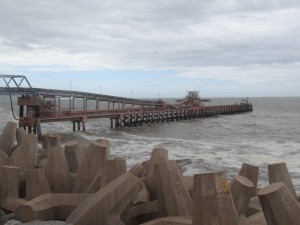
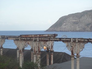
Further along the coast, the other side of LLandulas, the hillsides above the sea are cut with limestone quarries with vast conveyor belts taking the rock out along a pier to load ships.  For heavy or awkward goods, whether stone or Airbus wings, there are advantages still to water transport.

An information board describes the growth of this industry going back hundreds of years, but also describes the strength of community fostered by it.  What is it that makes industrialisation and its dissolution strengthen communities rather than lead to social dissolution?  I don’t know whether the workers here were well treated by the quarry owners, but even if not, the South Wales valleys show that resistance against hardship can also be community strengthening.  In contrast, in Flint, the chemical industry seemed to poison the hearts of generations as noxiously as it polluted the air and water.

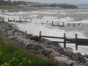
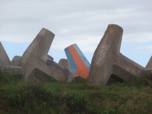
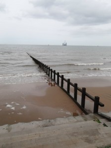
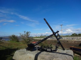
Although there is occasional marsh land or open sands, for a lot of the day the path runs behind or on top of sea defences, sometimes rotting timber groynes, sometimes large boulders, sometimes anchor-like moulded concrete pieces, each arm the height of a man. Along this coast, railway and road often run between the villages and the sea, but the entire strip of land is narrow, constantly threatened by the waves. On a wild day like this, I wonder at the cost of maintaining the defences and whether they would be abandoned and the community sacrificed to the sea were it not for the road and railway.

2013-05-15 14.50.55 2013-05-15 14.49.18 2013-05-15 15.28.42

[completed April 2014]

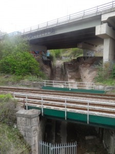
Llandulas itself is mainly visible on the coast path due to its beach caravan park and ‘Tides Café and Bistro‘; the road comes to the sea through a tunnel under the railway track and I assume the town itself behind.  The road tunnel does not need to dip as the railway embankment is set high to avoid, I assume, being washed over by waves and tide, well above the roof level of the caravans that face the sea.

Although there have been many signs of man’s despoliation of the environment and the harsh elements’ destruction of the land, there are occasional signs of hope.  A notice board describes the honeycomb reef worm, which has returned to these waters after 60 years, a sign of reducing pollution.

A half mile further is the main Llandulas connection to the sea, a near empty car park, public toilet and piles of those giant anchor-shaped concrete blocks, then another quarter mile behind, the vast conveyor belts that cross to the sea, some apparently disused, others still active.

2013-05-15 15.40.272013-05-15 15.49.062013-05-15 15.50.22

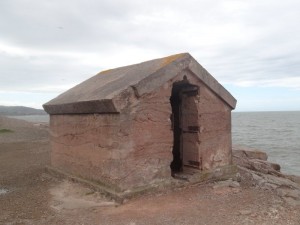
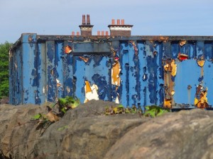
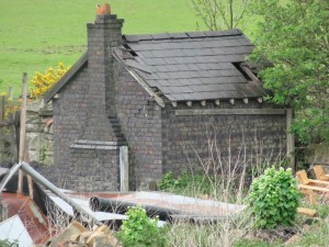
A headland separated Llandulas from Colwyn Bay and on the Llandulas side of the headland is a crude squat stone and concrete hut, its walls a foot and a half thick, an abandoned explosives shed for the quarry, set as far away from quarry and human habitation as possible.

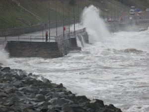
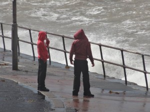
A road joins the footpath at the eastern edge of Colwyn Bay, and the waves break over the sea wall, flooding the road.  The footpath and prom is above the road, so you can stand relatively dry watching the few cars that brave this stretch of road as they time themselves to drive in both directions on the coast side of the road.  I can see sea-thrown pebbles on the road that would smash a windscreen.

2013-05-15 16.00.292013-05-15 16.04.492013-05-15 16.19.20

Despite the waves, the weather starts to improve, the cloud bank of the earlier part of the day gradually clearing and blue skies and sun peeking through. The stall selling brightly coloured buckets and spades makes it really feel like the seaside. And, yes, stalls open for business, so I can get myself another polystyrene-cupped tea to nurse along the way.

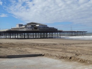
There is a new steel wood and glass building being constructed on the sea front, I assume an information centre, maybe café, complete with its own small vertical axis and turbine.  Further along the Victorian pier still stands, civic building of a different age albeit now derelict and home to buddleia rather than boater-hatted men in striped summer suits and wedding-cake-dress women with parasols.

2013-05-15 16.43.55 2013-05-15 16.46.06 2013-05-15 16.46.20

The prom continues, but a sign tells you that you have now entered Rhos-on-Sea.

A tourist information board had shown various local sites including the smallest church in Wales, which was clearly on the coast road.  Going round the headland at Rhos-on-Sea, the road is about ten foot higher than the prom, so I walk on the pavement rather than down on the prom to avoid missing one of the few coast-side sights.  And so almost do.

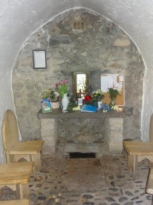
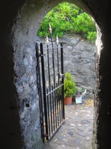
I had been expecting it to be standing on the road side facing across the road, or maybe up one of the side streets running away from the sea, but instead, and I might easily have missed it, I see the roof of a tiny building down beside the footpath, the ridge of its roofline below the level of the road.

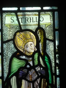
It is St Trillo’s church and one of my personal list of wonders of Wales.

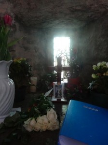
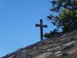
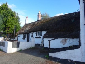
It is stone walled and roofed, almost blending into the rocks behind, with a small plain cross on the peak of its low gable end. Inside, it is barely the size of a living room, with six chairs arranged either side of a small altar above a grating, the site of an old holy well.

It is plain, peaceful, a jewel and a haven.

2013-05-15 17.25.06 2013-05-15 17.26.37 2013-05-15 17.27.02
2013-05-15 17.28.282013-05-15 17.31.112013-05-15 17.31.28

Beyond Rhos-on-Sea I could see another seaside town ahead and a headland beyond.  For a moment I thought this was Llandudno with the Great Orme beyond.  However, as I drew closer I realised it was just the Little Orme I was seeing, what appears on the map as more like a wiggle in the coastline and before it Penrhyn Bay.  Penrhyn is a sleepy town beside the sea, rather than a seaside town; I would guess a retirement rather than holiday destination, maybe the road sign that said, “Beach Drive (no access to beach)”, says it all.

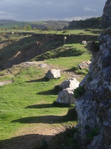
The way to Little Orme leads through a small maze of bungalow estate, but then opens out into quarried layers with many dog walkers amongst the remains of abandoned working gear.

2013-05-15 18.24.05 2013-05-15 18.11.34 2013-05-15 18.44.28

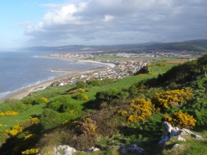
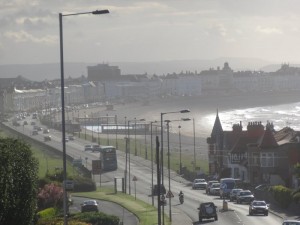
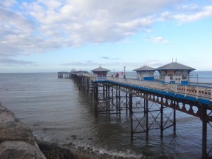
From the top of the Little Orme the views stretch back along the coast and over my day’s walking.  Then, after a short walk through woodland and grassy scrubland, I join the road that breaches the hill and looks down upon the evening-hazed grandeur of Victorian seaside landscaping at its prime, the arch of sea leading past tall sea-front terraces and leading the eye to the Grand Pier and Great Orme itself beyond; wilderness both framed and tamed.

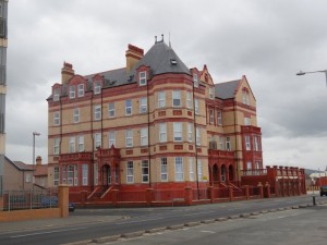
As I come closer I see that the hotels have grand names, the ‘Dorchester‘, the ‘Washington‘, the ‘Hydro‘; the last a reminder that the sea was at first as much a health cure as a holiday.

While there are the occasional signs of distress, on the whole Llandudno seems to have survived the 20th century and is thriving.  It looks as if it never had quite the flood of amusement arcades and fun fairs of the 1950s and 1960s, and so, in its late Victorian charm, is better suited to serve a new form of seaside holiday that is less threatened by Majorca or Ibiza.

The distances are deceptive, a good mile and half along the prom. The pier is still very much alive, but I cannot see a fish and chip shop, and I was finding myself hungry again.

2013-05-15 19.17.042013-05-15 19.18.542013-05-15 19.22.39

I had accomplished my day’s walking, and done plenty given my afternoon start, so I could walk up into the town, find the railway station, and maybe get some food while I waited for the next train.  But I felt strong, my sandalled feet so much better than the previous booted day.  So I kept on around the Great Orme.  It looks deceptively small on the map, and indeed is just a mile across at its neck, but more like five or six miles to go round.

I would like to return, as deep in its heart is an extensive Bronze Age copper mine, only discovered in 1987. Its size, and the geographic spread of the copper mined here, speak compellingly of the complexity of trade and civilisation that was here 4000 years ago. In the Bronze Age as in the 19th century, Wales was at the heart of global industrial expansion.

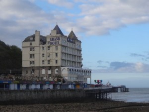
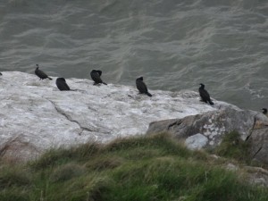
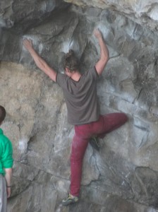
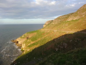
It is a lovely walk, at first rising above Llandudno Pier and the Grand Hotel and looking back towards the town, then gradually climbing further past rock climbers and nesting birds.  In the daytime there is a small café, but at night, once I am a short way out of the town, there are few cars and only one walker, me.

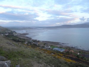
At the furthest point the views stretch along the coast both far back along the way I have come and also onwards to the west,  to Anglesey and Snowdonia.

2013-05-15 20.43.30 2013-05-15 19.57.05 2013-05-15 19.30.08

I don’t recall how we started talking, maybe she just stopped to see if I wanted a lift, but I start to chat to a lady passing in a car.  When she had first seen me she had, for a moment, mistaken me for a friend of hers, a druid and a walker.  I guess in long hair and sandals I only need a staff and hair shirt to complete the picture.  She is fascinated by the spiritual sites of the area, both Christian and pagan.

It is often said that we are an increasingly secular nation, and indeed in many ways that is true, but also there is a great thirst for spirituality.  As creatures we are made for a relationship with God, so it is no wonder that despite a culture of materialism there is that deep unfulfilled longing within. I despair sometimes that the church seems largely unable to connect to this seeking for meaning.

2013-05-15 20.03.41 goats-2013-05-15 20.32.30-cropped 2013-05-15 19.38.30 

The Celtic church had no such problems building from the local pre-Christian understandings as well as challenging aspects of them. This was, and can be no crude 1960s syncretism, but instead both an openness to value the many true and rich things in varied beliefs, whilst holding on to a fuller truth, and a willingness to meet people where they are, whilst pointing a route onwards, a pilgrimage to follow together.

We must have talked for half an hour and the dusk was drawing in when we bade farewell and she drove on her way.

For a mile or so I trot gently back down towards the far side of Llandudno.

2013-05-15 20.53.16

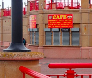
Llandudno spans the neck of the Great Orme, but this south-western part, overlooking the Conwy estuary, is a quieter place than the seaward facing side.  There is a café, but of course closed as it is now 9pm.  I had hoped maybe a fish and chip shop, but all is silent in the dimming light.

I go on along sand and sea-edge path to Deganwy where there is a halt, but sadly again no fish and chips.  It is now properly dark, and as I walk the last miles along the road past Tywyn toward the Conwy Bridge, the last light fades in the west, so, as I cross the bridge, Conwy Castle is lit ahead and Llandudno shines across the water.

I knew I would be too late for the last train, it is well after 10pm, so I look for a taxi, but come to a pub first, so go in, order a half pint and ask for a taxi number, I am hungry, and tired, but have accomplished far more than I planned.

It had been a day of unexpected joy,  chance yet rich meetings – happenstance, providence or simply the Holy Spirit.

2013-05-15 22.09.14

Day 27 – Mostyn to Abergele

Political images on the Duke of Lancaster, a wind farm farm, a gas terminal and a lighthouse, dunes and promenade, more promenade, and more, slightly dingy, promenade, and a sea of caravans.

miles walked: 18
miles completed: 260.3
miles to go: 800

I would like to say it was an exciting day, that I had found fresh insights amongst the mundane, and in fact there are some lovely parts, such as the dunes at Point of Ayr, but the reality was hard going.  My feet, which seemed to grow stronger as I walked Offa’s Dyke, which took each new hill with fresh vigour, fail against the monotonous flatness of the Dee and North Wales coast.  My ankles, the tendons across the front that lift the toe-end of your feet, were painful at the beginning of the day, screamed by the end and still hobbling-sore the morning after.  I had thought this would be an easy stretch after Offa’s Dyke, where I would make up time and distance, and maybe it is just the fatigue of daily walking catching up with me, especially the long day from Ruthin to the coast.

2013-05-14 09.48.19

Duke of Lancaster

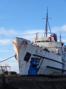
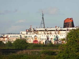
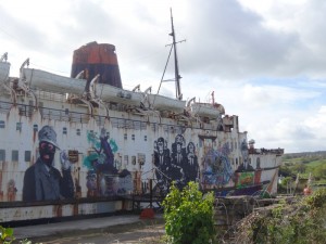
The day started where the last day ended, at the Duke of Lancaster at the far east end of Mostyn.  Whereas yesterday had been the port side of the Duke, this morning it was the starboard side.  Instead of the blue Transformer breaking out of the hull, this side was more a canvas of images, several with strong political overtones, on money and wealth.  It is worth visiting on its own.  Watch out for the blue and white ‘Funship Market‘ and the pub opposite, another ‘Old Tavern Inn‘, is open for food, but you have to go round the back, to the car park side, to get in, all the front doors are locked.

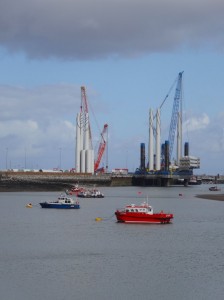
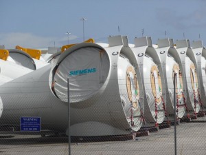
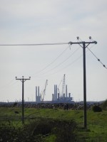
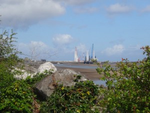
2013-05-14 09.49.57From there, the path follows the coast with mudflat to the right and ahead Mostyn Dock, where cranes are constructing wind turbine towers.  From the train I have seen the turbine parts lying in endless lines in a vast fenced area on the foreshore, but on the dock itself are the towering cranes, one blue, one orange, to assemble the turbine sections, I assume to take out to sea and ‘drop’ into place.  In the offshore wind farms in this area (small and far out to sea compared with the one planned for Tiree), the turbines are supported on piles driven deep into the sand and mud that flows for miles out to sea from the Dee and the Mersey.

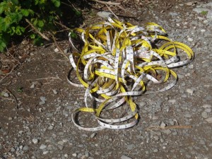
On this piece of path the two points of excitement are a discarded tape measure and a Coast Path sign, shot through as air gun practice.  I hope the marksman keeps a lookout for walkers, or rather I hope the marksman keeps a lookout and seeks to avoid hitting walkers.

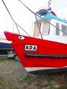
In a tiny inlet before the harbour itself, maybe even the original Mostyn harbour, lie small fishing boats, in blue and orange to match the cranes behind, and then on the path broken plastic, also in blue and orange, as if the landscape had been painted in a limited palette or the Mostyn football strip.

The path comes away from the foreshore where Mostyn Dock blocks the way and follows the roadside, sometimes along the pavement, sometimes a few yards away.  There is an alternative path that takes you a sightly longer, and I assume more scenic route through old Rhewl Mostyn village to Ffynnongroyw, but I stick to the road route as I want to see the turbine field close to.

2013-05-14 10.00.12 2013-05-14 10.05.34 2013-05-14 10.13.11

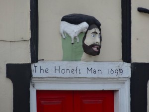
Just where the path joins the road is a pub, The Llaety Arms (originally called in 1699The Honest Man‘), which is, miraculously, open, but I decide to press on as I assume there will be beach caf&ecute;s later.  However, only a short while on, opposite Mostyn Dock, I find Anwen’s Grill Bar – now a pub, café or Egon Ronay restaurant I can pass by, but there is something about a road-side van, seeing the food cooked freshly in front of you, it is the ultimate cuisine.

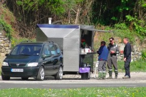
anwen-van-2013-05-14 10.20.16-croppedAs I eat one of Anwen‘s breakfast baps (sausage, bacon, egg and black pudding) and drink my tea, I sit with some electricity board workers about to replace wiring where copper cabling has been stolen, a growing problem across the country in recent years.  One of them chats a little about the walk, and the others talk about mountain biking along some of the trails at Llandegla and downhill tracks amongst the flint hills to the west.

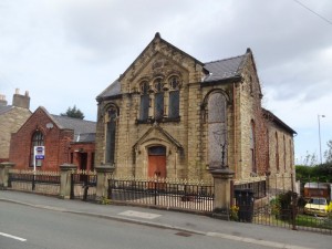
After Mostyn docks, the road leads to Ffynnongroyw, the ‘clear well’, where the well used to serve the village until the 1930s and was only shut off completely in 1980.  I pass one Anglican church and at least four non-conformist churches, all closed and residential or for sale.  I note that one of them had an annexe, clearly built relatively recently, probably the last 20 years.  I think of church repair and re-building discussions at my home in Tiree, and think again that the only church building that matters is the body of people, without them the remains are not holy, but simply empty.

2013-05-14 10.47.162013-05-14 10.53.402013-05-14 11.14.15

Beyond Ffynnongroyw, the next high point is the gas terminal at Talacre.  The path takes a v-shaped path around a piece of empty ex-industrial land that I assume the Flintshire path officer failed to negotiate access to, although the wording of signs suggest that this is work in progress, so maybe one day it will take a more direct route.

Although this part of the coast is not replete with obvious beauty spots, Flintshire Council have worked hard installing well-designed cut metal information boards, exposing some of the long industrial and natural heritage of the area.

2013-05-14 11.57.24 2013-05-14 11.42.45 flag-2013-05-14 12.11.39-cropped

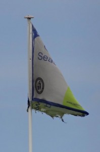
Rounding the hydra-like steel pipework of the gas terminal and set well away from the main complex, a tall tower with the distant roar of a pressure relief flame, the coast stretches due north through Point of Ayr nature reserve, past my first beach café (passed by as I was still full after Anwen‘s breakfast), the tattered flag flying iconic of the decay of the great British seaside, and then on to Point of Ayr itself.  This is a turning point, both literally and because it signals the end of the Dee Estuary and the start of the open sea.

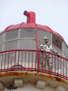
2013-05-14 12.28.31The lighthouse on the point lies on a caldera-like cone of concrete far out on the sands, there being no rocks to sea on which to place it.  It lies slightly to the west of the current Point of Ayr, I assume where the land has shifted over the years. As I draw closer across the sand I realise that there is a figure looking out from near the light high on the tower, an iron man, C3PO, Cyberman, watching out to the east, or maybe towards the English.
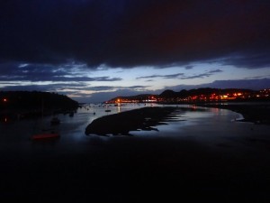
I follow the path along the top of the beach, below the dunes of the nature reserve where endangered natterjack toads have been reintroduced, their breeding ponds protected by fences.  ‘Endangered Predator’, the signs say, and I wonder about Arnold Schwarzenegger and whether he considered the environmental loss as he slaughtered a unique species.

Shortly after passing Presthaven Sands Holiday Park, which merits its own special bus stop, there is a sign announcing "Croeso, Welcome", to "The resort town of Prestatyn", although clearly the administrative edge of Prestatyn, the town itself still far distant, the cliffs above, where I had walked three days ago, now beginning to loom and around the sea edge of the dunes, a red-roofed building occasionally appearing.  The path through the dunes here is unclear at times, and I was trying to follow it rather than erode other parts of the sensitive environment, but eventually decided that if it were a problem they would sign more often, so just took a combination of the slightly more difficult (soft sand) path right by the sea edge, where waves broke against stone sea defences (the dunes would clearly like to move eastward towards the Point of Ayr), and easier trodden grass between the dunes.  I saw no toads, but I think this area was pond-less and they are largely nocturnal.

Finally, the dunes and the once distant red-bricked building mark the east end of the long Prestatyn promenade, which runs onwards into Rhyl and Abergele.  The building is a hotel, and I see a man pulling a wheelie suitcase and a sour-faced woman realising that the seafront hotel they had chosen is in fact a good mile from the centre of the town.

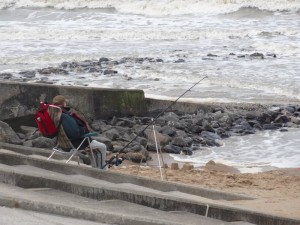
2013-05-14 13.50.13A man sits fishing, an image of patience, and I chat to a gentleman about cameras, walking and, after I mention that I am collecting partly for Tenovus, cancer. He and his wife had lost two members of their family in the last year.  Without rancour or self-pity he described weeks spent at the hospital waiting for the end, the simple courage of everyday people.

[completed April 2014]

After about half a mile of prom I get to the end of Offa’s Dyke Path where I had been just a few evenings before. I take some more photographs with the better light, but no selfies this time. It was after two and Anwen‘s breakfast had begun to bed down, so I went into ‘Offa’s Restaurant‘, which seems appropriate.

Between Prestatyn and Rhyl the prom just continues.

2013-05-14 15.35.36

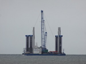
One of the floating cranes I had seen yesterday passes out at sea, looking rather like a powered oil rig, sections of wind turbines are stacked vertically ready to be lifted into place.

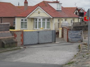
On the shore, on the outskirts of Rhyl, there is an estate of those pitch-roofed pre-fabricated constructions that are midway between static caravan and bungalow.  There is a four-foot wall to the same side and, where the tarmac prom path turns into the estate, huge metal gates to keep the sea water at bay.  Nearby there is a sign entitled ‘Coedwig Dan Y More” (the wood beneath the sea), about a drowned forest in the sea here.

2013-05-14 15.36.10 2013-05-14 15.51.10 2013-05-14 15.52.03

The encroaching elements are not a new phenomenon, albeit accelerated by climate change.  The lost land, the hoses struggling to protect themselves now, and the new turbines that will soon surround the coast, all linked.

I pass lidos and funfair rides, kiosks and cafés, but it is mid-May, well out of season for Rhyl, and everything is closed.

2013-05-14 16.08.50 hyl-cafe-2013-05-14 16.14.42-cropped 2013-05-14 16.26.59

Set back from the seafront are the lines of small hotels, B&Bs and apartments, many of which will be where the Liverpool cast-outs have been placed.  In the wide open I do not feel ill at ease, despite the warning I had been given, but I assume it is a few streets back, in the residential part of the town, where the streets are less safe.

However, Rhyl is trying to regenerate; at the far west end of town is the harbour and there is construction underway for a new marina and waterside apartments.  Gentrification even for Rhyl.  Right next to the sign showing the new apartments under construction is one announcing the West Rhyl Coastal Defence Scheme.  According to the web site it is not just the estate to the east which is at risk, but later parts of Rhyl are below high tide level and depend on ageing sea defences.  I’m not sure if this would give me confidence to buy a harbour view here.

2013-05-14 16.37.50 2013-05-14 16.38.59 2013-05-14 16.41.14

The works on the harbour mean there is a small detour of the path, but soon I am back on, not really prom, but a concrete coastal path, with a substantial wall to stop the sea from flooding it.  The tide is out and there is a wide sandy beach, so I walk along that for while, not entirely unconnected to a group of youths on the path and the warnings still at the back of my head.
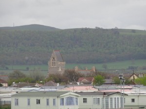
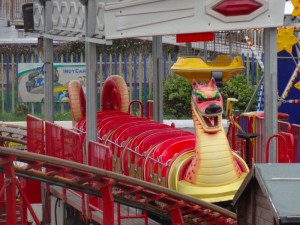
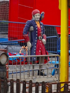
Coming into Abergele the first sight is acres of static caravans, all clearly below sea level. Through the fence at the edge of the site I see a tiny children’s fun fair, dragon and pirate silent in the evening air.

2013-05-14 17.11.45 2013-05-14 17.18.42 2013-05-14 17.18.50

Although the map shows the path continuing along the seashore, the guide arrows send me crossing the railway line and across through the caravan site, so I enter Abergele along the main road.  It is clearly run down as some seaside areas are, but with a different air.  It was evidently never a big funfairs and B&Bs holiday resort, and caravan sites have stood the test of time better than seaside guest houses.

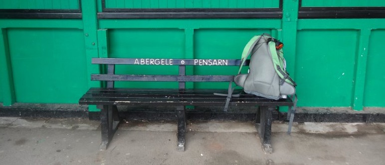
I arrive at the station ‘Abergele and Pensarn‘ just in time for the 18:05; if I had missed it there would have been an hour and half to wait and I would have been forced to have a pint or two in the local pub, which would have been tough.

2013-05-14 17.32.18 2013-05-14 17.37.07 2013-05-14 18.04.35

Day 26 – Flint to Mostyn

Eighteenth century immigration and pollution, gunshots across the marches, and one of the modern wonders of Wales.

miles walked: 8
miles completed: 242.3
miles to go: 818

The day had been forecast for rain, and so, given that, a few exhausting days before, and a backlog of writing and other work, I decided to have a day with no walking and lots of typing. However, by 2pm I found I had lots of writing under my belt and the promised rain was instead sunshine and blue skies, so I decided to add a few miles walking to the writing and set off on the 15:09 train to Flint.

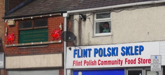
I spent a short while on the shopping street by the station as I needed to get lithium batteries for the SPOT tracker. I had been told that there was a large Polish population and sure enough, amongst a relatively small number of shops was a Polish grocer and Polish off-licence. I’m not sure what brings the Polish population here, perhaps cheap housing and easy access to Liverpool for jobs. I recall my surprise some years ago, when I realised that the signs in Liverpool Airport were all in dual language: English and Polish.

Flint is not new to immigrant population. During the potato famine, there were so many emigrées in Flint that the area between railway and river was known as ‘Little Ireland‘ and became a no-go area, even in the 1930s, the only person who dared enter was the Catholic priest.

Flint has a long industrial history, originally smelting lead ores from the hills above and then later the home of cesspit chemical industries that were deemed too dirty for Liverpool. The air and sea were foul then, choking Welsh and Irish alike. It seems that even in the 19th century, Liverpool‘s most difficult problems were exported to North Wales. The chemical industry continued, although with increasingly less filth, until Courtaulds closed its doors in the 1970s. So now Flint is cleaner, but with no jobs and no prospects for the young.

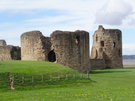
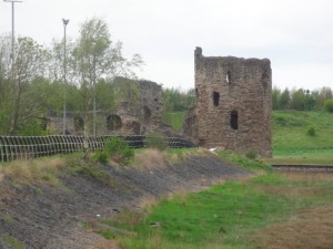
The Coast Path takes you past the castle, one of the Norman marcher lords‘ castles, but destroyed by Parliament after the Civil War. The path then hugs the coast, sometimes along sea wall, sometimes areas where the bedrock is broken slag from age-old smelting. I am glad of the recent rain as I was told some of the earth here is so polluted the blown dust is noxious. In fact, the only time I smell noxious fumes, it turns out to be that I am passing a sewerage farm.

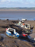
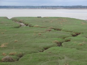
There are a number of inlets where small fishing boats lie tide-stranded on the grey mud. Some of these inlets were once major ports, shipping ores and passengers, but now silt-choked, tree-like channels cut across their soap-sheen surface.

I pass the odd dog walker, and see a group of youths heading across the salt marsh, carefully stepping over the channels. Remembering the things I’ve been told about Flint, I am glad they are not on the path, and I notice myself taking photos half from the hip, so as not to flaunt the camera. The sense of paranoia distorts the most innocent of things and, as I see a man ahead taking his fishing rod from a case, I half imagine that it is a gun. Only, when I get closer I see that it is a gun, a powerful air-rifle, which he proceeds to fire across the marsh, I think aiming at birds. As I take photographs of the inlet, he looks at me suspiciously; I guess he does not have permission to use the gun in this way, so I do not take a photo of him, and move on my way.

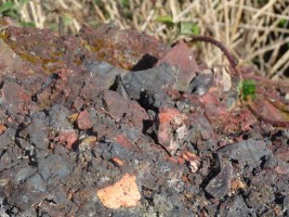
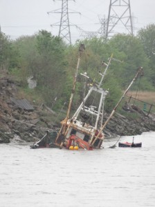
After a short while beyond the business parks of ‘Greenfield‘, the path heads along a sea wall, protecting the fields to landward, which lie well below the high tide level. On the ground are occasional pieces of almost jet-black rock, with a slightly metallic sheen, I assume discarded remains of old ore workings. The wall stretches out with the cranes of Mostyn docks in the far distance, but between them and me, the object I had been looking forward to since the first train journey to Chester on Sunday, one of the modern wonders of Wales, urban art in the middle of nowhere, the Duke of Lancaster, a large ship stranded on the mud, its sides covered in Graffiti, a blue Transformer bursting out of its starboard side.

2013-05-13 18.52.30 2013-05-13 19.36.24 2013-05-13 18.59.50

John on the train on Sunday said that it had been washed ashore after drifting and threatening the A55 and railway. However, when I popped into the Old Tavern Inn (another ‘Tavern‘), to wait for the bus, I found that in fact he had been conflating two stories. The Duke of Lancaster has been there since 1978 and at one stage was going to be turned into a casino; the ship that had been adrift was one carrying Airbus parts from Mostyn docks.

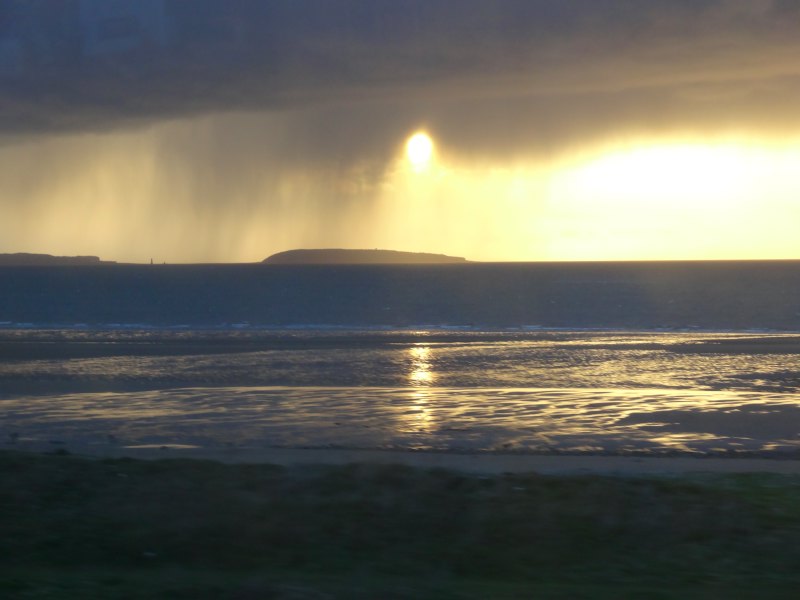
After getting the bus back to Rhyl station, I just catch the Llanfairfechan train, and on the way back, over Puffin Island off the north-east tip of Anglesey, the sun shines through jellyfish tentacles of rainfall.

2013-05-13 20.37.01

Day 25 – Chester to Flint

The northern start of the Welsh Coast Path … if you can find it. A day starting with a long walk along the straight canal-like Dee and ending with a castle dwarfed by towers. Power station and Airbus wing, tide-swept flotsam and rain-drenched walking.
miles walked: 11
miles completed: 234.3
miles to go: 826

2013-05-12 08.11.00The day started with me in a Travelodge a little north of Flint on the A55 where I’d stopped after the long previous day.  As I left, the panorama was one mainly of industry and city, the next few days’ walking will take me through some of the most deprived areas of Wales. And the weather forecast is for cloud and rain – pathetic fallacy?

I drive along the coast road to Llanfairfechan where I’m staying for a few days while I walk the Coast Path using the reasonably frequent train service from Holyhead.  It is strange again driving in less than an hour several days’ journey ahead.

I said the service is frequent, but (i) it is less frequent at Llanfairfechan, a minor stop, than other places, and (ii) even less frequent on Sundays.  The first train of the day is at 11:08, but if you miss that the next is not until four o’clock.  I have just enough time to nip down to the Beach Hut café for a breakfast and free WiFi (open Tues–Sun, 10am–5pm).

A little paranoid about missing the train, I rush my breakfast (maybe a more leisurely one another day), and half trot back up to the station, arriving there with still 15 minutes to spare.  There is one other passenger, an older woman relaxed under the shelter, reading while I peer anxiously down the track.  Llanfairfechan is not only a minor station, it is also one of the many ‘request stops’ along the North Wales line.  If you are on the train you need to tell the conductor that you want to alight, and if you are on the platform, you need to ‘make clear’ to the driver that you want to board the train.

I am waiting ready to throw out my hand, hitch-hiker style, or like hailing a London cab, but then, about five minutes before the train is due, other people start to arrive, and with a small crowd on the platform I relax and sit on the bench near the lady.  I then realise that she had left her small suitcase on the platform, so that it was obvious there was a passenger waiting.  It also transpired she set her alarm, just in case there were no other passengers.

It turned out she was a seasoned backpacker, although not walker, recommended couch-surfing and told me about a night sleeping in the back of a car in a ‘no overnight’ car park.  I feel positively un-intrepid.  She also strategically plans the use of her free bus pass, planning to only travel to Warrington on the train and then on to Manchester by bus as this works out cheaper and only an hour or so slower.  She trades time for money, having, as a pensioner, plenty of the former, but little of the latter.

2013-05-12 11.02.10When we are on the train and the conductor comes, she pulls out a wodge of cards and tickets, wrapped in a plastic bag (to reduce weight in her rucksack, purses and wallets take up precious ounces – I think of my heavy bumbag).  This includes multiple return halves of tickets, where she has gone one direction by train and the return by bus, but will then do the opposite at another time.  It reminded me of an academic I knew who lived in Milton Keynes, but worked in Amsterdam, commuting on a weekly basis through Heathrow.  Return flights without a Saturday stay cost a lot more (a way to single out business travellers), so he would buy combinations of monthly returns in both directions and alternate use of outwards and return sections.

The conductor suggests she moves further up the carriage where there are unbooked seats, so at Llandudno Junction the seat opposite is free and a wiry man sits down; he pulls out an envelope with a combination of train tickets and football tickets – double checking he has everything for the day.  His name is John, and he is off to see the ‘Hammers‘ play at Everton ground.  He notices my jacket is a Berghaus, and he explains that he has deliberately put on a warm fleece-lined hoodie, partly in case the expected rain and wind penetrates the stands, and partly because it does not look expensive and steal-able, "they are animals there", he says.

John has lived in North Wales for over 10 years, moving from the East End of London, via prison.  "The only way to get accommodation is to do time," he says.  As a single person it is almost impossible to get any form of local authority or housing association flat, but when you come out of prison you are instantly put into temporary accommodation and after that a flat.  From a life of drugs and petty crime, he has turned his life around, although he regrets that it is has taken him into his forties to do so.  He is grateful for his life now, living between sea and mountains, "what more could you want", he says, wondering how some of those who have lived in the area for their whole lives do not notice the grandeur around them.
He tells me about the line of rehab units along this coast, and a friend, who had recently, after ‘doing time’, got a flat in Conwy overlooking the harbour, and is now, like John, on a path to a new life.  But he also regrets the wasted years, and we wonder at the system that makes life so hard that it is only after hitting rock bottom in prison that help comes, but he praises the Welsh prison service, which he says really helps to rehabilitate, compared with London.

With recent benefit changes, things will get worse.  John tells me about a woman who recently hung herself, leaving a note to her children, saying it was nothing to do with them or anyone else, but the new ‘bedroom tax’ that had reduced her to despair.  If you are on housing benefit and your house has more bedrooms than the occupants demand, then your benefits are reduced, irrespective of personal circumstances or whether there is smaller housing available in the area.  In the case of parents with grown-up children, this will often mean it is impossible to accommodate them on visits, cutting families apart.  For MPs in Westminster who may stay in a hotel while visiting parents, this is presumably not a problem.

My own Mum lived for many years in a large double-fronted Victorian house in Cardiff.  Although she had some lodgers to offset costs, eventually the cost and worry of upkeep became too much and she sold it and moved into a purpose-built housing association flat.  In those days, my own income barely covered family expenses.  We had used to visit for a week at a time, staying in Mum‘s house, taking occasional trips out, sometimes leaving the children with Mum for the afternoon and visiting town.  After the move to the single-bedroomed flat, we would visit for one, maybe two nights at most, staying at a Travelodge, where we could stay as a whole family in one room.  But we had an income, and a car, and although it was a substantial cost, we could bear it several times a year.  If I had had no income, what then, maybe once a year at Christmas and letters in between?

Chester itself is comparatively affluent, as much as any area in these straitened times.  At the station I am met by David, a lecturer in building at Glyndŵr University, who was at the talk I’d given a few days earlier.  David gave me a lift to the start of the Wales Coast Path in Chester.  Not the most easy place to find, as the closest approach is the car park of Chester Football Club at the back of an industrial estate, still a mile’s walk from the path start.  The path runs along a long cycleway, so maybe there is a better place to join it closer to the centre of Chester.

2013-05-12 13.12.41 2013-05-12 13.13.53 2013-05-12 13.14.23

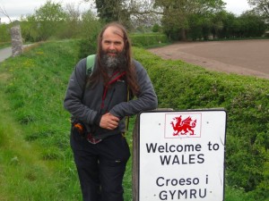
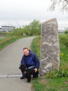
So, we walk back along the cycle path along the long artificially straightened banks of the Dee and almost miss the start of the Wales Coast Path.  Well, to tell the truth, we do miss it, and it is only when we see the back of a sign saying ‘Welcome to Wales, Croeso i Gymru‘ (there was no corresponding sign the other side saying ‘Welcome to England‘), that we realise the two upright stones we had passed, framing the path, were in fact the border, and start of the Wales Coast Path.  Even going back and looking closely, the only indication is some boot marks carved into the stone.  Compared to the roundel and obelisks in Chepstow, this is very low key, almost apologetic, as if the industrial northern border crossing were a lesser sibling, kept in the shadows, while the star of the family is shown off to relatives.

After a few photos, we set off, David and his black Cocker Spaniel, accompanying me for the first mile or two.  He explains some of the background to Rhyl, the most deprived ward in the whole of Wales.  Some years before, when there was insufficient housing in Liverpool, and, as in many decaying seaside towns, an excess in Rhyl, the local authority moved all the ‘problem families’ from Liverpool to Rhyl, instantly creating a perfect storm of a community.

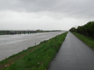
The path itself runs perfectly straight for several miles along the canal-like Dee, still tidal, flotsam floats upstream, mostly logs with the occasional car tyre to add variety.  The land to the north side is artificially drained and reclaimed, ‘Sealand‘, a miniature Holland.  Environmental impact and carbon footprint are a central part of building education today, and as part of his teaching, David uses simulations that show how sea level rises will affect different areas. "I wouldn’t buy a house in Sealand", he says, and explains how every few years, the dyke top along which we walk has had to be raised, and how in Chester the weir is for the first time being overtopped and salt water leaking upstream.

2013-05-12 13.16.292013-05-12 13.51.352013-05-12 13.53.46

The view ahead points directly to Connah’s Quay Power Station and the remains of the steel works that once gave 12,000 jobs to the area, where David‘s grandfather, father and brother worked until it shrank, the steel-making equipment shipped to India, and now only a small research facility remaining.

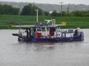
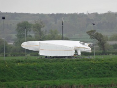
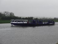
After David turns back, I am alone again, with a long walk in intermittent rain.  Across the water I see a strange wrapped thing, full of unidentifiable bulges.  If it were in the city centre, or along a major roadside, I would assume it was a piece of installation art, like Knighton Supercar, but here, as I pass by its shape becomes slightly more clear, more like a huge aircraft wing.  Sure enough, a short while later a large, low, flat barge, the ‘Afon Dyfrdwy‘ chugs slowly upriver, on its side ‘Airbus A380 on board’.

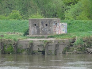
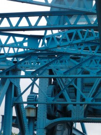
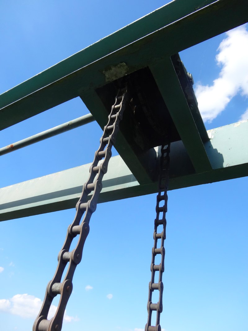
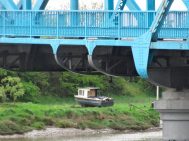
The path eventually crosses the river toward the end of its cut path, over a beautifully engineered blue-painted, riveted-girder rising bridge.  The riverside now becomes more varied, the occasional timber remains of old quays and Second World War pill boxes, as there were in the earlier straight section, but also boats on the river banks, old buildings or fragments of buildings that give a hint of a prosperous past.

2013-05-12 14.57.07 2013-05-12 14.59.50 2013-05-12 15.05.29

None of that prosperity remains in Connah’s Quay.  The path cuts inland and along what appears to be a vestigial high street.  The signage here is a little spare, and I found myself following the more clearly signed cycle route, although I realise that there are coast path ‘buttons’ set into the tarmac, so maybe it is just that the planners assume that when going through this part of the world you will be walking head bent, Lowry-style, to be in keeping with the environment.  I had been told earlier in the walk that investment and interest in the Coast Path was minimal in this area, as the local council sees industry rather than tourism as crucial.  To be honest, despite the occasional points of slightly obscure interest, selling this as a tourist area would be an uphill struggle, it is probably only the compulsive Coast Path collector who will want to ‘bag’ this section. This said, the final ‘Riverside Walk‘ leading into Connah’s Quay has both extensive information signs and interesting wooden and metal sculptures.

2013-05-12 17.09.37 2013-05-12 15.37.45 2013-05-12 15.38.50

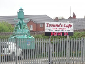
Turning into Connah’s Quay itself, I am getting hungry.  I plan to stop for half an hour and get a quick snack here.  I first pass a sign ‘Yvonne’s Café, Eat In/Take Out’, beside an green old ‘NE Mostyn light buoy’, beached on a small tarmac car park.  This looked perfect, a solid workers’ ‘caf’, but sadly, it’s closed on Sundays.  A few yards further on is the ‘Old Quay House‘, established 1787, but now, clearly in just the last few years, closed.  As I turn into Connah’s Quay itself, another pub also closed and boarded up.  When even the pubs close down it is a real sign of an area in freefall.

At the point of despair of whether I would find any food before Flint, there is a petrol station and small Spar where I get a sandwich and pie.  The lady behind the counter is friendly and mentions the wet sympathetically, but I get the feeling she is happy when I leave and take my dripping, muddy clothes outside.  Only yards beyond, but hidden by the garage as I approached, is the ‘Halfway‘ pub, which clearly is open, although given the atmosphere of the area, I feel I might have felt out of place, like the hush when the outsider comes into the bar in an old western.

2013-05-12 16.27.00 daffodils-closeup-2013-05-12 16.43.06-cropped wooden-bridge-2013-05-12 17.01.21-cropped

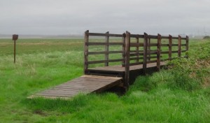
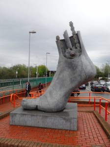
After this, I follow again the cycle route signs under the A55 intersection, along a small lane and then onto the side of the A55 which, quite quickly, takes you to the outskirts of Flint, where a sign declares it ‘historic market town’.  I note I only have just 20 minutes until the last train to LLanfairfechan for 2 hours.  Given the stories I’d heard of Flint, I thought there might be better places to spend two hours, so hurried along, as the path cuts around the town through marshes, with wooden boarded bridges over the (very) worst parts.  No matter the three fifteen-storey tower blocks rising above the town to the south, the approach along the salt-marsh estuary side towards Flint Castle is impressive.  Promising myself a close look at the castle when I rejoin the path at Flint another day, I pass quickly through a car park, where parents help children take off muddy boots after a just-finished football match, past a RNLI station, and along the road to the train station with its giant foot sculpture, where I arrived literally as the train arrived.

2013-05-12 17.06.24 2013-05-12 17.16.34 2013-05-12 17.07.00

Whether it was the wet, the late walking the previous day, sore wet feet, or the general depression of the areas through which I’d travelled, but I felt my own spirits low.  However, a curry from the Indian takeaway, and the promise to myself to take the next day off to write and catch up with university work, lightened my spirits as I snuggled, for the first time for a week, into the cosy van bed.

2013-05-12 21.00.27

Day 24 – Ruthin to Prestatyn

A long day, over high mist-swathed moorland, through horizontal stinging hail, across rolling farmland, and honey-sweet gorse hills, passing pack-laden school parties and meeting walkers from Colwyn Bay, before eventually skirting the escarpement high above Prestatyn and, with the falling sun, to the sea and the northern tip of Offa’s Dyke path.

miles walked: 20.7
miles completed: 223.3
miles to go: 837

2013-05-11 07.43.45It was a late start to what became a long day.  Breakfast was at Wetherspoons Crown Hotel where I’d spent the night. Although it is a chain, Wetherspoons has done a good job here, spending two and half million restoring the hotel, with wooden panelling, William Morris wallpapers and walls decorated with historic plaques and paintings by local schoolchildren.   The centrepiece is a towering eight-foot statue of Owain Glyndŵr.  I was typing over breakfast and so late to get finished, and then had a wait for the taxi to take me to the start, the car park below Moel Famau where I finished last night and where the planned shepherd’s hut would be sited.

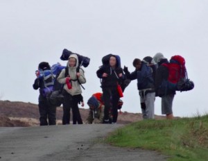
I’m sure the hut would have done good service this morning as the car park was full of teenagers, clustered around a couple of minibuses, the tinny sound of pop music half drowned by excited chatter. As I climbed up the path to Moel Famau I passed what I took to be some of their teachers from the mentions of ‘school’ and ‘DofE‘ that I heard as I passed.

I realised too, in passing them, that I had adopted a long-legged loping stride even going uphill.  "I’m becoming one of those annoying people who make hill walking look so effortless", I thought, "but if only they could see me at the end of the day!"

2013-05-11 11.19.47At the top of Moel Famau, the Jubilee Tower was shrouded in mists. The Tower was built in 1820 by the Prince of Wales on the Jubilee of his father – as Talentog put it, "one of the mad kings". The tower had a square base, with high lintel-topped openings on each side, like giant doorways, and an obelisk-like tower atop.  The latter fell down in a storm and the tower fell into disrepair, being half buried until Lottery-funded restoration work began in the last year. The work is not finished, but the lintelled openings have been cleared and I headed for the lee-side one to get some respite from wind-lashed rain. A group of DofE-ers were already there, gathering themselves ready to brave the elements again.

Heading back out myself, as I wandered down from the summit, the mists and rain cleared, looking back the Jubilee Tower was cut sharp against the skyline. I meet another group of DofE-ers climbing Moel Famau from the north; one of them noticed my banner and quizzed me about the walk, "one day is hard enough", she said, "and I’m fifteen".  They were glad that they were nearly done for the day, their end point the car park where I’d started, but seemed happy despite the weather, the first wet day I’ve had. Further on another group of teachers explain that there are several school DofE groups out that day, going in different directions, and for their group, it’s the first time on the hills.  I can see why they bring them here, it is hard to go wrong as the paths are wide and clear, yet it is high enough to give a real sense of achievement, and, when the mists clear, stunning views from Snowdonia‘s mountains to the sea.

2013-05-11 12.13.51 2013-05-11 12.41.37 2013-05-11 12.45.51

The official Offa’s Dyke route skirts the side of Moel Arthur, another Iron Age hill fort, but I diverted off the path over its top, no gently meandering climb, but straight up.  As I reached the outer ring the hail started, and coming over the top the wind and hail were thrown straight in my face.  The hailstones were small, but driven at speed, as if someone were taking pot-shots with an air-pistol. To protect my eyes I walked half sideways, my left shoulder hunched towards the wind, but still the icy buckshot stung my nose and left cheek.

2013-05-11 14.08.50Just as suddenly, descending the hillside, the hail stopped and skies cleared again, this time to glorious blue-skied, cloud-dappled sunshine, although to the west dark swathes of further rain could be seen cutting across the countryside.

From here on the ridge gradually descends and ahead I could see a group with whom I was gradually catching up.  As I drew near the group split, the larger part branching further along the descending ridgeline to the north, and three of them, with two dogs, following the Offa’s Dyke downward route towards Bodfari.  I greeted them as I passed and then one of them said, "are you Alan?" I thought they’d just seen the banner on my back, but it was not just that, "I saw about you on the TV", he said.  I’d given a couple of radio interviews early in the walk, but not spoken to anyone on TV, so they must have just reported using still images, I guess on the local news.

2013-05-11 14.30.00The group came from Colwyn Bay, and I think they said a rehab group, but wasn’t sure if I’d heard right.  However, I later learn that there are many rehab centres along the North Wales coast, taking advantage of cheap accommodation and natural environment.  We walked the rest of the way to Bodfari together, hoisting dogs over the stiles on the way; one a little Jack Russell, virtually hoisted by its lead and harness, the other, some sort of bull terrier, tough looking, but friendly, needing a bit more lugging.  As his owner put him down, "I don’t think he’d let anyone else do that", he said.

2013-05-11 14.49.22I was reminded of Teasel, our Bernese Mountain Dog, who died some years ago.  She was too heavily built to jump over stiles as a collie would do, but did not like being carried.  Although she was heavy, I could pick her up, one arm behind her back lags, the other under her breast bone, and could even step up the stile, but with no hands to hold on … and then, as I stood precariously astride the stile, she would start to struggle, kicking her legs to get away. Imagine holding on to a half-hundredweight sack of potatoes that starts to wriggle in your arms.

I had intended to stop at the pub at Bodfari, get a quick late lunch, and ring Stuart, who was going to give me a lift back to Wrexham after a family day on the coast, to work out where and when to meet.  The group’s minibus was in a car park right next to the pub, but, not being sure if they had said ‘rehab’, and if so, rehab for what, I decided to skip the pub and press on to Rhuallt, three or four miles further on where there was another pub marked.

2013-05-11 15.51.30 2013-05-11 15.53.47 2013-05-11 16.07.16

One last (I thought) climb up small lanes and mostly clear paths, to see views towards the sea ahead and Prestatyn appearing in the distance.  It seemed so close, only seven miles as the crow flies, but a lot further by the meandering Offa’s Dyke Path.  I felt on a roll, and wondered if I would be able to make it all the way to the coast, otherwise I’d have a bit of the Dyke path to ‘finish off’ in the next week.  I wonder now whether low blood sugar was already clouding my judgement slightly.

The path has to take a circuitous route to cross the busy A55 North Wales Expressway, and drops into Rhuallt.  From the map it looks as thought I will pass by the pub in Rhuallt for much needed, and, by that stage, very late lunch (near to 5pm), and ring Stuart from there, but as I pass through, expecting maybe to find the pub at the edge of the village, I never pass it.  I assume the icon on the map was indicative that there was food in the village, but not where!

2013-05-11 17.10.44 2013-05-11 17.14.57 2013-05-11 17.27.20

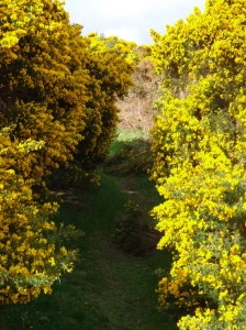
I kept thinking that the path would be ‘downhill all the way to the sea’, but in fact, out of Rhuallt, as if as a reminder of all those climbs in the mountains you have passed, the path cuts directly across the contours up a small, but very sharp, hillside, into first tree cover and then golden gorse, growing so close around the path that you are pushing through, your nose inches from the heavy sweet flowers, and the prickly branches catching on your clothes.

I should have rung as soon as I got to the edge of Rhuallt, but again, I think I wasn’t thinking entirely straight, and simply putting one foot in front of the other.  Eventually, in a tiny village with a Mt Hermon chapel, there is a seat, and on auto-pilot I sit down, get out the phone, see that there are messages, and belatedly ring, knowing I am already far too late for the lift, but to apologise for not ringing earlier.  I stuff myself with cereal bar and chocolate, drink plenty and continue the final few hours down (!) to Prestatyn.

2013-05-11 17.36.502013-05-11 18.16.362013-05-11 17.59.55

There are various roads directly to Prestatyn, but the footpath wends its way, taking country routes where possible and skirting the back of the long escarpment that lies above the town.  After occasional tantalising glimpses of parts of Prestatyn and the sea, through gaps in the hillsides, eventually the ground falls away and you are on the top of the old ancient sea cliff looking down on the flat land that would once have been beneath the waves, now filled with lush farmland and packed housing.

Rather than dropping straight down, the path follows the line of the escarpment, usually just below the actual ridgeline, a meandering cliff-side walk that I guess will be typical of many in weeks to come, except not crashing waves below, but an undulating sea of roof tops, breaking against the green scrub-clothed cliff base.

I knew that the path would eventually cut down from the escarpment for the last mile or so through the main street of Prestatyn and to the end of Offa’s Dyke Path where it meets the sea.  Tantalisingly the path would dip down, "ah I’m there", I would think, only to rise again as I passed some dip in the land.  But, at long last, as the sun dipped towards the wind-farm speckled sea, the path did drop into the town below, through a few streets of housing, and then the long road to the sea.  I stopped at the first fish and chip shop I passed and found they were about to close, but got what they had left, a sad sausage and overcooked chips, soggy, not crisp.  Later the taxi driver told me that there were far better fish shops than this one, but it was the first I saw and I was very hungry.

2013-05-11 19.28.43windmills-at-sea-2013-05-11 19.24.20-cropped2013-05-11 19.51.13

It was cold and dusk was falling as I got to the path’s end by the sea, a tall silver comet-tail sculpture marking the end, and an information centre that was obviously closed then (8:30pm), but was still closed when I next passed three days later at lunch-time.

After such a long day, I sort of expected fanfares, but have merely dim photos, the camera held at arm’s length to see me next to the end-markers, and then ringing for a taxi to Wrexham (a long and expensive journey) and drive down to the Halkyn Travelodge on the A55 near Flint as I was too late to go to the campsite.

2013-05-11 20.31.12 2013-05-11 19.53.24 2013-05-11 20.32.50

Day 23 – Llangollen to Ruthin

A day that starts with a journey to World’s End and finishes at Weatherspoons, taking in an Iron Age fort, Heathcliff moorland, and, guided by a gaping socket led eventually to the future site of a 21st century shepherd’s hut.

miles walked: 15.6
miles completed: 202.6
miles to go: 857.7

2013-05-10 09.26.30Richard Picking set me well on my journey, taking me from my hotel, The Lemon Tree, in Wrexham and dropping me where I’d left the path on Wednesday evening, already high above Llangollen, with Dinas Bran rising to the south. The path follows a road for several miles, and for those who do not want to walk, a drive along this is well worth while, with views the length of the Dee Valley.

Barely a half mile in, a car slowed as it passed and I heard a voice, "Hello Alan". At first I thought this was someone else who had found me on my way, but then realised that they had simply read the banner on my back.

The car contained two women, one who had just moved to the area, and the other her visitor from further afield, taking a day out together and enthralled by this road with its aptly named ‘Panorama Cottages‘ and leading to ‘World’s End‘. As we chatted we realised I had walked only a short way above her house on the way out of Trevor two days before. I hope it takes less time to become a ‘local’ in Trevor than Kington.

The road continues to gain height slowly, wending its way beneath the escarpment of ‘Craigiau Eglwyseg‘ or ‘Trevor Rocks‘. The former is named after the mountain beyond, and must mean something to do with ‘church’ as ‘eglwys’ means church in Welsh, but I will have to look up what the ‘eg’ ending means.

2013-05-10 10.57.44 2013-05-10 11.11.11 2013-05-10 11.17.35

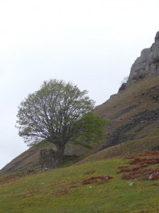
Eventually the road drops to the valley floor, but the path continues to maintain height (phew) as it cuts along the scree slopes below the scarp, passing a few farms, and just up the slope two trees that have small walls around them, almost as if they were some sort of Capability Brown parkland amongst the scree. I assume the walls came first, and the trees simply took root in one of the few stable places in a shifting hillside, but I could not work out a purpose for the walls themselves.

2013-05-10 11.12.13 2013-05-10 11.18.34 2013-05-10 11.25.01

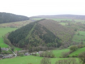
Across the valley is a forestry plantation on a long low hill. The hill appears almost perfectly rectangular with a triangular cross section, as if it were a flow bed or grave.

Bran was said to be a giant, and while the ships of the Welsh sailed across the Irish Sea to rescue Bronwen, Bran had to wade across as no ship was big enough for him. The reports came to the king of the Irish,

"A forest is approaching across the sea, and in the midst of the forest a mountain with a sharp ridge and two lakes either side, with beacon fires burning in each lake."

The king sends a message to Bronwen,

"What is this approaching from Wales?"

"Ah," she replies, "the forests are the sails of the armies of Wales and the mountain rising between them my brother Bran come to rescue me from my disgrace at your hands. The ridge is his nose and the two lakes his eyes each side, but, woe to you and all Ireland, the beacons are the fire of vengeance burning in Bran‘s eyes."

So the bloody Celtic battle began, the Welsh took the advantage, but one of the gifts that Bran had given when the King of Ireland first took Bronwen for his wife, was a cauldron that had the property that when a dead body was thrown in, it would awake again to life, except dumb.

As the living armies perished at each others’ hands, the Irish zombie army grew, and it seemed as if the Welsh would be slaughtered against the shoreline. At the moment of despair, Bran‘s brother, whose pride had initially caused the troubles (a long story, involving horses tails), threw himself down amongst the Irish dead, and when when he was cast into the magic cauldron, pushed, Samson-like, against its side, bursting the cauldron, and his own heart.

Robbed of their army of living dead, the Irish forces collapsed until all that stood upon the blood-soaked mud were a dozen of Bran‘s closest companions, and Bran himself, mortally wounded. It was then, when Bran died, that his head was cut off and taken to spend a year and day of feasting with his remaining companions, before its interment in London.

But of his body, the legends say nothing, except here, in sight of Dinas Bran, a giant grave mound.

2013-05-10 11.34.51 2013-05-10 11.36.34 2013-05-10 11.45.00

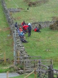
Eventually the path leads to the valley head, and switch-backs across a slippery concreted ford. In a clearing a large group of anorak-clad youngsters are gathered and eating early lunch with laden rucksacks scattered around. Older leaders shift cars around, either having just dropped them off, or simply met them midway to ensure none have been lost. I assume it is Duke of Edinburgh’s Award or something similar. I notice one group clustered, heads bent over an iPad.

2013-05-10 12.16.16young-walkers-2013-05-10 12.19.23-cropped2013-05-10 12.19.45

I recall starting DofE at my own high school, and finished everything except ‘hobby’. I was never a collector (didn’t have the attention span!), and couldn’t do after school activities as Mum was caretaker at the church and so every day after school I shifted chairs, washed dishes and brushed floors. My free time was spent walking through the bushes in the local park imagining myself in a distant jungle, other games of imagination (usually involving things going ‘bang’), and reading late into the night.

Thinking back, I could easily have had Scouting as hobby, but the only thing I thought of was reading, so was tasked with keeping a reading diary for my English teacher. The combination of my slow and unreadable handwriting and forgetfulness for anything regular meant it never happened. I would lie to say I have better self-discipline today, but…

2013-05-10 12.35.58I had confused World’s End with the spectacular Horseshoe Pass (I think where the opening scene of ‘Very Annie Mary‘ was filmed). In fact World’s End seems to refer more to the way the lush long valley gives way to Brontë-esque ‘blasted heath’, black bog covered in still-brown heather, with a pathway in places made by pairs of parallel eight-inch planks. As I get to the end of the bog towards the forest, mountain bikers pass peddling hard uphill. Richard had told me this was mountain bike territory and how he had once tried to ride across the boardways, at risk alternatively of getting stuck in the gap between boards, or cast off from the sloping boards into black oil-slicked bog to either side.

The way down to Llandegla was uneventful, a long descent through forest and woodland. Partway up I meet three women, in accidentally matching cerise/purple walking gear, who were wondering about the right path up until they saw me coming down.

2013-05-10 12.40.37 2013-05-10 12.54.04 2013-05-10 12.57.21

The Crown Inn in Llandegla says it is under new management and is open for food including “kick a***” all day breakfast, but the doors are locked and the lights off. Happily the Willows Café across the green is open and I eat a toasted sarnie, while using their free … and working … WiFi.

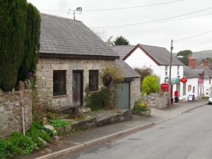
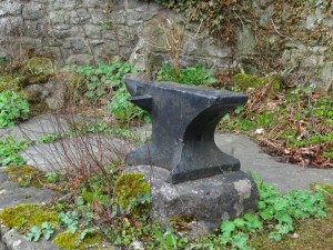
Llandegla is tiny but manages two old chapels and an Anglican church, reminder of the long rivalry between dissenters and established church that Borrow writes about repeatedly. The church says outside that it has refreshments, and the post office too has a small table for occasional teas, so a hamlet of culinary choice. Next door to the post office is an old cottage with a large black anvil outside. A man in his garden across the road shouts across to explain that this used to be the old forge and that the street name means ‘free street’ in Welsh, so it must have been a blacksmith going back many years.

2013-05-10 13.59.57 2013-05-10 14.52.00 2013-05-10 14.52.24

Leaving Llandegla, the path cuts across open farmland, towards the hill range that will form the next day and a half of travel. However, soon the signs become less and less legible, with the circle where they belong still incised in the fence post. This could simply be wear and tear; however, each round sign is held by three small steel or brass screws; the screw holes are clearly visible, but there are no rusty remains, each hole is clean and open, suggesting unscrewing. I know some landowners resent walkers crossing their fields, but if it is deliberate obstruction, it is short-sighted. All it means is walkers wandering over more of the their land trying to work out the way, rather than sticking to the footpaths.

After a short unscheduled detour due to the damaged signage, I re-find the path and start the slow ascent of the first foothills of the long ridge of the Clwydian Range. The path breaks clear of farmland and rises past a radio mast and signs to fishing and teas and cakes. Later I meet the owner of (one of) the fish lakes and discover that what I took to be signs for a single lake were in fact for two lakes. Originally the lakes served different markets, one was coarse fishing and the other trout, but then the other one changed from trout to be coarse fishing too, leading to just a little rivalry.

2013-05-10 16.07.51 2013-05-10 16.13.42 2013-05-10 16.22.59

I also learnt about the BROWN SIGN. Anyone who has driven in the UK will recognise the brown tourist signs pointing to historic sites, accommodation and tourist venues. I had thought that these were placed and chosen purely on amenity grounds, but I discover that individual venues have to apply, going through a long bureaucratic process, and then have to pay the county sign writers exorbitant fees to make the signs. Authorities differ in their rules, some allowing brown signs on main roads (where passing tourists will actually see them), whilst others do not want to clutter principal routes with excessive signage and restrict brown signs to minor roads. … and I just thought they were signs.

Earlier in the trip I had discovered that the whole northern section of the Offa’s Dyke Path is an invention, based not on the most likely route of the Dyke, but on the criteria for a ‘National Trail‘. Given there is therefore no need to actually ascend the Clwydian Hills at all, it seems strange that, at several points along the range, the path rises nearly to the top of several hills and then does not rise quite to the top, especially when the top is a hill fort. So, at several places including Moel Fenlli this day and Moel Arthur the next, I took short diversions from the formal route, which was skirting a contour line, to go over the top, and so see views across to Snowdonia in the west and, eventually, the sea in the north.

2013-05-10 16.39.07 2013-05-10 17.08.53 2013-05-10 17.18.58

At Clwyd Gate, the main pass over the Clwydian Hills into Ruthin, there is a substantial café/restaurant, which is currently closed and for sale. I later learn it has been on the market for 18 months, a sign of hard economic times.

Eventually, after another ascent and descent, I get to the Blwyd Penbarra car park where @talentog007 meets me to drive me down into Ruthin and to chat about the Moel Famau hut. Around 350,000 people stop at the Penbarra car park each year, and the idea is to place a kiosk there, in the style of an old shepherd’s hut. The idea is that it would be an amenity to tourists in the area and also act as employment for young people in an area that has few prospects after school. The project is still gathering funding, but Talentog used to work for the council, so knows her way round the funding systems. Look out for the hut late this summer.

2013-05-10 18.38.42 2013-05-10 18.48.05

Walk Q & A

As part of the publicity for the talk at Wrexham (see “day 22 – travel and talking“), Andrew Price at Glyndŵr University asked me to answer some questions.  These are my answers:

Where did the idea for your walk come from? What was the primary motivation?

I was on the mainland and ‘down south’ around March/April time last year and heard a radio report on the opening in May 2012 of the Wales Coast Path, it also mentioned that with Offa’s Dyke Path it formed a complete circuit round Wales.   When I heard it I just knew I had to do it.

At that point it was simply a compelling feeling, but as I thought more it became obvious that this project, in many ways, linked with areas of my research going back over at least 20 years as well as more recent community focused projects on Tiree (the little Scottish island where I live).

… and as a tiny child I used to look at the world and imagine walking round it … well, so not the world, but at least Wales, which is the bit that matters most 😉

Which towns have you visited so far? How has the journey been so far?

I started in Cardiff, and been through Newport (mainly the industrial/commercial area), Chepstow (with a 5-mile excursion back and forth over the (old) Severn Bridge, a wonderful walk), Llandogo, Monmouth, Pandy, Hay-on-Wye and Kington.

I was finding the pace quite heavy in terms of daily mileage (which seasoned ramblers said it was!), so am now sending bags on between B&Bs so I just have a day-pack … sooooo much better.  The odd ache and pain in legs and feet, but so far the worst problem has been getting too hot and catching sunburn on the top of my head (yep, sunburn in April).

I have already made so many new friends along the way, and seen the strangest things, from a tree-trunk doorway in Monmouth to a set of steps going down into the earth in the middle of a field. I am struggling to keep up with writing about it all!

What are the technological challenges that a walker faces (your thoughts on this before you set off…) and what would you say the technology challenges are for rural communities?

Because I am doing this with a research project I have a little more technology than the average walker (!). This means I end up carrying a lot of weight in terms of devices and power supplies, and also tend to take quite a bit of time each evening ‘tending’ my technology, transferring data, uploading stuff to the web, etc.

Because I have some quite critical apps running on my phones, I have become obsessed with battery life (some days the power has run out before the end of the day), and then paranoid about actually using them for anything, for fear of using up power!

One of the key issues is that even when in a fixed place, access to phone and internet is patchy: occasionally in unexpected places everything works wonderfully, but at other times you feel as if the internet, like the buildings, has reverted to the 16th century.

This is, of course, one of the problems for communities also, dealing with network connections vastly slower and less reliable than those in major cites … that is when there is any connection at all!  This then compounds existing problems of lack of resources in rural areas, not to mention often relatively low incomes, and higher proportions of older people, all leading to the danger of rural communities being marginalised in an increasing digital age.  This is exemplified particularly in the new Universal Credit which is predicated on easy access to the internet.

On a positive note, technology can be used to connect rural communities both internally within the community and externally with other communities with similar issues.  For example, I have been involved in a project on Tiree to help the youth worker connect with youngsters using a combination of web, social networking and SMS.

What technology equipment have you been armed with during your walk?

I have several mobile phones, mini-tablets and laptops of different kinds (happily not all being carried at the same time!). The phones run a variety of standard apps, including the navigation app, ViewRanger. The ViewRanger team kindly supported me by providing detailed digital maps. The phones also run some research apps, including one that allows family and other supporters to see my current heart rate and give me virtual ‘cheers’.

I also have some recording tools: a compact camera and voice recorder (so far I have been taking 100–200 photos a day plus around 30–40 audio ‘posts’ that I record while actually walking); a Garmin GPS reader and recorder (to create a full trace of where I have been, speed, altitude, etc.); and a ‘SPOT‘ device which uses GPS like the Garmin, but instead of recording it sends a ‘ping’ to a satellite every few minutes and has an ‘SOS’ button that can use the satellite link to call emergency services no matter where I am.

Finally I have a number of bio-seonsors: one hobbyist/sports heart rate monitor, a medical grade ECG monitor (the full blippty blip you see on Casualty!) and a wrist monitor for skin conductivity (like a i.e. detector!) and skin temperature.

How have you been going about exploring what the IT needs of walkers and rural communities are on a practical, day-to-day level?

For the walker first there is a very practical experience of using these things (or failing to!) on a day-to-day basis. And I even have apps that watch other apps to record what I am doing with some of the devices!

I am also observing the ways other walkers use or do not use technology.  For example, getting the SPOT device was prompted partly by the story of a young local man who had got lost with friends on a short walk in their own area and had to call out the emergency services by mobile phone, which thankfully had signal.

For the local communities I have some meetings pre-arranged (for example someone connected with the MonmouthpediA project that made Monmouth the ‘world’s first Wikipedia town’.  But also many chance meetings, such as one in Hay-on-Wye where I found that the man selling me batteries was the chair of a local organisation seeking to buy the fishing rights of the Wye near Hay for the community.

What do you hope to achieve from the journey?

Many things and nothing.

The many things … I have aims in terms of writing about locality and the thread of paths through them; making connections to enable practical things to help communities, understanding better issues of poor connectivity, creating data for academic colleagues to use in their own research.

… and nothing: the most exciting things are the things I cannot think of now, the things I learn from chance encounters on the the way, the unexpected and unplanned.

Why did you choose Wales – what is your personal connection to the area?

I was born and brought up in Cardiff and spent my first 18 years in the house where I was born.  However, I have not lived in Wales now for 35 years, so there is a big sense of re-connection with my roots.

Any other thoughts or interesting points about your trip to date

I am a person who is paranoid about being bored, having ‘nothing to do’, and yet in my walking so far, I have not been bored for a single moment.

It is really weird to change from being one of those people who looks on at other people who ‘do something’ unusual to find myself just one of those other people!

I could have done with a little more training :-/  Not walking for 35 years and then doing 1000 miles is maybe just a little crazy 🙂

day 22 – travel and talking

No walking today, just travel day back to Kington to pick up the van and then talk in the evening at Glyndwr University in Wrexham.

Awakening to the view of the Llangollen taxidermist, a relaxed morning writing in bed before breakfast, trying to capture the highs and lows of the day before (see “day 21 – Porth-y-Waen to Llangollen“).  Richard Picking picked me up at 10am and we meandered our way down the roads to Kington … and there is little alternative to meandering when going north–south along the Offa’s Dyke route. Just as the Dyke cuts across old drainage patterns, it still cuts across modern transport links. It is relatively easy to get to or from the Dyke, but so hard to move along it.

Lunch at the Oxford Arms, another one of the once 27 old inns in Kington, and then I picked up the camper van from Fleece Meadow Caravan Site (facilities basic but clean, very reasonable prices) and drove in convoy back to Wrexham.  It was odd driving so quickly past places that I had taken days to cover on foot.  Also often hard to make out the landscape, seeing hills from different angles from the road.

In the evening I gave a public lecture at Glyndŵr University. Amongst the audience was a lady, Cleopatra, who has two artificial knees and later this year is walking around the entire coast of the Isle of Man.  On seeing a photo of me standing by an Offa’s Dyke sign, Peter Excell was reminded that ‘BlueTooth‘, the wireless communication protocol, is named after a Norse king Harald ‘Bluetooth’ Gormsson … why he made the association??

I had thought of Glyndŵr as one of the ‘new universities’, but in fact Wrexham has a long university history.  A government report in the late 19th century suggested two Welsh universities should be founded.  However, when Wrexham (historically the largest town in Wales) was not chosen as one of the sites, the people of the town decided to set up their own by pubic subscription.  Without royal charter the Wrexham School of Science and Art could not award its own degrees, until over 120 years later, in 2008, it was eventually granted official university status.  … a real story of patience!

day 21 – Porth-y-Waen to Llangollen

A day of three castles, one that was not, one that was missed and one of a king who will come again. A day of lows, but ending on top of the world.

miles walked: 19.5
miles completed: 187
miles to go: 873.3

I knew it would be a tough day, sixteen and half miles from Porth-y-Waen to Trevor and then another four from there to Llangollen.  I’d decided that if I didn’t get to Trevor early enough I’d just take a taxi on to Llangollen, but really didn’t want to do that otherwise I would get more behind for next week.

The day started fairly leisurely, along lanes into Nant-mawr and up over the first hill of the day towards Trefonen.  The ascent passes through Jones’ Rough, old yew woodland, with a thick darkness below, and then into more ordinary woodland before breaking the treeline onto the top of Moelydd, just 285 metres (800 feet), but one of the highest points for many miles, with a panoramic view that takes in the Wrekin and Long Mynd on one side and on a clear day even Cader Idris and Snowdonia.  I forget sometimes just how narrow this part of Wales is. I am still standing in Shropshire, indeed far enough from the border that it does not appear on the Harvey strip map, but no more than 40 miles to the coast.  There is one of those round plaques showing the landscape silhouette and allowing me to identify the peaks I see.  Almost due north it says ‘Liverpool‘ – I wave to Esther and go on.

The hillside soil here is the colour of old red sandstone.  I’ve not noticed any outcrops, so assume it is more that the same processes that produced old red sandstone work here, probably simply iron salts.  The path across the last long field into Trefonen follows a wide shallow tree-dotted ditch, according to the map not part of Offa’s Dyke, but maybe simply just an old trackway out of the village.

I have a moment of confusion at the end of the field as I’d been walking the right hand side of the ditch and from there the stile ahead is hidden by hedgerow, but as I cross the ditch the way ahead is clear and I meet another walker, going in the same direction, but only as far as Chirk, where I am hoping for mid-afternoon tea at the castle café.  He is an experienced walker including many of the Scottish long-distance walks, and has a backpack, little larger than my day pack, but it’s his complete kit … I have much to learn.

At Trefonen I pop into the small post office to get provisions for the day and see signs for the walking festival that I’d been told about over breakfast. I was also told something in the Forden pub about a brewery here, and maybe later in the day would have sought out a quick afternoon half-pint of their brew, but as it was the closest I get is walking down a road called ‘Malthouse Lane‘.

The path then cuts across farmland through the tiny hamlet of Tyn-y-Coed, where the windowsills of a shed are decorated with ceramic heads, the result of a school project some years earlier.  The dyke rises steeply through woods, before levelling, tracking the ridge line for a mile or two.  When the path next breaks out of the trees it is into a large grassy clearing with stone work 100 yards or so ahead; the ruins, I assume of yet another Marches castle.

Before the ruins lies a sculpture, two horses’ heads with a saddle between where their necks should have been, a sort of extreme equine push-me-pull-you.  There is no plaque of explanation.  However, making my way across the grass, I find the castle-like ruins are in fact the remains of the grandstand for the old Oswestry racecourse which encircled the hilltop.  I don’t know the age of this, but I imagine Jane Austen-like characters, coming up the steep road from Oswestry in their carriages, to watch top-hatted riders gallop high above the surrounding land, as if they were racing round the very horizon itself.  Nowadays the hilltop is almost entirely surrounded by trees with scrub-trees on the racecourse common, so only another panorama plaque gives a hint as to the Regency and Victorian vistas.

Following the line of the racecourse, I took care, as I’d been warned, not to follow the footpath sign that turns right and the road, which would ultimately lead back to the grandstand, but straight on, past the second part of the racecourse, which has an almost figure of eight plan narrowing in the middle, to follow the lines of a slight double hilltop.

The route cuts down the hill and then follows the Dyke straight to Craignant, but before doing so rises up once more over what I only notice later is a much higher hill, Selattyn Hill, at 375 metres (a mountain in old money).

By this stage I am tired, following the top of Offa’s Dyke gives a great sense of connection to the past, but, like the woodland paths, the tree roots and stones make it hard going, your feet twisting at each step, my little toes that constantly have small blisters, suffer each time my foot catches on a root or rock and somewhere along the way a small stone is under the ball of my foot that for some reason I didn’t manage to shift when I shook my boots out at the grandstand.

I promise myself I will shake out my boots at Chirk, just the other side of Craignant, get tea, food, so just have to keep on going one steep drop into Craignant and the climb beyond.

Then I fell.

Nothing spectacular, just caught my right foot on a protruding rock and tipped head over heels along the dyke top.  Dusting myself off and happily with no harm to show except a few grazes and a bruised pride, I sit myself down and realise my clumsiness and fatigue are partly due to dropping blood sugar and, as important, not drinking enough.  I never notice myself getting hungry, but need to look out for that slight clumsiness that means I should eat and drink.

I empty my boots again and discover the small stone in my boot is no stone, but my foot, a small hard swollen blister.  I also refold the map, a symbolic moment, as this is now on the last quarter of the Harvey map for Offa’s Dyke.  However, I also realise that I’d lost track of which village is which, that Chirk Castle is not immediately beyond Craignant, but a whole hillside and valley beyond.  A Marathon bar and drink of water help, but suddenly the day seems longer.

I skip the opportunity to take a diversion to see a small hillfort and tower, pressing on as time is short and I have many miles to go, down past Craignant and steeply up, up the hillside beyond, at that point where I think it would be good, like the gentleman I passed earlier, to be ending my day at Chirk, and start to re-plan assuming I will get no further than Trevor.  The day becomes one of survival, even getting that far.

Over the rise of the 361-metre hill beyond Craignant I catch my first glimpse of Chirk Castle.  I had imagined seeing a few tattered battlements, but it looks large and imposing still, guarding over the Ceiriog valley, the rich farmland beyond and the route north–south.  Today the floodplain of the Ceiriog is home to a large works belching out white smoke, but, more picturesque, a canal aqueduct and train viaduct cut across the valley in the distance, and beyond them the bridge of the modern road, three generations of transport.

Dropping down and across the River Ceiriog I follow the Offa’s Dyke footpath signs back up a steep road past forest to the right, and only too late realise I am following the year-long path, but it is the summer-only route that I meant to follow, up through the parklands to Chirk Castle, so no tea and cake below the battlements for me.  At the top I instead take my second Marathon bar, another sip of water and start to plod painfully down towards the built up areas of Froncysyllte and Trevor below, with the estates of Cefn Mawr most apparent sprawling across the hillside opposite.

It feels late already, the day had been cloud covered for many hours, and darkening as the clouds thickened, the occasional stray droplet of rain and dark edges suggesting that tomorrow’s gales and rain may start tonight.  I pass a pair of walkers putting waterproof covers over their rucksacks.

At the base of the hill the path crosses the main road and then over a small canal bridge to join the canal towpath for the rest of the way past Froncysyllte into Trevor … but, on the map, I can see an ominous steep descent to the valley base and rise between the two.  The towpath is metalled and level, and I find that, sore feet not withstanding, I still walk far faster than a canal boat.  After a mile or so there are two Offa’s Dyke arrows.  One points across the canal to the left, but the other continues along it and says ‘Pontcysyllte Aqueduct‘.  On the map I couldn’t see the path crossing the aqueduct, but assumed there must be a way ahead, maybe dropping down just before it to rejoin the other path.  However, joy of joys, when I got to the aqueduct, indeed one can walk across … on the level … all the way to Trevor.

This is probably not a route for the nervous.  The footpath side of the aqueduct has a balustrade, but is narrow, with the canal beside you, yet not so narrow that some cyclists ride across, only dismounting at the last moment before they pass you.  I find that even when I stop to take a photograph and turn, I have a moment when my eyes and feet try to make sense of the lack of ground-line.

However, it is to the canal side it is most dramatic.  The other side of the six feet of water is a small, galvanised lip, maybe a foot above the water level, and then, nothing.  The narrow-boat sides will be way higher than this, so to go across by canal and look upstream it will be as if the canal is floating above the valley floor.  But the thought of crossing on a boat with a child or dog on board, I think I would lock them securely inside.

On the far side is a basin with tea shops and pub.  A lovely place to spend an hour relaxing, but I feel it must already be well on its way to seven o’clock and I need to get to the far side of Trevor where the path sets off along the hillside, find the pub there, order a half and a taxi (in order) to get to Llangollen and eat.  So I follow the pathway under the canal (a different view of the aqueduct), and along the Llangollen branch of the canal for a short bit further before crossing a lovely worn stone canal bridge and past some friendly horses and the road leading out of Trevor.

For the first time this day I dare to look at the time on my phone in the rucksack (I am so paranoid about battery use, I still just keep them there and do not touch them unless I have to).  With trepidation I press the button to wake up the phone, my time estimation is always optimistic, I am always saying (Fiona will attest), "it can’t be that time already".  But, when I look, oh joy of joy again, the time is quarter to five.

I had set 5pm at Trevor as the deadline when I would opt for a taxi from there to Llangollen, but my slow progress over the broken pathways meant I had long given up that thought.  I was a full two hours earlier than I had imagined.  I think a combination of my own fatigue and the cloud coldened sky had fooled my normal temporal optimism.

Elation at discovering the true time and a bite of Wispa bar, and my fatigue fell off me, even the pain in my feet felt less bad as I set off up the hill out of Trevor.  On the whole the path makes a gradual ascent diagonally uphill along the valley side, but I missed one sign and followed the road almost straight up the hillside for a short while before realising my mistake and backtracking.  I notice that many of the path signs are missing, the posts are there, but empty circular depressions where the signs should be.  This could just be age, but I wonder whether a local landowner has deliberately removed signs to discourage walkers.  However, I had no such excuse, the turn-off was well marked, just down a private road, so I probably just passed that by without looking.  Even an unnecessary climb did not quell my sprits, and they lifted yet further as I first glimpsed Dinas Bran ahead.

Bran is a semi-mythical figure, demi-god, king of Wales who defeated the Irish over the honour of his sister, Bronwen, perished in the attempt, but whose head spent a pleasant year still conversing with his retainers, before it was buried at Tower Hill in London.  It is said that while Bran‘s head was there Britain would never be invaded, but that Arthur dug it up as he thought the brave men of Britain could defend themselves without the aid of legends.  Maybe he would have been better to have left it in place.

The hill in which it is placed rises sheer above the valley, a cone topped with the rings of an Iron Age hillfort and the broken remains of a Norman castle.  An unparalleled command of the valley below and one of the major routes to West Wales.

The forest and then hillside path eventually joins a small mountain road cutting below the limestone escarpment, and the evening sky clears into occasional sheep-wool clouds and glorious low sunshine, now clear, now broken, that slices the valley with alternate gold-glow grass and sharp cut shadows.

And I decide.

I decide that I cannot pass the foot of Dinas Bran.

So, where a small lane drops its way towards Llangollen off the contour-hugging mountain road, I follow it for just a hundred yards before turning towards Dinas Bran.  The climb is steep and sharp, but well managed, snaking back and forth up the hillside, a pleasant and exhilarating evening walk if you are staying in the town.  But at the top, it is hard to find words, especially if you are out of breath.

And it is breathtaking, even when you have recovered your breath.  The Iron Age ramparts cut through solid rock and the tattered Norman remains frame the distant valley and mountain views to all sides.  It would be stunning at any time, but the combination of the light on the hillsides, sense of achievement at the day’s travel, and fact that in every direction I looked out and down meant I literally felt on top of the world … and there was even mobile phone signal to ring home at last.

As I’d climbed I’d noticed strips of plastic ribbon between posts that I’d thought were to encourage walkers to use the made-up paths rather than erode the grassy slopes.  However, coming down I began to meet marshals for the annual fell race that takes the runners up Dinas Bran, not once but twice, before descending again to Llangollen.  I met three, one after another, and each, from the oldest to the youngest, a teacher in the school, said that when they had been walking up the hill earlier in the day to lay out the route, walking itself had been exhausting enough let alone running.  I told one about Arry and her multi-marathon run, and he gave me what change he had in his pockets for the charities I’m collecting for.

And then finally into Llangollen, the road down coming into the town round the back of the Bridge End Hotel where I am staying for the night, where I am shown to my room that overlooks both the river bridge to one side and the mini-steeples of the taxidermist next door on the other.  I have visions of inebriated drinkers from the Bridge End, accidentally taking the wrong door and ending up, their skins already half tanned with alcohol, stuffed heads in the taxidermist window.

The Bridge End kitchen is closed on Wednesdays, so the day ends with the image of a tattered traveller, like a Chaucerian pilgrim, his worn boots swapped for sandals, straggling hair falling from his shoulders, making his way slowly and hesitantly from foot to foot, across the bridge in search of long-awaited food.

Day 20 – Forden to Porth-y-Waen

A longish, but easy day cutting across the flood plains of the Severn. Passing the birthplace of the now ubiquitous Leylandii, a dry dam and a possible nuclear bunker.

miles walked: 20.1
miles completed: 167.5
miles to go: 892.8

The day started slowly, I woke at 5:20 to the sound of a cockerel, and spent several hours writing before going down for breakfast. During a very leisurely breakfast I chatted for over two hours to John and Mary.

2013-05-07 11.00.02Both had been to ‘dame schools’, which I associate more with the time of Jane Austen, but in this area were small private schools, run principally by the wives of schoolteachers, catering, it appears, for those seeking a slightly better education than the state primary schools, the children of doctors, prosperous farmers, etc. The covered topics seemed to vary with the interests of the proprietor. John‘s first school focused strongly on arithmetic, ignoring writing and spelling, but this then utterly reversed when he later joined the same school as Mary, where language and drama were the heart of the curriculum, with amateur dramatics a high point of the year.

As we talked I recalled the book: ‘School without Tears‘ by Mollie Jenkins, the wife of David Jenkins the (in)famous ‘Bishop of Durham‘ of the early 1980s, for whose ‘blasphemy’ (doubting the virgin birth) some blamed the lightning strike on York Minster, which destroyed the Rose Window.  In 1984Mollie Jenkins ran a small private school in Durham where her philosophy was very much about letting children grow as children.

The most fascinating point in the morning was when John brought out an old book1:

From John O’Groats to Lands End
Or 1372 Miles on Foot

A Book of Days and Chronicle of Adventures BY Two Pedestrians on Foot

The local landowner in the late Victorian era, John Naylor, instituted many modernisations on the estate, including a gas works and a failed dam, which I would see later in the day. Not content with this, John and his brother Robert took what must have been one of the earliest north–south walks. The book, a limited edition with just one thousand copies printed by the Caxton Press in 1916, tells how, in 1871, they walked from John O’Groats to Land’s End, criss-crossing the country from east to west as they visited interesting places, and without any maps, which were too heavy at the time, instead relying on their general knowledge and people they asked on the way.

They travelled light, having fresh clothing sent on from the estate to local rail stations along the way and sending dirty washing back the same way, and followed a set of rules: no wheeled transport, no animal transport, no water transport, and no alcohol. So far I have managed three of those.

2013-05-07 11.16.27  2013-05-07 11.16.36  2013-05-07 11.16.51

The Offa’s Dyke Path passes the back of Heath Cottage and I pick it up as it passes behind gardens on its way from the village. For a while it follows the lane up the hill that lies between Forden and Buttington. I pass one tree that at first looks as if a small wall has been built among its roots, until I realise it is the naturally fissured rock; and then further on real signs of construction, where a small tree that bends naturally over in a depression in the bank of the lane-side has been filled in with a basket-like weave of smaller and larger sticks, making a bivouac shelter. Maybe it is a traveller like Jacob from the previous day who did not find a place to sleep, so made one here on the roadside.

2013-05-07 11.29.11 2013-05-07 11.31.29 2013-05-07 11.40.17

Later the path cuts through forestry tracks and I almost miss that above my head is another monkey puzzle tree, indeed a whole line of them follow along the track side. John had told me that there were specimen trees in the wood, but I had forgotten. More signs of Naylor‘s modernisations. Later I pass the site of the dry dam, impressive if ineffectual, and then further on again, one of those small QR coded plaques announcing that this was the ‘Birthplace of Leylandii‘. These fast-growing ‘hedging’ trees were beloved plants in the late seventies, growing several feet a year, wonderful to make a quick screen between neighbours, but before long turning your garden into a forest clearing.

2013-05-07 11.55.40 2013-05-07 12.04.34 2013-05-07 12.15.39

I recall in our house in Tang Hall in York, a narrow 100-foot garden with Leylandii all round, the annual job of lopping them off with a bush saw perched perilously on a ladder leaning on their swaying trunks; piles upon piles of six foot tree tops. One year we could not afford a Christmas tree, so a Leylandii top sat in the corner of our living room with its late 1970s stone fire surround and polyurethane mahogany varnished plywood television nook in the alcove. We had no television, but the Leylandii seemed a fitting replacement.

[this section written April 2014]

The path crosses a small road that leads down to Welshpool, stretched below, but the path onwards leads once more along forest tracks until it mounts the ridge towards the top of the hill, Beacon Ring.  The ‘Ring’ is because the hill is topped with an Iron Age fort, although the first sight is a large mobile phone mast, I guess the modern equivalent of the beacon.  However, I note that my photo of it was carefully posed so that a tree masks the mast.

2013-05-07 12.29.26 2013-05-07 12.46.54 2013-05-07 12.51.15

The ring is filled with a small wood, which is evidently causing some controversy.  It was planted in 1953 for the Queen’s Coronation, and the combination of pine and beech spell out ‘E II R‘ from the air.  In 2008 the Clwyd-Powys Archaeological Trust acquired it and are planning to improve the site, including removing the trees, which both hide the shape of the site and also, I assume, cause potential archaeological damage with their roots.  However, not everyone is in favour!

The wood within is quite a magical place, with wild flowers and a welcome shade from the hot sun.  Someone has left a contraption of bright orange twine and pieces of wood that seems somewhere between man-trap and monkey swing and a small stone, like a gravestone, commemorates the planting.  Both ancient fortifications and copses are often seen as the haunt of fairies, and maybe because of this I find myself losing sense of direction, with the trees and bank ring apparently uniform in all directions.  I half feel that, like Oisín or Rip van Winkle, I may get lost in time and emerge years later to a world… well who knows… I take the shortest route out.

2013-05-07 12.52.30 2013-05-07 12.56.07 2013-05-07 13.00.03

Certainly the Iron Age awakener would have been bemused to look up at the mobile phone mast, but I was equally bemused as I skirted the rest of the ring fort from the outside and came to a separate, smaller signal tower but with a low concrete dome beside.  The shape of the roof looked as though it was larger below ground than above. The fairy folk often inhabit hollow hills, but my guess is this was for no fairy folk, but instead a cold war bunker and signal station, the same site built for fortification 2500 years before with similar purpose today.  Maybe our Rip van Winkle would find less changed in human nature than in human construction.

2013-05-07 13.02.54 2013-05-07 13.03.37 2013-05-07 13.10.02

The path leads down a grassy hill, Welshpool and the Severn plain opening ahead. A small stile-shaped seat has the words:

There was a crooked man
who walked a crooked mile
he found a crooked sixpence
upon a crooked stile.

And a notice on it with a photograph of a collie dog:

If you see this dog on the path please be very firm and tell her to "Get Off Home". She is very friendly and if allowed will follow you all the way to Forden or Buttington. Thank You.

I never saw the collie, so could never test how sternly I could say "Get Off Home", but at a small farm a different dog, I think a Newfoundland, sits in the shade of a car, its thick fur not well suited for the intense heat of the day.  Beyond that onto small lanes and the road into Buttington to get a very welcome sandwich and beer at the Green Dragon.

2013-05-07 13.36.07 2013-05-07 13.42.55 2013-05-07 13.44.22

At one point I had thought of staying the night at Buttington as it seemed ‘not far’, but, although it is only four miles straight down the B-road, the route over the hill is six curly miles and about an 800 foot climb – it would have been a very late night.  However, today, not starting until half past eleven, I had 14 miles still ahead of me and it was already after 2pm.  I had a relaxing, but quick lunch and set off again.

At the end of the 10th century, the Anglo-Saxons and Welsh were on the same side, fighting the Vikings.   The Battle of Buttington in 893 AD temporarily halted the Vikings, but only for them to return in later years in greater numbers.

2013-05-07 14.06.58 2013-05-07 14.52.41 2013-05-07 14.58.28

Today the only battle at Buttington is to cross the bridge over the Severn, which has no footpath, but carries the busy A458 as well as the Offa’s Dyke Path.  The crossing merits a rare warning symbol on the map. The bridge is short and I can see some way in each direction, so I try to time my crossing to minimise traffic, but still one is squashed to the side as large trucks pass.  The worst are caravans, the owners give you a reasonable berth with their cars, but fail to account for the fact that the caravan sticks out several more inches behind.

2013-05-07 15.09.47

There follows a mile across riverside fields and then a very pleasant mile along the tow path of the Shropshire Union Canal.  I am a little worried whether it will be obvious where to rejoin and cross the road, but Pool Quay is very clear on the ground as well as on the map, so I leave the ducks, locks, wildflowers and shade (the latter sadly missed) and cross the A483 to follow the side of the Severn for the next three or four miles.

2013-05-07 15.21.35 2013-05-07 15.24.52 2013-05-07 15.36.58

After having spoken to the chair of the committee looking at community buy out fishing rights at Hay-on-Wye, I have been more aware of signs about fishing.   net that a stretch of the canal had a sign saying it is for Montgomery Fishing Club, which is close at hand, but I was a little more surprised to see a sign on the Severn saying:

Birmingham Anglers Association
Members Only – Private Fishing

For some of the way the path hugs the river bank closely, but sometimes cuts off the bends following along a bank, not Offa’s Dyke, but flood banks.  I assume there will have been no need for the Dyke along the section as the river forms the natural boundary.

2013-05-07 15.45.06 2013-05-07 15.47.04 2013-05-07 15.54.27

The section was flat and I walked it quite quickly, only about an hour and ten minutes in total, but it did feel rather interminable as I was aware that I was running very late again.  To  the east, quarries cut into the flank of the ‘Long Mountain‘ (not to be confused with Long Mynd further east), and at one point I thought I was nearly at the end as there was a large house coming up on the opposite side of the river, which I knew would be at the next turning point, but in fact it was another house only half-way along.

2013-05-07 16.03.50 2013-05-07 16.30.26 2013-05-07 16.35.08

However, eventually I came to the point where the ‘New Cut‘, a large drainage channel, meets the Severn near a giant sluice gate. The gate stands dry, well away from the river, but I assume is there to open should the Severn be high and it is decided to flood the farmland to save towns downstream.

2013-05-07 16.46.49 2013-05-07 16.57.43 2013-05-07 17.02.02

From here it is just another couple of miles into Four Crosses.  Four major roads and several minor roads converge here, the large roads crossing each other like hands crossing to make a fireman’s chair, creating a triangle of roads around the village centre.  This picture is made more complex now as a by-pass has been built to the west of the village taking the heavy A483 trunk road.  Unfortunately this was not marked on my map. The path on the map followed the A483 for a short time before turning down a lane westwards towards the Montgomery Canal.  What was unclear on the ground was whether this turning was before or after the bypass rejoined the old road.

There was a small pedestrian underpass just before the joining point and I wondered if that might be the way, but there was no signage, and in general Offa’s Dyke Path is very well signed, so I decided it must be further on.  There was a group of houses and a church just across the road, so I braved the traffic, and looked to see if the path left there, but nothing.  I tried to get any of my electronic gear to tell me exactly where I was, but to no avail as nothing could find sufficient signal – so much for technology!

In the end I went on along the road hoping to find the turn-off, but eventually realised it must have been through the underpass, the road construction was just too recent and the way had not been re-marked.  By this time I was a fair way down the A483 towards Llanymynech, so decided to press on and miss the loop along the canalside, which would have been a far more pleasant way, but would have involved a significant backtrack.

The road has a wide grass verge, but the grass was quite long, so I would walk on the road itself, and then jump up onto the verge when cars or lorries came.  It was fast, which was valuable given how late it was, but not at all the most pleasant walk.

[back to 2013 writing]

Coming into Llanymynech along the main road you find an old and lovely bridge across the River Vyrnwy. However, appreciation of its beauty and the peaceful flow of the river is somewhat marred by the imminent danger to life and limb as, like the earlier bridge over the Severn at Buttington, one crosses its short length clinging closely to the stone balustrade while an endless stream of lorries skim inches away. The bridge is narrow, so there is not only no room for a walkway, but the cars have little leeway to give you berth.

2013-05-07 17.56.53 2013-05-07 17.57.19 2013-05-07 17.57.40

As I get across I see a large banner:

15,000 Vehicles Daily
WE NEED A BYPASS

The house owner and his daughter were just coming out and watching tentatively up and down the road ready to cross, and when I said I’d just photographed the sign he and his daughter, who had already successfully managed the traverse and so had to make their way back across, told me the whole story.

Some years ago the road has been re-designated as a trunk road. Ever since various locals have been trying to get the council, not only to build a bypass, like that of the neighbouring Four Crosses, but at least to provide a footpath. Given the costs of road construction, it seemed such a slight extra, and at one stage a neighbour, the far side of the river, appeared to have almost won the argument with the planning official … at which point the official was moved to a post elsewhere, and so the discussion started all over again with a new official. The current footpath ends about thirty yards away from the bridge, so the man and the daughter described, with feeling, how getting to school each day required walking that thirty yards squashed into the scrubby hedgerow, on a blind corner.

Compared to the cost of the road, a footpath seems minor, but I guess if the council built a footpath, they might then have little alternative but to also build a footbridge, which I can see would be more expensive, though surely not prohibitive.

The house is itself set on marginal ground, what was once a small island, the current river course forming one side, and a now dry channel the other. The river formed the main boundary between Wales and England, and the man pointed out a line of fence posts set in the old channel, which had marked the separation. The boundary then roughly follows the existing roadline, but zig-zagging across to take in a holy well. This house was in Wales, but the neighbours either side in England. In addition the postal address for the house has no street name, as the street from the south finished at the current bridge, the street out of Llanymynech ended at the north side of the old channel, and the road across the island had no street name, an in-between place, a place where, maybe, all rules end … and certainly where the footpath ends.

As we make our way back across the road, so that they can continue their way to visit the next door neighbour (now there’s neighbourliness, a life-risking 40-yard journey), they tell me about a festival of music and storytelling in August. In particular how this will celebrate the mixed-up interchanges of a village caught between countries and counties, where the border, zipper-like, sees next-door properties fall one side or another. A place where, I later learn, the Welsh vet, whose surgery was strictly in Shropshire, still insisted on all correspondence being addressed to ‘Llanymynech, WALES‘, even though post then took a day longer.

2013-05-07 18.08.08 2013-05-07 18.19.19 2013-05-24 14.02.35

Saying my goodbyes, I pass up the road past the now closed hotel, where the border actually passes through the middle of the premises leaving one bar in Wales and one in England. In the days when there were different licensing laws in England and Wales, customers would periodically swap bars, all squashing into a single room when it got to closing time one side of the border, or on Sundays, when only one bar was open. I wonder whether there were any houses with a double bed, one side in England, one in Wales, where if you rolled over in the night you might find yourself waking in a different country from where you fell asleep the night before.

Llanymynech is the take-away Mecca of the area, two Indians, a Chinese, a lunchtime sandwich and teashop, and, literally opened in the last few weeks, a general kebab/burger/pizza takeaway. Knowing I will be late to eat when I get to Porth-y-Waen, I grab a kebab to eat on my last few miles across the quarry-torn hillside to the north.

2013-05-07 18.24.43 2013-05-07 18.25.26 2013-05-07 18.36.24

The ascent begins on roadway that passes houses perched above the village, and eventually turns into woodland and cuts directly up the hillside following the path of the old gravity funicular. Now it is largely just earth and rough broken stone, but occasionally you see a larger age-smoothed rock, with the marks where old rails ran the height of the hill, laden trucks rolling down tugging their empty cousins back up to be filled in turn.

Breaking the brow of the hill it is as if a medieval castle guards the hilltop, two stone watchtowers rise, a narrow gateway between, and beyond them, a natural keep of blasted rock, its shattered top like battlements. In fact the stone watchtowers are the brake-house, where the cable held back the rock-filled trucks from careering, precipitously and briefly, onto the waiting workers below. Often a small boy would be responsible for pulling on the lever that regulated the downward speed. There must have been many such funiculars and I’m sure not an infrequent accident.

2013-05-07 18.49.24 2013-05-07 18.51.14 2013-05-07 18.51.28

Now the crack of explosive, the grunts of workmen and the rumble of the descending trucks is replaced with the gentle rustle of wind-moved trees and occasional bird cries. The scene of Blake-esque industry, the lime-kiln chimneys, belching choking smoke below, is now a peaceful wooded heritage park, and the quarry itself a nature preservation site.

The final stages of the route to Porth-y-Waen pass yet another golf club (I am sure I will lose count of these once I hit the coast), and as I start my descent I meet members of the Border Outdoor Dabblers (BODs), who are out for an evening ramble.

2013-05-07 19.02.15 2013-05-07 19.58.28 2013-05-07 20.14.08

This part of Porth-y-Waen is almost all new build, the old village with church and pub about a mile further down the valley, and I have a moment’s doubt as to which road to take in the village, but then see Sue, my hostess for the night, beckoning as she and Andrew had seen me descending the ploughed field on the hillside opposite and were out to bring me in.

So, over a cup of tea in their conservatory overlooking the valley, we chat about Birmingham connections, how Andrew studied partly at the University and Sue‘s grandfather was an economics professor there, and how, further back, her family, the Martineaus, were cutlers and mayors of the city.

2013-05-07 20.03.05

  1. See full transcript on Project Gutenberg.[back]