Day 87 – Hillend to Port Eynon

encounters with a snake and a horsefly, an unexpected fellow traveller, eastern and western meditations, and two acts of kindness

13th July 2013

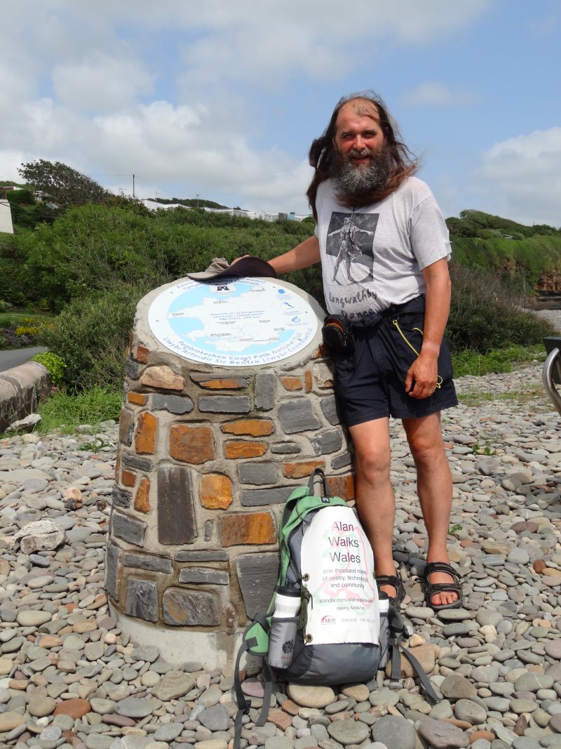
miles completed: 966
miles to go:  92

The original plan for today had been for me to meet Parisa and anyone else from Swansea at Rhossili at 9:30 in time for breakfast at the café there that starts serving breakfast at 9:45 (I had scouted out the day before). However, Parisa had texted the night before to say that her washing machine had died and the new one was being delivered, so she couldn’t make it. So I was assuming I’d be on my own and spent several hours writing after I woke, not washing until after nine.

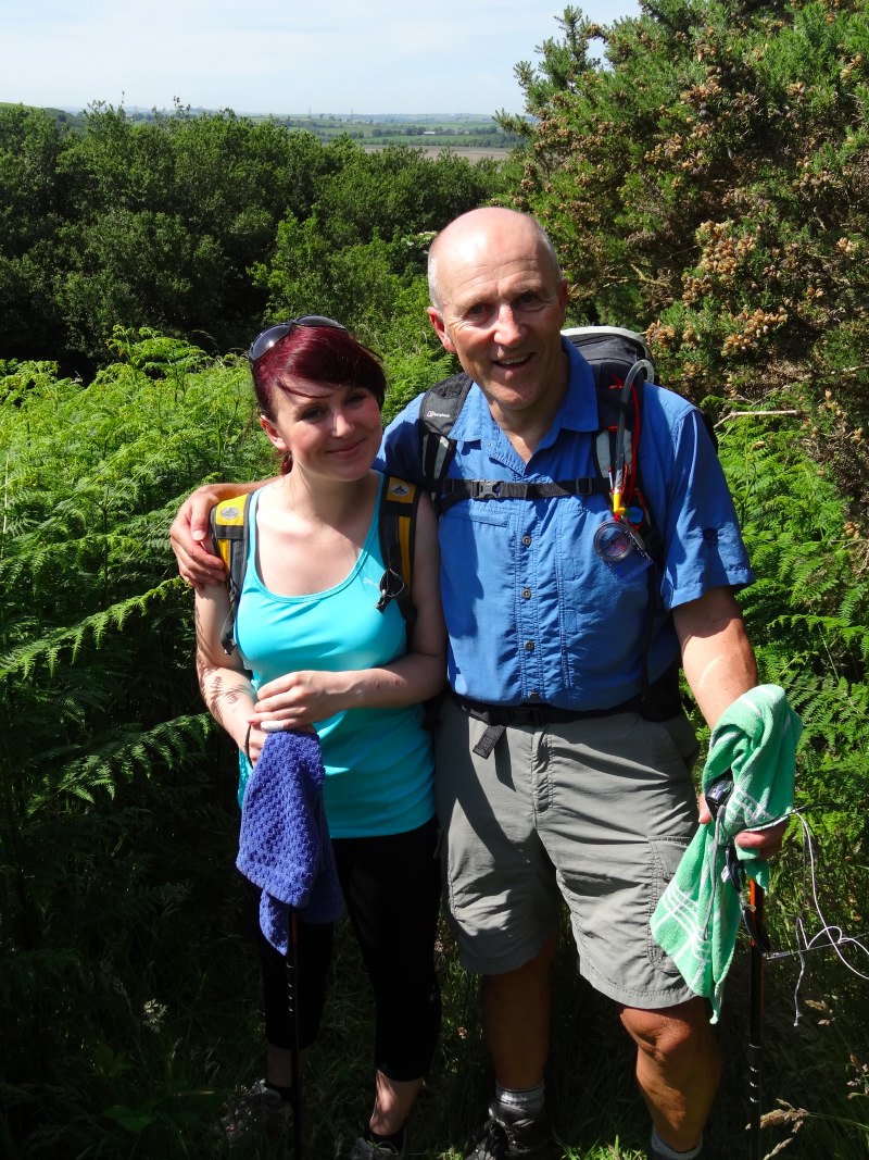
Phone reception down here is, well, let’s say ‘patchy’, but as I started to pack for the day and programme up the ActiWave ECG device, I noticed there was a missed call on the phone from when I was in the shower and there was even sufficient signal to ring back. It was Andy Gimblett from Swansea and he was going to join me at Rhossili.

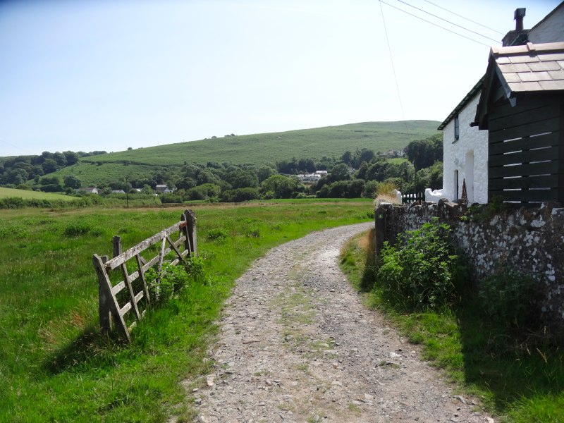
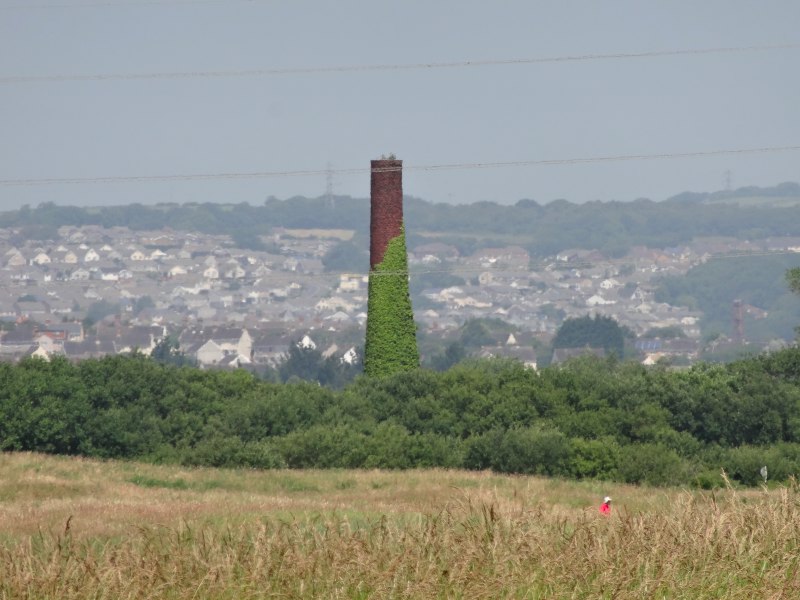
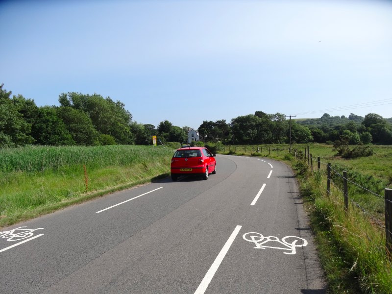
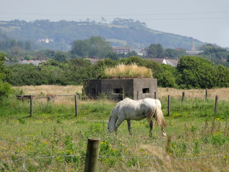
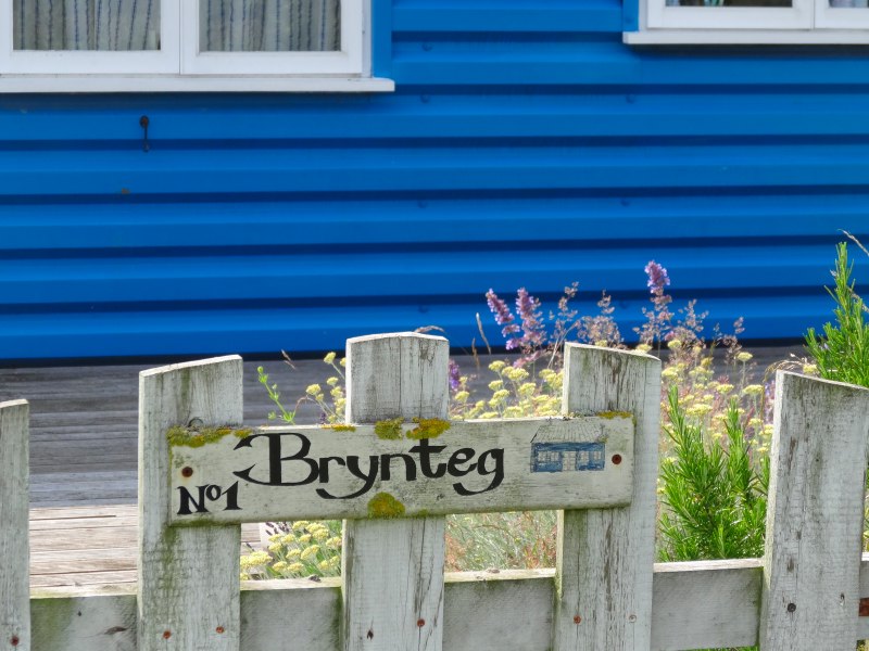
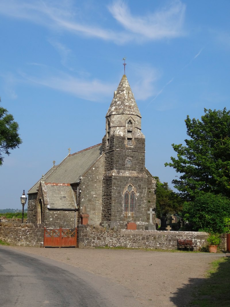
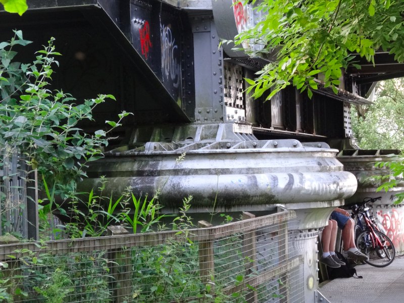
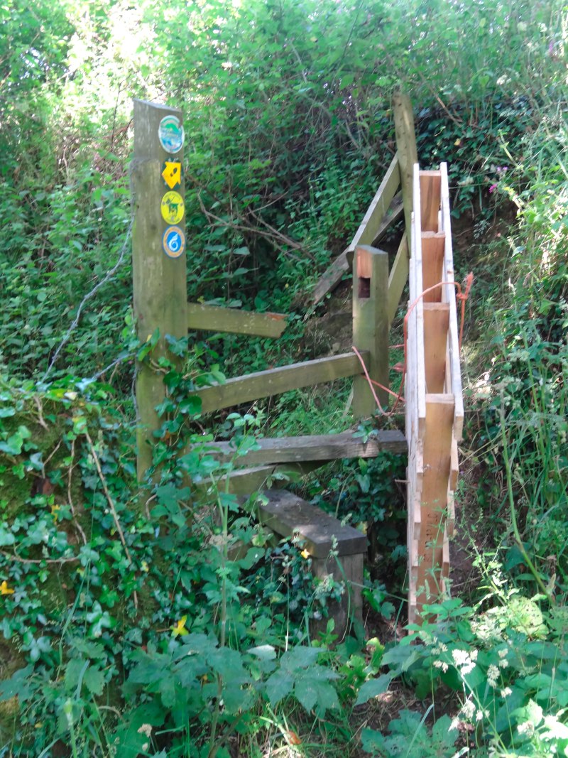
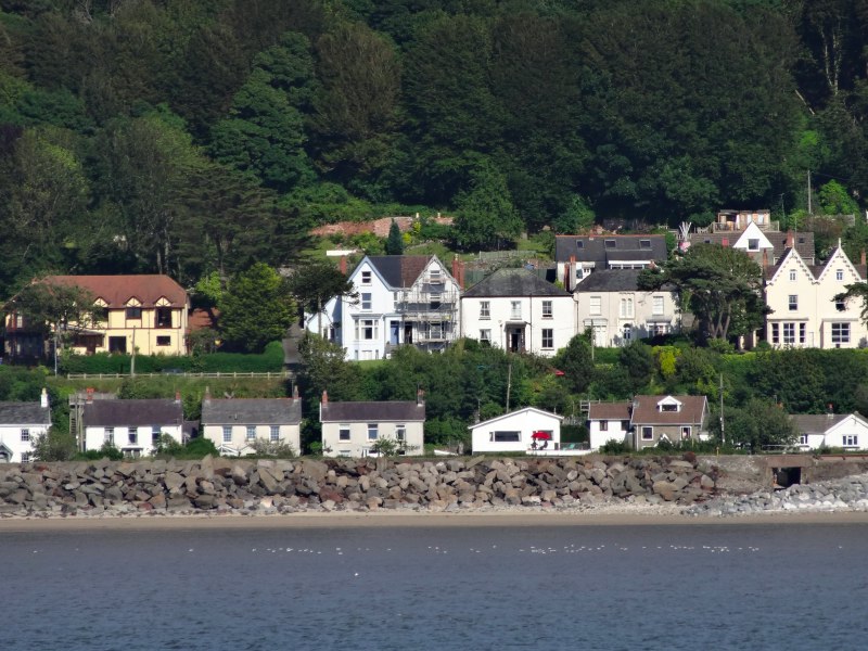
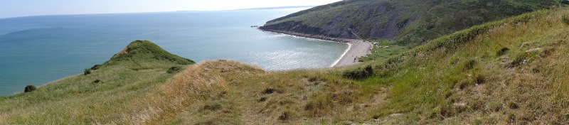
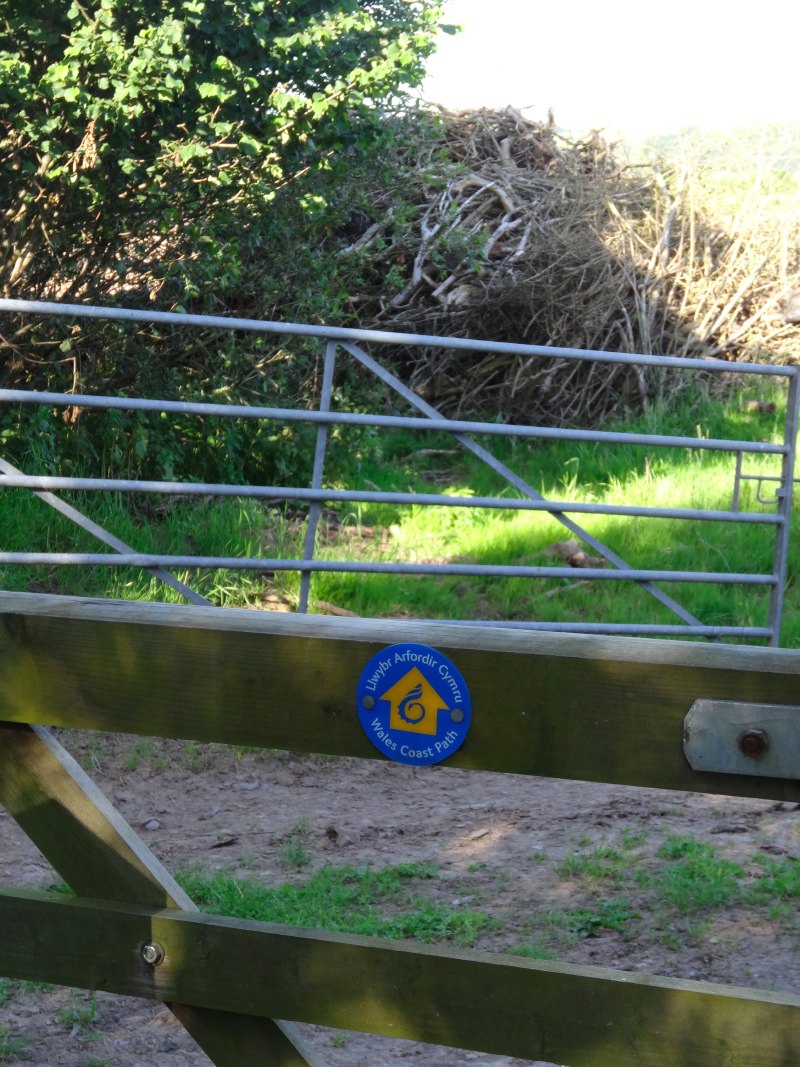
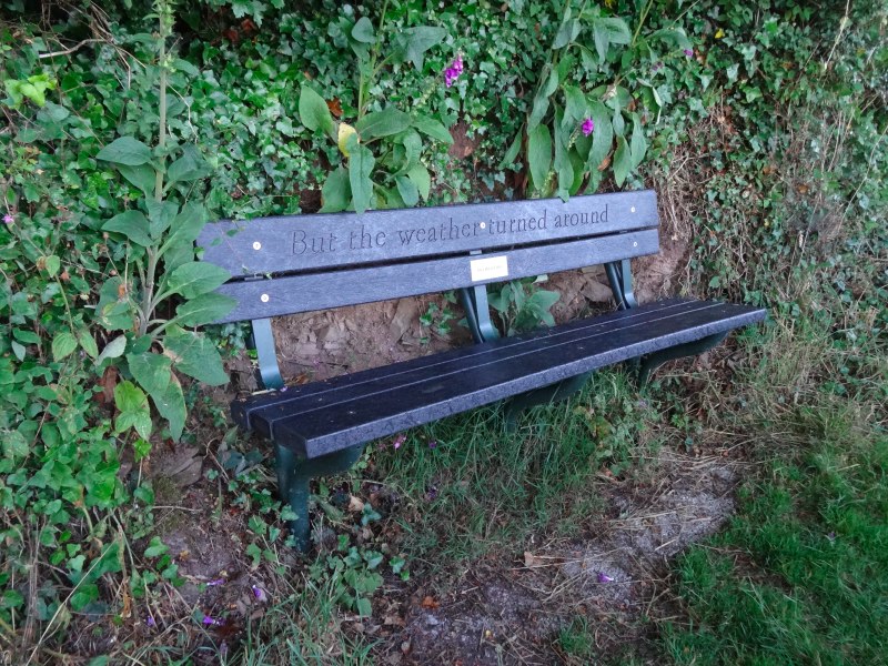
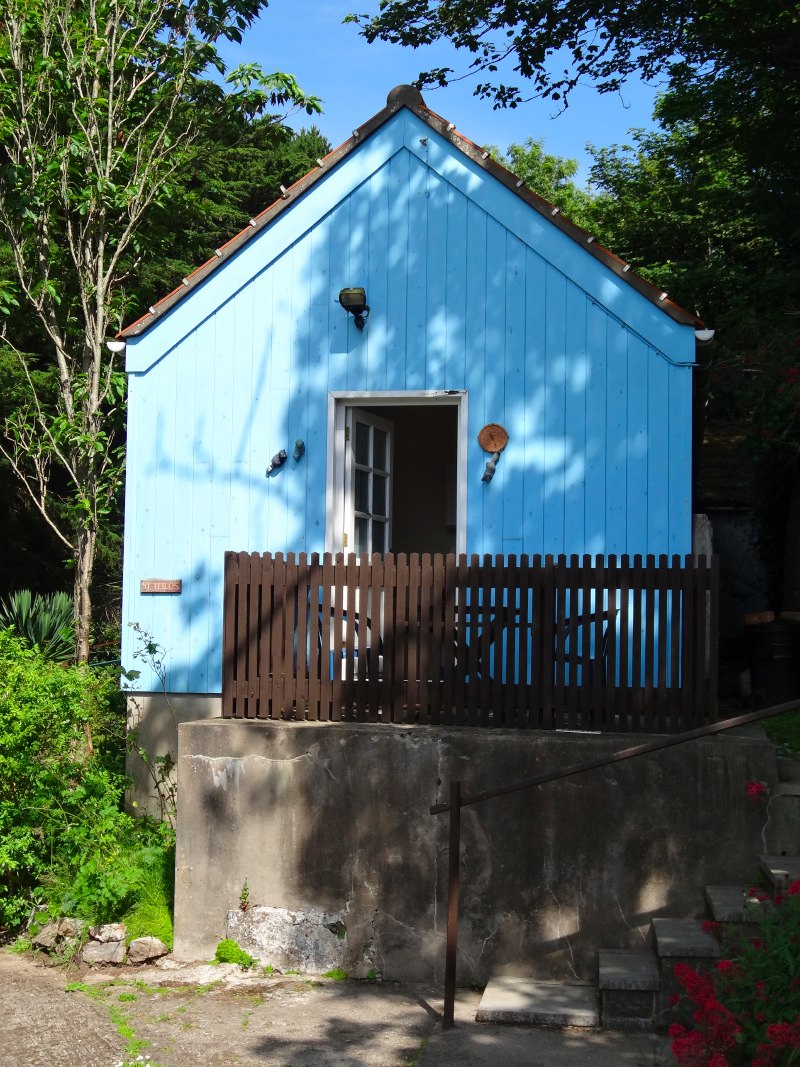
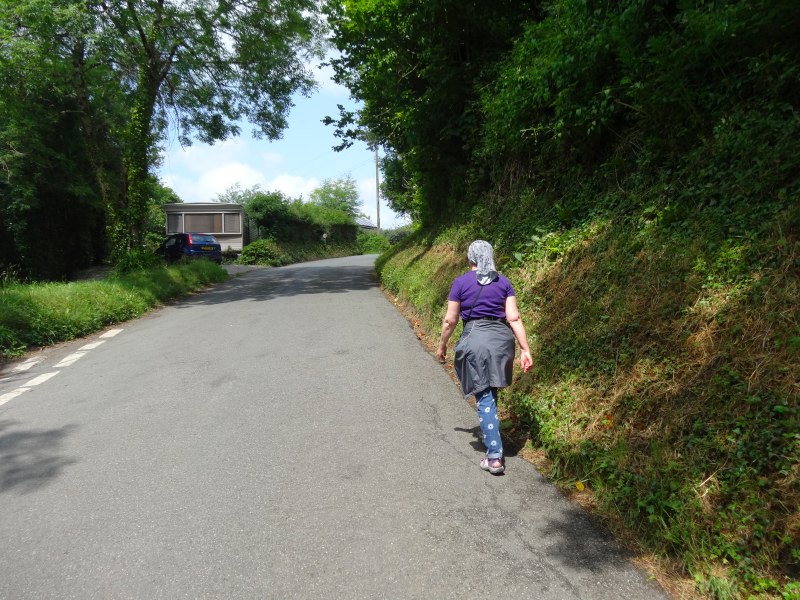
So, somewhat later than my original plan, but probably a bit earlier than if I’d been continuing my very relaxed (better word than lazy) morning, I set off out of the campsite which the Coast Path literally cuts through. I saw groups of people heading straight up the slopes of Rhossili Down, and Andy later told me that this was a very scenic route, the highest point of the Gower Peninsula. However, I followed the official Coast Path route, which follows along the contours partway up the hillside.

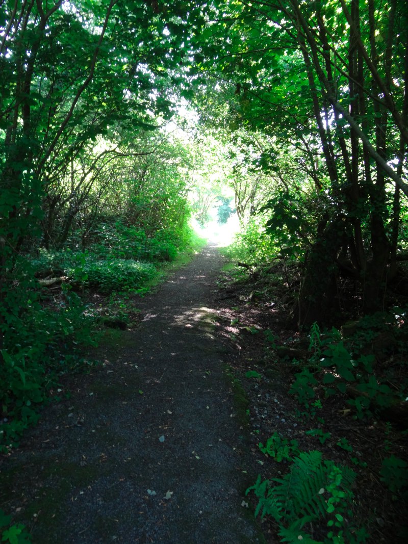
It is only a short walk from Hillside to Rhossili, maybe one and half or two miles, but along fast easy paths. The path was a mixture of foot-beaten orange-red soil and grassy sections and I almost simply stepped over what I thought was a dead bracken stalk, when I realised it was an adder, lying right across the path. I had no stick to frighten it into the undergrowth, and it wasn’t making any movement itself, except its head was cautiously raised, so I had to step carefully round its tail, assuming this would make it run rather than strike. It continued to ignore me, even when I took a photograph, but then when I started to take another it decided it had had enough of my staring and made off into the long grass. The sound of it passing I at first thought was it hissing, but was merely the whispering scrape of it gliding through the undergrowth.

So, I had escaped a snake bite, but the path was also a bridleway, and with partial shade from the already hot sun, ideal conditions for flies, which landed on me if I stopped to take a photograph, or did not walk at full marching pace. I got my first two insect bites of the trip, one on the back of my right calf, the other, a fair inflorescence of bites as if the insect, I assume a horsefly, had been having a seven-course banquet. I wonder how it can have been there so long without me noticing, and assume they initially inject some sort of anaesthetic to numb the area while they feed.

I have had areas with substantial numbers of flies before, including what looked like horseflies, so wonder why only today I get multiple bites. I didn’t put the sun block on until Rhossili, so maybe it acts as an insect repellent. I really could do with some Avon ‘Skin so Soft’, which is the normal solution to midges in Scotland, and even used by the army.

Nearly at Rhossili I saw a cyclist set off up ahead along the path, I assumed after a rest, but then a few moments later he was cycling in the opposite direction towards me. I was confused; was it just another cyclist who looked similar? But then I noticed the video camera on a small tripod beside the path. He explained that he was filming himself for a short video, then he asked me to take still shots of him riding first away and then towards me up the path.

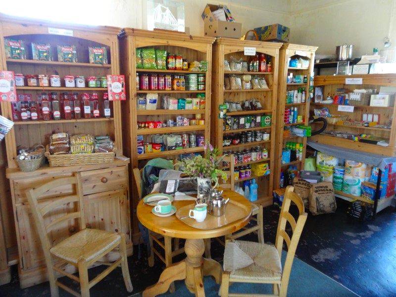
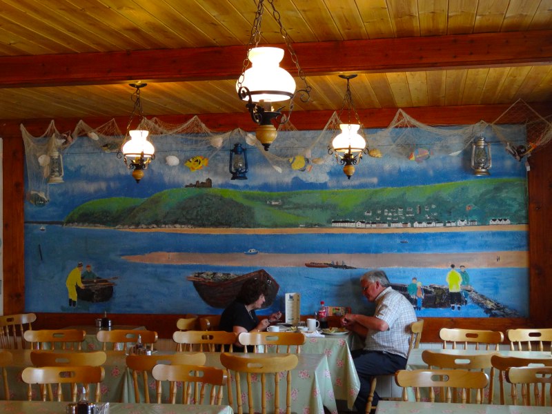
At Rhossili, Andy and I meet at the café and we chat. I slowly eat a full breakfast, while he sips a coffee (to be fair I think he had already had breakfast). We start to talk a bit about the walk and also about his thesis, which is nearing completion. He has been looking at the ways you can build models of interactive applications by driving them automatically, just as if you tried every possible combination of keystrokes and mouse clicks … indeed not so different from the way a child learns how to use a new computer game.

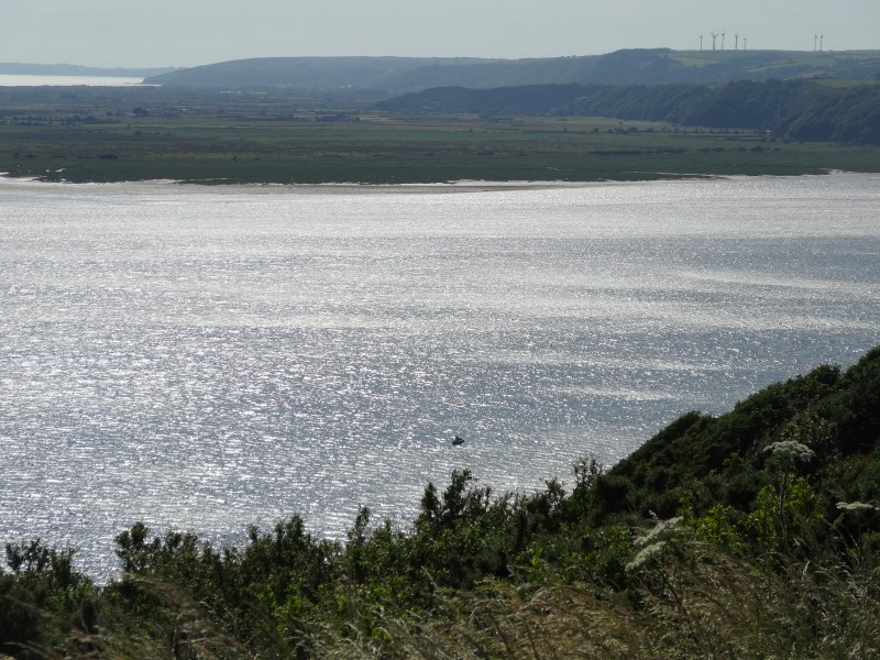
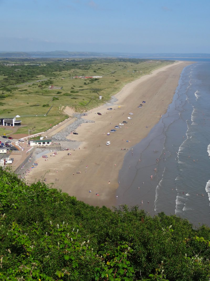
Near the till of the cafe there is a notice about a public meeting. There are proposals for an offshore wind farm out to sea. Visuals compare the 220 metres of the turbines that dwarf the 56 metres of Worm’s Head. They are perhaps a little over dramatised. The Tiree Array is due to start 3 miles out to sea, but that is very close (I think because we are an island and are not fully classified as shore), and I think the minimum around Wales is 12 miles.  Worm’s Head is about two miles from the café, so visually they will be about 2/3 its height, albeit a little higher towards the horizon. However, even without exaggeration, they will make a dramatic difference to the open seascape.

A few days ago, I mentioned that Les had spoken in Welsh at a Monmouth Council meeting. This was at the planning application for a large solar array in the farmland there, which he told me about and which was ultimately rejected.

I am again torn; it always seems that renewable energy, which is essential for the nation and the world, threatens the ‘unspoilt’ areas, often with fragile communities and dependent on tourism. Maybe if the horizon of every seascape is turbine filled, if there is no open sea, then the effects on tourism will be neutral.

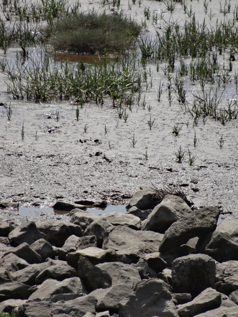
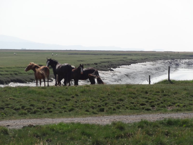
And if there are no turbines, no solar collectors and the energy future is not managed, then the salt marsh of North Gower and maybe the dune systems below Rhossili will be under threat anyway.

In fact, having met various people at Swansea and with zero ability to hold on to names, and even lower ability to keep track of which name is associated with each face, I was expecting Andy to be one of the solid, obvious rambler, types.

In fact Andy is lithe, and narrow faced, his hair tied in a topknot with a feather stuck through it. I was not surprised to learn he was interested in Eastern meditation and practices, and was due to go to the same Buddhist conference in London that Parisa is going to the following week. It is amazing how quickly we make assessments – and I complain that people always put me down as a vegetarian just because I have long hair, a beard and wear sandals.

Andy is also wearing those ‘barefoot’ shoes/socks, I don’t know the proper word, those things like toed socks made out of rubbery material, that protect your feet a little, but try to be as close as possible to walking barefoot. They make my sandals seem positively overdressed.

I tell him about my conversations with mc about barefoot walking, my own experiences with boots in North Wales, and my gradual metamorphosis during the journey from Berghaus man when I set off to my normal, everyday clothing of zip-offs, sandals, T-shirt and Australian hat.

For most of the way Andy actually takes off even his minimal footwear and walks barefoot.  He likes to walk barefoot, and I recall how as a child and at Cambridge I too used to often run through the streets, dodging broken glass and dog poo, with feet calloused and dog-pad hard (maybe the tanning effect of the dog poo), the skin peeling painfully occasionally in the winter. To be fair, the painfulness was because I tended to worry at it and end up pulling thin strips of raw flesh off with the dry leathered skin.

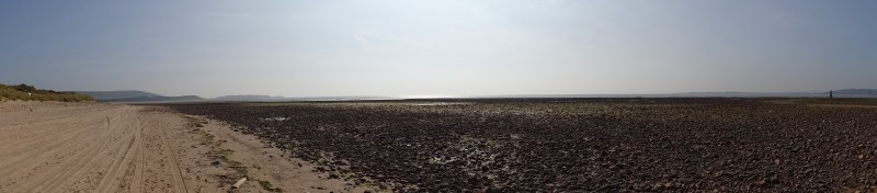
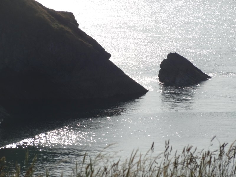
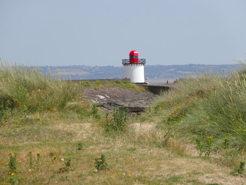
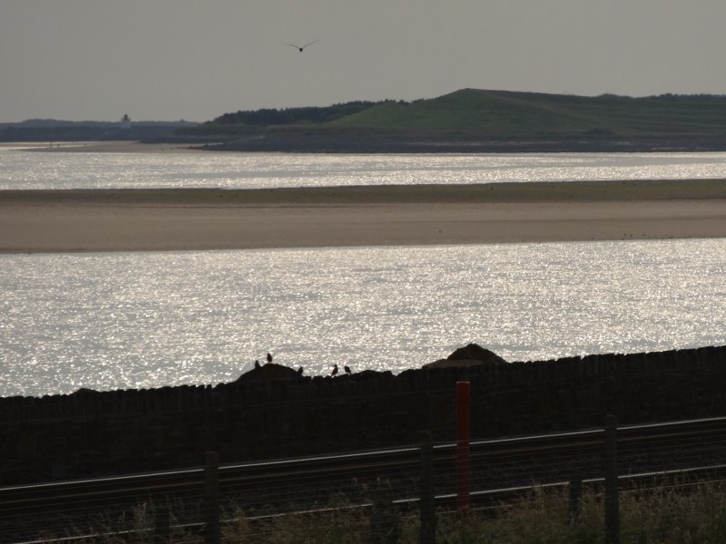
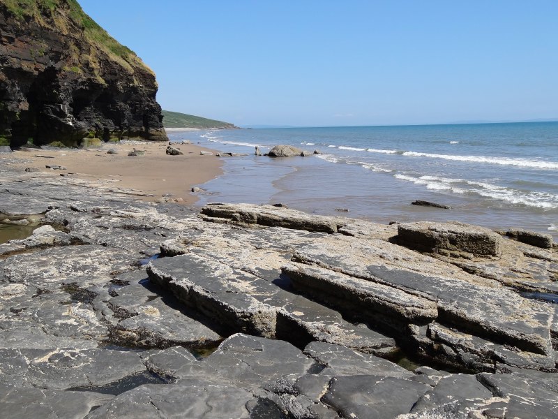
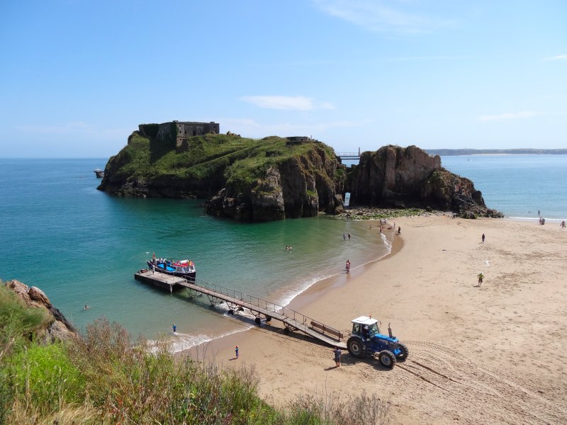
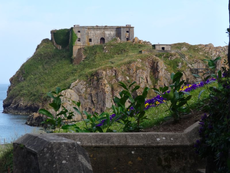
The most dramatic view from Rhossili to Port Eynon is at Rhossili itself, along the headland to Worm’s Head. Once, in my teens, I was in a church youth group and we visited the Gower for a weekend away, sleeping on a Methodist Church Hall floor. I recall we led some sort of service on the Sunday morning, but the four things I remember most are (1) the pain of stomach gas from too much dried soup, (2) because of that the fear of farting at night with so many sleeping bags pressed close together, (3) the distress of one of the older leaders of the group who burst into tears during an evening word game because she couldn’t read, and (4) the walk along the sharp dragon-back of Worm’s Head.

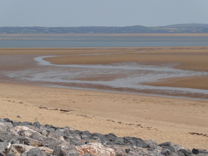
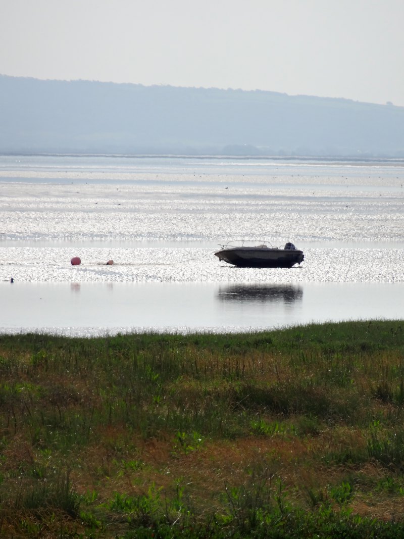
Given it was a short walk, we would probably have been tempted to walk it again today, but the tide was in and the rocky flats between it and the shore are only exposed at low tide.

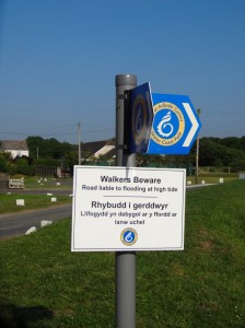
I had been warned by the couple from Abergavenny that there was a precipitous section of the path, and Andy said that he too had found himself tottering on the edge of steep cliffs last time he had walked this from the other direction, but afterwards he realised he had been walking a closed section of the path. Sure enough, we virtually at once came to a fork where one track led rightwards close to the cliff edge and the left path further up. By the lower path there was a small post in the ground with a smaller notice on it. In large letters, or at least as large as you can write in four inches, it said ‘Danger’, ‘Pergyl’, with the slipping of a cliff icon I had seen so often, and even a no camping sign – read, ‘don’t camp on falling cliffs.’  It is common to see such warning signs along the path, and we almost went down this path until, remembering Andy‘s previous experience, we looked more carefully, and in smaller letters below ‘Danger’, it read ‘Path closed please use alternative route’.

I can’t help but think ‘CLOSED’ would have been clearer signage.

Having successfully avoided the closed section of path, the way is easy underfoot and lovely to see, with various rocky bays and hidden beaches. I only recall one incident of note and one incident that failed to happen.

The first was simply when glancing back down a small cove, I saw a group of young people down by the sea, and then one of them draw a large bow. I would have loved to take a photograph, but it was over in an instant, or so I thought.

The other is that we intended to visit the Paviland Cave, where the oldest buried human bones in Britain were found. Andy had come across a more direct footpath before, but it had been high tide when the only access is a dangerous clamber from above, whereas today, with the tide dropping we should be able to access it from below. After a while Andy checked his GPS as he thought it should be soon, but realised we had missed it entirely and it was nearly a mile back. It was a very hot day, and we decided that the extra two miles to double back were too much, so we both left Paviland for another visit.

So, there was not much that caught my eye, except a general feeling of beautiful cliffs and coves, but that might partly be because we were so often locked in deep conversation. Feet were a not insignificant part of this conversation, especially as Andy was walking barefoot for most of the way and I felt for him on rocky patches, but even more so when there was recently strimmed patch of gorse with dead gorse and the odd tiny green seedling carpeting the way.

I had been thinking over recent weeks about the issue of feet, pain and the way it forces a connection to the ground and to the earth. I had also thought abut the difference between the Western Judeo-Christian and Eastern traditions. In the former God in Genesis creates the earth and declares it ‘good’ (indeed Genesis says ‘it was good’ about once in every verse in its opening chapter), and then (in Christian tradition only) God himself becomes part of the world, sharing in flesh, born bathed in blood from a woman’s womb. In contrast, Eastern traditions seem to use ascetic practices to separate from the world.

However, Andy explained that there are two kinds of practices in different forms of Buddhism. One was as I described, but the other, in particular Yoga and mindfulness (such a keyword of late), emphasises connection and concentration with the body. He talks about mindful walking techniques, which move from a step-by-step focus to an awareness of each tiny movement of sole and heel.

I realise too that there are large tracts of Christian theology that have their roots in either Greek dualism, or simply the difficulty of holding on to epistemic tensions, and have sought to establish just such a sharp separation of flesh and spirit, from the early saint who lived out his life on the top of a column, to Evangelical theology which often focuses exclusively on the wretchedness of the human heart in direct contradiction to God‘s declaration ‘it was good’.

Andy asks about my own confidence in the inherent sense of a good God and good creation, when there is so much in nature and the universe that seems at best uncaring if not cruel.

For me, my Christian faith is not unlike my academic work, based on its truth, not on more personal feelings or spiritual sense; by which I do not mean I never feel anything, but that these are secondary to what is true. However, this is not to say, of course, that I know all that is true!

This question of the goodness of God in an apparently hostile universe has been the subject of debate for two thousand years and before that in the Old Testament also (especially Job).

Often when we seek to intellectually deal with complex things that are apparent contradictions, whether in physics or theology we want to opt for one thing or another. However, I often come back to Paul (the arch Biblical intellectual!), trying to make sense of the role of Jesus and the crucifixion in the grand scheme of creation. He lays out the inherent conflict between God‘s justice and purity that should wipe away a broken world, and his love and mercy that cares for each person and would lose none. He paints this as a tearing in half of the heart of God, persisting through the ages. However, rather than opting for one or the other, God acts in the birth of the baby Jesus and the Crucifixion.

This option of action over reflection seems sadly missing in so much of our intellectual and spiritual practice, and is epitomised in scenes I witness later in the day.

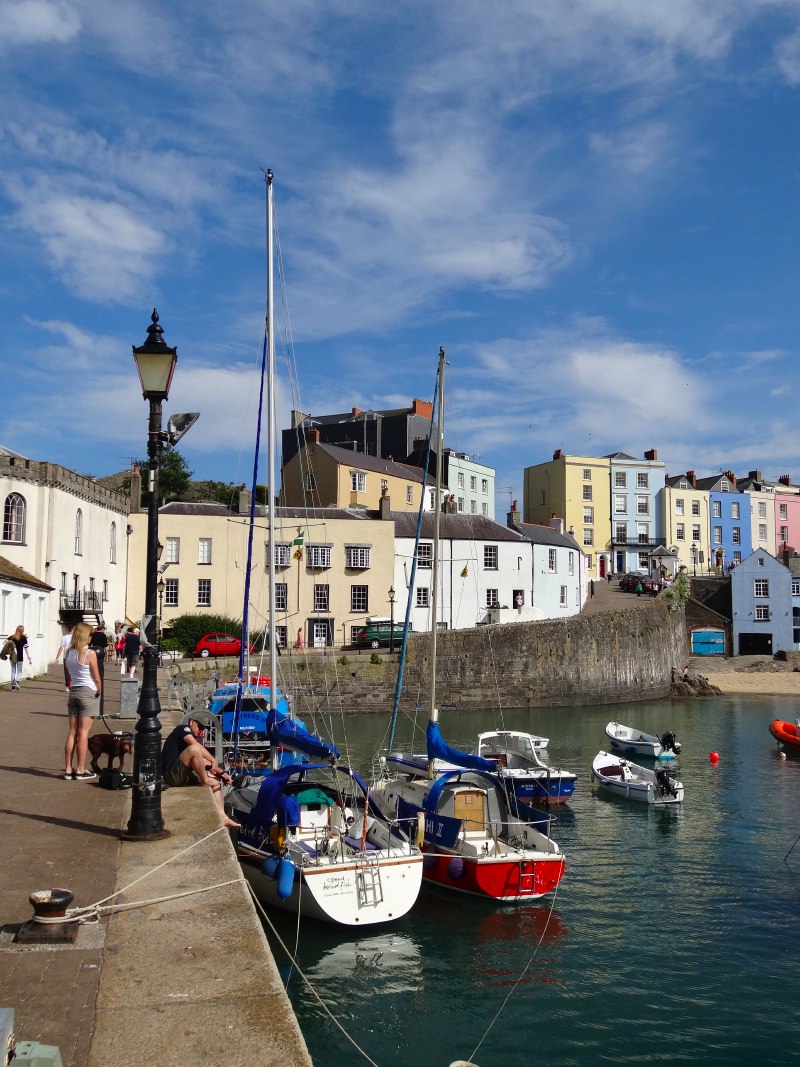
Eventually, we get to Port Eynon. For a moment we toy with going on to Oxwich, but it is Andy‘s first day walking barefoot this summer and he is developing a blister, so we go instead for a cup of tea and a bite to eat at one of the seaside cafés, then, when I realise I have no phone signal, a pint in the pub, then, when we discover that their phone is not working either, I run back down the waterfront where I am told there is a payphone, which, unlike the payphone in Llansteffan, does accept my money, and phone Mike’s Taxis to take us back to Rhossili.

Once back, we divide our ways, Andy to drive back to Swansea, and I to walk across the beach back to the campsite.

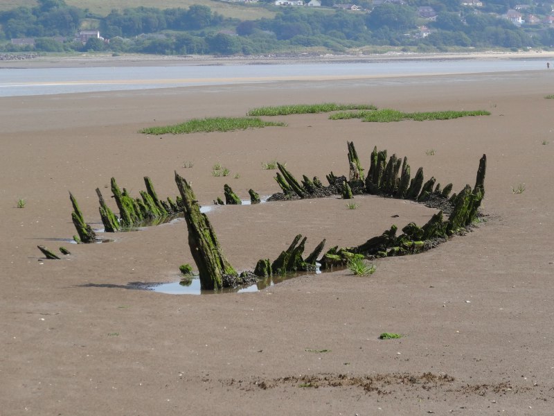
As I drop down to the beach there is something pointing out of the sand.  At first I think it is a rock, and then maybe just a large beach umbrella, but as I get closer I see it is very old, weathered wood, with smaller pieces of wood sticking out of the sand. Further up the coast I would have thought it was abandoned groynes, or on a river bank wooden jetties, but here it could only be a wrecked ship.

A woman was standing beside it, having just taken some photographs herself.  Her partner was on his way down to the sea rescuing a crab that they had found marooned far up the wooden structure, baking in the sun.

The wood itself was deeply cracked, covered in green algae and studded with long rusted metal pieces that looked like curved, tearing teeth. It reminded me a little of the snout of the dead porpoise I had seen on the beach the day before.

As well as the line of smaller pieces of wood I had seen at once, there was a second line, even more deeply buried. These must have been the ribs of the boat. They will have spread over time, but still it was a substantial structure, and the size of the large piece of wood, which is clearly the keel, suggests a large vessel.

Later I learn that this is the wreck of the Helvita, and a well-known landmark.

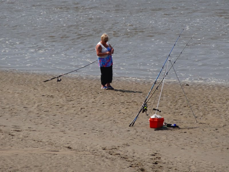
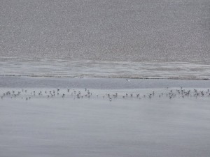
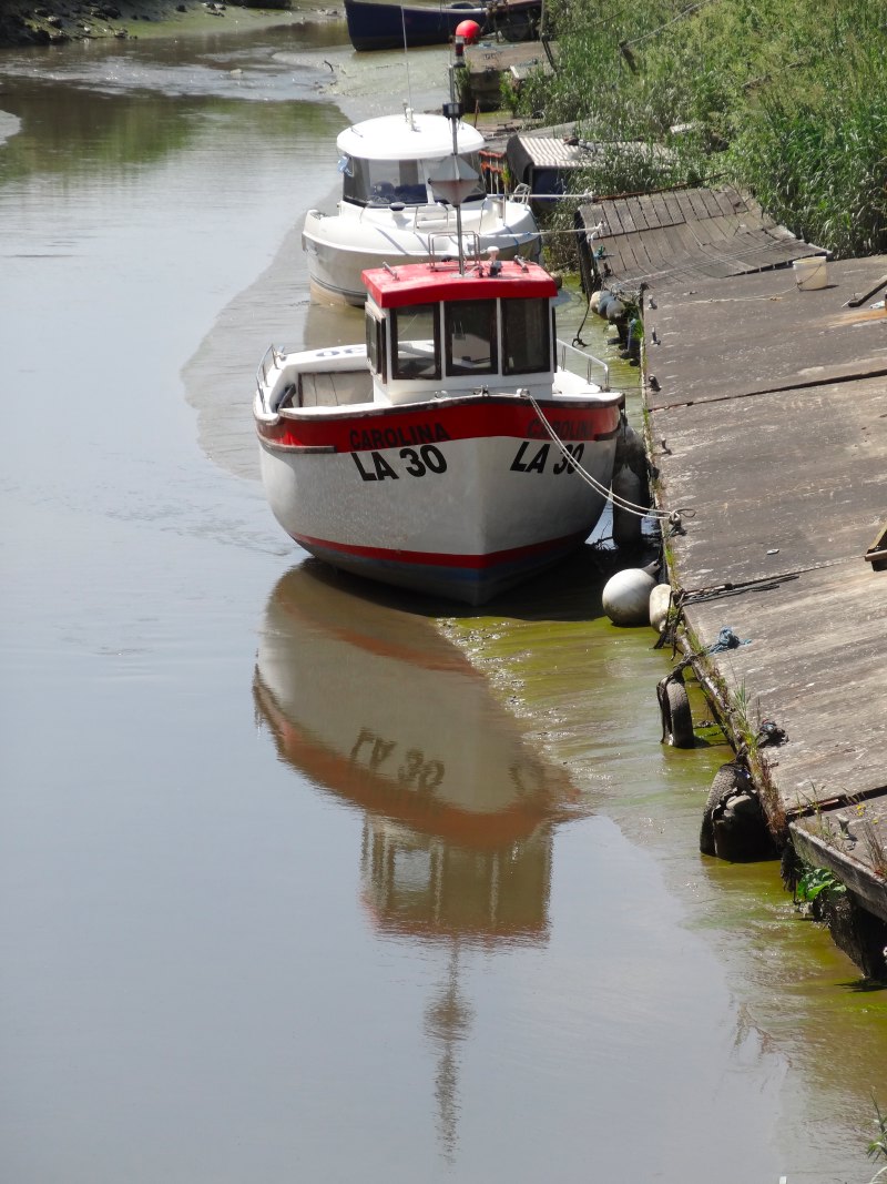
Further along the beach I pass my second lady angler (I almost want to write ‘fisherman’, but that would seem strange). Unsure whether it is politically correct to mention such a thing, I say hello and remark on the unusualness of seeing a woman with a rod. She agreed that she was unusual and knew few others. She was competing with her husband, who was fishing about fifty yards further down the beach, and was winning. Taking advantage of my presence, she asked me to bear witness to a 20cm flat fish and tell her husband the dimensions as I walked past.

"Don’t rub it in," he said, when I passed on the news.

Slogging through the sandy foot-beaten gorge through the dunes to the campsite, I catch up with a group. At the back is a lady with two dogs, and after I say something about the dogs and the heat, she says about a third dog, maybe a golden retriever, "she’s old and struggles with the sand". I realise that the dog in question has been hefted onto a body board and is being carried by five young people, I assume her family.

When we get to the solid ground of the car park, they exchange some words with her, she says "I’ll be alright from here". Clearly they had simply been passers-by who had either noticed her difficulties, or been asked to help.

Simple acts of kindness, to a crab, to a dog.

Thinking back to the conversation with Andy earlier, the man on the beach could have looked at the crab stranded high on the prow of the Helvita. He could have pondered the cruelty of nature that left it there baking in the harsh sun. But instead he acted and carried the crab to the sea. Action resolving contradiction, and, like a spot of light from a stained glass window, a small Christ-like image of the life-affirming action played large in the Easter story.

Day 86 – Llanrhidian to Hillend

fellow walkers and runners, a community shop and search for childhood cave

12th July 2013

miles completed: 957
miles to go: 101

I’m staying for the next two nights at Hillend campsite, at the far western tip of the Gower, so I leave Parisa‘s after breakfast and drive down. On the radio there is a news item about a survey that found that 50% of primary schools said poor internet access was hindering IT education. I’m sure this will be a problem in many rural and remote areas across the UK, but in Wales a particular problem as a larger proportion of the population are at the edges.

After setting up at Hillend, and then a taxi to Llanrhidian (with Mike’s Taxis, a Gower-based firm), it is nearly 12:30 by the time I set out.

2013-07-12 12.48.22The next day there is due to be a fˆte or show with a salt marsh lamb, donated by a local butcher, as one of the prizes. I’d seen a sign for salt marsh lamb the other day; clearly the locals here appreciate the special flavour. There was bright coloured bunting round the village in preparation.

The way leads down out of Llanrhidian, first along roads, then a smaller track and then a variety of wooded and field crossings. As I’ve found in this area, the signage is reasonably good, but you do need to keep your eyes peeled. In a wooded lane, there was a branch to the right, so I went straight on, though uncertain as it was immediately after a gate with no sign on it, but when I got to the end it was the right way. Similarly, crossing a field, there were a few gates; one looked most in the direction of the arrow (not a solid indicator), but it had no marker, however I went closer and could see a post 30 yards or so further along the way beyond the gate.

2013-07-12 13.37.32In one of the fields a stile stands in the middle, long grass where the mower has to go round it, a reminder of a past field edge, fence or hedge. In another the stripped leg of what looks like a calf lies, a reminder that life too can be short. Every so often I catch a glimpse of Weobley Castle in the distance, but never get close.

On a wooded section just beyond Landimore village, I meet Paul and Liz. They are walking around the Welsh Coast, and, depending on when they get to the north, Offa’s Dyke as well, either this year or next. They have large packs with full camping gear, and I feel I’m having it easy with my tiny day-pack, especially when they describe the cliff sections near Port Eynon, where Liz‘s thirty-four pound pack will significantly lift her centre of gravity.

2013-07-12 14.42.42They live in Abergavenny, so the last stretch down Offa’s Dyke will feel like ‘going home’ for them, a bit like this last stretch through Gower, Porthcawl, Barry and Penarth seems like ‘going home’ for me, not just because they are on the way to Cardiff, but because they are the stamping grounds of my youth. I am still in the unknown territory of North Gower, but once I turn the end, later today, I will be stepping back into my past.

Very like my own experience, when Liz heard about the Wales Coast Path opening last year, she thought, "we should do that", and, I gather, Paul does occasionally remind her that it was her idea! They are clearly experienced walkers and Paul has done the Hadrian’s Wall path in the past. Indeed, a few years ago they had booked two weeks’ holiday to walk Offa’s Dyke, but had then moved house, so spent the two weeks packing. Now, they are making up for that missed walk and more so.

I assume that they have now taken early retirement, as Paul says, "we can do other things like cruises later", but this was something to do when they were both in full fitness.

2013-07-12 14.45.56They have not long come through Llanmadoc. They warn me not to take the middle footpath, as they did, as it led through a tiny overgrown lane, which was full of bullocks, which meant that the floor was muddy with dung, but also that they had to negotiate past a small herd of bullocks in a nine-foot wide lane. Squeezing past skittish bullocks was not fun.

2013-07-12 14.50.33After a while the path rejoins the edge of the salt marsh past a cottage called ‘The Saltings‘, suggesting there were salt pans here in the past, and then along a gravelled path, with, like the day before, signs every so often warning you that this was once a firing range and that handling any military fragments could kill you.

Eventually the path makes a small loop where a stream joins the marsh, and at the far side a wooded hill rises. Between wood and marsh the path leads in two directions, one is marked ‘coast path’, the other ‘alternative high tide route’, which leads up through Llanmadoc " but not along the dreaded bullock lane.

2013-07-12 14.55.08At the top of this I would have turned left towards the pub marked on the map, and then retraced my steps to go round the low tide route (incidentally the only route marked on the map from here, the high tide route must be new). However, Paul and Liz had told me about a community shop in Llanmadoc. It was something not to be missed, they said, with teas and homemade cakes. I was after something a little more substantial than cakes, but I had a sandwich and sausage roll in my rucksack as backup, and definitely wanted to see this, both as an interesting community development in its own right, but also because Fiona had just joined the feasibility committee for a community shop on Tiree.

2013-07-12 15.07.28As I got to the centre of the village a sign with an arrow said ‘Old Shop, still open for range of famous cakes’. I did not understand the significance of this at first, thinking it meant that the ‘old shop’ had been going to close and was now a community one. Another sign read ‘Our Shop, just around the corner’, ‘welcome to our shop’,  and ‘croeso i’r shop yr pobl’; the latter I think literally, ‘welcome to the shop of the people’.

Llanmadoc Community Shop, or ‘Our Shop’, was everything Paul and Liz had said, a charming shop, with volunteers serving, tables outside in the sun for those who wanted, and also, thankfully, inside in the shade on this baking day.

The shop had been running for eight years in a barn that was once a garage, at the back of the house of one of the original founders, but is about to move into purpose-built premises, hence the ‘old shop’, meaning this, as opposed to the ‘new shop’; both were the community shop. It is café, grocery store and post office, although the post office part has already moved to the new premises. The lady I spoke to was a little wistful about the move as the place they are now has character and, I am sure, many memories.

They have a volunteer pool of around forty, and I recall Richard at Brandy House Farm, where I stayed in the MorphPOD, telling me that he thought thirty was the minimum for the community pub they were planning. However, there is a smaller group of four who are the main bakers of cakes. I had evidently just missed one of the trustees who might have been able to tell me more about the issues around the establishment and running of the shop, but clearly it is a resource for both visitors (others came while I was there), and, most important, locals, who popped in for a ‘quick cup of tea’ and then stayed all afternoon.

Underground coal gasification process (from [sem ]Wikipedia[/sem])

On the notice board in the shop there is an announcement of a meeting about the proposed undersea coal gasification project under the Loughor Estuary between Llanelli and Gower. I’d not come across this process before, although it was something that I recall wondering about as a child, especially when pits were being closed because of difficulties in mining. Basically you crack open a coal seam, a bit like fracking, and then set fire to it, managing a steam-based partial burn that produces what used to be called ‘coal gas’ or ‘town gas’, a mix between carbon monoxide and hydrogen.

In the UK all gas used to be made this way; not underground but in plants that took mined coal and heated it under controlled circumstances. When natural gas (methane) became cheaply available from the North Sea, there was an extensive programme switching the country to use the new gas. This involved modifying every gas appliance, as natural gas burnt at different pressures and temperatures to coal gas.

I recall the conversion team coming to our house and upgrading the gas cooker burners. It was one of those enamelled cookers standing on legs, with a plate drying rack above the hob. Now you only see them in museums. They also converted our old gas fridge, but it never coped well with the new gas, the flame kept going out and I’d need to reach behind to a tiny hole to relight it. Eventually, after a few years, we replaced it with an electric fridge.

Gas fridges used to be virtually silent, unlike the intermittent whirr of the compressor of an electric fridge, and gas fridges had no moving parts, so lasted virtually forever. I also always found it fascinating that you could cool something with a flame! Strangely they have all but disappeared. Our campervan fridge can operate on gas, but that is bottled gas propane or butane, maybe there is something about the burn qualities of natural gas that is unsuitable.

Anyway, back from fridges to fracking or at least underground gasification. There are concerns both about the industrial plant that needs to be built on the surface, but also about problems underground if the burn is not properly controlled, if by-products such as phenol leach into the ground water, or if the sea floor collapses as the coal is replaced in situ by ash.

Later I found a report of the meeting in the Llanelli local papers. Virtually all previous attempts at underground gasification have failed due to environmental failures, and only one plant in Uzbekistan operated for any length of time. Not surprisingly local people are worried about the impact on an area of outstanding natural beauty, where even minor modifications to their own houses are subject to intense planning scrutiny, and yet permission has been given to test drill in the estuary. The company doing the drilling is called ‘Clean Coal Ltd‘, although the process is anything but clean, and appears to have a worse carbon footprint than conventional coal burning. This PR-naming reminds me of the company proposing the vast windmill array near Tiree, ‘Scottish Power Renewables‘, which is, in fact, Spanish ;-).

2013-07-12 15.56.59I would have liked to stay longer at ‘Our Shop’ both to soak up the atmosphere, but also to stay in the shade, although by this stage it was four o’clock so the hottest part of the day had passed. I hope to revisit as part of my reprise travels next year, and by then it will be in the new premises.

I was directed the best way out of the village towards the Coast Path and set off on my way to go round the end of Whiteford Burrows. The way leads out of the village and past some sort of ranger station with a large truck and digger outside. The vehicles are painted dark green, I assume to blend into the green of the forest and not be conspicuous, but given the warning signs everywhere about unexploded ordnance, it has a vaguely military feeling.

As I approach the long path behind the sandy headland I spot two runners, or to be precise one day-glo runner, approaching from the right, along what I guess would have been the low tide route that I would have taken if I’d not detoured through Llanmadoc.

We arrived at the junction of the paths at almost exactly the same moment. They are Gerald and Julia.

Gerald said, "I passed you yesterday near Penclawdd, you were taking a photograph." He had seen me and thought I looked ‘interesting’ … I think in a good sense :-/

We talk a bit about the walk, and when he says about fitness I describe the way the first few weeks I seemed to get fitter and fitter, but then about halfway round seemed to hit both physical and mental limits.

"Ah, ‘the wall’," he says, "with her," pointing to Julia, "it is 18 miles".

I realise these are serious runners.

Julia has run a marathon for a breast cancer charity, and they have also done the 50-mile, overnight, endurance walk in Shropshire. So many times during the walk I have thought "never again", but this long single walk does attract me as I’ve now run further than I ever did as an eighteen-year-old, can lift heavier weights than as an eighteen-year-old, and have certainly walked further … but I did once walk a thirty-four-mile circuit from Cardiff when I was 17 … oh, how sad, a definite sign of ageing when you are competing with your younger self.

2013-07-12 16.35.54Gerald and Julia set off running again and the wild ponies look on, vaguely interested but not alarmed; they have seen it all before.

More ponies and sheep roam the woodland and sand dunes of Whiteford Burrows and the path is easy along the mile and half to its end. Somewhere to my left, in the heart of the burrows, are shell mounds. These are the places where the early post-glacial Neolithic settlers would discard cockle and other seafood shells, building large waste piles. Over the years these get covered in sand and are often only are found when rabbit burrows cast shells out. I learnt about these in Steven Mithin‘s ‘To The Islands‘, where he talks about his excavations in various Scottish islands.  To Dr John‘s great sadness the lack of rabbits on Tiree make it a poor site to search for shell mounds.

It would be lovely to see one of these, but finding a sand-covered pile of shells amongst a square mile of sand dunes sounds as if it would need an expert guide.

I notice on the map that the end of the long spit of Whiteford Burrows is also called ‘Berges Island‘, with the area towards the middle being ‘Great Plain‘. I wonder if there were times when the area in the middle was under water at high tide. As I approach the end, the salt marsh to the right gives way to open sand and a Landrover drives past at some speed.  As I go down to the sand to walk I keep near the tyre tracks on the principle that (1) the driver probably knew where the firm sand is and (2) if not it will sink before I do.

Beyond the end of the spit is a flat rocky area spreading out to sea, at the end of which is a disused lighthouse.  As well as protecting from these shoals, it also marks the south-eastern side of the channel between the mud banks either side of the channel towards Burry Port and (the now disused) Llanelli Docks.

2013-07-12 17.07.57The lighthouse is a quarter of a mile out towards the sea and it wasn’t clear whether it was reachable, nor whether it was advisable to walk across the tidal rocks. A few days later Yvonne told me about the lighthouse, which is evidently impressive up close, being entirely constructed of cast iron; an unusual, maybe unique, example of Victorian engineering, still standing despite the exposed position and lack of maintenance.

Turning my back to the lighthouse, there is ahead three miles of uninterrupted sand, the entire length of Whiteford Burrows and Broughton Bay beyond. At low tide you need to take a path at the end of the Burrows up the steep cliffs, and past, according to the OS map, ‘bone caves’. However, the joy of beach walking trumped the potential for seeing the empty sites of archaeological remains.

And also, I was a man with a mission, with my own cave to find.

2013-07-12 17.11.03

When I was about four or five years old, we went on holiday to Gower. The couple who lived next door were clearly somewhat upwardly mobile, owning both a telephone (in the house, not in a red box outside) and a caravan in the Gower. That year we went and stayed in their caravan.  This was the only time we stayed there. As we did half-board for students and theatre back-stage folk at home, Mum relished not having to cook while on holiday, so staying in a caravan was not quite the holiday for her that it was for us.

2013-07-12 17.55.09

Jacqui also remembers that it rained most of the time, but I have blotted that out except that I do recall being read to, fairy stories (I think Jacqui‘s book) and also a cautionary tale. The latter was about a boy who had tomato ketchup on everything, until one day he insisted on having it on his ice cream, despite the protestations of his parents; of course it was horrible and so he learnt (a) ketchup is good in its place and (b) to take notice of his parents. I don’t know whether I learnt the lessons, but I certainly recall the story!

It was only one holiday on the Gower when I was very small, and I did not visit again until I was at Scout camp at eleven; however, I think this was critical for my seaside ideal of dune and cliff.

In particular we found a cave.

2013-07-12 18.03.07On the first day Jacqui and I were clambering over rocks with Mum and Dad walking on the sand to our right. We were at around their head height (or it felt like it), and then came across an opening in the rocks. It was a long slit, wide enough to go through, or at least for a child to get through, but too far down to drop into without getting stuck. I can’t recall, but I would guess Mum may have been concerned when we said what we had found.  About halfway along the fissure was a rock bridge that would have been perfect to tie a rope round to let oneself down. It was a perfect Famous Five setting, although this was years before I read the Famous Five stories.

For years afterwards I dreamt of returning with rope to explore.

I had no rope with me, but I realised that either (a) the fissure would be too small for an adult anyway, but (b) if not the drop would be one I could manage now.

2013-07-12 17.56.44From OS maps and Google maps I had long ago decided that the caravan site we were at was the one at the south end of Broughton Bay with the rocks we explored at the base of the clifftop of Broughton Burrows.

As I got closer to Broughton Bay I began to see the first people for several hours, bathing, making sand castles, or simply lying in the sun, but I was not interested in the people, just the approaching cliffs at the end of the Bay.

The rocks here are limestone, rising steeply in places above the sands, with several sea-cut caves at beach level. Higher up would be the elusive bone caves.

2013-07-12 18.20.30At the far end I walked as far as the water would let me, but the tide was very low, so certainly further than we would have walked that first evening when I was five. Then I made my way back slowly along the shoreline, where possible clambering up the rocks and searching for the long-lost cave. I found one fissure very early. It was filled with sand nearly to the top, but, of course, the level of filling would change over time; however, it was also right against the cliffside, you could only stand one side of it, whereas the fissure we found could be walked past on either side. But after that nothing that even faintly resembled my memories.

I could not understand, it was so clear in my mind and yet there was nothing that corresponded on the ground. I know I was small at the time, but my childhood memories are good and this is particularly vivid.

Gradually the realisation dawned. I had been here the best part of fifty years ago, and this is limestone. The place I was looking at then had already been heavily eroded, and in the intervening time the rock to the sea side of the fissure could well have fallen in and broken into boulders.

I have lived geological time.

That is scary.

2013-07-12 18.40.16Disappointed and feeling very old, I climbed up the cliff to walk across the clifftop burrows and then back down near the place called ‘Spanish Rocks‘, with a small island opposite, that, belatedly looking at the OS map, would have been worth a visit as it has various signs of old settlements including a ruined church. However, by now I was tired and so made my way along another mile of beach and up through the dunes to the Llangennith campsite, too late for food at the café there, so simply eating from a tin amid the sounds of the now full site with new vehicles still drawing in.

Day 85 – Llanelli to Llanrhidian

we don’t do Swansea, the jungles of North Gower and a fortuitous meeting

11th July 2013

miles completed: 945
miles to go: 113

Parisa dropped me off at the Discovery Centre and then I walked back along the path to where we had branched off to the Sandpiper the day before. I am still amazed that the parking at the Discovery Centre is for four hours maximum, given they are promoting six-mile linear walks starting there.

2013-07-11 10.52.40Over breakfast Parisa and I talked about her roots in an Azerbaijani part of Iran. Her grandparents left Azerbaijan after the October Revolution, and after that time the languages of those in the USSR and those in Iran diverged, not least because of different scripts, and also the presence of different dominant languages, Russian in Azerbaijan and Parsi in Iran. This even affects basic grammatical constructs such as noun–verb order. As a child she spoke Azeri at home, but never saw it written until she learnt to read the Cyrillic script as an adult.

Language is such a core part of identity, especially for the ex-pat, but can be complex. I’m thinking about a news item on the SaySomethingInWelsh list about Les, who walked with me from Monmouth to PandyLes has just been the first person ever to present to Monmouthshire Council in Welsh. This would be remarkable anyway, but he is by birth a Lancastrian, only having learnt Welsh in the last few years.

I do not come from a Welsh-speaking family; in fact, in Cardiff I only knew one family who spoke Welsh at home. I had hoped to learn more Welsh while walking, but the time pressure has meant that has gone onto the back burner, like so many things. However, over the last few days, except when I was walking with Parisa, I have been plugging in my iPod shuffle and listening to random SaySomethingInWelsh lessons as I walk.

The SaySomethingInWelsh lessons really intend you to speak back on every line, and progress through them in order. However, (1) I don’t know how to get the shuffle to play in a particular order, nor even if it can, (2) I get bored too easily, and (3) I don’t think that learning style suits me as I struggle to repeat sounds back, especially if I don’t see them spelled out. The purely oral method works for a lot of people, and in particular Les found it wonderful, but I find that if someone says a name or word to me I am unable to repeat it back even straight away. I think I just have some sort of specific problem in my auditory loop, or maybe I just don’t listen hard enough!

As I put on my rucksack for the day, and Parisa prepared to drive off, I remarked how odd it was that for the first mile as I walk back down the Coast Path to the start point, I will be simply walking, not ‘on the walk’. Indeed as I walked I kept finding I had to tell myself, "No, I’ll photograph that on the way back,” and tried to simply walk!

Turning round I climb a small knoll and look along the length of the lake that we walked beside to get to the Sandpiper and then at the grass-covered railway tunnel that was Parisa‘s landmark. There is a stone sculpture that has a notice on it about the history of the Llanelli Water Park. It is on the site of an old steel works, originally built on reclaimed land in 1897, and now a large recreational area that is heavily used by the local community. Although not the most spectacular, it is one of the few parts of the Coast Path that is easily accessible by wheelchair.

2013-07-11 10.59.35The Discovery Centre is an impressive construction of concrete and glass that could easily be a modern art gallery, or sailing club, with a curved sun-shade projecting to the south of the building that looks like it could just catch the wind and send the whole structure sailing out towards Cornwall.

Inside there is a café where I get a quick cuppa, the normal round of tourist leaflets and one of those glass-boxed scale models showing the development plans for the area. A lady is putting out leafets, so I ask her about the likelihood of finding somewhere to eat between here and Pen-clawdd on North Gower.

"Ah, that is Swansea, we only have information about Carmarthenshire," she said, "Although I think there is more likely to be something to eat over there than here."

It was not that she was being unhelpful, she seemed genuinely to have no idea about anything more than five miles east, although she presumably could have given me information about Laugharne, 30 miles in the other direction, as it is in Carmarthenshire.

2013-07-11 11.42.18This would be shocking enough if it were any sort of tourist information; the centre may well be in Llanelli, but tourists coming here will presumably spend time in the Gower, and effectively they were being told to go there and find a tourist office to ask. However, I was not even asking about general information, but specifically about the Wales Coast Path, supposedly a pan-Wales initiative and one intended to be bringing in tourists from around the world, who are then being told "we don’t do Swansea". Unbelievable!

East from the Discovery Centre, the coast path leads you along the landward side of a wetland area, where sea birds dabble in the tidal mud. The beach stretches along the other side, but there is no way across the river mouth that feeds the marsh.

2013-07-11 11.57.27Beyond the wetlands builders are at work, and beyond that new housing and beyond that housing that is already occupied, the residential area is being developed as a wave of brick, tile and concrete moving westward.

The sign says, ‘Beachfront Executive Homes’ and although the pricing here will not be the same as, say, that on Cardiff Bay, still I would expect the homes to be out of reach of the majority of Llanelli‘s residents. However, it is clear that the Water Park as a whole is seen as something for the whole community, even if the residential development will be more exclusive.

2013-07-11 12.28.06

I assume that many of the residents will either be commuters to Swansea or retirees, and indeed I chat to a couple, walking their dog, who have retired and moved into one of the flats in the last few weeks. I cannot recall the whole conversation, but I guess as I was talking about the walk in North Wales I mentioned Rhyl. The lady had been brought up near there and she said that Rhyl had been a depressed area even then, 50 years ago. She lived a bit further along the coast, but occasionally visited cousins in Rhyl to go to the swimming pool there. However, they were only allowed to go to the leisure centre and not any other part of Rhyl.

I had wondered whether I would find some sort of small waterside café or bar amongst the new housing, but I found nothing. Maybe housing is more lucrative per metre of seafront than restaurants. I wondered how the area would develop any sense of community when from the start everyone was being forced to go elsewhere for everything from a newspaper to a meal out. Indeed the only way you would be likely to meet a neighbour would be walking on the waterfront path.

2013-07-11 12.43.28

Beyond the housing is a plaque about Machynys, ‘Monk’s Island‘ where the 6th Century St Piro is said to have had a monastery. According to the BBC‘s ‘Weatherman Walking‘, this ‘even had its own tunnel running from below a cellar underneath the estuary and was used by the monks to cross over to north Gower.’  Far be it from me to contradict the BBC, but the idea of a 6th century tunnel beneath the sea that stays dry without constant pumping does sound very much like the Famous Five.

Further still is another plaque to the ‘lost’ village of Bwlch y Gwynt, ‘circa 18801973‘. There is even a bench nearby donated by the ‘Lost Communities Group‘. If this were a medieval village I would understand it, but losing a village in 1973 sounds like pure carelessness (although to be fair there is more info on the BBC and Abandoned Communities websites).

2013-07-11 12.35.21

Out to sea there is a line of cars on a sand bar. At first I think these are more sea anglers, but then realise they are cockle pickers. Happily these are only a short way out, as I remember still the news of the Chinese cockle pickers drowned in Morecambe Bay when we lived in Kendal.

Cockle picking is a bit like general coastal fishing. Once it would have been the preserve of locals who knew the waters, but then, like foreign boats, people came from further afield. I think about the Special Area of Conservation recently established around Barra despite local opposition. It seems crazy that it appears impossible to establish rules that prevent large-scale despoliation of the environment and yet still allow limited local exploitation.

2013-07-11 13.51.39

Further on I meet a lady and her daughter out walking a dog. Away from major towns, it is easy to greet and often chat to any other walker, but in towns and busy areas it tends to be dogs that allow one to make contact. Indeed, a bit like mothers and babies, if you first admire and greet the dog and then say hello to the owner, you are almost always sure of a warm reply.

When I told them about the walk, they told me about their son and brother who has done various major challenges in support of cystic fibrosis charities. This included a Lands End to John O’Groats cycle and running Offa’s Dyke in four days. Think about it, that is 45 miles running every day. As they said, "the harder it is the more he raises". Maybe I need to hurt more.

2013-07-11 12.53.35Although I am still close to Llanelli and I am still in the Water Park, which is a major tourist attraction, I am passing by a busy golf club, and it is a sunny day in July, and yet for several miles I meet no one on the path. It is amazing how easy it is to find solitude even close to major urban centres.

Beyond the wetlands is more well-paved pathway passing the Gateway Caravan Park. Across the water Pen-clawdd seems no distance away, and I know that with the right guide the sands and mud flats can be forded at low tide, but I will keep to the path and cross the bridge at Loughor. The path passes the ‘National Wetland Centre Wales‘. This seems more like Fort Knox than a nature conservation with high fences. Are there crocodiles inside? The reserve stretches either side of the path which goes in a sort of alleyway between high fences and then I spot a group of (paying) visitors overhead, on a raised walkway, not only above the path, but high above wetlands, allowing them to see without disturbing the wildlife.

I am getting hungry. On the map there is a ‘beer glass’ symbol that looks as if it might have been the caravan site clubhouse … I have seen those marked before, but they are rarely open to the public. Further on there is one marked just by the path, near the Loughor Bridge, but is it real?

2013-07-11 14.03.44Getting closer to the Loughor Bridge, the path soars above the railway and dual carriageway on a new footbridge. A short distance on the other side is a notice ‘The Lewis Arms, For Great Food, Only a 1 min cycle ride away’. It is real and a rare example of signage telling you about potential food or other things on or off the path. As a walker I would have just pressed on anyway, but I assume they have put the sign here in case a cyclist decides to detour into Bynea.

A short way on, I guess more like 5 mins for the walker, is the Lewis Arms " and it is still serving food 🙂  Their house special beef burger is home made and tastes it.

2013-07-11 14.04.32In the Lewis Arms is a party of elderly ladies. I don’t know if it was a birthday, or just a girls’ lunch out, but seeing them reminded me so much of the trips my Mum used to organise, sometimes local, but often further afield. I spent much of my young life amongst pensioners. At their peak, Mum would sometimes hire two coaches to take parties to places like Weston Super Mare, or the American Museum at Claverton. Often the lunch would be at a church hall somewhere along the way, sandwiches and homemade cakes in aid of the church funds. I was especially proud when I had responsibility for the second coach, ticking people off and making sure everyone was happy.

Outside the Lewis Arms I chat to a lady and her daughter. The lady spots my rucksack and asks where I am walking to.  When I say Cardiff, she almost falls off her chair, and even more so when she realises how far I have come.

I say, "less than 150 miles to go", and she says, "I don’t drive 150 miles".

2013-07-11 14.12.03She tells me that the thermometer in her garden said 40 degrees yesterday, a sun trap, which would be wonderful in a normal summer’s day, but more like a death trap in the heatwave we are having.

As we talk about mobile signal on the way, I mention that email works best and at this the daughter chimes in. She has found exactly the same – 1970s technology wins every time with low bandwidth.

2013-07-11 15.33.21The path then leads past a small factory and out over the Loughor Bridge. A heron stands by what looks like the remnants of an old ferry landing stage, or maybe an old wooden bridge, and as I go to the other side to look along the line of it, I notice that the angler standing below is a woman. This is the first female angler that I have seen in the whole trip.

Looking across I see a line of either stones or remains of wooden posts in the mud. Rather than a bridge I think they are simply marking the route of an old ford across the river. Indeed I later learn that the ford was of strategic importance in Norman times and guarded by Loughor Castle.

Once the road would have run right through the village of Loughor, but now this has a bypass. I’m sure the residents will have been very pleased, but the Hurrens stands empty; once, I am sure, a bustling pub and restaurant with passing trade, but now starved of business and boarded up.

2013-07-11 15.36.57    2013-07-11 15.42.34
2013-07-11 15.44.50    2013-07-11 15.46.43

The path continues alongside the bypass, but on the village side of the fence, beside a playing field and behind houses, until it crosses under and heads along small roads and over a few narrow bridges towards the outskirts of Gowerton.

These roads are quite narrow, but narrowed further by cycle and walking lanes either side, so the road is effectively single track even though the overall width is two cars’ worth. Cars can pass easily when there are no pedestrians or cyclists, as there is ample width, but are otherwise giving them a wide berth. This seems a very good compromise between car flow and pedestrian and bicycle access. The bridges are a bit of a challenge, however, as they are little more than a car’s width anyway. I chose to cross when cars were flowing in the opposite direction to me as then it is easier to see each other.

2013-07-11 15.58.10   2013-07-11 15.50.06   2013-07-11 16.02.26

In general I found signposting in the south better than that in the north of Wales.  However, some of this is due to the fact that the path in the south follows the coast more closely, and it is easy to signpost the coast itself.

The section after Gowerton tracks the main B-road down the coast to Pen-clawdd, through lanes and fields, about a quarter to half a mile inland of the road. It was certainly better signed than some of the places in Llŷn or north Gwynedd, but still left me guessing occasionally. So long as I followed pretty much straight ahead I seemed to stay on the right path, but occasional additional signage would have helped.

2013-07-11 16.09.54At Gowerton itself I could see that the path diverged from the road, but I almost missed it as it is signed down an alleyway using a conventional footpath sign that says ‘Coast Path’ but without one of the yellow and blue Coast Path symbols. The alleyway is followed by a patch of scrubland that is approaching small woodland height. I’m still not sure whether I happened to follow the right path through, or whether all the maze of pathways led to the same place out. However, beyond that it was along a long tree-lined lane, with the occasional side route until eventually the lane ended at a gate nearly blocked by a large trailer, opposite a house or small farm with a small tarmac road leading out of it and turning back on itself down the hill.

I was unsure what to do. The roundel on the far side of the gate did point straight ahead, but I knew that these directions could be a bit vague, so maybe it meant go down the road to rejoin the B-road here, rather than go through the house’s back yard. In the end I scouted ahead past the house, which had an Arabic sign and in EnglishTahir Square‘ beside its door.   Sure enough at the far end of the yard, half hidden behind old machinery, was a stile.

2013-07-11 16.37.43I have a feeling that of the few walkers who follow this section of the path, most have gone down the roadway and never found this stile. Certainly there is no sign of a well-trodden path on the fields beyond. I think it is just two fields, though I may be losing track, but certainly the last field was large, had an arrow vaguely pointing along its length, but had two gates towards the end, neither of which had a Coast Path sign, nor indeed any path markers on them.

The one closest to the road was most obvious, but the other was slightly closer and I looked more closely at that first and, after going right to the gate and peering beyond I happily … or maybe not … spotted a sign about twenty yards down the small earthy lane beyond. I followed the small lane that ended at a stile, which this time did have a Coast Path arrow … and beyond which appeared to be total jungle. I recalled having met someone earlier in the walk who warned me of a section with head high vegetation, but I had assumed he was exaggerating. He was not.

2013-07-11 16.40.00The bracken came to the top of my chest and within the bracken, cutting back and forth across the path, were brambles and stinging nettles. At first I tried to stamp down the nettles and brambles ahead, but they were too high and also virtually invisible beneath the bracken; all I could do was simply push through, ignoring the thorns tearing at my clothes and flesh. I had no idea how long it would go on like this, a hundred yards, a mile, but once I was committed I pressed on, brambles tearing at my legs. Happily, barely ten yards further I saw a tarmac lane to the right and realised the route was joining it. Exhausted, cut, and my legs throbbing from the nettles I emerged.

In the end the overgrown section was barely thirty yards long, but that evening my legs still stung from the nettles and it took several days for all the tiny bramble cuts to heal.

2013-07-11 17.06.03I have had two tests in mind as I walk the Coast Path. One is the three-year old test: is it safe to walk this section with a (well-controlled!) three-year-old child. The other is the twelve-year-old test: if I had asked my daughters to walk this path with me when they were twelve would they have hated walking (and me) for the rest of their lives? I guess this section of the path would just about have passed the three-year-old test as I’d have put a three-year-old on my shoulders, but would have been utterly disastrous with six- or eight-year-olds for whom the undergrowth would have been above their heads. I cannot even begin to imagine what my daughters would have said to me at twelve.

This patch worried me particularly because it wasn’t in a hard-to-reach part of the Coast Path where only seasoned ramblers might be expected to go, but near a built-up area and in the Gower, which is a major tourist area where inexperienced walkers are likely to go, and maybe never walk again.

2013-07-11 17.00.24Furthermore it is just a small path right by a small road, so access is easy. Later I learnt from Andrew that the Swansea Ramblers had reported this section to the council and cleared it themselves on one occasion. I assume the council are simply reducing the frequency of roadside cutting; this is certainly evident in roadside hedges and the poor campervan has extensive scratching along its side to prove it.

Anyway, down the little road to join the main B-road at the Sea Garden Chinese Restaurant.  From here to Pen-clawdd the Coast Path follows the road, which has a footpath, and I find myself letting out my breath in relief. Happily the rest of Gower turns out to be adequately signed and easy to walk.

On a lamppost there is one of the bunches of fading flowers that I have often spotted along the way. Clearly someone was knocked down here in the past, so the planners are probably right to avoid sending walkers on it where there are alternative footpaths.

After a few hundred yards along the road I realise there is a second footpath a few yards off the road, and soon after I find a way onto it. This is the new ‘North Gower Trail‘. It also has a Coast Path marker on one of the notices and Andrew says there is an access point by the Chinese restaurant, which I must have missed, but he says it is not well signed at that point, so I have an excuse.

2013-07-11 17.18.33Penclawdd starts as a ribbon development alongside the B-road leading to pleasant small village along the ‘water side’ (read estuary mud at low tide). There are small local shops including a traditional butcher offering ‘Salt Marsh Lamb’; it is not only the foreigners who appreciate it! I pop into the post office to post a USB stick with photos on to Fiona.  I have the photos on two portable hard disks in the van, but sending a copy to Fiona is a final backup. By the end of the trip I will have taken nearly 20,000 photos, so it would be a pity to lose them.

I tell the man behind the counter what I am doing.

"I swear by Dropbox," he says, and when I say that the total size might be a little large, he advises me that, "there’s an open source version you can install on your own computer."

We get on to talking about internet access in general, and I notice my phone says it has 3G.

"That’ll be over there", says a lady in the post office, pointing across to Llanelli.

2013-07-11 17.41.26The waterfront walk continues beyond the post office, but rather than the metal railings common on sea fronts, here there is a concrete wall, with strong wooden gates where access is required. The high-tide line is clearly very close to front-door level for the houses near the estuary. Out on the mud a few abandoned boats sit, one with its prow pointing upwards as if it were frozen, about to sink beneath the thick grey ooze.

Further on, the path cuts through a small industrial estate, which contains the sea food factory that processes the local cockles. It is an eclectic mix of businesses with a traditional slate cutter next door to a unit providing ‘computer forms’. I guess the latter means pre-printed computer paper rather than online forms, although when I first saw it I imagined 3D printed digital art.

At the end of the industrial estate a rough path cuts onwards along the sea edge while a small lane leads off to the left. I assumed the seaward path was correct, although it is hard to work out given the spread of salt marsh exactly how close to the water’s edge the path should be.

2013-07-11 18.15.38

Some parts are quite rough, but underneath there is obviously a well-made stony roadway, I assume the original coast road before the inland routes were made. From the occasional dry seaweed I assume this is occasionally flooded, although I’d guess not deeply so.

The waterside path leads round the end of a small headland before coming to the children’s playground of the village of Crofty and the small unclassified road to Llanrhidian that continues along the tide line. At some stage I need to ring a taxi and go back to Swansea where I am staying another night at Parisa‘s flat, but it is not far to Llanrhidian and so I decide to press on.

About half way along is the hamlet of Wernffrwd, but this appears to be mainly away from the water’s edge (where it is less likely to be flooded). Where the side road that leads up to Wernffrwd meets the shore road, there is the small church of St David’s facing the estuary and a sign warning of unexploded ordnance as the mud flats used to be an MOD firing range. Nearby there is a large concrete block about the size of a bus shelter. I thought at first it was a pillbox, but there were no openings whatsoever and so I wonder whether it was once simply a target for shooting at.

2013-07-11 18.16.01Eventually, the church and houses of Llanrhidian appear across the marsh and the road leads in and up to the Dolphin Inn.

I check my phone and have no signal, so inside I ask, in order of urgency, for a pint and a phone for the taxi. The pint was easy, but their landline phone was not working. The man behind the bar suggested going outside and just up the street as he said I’d probably get some O2 signal there. Then as I was going out he suddenly called me back.

"I almost forgot," he said, "Mike will do you a taxi."

Mike used to have a taxi in Swansea and saw that people in the Gower always had to pay for a call-out fee for a Swansea taxi to come all the way down. He saw that there was a gap in the market for a Gower-based taxi and soon had as much work as he can manage and more, recently buying a people carrier and employing a second driver.

This was a very fortuitous meeting as I needed several taxis over the coming days going back and forth to Gower campsites and it would have cost me around £25 a time for the Swansea call-out before paying for the actual miles travelled.

So Mike called for his driver and I had just time to leisurely finish my pint before he arrived to take me back to Swansea.

Day 84 – Kidwelly to Llanelli

‘one aim, one business, one desire’, a repaired exhaust, and cycling for work

10th July 2013

miles completed: 928
miles to go: 130

This day I am to be joined by Parisa from SwanseaSwansea definitely feels close to Cardiff, so another indication that I am on the final stages.

2013-07-10 12.18.27The day before, early in the day, I had thought to myself, "This is the last of the large estuary inland excursions. Now, I have sometimes hated these, especially the day-long march from Penrhyndeudraeth to Harlech, and I have wished them to be over. However, thinking this was to be the ‘last’, had given me a sad feeling, not a depressed feeling, but something akin to nostalgia, but in prospect, knowing that the way of life I have had for the last three months is soon to end and I will return to ‘normal’ life.

Now I think that many people would say that few things about my life are ‘normal’, and indeed someone recently asked me about my ‘non-standard’ academic career. However, the truth is that I have been struggling for a number of years to change some of the ways I work; the move to Tiree has been part of this, as has been my gradual reduction in academic hours.

2013-07-10 12.34.29People have often asked if the walk is a journey of self-discovery, and I think not, I know plenty about myself already; the problem is always action not knowledge. And, in a way the walk is a microcosm of my normal life, taking on a bit too much, struggling to do it, not quite feeling I am doing things well enough. However, there are three big differences.

First the patterns of day-to-day life are far more clear cut, measured in miles and sheets of maps. There are aspects that are less measurable, the contacts along the way, the learning from these, but all set within a matrix of mileage.

Second is that the walk has been an expedition of my own choosing. I have laid it open to others, but within a broad agenda that I have set. Most of my time, because of my own broad interests and abilities, I work to other people’s agendas, fitting myself and my time around incoming requests for this or that.

2013-07-10 12.18.35Third, although there are many things to worry about en route, not least the logistics of getting from place to place, still I am mostly focused on one thing; none of the salami-sliced focus I am used to. There have been external things I have either gone off path to do, or that have found me via email, but these have been far less than normal life, I have had a sort of ‘get out of jail free’ card allowing me to say to people, "sorry I’m walking round Wales". So my life has been more one of single purpose, like Matthew Arnold‘s Scholar Gypsy, who lived beyond the age of ordinary men because he had ‘one aim, one business, one desire.’

I’m due to meet Parisa at half past nine in Llanelli, but I remember that I needed to call in to one of the car exhaust places on the edge of Carmarthen, as a rubber piece that holds the exhaust on has come loose, meaning the exhaust is dangling below where it should. I almost decide I could leave it until Swansea, but then decide this would be foolish, so text Parisa to tell her not to leave until I ring.

This was definitely the right decision. When I got to ATS on the edge of Carmarthen, they took one look and told me that in fact two of the four rubber pieces had broken, probably I never noticed at all when the first one had gone, and another was on its way out, after which the exhaust would undoubtedly have come off with a big, and expensive bump.

2013-07-10 12.09.35As well as the staff being very helpful and friendly, I discovered that ATS have free WiFi while you wait, so I managed to upload another blog.

Eventually, with a secure exhaust, Parisa and I meet at the Coastal Park Discovery Centre, where several of the official short walks based on the Wales Coast Path begin or end, only to discover there is no long-term parking. This is not in the heart of Llanelli, so how they expect people to do the advertised walks I don’t know.

Happily, Parisa knows of a restaurant, the Sandpiper, on the lakeside just a short distance away, which has parking with no restrictions, so I am able to park the van there and we ‘pay’ for the day’s parking by having a meal there at the end of the day.

2013-07-10 11.48.46We then drive in Parisa‘s car to Kidwelly to eventually start the day, not much short of noon. We park on the street side, although there a number of car parks too that are both long stay and do not have height barriers, so a campervan-friendly town, so much so that in one of the car parks there is a gypsy encampment.

The day starts with a short road walk on pavements, but after that is all on well-made-up paths initially through woodland and then along the coastal path. The latter is wheelchair friendly, and a major investment at Llanelli.

However, that is getting ahead of ourselves. We take a slightly wrong path through Kidwelly itself. Starting in the middle of the town, I read one Coast Path arrow as pointing along the path we had come, when in fact it was supposed to be the way we should take. 
I sometimes wish there was a slightly different colour, or symbol, for the direction you are following, clockwise or anti-clockwise!

2013-07-10 12.17.56After the town there is about half a mile along the road and then you turn towards Pembrey Forest. Only at the turn there is a sign saying that the Pembrey Forest route is closed due to flooding and signposting an alternative route far inland. It has been a long time since there has been any rain, so we wonder if this is still current, and have almost decided to risk the forest route anyway, even if it means backtracking, when a cyclist passes, about to go along it. We ask him.

"Oh, that was during the winter," he tells us.

2013-07-10 12.19.08So, we set out, first across open ground, beside drainage channels, with the odd ruined military building visible in the distance. We are skirting the edge of another ‘Danger Area’ on the map, and I think a larger area may once have been used for military purposes, but none of it has been actively used for many years. However, in the distance we do hear the occasional thump of firing from Pendine.

2013-07-10 13.00.25After a while we entered the forest. It was another long hot day, and I’d thought we would get a little shade under the trees, but the wide well-made paths were clear cut to either side, so it is nearly the end of the forest section, a couple of miles, before we find shade to eat our lunch. Before that we passed both some managed fir plantations, but also lots of land that appears to be mature scrubland, birch and, I think, alder, but at thirty feet height, not the normal head height of recent scrub. This is probably what a lot of the countryside would be like if sheep and cattle stopped grazing, and looking under the canopy, where one would have had to make one’s way if travelling before the days of roads, no wonder most movement happened around the shore.

2013-07-10 14.00.59Just before the end of the forest is a small campsite in the woods, and then soon after a car park and mown grass area in the shade of a tree, near an old brick building that declares, in age weathered letters cut in stone, that it is ‘Llanelly Corporation Waterworks, Pembrey Pumping Station‘. We sit under the welcome shade and eat our lunch.

From the map, I can see that beyond this, towards the sea, is Pembrey Country Park including more walks through dune and woodland, and also a dry ski slope, golf course and miniature railway. This is also the start (the ‘Pembrey Gateway‘) of the Millennium Coastal Park, which runs past Burry Port and Llanelli, nearly all the way to the edge of the Gower peninsula.

2013-07-10 14.57.17Along the way we meet a man and woman cycling along the path. It turns out they are environmental officers patrolling the paths, looking for problems, and out to give you a ticking off if they spot you dropping litter. On other days, they may be out checking that industrial chemicals are disposed of properly, which may seem more ‘important’, but if the Coast Path is to succeed in getting local people out on their two feet or two wheels, and tourists to come, then this simple patrolling and spotting of problems is just as crucial both for health and wellbeing and for the economy.

"It’s not a bad job, the man says, "when the weather is bad, we work in the office or are in the car but on a sunny day, we can get out like this."

2013-07-10 15.19.44Burry Port lighthouse appears ahead and soon after we get to Burry Port itself, now a marina with a few fishing boats, but in its time, with Pembrey Dock, now silted up, a busy coal dock. The approaches to both were hazardous due to the extensive sandbanks, and were evidently also once the haunt of wreckers.

The first building on the quay is the ‘Lighthouse Café‘, and time for a brief cuppa and a few moments of shade.

The quayside has scattered dockside ironmongery with iron and stone bollards along the edges.  We cross Pont Marti, a footbridge crossing the harbour mouth opened in 2006; before that there would have been a long walk around the whole dock.

2013-07-10 16.12.10   2013-07-10 16.20.48   2013-07-10 16.22.14

Beyond that is a long easy walk sometimes along the top of sea defences, sometimes through grassy parkland, passing one of the 2001-like metallic Coast Path monoliths.  We drop down onto the sand for a while at Tywyn Beach, virtually deserted despite the hot sunshine. However, we then miss the point we should have taken the path inland over the railway and have to push our way through thick undergrowth to get back on track.

2013-07-10 17.47.36We find ourselves in what an information board tells us is ‘semi-natural grassland’. In the UK, where grassland is almost always the sign of grazing sheep or cattle and land left to its own devices quickly reverts to scrubby woodland, I wonder what would constitute fully natural grassland.

Finally we come to the place where the railway cuts through a tunnel under a small, I think artificial, grassy knoll. This is Parisa‘s landmark for us to turn inland past a small lake to the Sandpiper for dinner.

Day 83 – Carmarthen to Kidwelly

mostly roads, a little beach, a rebel and a local hero

9th July 2013

miles completed: 915
miles to go: 143

2013-07-09 10.08.31The Coast Path leaves Carmarthen across the new footbridge, I’m guessing a millennium project, then past the station to follow roads through an industrial estate and then alongside the main road for a mile, before turning down small country lanes through the village of Croesyceilog, and then more lanes and farm tracks most of the way to Ferryside.

At the last major roundabout before the small roads is an open garage with garden planters lined up, and behind them a man at work. He had started out making planters for his own garden, and now it is a profitable hobby.

There is one stretch of fields and woods, the former are hard work wading rough thick uncut grass, but midway, like a silver sixpence in a Christmas pudding, is a small wooded stream valley that is magical, with rich fern-laden red earth sides, and dappled sunlight playing onto water. The map says ‘hydraulic ram’ near here, but I didn’t see it.

As I come out of the woods I meet another walker, who is going around the whole Coast Path from Chepstow to Chester.  He is obviously experienced as he mentions having done half of Offa’s Dyke previously as part of a Land’s End to John O’Groats walk.

2013-07-09 14.43.06In Ferryside I stop at the ‘Ferry Cabin‘  and have one of their homemade Ferry Burgers.  It is wonderful, a strong gamey taste, almost like a venison burger. I ask the boy who is serving and he says the beef all comes fresh from a local farm.

When I first come in three elderly regulars are talking, I think in Welsh, but it may have simply been toothless English. Later a couple walk into the café, the man’s black T-shirt has an image of two crossed guns and ‘Hippy Killer’ below. I consider my long hair, beard and sandals. However, he does not look as if he would hurt a fly let alone a hippy. Then, from behind, I hear a snatch of conversation, "there’s only two net fishermen left." I will never know where or why it was said.

2013-07-09 14.58.24So I set out, at first along the beach. I ask advice on where to get off the beach from a lady walking her dogs, her feet grey after her dogs led her into slightly too soggy mud. I stick close to the shore until there is a sandy path off leading to a place to cross the railway line and a narrow snicket back to the road. You can do this stretch on the beach whether you follow the official path over the top or the coast road. However, a short while later the Coast Path is signposted straight up the hill on newly constructed steps. I felt a little guilty as there has clearly been considerable investment in this route, but I am tired, my right foot hurts and hurts especially badly on uneven ground, and I want to stay close to the sea. So I ignore the steps and continue.

2013-07-09 15.25.15

Across the estuary the birds’ calling is like a sort of trilling music, or like a waterfall, with so many overlapping voices. This peaceful sound is punctuated by the occasional dull thud from the firing range far away across the water.

There are good views over the bay from the firing ranges beyond Laugharne, to the Pembrey range on the opposite side, but the only real thing of note along the way is St Isfael’s Church, which sees itself as being a church for the community, and where there is a small exhibition about the Rebecca Riots.

2013-07-09 15.34.31The latter is there because Hugh Williams, the lawyer who defended the rioters in court, lived at the end of his life in Ferryside. Some believed he was not just the lawyer, but the brains behind the whole movement, and 19th century intelligence services had swung into action intercepting his mail.  He also had a colourful life, with several illegitimate children, marrying the mother of one of them when he was 65.

The final approach into Kidwelly is along a tarmaced path through the Glan yr Afon riverside nature reserve, where the church tower and the castle gradually emerge over trees.  This ends at the river bridge where the car park has become a temporary gypsy encampment.

I start to make my way down the main street for the rail station when a bus stops nearly where I am standing with ‘Carmarthen‘ written on it.

In front of me on the bus is a lady with a reflective jacket on and a folding bike. It is only as we get off at Carmarthen that I notice it says ‘Sustrans Volunteer Ranger’. I ask her about it as she unfolds her bike. Her name is Bethan and she explains that she rides the cycle routes, checking signage, condition of track, maybe pushing back the odd bramble.  Thinking about the condition of some of the footpaths, I really appreciate the value of her work.

Day 82 – Llansteffan to Carmarthen

a walk on the sands and a curious community, learning from locals, and the dog who was afraid of hats

8th July 2013

miles completed: 901
miles to go: 157

In the morning I left the Stables at Laugharne and drove to Carmarthen to check in at the Drovers Arms where I’m staying for the next few days, and to meet Alan ChamberlainAlan was doing a sort of debrief about aspects of the walk, and as we chatted we had coffee, tea, bara brith, and lunch at the healthfood shop and café across the road from the Drovers.

2013-07-08 19.08.59Alan needed to get back to Aberystwyth and I was walking the nine miles from Llansteffan to Carmarthen, so at two o’clock (or so) we set off. Alan would drive me to Llansteffan before going home. The route back to Alan‘s car included a quick diversion into the Drovers to swap my laptop for water bottles, and a visit to the 99p shop to try to get a certain special brand of razor blade (not for me!), but before long we were out of Carmarthen and down to Llansteffan.

Then we wandered along the quay to chat for another five minutes …

… at four o’clock, we suddenly noticed the time.

So, belatedly, Alan drove me back a few hundred yards to where I had got to the day before and was on his way. From Llansteffan the Coast Path heads inland over hills, and I was trying to work out whether to follow a road or something that looked like a private drive, as neither were marked and the arrow across the road could mean either of them.

"Are you looking for the Coast Path," an elderly lady asked.

The lady was standing outside her cottage at the crossroads.

Her name is Bron (short for Bronwen), her father was Welsh and her mother Irish, and the name was suggested by her grandmother, who, whilst Irish herself, had a love for myth and legend of both Wales and Ireland. In some ways as a Welsh princess who became an Irish queen, Bronwen is a good name for a child of both Welsh and Irish descent, but there again the story of Bronwen ended in war and bloodshed.  Happily, Bron seemed to have escaped the calamities of her namesake.

"It is that way," she said, indicating the lane that looked like a drive.

"I see a lot of walkers confused," she said. "There used to be a sign, but someone has pulled it up, probably one of the farmers; some don’t like walkers."

She had seen both sides as the daughter of a farmer and as a rambler in later life.

There used to be a footpath and a Roman road at the bottom of the farm, and her father would sometimes block it with barbed wire, much to the embarrassment of her mother. However, when out with fellow ramblers, she had sometimes seen groups of young men with large dogs, leaving them off leash and not caring if they distressed animals.

She was not very complimentary about some of the routes for the Coast Path. "They cut corners," she said, and not meaning to shorten the route! "They simply found any existing path and used that."

Pointing to the path I should take, she said, "it’s not exactly coast."  This was undeniable.

"It is very muddy and tortuous," she declared, and then expanded in more detail.

As she described the path’s meanderings she used the word ‘tortuous’ at least three more times.  This did not sound promising. She said the main road to Carmarthen was busy at weekends, but at this time on a weekday would be quiet enough to walk. I am sorely tempted as (1) it is late, (2) it would be good to get back a little earlier after a fast road walk, and (3) the road is closer to the coast than the official path. However, I feel I may be using (3) as an excuse for (1) and (2), so am about to bite the bullet and take the tortuous route to Llangain, when Bron makes a third suggestion.

"You can go along the beach as far as the boathouse," she says, "and then join the road, but the path joins the road later anyway."

2013-07-08 16.22.19Doing more beach walking is one of my acceptable reasons for going ‘off path’; I am decided.

So, back down the hill Alan had driven me up, and down onto the beach.

As you go upstream from Llansteffan, there are a couple of rocky groynes to cross or go round, and the sand becomes silty and covered in hard packed ripples, fossilised until the next tide. Patches of what at first appear to be grey pavement-like rock appear, only if you kick slightly at their edges they break. They are not rock at all, but patches of silt and mud at the very highest point of the tide, stabilised by a thin layer of algae, and gradually compacting and thickening. It is not rock, but these are precisely the processes by which, over many, many years, rocks form.

I had slightly misunderstood Bron, and thought the boathouse was a small huddle of buildings on the map named ‘Ferrypoint‘; I assume this is the point from which the ferry would once have plied back and forth to Ferryside across the water. The shore side had had the occasional cottage or house, but there was a point with no immediate house, where a cinder track came close to the beach, where there was a footpath sign pointing the way, and along it could be glimpsed some sort of hut-like structure that I assumed was the ‘boathouse’.

Indeed, this was the path to Ferryside, but not to the boathouse. The building I saw was in fact a single storey, corrugated iron residence, number ’12’ of a loose cluster that ranged from tumbled down shacks, to neatly painted, and quite substantial beach houses, with modern large-section corrugated walls and roofs.

I felt I had been transported to the Appalachians, and expected that at any moment the sin-eater would rush past.

2013-07-08 16.25.08 2013-07-08 16.26.21 2013-07-08 16.25.44

I wonder at this tiny hamlet and its history. Are they all holiday houses, or do some have permanent residents? It must have formed before modern planning regulations, and persisted, with updates and improvements to various properties. I look at the distance between this and the riverside. Do storm-pressed spring tides ever push up this high? Maybe it is just high enough to keep them clear, it is hard to imagine some of these properties surviving a flood.

Beyond Ferryside the path continues but as a grassy sandy track. From the map, it once led back to the road, but now that part is overgrown and instead leads onto the beach and along the foreshore. In the distance I see yachts and realise the ‘boathouse’ is in fact where my map says ‘jetty’, and is Towy Boat Club, not just a small private shed for a single boat.

2013-07-08 16.30.26After a while a bed of lush green reeds blocks the way and the path skirts this towards the water. When it finishes I keep going along the sand, until it changes to a sticky mud and I realise I am the wrong side of a marshy area. Maybe it is possible to go on and it stays simply sticky, but also it might turn to knee high river mud, so I backtrack and see that there is a well-trodden path heading shoreward round the edge of the reed bed. The shore is tree lined, and so, beneath trees and at the point where shore-side shingle and salt marsh meet I walk the rest of the way to the actual ‘boathouse’.

There is a substantial jetty with a few boats next to it and more beached on the river mud. The boathouse itself is indeed a yacht club, which may well be open to non-residents as ‘croeso’, ‘welcome’ is written in various places. I am only a mile or so into my day’s walk, but it looks like a relaxing stopping point along the way.

Stepping out of the boatyard, there is about three-quarters of a mile walking along the road, before the official route also joins it, just beyond the hamlet of Pant yr Athro.

It is not a wide road and Bron had said that this could be nose to tail at busy times, so I can see why the official path keeps you off it as much as possible, but it has only the occasional car now.

2013-07-08 16.49.01When walking roads with no footpath, I have formed the habit of walking about a yard away from the road edge, rather than as close as possible, even if there is a grassy verge. Then as a car approaches I step closer in to the side. I hope this means cars end up giving me a wider berth, although there are some cars (and yes it tends to be young male drivers) that seem to delight in driving as close as they can to pedestrians.

Now the road is the official way they signpost you into one of those fenced-off sections of field beside the road. Sometimes these are wide, well-mown strips, but the first was anything but. The gap between hedgerow and barbed wire fence was shrunk by the overhanging hedge, and the ground below thick with bramble and stinging nettles. I was glad when, with smarting legs, I was once more able to rejoin the road and, not long after, branch up a quiet side lane.

Did I say quiet?

As I turned up the lane a black and white collie appeared a short way ahead barking loudly.  As I drew closer, he was joined by a Tibby (Tibetan Spaniel) and another small white dog. When I got too close, he would retreat a few steps, but barking all the time and as I passed the drive of his house, he came behind, and then was barking inches from my calves. He was neither growling, nor snapping, so I did not feel alarmed, but, still, it is not totally comfortable having dog teeth so close to your flesh.

A lady emerged, calling to the dog and apologising in almost the same breath.

"It’s the hat," she said, "he’s afraid of hats."

I took off my hat and the transformation was instantaneous: he stopped barking, came up, sniffed at me, and then wanted to jump up, play and have his ears fondled.

At an earlier point of the Coast Path I had had a similar incident on a narrow cliff path, where a dog was with its owner and started to bark. Again it was the hat. On that occasions the owner said she thought that the fear was because hats hide your eyes and so the dog cannot see if you are friendly or a threat.

2013-07-08 17.42.44I talked with this lady about her Tibby, which was about twice as big in all dimensions as Tansy used to be. I said that they were like greased lightning running. "Not this one," she said, "he is lazy and stubborn".  She found the collie, hat-phobia notwithstanding, far easier to handle than the little Tibby.

I continue along a few lanes past a small, disused church, which is half a mile from the village of Llangain, but was clearly once the local church.

A little further I see the water of the river Towy once more and enter a field. A notice says there are cows, calves and a bull in the field. At the top of the field a small 4×4 is stopped with a couple in the front and their two grandsons in the back leant half over the front seats to see ahead. As I pass the lady calls me and her husband then says it is best to wait as his daughter is rounding up the cows that have broken through the electric fence. As if to order, the sound of a revving quad bike rises from the bottom of the field, and she appears, periodically weaving back and forth behind the cows, sometimes having to swing back to corral a cow that has broken free. The boys keep up a running commentary on their mother’s progress as I wait and we chat.

The farm stretches all the way back to the church and down to the river, and thinking now, I assume ‘Church Farm‘, which is the only building by the lonely church.

The farmer explains that the lane I had come down, the path across this field, which is only visible because of the line of the electric fence, and the path through the woods that I would follow when I got to the end of this field, were all part of what once was the main road from Llansteffan to Carmarthen. This is why the church is so far out of the village; it was where the village road met the main road.

When his father took on this farm in the 1940s the field we are in was also woodland, but in those days, with food rationing still in place, farmers were encouraged to bring land into agricultural production, so the trees were grubbed up and the land turned to grassland.

He also tells me about the boats that used to come up the river, to unload at a wide basin in the river and transfer coal, flour and other goods to horse and cart to take them on into Carmarthen itself. Still a working port into the early years of the 20th century, in the 18th century it had a bigger tonnage than Cardiff.

Eventually the cows, calves and bull are rounded up to the far side of the electric fence, even though the calves instantly duck under again, and the lady-farmer roars up astride her quad bike.

She and her husband both have other jobs, as the farm, at 130 acres, is not enough to support them.  She says that in her grandfather’s day it employed 15 men and their families as well as the farmer’s family, but now is not sufficient for one. I wonder at the change in things, food is still a major part of expenditure, so how is it that food production yields such a poor income. I recall the farms I visited when on the graduate induction programme at the NIAE many years ago; some were 25,000 acres (10,000 hectares), owned by insurance companies and employing maybe two or three permanent staff.

2013-07-08 18.35.52    2013-07-08 18.35.19

The road (not path!) through the woods is wide and although occasionally muddy in places, this seems so much different when you know it is a path with a purpose, a piece of history I am treading.

2013-07-08 19.25.04Eventually the old road joins the new road, but the path almost instantly branches off to the left through a very well-made woodland walk, then back on the road for a while, and those edge of field paths tracking the walk until it turns away towards a wonderful-looking place called ‘Trysorddy‘, ‘Treasure House‘. It is some sort of community centre, and Smartie-coloured bilingual signs point ‘Craft Workshop / Gweithdy Crefft‘, ‘Storfa Sgrap / Scrapstore‘.

The path here is signed, but utterly obscurely, you have to turn round and then look almost the way you have been going. It then follows round the back of a sports field and some sort of sports centre or maybe store, before crossing a brook and joining a well-made path across the river meadows towards the heart of Carmarthen. On the far side of the river cows graze the salt marsh, but on this side a handful of horses have the expanse to themselves.

2013-07-08 19.41.01A gentleman in a grey jacket, looking as if he has come from a different age, is smoking looking out over the river, and I stop near him to photograph one of the horses.

"Did you take that horse," the voice made me start. Did I do something wrong, is it his horse and he objects?

"It is thirty seven years old," he says, "they say a horse year is five or four human years, thats …"

"Very old," I interject.

He points out another: "that one is over thirty two."

He seems to know each horse individually, who owns them and who keeps an eye on them, as one of the owners now lives some way away.

Given the longevity I ask whether the ground here is especially good.

"Not in winter," he tells me, "you should see it after that."

I imagine the damp mists and sodden earth.

However, there is clearly something good here.

"The sheep and lambs from the salt marshes are all sold overseas," he says, "they think they are the best."

We get on to talking about foods that other nations enjoy, but the British do not appreciate, I mention the crabs from Tiree that all go to Spain.

He says, "Eels, the Chinese like them. There used to be eels in this river. There was an abattoir and a milk factory; the eels fed off them; when they closed the eels went too."

It’s strange, you usually think that cleaning up a river would increase biodiversity, and indeed may have done so; however, things may also be lost.

2013-07-08 20.00.56Coming along the riverside you notice the bridges, first a railway bridge, which can clearly rise like a drawbridge to let through tall river craft, although I would guess does not get raised often nowadays. Then the footbridge, a sinuous suspension, its curving walkway supported by two Christmas-tree-like pyramids, steel trunks and wires.

However, before the second bridge there is a small lattice-fronted shed, which I almost miss, thinking it is full of canoes, or small river boats, but then I realise it is in fact full of coracles.

Coracles are the traditional boat of rivers, a sort of hide (or now tarred canvas) covered round basket. They are in direct line from the hide-covered boats that would have been used at sea, including the one recreated for the Brendan Voyage crossing to America, and are also related to the sea-going curraghs of Ireland.

There were once hundreds of coracles fishing in these waters, but now only eight coracle fishing licences are issued. I wonder if these coracles belong to those licencees, or maybe it’s a sort of ‘coracle experience’ tourism.

2013-07-08 20.13.302013-07-08 20.14.47

Carmarthen was a Roman garrison and town, and then was occupied by the British when they left. Its Welsh name ‘Caerfyrddin‘ is ‘caer-myrddin‘ the fort of Merlin, and this Arthurian connection is celebrated in the Merlin’s Walk shopping centre, complete with statue of Merlin, resplendent with pointed hat (no pretence of druidic Merlin here, straight for DisneySword in the Stone‘), whom Alan Chamberlain thinks looks like me, and I think looks like him. Incidentally, the Welsh name for the shopping centre is ‘Maes Myrddin‘, which, I think, means more like Merlin’s Meadow.

2013-07-08 20.23.05I am staying at the Drovers Arms. It and several other hotels and hubs are at the west end of town, where the road widens into what must once have been the market area. ‘Retail development’ in the town has largely happened to the sides of the main streets, so that there is an eclectic mix of high street shops you would expect to find in the largest cities, with the more individual shops that have all but disappeared from most high streets. I spot an old barber’s pole and then realise that there is still a barber trading there, and on the Main Street a Victorian chemist’s frontage over a current day chemist.

The Drovers itself feels like the sort of place that the drovers and farmers visiting the market two hundred years ago would have visited. By this I do not mean olde worlde oak beams and four-poster beds, this is no romantic break hotel, but it is a basic ‘inn’. I notice that many of the people in the bar in the evenings also work there; the fact that the staff choose to spend more time here says everything about its atmosphere.

Day 81 – Laugharne to Llansteffan

the deserted path of the first Carmarthenshire estuary, a glimpse of Dylan Thomas’ boathouse, no rest at the Pilgrim’s Rest, but water from a mythical queen

7th July 2013

miles completed: 892
miles to go: 166

The Stables is a scene of feverish activity in preparation for a local riding competition today. Jackie takes time out, leaving her ‘girls’ (the stable hands) to do the feverishness, while she shares a cup of tea over breakfast with me. Yesterday had been a day of crisis and excitement, as her daughter had gone to pick up a new horse and realised the clutch was going on the van, happily before she picked up the horse. As well as meaning a trip to pick her up and collect the horse with a trailer, Jackie needed to work out how to take five horses to the event today.

They all seem successfully on their way by soon after nine, and I make my final preparations for the day, before striding off down the mile to the centre of Laugharne where I finished the previous day.

The way passes a small bridge where the houses nearby have sandbags piled outside. I chat to one of the house owners. He tells me that the bridge has recently been rebuilt, but he didn’t think it would help with the flooding, maybe make it worse as places upstream have clearer paths for their water, meaning more will get here even more quickly.

Down the main street leading into Laugharne there is a fascinating range of housing, from the imposing church high on the hilltop, to the ‘Tin Shed‘ car repair garage, that I think may have once been a museum, and some old cottages, some Georgian, and one amazing house for sale, complete with gated porch. I also see the interactive town gaol where the dummy imprisoned inside says things when you approach.

2013-07-07 09.49.32 2013-07-07 09.45.47 2013-07-07 09.49.57 2013-07-07 09.51.27 2013-07-07 09.53.53 2013-07-07 10.09.37

I buy food for the day as I know there will be nowhere to get food or drink except maybe St Clears, until I get to Llansteffan in around seven hours’ time. I also get an additional bottle of ’emergency supply’ water to pop in my rucksack in addition to the two 75cl bottles I always carry strapped to my rucksack. It is not yet ten o’clock and it is clearly going to be a very hot day.

2013-07-07 10.16.04The path leads around the Norman castle, guarding the approach to the Taf, past Dylan Thomas’ boathouse, both the garage for the boathouse where he composed a lot of his later poetry and also the boathouse itself, where he lived for some years with his family. The old garage has a semi-glazed door, so you can look in at the desk laid out almost as if he had just got up and left for his birthday walk. The boathouse is now a small museum of Dylan Thomas memorabilia.

The path rises on through a wooded area, with glimpses of the river below, before passing through fields. Eventually it reaches a lovely kitchen garden, a lady at work amongst the neat rows of vegetables, and then through the yard of what I assume is her house, and on to the road, and then the turn in the road that signals I have completed almost a full circle in the first hour and half of the day and am less than a mile from where I started.

2013-07-07 11.32.35The path cuts through green lanes, fields and woodland paths, with occasional glimpses of water, but drawing inland around the marshes and numerous tiny rivulets that feed the Taf.  Eventually it joins the main LaugharneSt Clears road, and I had thought I would have a period of fast road walking, but it is narrow and fast and so they take you along mown and strimmed field boundaries.

Eventually I pass behind a few caravans and a cottage, washing hanging in the baking sun, and come to a stile with an arrow pointing forwards into a huge hill-humped field of knee-high unmown grass, pylons striding in line across its rise.

I set off as near straight as I can, when a man from the back of the cottage shouts to me, "are you looking for the path?".

"Yes," I reply.

"Up to the right. Can you see the post?"

"No," I say and climb higher towards the pylons.

"A bit more to the right," he says, and then I see it and thank him, following almost the line of the pylons towards a lone tree in the field, and then a second post (visible once I found the first), pointing diagonally across the field to where I find another stile.

2013-07-07 11.49.02The route across the field has been an odd zig-zag, and I assume it follows an old field boundary, maybe the tree stood at the corner where several fields met. However, given there were path markers in the middle of the field, I wish they could have been made a little taller so they were easier to see over the curve of the field and the height of the crop, and I would guess this would also make them easier to avoid when the farmer mows the field.

The path swings once more, rejoining the road and actually following it for fifty yards where, by the big signs saying ‘NO Trespassing’ and ‘KEEP OUT’, I assume the footpath officer did not manage to negotiate access from the landowner. It then tracks the road on the other side until the approach to St Clears where the road has a pavement (hallelujah).

The path just skirts the lower end of St Clears, crossing the river bridge, but not going on to the heart of the town. I had wondered whether there might be a pub or café at this end of St Clears, but when, after crossing the bridge, I looked up the road, there was nothing to be seen. Here is where a sign to say ‘food, half a mile’ would be so useful. In fact, later, I discover that I would have had to go a long way up the road to find anything; there really is nothing to eat between Laugharne and Llansteffan. However, I don’t know that for certain at this point. There is a wonderful house with completely over-the-top garden decorations, but no sign of any people, just a driver from a passing car who shouted "great work", or something like that, having obviously seen the banner on the rucksack back.

2013-07-07 12.13.02

So, without the hoped-for break, I followed the path alongside another small river with a launch point and the St Clears Boating Club (closed, but probably not open to non-members anyway). From an information board I learn that St Clears was once a substantial seaport, with ships up to 250 tons coming upriver, but now it is a sleepy town, especially the southern edge that I pass through.

The path then crosses this rivulet and goes along a concrete road through fields. The road swings first to the left and then, as it approaches a hedge, to the right, and I follow it along until I get to a chained gate and an electricity substation. Retracing my steps I realise I’ve missed a small stile near the last bend in the road, the stile just visible, but the Coast Path symbol completely hidden by the hedge.

My mind goes back over the morning’s walking, the heat and the dry grass that constantly shed seeds into my shoes (this day I wore trainers as I was expecting significant road walking); I write a short poem ‘Heat.‘.

2013-07-07 12.38.56Soon after, the path heads through a wooded section in the middle of which the signed stile is blocked by a wooden pallet tied tightly on with baler twine. This was only the second time a path appears to have been deliberately blocked after the obstruction in Trefor.

So many times before and since I have been told, "they are funny in Trefor". I take this to mean Cold Comfort Farm funny rather than Lenny Henry funny. (Sorry if you come from Trefor, it is what people say! Maybe you have an alternative story? Also, if they say folk from Trefor are ‘funny’, what will they say about a man walking round Wales?)  Anyway, I wonder whether folk from St Clears (sorry again) are also ‘funny’, or just this farmer, and wish that I had learnt my lesson and had been carrying a knife to cut the baler twine.

Happily, I manage to unhook one corner of the baler twine and open the pallet like a doorway, before climbing over the stile itself.

2013-07-07 14.13.20

Beyond that the way runs through more woods, then out onto a farm track and over a few fields before nearly doubling back on itself onto a road at Poxhole. I recall that one of the fields was slightly confusing as there is a hedge running into the middle of the field that then stops. It was only after finding no way out that I realised the hedge was in fact double line with a lane running between them. I assume that the path and lane followed old field boundaries where some of the hedges have since been grubbed out.

2013-07-07 13.57.19

After Poxhole the Coast Path follows roads for a couple of miles. Again this may be confusing as the OS map for the area (Explorer 177) and the original PDF download maps from the Wales Coast Path web site both had the Coast Path following public footpaths that skirt close to the meandering Afon Cywyn, only going on the road to cross the river at Pont-ddu. However, the newer PDF maps from the web site and the signage on the ground is on the road from Poxhole (I keep wanting to misspell it!) to (and I love the name) Pilgrim’s Rest. I assume there was some legal or physical problem with access to the original route, even though it was along existing public footpaths. I am not unhappy, though, as the road walking will eat up the miles quickly and I am still hoping that if I can make up a little time maybe I could get a little further than Llansteffan.

2013-07-07 13.41.23

At Pilgrim’s Rest the map shows some buildings and the remains of St Teilo’s Church, which I later learn is a stop on the Cistercian Way long distance walk. I was getting hungry, but decided to wait until I got to Pilgrim’s Rest and, as it says, take a rest there, shaded by the ruined walls of St Teilo’s Church. How perfect.

Unfortunately, when I get to the end of the long farm road, the way ahead is closed and the path leads to the left, bypassing the farm and St Teilo’s Church 🙁

So, I have to eat my sandwich on the hoof with the sun beating down.

2013-07-07 14.45.14Munching, I walk along a path through woods, out onto the edge of the marsh, over a stile with a baseball bat beside it, through a farm with a field of dirty-white Jemima puddleducks and then back onto road for three-quarters of a mile. The road goes round the head of the marshes, over tiny streams that together seem to feed a wide wetland, then partway up the side of a small hill, which seems so much higher in the heat, and into a field skirting the contour of the hill.

As I follow the field boundary I must have missed a sign, as I realise at the far end that I am the wrong side of a hedge and fence. However, I am clearly not the first person to do so given the well-trodden path and the corner of the fence where past walkers have clearly climbed. I follow over, and then through a few yards of thick undergrowth, before the path opens out slightly again.

2013-07-07 15.41.09I meet my first and only walkers of the day since I left the Dylan Thomas boathouse and until I get within a mile of Llansteffan. They are Lionel and his daughter Rhiannon.

"That’s a very mythical name," I say to Rhiannon (Rhiannon is one of the major characters in the Mabinogion).

Lionel explains that he only later in life realised that his own name is an English form of Llewelyn, which had been his grandfather’s name. So he had named his own son Llewelyn and given his daughters Welsh names as well, Rhiannon and Meghan. It turns out that Lionel had studied human communication at Aston University, some years ago.

2013-07-07 14.59.43

As my water is running a little short Rhiannon shares some of hers with me as Lionel has a large hydration bladder in his rucksack. We talk walking and feet, including the advantages of walking poles in encounters with nettles. They seem to be experienced walkers, more so than I before the walk. Problems with signage seem to be endemic, even in this area, where there seems to be an attempt at comprehensive signage. The footpath officers are often not walkers themselves, so do not realise the issues about being able to see a sign from a distance when walking across a field, nor that hedges and crops will grow, so that a sign that is readable when put up may not be so even a couple of months later.

2013-07-07 16.29.04

When I told them about my use of audio and photo records, Lionel wondered whether I would remember different kinds of things from image or audio prompts.

I recall research some years ago, in the early days of multimedia, on pure audio vs audio-visual material. The same material was presented in both forms and the subjects tested. Those who had audio-visual did better than those with pure audio. Not so surprising, we know how important vision is. What had been less expected was that, when they did a re-test to the same subjects two weeks later, the results were reversed. The video was good for immediate recall, but didn’t ‘stick’. Of course, there may be different results again two years later.

What Lionel was suggesting was slightly different, more the prompting effect. Audio tends to make you work more in bringing things into your imagination, and yet can be more vivid, more all absorbing, because of this. I don’t know of any experiments on this, but it seems a very interesting topic.

2013-07-07 17.30.51We take some photographs and say good-bye, I warn them about the upcoming nettles, and they tell me that the path on to Llansteffan is good.

In fact, quite soon after I leave them the path joins the road for a while, until it skirts the final headland into Llansteffan. Ferryside looks so close across the estuary, but is a day’s walk away via Carmarthen. From a distance the small cottages that line the shore of Ferryside look like child’s playhouses compared to the larger, I assume Georgian or Victorian, houses behind. I wonder if this is just the effect of distance, or whether it will feel like this as I pass through.

2013-07-07 16.56.27The views from this headland between the Taf and Tyfi, are wonderful, with Laugharne on one side and overlapping headlands on the other all the way out to the Gower and Worm’s Head.

Eventually the wooded headland path leads down steps to a small bay, where a car is stuck at the sand just below the access road, its bonnet open. Happily there are no other cars on the beach stuck behind it.

There is then just a short rise and down to Llansteffan itself, the beach still full at five-thirty and the fish and chip kiosk that says opening times are 10–5:30 is clearly still much at work and is so until I leave … but no, I know what you are thinking, I did not have chips, as I didn’t want to spoil my appetite.

2013-07-07 17.36.26   2013-07-07 18.07.32   2013-07-07 18.17.19

I had been unsure whether to call for a taxi from Llansteffan, or to go on to Llangain, the next obvious place along.  However, even making good time, it would be 8pm or 8:30 before I would get to Llangain, which would make it tight to get food back at Laugharne.

The decision was almost taken from my hands as neither of my phones had signal at Llansteffan (does Vodafone ever have signal?) and the phone box (they do still exist) would not accept any money. However, the pub (I think it must be The Sticks) does have a phone and a beer to have while I wait. The walls have old photographs, including coracles, which are still occasionally used in these waters.

It is the same taxi and driver as yesterday.  When I tell him I’m going to eat at Culture Café again, he tells me about the sister café and kebab house in Whitland and, like me, has nothing but praise for Amir.

So another night of lovely food, and Amir does not let me pay, "it is my small contribution to your walk," he tells me. He also says that if anyone goes to eat there and says it is because of the walk, he will put all the proceeds to the charities I am supporting.  More than this, it is his warmth, which I cannot express in words, and is so deeply encouraging.

And so, back a little earlier to the Stables, and down the lane before it is dark this night. Jackie and Melissa are still up watching the end of, as Jackie put it, "some trashy historical thing", I think charting the Wars of the Roses and rise of the Tudors, quite apt as the journey down the west of Wales has tracked the fortunes of Henry VIIJackie tells me that the day went somewhat easier than the one before, with all horses delivered safely in both directions, and a couple of second places and other places in different categories, including a second place for one of their riders who had never competed before.

Day 80 – Amroth to Laugharne

I negotiate a beach, sink in a ford, walk where a poet has trod, and meet a philosopher chef

6th July 2013

miles completed: 877
miles to go: 181

Fiona and I have breakfast at the Tenby campsite and, on the way through the campsite, Fiona remarks at how many of the number plates of the cars are from the Republic of Ireland. We assume they come over on the CorkFishguard ferry, but wonder at the sheer number given the wonderful coastline of Ireland itself.

As we fill the van with water on the way back we meet an Irish family packing up themselves ready to catch the afternoon ferry, who tell us more. While there are plenty of beaches in Ireland there are no holiday parks such as this with planned activities for children. In fact they have not visited any of the coast around; they have a single daughter and she has been taking part in archery, airgun shooting and similar activities at the site. "Show her a Barbie and she wouldn’t know what to do with it," said her father.

2013-07-06 13.09.21I am staying two nights at Laugharne for the first two days of Carmarthenshire, so drive the van there from my last ‘base’ at Tenby, and we write postcards while we wait for Fiona‘s bus to take her to Carmarthen and on her way home, and for the taxi to take me back to Amroth and the start of today’s walking. It will only be a half day, but just nine miles from the end of the Pembrokeshire Coast Path to Laugharne, and much of that (I thought) on road.

As Fiona gets on the bus a passing woman shouts the score of the British Lions match to the driver; it is the last day of the Australian tour and the decider match. I ask him if he gets a running score at every stop.

"Yes," he said, "I dropped a lot of the boys off earlier, and they said they would be on the one o’clock bus if things were going badly, or the three o’clock bus if they went well."

2013-07-06 14.30.12From Amroth, the path follows the road up the hill at ‘The Water’s Edge‘ and then along a grassy footpath above the cliffs, but then drops back down to nearly beach level, where a footpath leads down to the sands. So, when the tide is low enough, as it was today, it would be possible to simply walk the length of the sands. I always feel slightly cheated when I miss a beach walk.

Having dropped, the path then rises again over another headland and then drops down again to beach level at a tiny rocky cove at Telpyn Point. It looks as if, with a bit of wading, I can walk round the next rocky headland and walk about a mile along Marros Sands. This is not marked as a possible route on the map, but I check with a walker coming the other way that it is possible to get from the Coast Path to the beach at the far end, and she says it is although she hasn’t done so as she was worried the tide was too high.

From the east end it will be hard to tell if it is possible to get round the headland ahead, and a mile backtrack if not, but from my end I get the difficult bit first, so backtracking would not be a problem. In fact I barely get wet to my ankles, and if I had climbed across the rocks, probably not even that.

2013-07-06 15.09.11 2013-07-06 15.09.37

Of course knowing you can get off a beach and finding where are two different things. Happily a couple are walking down the beach from that direction, so I ask them and they point out trees part way down the beach, where I will find a footpath pointing off the beach.  When I get there I first find a tiny baby adder on the path; it does not move as I approach, so I think it may have died. I also realise that while this will connect with the footpath, in fact I can go a little further along the beach to where the Coast Path nearly meets the sea. Indeed, a few hundred yards on from the trees is another footpath post and this leads to two footpaths, each of which joins the Coast Path.

From here it is another slow climb across the cliff contours, and then another drop down to a small sandy cove, between Ragwen Point and Gilman Point. It is nameless on my map, but a sign says Morfa Bychan.

There is a narrow road leading down to it, and it seems to act as an informal campsite with bell tents, modern hoop tents, small and large campervans. A smell of wood smoke drifts up even when I am high on the cliffs.

On the west side of the beach, perched perhaps twenty yards up the cliff, is a concrete structure with a pipe running out of it. The map says ‘pumping station’, but I am not sure what it is pumping, maybe draining the marshland to the sea, but why?

2013-07-06 16.22.25 2013-07-06 16.29.19

There is also a large rectangular block of concrete about thirty yards behind the pebble storm bar. It is the size of a long thin building, perhaps two static caravans end to end, but appears to be solid reinforced concrete. I write ‘reinforced’ with confidence as the seaward side is battered down in a number of places, almost like window holes, but just dents exposing the rusting steel reinforcement rods. If it had been wider, extending fully to one side of the valley, I might have imagined an old breakwater that had been rendered useless by a new storm bar, but it is too narrow and is just perplexing.

2013-07-06 16.41.45

After this there is another climb for the last headland before Pendine.

2013-07-06 16.52.48As the path does its final turn before descending into Pendine, there is a bench with views along the length of the sands. Another Alan is sitting there and advises standing on the bench to take a photo. He has just bought one of the static caravans in the site below and is looking forward to driving over for weekends here from Chepstow where he lives. He quizzes me about the walk as he has done both Offa’s Dyke and the South West Coast Path in stages. He also tells me there are 240 steps down to Pendine, he knows because he had recently come up them.

Two hundred and forty steps later I stop at the Point Café, which the taxi driver recommended, and see a notice for Walk on Wales in the window.

Alan had also suggested it was possible to follow the beach rather than the road as there were no red flags flying. There is a footpath marked on the map that takes you back to the road but nearly all the way into Laugharne.

It would be lovely to walk the beach as this is where so many land speed records were set and there is a ‘Museum of Speed‘ here to celebrate this. However, Alan has not walked this way himself yet and so doesn’t know whether it is easy to find the correct places to leave the beach. It would be a long way to come back if I don’t find the right place, and a lot of dune to get lost in if I take the wrong path, so I decide to opt for safety and speed and follow the road as it is the official path; a decision I will come to regret.

2013-07-06 18.24.26The Coast Path follows the pavement of the Laugharne road out of Pendine itself, and then through Llanmiloe, an estate of military housing on the outskirts of Pendine. In Llanmiloe I spot the church of St Barbara in what appears to be some sort of ex-military building, swords into ploughshares, rock on!

At the edge of Llanmiloe the pavement disappears and after a short while walking beside the road the path is signposted into the fields running alongside the road. I had been looking forward to the road stretch as I’d started late and thought it would give me a chance to catch up, but I followed the signs, partly because I try to follow the official path as closely as possible unless there’s a good reason not to, and partly as I don’t know the reasoning behind the route of the path; maybe this is an especially narrow and dangerous stretch.

2013-07-06 18.43.34After about a half-mile or mile of this, the path runs along the edge of a ploughed field, squashed between hedge and churned earth. Ahead is an open gate and, after making my way over the furrows, I come to it. However, between this and the gate into the next field, a mowed or trodden grassy path beyond, is a ford across a stream, with no apparent way to cross except wading. The approach on either side is heavily cattle trodden, and flies fill the air above the gently moving water.

There are no helpful stepping-stones, or plank to cross, but the water is only a few inches deep and runs clear and clean (even if the mud either side is not). So, I take the plunge, only the sandy bottomed ford turns out to be a slimy mud bottomed ford, and I sink up to my ankles.

It could be worse. I am wearing sandals, so it is unpleasant, but less so than if it had been running shoes filled with muddy water, or boots, as I think the mud was higher than the waterproof level.

Now on the other side I realise that the gate there is tied shut, and so have to cross back through the mud once again.

2013-07-06 18.46.04I curse the Wales Coast Path and all who conceived, planned, or contributed to it. I fear a return to the trackless routes I met in North Wales, and, not for the first time, the path reduces me to tears.

My relationship to the Coast Path has become like family. I have a great loyalty and I guess love for it, but also can rail at it. As a boy, I would often complain about my Mum to Martin, my best friend, but once, when he said something critical about her, something I might well have said myself, I was indignant.

Having vented my frustration to the empty fields and furrows, I went back along the field edge, and looked once more at the Coast Path arrow on the last stile, which so clearly pointed along the field edge and towards the miry ford.

Shaking my head at the perversity of the path, I follow instead the road, resolving to do so and ignore the parallel field paths.  However, my indignation was somewhat tempered when I passed the dreaded ford, and from the road could clearly see, no more than five yards further on, a small wooden bridge with a Coast Path sticker on it.  If I had simply taken a few steps along the field boundary, away from the road, I would have found it.

I still don’t know how I missed it despite looking back when I rechecked the arrow at the previous stile. I guess it was perhaps partly hidden by the hedge and I was walking very close to the field side because of the ploughing.  So while something went seriously wrong with the signage, they had not intentionally led me into the mud!

2013-07-06 19.32.42As I said, the Coast Path has become like family, and despite being let down by it, I gave it yet another chance to make amends and at the next chance left the roadside and once more followed the field paths.

Eventually, when the fields gave way to a wooded hill, the Coast Path arrows led back on to the, now wide, road, and then, not long after, turned right away from the road, to follow lanes and farm paths between hill and flood plain.

For the final approach into Laugharne, the path mounts the hillside, where, I guess, the mud of the estuary cuts too close to allow a path. Indeed, from one of the information boards I find that this path over the hill was made by the local corporation to allow the people of Laugharne to access the cockle beds on the far side when the tides made it impossible to go around. It is also now known as the Dylan Thomas Birthday Walk, as it was here he composed a poem about his thirtieth birthday, and on the benches as you go past are lines from the poem.

2013-07-06 19.46.45 2013-07-06 20.07.092013-07-06 19.52.03 2013-07-06 20.06.23

Finally, I get to the town quay and head for the Culture Café, which had been recommended by Jackie, the landlady at the Stables.

Culture Café is an Italian/Mediterranean-style café, although Amir, the proprietor and chef, is not Italian, but, I think, of Middle Eastern extraction. I had a carbonara. These are often disappointing in the UK as it often simply means pasta in a cream sauce, but I decided to give it a try. It was a good choice, not like an Italian carbonara, but neither like the typical British one; delicious, but in a very individual way.

The lady who serves me is wonderfully welcoming and interested in the walk, so I give her a few leaflets. It turns out she is from Syria and she is clearly feeling deeply the suffering there.

2013-07-06 22.13.26As I arrived late, I am one of the last to eat that night. Towards the end of the evening Amir comes out to talk to a neighbouring table. They are staying in Laugharne, and after coming here one evening for a meal had then come every following evening and for breakfasts as well!

After they leave, Amir tells me a bit about the restaurant and his philosophy as entrepreneur and chef. He already had a café in Whitland, a town nearby, but wanted to push his boundaries and start something a little different. Before starting, he spent time visiting Italian restaurants, going into the kitchens, talking to the chefs, keeping notes and learning.

He takes the quality of the food very seriously. That evening, he said, he had prepared two lasagnes, but they were not cooked to his satisfaction, so he threw them away and started again. It is better that they wait a little longer for the food, he told me.

It is not just the food he cares about, but also that he creates a business that is fair and welcoming.  "I talked to a chef who looked through my menu and he told me I should charge more for this, and less for that," Amir said, "but I didn’t do it. I work out how much it costs, what I need to pay for the restaurant and the staff, and a small profit and that is the price." It is clear that this business approach based in fairness, not making the most out of each customer, pays off, as his custom is growing fast.

However, maybe customer is the wrong word. "They are not customers," he says, "they are guests".

2013-07-06 22.20.18I am sad to leave, but it is getting late and it is dark outside.

As I leave Amir says, "if you come by and we are closed, just knock and we will open for you."

I walk slowly back through the streets of Laugharne, past the old lock-up where a voice speaks out of the darkness, the automated system Harold Thimbleby had installed a year or so ago. A small group of men, somewhat worse for wear, chat for a while and tell me I should visit one of the pubs where the barman is from Cardiff, but it is already late and instead I make my way back down the pitch dark lane to the Stables and sleep.

Day 79 – day off – Tenby and Caldey Island

a lightning visit to the island of the saints, fear of loss and a gift of cake

5th July 2013

It is a long morning washing clothes at the campsite laundrette and trying to catch up with (some of) the backlog of email over a late breakfast. So, by the time we walk along the beach to Tenby, it is quarter to three and the man selling tickets to Caldey Island is worried that it is too late and we will not get our money’s worth and so he knocks a few pounds off the ticket price.

2013-07-05 14.37.01The boat leaves from the beach below St Catherine’s Island with the derelict Napoleonic Fort on top.  Since its military days, the fort has been a private home and a zoo and there are now plans to connect it permanently to the headland by a suspension bridge and reopen it as a tourist attraction.

The current access is via (barricaded) steps from the sand bank that connects the island at low tide. I recall from when we stayed in Tenby one summer for two weeks, how we often came down to this beach, but the lifeguards would warn when the tide was about to overtop the sand bank.  It did not cut off the beach, but the rush of water over the bank could easily sweep a child off their feet and out to sea.

2013-07-05 15.14.40We have the boat to ourselves, just the crew and two young girls, who I assume are relatives of the skipper, sunbathing on the bow. The water near Tenby has that over-silken-smooth look, like a photograph taken on slow exposure, blurring out the fine details, leaving it oily heavy; maybe literally oily heavy as this is the same sea you see in the wake of boats.

The journey is short, just three-quarters of a mile, with views of the far side of St Catherine’s Fort and ever approaching Caldey Island, its wide beach and small jetty. We double-check the time of the last boat as we get off, five o’clock. I wonder how often someone gets left behind and the monks have to entertain an unexpected guest.

2013-07-05 15.20.58From the boat it is barely ten minutes up to the Abbey and sort of ‘village’ green with shops and small café. The way leads past a small, but impressive, red sandstone cliff under which is parked an even more impressive vehicle. It is one of those amphibious ‘ducks’ that are sometimes used for river and road tours – I want one! A notice says that it is used when the tide is too low for the jetty and I mentally resolve to revisit some day at low tide.

It is likely (reading Bushell’s Guide) that ‘Caldey‘ is a Norse name meaning "isle of the fresh spring", as there is a good water supply on the island. This would have been important for the Norse raiders for whom taking on water on an offshore island would be a lot safer than making camp on land.

2013-07-05 16.43.47I recall I was on holiday in south-east Ireland and wondering where the ‘ford’ was at Waterford, when for the first time I realised that this was not a ‘ford’ but a ‘fjord’, as Vikings occupied and named places both there in and in Pembrokeshire: Milford Haven, Haverford West.

The spring will have also been the reason that Caldey has been occupied since Neolithic times, soon after the last Ice Age, with flint working dating back 8000–9000 years; and for the early Celtic monastery and later Norman priory on the island.

The Priory was occupied until the dissolution of the monasteries under Henry VIII, and was in private hands until it was sold to Benedictine monks in 1906, and later handed to the Cistercian community who are there today.

2013-07-05 15.25.19

It is barely five minutes from the beach to the small village-green-like area of shop, tea-room and post office with the Abbey buildings rising behind.  Although we didn’t see the spring, there is a large duck pond.

The Abbey itself does not feel as if it belongs on British soil, instead a combination of white-rendered walls and slightly convex red-tile roofs that would look more in place on an Alpine slope – very much Sound of Music. I guess that the monastic orders in Norman times may have been a bit like Tesco today, building to a standard pattern across Europe, although maybe the colouring and roof shape are more recent.

2013-07-05 15.40.33We do not have much time to wander the whole island, but we visit the main Abbey chapel.  At one point I almost walk into another small wooden chapel, but just in time Fiona (who actually reads notices) saw that it said ‘private’. During the summer months the monks must long for 5pm when the last boat goes back and they can have the island back to themselves for prayer and work.

The Cistercians were founded at the end of the 11th century as a reaction to the growing riches of the Benedictine monasteries of their time, returning to a pattern of life focused around manual labour and prayer. The Cistercian monasteries of the post-Norman period, such as Strata Florida, were critical in transforming the landscape of Wales as they created huge upland farms.

Today the Cistercians of Caldey Island do not transform landscapes on quite the same scale, but the same ideals of manual work are apparent in the various products they make, in particular the perfume, which is one of the principal products of the island, and also the chocolate in the gift-shop, another signature item.

We decide gifts of chocolate would not last long in the heat, but we do buy a few soaps, and in the gift shop I succumb to a few books:

  • Rev. William Done Bushell, ‘Caldey: An Island of the Saints‘, Lewis Printers, Carmarthen, 1991
  • J.B. Midgley, ‘Dewi Sant, Saint David, Patron of Wales‘, Gracewing, 2012, ISBN13: 978-085244-758-1
  • David Hodges, ‘The Music of the Ocean‘, The Abbey, Caldey Island, Tenby, 2013, ISBN13: 9780956688415

2013-07-05 15.54.57The last of these is the latest of a series of poetry books written by one of the monks, mostly about the island and his walk with God.  Much of the verse is of value mainly for the sentiment it expresses more than its form, but every so often one stands out.

Along the Ridge (p. 61)
Between us
no word is spoken
in the sunset’s afterglow.

Self Portrait (p.55)
Practiced hands
take up again
the once discarded canvas.

Youth’s agressive style
softened now with age;

2013-07-05 16.48.05Maybe most topical for the walk is ‘Fear of Losing You‘ (p.54), written not about a lover, friend, or favourite pet, but a new mobile phone. I’m writing this about 2 months after the event and a recent Times report on ‘Mobile phobia‘ gives this a name nomophobia and reckons that, according to a study, over half of British workers live in fear of losing their phone. David Hodges ends up looking back to God who:

… is always there for us
watching, waiting,
always ready
to receive us.

… and presumably his battery does not run out.

Having not gone for a walk around the further parts of the island due to the limited time, we suddenly realise we still have loads of time before the boat is due, so we go to the tea shop; we are both peckish by now, having not eaten since breakfast, albeit a late one.

It is too late for hot food, and the last of the fruit cake has gone, so, lacking a sweet tooth, I struggle to find something to eat, when a lady comes in and says "you can have my cake" and hands me a small plastic box with cake inside. She had bought it with her meal earlier and it had been too much.

It is a small act, and unexpected, but yet maybe not so amongst visitors to an ‘Island of the Saints‘.

2013-07-05 17.05.42When we return her box later she and another visitor are sat talking to one of the monks whom they are evidently visiting for the day. Maybe he is a relative or perhaps a spiritual adviser from a previous retreat on the island.

Still in fear of missing the last boat, we pass back through woodland, past the duck and red cliff to the shore, wandering slowly amongst those who simply came over to sit or play on the beach, and yet we are still twenty minutes early and catch the last-but-one ferry that is about to set off.

It is full, unlike the one we took on the way out, and we wonder what happens at the very last run of the day if there is not enough room. Do they do an extra trip, or leave some on the beaches?

2013-07-05 17.10.52Back in Tenby the town is shutting down, but horror of horrors, the bookshop is still open and, like bees into a honey trap, we wander inside.

I come away with maps for the Carmarthen and Llanelli areas and also a couple of relevant books by local authors:

The first of these is about a woman who goes out to Patagonia, in search of the Welsh connections there. This was a voluntary exile in the 19th century by a group who believed that their culture and language were so under threat in Wales itself. This was of course a period when the language was still being actively suppressed, as it was well into the 20th century.

2013-07-05 17.48.57The second is by a woman whose husband died and as a way of dealing with grief she set out to run around the world as a memorial to him. My childhood imaginings of walking round the world were one of the inspirations for my own (relatively) short walk around Wales, but no, I am not getting any ideas.

We ate in one of Tenby‘s many fish and chip shops and then walked back to the van along the now cooling sands.

Day 78 – Saundersfoot to Amroth

in which Fiona and I travel through dark tunnels and across wooded cliffs, to get to the end of the Pembrokeshire Coast Path

4th July 2013

miles completed: 867
miles to go: 191

Today I am not alone; Fiona is walking with me the short hop from Saundersfoot to Amroth.

2013-07-04 12.50.28

On the way to Saundersfoot, we talk with the taxi driver about the industrial-scale lime kilns that give the campsite its name.  Mostly around the Pembroke coast there are small lime kilns at each tiny port, cove or inlet where ships could bring in lime; it would be burnt and then the quicklime taken by horse and cart to fertilise the acid land beyond.  Here the limestone is local and so the kilns are set back from the sea.

You can follow the road through Saundersfoot, but it is nicer to walk along the beach to start. The path initially follows the Dramways, a series of tunnels and low-level promenades, which I assume is the route of old trams for the coal mining that was once an important industry in the area. Unfortunately the excellent leaflet that tells you about it as a walk does not tell any of the history. However, I note that there are more leaflets about circular walks around Saundersfoot, one of which is an industrial history one.

2013-07-04 12.59.57If you take the beach route you miss the first of the tunnels, which is lighted, the other two are not. The first is only very short, but the second plunges you into darkness for several hundred yards, the floor and walls only vaguely visible in the dim light from the tunnel ends. If you are scared of the dark bring your own torch.

After the tunnel is a level concrete promenade-style walkway, which leads you all the way to Wiseman’s Bridge. The rocks between promenade and sea start as flat limestone pavements, criss-crossed with tiny fault lines. Later the strata start to slope and the different erosion rates leads to a mix of sand between bars of rock that are almost like natural groynes.

The bridge at Wiseman’s Bridge just crosses a small stream and I don’t feel any wiser having crossed it.

The man at the Saundersfoot Tourist Information recommended the Wiseman’s Bridge Inn for lunch, and it is a good choice.  So, whether or not wiser, we are certainly fuller as we set out again on the path to Amroth.

2013-07-04 14.37.03This initially sets off up the road behind the Wiseman’s Bridge Inn, then branches onto another smaller road until, just as it levels off, you turn onto a variety of wooded paths and grassy cliffside paths. After a couple of miles, you drop into Amroth. The same man at Saundersfoot Tourist Information told me that there were not many houses in Amroth, but that a substantial number were pubs or cafés. I can confirm this.

2013-07-04 15.29.49We walk past many cafés advertising ice creams, and beach shops selling buckets and spades.  The prom goes on for about a quarter of a mile, but for some reason, maybe erosion, is blocked off. We take a short road stretch of less than a hundred yards before continuing along the prom, past a man stepping carefully over the head-sized boulders on the waters edge, past Amroth Castle that seems mostly Victorian, and eventually to the plaques and plinth that mark the end of the Pembrokeshire Coast Path and only 190 miles left to Cardiff.