day 2 – Nash to Severn Bridge

The second day starts in the wildlife wetlands near Newport and takes me to the Severn Bridge (a short diversion form the path!), icon of 1960s modernism.

miles walked: 22
miles completed: 42
miles to go: 1018.3

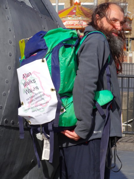
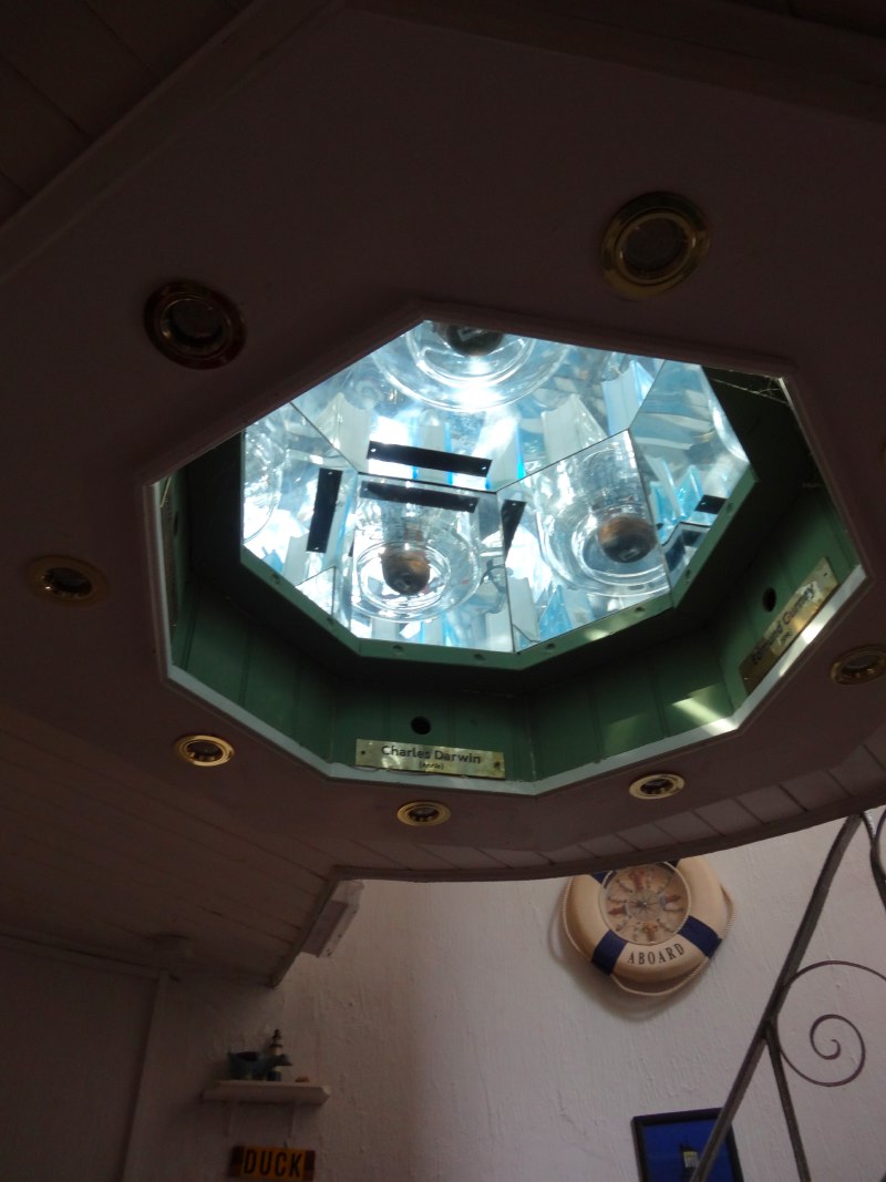
I stayed overnight at the Cedar House at Nash. The landlady told me some of the stories that Rosie had told her when she passed that way on her own journey round the Coast Path. She wants to be the first Brazilian to do the route and sounds quite a character … I’m looking forward to meeting when our paths cross somewhere in North Wales, and maybe hearing some of the stories from her own mouth.

The landlady at the Cedar House gave me one of their business cards.  She told me that she was thinking of laminating a few and pinning them along nearby points of the coast path – an interesting (non-digital!) take on off-path destinations for Claire.

[the following added 13th April, 2014]

Claire described her life as living in a bubble.  I can’t recall exactly what was on the news to prompt this discussion, maybe the aftermath of the Boston Marathon bombing.  In an age of instant global media, the flood of traumatic events that we can do nothing about can seem overwhelming; Claire described a sense of disassociation, ignoring much of the media tumult and focusing on the small world about her.  It reminds me a little of the Hobbits in the Shire in Tolkien‘s writing, although whether that made me Gandalf or Bilbo Baggins I’m not sure.

It was a short walk from Cedar House into Nash where I had finished last night and I passed again the church with the flood plaque and the Waterloo Inn before setting off on the fresh path, across fields, back towards the sea.  Nash is a few miles inland, but a power station stops the path tracking the Usk river completely along the waterside to the sea.

I didn’t start as promptly as I intended and I had a long day ahead, around 24 miles, albeit very flat.  So I set as good a pace as I could, and maybe because of that I had my first detour from the path (aka ‘lost’), although not by any means my last.  I knew the way led near the Newport Wetlands  and when the path joined a small lane near the visitor centre, I turned to go past it (and towards the sea), whereas I think I should have turned the other way and taken a slightly longer arc skirting the edge of the wetlands.

The Newport Wetlands were created as a reserve as a form of environmental compensation when Cardiff Bay was enclosed and in the process losing some wildlife habitats beside the Taff and Ely.  Along the coast there are many wildlife reserves, which at first seem perfect for the Coast Path, allowing walkers to go through managed natural areas.  However, the opposite is the case as it is feared that the volume of visitors attracted by the Coast Path will disrupt the wildlife, so often, as here, the Coast Path skirts reserves.

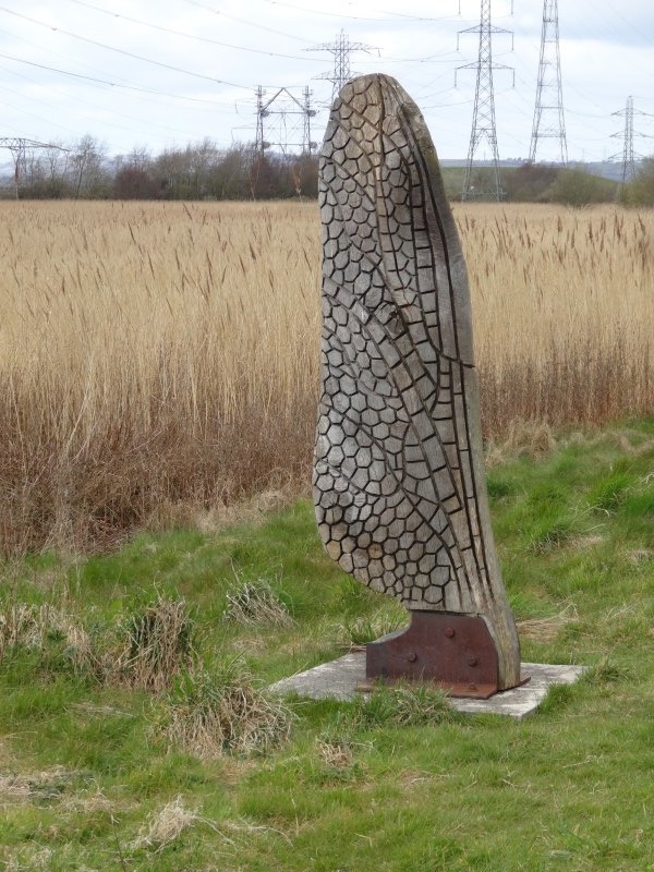
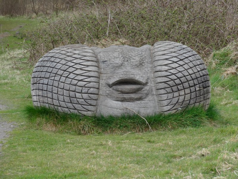
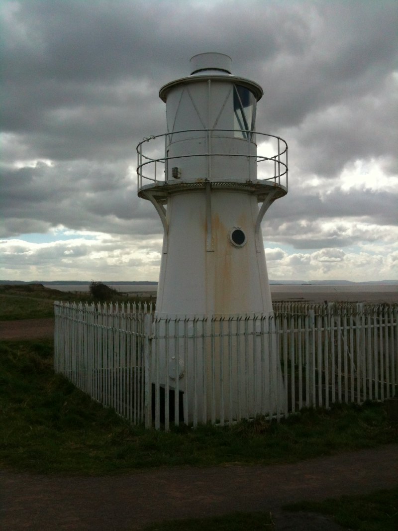
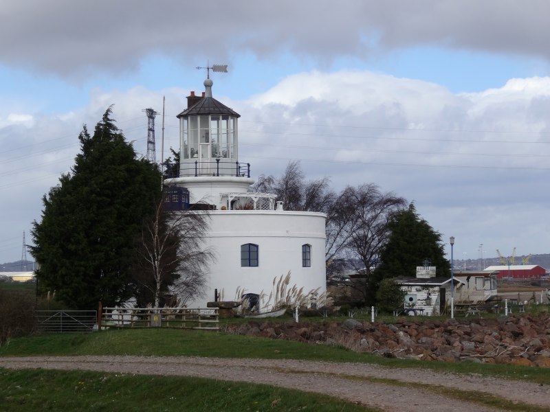
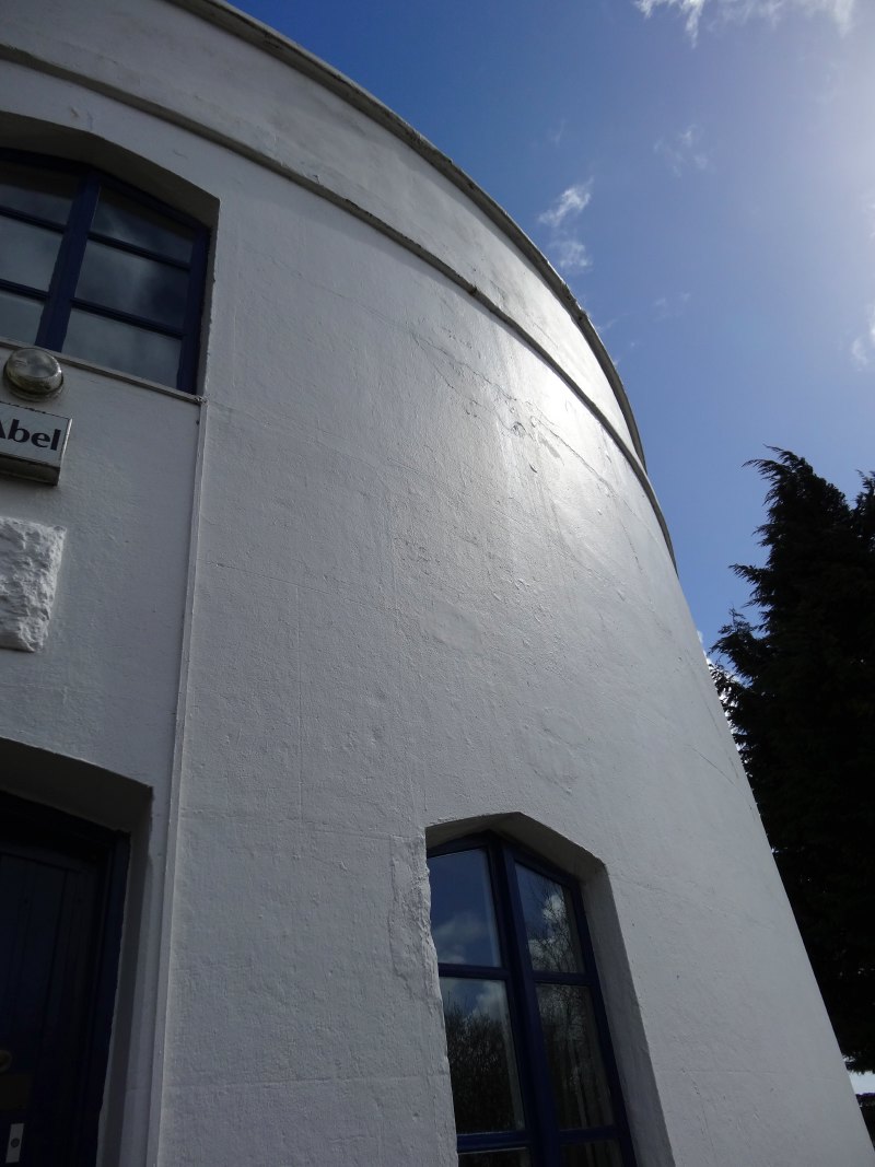
However, I ended up going through the middle of the reserve, itself clearly designed to attract visitors with an extensive visitor centre including a café and artworks along its well-laid paths.  Of course these are paths designed for meandering along, rather than getting through the reserve, and at first I thought I’d need to retrace my steps, but happily it is possible to get out, quite close to the East Usk Lighthouse, smaller sibling to the West Usk Lighthouse I’d visited the day before and could see, a small white speck, far away across the Usk river mouth.  Although the East Usk Lighthouse is now diminutive, it evidently once stood tall, but was partially buried by fly ash tipped in the area.  Interesting that this ex-industrial site is now a ‘natural’ environment.

2013-04-19 10.47.28 2013-04-19 10.48.42  2013-04-19 11.00.37

It was at the lighthouse that I experienced my first Twitter failure.  My original intention was to tweet extensively as I walked.  The previous day, because I’d been walking with Andrew, I’d not done this, but decided to do better this second day.  However, despite there being signal when I looked, it was clearly insufficient, and my carefully crafted tweet was lost, sadly, like getting lost myself, an experience that would repeat until I largely gave up on Twitter.  Even three or four miles from a major South Wales city, technology was failing.

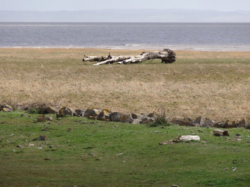
Apart from a few detours inland to cross streams, or bypass land where the Coast Path officers had not been able to negotiate access, the day’s walking was all along a great dyke, with salt marsh leading to grey mud on the right and drained farmland to the left, mini-Holland.

I passed Goldcliff, which has the last remaining ‘Putcher Rank‘ in Wales.  All along the Severn estuary the remains of fish traps can be found, lines of posts going out into the mud, where once wicker baskets would have been laid to catch salmon as they made their way up river.  The Goldcliff Fisheries were the last, but may not be operational anymore, as their web page says they were hoping to restart fishing in 2007 after a period of set-aside, but were waiting for the Environment Agency‘s approval.

2013-04-19 11.19.42  

I had arranged to meet Matt Chilcott and Baronne Mouton for lunch at the Rose Inn in Redwick, about 3/4 mile inland, and clearly I was running late, even before a rain squall forced me to don waterproofs, but I could not find mobile signal to let them know I’d be late.  This was compounded by not being at all sure which road that met the path led to the village.  One mini-mission during the walk was to look out for these ‘off path destinations’, to see how well signposted they were, and here, at my first attempt, I found signage wanting: there were plenty of finger posts to show me the way along the path, but nothing to say what lay even a short way inland.

I came to what I believed was the first road towards the village, but still a mile and half to go.  However, joy, I had signal.  I rang, got through to them where they were enjoying a pint at the Rose and chatting whilst waiting for me.  To speed things along I gave instructions as to where I was and they drove off to pick me up.  Only when a map slowly loaded on my phone did I realise that I had come further than I’d thought and was actually at the nearest point.  Of course, while I had mobile signal Matt, driving in the opposite direction, clearly had none, and the best I could do was leave a message and start to walk along the small lane towards Redwick.

It was not far, but just as I got towards the village I found the lane ahead flooded with slurry.  I’m not sure if the tank had overflowed, or the farmer was deliberately pumping it out, there was some piping around to suggest activity, but not pumping it off the road.   Even with walking boots on, it would have come over the tops, but this day I was walking in just running shoes.  Happily I found a pile of gravel filled sandbags, I assume these were for directing the flow of slurry, but I laid them as stepping stones at the shallowest point and made my way gingerly across.

So I got to the Rose Inn, not too filthy footed and again unsuccessfully attempted to ring, until a car pulled in and it was them.

Matt is from University of South Wales, Newport, but seconded to CMC2 a community interest company set up by Monmouthshire County Council to promote sustainable development.  Baronne is (in the words of his website!) a ‘web frontiersman’ living in Monmouth and planning to create a new web conference BBQsrc in the heart of the Wye Valley.  Both have been involved in the launch of MonmouthpediA, a collaboration between WikiMedia and Monmouthshire County Council to create the first ‘Wikipedia Town‘.  I will see more in a few days when I get to Monmouthshire, but essentially the town has been filled with QR codes that link to special Wikipedia pages for each monument, shop, and indeed anything you can stick a QR code to.  In addition free WiFi access has been provided in areas of the town to make it easy to snap QR codes with a smartphone and see the associated web content.

Unfortunately our lunch was rather brief due to my lateness, mutual lostness and Matt‘s afternoon meetings, but Matt did have time to drop me back at the path, so I didn’t have to brave the slurry lake again … however, I hate to think what his car smelt like for the rest of the day.

As a schoolchild on a fine day I would sometimes walk out from Cardiff, either on my own, or with Martin, my best friend.  My preparations were slight.  I would fill up my water bottle, one of those metal military-style ones that could clip to a belt.  If I had any money I might go to the baker’s and buy a single cob roll, the kind with a crusty top; from the fridge I would take one or two Dairylea cheese slices, and, if I was lucky, maybe a chocolate biscuit.  I rarely had sufficient money for the bus, and for rainwear I had an old cut down raincoat of my Dad‘s, that was sufficiently large that I could wear it more like a poncho.

2013-04-19 14.58.50I most often went north, towards the low hills that surrounded the city, and the foothills of the coal valleys beyond, as this was the fastest and most pleasant route out of the city.  Occasionally I would go west towards Penarth and the coastline beyond, although that involved a good few hours’ walking across the city before I reached the countryside.  Only once or twice I went east along the coastline I had walked on the first day.  With a ten-mile radius for a reasonable day’s walk, that took me only part of the way to Newport, but still, my abiding memory was one of acres of flat drained farmland, an seemingly endless seawall, and the thick foul grey of estuary mud.  To be honest, for a 16/17 year old’s eyes, boring.

This was one of the reasons to get this bit of coastline done first, to ‘get it out of the way’, but I was also aware that I no longer had the eyes of a 16/17 year old, and that this area was rich in wildlife.  So 36 years later, three times the age of those eyes, it did seem different.  An austere beauty, but beauty nonetheless, and although it was always the same, yet it was not; my eyes after hour upon hour of gazing at flat drained land, dyke, salt marsh, grey mud and sea, became aware of variations, changes in the quality of the sea-washed grass, the flotsam, and occasional lines of abandoned fish-trap poles.

I have no vocabulary for these subtle differences, and I struggle, without the scaffolding of language, to recall these now, and yet, in the midst of the time, I developed the tacit understanding of the inhabitant.

I live my life in mortal fear of boredom, I hate to be early for meetings in case I am stuck sitting, standing, waiting; if I am setting off somewhere and realise I do not have a book, or paper, I begin to feel out of breath, my heart rate rises – a true phobia.

And yet …

In all those miles of monotonous walking, I never felt bored for a moment.

2013-04-19 15.10.20 2013-04-19 15.09.05

Maybe I was lost in my own thoughts, maybe lost in the landscape, maybe simply lulled into a semi-trance by the constant rhythm of the walk.

So it was, with surprise, when a man walked along the path towards me and greeted me by name.

It was Jez, a lecturer in the Arts Faculty at UWE.  He had left a note on my web site to say he would try to meet up, but I had entirely forgotten.  A few hundred yards on from where we met a road came down to the sea and at the end of it was JezVW camper van, like the one Fiona and I used to have many years ago when the girls were little.  He had driven down the road from his home, which was not far away, and waited, I don’t know how long, for me to come along.

Jez made me a cup of tea … well actually I think we got through several, he fed me biscuits … and was there cake too, I can’t recall?  He told me about his ongoing chef d’oeuvre Coastline.  On weekends and holidays Jez walks the coast of Wales pushing his bike with a small video camera mounted on the handlebars, and then cycles back to where he has left the van.  Each section becomes a audio-visual work, with time-lapse video overlaid with soundscapes, or interviews … and he recorded our conversation, so maybe on one of his videos there will be my voice.

After a while Jo and Jeannie, his wife and daughter, came cycling down the road to say hello, and then after they left we talked more.  I felt so blessed at this rich and unexpected meeting and privileged that Jez had taken so much effort to make it happen.

However, I still had many miles to walk, and so, reluctantly, set off again.

I can’t recall when it first came into view, but for much of the day the Second Severn Crossing dominated the view, first quite small in the distance, but gradually closer and its size more impressive, its white concrete piers striding for five miles across the Bristol Channel, to Bristol docks, the seaside towns of North Somerset and the brooding presence of Hinkley Point.

As the bridge drew closer, the path temporarily diverted inland, to the north side of the M4 and then back again less than a mile from the bridge when it came out onto a concreted waterside path leading towards and then under the bridge.

2013-04-19 18.07.06The noise of traffic overhead is in its way ineffable, the ongoing low-pitched rumble broken by the periodic rattle as a lorry or car crosses directly above (hear it here).  This all set looking through a tunnel of concrete piers, rising from the water as far as the eye can see.

However impressive the Second Severn Crossing is, once I passed under there was no looking back, for, far ahead, lay the old Severn Bridge.  By ‘old’ I do not mean medieval stonework, not even Brunel‘s Victorian ironwork, but the 1966 motorway bridge.

My target for the night was to cross the bridge and sleep at the Travelodge at the motorway services that used to be called ‘Aust‘, but now Severn View.  This is a detour from the Wales Coast Path, which passes the west end of the Severn Bridge, but stays firmly in Welsh territory.  My English diversion would be for nostalgia’s sake.

As a child I recall the first time we crossed the then’ ‘new’ Severn Bridge.  Until that time the only way to cross was either to wait for the ferry at Aust, or to drive thirty miles north along the bank of the Severn to the first bridge at Gloucester.

We were driving in a blue Ford Popular, Mum, Dad, Jacqui and I.  When Jacqui and I were very little we had another Ford, one of the black taxi-cab style ones, but this was the modern saloon with rounded curves.  Dad loved the inventions of the modern world, and so it was not just Jacqui and I who were excited as we approached this wonder of the 1960s white heat of technology.

In years to come I would often find my imagination had made things bigger than they were, so was disappointed to see them in reality.  But at this age and this time there was no disappointment.  We gawped in amazement at the immense size of the bridge, until Dad said, “this isn’t it yet”, we were still on the maypole-suspended Wye crossing that leads on to the twin-towered cable suspension of the Severn Bridge itself.

In memory of that day when we stopped at the services and walked along to the observation point where we could look down from the red sandstone cliffs across the expanse of the Severn and the glory of the bridge, I would cross over and stay the night on the far side.

But there were still many miles to go, and it was two and half hours later before I got there.

Soon after the Second Severn Crossing was a vast, strangely shaped, brick building at Sudbrook that I realised was the air pumping station for the Victorian railway tunnel that dives through the rock deep below the water.

Sudbrook camp
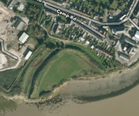
I went slightly wrong at Sudbrook, when the Coast Park sign seemed to direct me through a tiny rough gap between undergrowth onto a small semi-wild playing field.  I thought I’d got it wrong and backtracked onto the main path that skirted the area on the landward side.  It was only when I got to the other side that I saw the far more clear sign from the opposite direction.  Now, with the benefit of satellite maps, I can see a half round embankment and the name of the road leading to it, ‘Camp Road‘, clearly an Iron Age fortification, most likely once a full circle, but cut in half by riverside erosion.

Not much further again is a small estuary. On the map it is marked simply ‘Red Cliff‘, which is hardly a defining feature in this area. Small boats lie on the mud and a tiny lighthouse rises on the diminutive headland beyond.  The Severn Bridge (the proper one!) is now close, barely two miles away across the water, and in the middle of the flow, a rock with another small light, Chapel Rock on the map, with the remains of St Twrog’s Chapel on it, just a small piece of broken wall.  It is marked as entirely below the high tide mark and accessible only at low tide, but a small grassed area clearly does always peek above the high water, suitably isolated for the medieval hermit.  It was evidently well visited in the 14th century and a light maintained there, but happily abandoned by the time of the 1606 flood.

2013-04-19 19.41.18The path does not cross the tiny stream, St Pierre’s Pill, but instead cuts inland to the village of Merthyr Tewdrig, where a wooden statue of Brenin Tewdrig, king and saint of Gwent, who in a tale of Arthurian tenor, abdicated in favour of his son to live a life of prayer, but then took up the sword to defend the monastery from the despoliation of the heathen Saxons.  The Saxons were defeated, but mortally wounded Tewdrig was on his way to the isle of Flatholme to be healed when he succumbed to his wounds and was buried here.

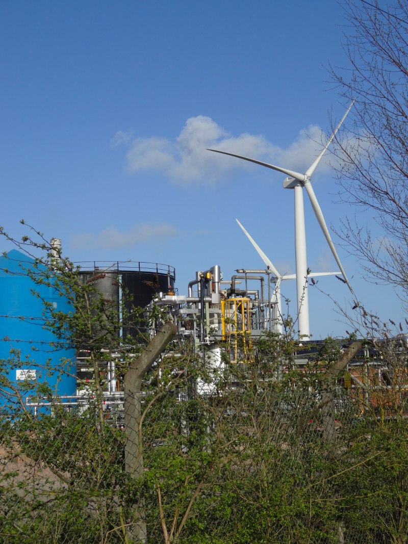
It was approaching eight o’clock and I had been walking for more than twenty miles when I passed through the large industrial estate on the west bank of the Severn.  I passed a warehouse where they were still at work, wind-turbine towers laid out in ranks, and then, eventually, onto the bridge itself.

Although it is a motorway bridge there is pathway each side for bicycles and walkers; strictly the southern side is for walking and the northern side for bicycles, but in practice there seems no difference and I wasn’t sure how to get onto the northern side anyway.

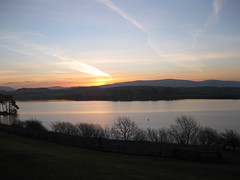
I looked back along the M48 leading into Wales, a deep sunset forming in the west, and then out along the bridge arching to England, nearly two miles away; first the single maypole support of the Wye Bridge that I remember so well, and then the dual towers of the box-girder suspension bridge.

It was late so the traffic was not so heavy, and it was not so much the sound, but the feel of the vibration of trucks passing and the shaking and rattling of the structure that made me glad to know it had stood for 47 years and was unlikely to collapse just now, whatever my senses told me.

I was crossing the bridge for nostalgia’s sake, thinking that it would be a long slog, exposed to the elements.  Worthwhile, I hoped, for its symbolic value, but not of value in itself.

Nothing prepared me for the deep serenity of that crossing, with the lights and sound of the traffic still there was a sense of peace beyond anything I felt at any other point of the long journey that was to come.

2013-04-19 20.35.49
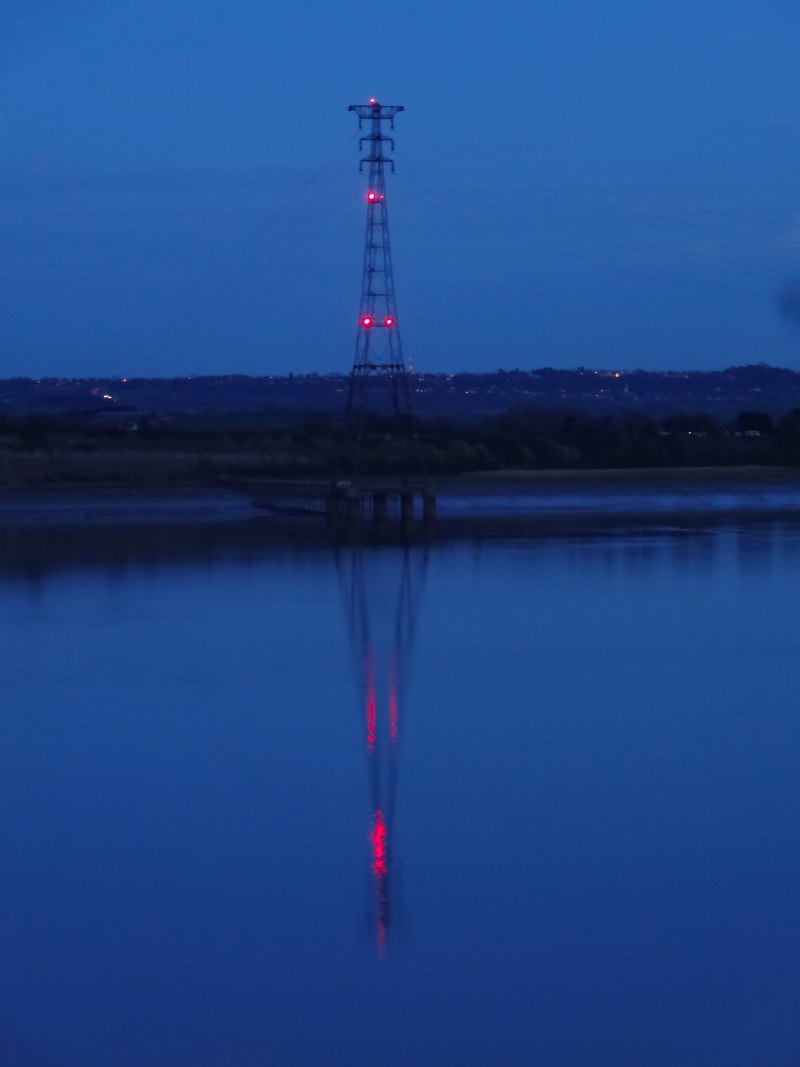
I started to cross with the sunset and the day moved from dusk to evening as I walked, for nearly half an hour from side to side.  First past the barracks on the low headland between the Wye and the Severn, and then out along the wide span.  The lights shone on the wide span of the Second Severn Crossing, now many miles downstream towards the sea, and red lights topped the towers close at hand that suspended the electric wires connecting the Welsh and English grid.

Half way between Celtic and Anglo-Saxon worlds, above flowing water, yet suspended in air, it is no wonder that there is a magic.

The waters far below seemed still in the half light, and sounds of birds were muted by reflection.  I remembered a time as a schoolchild, standing on the bridge at the top of the hill in Penylan in Cardiff, looking out over the dual carriageway of  Eastern Avenue, hearing the traffic below, and then realising that behind the sound of engine and tyre on road there was a deeper silence.

Here, the deep peace needed no seeking or meditation.

And so to rest, at the far side, a Travelodge, the modern equivalent of the monastic hospital, but the refectory was closed, I was too late, as if vespers had already been called, but more likely open during commuting hours only.  So my meal was the pies of the garage, open all hours, a traveller’s fare.

day 1 – Cardiff to Newport

It all begins: a lost Garmin, a drowned land, a lighthouse with a Tardis, a bridge that moves, and an interview in woodland

miles walked: 20
miles completed: 20
miles to go: 1040.3

The first day started at the National Assembly building in Cardiff Bay. Its huge awning would have been good shelter if it had been raining, but is very exposed to the winds!

Fiona and I had spent the night at Jolyons, which is just opposite the Millennium Centre, a very special tiny hotel with six rooms, each sumptuously furnished, and miniature cafetière as well as the standard kettle and teabags and … a tiny tin with doll-sized Welsh cakes in it.  I’d meant to take them to try on the journey, but forgot 🙁

A few more family and friends gathered and, after customary photos and checking that the Garmin, which had arrived the previous day, was picking up GPS and set to track me, we set off.  As the start/end of the Wales Coast Path is at Chepstow (where I’ll get to first thing Saturday morning, there is no obvious ‘starting here’ point when you pick it up in the Bay, so we opted for the Merchant Navy memorial directly by the water side in front of the Welsh Assembly, a sculpture that is both boat hull and face.

bythehead headalonesettingoff

A few folk needed to leave nearly straight away, but Fiona, Esther, Janet, Rachel and Andrew were walking with me for a short while.  We had only gone perhaps ten minutes, when I realised I didn’t have the Garmin unit. After searching pockets, we retraced our steps back to the Assembly area, for more scouring of ground and emptying of bags.  The security folk at the Assembly even put my rucksack through their scanner in case I’d slipped it in, but to no avail.  The procurement folks at Birmingham had gone to great lengths to get it to me on time (despite me asking very late!), so sad not just at the lost value, but for their wasted effort.1.

So, starting with a minor disaster, but if that is the worst that happens during the journey I will do well.

So, albeit a little deflated, I said farewells to family, and Andrew and I set off together. Andrew Morgan was one of the Ramblers Cymru team who had recced the path over several years, so it was marvellous to spend the first day’s walking with him.  As we went along he could tell me of the compromises, planning issues and occasional bureaucratic barriers that meant that the Ramblers’ idea of the best route of the path was not always where it goes.  In particular the Cardiff section takes a long detour inland along busy city streets as it has not yet been possible to negotiate a route through the city docks.

When you first hit the sea it is near the city sewerage farm and at an inlet beached with broken bricks and the detritus of an industrial past.  This is the past of only maybe a half century, but there are signs both in Cardiff and Newport (and I’m sure in July when I go through Swansea and Port Talbot) of the fact that this area was once the industrial heart of the world and Welsh iron and steel (and copper earlier) fuelled global engineering.

As we crossed the Rhymney we were met by Ted Richards, an ex-Howardian pupil, a couple of years ahead of me. As we’d been delayed by an hour by the fruitless Garmin search, he must have been waiting ages (sorry, Ted), so could only join us for literally a few hundred yards before leaving for a meeting, but wonderful to meet with another ex-Howardian.

From the Rhymney to Newport, the path follows the sea wall. To the right lie mudflats and salt marsh, driftwood strewn like bleached dinosaur bones along the base of the dyke.  To the left drained farmland spreads far and flat, but well below the high-tide line.  At the end of the day, when I got to Nash I visited the church, which, along with others, has the flood line marked on the wall, when in 1606/72 a tsunami or storm surge swept up the Bristol Channel (Môr Hafren) and funnelled by the Severn Estuary drowned vast swathes of land and killed thousands.3

2013-04-18 12.55.48  2013-04-18 13.37.03

It makes me think of the Lost Cantrefs in Cardigan Bay, inundated on a stormy night, when the drunken revellers left open the sluice gates.  The dinosaur bones suddenly become the bones of the giant cattle of those half-faerie times, washed by the relentless Atlantic waves; and I wonder about that future for this endless fight with the sea, hubris in the face of global warming and rising sea-levels.

If a Severn barrage is eventually built (and I recall plans for this when I was a child), then this area will change dramatically. The environmental damage will be incalculable as habitats of sea birds will be destroyed, but if projects like this do not go forward then these habitats will be equally destroyed, albeit over a longer timeframe, and with them the lives and homes of millions across the world.

We are a people who always live at the edge, on the margins.  Our cities bead the ocean fringes, clustered in flood plains and river deltas, like Canute challenging the tides, the elements, the very earth. Canute retreated when his feet got wet, but globally it is more like those Chinese cockle-pickers who were trapped on the Morecambe sands some years ago; the seas are coming and they will overtake us.

I’m afraid Andrew did not get a relaxed day’s rambling (sorry, Andrew) as it was going to be a heavy day and doubly so after the early delay. But we were kept going by the promise of tea and cakes at the West Usk Lighthouse. As we neared it I remembered that it had been weeks previously that Danielle had offered this when I asked to pop by and talk, and I had meant to mail back over the last few days to confirm when I was coming. Would she have remembered, or would there be no-one there and I had driven Andrew stoically on with no reward?

2013-04-18 14.32.05

The lighthouse appears at first a small white dot along the line of the dyke, one of two either side of Usk mouth guiding ships into Newport, no rocks to crash against, but thick mud that will drag a ship just as terminally.

Even from the outside it is a magical place, with a small summerhouse/playhouse in the garden area, its own tiny light a-top.

As we made our way to the port-holed door, a smiling face was at the window, replacing screws in the heavily storm shuttered windows. This turned out to be Frank, the co-proprietor.  He had no idea of who we were, but welcomed us in anyway and Danielle, who sadly we did not meet as she was ill with a cold, told him where to find cake; "she never gets cake for me", he said.

Inside, the lighthouse is even more magical, a mixture of Dr Who and nautical paraphernalia, a Tardis, Dalek (signed by John Pertwee), rooftop hot tubs, wonderful views, and glimpses of romantic bedrooms, with beds on platforms to give uninterrupted sea views (they are registered for marriages!).

Danielle‘s glorious lemon cake and Frank‘s tea and coffee refreshed tired feet, and Frank told us a little of the move to the derelict lighthouse, over twenty years previously, escaping the rat race of London and a faltering record industry, that did not know how to meet the changing times, even then before the rise of internet downloads, Napster and iTunes.  He told us of the work they did together, a DIY job of massive proportions, and of the raising of the new light (this time with professional help!), copper and glass suspended above the spiralling staircase.

Some of their guests come from abroad, flying in from northern Europe to spend a single night in a real lighthouse, before flying back the following day.  Hundreds, maybe thousands of miles, for a night they will never forget.

2013-04-18 14.38.31 2013-04-18 14.41.01 2013-04-18 14.44.23

[the following added 13th April, 2014 — nearly a year on! …]

Reluctantly we left the magic of the lighthouse and set our feet once more towards Newport.  My original plan had been to get to the Newport Transporter Bridge, to talk to people there before it closed at 5pm, but it was already well after four, so there was no hope of that now.  As I would increasingly find in the days and weeks ahead, my plans for when I would reach where were always widely optimistic.

The Newport Transporter Bridge is a miracle of engineering.  I had often seen it from a distance, two pylon-like towers straddling the Usk, with a high bridge-like connection far, far above the water and land.  I think I had assumed that this was a raising-lowering bridge, but in fact it is no bridge at all, but more like a giant version of a ski-lift.  Below the bridge-like structure, suspended by cable and chain, is a gondola, the size of a small landing-craft-style ferry.   When the ‘bridge’ is open this shuttles back and forth taking half a dozen cars at a time across the river.

We pass through the nether reaches of Newport and come to the Transporter Bridge.  It is, as we expected, closed, but from the notice it sounded as if it hadn’t opened for the year yet even though it was well after Easter.  Even not in operation it is impressive, painted bright blue metal and woodwork, like a Victorian bandstand, the gondola sits at eye level while the support bridge towers above.

2013-04-18 16.55.27  2013-04-18 16.57.07  2013-04-18 16.57.47

After the Transporter Bridge, Andrew and I part ways, he to the railway station to take a train back to Swansea, and I to continue my way to the other side of the Usk, so close, but so far.  When the Transporter Bridge is in operation it is an official part of the Coast Path, cutting several miles of Newport road walking from the journey, but I must travel up the river bank to the new concrete arched road bridge.

The banks of the Usk are littered with the remains of old wharves, massive timbers and rusty bolts, rising like tangled architectural forests from the thick grey estuary ooze I am so familiar with from the Taff and Rhymney rivers of Cardiff.  It has an austere nostalgic beauty and one can almost hear the creak of ships against timber, barrels rolling along docksides and the shouts of longshoremen winching cargo into rat-dark holds.

My reverie of the past had to give way to the present as I was due to give a radio interview by telephone and wanted to get to a landline in Nash, another five miles or so.  I’d said I’d be there by half past six, but as I crossed the river bridge, heavy with end-of-day traffic, then walked a long road through an industrial estate to get me back to the east side of the Transporter Bridge, I realised I was not going to make it.

The path along the east side of the Usk towards Nash runs through a narrow band of woodland area only yards from breakers’ yards, oil tanks and wind turbines, and yet seeming a world in itself.  Beside the path the top of a thick upright branch has been carved into a mushroom head, the wood still fresh white and a chipping lying amongst the grass, a guerrilla sculptor only recently passed.

2013-04-18 18.01.55  2013-04-18 18.13.34 2013-04-18 18.34.32

In the end I gave the interview on a rough wooden seat, cut from old railway sleepers.  I had to admit that I had started in this direction as I felt it was likely to be one of the least interesting parts … although I was willing to learn otherwise.  The interviewer, a Newport lass, forgave me my ignorance and assured me that Newport was in fact one of the best places in Wales, although I’ve a feeling slightly tongue in cheek.

I had arranged to meet Fiona, Janet and Rachel at the Waterloo Inn in Nash for dinner at 7pm, and got there just a little ahead of them, so I just had time to look around the church with its flood mark at head height, despite being several miles inland.

And so, with a good dinner inside me and dropped at my bed and breakfast, my first day ended.

  1. The morning after now, and I have double checked my pack overnight, I will need to buy another along the route and rely on ViewRanger‘s GPS track in between, although that cannot be as fine grained because of power drain.[back]
  2. The date is 1607 by modern reckoning, but at that time the year end was Lady Day, 21st March, so it was counted as 1606 until then.[back]
  3. A year later, I am still amazed that I never learnt about the Great Flood of 1606 in school as it was such a cataclysmic event for South Wales and Somerset, and following a winter of widespread coastal flooding a salutary reminder of the power of the sea.[back]

Journey’s beginning

River Severn (Synwell @ Flickr)

I am travelling on the train from Birmingham to Cardiff along the banks of the Severn; the river spreading, sand-bank strewn, to the left.  Soon we will pass Chepstow and thirty minutes later into Cardiff, the distance it will take me two days to travel by foot on Thursday and Friday.  We say time is money, so are the miles travelled in two days more valuable than the miles travelled in half an hour, or the other way round?

Although I’ve not started walking yet, already time and space become confused or interchangeable in my mind.  On Sunday, Steve Gill mentioned Newgale Beach and instantly I thought ‘late June’ (when I arrive there walking).  On my first day’s walking, the day after tomorrow, I will call at the West Usk Lighthouse, where they have offered me tea and cake, and where they have a Dalek (joy) and Tardis.  Journeys are time travel.

Tomorrow evening I will, in a sense, start the walk psychologically as I am giving a public pre-walk lecture at Cardiff Metropolitan University’s Llandaff Campus.  This will be a great joy, partly because of current collaborations with Steve and others at Cardiff School of Art and Design and partly because of childhood associations.

I am a professor in computing, but my computing A’level was studied and examined in the Llandaff site of what was then an FE college.  At that point Computing was not a standard school subject, but one of the lecturers at the then FE college taught a Friday afternoon computing class to a number of pupils from Bishop of Llandaff High School and Peter Lloyd and myself from Howardian Comprehensive.

Our studies there were not unconnected to walking as each Friday took us rain or shine on a long trek from Roath Park through the streets of Cathays and across Llandaff Fields to the campus at Western Avenue and back; once accosted, menacingly by two policemen in a Panda car driving down the footpath.

Because we were studying at the FE college, we had access the library and in particular there were maths books (joy), some clearly not suitable for the vocational courses that were then taught.  I have a feeling one or more of the lecturers suggested books to read themselves rather than for their students.  This, along with the Saturday morning Open University programmes (so, so sad when they went off the air), was instrumental in my own learning of maths beyond the school curriculum.  I am sure this was in turn helpful when I later sat entrance exams for Cambridge (not common for a comprehensive school), won a scholarship and through that was invited to take part in first the British Mathematical Olympiad and later the British team to the International Mathematical Olympiad in Romania.

It is many years on, the FE college is gone and the site is now part of Cardiff Metropolitan University, but it is fitting that the place that played such a strong part in my own academic career, is now the start point for a new journey.

digital travel – Band4Hope

One of my research interests is the connections between the digital and physical world, and I have just come across Band4Hope, which is both a lovely example of this and a wonderful project.

The idea is that you get a band with a unique ID encoded on it.  You then enter the code into the Band4Hope website and after a few days pass it on to someone else.  They do the same in turn.  Overtime you can track the band as it makes its way across the country or around the world.  Before you pass it on you are also encouraged to do some small act of kindness and record these at Actions4Hope so that a record of this also spreads around the world.

It is strange how things come together. Actions4Hope is a very different project, but also makes me think of One Million Lovely Letters that I blogged about recently (Wonder Women). Both are about making small but significant differences; big differences are made by many tiny acts and each act may make a big difference to those it affects.

Band4Hope is a project of Lucie, Lachlan & BowWow (Vagabond Adventures) who travel the world in a Land Rover doing interesting and worthwhile things.  It reminds me a bit of my own idea as a teen to travel when I left school .. but with a trek cart full of my DIY tools and basically tramp doing the odd house repair for an old lady, small acts to improve things with minimal impact.  So, while things didn’t quite work out that way for me, maybe now my ‘tool chest’ is my computer.

I was also reminded of two people I met during my February travelsLeanne at dot.rural in Aberdeen and Dimitrios at Horizon in Nottingham.  Leanne’s PhD work (in architecture, before she was at dot.rural) looked at the lives of objects in the home (I hope I have got that right Leanne).  Dimitrios is nearer the beginning of his PhD journey, but also interested in objects and their digital traces.  It is one of several introductions that I have found myself making in connection with the Wales walk between people I had not encountered before. This includes two academics in different departments at Bangor who had never met.  It is as if my own intellectual and spatial travels are starting to make threads between people afar — very exciting.

I found a map

Sometime soon I need to check which maps I already have and fill in the gaps.  My OS maps are ordered on my shelves roughly by region, and the Welsh maps sit together in a few geographic groups.  Only then I spot, in the middle of a shelf, after the last of the Welsh maps give way to Stafford and the Peak District, just beyond the Isle of Man, an old, cloth map, stained by age, the cover long lost, and only a tattered bleached red remnant, suggests it is of the old one inch OS series.


Opening it up, I find it is of Cardiff and Glamorgan, the valleys black spider webs of railways before Beeching, a dark brown stain (water or campfire? odd that the two are indistinguishable with age) obliterates an area north of Barry Island.


My eye and finger trace old places walked, one day up beyond Caerphilly, rain-soaked amongst the coal tips; and places of childhood, Dynas Powis for the Whitsun sports, Ogmore for the dunes.  Some I’ll pass through again in a few months, others who knows?  But the map, a thing of magic, sometimes taking you away in your imaginations to places you have never seen, and sometimes back into your past.

February travels

I am back at home now after two weeks travelling up and down the country (see talking about Wales from south to north).  Gave five talks, visited seven cities in three countries; some fantastic conversations with old friends and new.

At Birmingham I was taking principally to MSc students.  At the end of the talk the questions were mainly from one of the academics, but afterwards as we walked across the campus, then the questions came and ideas flowed.  The Aristotelian school of philosophy is also called The Peripatetic as they pondered and taught while walking round the colonnades of the Lyceum in Athens.  There is something about walking …

At Brunel in West London I went to an Italian restaurant … in the UK with an Italian!  High praise indeed.  I forget the name, but ask Alessio!  They have an enormous indoor running track and athletics centre where Usain Bolt trains.

At Cardiff I had no talks, but lots of talking!  In the morning I was able to visit Ramblers Cymru, tucked down behind the station towards Butetown … I had never been in that part of Cardiff before.  Gwenda and Elly gave me a warm welcome with cups of tea and while I was there @jacswork rang Gwenda and she passed him over to chat about SeenSend.  Due to familiy and work commitments, he can’t get out to the hills so has become a virtual walker: he invites others to post photos of places they are walking and he chooses some as inspiration for paintings.  SeenSend is looking for more artists to join in, so if you are a walker and want to inspire or an artists and want your own virtual tours, check it out!

As I walked through Cardiff city centre (familiar and yet so different), I dropped off at the tourist information to get some of the Wales Coast path leaflets (you can download the PDFs, but the long multi-folds print too small to be readable) and also into St David’s Hall to see the Short Memory Stick (Ffoncof Fer) part of the Triad exhibition by Gareth, Morgan and Ioan Griffith.

Aneurin Bevan (1897 - 1960)

Aneurin Bevan (1897 – 1960)

Chatting to a Big Issue seller while his oh so patient (and well wrapped up against the cold) dog rolled over inviting passers-by to stop and tickle, I remembered that many in the UK and across the world walk and sleep out not through choice.  After Christmas when I wrote about Epiphany, I was focused on the journey of the magi, but after the Magi leave in the Christmas story there is the long journey into Egypt to flee Herod, the tiny baby Jesus a refugee, asylum seeker.  Then as you turn into Queen Street the statue of Aneurin Bevan, architect of the National Health Service, one of the glories of Great Britain … all from a Welshman brought up in mining family in the valleys.

The city centre campus of Cardiff Metropolitan University is set in Howard Gardens … on the site I think where my mum went to school in the 1920s.  Steve Gill showed me round, always so many interesting things lying around in a product design department, before lunch with Olivia Kotsifa, who runs the FabLab at Cardiff, to talk about the potential for a mobile FabLab to tour Wales, rather like the FabLab Truck in the Netherlands.  Also talked to Claire Haven-Tang about digital tourism and she gave me so many contacts, that I have still to follow up.

Monday saw me down in Southampton (deep semantic web territory) visiting Claire Hooper and mc shraefel and others.  Talked technology and education with Mike Wald and Yvonne Howard and technology for walking wales with Hugh Glaser (creator of sameAs.org) and Andy Sanford-Clark (creator of the house the twitters) — loads of ideas … just need another six months to prepare … but yikes, six weeks :-/

Wednesday and Thursday had successive talks in Horizon (Nottingham) and dot.rural (Aberdeen), two of the EPSRC funded Digital Economy hubs … just a bit of a long drive apart.  The long drive was broken by a night at Annandale Water Days Inn as lovely a view to wake up to as Killington Lake on the way down, and even a little balcony.  Days Inn certainly know how to pick good motorway service stations!

At both, especially dot.rural I felt I was preaching a little to the converted as I discussed issues of physical, social and economic marginality and the way this is often exacerbated by digital exclusion.  As with other places a mixture of rich conversations with old friends including Genovefa, Tom, Steve and Alan at Nottingham and Konstantinos at Aberdeen, but also met so many people and learnt a lot including serendipitously someone at Notts who did her first degree in Aberystwyth.  I know the work at Nottingham well, but not dot.rural and realise there are so many points of connection, both for the Wales walk and also projects on Tiree.

Finally on Friday I met Philomena de Lima in Inverness to hear about to some of the work  at UHI on social and policy issues for the rural economy at UHI Centre for Remote and Rural Studies.  And after leaving Inverness then a beautiful drive down the Great Glen back to Fort William and Oban … But what was that thing like giant hippopotamus in the water?  I guess just normal highland wildlife.

award for art of cartography

The Ordnance Survey in collaboration with the British Cartography Society, have announced an award, the OS OpenData award, for work that spans art and cartography, using the hard data supplied in OS OpenData but combined with the flair of the creative individual.

The award celebrates the fact that “The creation of maps is a fusion of art, design, science and IT …”, reflecting some of the issues I’ve raised myself in recent posts such as “flowing cities – beauty in bits and buildings“, “maps in textiles“, and “Stilgoe on why precision is not always best” as well as general awareness of the importance of non-standard maps.

talking about Wales from south to north

Killington ReservoirI’m heading down south, for last trip before the walk, taking in five talks about the walk, from Southampton to Aberdeen, with Birmingham, Brunel and Birmingham between! I’ve also got meetings discussing it at Cardiff and Inverness, not to mention time at Talis and my future sun-in-law’s stag do!

Last night I stayed at the Days Inn at Killington Lake, near Kendal on the M6. It is rather cheaper than the hotel at Westmorland Services near Tebay (definitely the best motorway services in the country!), but as a view to wake up to may actually beat it.

Talk timetable

The talks are  all called ‘Treading Technology” with similar abstract to the first talk I gave in Swansea last autumn … although updating the slides a bit.

Mon, 18 Feb, 3pm, HCI Centre, University of Birmingham, (location G26 in Mech. Eng.)

Thurs. 21st Feb, DISC, Brunel University, London

Mon, 25th Feb, EECS, Uni. of Southampton

Wed, 27th Feb, Horizon, University of Nottingham

Thurs, 28th Feb, dot.rural, University of Aberdeen

I’ll also call into Ramblers Cymru and Cardiff School of Art and Design on Friday 22nd and University of Highlands and Islands on Friday 1st March, so if you are near any of these locations and fancy a chat, or dropping into one of the talks, give me a shout.

Stilgoe on why precision is not always best

Good article “You can have too much precision” on Guardian Geography blog by Jack Stilgoe picking up similar themes to my recent blogs on maps and mapping:

“The search for precision is a defining feature of scientific reductionism. But as our maps and models become more sophisticated, there is a danger that we lose track of why we have them.”

The text starts off looking at maps, including the Borges 1-1 map, but then applies this to climate science asking whether exactitude is more important than communication.

(cc) loronet@Flickr

Incidentally, if you don’t know the Borges story, it is repeated in the above post and basically is about the end of geography in mythical land due to the desire for ever and ever more exact maps, that are eventually the same size as the land being mapped.  The story ends:

In the deserts of the west, there are tattered ruins of that map, inhabited by animals and beggars

I have often thought that this would make a wonderful art project1, to literally make ragged fragments of 1-1 map and leave them in the locations they represent.  Anyone care to join me in this sometime (after the walk!), something you do in different places, sort of distributed-flashmob-like.

  1. Maybe my fascination with this is inspired in part by the 1966 television series “The Master“.  Two children are stranded at a secret base inside Rockall where an ancient scientist plans to take over the world. Deep in the heart of the base there is a chamber containg a huge map (not life sized, but BIG) where, at one stage, a minion is zapped to a charred patch by a giant laser.  The series was based on the novel “The Master: An adventure story” by T.H. White, but the episodes of the black-and-white TV series are now sadly lost.   [back]

flowing cities – beauty in bits and buildings

Flowing CityI have written quite a lot about the use of local maps that emphasise the identity of an individual or of a place.  However, there are also incredibly creative uses of maps that are more in the Cartesian tradition, combining geospatial data and digital mapping to creative visualisations that may be informative, subversive, beautiful and, at their best, all three at once.

As part of her master’s studies Margarida Fonseca has created Flowing City,  a stunning collection of visualisations of urban data1. From routes of Beijing cabbies, to galvanic skin response in Greenwich, and social network language in Milan, the examples Margarida has collected show the amazing ways different projects and individuals are remixing their own data, or publicly available data in order to make the often unseen patterns around us visible.

Urban computing with taxicabsGreenwich Emotion MapMaps of Babel

Many of the projects are by university research groups, but I’m also aware of many basic, but often transformative uses of data by simply mixing open data with Google maps or other similar technologies.  I’m wondering what it would be like if visualisations such as those found in Flowing City could be in the hands of every community group, urban or rural: campaigning for better transport, understanding education needs, preparing for floods.  But while pondering that I have downloaded a copy of Margarida’s thesis.

So, just browse the Flowing City site, compare with the Maps in Textiles I posted about a week ago: art and technology, the Cartesian and the idiosyncratic, may be not so far apart.

  1. Thanks @aquigley for sharing this link on Twitter. [back]