Day 54 – Penrhyndeudraeth to Harlech

a day on the coast path with no sea, oak wood and hydroelectric, exhausting, depressing, and encouraging at the end

10th June 2013

2013-06-10 10.48.57Penrhyndeudraeth is where the toll bridge crosses the Afon Dwyryd, which runs down the Vale of Ffestiniog.  The official Coast Path for some reason does not cross the toll bridge.  I had assumed this was because it does not carry pedestrians, but in the Lion in Harlech I was told there was a pedestrian toll (I think about 6p), so maybe it was deemed too dangerous to funnel walkers onto? However, as it is closed for works, it is a moot point. I just hope the works will include a pedestrian walkway, as this would save the ten-mile diversion up the vale that takes up the majority of this day.

Out of Penrhyndeudraeth, the path quite quickly enters woodland, which is sometimes pine forest, but sometimes oak plantation perhaps 50 to 100 years old.  At one point I spot a broken tree trunk, I guess snapped in a gale, with a silver birch sapling growing from its broken top.

The path runs roughly parallel to the Ffestiniog Railway, sometimes only yards away, sometimes only discernible by the occasional train whistle. At one point, when the track is visible through the trees, there is a rusting water butt beside the track, like a giant bathtub, and echoing that thought, on the surface of the water float two yellow plastic ducks.

In the woods the path is well signposted at each junction, but along some of the small paths, someone has placed red tipped bamboo canes and the occasional dab of red paint on a stump or tree trunk. Although strictly unnecessary in some places where there is only one clear path through the trees, on the bendy sections, where the path switches back on itself, or takes unexpected turns, the red markers are welcome reassurance.

Although the path is well signposted, you do have to keep your eyes open, and there is one significant exception. At a large Y-junction in the woods there is no signposting. It may be that the signposting was there once, but has been broken down and crushed by passing forestry machinery. One path heads off to the right, but seems to grow gradually less as I scout down it, so I return to the larger path, a small forest roadway, which runs above the railway. At some point I need to cross the railway, but looking down the smaller path it appears more to double back, so I decide to take the larger one. This turned out to be the wrong decision, but by the time I realised, I had gone so far I continued on until it hit the minor road that runs back down and eventually meets the correct path.

This diversion added a mile or so to the day, and meant I spent longer road walking later, but did mean I got to see the small upper lake up in the hillside as well as the slightly larger Llyn Mair.

The signpost for the Coed Llyn Mair nature reserve describes the woodland around the lake as one of Wales‘ ‘rainforests’; the moist atmosphere under the thick oak cover encourages all sorts of mosses and lichens. Rosie, who had walked in the opposite direction a few days previously, described the woods here as magical, making her feel Druid-like.  Sadly the wrong path meant I missed some of this, including the reclusive hermit and his bivouac that she spotted.

By the time the road met the footpath at Tan y Bwlch, the Oakeley Arms was a welcome sight.

With a meal inside me, a sort of late breakfast/early lunch, I set off again. The main A496 runs alongside the river and would have been the fastest way down the valley, maybe an hour and half at most to get to the far side of the toll bridge, rather than the four and half hours it actually took.

However, the A496 is busy normally, and even busier given the closed toll bridge.  With no footway at all and heavy trucks and fast cars, even the couple of times when the path touches it for 50 yards at most, it feels dangerous and I find myself pressed flat against the wall. The coastal cycleway, which would normally cross the toll bridge, also avoids the A496.  As well as being dangerous for the cyclists themselves, the bendy road means that cars are forced to either slow down to the pace of the cyclist or overtake dangerously.

Here as in other places, I realise just how terrible it is, in an age of global warming and growing obesity, that the inclusion of a cycleway and footpath is not a standard feature of any road.

Happily the short stretch of road between Tan y Bwlch over the river bridge to Maentwrog does have a footpath.

In Maentwrog, the church of St Twrog declares it is an ‘Eglwys Masnach Deg‘, a ‘Fairtrade Church‘, and has a prayer posted on the notice board labelled ‘Croeso’ (welcome), starting:

O Dduw, gwna borth yr eglwys hon yn
ddigon llydan i dderbyn pob un sydd angen
cariad dynol a chyfeillgarwich

And an English translation, headed "Welcome, Benvenuto, Welkom, Shalom, …"

O God make the doorway of this church
wide enough to receive all who
need human love and fellowship

Thereafter, the Coast Path is signposted up a small lane. About a half mile up the lane the footpath is signposted off to the right. It will rejoin the same lane after a mile or so, cutting off a small amount of distance, but taking the path entirely off-road.

I must admit my heart does drop now when I encounter these off-road inland sections of the path, but I pressed on. On the map I could see that the footpath immediately diverged from another path, and this was exactly the case, so I took the leftmost, and larger, path, and continued up the hill. The views are spectacular (even if you are tired!), although you need to remember to look back sometimes.

After a while a sign announces it is ‘Coed Camlyn‘, and I think of the ‘Battle of Camlann‘ reported in one of the early documents about Arthur.  Sure enough, around the turn of the path is a small castellated tower, only made of concrete not stone, so probably not Arthurian in origin.

A sign on the tower says it is for pressure relief.  I know that down below there is a hydro-electric station driven from Trawsfynydd Lake; I assume that this tower is connected to the underground pipes so that, if for some reason the turbines seize up, there is somewhere for the water to go, like a giant toilet overflow.  Only this overflow is perhaps 15 feet in diameter: if thousands of gallons of water were to suddenly spurt out of this then where I am standing would be very wet indeed.

The path then heads down the hill and comes to where the twin water pipes, each around five or six feet in diameter, emerge from the ground and head down the hillside on their final approach to the turbine hall below. I can only imagine the power of the water flowing down these pipes rushing from the mountain above. A small building where they emerge says it houses high-pressure valves; high-pressure valves indeed, each one will be holding back several thousand tons of water.

After breaking my reverie, I return to the pathway, only to find a turning circle, the end of the line; it is a path to service the valve house. There is a small stile, but no onward path as the slope below is steep and thickly covered in bracken and brambles. I may have only been a few hundred yards from the power station, but I had to turn back. Looking again at the map I realised that the Camlyn tower was at the top of the hill I should have skirted to the south of; although I’d taken the leftmost branch at the beginning there must have been another path branching left further on.

Despite looking carefully all the way back to the road, and then scouting back once more on my tracks for a few hundred yards, I never found the missing sign. So I took the road instead, my initial misgivings, sadly, justified. Later I found the other end of the path, well signposted.

On the road back down the hills towards the power station, there is a picture postcard cottage beside the road. Only as you draw closer you see just behind the cottage, running beside its cottage garden, is an enormous water pipe, far larger than those I’d seen earlier, maybe 8 foot diameter.  I wonder if the dull rumble of water rushing through it keeps the cottage dwellers awake at night, or maybe scares away moles from their grass.

Down at the power station, Maentwrog, I chat to an engineer taking a fag break by the gateway.  He talks about the twin turbines driven by the two pipes, but has no idea what the single large pipe is for; it heads far away across the landscape, maybe to supply a new power station.

This plant is owned by Magnox, which is also responsible for running and decommissioning Britain‘s end-life nuclear power stations including those at Wylfa and Trawsfynydd.  I have a feeling this was a semi-random decision at the time the power industry was privatised. The old Magnox stations were a poisoned chalice that could not be sold off, just as the new planned nuclear stations can only be built if the government underwrites decommissioning. So they were retained in a government-controlled company – Magnox. The Scottish hydro stations went into their own company, but the few non-Scottish hydro stations didn’t fit anywhere, so were tossed into Magnox as well.

The Coast Path leads up to the final steep climb of the day. Partway up there is a red sign on a track branching to the right, ‘Path in dangerous condition’, but then a few yards later the Coast Path arrow indicates joining the very same track. I think, having walked the track, the danger sign is for something now past … but it did not inspire confidence.

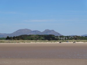
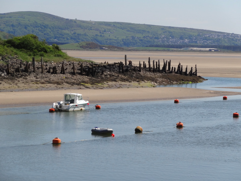
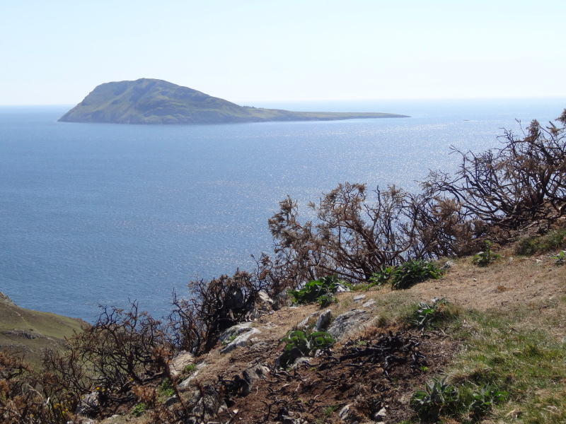
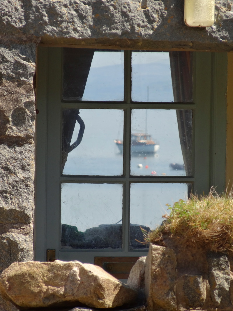
The track (safely) leads past a small mountain lake, either artificially made or at least height managed by two small dams, and then back down the hillside, and, eventually, at 5pm, for the first time this day, on the Wales *Coast* Path I see the sea.  Then, a short time later, I am at the road leading to the southern end of the closed toll bridge, less than a mile away from where I started the day, seven hours previously.

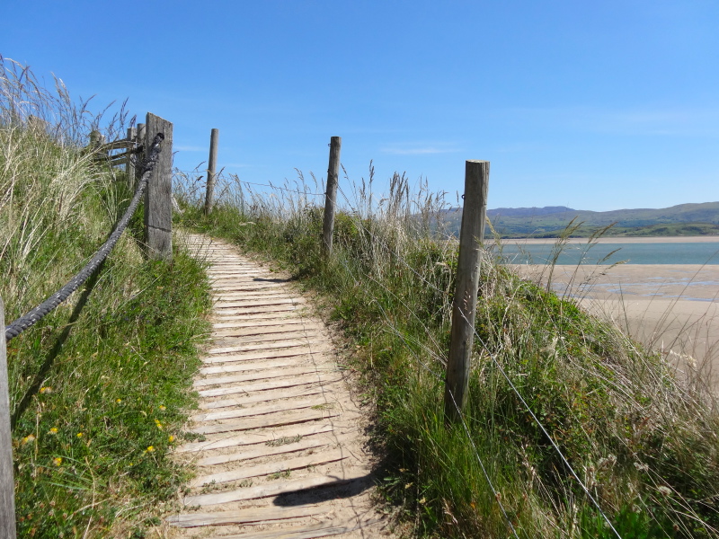
Thereafter the path is on the flat. The expanse of Morfa Harlech stretches out towards the sea, but it is a nature reserve, so the Coast Path skirts its inland edge along the side of a dyke, not daring even to take the well-made track following along the seaward, and nature reserve, side.

Eventually you reach a small industrial unit and the Coast Path is signposted onto a straight and apparently endless concrete road, which is crossed periodically by other concrete roads. It feels as if it is the site of an demolished industrial plant, with concrete roads between the now-gone buildings. But then I notice that the raised grass between the banks is pockmarked with breather tubes, as if something is decaying below. I imagine anything from noxious chemicals forever poisoning the land, to abandoned war-time nerve agents.

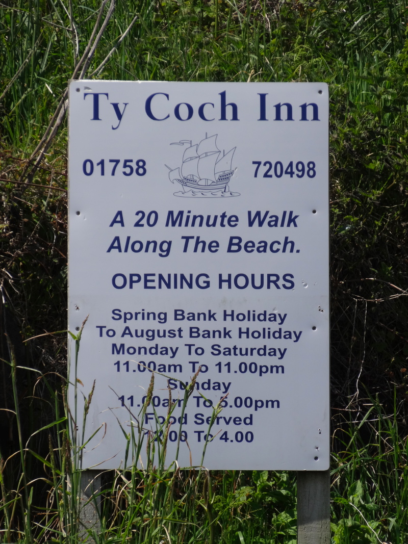
Later, at the Lion in Harlech, I learn that this was a war-time site, but is now the county recycling centre.  The vented area is collecting methane. I had noticed a slight smell at one end of the concrete path, which was presumably near where new material was being buried, but nothing in the grassed vented areas, so it is clearly being well managed.  They also produce compost, which is then available free to gardeners, although it evidently took them a while to sort this out as the early batches had too much salmonella and so could not be used.

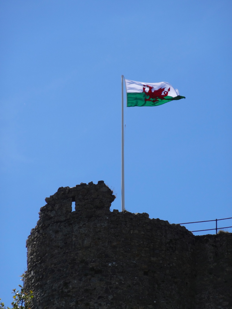
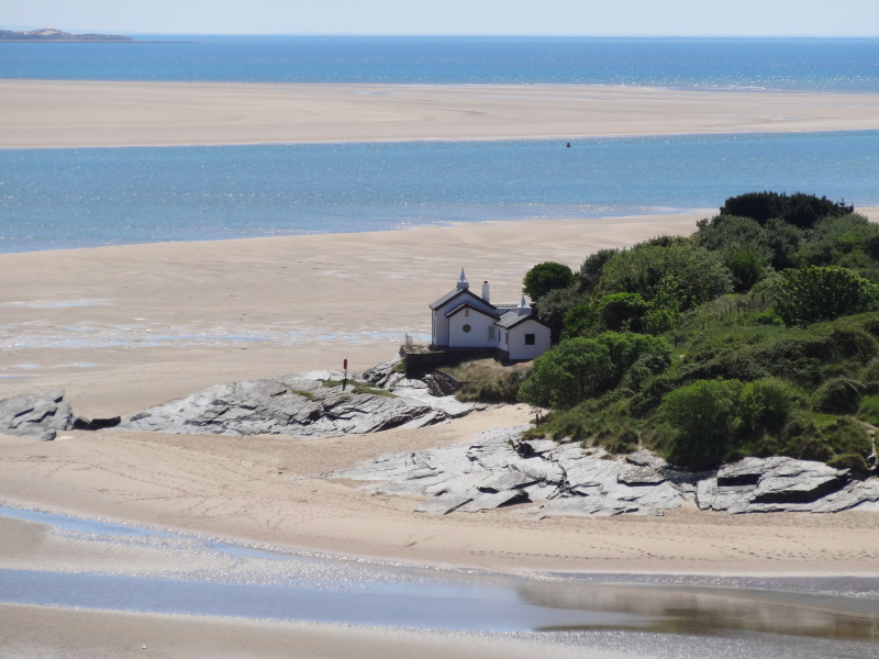
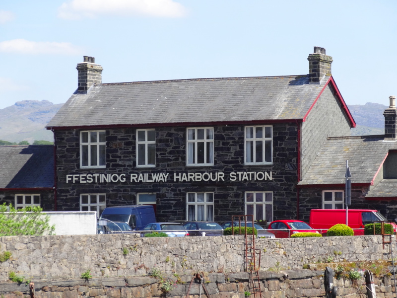
Coming into Harlech, the castle dominates everything, the railway station huddled apologetically below its grandeur. The castle is now about three quarters of a mile inland, standing high on a precipitous rock above a flat plain where the station and modern estates gather, rather like in Edinburgh, always looking upwards to the castle.  But it was not like this 800 years ago when the castle was first built. At that point it was on the coast, the precipitous rock face cliffs falling directly into the sea.

Of course further back again, the whole of Tremadoc Bay, indeed large chunks of the entire Cardigan Bay that stretches across the whole west of Wales, would have been dry land, drowned as the southern part of the {UK gradually sinks, seesaw-like as Scotland rises with post-ice-age rebound.

For Wales and even more so Cornwall with its huge drowned river valleys, it is like being the small child suspended in the air on one end of the seesaw, while your elder sibling sits on the far end: eventually the glaciers left Scotland, and as when the older child gets bored and jumps off the seesaw, the smaller child comes thumping down.

However, that is the overall state, and even in areas where the land is still sinking (a few centimetres a year), sand deposition can be far faster. Much of south eastern Snowdonia drains into Tremadoc Bay, down Glaslyn, tamed by the Ffestiniog Railway causeway, and down the Vale of Ffestiniog itself.  The rush of water after winter thaw, the lashing winter rain or sporadic summer downpour turns each mountain stream into foam-filled fountains, rushing down, rolling stone upon stone, ice-sharded fragments tumbled into dust, moraine soil, dumped by the receding glaciers scored from stream sides, washed down together into larger waterfalls and rushing rivers that gradually spread and slow until, youthful force spent, their last ageing strength is broken against the power of sea and tide. Like an old man putting down his burden, or maybe a walker taking off his rucksack at the end of the day, the assorted grits and silts, soil and stones are dumped, tide sorted, wave washed, wind scattered, grass gowned, thrown into unlikely dune ranges, or spread thin in salt marsh.

Thus is the land we stand on.  Built hard by toil and tumult, but, as easily, washed away by the next spring tide.

The main town of Harlech is up on the hillside, behind the castle.  There are slow roads that cut up diagonally across the hillside, but when you are at the station, directly below the castle, there are two roads up, the more obvious, and easier, one is a 25% slope, or 1 in 4 in old terms, and that is the gentle slope. There are some steps in parts for the walker, but if you drive up you need to believe in your low-gear torque.

It was after seven when I arrived, and most of the shops and cafés long closed.

At the beginning of the day I had wondered if I’d be able to make it all the way to the campervan at Tal-y-Bont, so it wouldn’t matter how late I was. However, this was still twelve miles away, so I would be trying to navigate the final parts in the dark. I was also so exhausted by this point, that I had decided simply to find somewhere to stay in Harlech, and set off first thing to continue south.

So, amongst the closed shops, I was scanning for a small hotel or B&B. It seemed a nice place to stay here, high overlooking the sea that had eluded me the whole day, with the mountains as backdrop, and castle in near focus.

A couple of restaurants were also closed, I guess still not high season, but at a crossroads a chalkboard advertises the Lion Hotel, which oddly has no name sign on the actual building, just a sign saying ‘Bass in Bottle’, a menu board and an Irish Tricolour.  There is scaffolding up, so maybe the pub sign is just temporarily taken down, and I forgot to ask why.

Ah yes, the other signage, a small hanging sign in the window, ‘No Vacancies’, but I went in anyway to ask if they knew anywhere else I could ask.

It had been a depressing day, hard work, wrong paths, aching feet and legs, and no sea.  Not a day where I felt I’d learnt anything of any significance, merely covering some miles that were on the official path, but would probably disappear from it once the toll bridge reopens.

But small kindnesses can change everything.

Although they had no rooms themselves, the lady behind the bar and a young man who was obviously connected with the pub started to discuss options, rang one place and, when another lady came in, she started to look up the phone number of another option on the internet … a laptop on top of the (not alight!) woodstove under the chimney breast.

Then they noticed the banner on my rucksack, and remembered when Christian Nook had come by as part of his all-Britain walk last year.  He had refused a bed for the night as he is rough sleeping to highlight ex-Forces homelessness, but they had given him use of a shower and a man from the village had taken him home for a meal, before he eventually slept in the covered alley that leads to the beer garden. Since then they have been keeping watch on his website and knew his progress.

They asked about my walk, gave me a drink and food, and the lady behind the bar gave me her night’s tips to go towards the charities.  When accommodation was proving hard and I considered a taxi to Tal-y-Bont, they reminded me that the last train had not yet left.

While waiting, the young man talks a little of a trek he took across one of the pilgrim routes in southern France.  He’d like to do the Spanish Camino some day too.  He belittled the tiny path signs in Britain compared to France where large markers were painted on roadsides and arrows painted on the track, none of our British pretty-prettiness.

2013-06-10 20.45.04Eventually I took the other road down the hill to the station, round the north side of the castle, at 40% not a slope I’d like to drive up, and walking down definitely better than walking up.

My feet still hurt, my muscles were still in knots, I was still tired all over, but my spirits, which had been depressed all day, were lifted by the kindness, interest and encouragement of The Lion.

Day 51 – Criccieth to Porthmadog

a short day to start the second half, an ice cream parlour and quay-side bistro, a steam railway and a surreal village

7th June 2013: flickr  | audio | map

2013-06-07 11.04.44I come into Criccieth off the train from Porthmadog, there are not many trains a day, so it is definitely worth getting your timing right, but there are also buses.

Criccieth is a traditional seaside town, not of the Blackpool variety with wall to wall slot machines, but seaside guesthouses, prom, small cafés, which are clearly doing well, but do not appear ‘gentrified’.  Indeed maybe not so different now than in its Victorian heyday.

The castle dominates the town, you can see why it was built there, with sea cliffs and steep ascents to landward.  Unlike the other castles of North Wales this was built by the Welsh rather than built by the Normans to subjugate the Welsh.  However, after Edward 1‘s successful campaign in Wales, Criccieth fell to the English and remained that way until Owain Glyndŵr‘s glorious rebellion when the castle fell to siege aided by French and Irish ships.

2013-06-07 11.24.54Just below the castle is Cadwaladers Ice Cream shop.  I’m not sure how widely it is sold, but I certainly saw signs in cafés in Porthmadog saying ‘serves Cadwaladers‘.  After a little investigating amongst the staff, they thought it had been operating since the 1950s or maybe early 1960s, but looking at their web site it is 1927. Seeing the little shop reminded me of Thayers in South Wales.

Nowadays {{Thayers} is sold over a large area and has a factory, but when I was little it was served in only two places, a little kiosk on Penarth Pier and their shop in Wellfield Road, the next street to Bangor Street where I lived. From the back bedroom of our house, you could just see the dull-green-painted, two-storey building in the back yard of the shop which was where the Ice Cream was made until production moved to the factory in 1966.

2013-06-07 11.19.41

I think they may have had Italian connections, but it is not like Italian ice cream, much lighter and milkier rather than thick creamy.  Gelato is good, especially stracciatella, but to my mind never as good as Thayers.  Their signature ice was plain dairy, which was pure white, and had no discernible vanilla flavour, and this in the days of virtually luminous yellow Wall’s and Lyons Maid vanilla ice cream blocks.  But they also served orange ice cream, not sorbet, which they made later, but ice cream.  You could eat in at the shop, take a cone, or buy blocks of ice cream to take home to either have in a bowl or cut in slices to eat between two rectangular wafers.

I would embarrass my parents, as when we went to a café, the waitress would say, "do you want ice cream," and I would answer, "is it Thayers?"  At this the waitress would scurry off to find out, despite my Mum and Dad‘s protestations, as they knew it would not be. A few minutes later the waitress would come back and say, "sorry it’s Wall’s," and very politely I would say, "no thank you then."

Cadwaladers signature ice cream is vanilla, but a very subtle one, virtually pure white. Of course, nothing can ever match Thayers for me, although nowadays it is not hard to find locally produced dairy ice creams sold in most areas of the country. However, Cadwaladers was very good ice cream :-).

2013-06-07 11.53.15I walk out of Criccieth along the beach (eating my ice cream). The formal Coast Path runs on a path the far side of the railway, but crosses over and mounts the headland just at the end of the beach. Maybe the beach route is inaccessible in parts at high tide, but today the sand stretches all the way to Black Rock.  You can almost go round Black Rock by clambering over the rocks, but the water the other side is just a little too deep for wading, at least chest height, so I follow the Coast Path along increasingly high and precipitous cliff and then inland, just a half a mile or so, before coming back down to Black Rock sands the other side of a campsite. On the way I pass a couple, and we stop for a few moments’ chat, where it turns out the man had just finished a Land’s End to John O’Groats cycle ride in the last few weeks.

Black Rock sands is wonderful, a mile and half of open sands, backed by dunes, hills and Snowdonia beyond, and looking across the estuary to Harlech and the Cader Idris range.  The sand is firm, so cars are parked and maybe in high summer it will be too busy, but today, even with all the sunshine, not densely parked.

2013-06-07 12.50.08    2013-06-07 12.38.11
2013-06-07 13.16.43    2013-06-07 13.34.20

Wandering along the water’s edge alongside pottering gulls, I wonder if I can wade across to the Harlech side, but then realise that I have simply waded a little tributary and the larger river runs close to the other side, so I follow the path of the end of the beach, and along a cliff path toward Porthmadog.

Coming into Borth-y-Gest, just before Porthmadog, I pass St Cyngar’s Church, a solid grey stone church, I guess made from the quarry on the far side of the Ffestiniog railway causeway.  A man sits in the churchyard; he tells me how his parents’ ashes came to be scattered here. Although his parents came from England, his sister married a Welshman and hence they ended up here. The church is so small, he said, that the coffin needed to be spun round to get down the aisle.  But it is clearly a lovely spot to be remembered at, looking out over the sea and mountains.

The Moorings Bistro I will pass soon is run by his nephew and his French-Canadian wife. "Tell them you’ve been talking to Steve‘s Uncle Tom," he said.

So, I do visit there for lunch and it is a lovely place … they even serve drinks in traditional dimpled pint mugs.  Evidently, one of Jamie Oliver‘s cafés serves using miniature half-pint versions, so rather than being the old man’s glass, they are now trendy!

I see the bistro is for sale, so if you fancy a change of life …

2013-06-07 15.07.33Porthmadog itself is more port than seaside, but also has that old market town feel, with traditional shops in the centre, and it is one of the stops on the Ffestiniog Railway where you can take a narrow gauge steam train up the Vale of Ffestiniog.  I see that the Coliseum Cinema is under threat and with a community group working to keep it open. As a child on seaside holidays, a trip to the cinema, the old time music hall or theatre, was one of the holiday treats.  With DVDs in holiday accommodation, and expectations of multiplex choice and seating, it must be hard to compete.

In Oban, where you get the ferry to Tiree, the cinema closed, but has been re-opened as a community enterprise, and so far, I believe, is being successful.  The tiny community-run Ringside Cinema on Tiree won a popular vote for funding for its innovative dual use of the cattle sale ring as a cinema; however it ultimately failed to attract sufficient numbers for regular screenings. This was partly because the cost of film hire means a small cinema cannot screen the ‘just released’ blockbuster, but it is also simply a matter of scale.

On an island of 750 people the number of people who can go out on a particular evening and are interested in a particular film is always bound to be small. In fact this is also true of the big city multiplexes; if you go to a film on any night, except the first few post-release nights, you find the auditorium virtually empty, it is just there are a lot of auditoria for the number of staff. It would be interesting to see the financial books of these large cinemas; I would guess that the benefits of having multiple screens reduces the per-customer costs sufficiently to make it break even, but the profits come from those few first screening nights, which a small cinema cannot afford.

For the seaside town cinema, the secret for sustainability must be to make the most of the complete ‘experience’, maybe making a virtue of the olde-worlde-ness of the venue, whilst offering more modern comfortable seating inside.

2013-06-07 15.11.33       2013-06-07 15.14.40  2013-06-07 15.18.07       2013-06-07 17.17.51

The walk from Criccieth was only short, as the previous day had been longer than I’d originally intended, but the latish start to sync with the late morning train meant I didn’t have time for a full day.  However, I decided to go on the extra few miles to Penrhyndeudraeth, starting up the Vale of Festiniog, where you have to cut five miles inland to the first river crossing at Maentwrog as the toll bridge below Penrhyndeudraeth does not take pedestrians. The bridge is in the process of being upgraded, so I hope this includes a pedestrian footway to shorten the route for future years.

The short way between Porthmadog and Penrhyndeudraeth takes you over the causeway carrying the Ffestiniog railway and old road, with what look like wildlife-rich marshlands behind.  Once upon a time the causeway will have destroyed the previous tidal estuary ecosystem, but a new one has taken its place. The path also takes you just past Portmeirion (but not into, you have to pay for that!), the surreal Latinate village, home of ‘The Prisoner‘ and flowery pottery.

Penrhyndeudraeth itself became the UK’s ‘first networked village’ in 1998, delivering internet access in a rural location, and then a few years later upgrading this using wireless links, rather like Tiree Broadband does on Tiree.

Day 50 – Abersoch to Criccieth

shifting sands and an iron man, coin studded trunks, bright painted huts, and I get to half way,

miles walked: 20
miles completed: 536.3
miles to go: 524

Abersoch definitely looked more inviting on a sunny morning, despite finding that I’d packed the room key in my trouser pocket after the taxi had left with my bags. The Angorfa is organised very efficiently as a morning-only business, with the night time ‘check-in’ via an entrance code and the breakfast room open as a breakfast bar. I ask Andy, one of the owners, about the afternoon, "we’ll be on the beach".  Whereas many B&Bs are run by retirees, after a small extra income and sometimes simply company, this is a different style, very much an efficient business, with a single purpose, to allow the owners to live by a surf beach.

This reminds me of Polly and Duncan on Tiree.  They have moved the other way: whereas they used to run both a B&B and evening restaurant, they are turning the B&B into self-catering and focusing on the restaurant. There seem to be important lessons here about finding ways to combine work and life.

2013-06-06 18.38.11In some ways the Angorfa system is a little impersonal, but knowing that I have a keycode, rather than disturb the landlady, was welcome the night before when it was nearly 9pm when I arrived in Abersoch.  In many ways like the MorphPOD experience.  I have been staying in a lot of B&Bs and for the purposes of the walk, I often learn a lot from chatting to the owners. However, if travelling with Fiona for pleasure, we usually prefer a Travelodge, Days Inn, or other roadside motel, for the ease of late night check-in and, to be honest, the less personal, but slightly more private feel.

When in Tudweiliog, I had discussed the changing tastes of seaside tourism. Expectations are high, and many small one- or two-bedroom B&Bs do not have en-suite bedrooms; on its own this is enough to rule them out for many, especially younger, visitors. It is odd really, with couch surfing on the rise, this contrast between personal and impersonal travel, privacy and openness.  I guess too, despite health recommendations, breakfast is becoming a meal of the past, especially on holiday, and especially if it comes at fixed times of day. Many prefer the flexibility of self-catering … and, again to be honest, when not ‘on a mission’ I would be the same.

It is also surprisingly hard to find basic B&Bs in the internet age. The slightly larger, slightly more organised ones are net-savvy, manage their online presence, and make sure they are well represented on TripAdvisor.  But these are the slightly more expensive ones. The simple £25–30 B&B is almost impossible to find unless you are on the ground. Paul used to work at the council and in his current business often works closely with local council tourism. He explained some of the problems to me.

When I was a child we would write (!) to the local Tourist Board, who would have a list of local B&Bs. But now, with everything online, these smaller B&Bs, often with older owners, are a ‘problem’. They may not manage email efficiently, may not keep their online availability up to date (if they access the web at all), are less likely to have a mobile phone for last-minute queries, and may not have all the facilities expected (TV in each room, en-suite, etc.).  Understandably, the tourism office drops them from their lists, which means they do not get visitors, and ultimately the number reduces.

Thinking about affordable tourism, this is a disaster.

[completed 5th June 2014]

As I walk back towards the harbour a man sitting outside a café greets me. It is the same man who had been helpful when I was finding my way through town the night before. He checks that I found the B&B and food OK. Strange how much nicer Abersoch feels in the morning sunshine rather than tired at the end of the day.

The marina at {{Abersoch} is really the outflow of a small river, I pass new yuppie boats and rotting hulks, then cross the river on the road while a swan passes through tidal flood gates.  These are small compared with the vast flood defences on the Severn or on the coasts of North Wales and Anglesey, but still a reminder that the sea is ever a threat as well as a source of tourist income.

Down to the beach past a few eco-houses and then, about a mile north-east of Abersoch, a small township of static caravans. Here the threat seems to be less the sea itself and more the sand that seeks to bury the wooden steps that lead down to the beach. A JCB is digging sand out from around the steps and then spreading it out along the shoreline. I am guessing that this is an annual early season job after winter storms.

Following the way through these caravan sites always feels a bit like the Minotaur maze, but a helpful gentleman points me in the right direction, past the red house and then cutting diagonally up the slops of Mynydd Tir-y-cwmwd, the 400-foot headland that separates the sands east of Abersoch from another long beach that stretches from Llanbedrog to Pwllheli.

From the headland you can see the coast ahead, Pwllheli itself partially hidden by a sandbar partway, and then Llanbedrog itself appears, or rather not the village itself, but the brightly coloured beach huts strung along the sand, rather like at Abersoch, but of a slightly more modest variety.

However, before coming into Llanbedrog, partway down the headland, a rust-red iron-cage of a man stands guard on a rocky outcry; somewhere between Gormley‘s ‘Another Place‘, Wicker Man, and a medieval instrument of torture.

I end up staying there more than 20 minutes, first of all trading stories about sandals and footwear with a small family group and then chatting to a gentleman who seems to know a lot about the history of both this statue and the previous version, which had rusted away before being replaced with the current version. I have found a local web page with a picture of the former iron/tin man which reminds me of the robot from ‘The Day the Earth Stood Still‘. This itself was a replacement for an earlier ship’s figurehead, which was vandalised in the 1970s.

Beyond the Tin Man the path cuts on down the headland, past several tree stumps densely embedded with coins, each edge in, hammered, I assume with stones, for luck.  Who was the first person to do this and why?

I must have cut slightly more steeply down to the beach than I should have as at first I couldn’t see the next Coast Path sign, asked the tourist information man who half knew, and then saw a sign.  I think the proper path takes you on a more gentle line a few hundred yards inland and then back down to the sea, whereas I’d taken the path straight down.

In Llanbedrog, as well as the wonderful line of beach huts, there is a public toilet and a beach café that seemed to serve sea food at reasonable prices. I have a feeling that the demographic of the Llanbedrog visitor is slightly different from that of Abersoch.

From Llanbedrog to Pwllheli is a straightforward walk, sometimes along the beach itself, sometimes along a grassy track behind the shingle. The final half mile is along the edge of a golf course unit; Pwllheli esplanade appears ahead, a terrace of beach-front houses, of a style that eludes me, I assume very early 19th century three-storey apartments.

The Coast Path cuts past municipal buildings and an Eisteddfod stone circle (these will so confuse future archaeologists).

I cannot now recall what I ate this day, as I know I didn’t  stop in Llanbedrog, and don’t recall finding a sandwich bar on the waterside of Pwllheli.  I certainly did not have time to investigate further into Pwllheli as I was due to meet Paul at Criccieth.

There is a short inland section past Pwllheli, about a mile and half along a busy road before cutting back to the sea. From the map it seems that it is possible to follow the shoreline along, as long as the tide is not too high, but the railway separates the shore from the road and so if there is any barrier you would be stuck; so I stick to the official path. After a mile or so actually on the shore, there is another small headland, before the final run of coast towards Criccieth.

Beyond the headland there is another stretch beside the busy A497, and so, when I meet a man walking on the headland I ask him if it is possible to stick to the beach. I can see that there is a small river halfway along, but from the map you cannot tell if the river can be waded.  He tells me it is possible, but is a little doubtful. If I follow the sands and then get stuck it will be a very long way back, so in the end I stick again to the official Coast Path route, albeit not entirely pleasant.

This time, I am glad that I did so.  When I do eventually follow the path along the edge of the small river to the shingle beach, it is clear that it would require at very least chest-high wading, although the tide was quite high, so maybe at a different time of day it would be possible.

From here it is simply a mile along the shore to Criccieth, where I go to the small hotel nestled below the castle to meet Paul.

Day 49 – Aberdaron to Abersoch

a goat, a bull and a dead calf, a subterranean landscape populated by the Cornish, brought to tears twice, and lost four times, and end in the land of private

miles walked: 21
miles completed: 516.3
miles to go: 544

Although it is a reasonable walk this day I take a very leisurely breakfast at Gwesty Ty Newydd, looking out over the sea … and making the most of their WiFi!  The checkout time is 10:30, and I think I am a little late leaving, but no-one minds and they direct me to the best shop to get myself a pie for lunch.  Unfortunately the little bakers is closed, so I go to the Spar across the road. At the cash desk I count out my coins in Welsh, as I normally do, and the lady at the cash desk instantly repeats the amount in Welsh for me.  I explain I only have school Welsh, "Oh, that doesn’t matter," she says.

North Llŷn is definitely very Welsh.  Before turning off Menai Bridge into North Gwynedd I had heard little Welsh spoken.  In Anglesey I think this is largely because I was on the tourist and retirement coast, whereas inland I would have heard far more.   However, once west of Bangor, I was clearly in deep Wales with overheard conversations in pubs and shops, and parents talking to their children in Welsh. I occasionally see the red dragon on a black background, the symbol, I am told, of the Free Wales Army and aggressive nationalism. If I had known that as a child … Sometimes, I get a slight feeling of being classed as English, but being from Cardiff is not much better.  "A different country," I joke to one bartender, "Definitely," he replies with no hint of humour.  However, at Aberdaron while every other person at the bar orders in Welsh, I notice no trace of a shift of welcome.  I think here, at the inaccessible far West, tourism is sufficient to be important, but not so much as to be a threat.

Stocked up for the day at the Spar, I set off up beside the small river that runs out into the sea at Aberdaron. A party of schoolchildren are on a field trip, in red sweatshirts and baseball caps to protect them from the sun, now 11 o’clock and already hot.  The teacher is explaining something in Welsh, I pick up ‘afon’ (river), but that is all.

As you leave the river valley, there are a set of stone steps with a non-coast-path footpath sign, which I almost took before noticing the Coast Path symbol was on a different stile a short way off. In fact, when I got to the road on the far side, I worked out the steps are right and the marker on the stile is wrong! I assume the council worker putting up the markers had a bad day!

The Coast Path is mostly inland, but takes a dive to the coast literally touching it for 50 yards before heading inland again. I thought this might be just a touch of WCP OCD taking you down for such a short coastal stretch. The way down is through National Trust land (which always means good signage!), past an old large farmhouse with a wall half collapsed and a tiny new house next door, a couple of goats tethered nearby and a tiny car park at a pound a day, which is not signposted. There is one car there and in the little cove down below a single family enjoy the beach all to themselves.

Now I can see why they bother to take you here. You get a view of a part of the coast that would be completely hidden once you get to the next place where you can reach the coast, beyond the next big headland.

As you round the small point ready to head back inland up a shrubby valley, you see winding gear at the top and bottom of the cliffs that turns out to be connected with levels and mines. The spoil heaps at first look just like a quarry for building stone, but then you see the sides of the small valley pock-marked with small hand-dug caves, levels cutting deep into the rock to extract minerals or ores. I have no idea how far they go, and did not explore. The stone looks very solid, so roof falls are unlikely, but they are low – the miners must have walked along bent – and I’d guess would soon degenerate into a warren of paths. My SPOT device would not be helpful if I was lost in solid rock. Some, perhaps the most dangerous, have been half walled up to try to prevent people going in … maybe they have lost the odd tourist before!

It is odd that this, at first sight ‘unspoilt’ verdant landscape is in fact a post-industrial relic.

On the way back up, on a path partway up a small stream valley side, I meet a small herd of cows and calves amongst the mine shafts.

When you next hit the coast you soon see Hell’s Mouth (Porth Neigwl) opening out in front of you. Hell’s Mouth is a vast sandy beach, around three miles long, backed by soft sandy rock and facing south-west to the sea. It looks idyllic, but I imagine the sailing ship in winter in a raging sou’westerly, the prevailing wind direction. There are deep headlands at either end, so once within its maws there is no escape: slowly and inevitably you are blown landward until the keel drags on the sand and the ship begins to break up. If you are lucky you may manage to swim to shore, but then have to clamber up the soft crumbling cliffs, the waves pulling you back with every shifting handhold. Hell’s Mouth indeed.

The path over the headland is good, but I manage to catch a stray bramble branch and cut the back of my ankle. However, I know I will soon be down on the beach at Hell’s Mouth and will walk its length (strictly the Wales Coast Path joins it partway along, but the Llŷn Coastal Path shows access right at the west end). I can bath my bloody ankle in salt water.

Before that there is a walk down a small country lane, which is pleasant enough, until I see a Coast Path symbol pointing to the left. I still don’t know why they didn’t simply follow the lane; it was quiet, safe, and closest to the coast. I think the path planners try to maximise the off-road time. The path cuts past a farmyard and along a field, before coming to a gate that appears blocked by two football-crowd like barriers with an arrow pointing left into scrubby dappled woodland, quite an idyllic spot were it not for the dead calf that had been left to rot, fly coated, amongst the trees.

Coming to the far side it is clear I should have been the other side of the fence and so backtrack and realise that the barrier can open at one side, and so make my through a sheep field back to the road. Just before getting to the final gate the way turns boggy and my injured foot ends up ankle deep in sheep-dung-laced mud.

It seemed so unnecessary, this apparent feeling of the planners that walkers must, by disposition, feel disappointed if a day does not include a knee-deep wade through mud. Clifftop streams are one thing, or clinging estuary silt – they are part of being ‘coast path’, but when inland why not make things easier? I think also my blood sugar was low as I’d not eaten since breakfast and (although I didn’t notice until a short while later) it was already after 2pm. So, torn between self pity and cursing of all who planned or executed the Coast Path, I burst into tears.

I resolved to ignore any further signs and follow this lane down until I passed the next Coast Path sign and saw it ran through National Trust land – safe 🙂 Plas-yn-Rhiw is a small property that was left to the Trust by the McKeating sisters in memory of their father. As I was late already I did not visit, but did go into the shop and have an ice cream and drink; suddenly the world seemed brighter. It is so easy to let energy reserves drop and then on top of the general physical and mental tiredness after so long on the road, the simplest thing becomes a major disaster.

So eventually, through a woodland and ignoring the Wales Coast Path arrows that would take me parallel to the coast for half the length of Hell’s Mouth, I drop down to the long sands and walk.

I know that in Australia there are beaches 70 miles long, but, here in Wales, three miles is almost Sahara-like in its feel. A way off I spot something that at first looks like an old oil drum, but then is clearly a far larger cylinder and appears to be made of concrete. When closer still the concrete turns out to be a thick layer of barnacles over rusting metal. Instead of being a complete cylinder, it seems to be semi-cylindrical, or maybe broken in half, with a smaller cylinder, perhaps half the diameter, running through it and then a matrix of even smaller tubes, each 2 inches across. It looks like some sort of heat exchanger, but how did it end up here, far from anywhere?

At the end of Hell’s Mouth the path mounts the headland in what, on the map, seems a see-saw like swing, but I assume is traversing the contours. The way off the beach is (for once!), well marked, but after that several paths mount the headland. As the path on the map appears to head near south I take the rightmost, and most well-trodden, path, but, uncertain, I scan in all directions for further markers. Some time later, when I come to a locked gate with barbed wire wrapped along its top I realise that this may not be right, and turn back along the field boundary, following a beaten-out path, presumably from others who went the same way. The path gets less distinct and the grass higher, until eventually it hits the top of a bluff, but from its vantage I can see a marker post. I’m still uncertain whether I followed the path on the map, and the path on the ground is different, or of it was simply that the swing is slightly less extreme than it appears. However, for the second time that day I simply wept. It was odd, so minor compared to many other wrong paths, but I guess I’m simply more exhausted.

Having battled through the remaining knee-high grass (happily with no nettles, thistles or brambles) and regained the path, at the edge of the field was a clear sign. Another footpath was signposted off to the left, where trodden grass showed it was a frequent route, and the coastal path was signposted sharp right … straight up a steep gorse-filled bank with no signs of a beaten path through it.

My confidence in the Path hit a new low, and I almost took the well-trodden path, which would cut off a chunk of the coast, but was clear on map and ground. However, for some reason I persevered. I did not climb up the slope where indicated, but further on it was clear of gorse, easier to climb and signs of what could be sheep tracks, but could be human, mounting it in various places, so I scouted up there and sure enough saw another sign. I still don’t know whether formally the path is in the direction shown, or whether the signpost should have pointed slightly at an angle.

After this, until I hit the sea and the walk around the first of a double headland before Abersoch, the way was clear, wide and easy, wonderful late afternoon walking … except that once in the open grassy country above the sea, the path bifurcated again and again. I kept to the main, most well-trodden one, but multiple smaller paths cut off to right and left, with no signs visible at all.

Eventually the well-trodden path was blocked by a locked gate and a wall that appeared to run all the way down the cliff to the sea. The path was supposed to continue around the coast, but I thought, "maybe further up there will be another open gate". On the headland there was good signal, so I rang Fiona to say hello and she watched where I was using the SPOT tracker and satellite images. "you are going almost back the way you came," she said. Sure enough, looking back on my track for the day, I followed a route that took me within half a mile of the point with the bluff.

By turning right as often as I could, the wall-side path became a farm track and eventually a small lane and road. I still do not know whether if I had scouted down towards the sea when I hit the gate and the wall, maybe there was a way round the seaward side of the wall.

Eventually, the route I took along small roads joined an inland section of the path: I had missed some of the coast, but not too much; and then headed back towards the sea once more. Down a small path past a campsite and car park, you overlook a small but lovely beach with a long flight of wooden steps taking you down the steep cliffside to the sea. At the top of the cliff is a large metal signpost. One finger points right back along the coast, one points inland, along the path I had just come down, and one points down the steps to the beach. None have Coast Path arrows, but the only one of the three possibilities is down to the beach, and I assume there will be an equivalent set of steps at the far end. Down at sea level it is lovely, and not a bad excursion, with a small number of both families and surfers enjoying this slightly out-of-the-way beach. But there is clearly no other stairway up the increasingly sheer cliffs at the far end.

After trudging back up (in surprisingly good mood!), I get back to the clifftop, look right along the clifftop and spot, about 30 yards away, a small stile with Coast Path stickers just visible. "Silly me", I think, "why didn’t I notice them?". But then I retrace my steps to where I would have been coming down the path, turn around, look at the large, obvious fingerpost with no Coast Path sign on it, then look to the left, and realise stile and certainly stickers are completely obscured by a large gorse bush, which must have been there last year when the Coast Path signage was first installed.

By the sign was a man collecting those little black, grey and green dog-poo bags into a box. I had noticed before that after bagging their pets’ excrement, many people simply deposited the bag beside a gate or stile. I can understand that some thoughtless people do not collect at all, or others might bag, then throw into deep bushes, but why go to the trouble of bagging and then leaving it where others will find it? The man, the local campsite owner, found that at the top of the steps, once one person deposited their bag, the next person dropped it in the same spot until there was a pile. He had contacted the council and National Trust to get them to provide either a bin or a sign, but had failed. He was collecting when no dog owners were about in case the fact he collected from there further suggested it was the right place to dump!

We talked about the signage. He regarded the Coast Path as slightly more a ‘work in progress’ than an accomplished fact!

He also advised me on the remaining way. It would take a few hours to go round the last headland, but it was an easy walk; however I couldn’t follow my original plan to have a quick rest at Machroes before the last miles to Abersoch. "There’s nothing in Machroes," he informed me, "but about a mile inland there is a lovely pub where the locals go".

As I get to the end of the final curve of the last headland, I see two things.  First a small round tower, barely 10 feet tall, with a small tree growing through it, which, if I had seen inland I might have taken for a railway tunnel airshaft.  The other was a small farmhouse with what looked, if it had been up in the {Borders}}, like a small pele tower.  I also see a man, wearing a salmon-orange sweatshirt and a bright blue rope tied round his waist, walking a small and, when I approached, barking spaniel.  In his hand he held a small plastic glass of beer.  It turns out that the blue rope is the long end of the dog lead, I assume wrapped to keep it out of the way when only a short leash is needed.

He was local and didn’t know what the round tower was precisely, but ventured "I think it is an explosive store, there are a lot around here, although they are usually rectangular."  The ‘pele tower’ has a different story.  "The Cornish built it," he explained, "There is a street below called ‘Cornish Row‘, where they lived, they were brought over as they knew how to mine."  But he didn’t know if they were mining tin here or some other metal.

The official Coast Path route takes you into Abersoch along the back of a golf course, but, if the tide is not too high, you can drop down onto the beach at the slipway at Machroes (a tiny unmarked lane off the road) and walk to Abersoch along the beach itself, crossed at the Machroes end with wooden groynes to hold the sand.

The initial view of Abersoch across the sands is beach huts; they stretch in a multicoloured row around the arch of the bay. Some are striped; some have paintings on their doors; some palatial, some tiny.  And, beyond the beach huts, what at a distance I first took to be a complex of beach-side apartments, but turn out to be more beach huts, but of a reinforced concrete and brick kind, perched above the sand on pillars, some on timber, some, where the timber has rotted, on brick and concrete columns.  All locked.

On the steps to each of the beachside ‘chalets’ (a step above beach huts), painted in black letters on white background, a single word:

‘Private’

This, I will learn, is to define Abersoch.  I had heard that it was a town of yuppies; what I had not realised is that this is the land of private.

My first inkling was when I tried to get off the beach.  The Coast Path makes a loop of the small headland, but the official route round the back of the golf course comes to this from the land side.  It seemed a simple matter, surely, to get from the beach to the headland road.  I saw some steps, but they just led partly up the cliff, giving access to a tiny sea-filled inlet.  However, there was also a large slipway, which must surely lead to the town.

As I get to the top I see a big gate, ‘car park CLOSED 8pm–8am’; the pedestrian access to the left also had a chained gate across it, but there was a way through on the right.  I see more stairs, ‘key holders only’, but I make my way across the empty car park to the far side where I see another closed gate. This time there is no way through for pedestrians, but the chains on the gate are loose enough to squeeze through the end, ducking under the taught chain.  This is clearly the normal form of access, as three young girls pass me, heading for the same ingress point.

Just outside the locked gate I see a Coast Path sign, one way pointing to the town, the other around the headland.  I follow it past the back of a yacht club, and other buildings with their own car parks: ‘Private Land’, ‘No Unauthorised Parking’, or simply more ‘Private’.

I cannot imagine a more uninviting seaside town than Abersoch.  It is not run down or down at heel like many of those in North Wales; in fact; the opposite; it is yuppie town with flash cars and wine-bar-style restaurants.  But, like an Italian resort, every foot of sea frontage is owned by someone, access denied, shut off, private. I had expected that the headland and harbour area would have bars, cafés or restaurants, instead there were simply the locked back doors into cliffside properties, each with ‘Private’ – but always in English, never Welsh.

The contrast with Aberdaron could not be more sharp.  I guess Aberdaron is still a village that happens to be by the sea, whereas Abersoch, as the campsite owner said is, "just another seaside town".

To be fair, my own impression is partly because of the way I came to town. If you came by car, settled at your accommodation, and only later went down to the beach you would see it quite differently. At sensible seaside times of day, the gates I squeezed through would be open, with laughing children, and parents laden with coolbox, parasol and beach chairs, streaming back and forth to the beach. It would be obvious from the town plans there was no clifftop walk and so you would never try to visit the private-no-entry-headland.

Also the people I met here could not have been nicer.  On my way up from the beach a man standing outside one of the pubs gave me directions to the Angorfa B&B and Breakfast Café (‘angorfa’ means ‘anchorage’), told me about shops, including a Spar that is below eye level as you go into an estate (maybe where local people live), and as he gave directions used another B&B as a landmark, "but don’t stay there," he said, but never explained why.

The restaurants all seemed very wine-bar-ish and the fish and chip shop was already closed, so I ate in East meets West (EMW) a Balti House where the waiter and a man I took to be the proprietor (Abul it says on the card, so I will call him that) were very interested in the walk, "If I walk four minutes," said the waiter, "I get tired." Abul asked whether I’d come from Flint, and I said, "I’ve even been through Connah’s Quay."  We talked about the railway, seeing the Duke of Lancaster from the train and some of the other sights along the way. Talking, I assume, now about driving, Abul said, "as you go on toward Ruthin, Bala way there are lovely scenarios."

So, by the end of the evening, I’m feeling more positive about Abersoch than at the beginning. It is, as the man said, "just another seaside town."  It has large beaches, flat access behind, dunes to build holiday parks upon, everything that goes into the great British seaside holiday.  Well, not quite; if I imagine going as a child there would have been nowhere we could have afforded to eat that I could see, none of the formica-topped seaside cafés.  It is a prosperous town, even an outlet for Fat Face and similar brands, I hope bringing money through council taxes and wages into the Llŷn economy, even if no one from Llŷn can afford to live here.

The campsite owner also suggested that it was worth going inland from Machroes.  There is nothing in Machroes itself but houses, but slightly inland he said there was a good pub, I assume at Bwlchtocyn, from the map, where all the locals go. When I mentioned Aberdaron, "that’s lovely," he said and instantly mentioned Ty Newydd where I stayed.

So, Aberdaron I would like to visit again, but Abersoch, well I’ll leave that to the sports cars and speedboats.

Day 48 – Tudweiliog to Aberdaron

round the end of Lleyn: fishing, orchids, ham and eggs and a pilgrimage

miles walked: 17
miles completed: 495.3
miles to go: 565

2013-06-04 08.54.15I make an early start, leaving the Gerwen B&B by 8:30, as I am uncertain how difficult the terrain will be coming round the end of Llŷn. (In fact it turns out easy, so I will arrive at Aberdaron at 5:30 after a relatively uneventful day.)  Gwenda, the landlady at Gerwen, tells me that there is a beach café at Whispering Sands, so that is my target, about halfway along, for lunch.

I walk the short way from Tudweiliog to the coast at Towyn, where the path leads for a short way across the sands.  It is good to feel sand beneath your feet.

The path from Tudweiliog to Whispering Sands is almost all exactly along the clifftop except for a short excursion inland just before getting to Whispering Sands.

On a headland I spot a small shack, but as I approach I realise it is one among several shacks above a small sheltered cove, Porth Llydan, where some fishing boats are moored. On the opposite side of the small headland a sandy cove, Porth Ysgaden, has a slipway, where more boats are launched and, from the tractor and trailer on the slipway, one just recently.  The gabled end ruin of a once substantial house suggests this has been a port for many years.

2013-06-04 09.11.16

The boats that go out are small craft, I think mainly dropping creels, very like the fishing boats from Tiree.  The previous night Caroline, the landlady of The Lion told me about the proposals to turn the coasts around Llŷn into a ‘highly protected’ area, I guess range like the proposals for Barra.  This would have ended the traditional fishing industry around Llŷn as well as some tourist activities.  Caroline showed me the noticeboard with copies of protest letters and official responses. Although the number of fishermen is small, they are part of the culture of Llŷn, as well as each having families to look after.

“It seems to have passed,” she says, but that also means the rich ecosystem is unprotected. We wonder why it seems beyond the wit of Whitehall bureaucrats to create conservation plans that prevent large-scale trawling (by boats from far away), but allow small-scale fishing to continue.

2013-06-04 10.28.25Further on, along an orchid-fringed cliff path, I come to another small cove, where an old lady sits stitching outside a postcard cottage, ‘Glan y Mor‘.  Out to sea two men in a small boat are having problems.  From the shore a man wearing a baseball cap proclaiming ‘skipper’ shouts instructions.  He thinks they have forgotten to loosen the cap on the petrol tank for the outboard, which lets air in as the fuel is pumped out.

“Remote debugging”, I suggest, as he shouts again.   “Yes,” he replies, “I don’t know whether to dial 999 or 111 for them.”  “Well, at least they have oars”, I say, and as I continue I see the men at sea rowing for shore, where I’m sure skipper will relish their discomfort.

On a stile a scallop shell is fixed.  As I stop to photograph it I see a notice, posted by the Penrallt Coastal Campsite:

Pilgrims are Welcome
to camp here or
use our  facilities.

One bright spot (or at least less dim spot) of the road detour I had taken at the end of the Caernarfon to Nefyn day, was that I passed another holy well, the well of St Aelhaiarn, in Llanaelhaearn.  I say “less dim” rather than “bright” as the well was roofed in 1900 and this included adding a lockable, and locked door.

However, the well and the welcome at the campsite are reminders that, as I go down Llŷn, this is a not just a coast path, but also a pilgrim route.  Later I also notice a post with a simple cross carved in it.

2013-06-04 11.42.11In some ways the Coast Path is pointless, or destination-less, compared to the pilgrim routes, such as this one, taking you to Bardsey Island.  I started at Cardiff and will end up in Cardiff.  Am I going nowhere?

Of course, this journey is a sort of pilgrimage as the spatial endpoint may be where I began, but the point of pilgrimage is not the spot on earth where you end, but the change within.

Eventually the path takes its inland detour, happily well signposted, and drops back just at the end of the whispering sands … and they do whisper, or almost sing, as you step on the dry sand, or rub your feet with a high-pitched squeak.

And the beach café is indeed open and so, stocked up on ham and eggs, and my feet bathed with a quick paddle, I proceed on the second part of the day towards the end of Llŷn.

After some more clifftop walking, the path leads up toward Mount Pleasant, a name that always makes me think of a funeral parlour, but is a small farm huddled under the slopes on Mynydd Anelog.  The path does not go over Mynydd Anelog itself, but skirts its coastal edge until, having crossed a small bridge over one of many small streams leading to rock coves, the path fragments into numerous criss-crossing sheep paths that cover the sloping cliff slides like a spider’s web, or maybe a labyrinth.  Some look more well trodden than others and I wander sometimes higher, sometimes lower until ahead I see a last bridge and spot a marker post.  I realise I should have been following the uppermost path, beside the fence, rather than wandering aimlessly below.

It would have been better to have followed the right path, but, in the end, all the paths, both the right path and the others, lead to The Bridge, and after The Bridge there is but one path, and it may be hard, but it leads ever upwards.

These are almost the words I spoke into my voice recorder and as I heard myself it seemed they were a parable for the pilgrimage route.

2013-06-04 13.25.32Often I have heard the metaphor of the cross as bridge between humankind and God, and this seems not a bad model for the journeys we take.  There are many paths we take on our own pilgrimage through life.  Not all are equal, but when we cross the bridge, whatever path we have taken is forgotten; the way onward may not be easy, but it leads upward.

Well, it sounds good, but in my experience of footpaths and Christian life the criss-crossing sheep paths do return.  Maybe I should take my moral compass out of my pocket more often?

Well maybe this is different as on the pilgrimage route this is the final ascent, with just the boat journey to Bardsey on the other side of the last mountain.  I hear the strains of Cwm Rhondda in the bass and tenor voices of a valleys male voice choir: “Land me safe on Canaan’s side“.  Checking the words on Wikipedia, I see a ‘verbatim translation’ (transliteration?) that translates the Welsh “Fi, bererin gwael ei wedd” into “Me, a pilgrim of poor appearance“. Amen to that!

At the top of Mynydd Mawr, the ‘big mountain’ (less than 200m, but big for the end of Llŷn), is a coastguard station, which was also a defensive lookout during the war.  Dropping down the far side I see the concrete bases of further wartime buildings, with a family having a picnic beside.  I’m reminded of the playground in the killing field of Beaumaris Castle, and the demolished WWII concrete that holds the dunes together on Tiree.  Although when we see conflicts today it seems impossible that the pain will heal, the land does eventually forgive and the heart forget.

2013-06-04 15.40.46Bardsey itself is a strange island with a large hill facing the Welsh coast and the low, flat, habitable land facing west into the Irish Sea.  You can understand the hermits’ logic, shunning the world as they sought God in the open horizon; and subduing their bodies as they faced the January gales.  But it is perhaps also significant that it faces West, the place of magic in the Celtic soul.  I do not understand, but I cannot resist the drag of the western ocean: Tir-na-nÓg, the lost cantrefs, cry out. Celtic Christianity seemed to be able to take hold of the best of the old ways and old knowings and then flood them with the new wine of the kingdom.

On the way back I pass the ruins of an old cottage, huddled between pathway and rock face.  A ruin, like many other ruins, except one of the walls contains a six foot slab of rock that I assume was already in place and the rest of the walls built around.  I feel there is another parable there, but it is late, so a parable for another day.

Finally into Aberdaron where the solid stone church sands firm against the elements and a sign says:

A Parish Church
A Pilgrim Place
A House of Prayer for all People
CROESO – WELCOME

It is locked.

Happily the lovely pub on the quay next door is not locked.  I resolve to go in, drink a cool pint below the falling sun and get directions to my accommodation for the night and wishing that it were this lovely place by the sea.  And then I see the sign, ‘Gwesty Ty Newydd‘ – it is my accommodation for the night.

Day 47 – Nefyn to Tudweilog

a leisurely day, bread pudding and marine biology, seaplanes and wild boar pate

miles walked: 9
miles completed: 478.3
miles to go: 582

2013-06-03 11.01.00This was going to be a short day’s walk and there was WiFi at the Caeau Capel, so I took a leisurely breakfast catching up on email and some urgent work, before setting off around 10:30.  So leisurely, in fact, that I forgot to start my GPS devices and only noticed at lunchtime at Ty Coch.

The Coast Path goes right across the end of the road, yards from the entrance to Caeau Capel, so I could have come down it the previous night, rather than into the centre to ask directions at the Indian restaurant.  However, last night I was not following Coast Path signs anywhere!

This morning was a new day, bright and sunny … indeed more sunny than I’d anticipated and I realised later in the day that I should have renewed the factor 50 on my arms.

The path runs straight down to the cliff, and you have to follow it as there is a fence on one side and a bank on the other, and yet half-way down there is a finger post pointing Coast Path in both directions.  I wonder why there can be a Coast Path post where there can be no choice, let alone confusion, and yet yesterday nothing on the dyke near Caernarfon … ours is not to reason why.

Nefyn Beach is down a steep road from the town, and many years ago, before we moved to Tiree, Fiona and I had looked at a small plot of land for sale beside the sea. It was in the middle of a number of beach-chalet-style properties, but was only accessible by walking past one of the other properties’ front door.  We decided that facing due north with the cliff straight behind may be lovely on a day like this, but depressing in winter … and the van only just managed to drive back up the road. Looking down from above I notice the plot is still empty.

2013-06-03 11.50.59With a very short diversion inland, where, I guess, the cliff is too eroded, the path follows the top of the cliff all the way round the headland to Morfa Nefyn, where instead of continuing along the cliff I cut across the sand to Porth Dinllaen where I was hoping to hole up for an hour or two at Ty Coch, ‘the pub on the beach’, and write.  However, it was still early, barely noon, so I decided to go round the headland and come back across. It wasn’t very obvious where the path comes out of the hamlet to go anti-clockwise round the headland, so I went up to the golf course on top and went the other way round. I was going to cross my own path; would I need to spin round when I got back to Cardiff to make up?

Unlike the Trefor farmer, the golf course seemed very helpful to the walker and one of the people looking after the greens told me where I should go. I guess the golf course is part of the tourist industry and can see the advantages of the Coast Path whereas the hill farmer has no direct benefit.

2013-06-03 12.23.11I guess all coast guard stations are picturesque, but the one on the headland stands on wildflower-draped rock, and must rank high. Further round, back on the eastern side, a new lifeboat station is in the process of being built and the cliff path is diverted down a staircase constructed in a scaffolding tower.  Well, I should say ‘down’ in my direction, but the somewhat well-built lady coming up said "my body was never made for that".

Back on the shoreline, two young women in wetsuits were standing in a tiny cove and packing snorkels into net bags. At first I thought they were coasteering, until I saw them hold up a plastic bag with something brown inside and overheard one say ‘specimen’. They turn out to be marine biologists from Swansea, looking at the undersea ecosystem. Evidently this small area has very rich marine biodiversity, probably due to the east-facing direction sheltering it from the prevailing westerly winds, just the same reasons that it was used as a fishing port and, I later discovered, was once considered, at the beginning of the 19th century, as a possible site for the packet to IrelandPorth Dinllaen could have been Holyhead.

The Swansea biologists were also working on a project to lay out a trail for snorkelers.  This requires having good things to look at, but also includes finding access points; when you have only a thin layer of rubber under your feet, you need smooth steps down, and also areas you are not likely to get in the way of passing boats.

2013-06-03 11.38.50Ty Coch is lovely. Today, most people are sitting outside, so there is plenty of room inside for me to spread out computer and papers sheltered from the noon sun.  Amongst the pies on the menu are two that are described as ‘bread pudding’; I’m advised the duck one is particularly good. I initially imagine something like a lasagne with bread slices between, like a fruit bread pudding, but instead it is more like a normal pie, except formed with bread instead of pastry. They are served with a little jug of sauce as the filling is almost dry so that the bread ends up crisp, almost rusk-like.  It is a simple thing, just sliced bread pushed into a mould, and yet very special. And they have WiFi 🙂

Around the walls are photos of old Nefyn, including the high seas of 1983 and an image from 50 years earlier, when on another stormy night, a seaplane anchored in the bay was blown ashore, its wings wedged against the pub roof. Another seaplane, also anchored in the bay, managed to manoeuvre onto the beach. Happily there were no serious injuries, although one of the pilots had to be rescued by a lifeboat man, swimming out with a line, but both seaplanes were destroyed.

Stuart the landlord recalls meeting Will on his way round a few weeks earlier, and gives me my lunch for free.  He is clearly a central figure in the community; while I sat, one person came in to ask if he could attend a meeting and another to ask if he’d be part of a new committee for something. I think about people on Tiree, such as Dr John, who are social pivots, connecting many organisations and activities. Sadly, we cannot talk longer, as the sunshine makes it a very busy day for him and I need to make my way to Tudweiliog, but I feel this is a place I’d like to come back to if I can manage a ‘revisit’ tour next year (motorised!).

The rest of the day is uneventful, but very lovely, the path running along clifftop the whole way, sometimes the cliff side of a fence, sometimes with open pastureland.  One such open field has a car driven right to the cliff top. A lady is sitting sunbathing on the clifftop, her husband tending fishing rods behind the car. "I’m like a mountain goat," he says as he goes up and down to the sea to fish and back up where the lines have got tangled with sheep’s wool.  They were able to drive to the clifftop because the farmer also runs the campsite where they are staying. If more famers could see positive benefits from tourism, like this one, then maybe they would be more friendly to walkers.

2013-06-03 17.42.48Tudweiliog is about half a mile inland down a footpath between two sandy coves, and I wondered with many coves and many footpaths how I would work out which one to take. Happily I met a family coming up from the beach, who are staying at the campsite where the path meets the sea, and in fact when you come to it, the large beach ahead is very clear.  However, for the walker going past there would be nothing to say that this is the way to somewhere where they might take a break for lunch at The Lion (I am eating wild boar liver, rum and ginger paté as I write!).

Day 46 – Caernarfon to Nefyn

starting the Lleyn Peninsular, race for life, a wrong turn on the dyke, the road goes ever on, I need a knife and glimpse a half-understood fragment of local life

miles walked: 26
miles completed: 469.3
miles to go: 591

2013-06-02 11.27.26Paul drove me into Caernarfon and he and his children waved me on my way, sandwiches and banana to sustain me.  Our route into Caernarfon had been interrupted by closed roads as today was the Caernarfon Race for Life.  The route of the run lay along the same riverside road as the Coast Path, and as I passed the race end point, the first few runners were crossing the line. Then, for the next mile or two, I was walking against a tide of pink: pink t-shirts, pink tutus, pink fairy wings on adults, children and dogs, pink ribbons, pink rabbit ears and even pink hula skirts. One girl had a black t-shirt with ‘This is for you, Nan’.

The runners become walkers, and the fast walkers slow walkers, until eventually the tail-end marshal passes, behind four women who had been space-hopping their way round; two had found it too much and were carrying their space hoppers, but the other two were still bouncing slowly along.

Heart Radio were packing up sound equipment where they had been playing music to encourage the runners, and the first aid car was preparing to drive off.  It was wonderful to see so many women and girls of all ages working together for a good cause and so many supporting them from the sidelines.

The road mainly follows lanes and roads, except where it meanders a little to go round the end of an estuary. I follow a signposted path that shrinks from green lane to narrow track and eventually over a bridge and onto a dyke. There was no sign, so I turned left along the dyke and eventually, through a few parts reached the road again. It was only some time later that I realised the route could not be correct and I should have turned right onto the dyke. At leisure I later looked at the 25000 OS map and it is ‘obvious’ which way to go on that, if not from the Coast Path map or (lack of) signage.   Whilst gaining me some soggy feet, it did cut off a mile or so of walking, so not an ultimate disaster, but it did cost me the only actual moments beside the sea in the day.

2013-06-02 16.31.58For maybe 10 miles, maybe more, the Coast Path runs along the main CaernarfonNefyn road, sometimes in separate footpath beside the road, sometimes taking the old path of the road through the villages along the way. I have often found the discipline of walking places you would not walk if it were a holiday in some ways giving me insights that the obvious pretty holiday destinations have not. There were a few interesting points, a glass and bent steel garden mermaid, Beuno’s Well (not as mystical as the one amongst the moorland on Anglesey), and the small solid abandoned building of the ‘Enderby, Stoney and Stanton Granite Co.‘ (I assume an old quarry office). However, to be honest, this is just a road march, but a quick way to eat up miles.

This slow walk really gives one a sense of distance as The Rivals, the high hills/small mountains that separate Llŷn from the rest of Caernarfonshire approach. Indeed it was almost a surprise when I realised that some of the hills that had been ahead for so long were actually beside me.

Eventually, the path turns in towards Trefor, where it skirts the village, drops to the small working harbour and goes round the headland, before coming round to the south-west side of the village ready to ascend the hill pass. The hill above Trefor is heavily quarried and the reason for the current village. The old engine houses and maybe quarry offices sit Tolkien-like high on the hillside as if they were a castle with keep and outer walled courtyard, all suspended precipitously above the crumbling slate slopes.  As you look up towards it, you pass the site of the old hotel (there is now nowhere to stay in Trefor), and then a private club, men drinking outside, that appears to be the old working mens’ club from the days of the quarry.

It will be my first proper ascent since Offa’s Dyke, but one I need to do quickly as it is already six o’clock.  Initially you go up a small lane, so narrow that when an old Ford Escort comes up the lane behind me it has to stop and I squeeze back round it before it can continue. At the top, as the road turns sharp left, the (for once) well marked coastal path sign sends you straight onwards, directly up the hill, where barely 50 yards on, the farmer has blocked the path with a small fence of wooden pallet and metal fencing all tied together with baler twine.

At first I think that maybe the baler twine loops off in some way to swing the pallet awkwardly open, but on closer examination the only way to get through would be to cut the baler twine.  I have no knife with me to cut my way through, and the blockage is too rickety to climb without pulling down the fence posts on either side. Even though the farmer had clearly blocked the path deliberately, I couldn’t bring myself to deliberately cause this damage, albeit justified to keep the path open. Maybe if I had come down the pass I would have forced my way through no matter the damage.

Another public footpath leads off directly to the left along a green lane, but it too is blocked another 50 yards on with barbed wire. So reluctantly I backtrack and go round the hills on the road. If it had been a shorter day (I had already walked nearly 20 miles before encountering this), and less late, I would have persevered, but if it was blocked here I realised it might well be blocked again later and I foresaw myself being stuck on the hillside as dusk came down.

As I rejoined the main road barely two miles from where I left it and skirted the hills, I felt doubly cheated, as Paul had suggested an alternative path to go along this road and then branch off up Tre’r Ceiri fort, round Yr Eifl and rejoin the Coast Path above Nant Gwrtheyrn, the hidden valley.  I passed the end of the path up to Tre’r Ceiri, but it was by now far too late to attempt this.  Instead, even when the road rejoined the path I ignored the meandering of the Coast Path signs either side of the road and simply marched on, getting to Caeau Capel Hotel in Nefyn just in time to eat.

However, the road detour did open a glimpse into a local story, which I’ll never fully know.

Just as the road approached its highest point skirting Yr Eifl, a man appeared coming down over the high spot with a dark holdall in his hand. I thought again, just as I had earlier in the day when I met someone not far out of Caernarfon, that there are clearly people on the road for whom walking is a necessity, not a choice.

When I came into the next village, [{Llithfaen}}, I paused for a moment to get some water and phone Caeau Capel to say I was on my way. A few moments later I passed a group of women and men on the roadside looking down the road from which I was approaching. "Have you seen a young lad", one of the ladies asks.  I think for a moment, as a boy may have passed me while I was rooting in my rucksack; as I pause, she says, "with a rucksack", "no a carry bag", another pipes in. "Yes, I saw him back on the road", I reply. They quiz me further, how far back? ten minutes? half an hour?

Various thoughts go through my mind.  Is this a husband or son who has had an argument and gone off and they are worried?  Was he going on a known journey, and they were checking on progress? They did not seem worried, however, and seemed uncertain as to which direction he was going.

So, when eventually they were satisfied that they understood where he was and which direction he was going, I ask "is he a relative?", but, "no just someone we’re interested in", they say.

Various other thoughts flash through my mind, maybe an internecine feud and the young man is fleeing retribution for an insult or crime. However, they all seem in a good mood, so more likely simple benevolent interest … but deep into the margins you can never tell.

Day 45 – a day in Caernarfon

radical roots in the North West of Wales

2013-06-01 16.12.55As I write I am sat in the Black Boy Inn within the walled town of Caernarfon.  The name does not seem very ‘PC‘, but the story is quite radical.  The pub is named after Jack Black, who was captured in Africa in the 1700s and brought to Wales.  He eventually married a Welsh girl, fathered seven children and is buried near Criccieth.  He is believed to be the first black man in Wales, and maybe would be forgotten if not for his eponymous inn.

It is a traditional pub, rich dark oak settles, the majority of voices speaking Welsh, and tempting smells drifting from the kitchen. Earlier, I went to the ‘Wal‘ to eat one of the fish finger sandwiches that Paul had recommended.  I must admit I was imagining white sliced bread and Birds Eye (which I would have also enjoyed), but this was definitely a different kind of fish finger sarnie!  So, even a few hours later, still replete, I simply savour the smells here at the ‘Black Boy‘.

In between I have been at Bocs where Alana, one of the artists exhibiting as part of the Spatial Threads exhibition, had been doing a workshop followed by a Q&A session. Rebecca, the Bocs arts centre coordinator acts as interviewer and MC for the Q&A session, enlivened by Eva, Rebecca‘s three-year-old daughter, while Yvonne records it all, her camera propped on a pile of books and India rubber as a makeshift tripod.

2013-06-01 15.10.41 2013-06-01 15.10.48 bocs-2013-06-01 15.11.10-cropped

Alana‘s work involves manipulated fabric spreading into the space of the room.  Repetition is integral to her work, the structure being the result of innumerable basic stitches, and she is about to start a nine-month period experimenting with ceramics.  As she spoke in the Q&A and earlier, she talked several times about the creative power of encountering resistance of setting and material, and of establishing her own boundaries.

Alana‘s work spreads across the walls and the floor of the gallery space, and a small alcove is completely hung with rich boudoir-like drapes, which are inspired partly by the interior of the body.  Some viewers stroke the voluptuous folds, or brush their whole bodies, cat-like, against the alcove walls; others find the organic shapes threatening.  "I quite like the idea of them being spooked", she says, but also welcomes the warmer response.  I wonder whether it is the very fact that it sits on the emotional cusp between comfort and caution that gives it its edge.  The boudoir aesthetic is both sensuous and perhaps also touches on the erotic, where raw flesh meets raw flesh.

When not in the studio, Alana works at the Mostyn in Llandudno.  The Mostyn family owned large parts of the town, as well as, I assume, Mostyn Dock.  The Mostyn gallery was established in 1901 by Lady Mostyn to exhibit women’s work, as female artists were being refused entry to the established art circles.  I had not heard of this before, but it seems a really critical shrine of the development of women’s rights in the early 20th century.

Both Mostyn and the Black Boy Inn are reminders of a past that we would like to forget, but also that people can rise above their times.