Reflections on ‘Making There’, Bidwell and Browning

I have just read Nic Bidwell and David Browning’s  paper “Making There: Methods To Uncover Egocentric Experience in a Dialogic of Natural Places” (OZCHI ’06, pp.229-236, doi: 10.1145/1228175.1228216).  It discusses two studies focused on the phenomenological experience of natural places, and in particular while walking in those places.  Nic pointed me to this paper after I finished my notes of the APCHI / India HCI keynote, and I am sure it will influence further reflections on the Wales walk.

Reading it I cannot help but compare to my own experiences as walker, but of a very different kind, the vista of the long-distance voyeur rather than the familiarity of the local.  Nature is personal and social, and yet impersonal and uncaring, place and non-place, parochial and universal.

Starting with the paper itself; the first study in the paper involved giving walkers head-mounted cameras during a woodland walk.  Now-a-days there are off-the-shelf products, but at that point, 2006, they had to hack up their own Heath Robinson-like assembly of spy-cam, microphone and video recorders in a rucksack, typical of ubicomp research at the time.  The second study asked attendees at an art in the forest event to gather an object during a short walk and then describe its meaning.

the alterity of place

The paper makes frequent reference to notions of ‘place’, developed in human geography and brought by Harrison and Dourish into HCI1.  That is not simply cartographic ‘space’, Cartesian points on a map, but areas vested with social significance.

This was certainly relevant to the data from the first study where participants reminiscences were triggered by landmarks, some obvious to the eye and others more personal.   However, this was specifically aimed at understanding ‘belonging to a community through its natural landscape’; the site for the walk was chosen ‘based on proximity, and familiarity with all participants.

Harrison and Dourish’s concept of place was influenced by Yi-Fu Tuan’s “Space and Place. The Perspective of Experience“, (University of Minnesota Press, 1977).  He says:

“Place can be defined in a variety of ways. Among them is this: place is whatever stable object catches our attention. As we look at a panoramic scene our eyes pause at points of interest. Each pause is time enough to create an image of place that looms large momentarily in our view.” (p.161)

One of Bidwell and Browning’s participants was surprised that a major landmark, which appeared large in his mental image, looked “not much more than a pimple” in the video footage (p,233/234).  The subjective ‘looming large’, is not captured by the ‘egocentric Point-of-View’ camera; the technological ‘infinite archive’2 captures sensation, but not perception.

115-1569_IMG
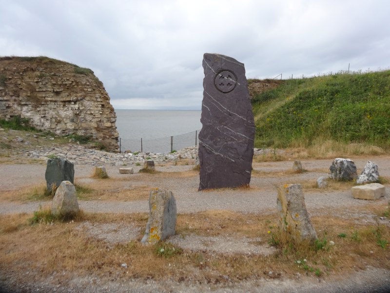
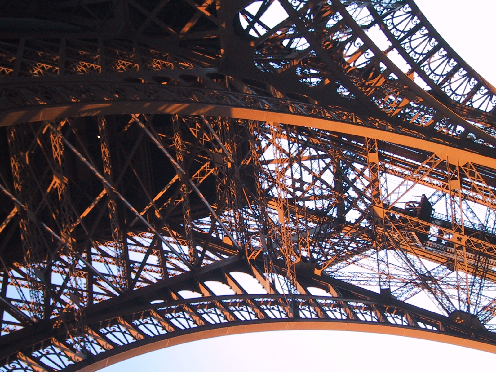
It is interesting that some of the markers that give us a sense of place are remote: the Eiffel Tower in Paris, the Empire State Building in New York, Tower Bridge or Buckingham Palace in London.  I have taken the lift to the very top of the Empire State building, but only stood underneath the Eiffel Tower, and yet each has significance to my notions of New York an Paris as place.  Similarly in London I have only in the last month crossed, or even been close to, Tower Bridge, and I have never been inside Buckingham Palace, and yet these are central to my personal concept of London.  There is surely some weird alterity here in that we often define a place by the landmarks seen from it, rather than the ground beneath our feet.

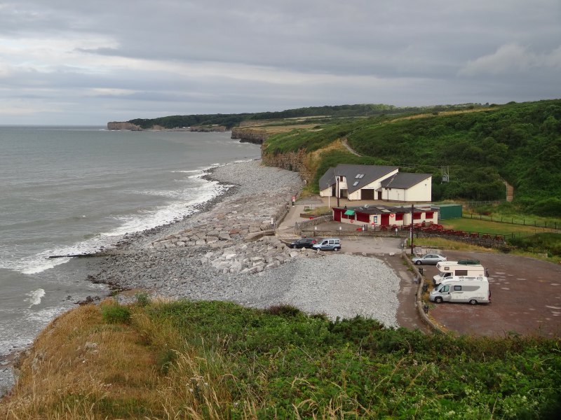
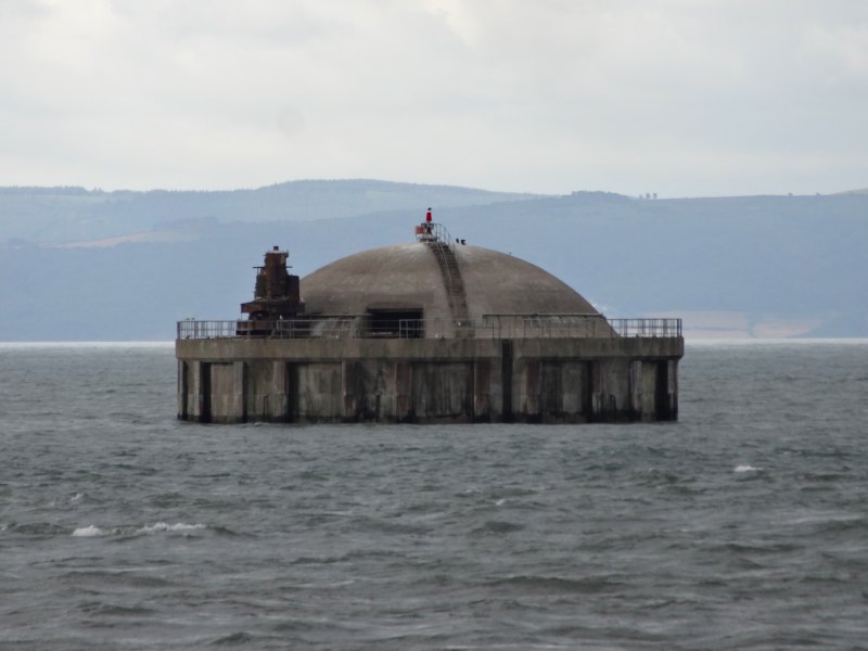
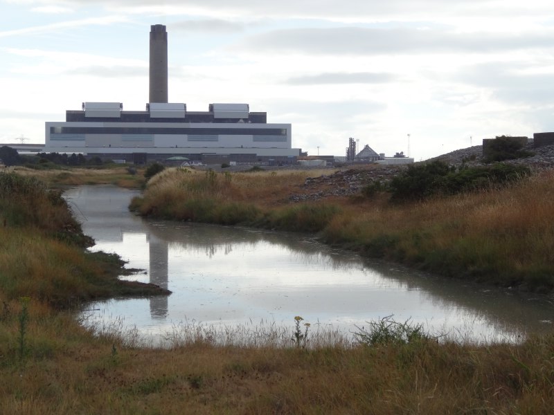
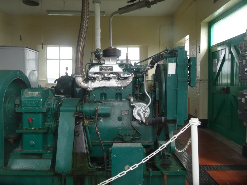
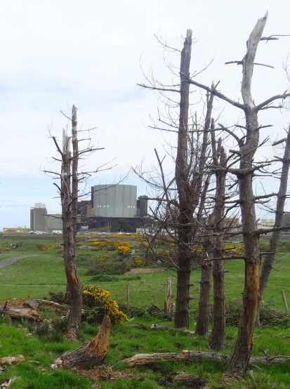
Walking the north east coast of Anglesey, Wylfa Nuclear Power Station dominates the view for miles in each direction, its remorseless concrete cube casting a palid glow on rocks, sea, gravestone, and dead-fir copse (see day 33 and day 35).  And yet close by, it becomes invisible, a double fence of razor wire, the hum of transformers, and a nature walk.  To see it close to, you must enter the visitor centre, as if, like the nuclear fires within, its outer shape can only be seen in simulacrum, and yet the visitor centre is closed to those with muddy boots, the walker in the land is excluded and only those who come by car from afar welcome.

forgotten places

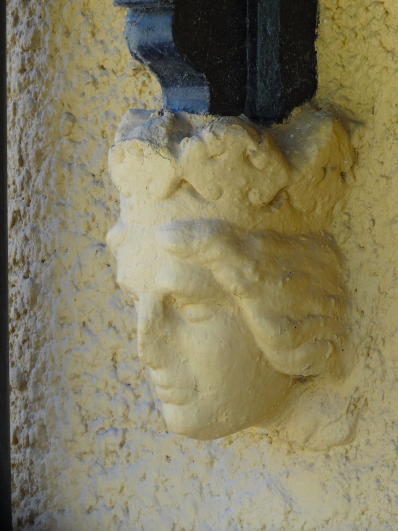
The quote from Tuan is at the beginning of a chapter entitled “Visibiity: the Creation of Place”. Bidwell and Browning’s  paper’s title starts “Making There”, both emphasising the conceptual construction of a sense of place.  In one of Tuan’s examples (p.169–171), Boston’s West End is to be demolished and yet the activists speaking up for it were “artists and intellectuals” as the idea of the neighbourhood of the West End was foreign to most of its residents.  Each felt passionately about their particular street, but had no concept of the larger area.  It was only through the campaign that it became, metaphorically, ‘visible’ and so the idea of the neighbourhood and the ‘place’ were created.

But, if place is constructed, what of its dissolution?

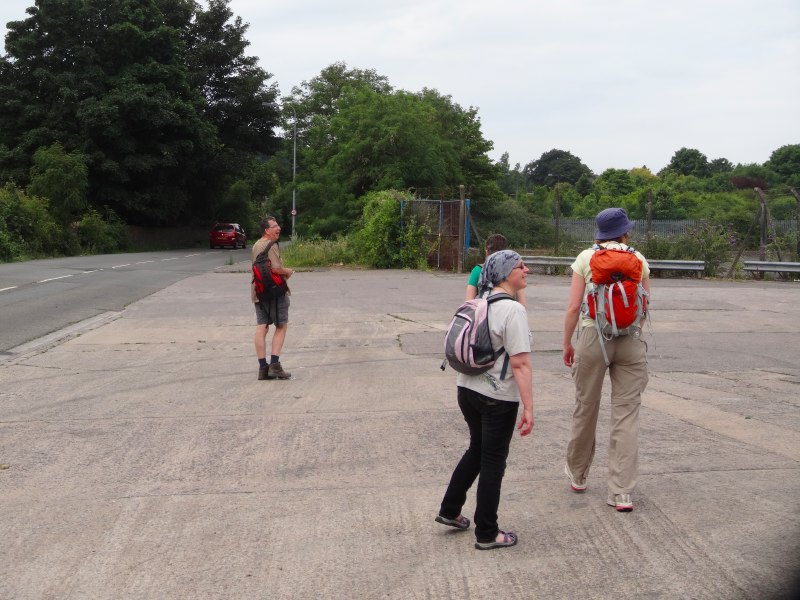
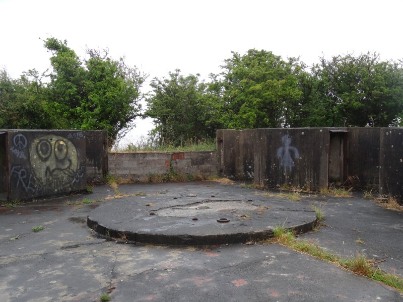
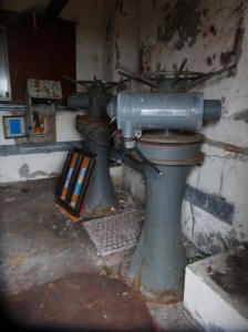
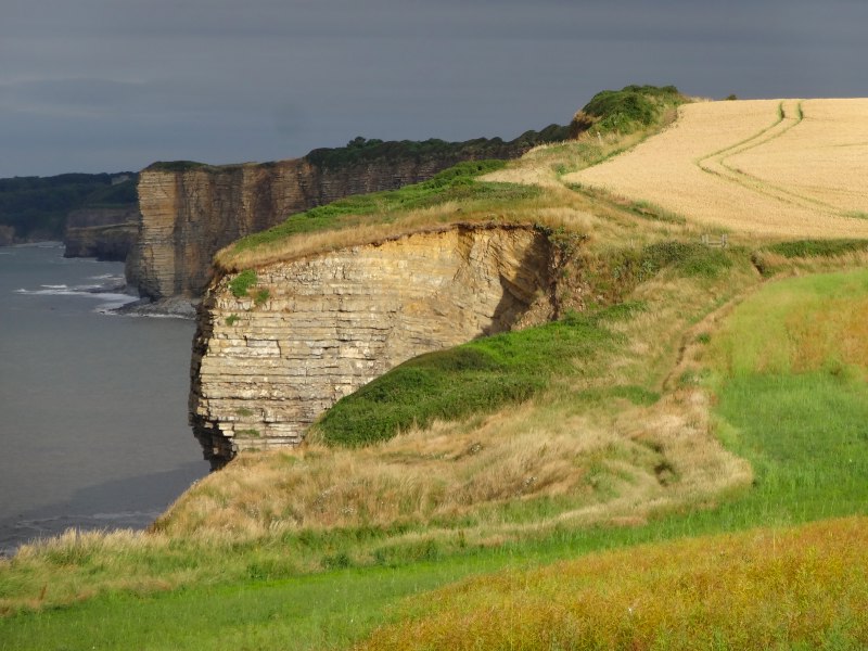
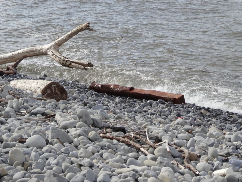
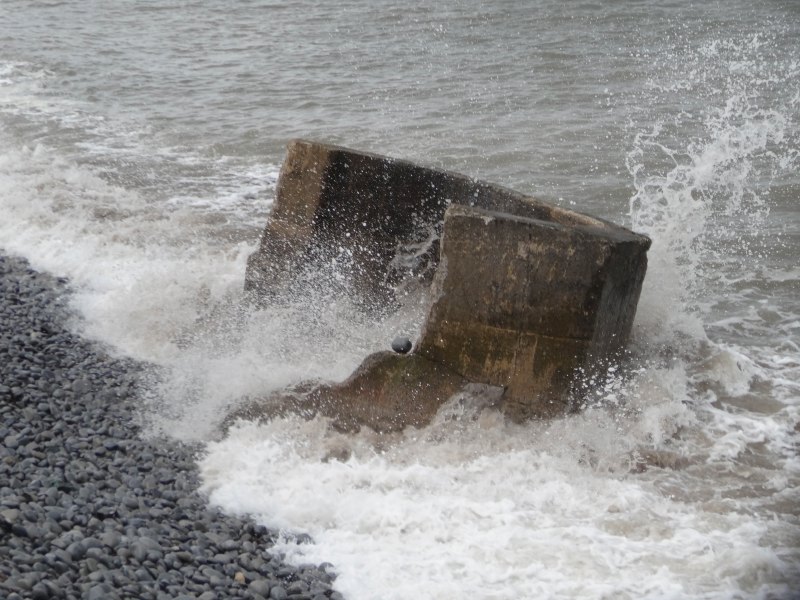
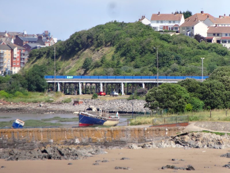
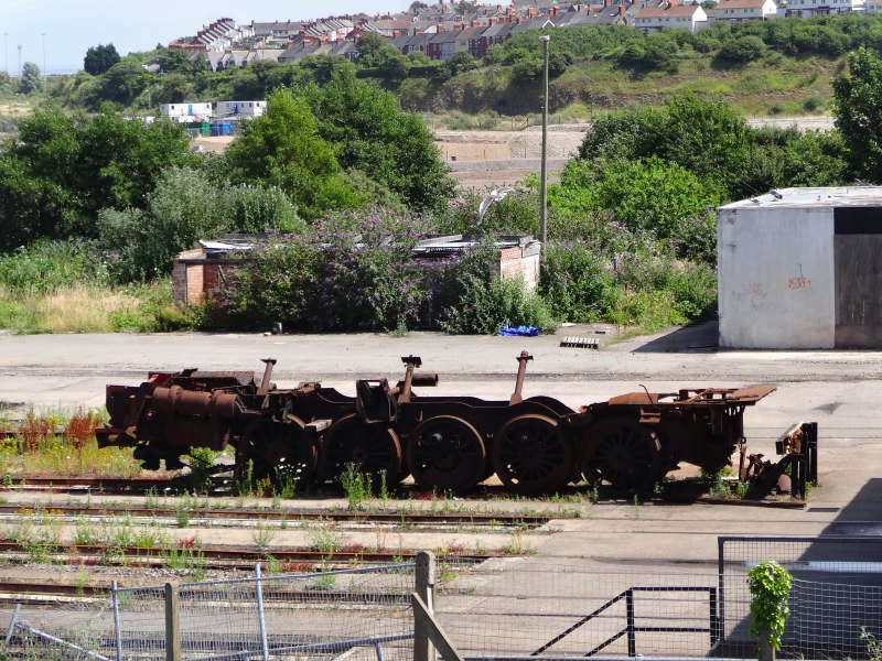
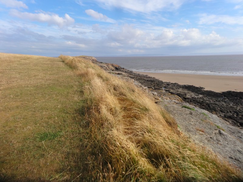
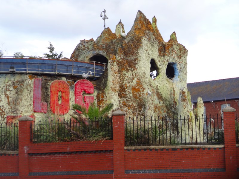
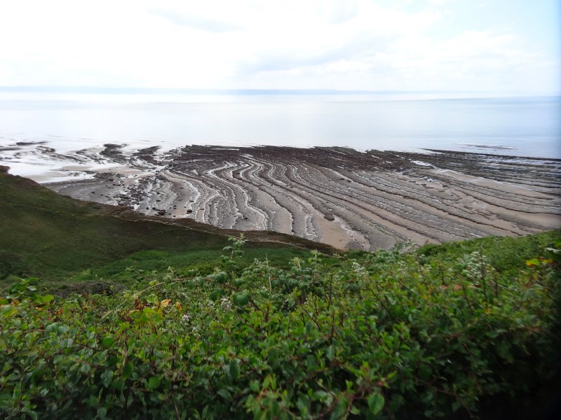
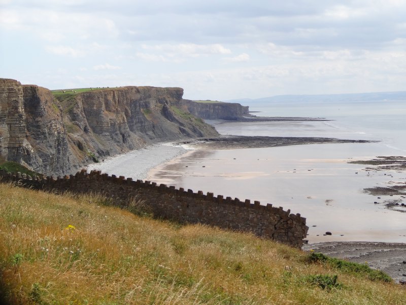
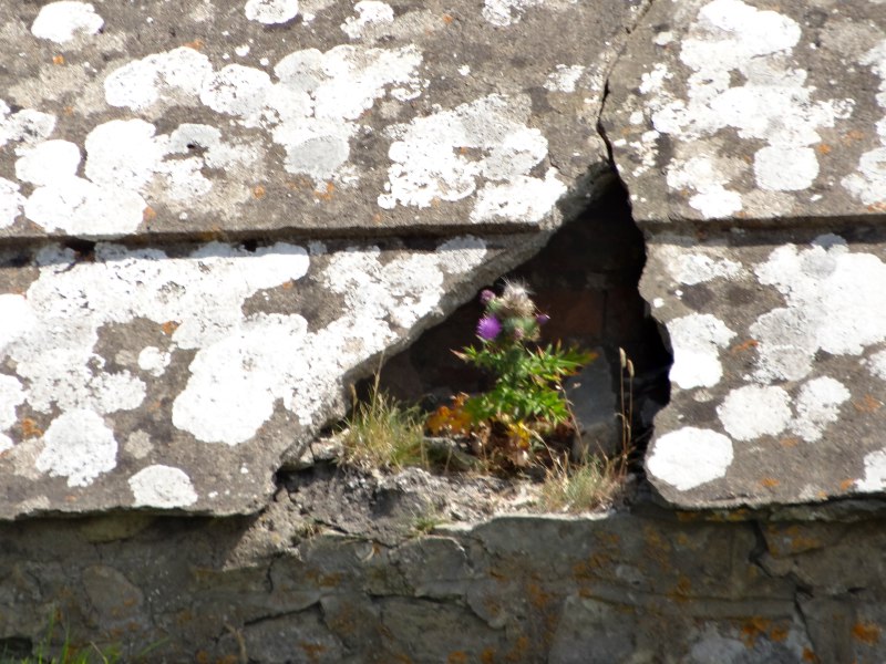
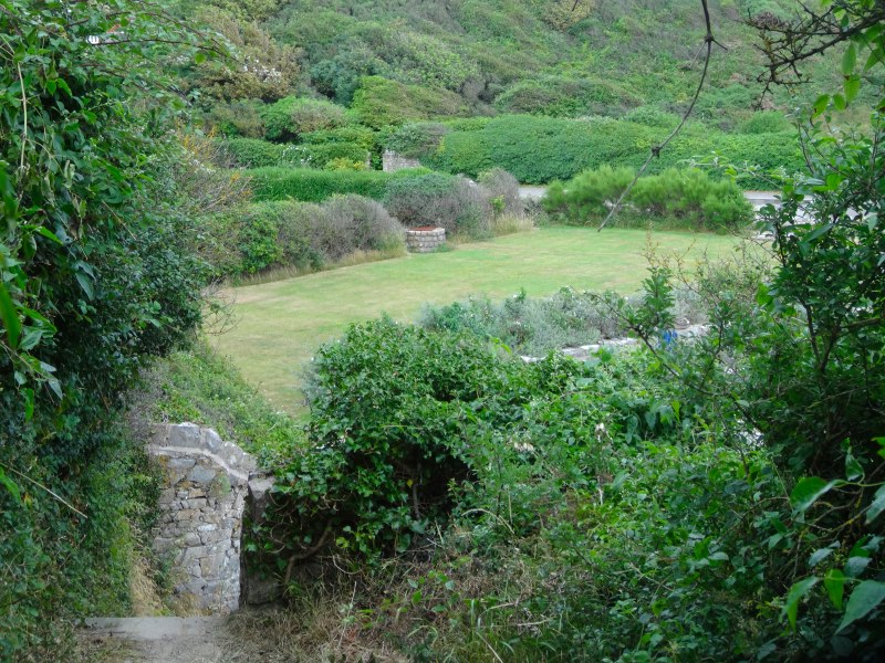
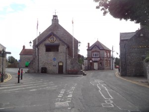
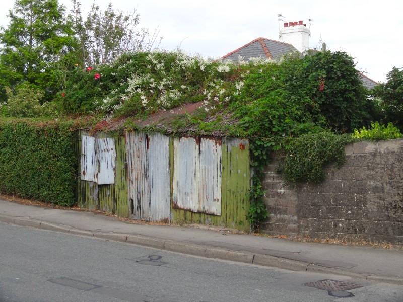
When walking, I sometimes became a little blasé to beauty, “another cove, another headland, another craggy cliff face.”  I have spent my whole life wishing to get away from the built environment, a Rousseau-esque idea of the noble savage almost before I could read.  And yet, in my own walking, it was the points of human habitation and intervention that were the points of growth.  This is partly the obvious ‘places’, seaside towns and villages where, as passer-by and dilettante, I sought to make sense of locality and community.  However, there are also the forgotten places, the remnants, the ruins, the abandoned workings and redundant factories.

To be honest I enjoy these sites purely for the joy of abandonment, the aesthetic of desolation.  However, there is also a desire to know more or simply fantasize about the people who lived and worked here before leaving their homes and work places, like their own bodies, to decay and dust.

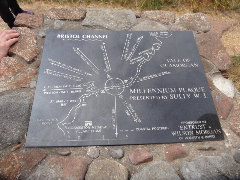
Many of these sites had information boards telling stories of the past and on Tiree I’ve been involved in efforts to make the extensive local archive available online in mobile app Frasan (meaning ‘seeds’ or ‘shower’ in Gaelic).  We cling to the memories of the past even when they are not our own.

2013-07-11 12.29.23
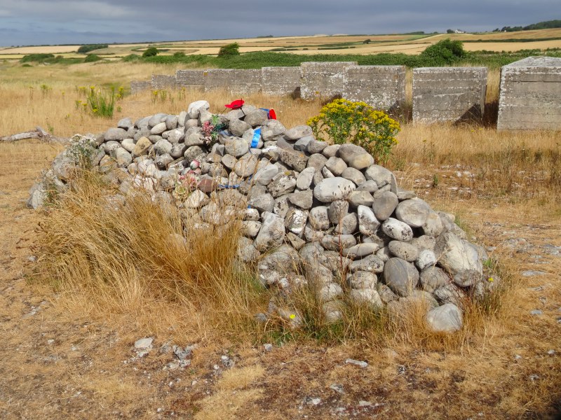
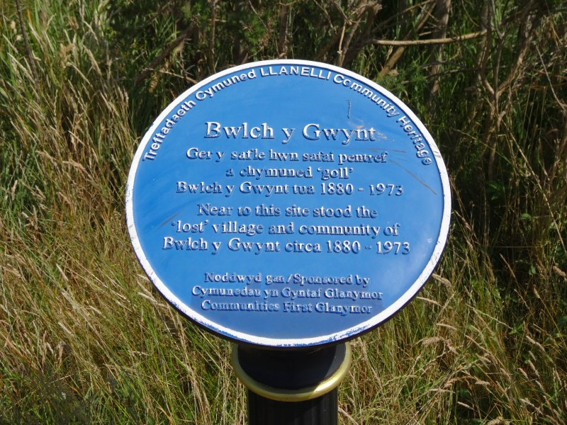
Walking east from Llanelli (see day 85) I passed a plaque to the ‘lost’ village of Bwlch y Gwynt, “circa 1880–1973“, a community that dissolved after the closing of the tinplate works that had dominated the landscape and economy for more than a century.  It seems odd that a community can get ‘lost’ in my own lifetime, and yet that sense of loss has moved others to form an ‘Abandoned Communities‘ web site.

I have also been reading Bell’s analysis of the ‘infinite archive’, alluded to earlier, and a recurrent theme in digital humanities.  Bell’s article starts with Derrida’s “Mal d’archive” (1995) and Nora’s vast ‘Lieux de Mémoire‘, project, which sought to document exhaustively the ‘sites of memory’ in France.  Bell, interpreting Derrida, sees the focus on the ‘archive’ as symptomatic of a fear of loss, and according to Nancy Wood, another commentator, Nora saw the “lieux de memoire” as “themselves the impoverished substitutes of the “milieux de memoire,” “environments of memory,” which have all but disappeared3.  Is the love of heritage and desire to record no more than a clawing at our graves, fighting the inevitable progress to death symbolised by the burial of our own memory?

wilderness and self

The participants in Bidwell and Browning’s first study were at a place of familiarity, but there is also a tradition of seeking true wilderness, places without memories, or at least without our own memories.

We often talk of people ‘being alone with themselves’ in nature, and there is a truth in this, a time to ponder, to contemplate, almost easier in places not too replete with memories to intrude or direct.

Nora, in an apologetic for the ‘ Lieux de Mémoire’ project says that4:

“Modern memory is, above all, archival. It relies entirely on the materiality of the trace, the immediacy of the recording, the visibility of the image. What began as writing ends as high fidelity and tape recording. The less memory is experienced from the inside the more it exists only through its exterior scaffolding and outward sign” (p.13)

In the wilderness, in the absence of this external scaffolding we are free to experience memory more directly, more starkly, supported only by our own non-archival minds; for once experienced ‘from the inside’.

Or perhaps not?

In a way wilderness, places without personal significance, places that are place-less to you, open space; these places, in taking away the external props, can lead you not to be alone with yourself, but to be alone without oneself.  To the extent that our notion of self is a construct of our own personal histories, in these spaces without ‘lieux de mémoire’ we are in some sense cast adrift or perhaps cut loose.

Bidwell and Browning’s studies are set in Queensland, Australia, a land where land and culture are deeply entwined, for the aboriginal inhabitants, but, in large part, apparently trackless and empty to Western eyes.

I recall my first visit to Australia many years ago, to Melbourne in the South.  After several heavy days of meetings we had a day off before the flight back to the UK. My colleagues wanted to go shopping, so I got the hire car to myself and set off to see Hanging Rock to the north and the apparently endless beach to the south west of the city.

As I walked the ground I felt the age of the rocks, rooted deeply into the fabric of the land, calling me, as if, when I stood still, the rock were creeping up my legs, so that I could become one with the land itself.  I recall the spirits of the land in Patricia Wrightson’s Song of Wirrun trilogy; creatures of the rock, slowly moving, ageless.  It were as if I could become like them transient flesh to eternal stone, and yet, in their age and primitive wisdom, did they lose something of the contingency and compassion of mortality?

But as well as that more transcendent yet earthy desire to lose myself in the land itself, I felt a more earthly temptation to abandon hire car and passport, to simply walk, a hobo traversing the empty places.

Of course, it is not just in nature that we can find such wilderness.  Films and books return repeatedly to the trope of the urban wilderness, the allure of anonymity in the crowd, the desire to cut oneself off from the archive, authority and past.   In anther recently read book, ‘All Things Betray Thee‘, the inhabitants of Moonlea long to destroy the hall that contains the records of their debts, although it is jealously guarded by clerk, Yeomanry and priest; the latter forgetting the one who battered down the gates of hell to wipe clean the debts of all.  The record of things past can be a heavy weight.

Augé’s Non-places considers malls and airports, vanilla spaces without the social history to make them places.  Yet maybe it is this that is part of their appeal, satisfying for the modern consumer the same urge that led the inhabitants of Moonlea to throw themselves vainly and bloodily into the Yeomanry’s musket fire or that led the heroes of spaghetti westerns into the desert.

the universality of the particular

Bidwell and Browning’s second study was also with people local to the area.  However they were at an event and in particular an arts workshop, which will have changed their perspective.  The data gathering was also focused around found objects, what Bidwell and Browning call nature probes’.

It maybe the object-centric, event-based or arts-focused nature of the study, or some combination of all, however, whatever the cause, in addition to very situated comments, there were also more personal and crucially less-site specific ones:

“… a participant compared the unobtrusive slender leaf to herself “during in the week” but its dazzling, coloured tip to herself “at a party”.” (p.234)

The leaf could have been a leaf anywhere.

I walked on a number of long beaches: Hells Mouth in the Lleyn Peninsula, the endless sands north of Aberdyfi, and more.  Most I have never been to before, and yet there was always a sense of nostalgia, and déjà vu, of coming home.  I think they conjured up remembered and half-remembered feelings of childhood seaside holidays, even though the beaches I actually visited as a child often evoked less visceral feelings.  Perhaps the idea is more solid than reality.

Indeed, there is something about the universality of the particular: each tree becomes every tree, each leaf, every leaf.

142_4272Some years ago, when giving a keynote at a workshop of Space and Spatiality, I used my own childhood memories of growing up in Cardiff, the way my infant mind gradually joined together the scattered jigsaw pieces of experience, threaded them like a toy necklace, and eventually laid them flat in mental maps5.

I had feared that this personal reminiscence would be too self-indulgent, and yet quite the opposite, so many people were touched — my own, very personal story struck chords in others, reconnecting them each to their own childhood.

And this is some of the power of the wilderness, bereft of particular memories, it becomes all our memories.

  1. Harrison, S. and Dourish, P. 1996. ‘Re-Place-ing Space: The Roles of Space and Place in Collaborative Systems’. CSCW’96, ACM. doi:  10.1145/240080.240193.       Dourish, P. ‘Re-space-ing place: “place” and “space” ten years on’, Proceedings of the 2006 20th anniversary conference on Computer supported cooperative work, November 04-08, 2006, Banff, Alberta, Canada. doi: 10.1145/1180875.1180921.[back]
  2. See David F. Bell, ‘Infinite Archives’, SubStance, Issue 105 (Volume 33, Number 3), 2004. pp. 148-161, doi: 10.1353/sub.2004.0034[back]
  3. Nancy Wood. ‘Memory’s Remains: Les lieux de mémoire’.  History and Memory. Vol. 6, No. 1 (Spring – Summer, 1994), pp. 123-149. Indiana University Press   http://www.jstor.org/stable/25618664[back]
  4. Nora, P. (1989) ‘Between Memory and History: Les Lieux de Mémoire’, Representations 26, 7–25. http://www.history.ucsb.edu/faculty/marcuse/classes/201/articles/89NoraLieuxIntroRepresentations.pdf[back]
  5. A. Dix (2004). Paths and Patches – patterns of geognosy and gnosis. In Spaces, Spatiality and Technology. Napier University Edinburgh.  http://www.hcibook.com/alan/papers/space2-2004/[back]

health, pain and fitness – does 1000 miles help?

People have often asked me, both during and after the walk, about its impact on my general health and fitness.  The answer depended a lot on the point in the walk I was asked, but now, when my body has had a chance to recover, I can unashamedly say yes, the impact is major, but not necessarily in the ways I had expected.

I’ll spare you the before and after pictures, and give the blow-by-blow account, but as a sneak preview, it ends with 200 push-ups at a ceilidh.

I’ll start with the base point.

I live my life behind a computer screen or the wheel of a car, and for many years relied on a good general level of fitness as a child.  I was never a sportsman, partly because I was not particularly athletic, and partly because I needed to help my mum with her job as caretaker at the church and this pretty much precluded any after school activities However, in my late teen years I would regularly go for a run each Saturday morning in between watching Open University programmes and shifting hundreds of chairs and tables at the church.

As well as regular runs, I used to walk everywhere as a child, as I generally could not afford buses.  On one occasion this involved dragging old mattresses several miles to the local waste disposal site, with only the wheeled frame of a shopping trolley to help.  However I also used to walk for pleasure, out of Cardiff to the hills or sea shore beyond on my own or with a friend.  This would start with an hour or two to get clear of the city before walking in the countryside, and a day of 20 miles was normal.

But that was all 35 years ago.  Since then exercise has gradually shrunk to the tapping of computer keys or dashing back and forth down university corridors, often leaving passers by spread flat against the walls for fear of being knocked over.

When we moved to the island I started to run regularly on the beach for about three months … and then I started travelling again, stopped running and never restarted.  Between that and the walk there were a few sporadic, and maybe precipitous to the point of foolhardy, attempts at exercise.

After 18 months of indolence I was going to be on Tiree during the annual Tiree 10K, so, with a grand total of two practice runs, I entered and, to be honest, while running thought I was not going to make it to the end.  Buoyed by the knowledge that lack of preparation does not guarantee fatal consequences, six months later I cycled the Cumbria–Newcastle coast-to-coast with Miriam, not having cycled up a hill for 15 years.

My next feat of fitness foolishness came six months later again, at the next Tiree 10K.  To be fair this time I started to train well in advance (three weeks), partly because I was to be away at a conference just before, so needed to be able to leap from the plane and run pretty much straight away. In ten days I worked up from nothing to running a half marathon distance (which did amaze me, even though it did take weeks to wash the blood out of my T-shirt); at this point my Achilles tendon had had enough of this treatment and decided to teach me a lesson.

However, while I was indisposed for the spring 10K (the pain of hobbling across Gatwick airport is still fresh in my memory), last December there was a winter 10K on the island.  Avoiding my over-preparation mistake of the spring I returned to my original exercise regime, two practice runs then enter, and survived without intimations of death at any point — clearly the long-haul intermittent hell strategy does have positive effects on the body.

After this I intended to do lots of practice walking through the winter in preparation for the walk, both for body fitness and to get used to walking in bad weather — I spend my life trying to stay ‘comfortable’, I needed some discomfort training.  Well this was the intention, but well … walking takes a lot of time, and I always feel too busy …  the pattern should be familiar by now.  Three weeks before I was due to leave the island I started some practice walks.   Tiree is pretty flat, but there is Ben Hynish with the radar golf ball that sees civil planes safely across the Atlantic.  I intended to practice walking up Ben Hynish, but …

The long and the short of it is I started out walking 1000 miles around Wales with a grand total of two weeks preparation (the last week was Miriam’s wedding).  If I was going to get fit it was going to be ‘on the job’.

I expected some pain early on and then to get fitter and fitter during the walk, so that by the end I would be like a mountain goat gambling up hills as if I didn’t notice them.

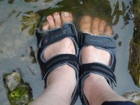
To some extent the part up Offa’s Dyke went like this.  Day three was the hardest, long, low on food and water (yep, I know that should never happen to a well prepared walker, I was in the Scouts, I know the theory!), and the first time I had walked any slope for years … and by slope here we are talking just 1 in 10.  Amazingly my actual feet survived the whole way with virtually no blisters.  I used the grand total of two Compeeds (plaster + padding) and three elastoplasts during the whole walk and two of the latter were for bramble cuts.

As expected, by the time I got to the last day of Offa’s Dyke I was striding up Moel Famau, the highest point of the Clwydian Range, effortlessly passing other walkers along the way.  I realised I had become one of those really annoying people who make it all look too easy.

However, any danger of smugness was shattered by North Wales.

The North Wales path from Chester to Bangor is along a flat sea coast, barely rising a few meters for its entire length; indeed for much of the distance it runs along seaside promenade.  I had thought this would be an easy stroll after the hills of Offa’s Dyke, but the flatness was nearly my undoing.  On my first full day of walking I got some sort of tendonitis on the top of my left foot and it swelled up like a balloon.  I think it was due to the regular unchanging nature of walking on the flat, constantly using the same muscles, the same tendons, in the same way.  I swopped into sandals, not knowing if it would help, but worried this might be the end of the walk.  However, the increased flexibility of wearing sandals made all the difference and very gradually the swelling eased.  When a week or so later someone looked at my still slightly swollen ankle and said “you I can’t walk on that”, I said “you should have seen it a week ago”; I felt I’d managed to work through difficulties and win through.

So no longer a mountain goat, but I guess still a little smug.

Not long after, that also changed.  From about the third way point, and especially as I got to half way, things got harder and harder.  Long term strains and pains started to set in, I couldn’t bend at the knees, different joints and muscles would hurt, and the knowledge that I still had as much to do weighed down on me.

Instead of a mountain goat I felt like a geriatric.

Over recent years I have run further than I had as an 18 year old, I can lift heavier weights and now was clearly walking far far further.  But when it comes to repair youth wins; I was doing damage faster than my body could strengthen itself and was seriously worried that I was causing permanent injury.

I was sleepy tired because I was walking, writing and tending technology for 18-19 hours a day, I was physically tired, and hurting, depressed as I wasn’t getting as everything done that I intended, and worrying that I wouldn’t get the miles in to get me back to Cardiff on time (see my poem ‘Tired‘ for a hint of the feelings, written when I was ‘on the mend’, but still feeling the fatigue)

With no mental or physical reserves, the only thing that kept me going was the knowledge that I had decided to do it.

In a race they talk about the wall.  In a marathon it may last half an hour, in an Ironman several hours, but here day on day, week on week, and yet slowly, I came out the other side.

The physical pain did not go away straight away, nor the stiffness, but gradually things got better.  This was partly the result of wonderful people I met along the way, partly that the path got easier (Ceredigion coast path is wonderful), and partly that I did try to take some full or part rest days.

And after the initial worries about getting sufficient miles under my belt, I ended up ‘front loaded’, so that the last quarter of the walk I could average less and less miles each day, and my body could start to recover.  By the time I finished in Cardiff it was really just the soles of my feet that still hurt.

Now, more than six weeks on, even these are beginning to heal and last weekend I did my first two runs since the winter 10K , and it was easy.

I have not forgotten the pain and intense weariness of the middle times and yet, if there were no constraints of work or money, I would start again today, maybe going the other way round, or maybe walking somewhere else.

However, it is not with the slowly healing soreness of my feet that I want to end.

I had expected my lower body to toughen up and my legs and gluteus are indeed firm.  After a few days when my blood sugar dropped I worked hard to eat plenty, so I only lost a little weight, but have clearly converted some excess fat into muscle.  My belly is no rippling six-pack, but under the hair and fat (aren’t you glad no pics) clearly more toned.

I also expected that the inevitable calorie deficit would eat into my upper body if I wasn’t careful.  I deliberately took a Bullworker along so that I could do a little exercise, but never had time and it sat unused.

When I got home I decided to see how my arms had fared through the neglect.  Before I left, if I occasionally did some press-ups I could manage 20 with a struggle on a good day, but that was the max.  But now, when I got down I powered through 20 and at 30 was still feeling fine. When I tried again on subsequent days I got to 40 and then 50 press ups.  It really does sound like one of those food supplement adverts, except instead of ‘instant’ fitness this took 100 days of toil!

I think this is all down to the long-term cardio-vascular exercise of walking.  It is known to be one of the best ways to strengthen heart and lungs.  I wish now I had taken a peak flow meter to see how my lung capacity changed, but hopefully when those who know how to analyse my bio-data look at it, that may reveal some of the changes.

Looking back I also realise just how efficiently I worked during the walk.  On top of 8-10 hours walking each day, sometimes driving or public transport time on top of that and an hour ‘tending technology’ (charging, copy data, etc.), I was also writing around 2000 words a day, that would be a good rate if I were doing nothing else.

A recent study took children with ADHD and tested their attention span after 20 minutes walking.  It was as good as when they took the standard dose of medication.  Physical exercise is as good for the mind as it is for the body.

Finally, and what made me want to write this, was the experience at the HCI conference last week.

On the Thursday evening there was a ceilidh after the conference dinner.  A wonderful band, Modhan, had travelled down from Edinburgh to play for us.

After the first set I we all went back to our places breathless, while the band played a few non-dance tunes.  I was feeling exhausted, but wondered how my strangely altered body would fare when word out like this.  In a secluded corner I arranged some chairs so I was not too obvious and started to do push-ups; the last half dozen were hard, but I got to fifty.  After the next set I did the same and fifty again, then the third set another fifty.  Towards the end of the evening well after midnight a fourth set of fifty, two hundred in total amongst the ceilidh dancing.

I did wonder if this was the effect of the copious wine and that I would be unable to move in the morning, but in fact, the only pain was a soreness in the calves from the dancing.

I am still amazed at this alien body I have been transposed into.

I’m sure you’d get 90% of the benefit from a simple 20 minute walk each day and avoid the pain. This coming year is going to be very busy, so I am certainly hoping I can maintain this unexpected fitness without doing a 1000 mile walk every year.

Indeed signing up for Will (resident Tiree Ironman) Wright‘s autumn circuits sessions now 🙂

… but then there is always 2015

walking again, back on Tiree

Just had a wonderful day walking the length of Tiree.  At just twelve miles just a step compared with 1058 miles around Wales, but still the length of a whole island!

I got back to Tiree just over a week ago, on Monday 5th.  On the way over I had wondered about doing a walk on the island so that some of the people here could join in.

As we drove off the ferry, we passed a few folk we knew walking off and shouted hello through the windows, then Fiona said, “look”, and as I looked ahead (not a bad thing to do when driving along a pier), I saw a crowd of people waving flags, with champagne popping.  It was a wonderful moment and one I had not imagined.

2013-08-13 09.38.41-cropped

setting off (photo Esther Dix)

So, it was lovely to be able to share a bit more of the feeling of the long walk, by walking the length of Tiree.  With the Coll Half Marathon and 10K next weekend, there wasn’t going to be a perfect time for everyone, but eight of us walked together, some for the whole way, some having to break off for dentistry or conserving feet for the 10K on Saturday.

We started in Caolis at the North East and walked on roads and beaches, within lunch sat outside Dorinda’s gallery in Scarinish, a quick cuppa at my house in Crossapol and then finished down at the Skerryvore Lighthouse Exhibition at Hynish.

During the walk we talked a bit about the combination of commitment and perseverance that has to take over when physical and mental endurance fail, and Dorinda told me about the people of Galacia in Northern Spain, another Celtic area, whose traditional dress is just like in Wales.

Radio Wales interview

A resting day (wow!), with just a short trip back to Barry to pick up the van.

Esther left by train on her way back to Liverpool, and Miriam and Oliver driving back to Birmingham, so celebrations coming to an end … real life soon!

However, this afternoon I had a short interview at Radio Wales on the Good Evening Wales show.

I found the whole process fascinating and very efficient, the gap between being picked up to when I was back at the hosue was barely an hour.  At the studio there is a control side and the room with the presenters in.  In the control part Louise, who had talked to me by phone eaelier to set up the interview, sat with two others each with two or three computer screen search.  High on thew walls large screens showed news stations on silent, the ticker0tape announcing breaking news.   I’d have liked to find put more about the different roles, but they were in the middle of broadcasting, and obviously doing various coordination jobs centred around, what I think was, a timeline of the programme.

Nelli Bird talked with me in the studio with Gareth Lewis chipping in.

Nelli had interviewed me by phone at the beginning of the journey in April, while I was sitting on a wooden bench at the back of an industrial estate between Newport and Nash.  She is a Newport lass, but I had to admit that I was doing Newport first not because it was the ‘best bit’, but rather I was ‘getting it over with’ first.  I should add, that I learnt lots of good things about Newport that day!

We talked mainly about the issues of poor mobile and broadband access across Wales, the impact on education and general inclusion.  Garath said that maybe sometimes it is better not to have Twitter access, which is absolutely right in the middle of a wild area.  However, the Arab Spring and similar movements elsewhere have shown that Twitter and other social media give people a voice; if people in the Welsh margins do not have effective access, they they effectively become voiceless.

The full programme can be found on the BBC Wales website here (streaming, see 1:15:25), but I have also made an extract of the interview (mp3).

Day 102 – Penarth to Cardiff

homecoming to classic Cardiff weather, the end is a beginning

28th July 2013

miles completed: 1058
miles to go:  0 — Finished!

Three miles to go, a simple morning stroll.  In fact, given the weather forecast, perhaps we should have walked across at eight and had breakfast in Cardiff.  However, that was not the plan.

Fiona and I had spent the night at the Pier Hotel in Penarth, and at various points between nine and eleven, several people joined us for breakfast … some closer to eleven: Esther, Janet and Rachel joined us first and then later Zac and Candace brought Miriam and Oliver, having negotiated confusing roadworks in Llandaff and then Penarth, which includes going the wrong way round a roundabout.

At eleven I went down to the Pier and Andrew was there to walk the last day with me as he had walked the first.  And the rain started.  By the time the rest had joined us, after packing cars and finishing breakfasts, we were already a slightly dripping crew sheltering under the canopy at the pier head.   There were eight of us as Zac and Candace were not walking, but were going to drive round and meet us in Cardiff Bay.

So the final three miles started in classic South Wales weather; the rain poured.

We made our way over Penarth Head up stairs, then along Victorian terraces, with occasional views of the sea or of Cardiff ahead, all in surprisingly good spirits given the rain soaked every inch of our bodies, finding ways to sneak through unsuspecting gaps in waterproofs, or simply swamp them with its volume.

I was wearing my hat for this last day, but, worn and bedraggled I felt rain gradually dribbling down through the top onto my head, and starting to fill up above the seal between brim and head.

After a short while the path drops down towards the marina, where Janet and Rachel, who had popped ahead to find a shop, were waiting.

There is an imposing building, which, I guess, used to be the port office and is now a restaurant, the marina with a waterbus just arriving and then the expanse of the barrage stretching out ahead.

I was trying to take some photographs, sheltering the camera from the worst of the rain, but had to give up.  I must go back sometime, as I had never seen the barrage up close before, and the engineering is impressive, first a bridge and lock, although I did not spend a lot of time examining its mechanism, as I normally would, then what I think is a large adjustable weir to control the level of water in the Bay, and finally, after that, two large sail-like structures, huddles of sodden people sheltering in their lee, where the barrage becomes more of an earthy causeway.

Although the forecast had been for rain, and the previous day had rained, the majority of people were in summer clothes, whether in the perpetual state of British summer optimism, or simply not having adjusted to the break in the heat wave.  Although, the British are never totally unprepared for the weather, and there were many umbrellas over dripping summer tops.

I recall the first term I went to university in Cambridge. On the dry east coast it rained about twice.  I had a six week Christmas break and planned to do some repairs to the back door of Mum‘s kitchen over the break.  I had forgotten Cardiff weather.  It of course rained every day of the entire six week break.

I had expected days of rain like this during the last few months, to have to walk when the rain went on continuously from morning to night; this is Wales.  Instead I have had amazing weather with only six days of proper rain and then no day that was utterly unremitting, some days, as when I walked Church Bay to Holyhead, starting with heavy rain and then easing in the afternoon, some days, like Holyhead to Rhosneigr, starting bright and then turning to rain later, some, like going over Moel Famau and the northern Clwydian Range, with horizontal hail, but then alternating with bright and clear periods.

However, the weather decided I needed reminding that indeed this is Wales and Cardiff to boot, and so upped my rainy days quota by 33% in the final two days of walking.

Part way across there was a useful public toilet, of which those who had had serious amounts of coffee at breakfast availed themselves, while the rest gained what shelter they could against its walls, and then the final walk past the new Dr Who exhibition, where, just in time to let me photograph the Tardis by the waterbus stop, the rain broke and the blue skies that seemed to be to either side, but not over us, did eventually catch us up.

The last half mile was, well not in absolutely glorious sunshine, but bright and, compared with the hose-pipe-like torrential downpour as we crossed the exposed barrage, dry.

But we were early, as we got to the Norwegian Chapel it was only twenty past twelve.  The three miles on the official mileage charts feel as if they are definitely rounded up, and, with heads down and few stops to take photographs, we walked quickly.  We didn’t want to get to Cardiff Bay too early as Zac and Candace were meeting us there and also Rosie had said she was coming, and we had tweeted 12:30 to 1pm.  We didn’t want someone who had come to meet me miss me arriving.

So, for a few minutes, we dawdled near the Norwegian Church, built for Norwegian sailors on their visits to the docks, and Andrew and I took a look at the lightship, that once was moored in the channel to guide ships into the ports of the Bristol Channel, but is now permanently moored, and, if I recall, is some sort of Christian centre.  Near it is a tea, coffee and sausage van, but having had a very big breakfast at Pier Hotel, I resisted the temptation.

So, after dawdling for fifteen minutes, it was after half past twelve, and we slowly walked towards the Merchant Navy memorial, in front of the Welsh Assembly, where I had begun, three and a half months, 102 days, ago.

Zac and Candace had been sheltering under the huge canopy of the Assembly and took photos as we approached, and then more photos, and we opened two bottles of champagne at the memorial.

Rosie wasn’t there, but it turned out was at the Scott Exhibition; she had been at the end some time around twelve thirty, and then came along the barrage in the opposite direction, I’m guessing missing us when I was looking at the lightship, so for the third time we managed to miss each other along the path.  She had completed the coast path only a few days earlier up at Chester and then drove here on her way back down to the South East (of England).

So, that is it, the walk ended, but more celebrations for birthday and of the completion of the walk over teas, coffees, cakes and moussaka at the Norwegian Church cafe, Jaspers at Llandaff and the Bosphorus on Cardiff Bay.

It is odd, for three and a half months I have been ‘the man who is walking round Wales‘, and that has become who I am.  It feels odd to shift from being ‘Alan walks Wales‘ to simply ‘Alan‘.  Of course that is part of the point, although I end up where I began, things have changed, the location is the same, but I am not the same.

For 102 days the future has been to some extent mapped out, where I would be, and approximately when I would be there.  However, that presages a time of more openness.  I know some things that will happen in coming months, not least catching up on my work for Talis, including working on the online HCI course for a fresh autumn run, completing the TouchIT book on Physicality, and lots of data curation and writing relating to the walk.   But there will be more, everyone asks ‘what next’, and the question will hang there awaiting an answer; at the risk of nearly quoting Terminator, the future feels more open than it did when I started.

Day 101 – Cadoxton to Penarth

and then we were five

27th July 2013

miles completed: 1055
miles to go:  3

2013-07-27 11.22.03Clare Hooper had joined me in Penarth to walk with me today, so after a relaxed breakfast at the Premier Inn in Barry, we caught the train to Cadoxton two stops down the line.  There Fiona, Janet and Ted were waiting for us.  I hadn’t known Ted would be there and it was wonderful to see him, he had met me briefly on my first day’s walking and had come again to join me near the end.

I displayed my superior navigational skills to the assembled masses, by confidently leading us down into the subway to the next platform, but quickly corrected this to the pathway down to the road and join the coastal path.

By walking to Cadoxton the morning before I had cut out some of the road walking, but there was another mile or so through town streets and past a chemical plant.  Ted works for the company that runs the plant and explained that the towers were the tallest in, and now my memory fails me, certainly the UK, maybe Europe.  The plant is shut down at present for annual maintenance.  Ted explains that it is better to have a single scheduled maintenance period, than risk closures while in operation.

2013-07-27 11.11.07As we walk past the plant, on the one side small horses rush up in the hope that we have something to eat, but as a warning against their importunate nuzzling a sign reads:

Please
Do Not ^ horses
     feed
Anything

The kerbstones proudly announce that they are not stone, but instead, “Enviro-Kerb. The recycled composite curb drainage.”

Eventually, we reach the sea, sadly Cardiff-side of the dinosaur footprints.  Later we meet a local man, Linus, who told us that there were alternate ways through the docks which allowed you to walk more of the coats, but the port authority had resisted the Wales Coast Path leading through the docks.

As we look down the coast Sully Island, joined to the mainland at low tide, already looks close, and Steepholm, which has been visible for some days, is less indistinct although still some way off in the middle of the Bristol Channel.  As we walk, Flatholm appears, apparently between Sully Island and the mainland, although in reality much further away and further out to sea.  Both were fortified during the last war, and I’m sure there used to be day trips to Flatholm, although I never went.

2013-07-27 11.52.51We met Linus a little way along the coast at Sully, after the path had passed in front of some houses, a playing field and then some more houses, and appeared to be about to cut inland.  We knew there was a short zig-zag inland coming up, so we almost followed the road.  Happily, Linus saw us and pointed out that from the other direction the coast path arrow appeared to point to the sea.  In fact the post had been removed and reinstalled as part of some building work and the builders had put it back the wrong way round.

A short way after we got to the point where the path really did do its little zig-zag, along the edge of a small field, where the diminutive coast path roundel would have been all but invisible if not for a large sign that said, “End of the Footpath”, with an arrow pointing the way to go, just beyond which we found the ‘Captain’s Wife‘ where we stopped for lunch — indeed, the only eating place in the ten miles between Barry and Penarth.

2013-07-27 12.18.19The story is that the ‘Captain‘ who lived there kept the body of his wife in a box after she died.  Some time afterwards thieves broke in and, thinking it a treasure chest, stole the locked box.  The story ends there and we are left to imagine the distress of the Captain (although I’m sure modern counsellors would see it as a way to ‘move on’) and the shock of the burglars when they opened the box.

Just beside the Captain’s Wife is the clubhouse for Swanbridge caravan site.  When we had one of those ‘what did you do over the weekend’ sessions, one of the boys in my class  at junior school, used to talk a lot about going to their caravan (a bit of social one-up-man-ship), I thought at ‘Swanage‘ … a bit of a long drive for the weekend.  I have a feeling I had realised my mistake in the past and then forgot again, and it was only when I looked at the map in recent days that I realised it had been ‘Swanbridge‘, just a few miles from Cardiff.

While we started our lunches (they had real toad-in-the-hole), the rain started, and poured.  Everyone who had been eating and drinking outside rushed inside, and whether it was the swelling numbers, but the efficiency plummeted in Fawlty-esque fashion.  On the menu there was a coffee plus a mini-pudding option, but the coffee machine was broken.

“No problem, we wanted tea with it anyway,” we said.

But the waitress replied, “we have no hot water either.”

2013-07-27 11.43.19

We assumed this meant that they normally make tea using the hot water from the coffee machine, but felt it surely was not beyond the bounds of culinary possibility to boil water on a stove.

A little later the waitress returned to explain that the brulée torch was not working.

Happily, the puddings that were available were nice, and as we finished them there was no further excuse not to go out into the wet.  At this point Ted had to leave us to go back to his car in Cadoxton, it had been lovely to have him with us and to compare notes with his own walk round Wales, in stages, twenty years ago.

The cliff walk had to divert down a small lane and then across fields to avoid a small caravan park.  The soil from the fields, newly wetted upon a dusty, dry and cracked surface, clung damply to our boot, sandals, feet and trousers; each step made us taller until our footwear resembled 1970s platform boots, and we attempted to scrape off the clinging mud on every sharp corner of wood or stone we could find.

2013-07-27 15.36.09Back on the cliff-top path, not quite as clingy as the field mud, we found ourselves at a substantial WW2 anti-aircraft gun emplacement, the concrete bases, and old metal door and gun fixing points all that remains of a time when Luftwaffe bombs rained on the strategically essential docks.  I recall Mum told me tales of the excitement when a food boat docked raising hopes of luxuries such as bananas.

For a while a section of WW2 concrete path also helped us on our way.

We pass the ‘Marconi Holiday Village‘.  This is the site where Marconi sent the first radio message across the sea from Lavernock Point to Grassholm.  The holiday village sign was the only reminder of this historic event.  Where is the information board at least?

2013-07-27 15.54.53

Along the way is a small castellated building with an entrance, partially boarded up with broken plywood.  Inside the remnants of electrical equipment cling to the walls and two huge grey valves suggest some underground water course, maybe sewerage or maybe fresh.

And then, very soon, the first glimpses of Penarth Pier and Cardiff Bay through the trees, before we come to open parkland in front of expensive sea-view houses, the old metal cliff top railing, backed by a new post and wire fence where the cliff is clearly becoming unstable.  Here, as in so many places, the ever-shifting nature of the coast is evident.

The Pier, which dominates the view, would once have been a place for day-trips and ferries across the channel towards Weston-super-Mare.  Indeed I recall once as a child going on a trip almost all the way across, but not landing.  Maybe even then the Weston end pier was not in service, and I’m not even sure whether the trip went from Penarth, or Cardiff Docks.

2013-07-27 16.41.29Past the park-side bistro (also the place to go if you wish to pay for golf putting), we drop down the road to the Penarth prom, which has building work for new apartments, but otherwise is surprisingly like I recall it from forty years back.

However, at the pier I did have the disappointment I had been steeling myself for.  The Thayers kiosk has gone.  The girl at the current pier-end kiosk explained that Thayers had gone into administration and been swallowed up into a parent company.

So, then up into town to the rail station to have a quick cuppa and cake at Foxy’s Deli  before Clare‘s train back to Southampton and Janet being picked up by Rachel, who dropped Fiona and I at the Pier Hotel where we spend the night looking out on the typical South-Walian rain-greyed sea.

Day 100 – Barry to Cadoxton and MHA visit at Penarth

a short walk and meeting nonagenarians

26th July 2013

miles completed: 1047
miles to go:  11

The main thrust of the day was to visit the Ty Gwyn and Morel Court MHA homes in Penarth, but instead of taking the train from Barry Station, I walked the two miles to Cadoxton to make the next day slightly shorter.

2013-07-26 07.50.25The walk from Barry to Cadoxton starts along the side of the Barry west dock, which is now no longer a commercial dock, not an ‘Oil Storage Teminal’, as is still shown on the OS map, but now the site of dock side residential development.  I would not be surprised if it becomes a fully-fledged marina in due course.  From building signs there will be more development in the area between it and Barry Island, in the area that I recall as the railway engine graveyard.

2013-07-26 07.58.01Further east are commercial and industrial buildings clustered around and beyond the east dock, and my photos for the walk seem to be a mix of the abandoned quayside ironmongery, industrial views and the clock tower of, what I take to be, the massive Victorian dock offices.

Barry, like so many South Wales ports, developed in the 19th century to serve the coal and iron industries, but was created a s a sort of queue-buster.  One of the valley’s steel magnates got tired of having to wait for his ships to get into Cardiff Docks, so simply built his own at Barry.

During this stage I learn the word ‘revetment‘ from the signs that read:

Danger
No Access
Keep Off
Revetments

However, I can’t help but feeling that a warning using a word that no-one but an expert in marine engineering will recognise is somewhat less than user friendy?

2013-07-26 08.02.49After the waterfront walk, the path then goes along the new Millennium Way, a mile-long avenue, the high spots of which include the rusting railway signals, the Victorian villas on the high road overlooking the railway, and occasional glimpses, through the trees, of chimneys in the industrial area.

Although going through such areas is part of the nature of the walk, I am glad that I did it on my own and reduced the road walking for those joining me tomorrow.

2013-07-26 10.11.01I took the train from Cadoxton to Cogan Station on the edge of Penarth where I met Keith Albans, who is going to take me to the MHA homes, but not before a lovely breakfast at Elbo’s in the centre of Penarth.

We came to it by accident as it was just opposite where we found a parking space, but is a lovely place that seems to bridge the gap between ‘caf’, ‘cafe’ and coffee house.  The clientele included workmen, little old ladies and more hip (if that is not an old fashioned term) young people.

The first home we visited, Ty Gwyn, is a residential home for those with medical needs, some with strokes, others simple frailty.  It is on a wonderfully converted Victorian building and had been a private nursing home for many years until MHA bought it 10 years ago.

2013-07-26 12.26.56As well as talking with various residents, the manager told us about the way some of the residents were using computers to communicate with relatives via Skype.  One lady who was terminally ill was taken to the computer where she was able to talk to her son overseas just days before she died.  Now they also have an iPad allowing more infirm residents to communicate from their beds.

While few, if any, of the residents would use a computer freely, they can make use of specific facilities if a carer sets up the Skype call.  In some ways this is a bit like transport, you don’t have to be able to drive a bus to be able to have a day out.  Similarly, there is no reason why effective use of IT need not be mediated by another person.

As we chatted to one of the carers, she showed us the small handheld Psion device that is used to keep track of medication.  She told us how it helped reduce the risk of medication errors and also prompted when a patient’s medication was running low.  I recall first seeing the use of this kind of thing many years ago in a state of the art EU project in da Trofa Hospital in Portugal, so interesting to see this now part of normal practice.

2013-07-26 10.57.21The home has no proper garden, but they have turned a tiny yard into a beautiful ‘secret garden’, which residents have decorated with painted stones and planted with flowers and vegetables.  It was hung with bunting and had tables with parasols for garden parties.

Chatting with residents and looking at the pictures made me aware again of the need to allow those well beyond even increasing retirement ages to be active in productive ways.  Many people are failing in physical health, but have still a wealth of experience, knowledge and skills to offer.

2013-07-26 15.01.02Morel Court is a newer home. It is a residential home, but for those without any serious medical or mental needs, beyond the normal mobility problems of age.

I met one resident who had fund raised for MHA for many years, visiting one of their homes in North Wales, but with each donation she sent, she added a note saying, “why not have a home in South Wales?”  MHA obviously listened and Morel Court was the first of several MHA homes in South Wales, and the lady who collected was here for its opening and then later came here herself, now being the longest-staying resident.

We had lunch in a dining room with a large picture window looking out to the front garden and street.  In a way it was restaurant-like, but the family atmosphere made it feel more like home.  We ate at the largest table, where the residents laughed a lot, and during the visit we both heard plenty of laughter ourselves and, from the stories we were told, it seemed that there was laughter everywhere, in lifts, in the reflexology room, in the jacuzzi, and during games and activities.  One of the residents who is a Welsh speaker complained that the others thought it unfair to use Welsh words in Scrabble 🙂

The home also had a lovely garden, with a large residents’ vegetable bed and even chickens for eggs, although they needed to be put away each evening for fear of urban foxes.

I was still in deep conversation with lady telling me about her childhood in Shrewsbury, when it was time to go.

2013-07-26 15.48.09Back in Barry I wandered up to the High Street that is a lovely combination of small independent and yet contemporary shops, not frozen in time, like Kington, but not succumbing to the mall-ification of most town centres.  Maybe the closeness of Cardiff has saved the town centre from the invasion of the chains, allowing it to prosper more like the small shopping streets that are still found in areas of Cardiff, like Albany Road and Wellfield Road near where I was brought up; the sort of places you go for daily shopping needs, with occasional forays to the big city centre shops.

Day 99 – Llantwit Major to Barry

tank traps at the power station, and a fresh view of childhood haunts

25th July 2013

miles completed: 1045
miles to go:  13

This was really a day in three parts: I first walked Llantwit Major to Barry, then train back to Llantwit to pick up the van, and then walked round Barry Island.

2013-07-25 07.30.32The car park at Cwm Colhugh has a small gravelled section without a height barrier and then behind that a large field, but with a height barrier, I assume to prevent travellers camping.  My initial plan was to go down for 9am , have a breakfast at the little beach cafe there, and then start walking.  However, I woke early and thought It would be better to get on the road.  So, with a Welsh cake or two in my tummy, I parked and set off.

Just a couple of miles down the coast the ‘Seawatch Centre‘ was marked on the map so I thought there may well be something to eat there, or when the path passes Rhoose, near the airport.

2013-07-25 07.52.49The days walking was all quite easy, mostly flat cliff top, but with less spectacular views than the day before, partly because the cliffs were often lower and partly because the cliff edge was often fringed with high bushes or trees.  You could hear the pull of surf on pebble beaches below, but rarely see it.

The Seawatch Centre turned out to be a small red brick observation tower, next open on 31st July, so not useful for cups of tea.  I assume this is for spotting dolphins and the like, or maybe birds.

2013-07-25 08.21.13Even before the Seawatch Centre, the towers of Aberthaw Power Station have begun to be visible over the fields ahead, and out to sea, what I had taken to be a small island the previous day, became more clearly dome-shaped and man-made in shape, and I eventually realised must be the sea-water intake for the power station, in deep water below the low-tide mark.  The 40 foot tidal range in the Severn means there is constantly fresh water for cooling, but you cannot simply put a pipe near the shore.

The path comes to the shore by a curious round stone structure with a flat circular concrete roof, that I at first think must be a small WW2 pill box, but it has no doors and no windows, entirely sealed.  Behind are some ruinous, but relatively modern buildings, that I wonder maybe small barracks, and, amongst the shells, some lived in bungalows with plenty of ‘private’ signs.  I assume that the Coast Path officer never managed to negotiate shore-line access with these properties, so the path follows along the pebble beach for a few hundred yards until it is past them and back on fields

A bit further is the place, where, on the map, the Coast Path diverts inland as far as Gileston before rejoining the shore at the power station.  This is apparently to avoid a single small field as there is a marked public footpath the other side of the field.

2013-07-25 08.58.09  2013-07-25 09.49.05   2013-07-25 09.52.43

I had already been wondering about whether to follow the more direct route along the shoreline if possible, when I came to the sign pointing inland along one edge of a large field.   However, there was also a permissive path marked pointing forward along the field edge near the sea.  The ‘official’ coast path was completely untrodden through the tall crop of wheat, whereas the more direct path along the field edge was clearly well used.

So, the decision was easy.

At the end of the large field, the path goes temporarily onto the stone storm beach to avoid the small field that I assume did not allow access, and then back along a grassy path behind the storm beach line.  Along the beach are, what I take to be, tank traps, huge concrete blocks that look approximately cubic about four feet in all directions, but I assume may be taller and partially buried.  Every so often there is a small pill-box, although one is gradually washing out to sea.


2013-07-25 09.22.31I assume the tank traps were to prevent a sea landing in the war, as this is an area where the cliff had slopped away to nothing with a large flat farmland beyond, a perfect spot for invasion … although negotiating ships up the Bristol Channel would have been a bold move.  However, the tank traps do not seem to go all the way to the last cliff edge, starting maybe half a mile towards the power station.  Maybe there was some reason for this, perhaps the land behind was at that time inaccessible, perhaps marsh; or maybe the tank traps are there, simply buried under the pebbly storm beach.

The path from the beach to the power station is obviously well used by dog walkers but does run very close to a drainage brook that stretches out forming almost a small pond.  I’m trying to work out why the coast path does not take this route and perhaps this part gets flooded after heavy rain.

2013-07-25 09.20.25Quite close to the power station along this path, just before it rejoins the coast path proper, is a sort of long cairn with flowers and a poppy wreath on it.  It looks as if it must be a memorial to a soldier or soldiers killed, but there is no message on the flowers nor marker on the cairn to say whether this is recent or old.  It is an unlikely spot for a memorial, not in an obvious beauty spot, but a brief web trawl revealed nothing … another one to add to my unsolved mysteries of the coast.

(Added 24/6/2018: thanks to Nathan Ellis for shedding light on this “this marker is in remembrance to a 17 year old boy Keith David who died riding a off road motorcycle when he hit the anti tank blocks to the left of this memorial“.)

2013-07-25 09.12.40A curved concrete fence-topped seawall protects the power station from the waves and below this the tide is almost to the top of the highest point of the storm beach.  I walk on the pebbles for a few hundred yards, realising that at spring tides or in storms, the sea would run all the way to the sea wall.  Slowly I then realise the fence is behind, not on top of the sea wall and I should be walking up there.  There are access ladders every so often, and I climb one, but realise that the way I should be taking is in fact below eye level behind the wall, so instead I walk along the top of the seawall.  It is quite a long way down to the pebbly beach, and as I turn to point at the end the sea comes right up to the wall, but the concrete is about four feet wide, so it is not particularly precipitous.


2013-07-25 10.13.58At the point, within the power station perimeter fence, is a building with a structure on its roof that I took to be radar or radio, but when I get close announces itself to be “Aberthaw Centre for Energy and Environment“.  Through its windows I can see cartoon images and also rooms with computers.  I assume it is a visitor centre for school visits to tell them about the wonders of coal power.

As well as small mountains of coal and gantries to take it to the furnaces, I can see smaller piles of logs, or to be precise whole tree trunks.  I can’t tell whether there is a separate wood-chip furnace or maybe the wood is mixed with the coal.

2013-07-25 09.43.30Beyond the main body of the power station is some sort of ash treatment plant, with an enormous car wash to clean fine ash off vehicles before they leave the area.  And beyond the ash plant, green hills, that I realise are the piles of burnt ash from more than fifty years of operation.  The area is still fenced, but the fence is now smaller and less intimidating (and none of it anything like the double fences of Wylfa) and as the path skirts between sea and ash tip there would be no way of knowing that it was not simply smooth green hillside.

Indeed, just beyond the ash tip downs is a sign:

Welcome to
Aberthaw
Biodiversity Area

2013-07-25 10.22.48There is a lake and below the cliff, which rises again nearby, the ruins of an old Victorian industrial building.  An information board explains that in the 1950s when the plant was built the shore defences created a lagoon.  Furthermore the ash tips, once they greened over, have become a unique habitat with unusual species of orchid, and now this part is specifically managed to enhance this already rich albeit unnatural habitat.

Sometimes industry despoils and destroys; I think again of the coal tip sliding on its cushion of slurry, to engulf the school at Aberfan in 1967.  However, I am also aware that many of our apparently ‘unspoilt’ and ‘natural’ environments are actually the result of human intervention both agricultural and industrial.

2013-07-25 10.28.28

Past lagoon and marsh, steps mount the cliff side and take you through a campsite perched above the sea.  It is obviously popular with fishermen and there is a special way through the cliff top fence to an area where sea anglers cast their lines from the top of the cliffs into the deep waters sixty feet below.

Beyond Aberthaw is Rhoose, which is mostly separated from the sea by old quarries.  The coast path follows the sea edge of these large but shallow quarries where there is always a narrow layer of rock left to separate them from the sea, and in some places new housing and a caravan site have been built across their flat bases.

2013-07-25 11.15.32At a break in the cliffs there is a stone circle and a modern megalith in the middle.  This is the southernmost spot of mainland Wales.  I then realise that I never noticed the extreme points to the north, west and east.  However, Wikipedia comes to the rescue with a page about ‘Extreme points of Wales‘.  Evidently it was Point of Ayr in the north, where the Dee estuary ends and the North Wales coast begins; Pen Dal-aderyn a headland west of St David’s opposite Ramsey Island, and Lady Park Wood, near Monmouth in the east.  There, and I missed them all.

2013-07-25 11.54.44Beyond the quarry floor caravan site is Bulwarks Camp, an Iron Age ring fort. The embankments are covered now in trees, but were maybe once the scene of bloody conflict, and within is a large flat area, that would have been filled with smoky huts, smelly cattle and screaming children, but now housing the landing lights for Cardiff Airport (that used to be called Rhoose Airport).

I found the post at the far side of the field confusing: it pointed to the left where a small path left the field, which I took to mean “don’t take this path, but skirt the field to the left”, but really meant “follow this path that is vaguely, albeit only slightly, turning left”.  However, I did get a closer look at the landing lights.

After this a short walk along the beach shingle below an impressive looking house and you get to Porthkerry Park, complete with golf course and, across the other side of the golf, a cafe.  It was now well after one o’clock and I’d been walking since half past seven in the hope of a breakfast, so it was very welcome indeed.  I recall Porthkerry Park being mentioned when I was a child, so must have come at some stage, but can’t recall actual visits.  Maybe the grass was less memorable than the sea?

2013-07-25 12.11.05A railway viaduct rises spectacularly over the forest near the park, but it was clear from Porthcawl, where I had no memory of the chimneys of Port Talbot that are very clearly visible over Rest Bay, that as a child my focus was very much on foreground, the here and close, it is only later that the background and the potential of distance became important.  Is that size, age or the control of mobility?

As I took the path across the field, a lady ahead was walking a dog, which ran towards me sniffing, licking and then mouthing my legs and the back of my hand.  The lady was apologetic, vainly calling off the dog.  The dog was a 16 week old Staffordshire Bull terrier and the lady said that it has started as a tiny puppy, but had grown so fast, and seemed to always be naughty on days when she didn’t feel up to it.

I just hope that she learns to control it.  While I could see it was just being affectionate, I imagine a small child feeling its teeth and being terrified even now, let alone when it grows up.

It began to rain a little, so I ordered my breakfast and intended to write while waiting for my breakfast and the rain to stop.  And then found the iPad had seized up: on the screen was a message saying I had not backed up the iPad to iCloud for seven weeks, with an ‘OK’ button, but it stayed there even when I clicked the message and blocked everything else including the System Settings, so I could not tell it not to bother backing up to iCloud!  Happily later that evening I was able to fix things by connecting the iPad to my computer, using that to tell it not to backup to iCloud, then doing a computer backup and restore … in other words a great big violent digital kick up the arse.  If I’d just been using the iPad on its own I don’t know what I could have done; once more I despair at the engineering of the systems I use.

It is then that I discover that I forgot to put the bag into the rucksack that has both the Garmin in it and the external battery for the iPhone … OK, fair cop, so I am as technology incompetent as Apple.

Happily, breakfast eating requires no technology.

2013-07-25 12.52.55The way from Porthkerry Park leads up the ‘Golden Steps‘, but I saw no gold only concrete steps, and a lot of them.  The Golden Steps lead through a small wooded area and out into a grassed area in front of relatively well to do houses (read bank manager not A-list) overlooking Barry.  At first I think the headland in front is Barry Island, but then realise it is just Cold Knap Point; Barry Island is behind and far more substantial than I recall.   Looking at the map, I see that the fun fair, that for me was Barry Island, is on fact in a small loop of road near the beach, Barry Island extends as a residential area over an area nearly a mile across, and rising quite high in the middle.

My knowledge was partly from visiting by car as a small child before my Dad died, but I had also visit as a teenager.  Yet my knowledge of even this, for me a well-known area of Wales, is so partial, basically fun fair, beach and railway station.  I’d found this also when I visited the Ramblers Cymru HQ in Cardiff back in February.  It is in Butetown and I realised that I was going down streets and indeed a whole area that I had never visited at all as a child living the opposite side of the city.  The closest I would have come was when I visited the docks with my Dad, a tiny child looking down at an enormous ship in dry dock.  The propellers emerging from the hull were particularly impressive, and I am sure I recall Dad mentioning something that I would now think of as electrolytic corrosion, although I am certain he did not use the term!

From the hilltop suburbs, the path drops down smoothly past exposed Roman remains, with no information board to explain their significance, and to a small promenade.  There are steps down, but the Coast Path follows the smoothly sloping path, I guess for the sake of heavy rucksacks in the opposite direction, but also making a rare, albeit challenging (because of the slope), wheelchair accessible section of the path.

2013-07-25 13.15.05The short prom has a shingle beach on one side and a grassy park with a paddle-boat lake on the other. My memories are mainly of Barry Island itself, but there was somewhere we occasionally went to a paddle-boat lake, maybe this was it.

The layout of the land here is interesting, a headland, Cold Knap Point, is almost an island with the triangle of land between the prom on one side and another beach facing the old harbour, on the other, is very low lying.  So I wonder whether this is entirely natural, or whether a natural semi-tidal reef was built up artificially.  However, whatever its long-term history, certainly it was already well established in the late 19th century according to Tom Clemett’s History of Knap.  This also says that as well as the boating lake there was also an open-air swimming pool, which was closed in 2003 despite a 15,000 signature petition.

2013-07-25 13.17.09As I walk along the short prom a man is taking photographs, and his wife, sitting on the bench asks how far I’d walked.  She had seen me at the cafe at Porthkerry Park, where they had been (and driven here) to take photographs of childhood haunts while visiting their son.

After going round the small headland at Cold Knap Point, I pass the Lifeguard station offering teas and coffees, but I decide I need to make time so (amazingly) resist a cup of tea and walk on pass the old Watchtower, according to Clemett’s History, an old lifeboat station.

2013-07-25 13.19.36Opposite the small Watch Tower Bay is the breakwater and old Barry harbour.   I know the port grew in the 19th Century, but the main docks are the other side of Barry Island.  I assume this western breakwater would have been for fishing and trade in earlier years, and is now merely a grave yard for a few decaying craft with just a couple of boats that appear to be in use.  As the West Dock is developed on the other side of Barry Island, I’d guess it will become a non-tidal Marina area and this, the old port, continue to decay gracefully.

I go through a small park and pass the end of the Causeway where the coast path continues around Barry Island, but at this point simply go to Barry Station for a train to Llantwit Major.  Once there it is a short walk, perhaps a mile and half or so, to the coast where the van is parked.  Having missed my breakfast there I get a burger and tea and sort out my ‘stuck’ iPad while I eat.

Then a short drive to Barry to check-in to the Premier Inn there.  I was originally trying to find a B&B on Barry Island itself, but couldn’t find any listed on the web.  However the Premier Inn, being close to Barry station, and with its own parking is probably more convenient, and is also positioned at the edge of the growing dockside residential and commercial areas, so, in a way, a taste of the Barry to come to balance my more nostalgic views of the Barry of yesteryear.

2013-07-25 17.33.54So, back in Barry I retrace my steps to where the road to the causeway goes towards Barry Island.  The railway line runs to the right (west) of the road, and the harbour of abandoned boats to the right, looking out towards Watch Tower Bay where I had been a couple of hours earlier.

Barry Island was originally only accessible at low tide and a place of pilgrimage and Celtic saints, it was only in the 19th century, with the building of Barry Docks, that the causeway was built, and then the land behind it becoming, eventually, vast sidings.  For a period in the early 20th century, Barry carried more tonnage of coal than even Cardiff, and there must have been a never ending stream of trains from the valleys.

2013-07-25 13.59.43However, what I recall, as an older child after Dad died and trips to Barry were by rail, was the graveyard of rusting steam trains that seemed itself endless, off in the sidings area between the causeway and West Dock.  Now this area is cleared and destined to be a huge Asda and, I’m sure, more waterfront apartments.

I think these trains must have been scrapped after Beeching.  On my old cloth-backed OS map of Cardiff, I guess early 1960s or maybe even 1950s, the valleys area is a spider’s web of black, railway lines to the collieries in every valley.  Still the hinterland of Cardiff is well-served compared with many area of the country, but a mere handful compared to the pre-Beeching times.  Searching to try to find out precisely when the steam trains stopped in South Wales, I found a great BBC report on the ‘golden age of steam trains in Wales‘.

2013-07-25 17.37.16The Celtic lore of the island forms a salutary reminder to be well prepared for any journey.  St Cadoc went to the island with his disciple St Baruc.  When it turned out the latter had forgotten to bring the necessary holy book, he was sent back to fetch it, but was drowned on the way back.  Happily the book was retrieved unscathed from the belly of a fish, so, from a librarian’s point of view, all’s well that ends well.

As the causeway meets the island, the coast path branches right to skirt the shoreline, getting a closer look at some of the rotting hulks, some picturesque, some, like half a glass fibre hull, less so.  I couldn’t decide whether the image of a small motorboat hull, ‘Menace II Society“, half buried in the mud was reassuring or disturbing.

2013-07-25 18.01.48Beyond the breakwater is a quiet beach, where I recall Martin, my best schooldays friend, and I played that timeless game of fighting back the tide.  Indeed I recall about a week earlier seeing a young couple sitting on the sand on another beach repairing their own sea defences against the incoming tide.  Then, beyond the beach a small limestone headland, that is as lovely as any on the coast.  I am amazed at the variety of scenery in just a small area.  My childhood Barry Island is very much the ‘Blackpool of South Wales‘, fun fair and beach, but it is so much richer than I recall or popular images suggest.

Having rounded the headland, the main beach comes into view.  As it is late by this time, the sands have only a small number of people soaking up the evening sun and even, amazingly, a squirrel, making a foray to the rocks at the cliff base to eat some crumbs missed by the seagulls.

2013-07-25 17.40.12   2013-07-25 18.10.39  2013-07-25 18.13.50

Of course, it is often far busier even today, and even more so in its heyday.  Looking up the history of Barry Island at WalesOnline, I found this image of 1967, the sort of time when I would have visited as a child — no wonder we often skipped the beach and went on to Rest Bay in Porthcawl.

At the top of the beach the shops and kiosks are mostly closed for the evening, but a chip shop that declares it has the best chips in Wales (don’t they all), also offers a “Man v. Food Challenge” with a double of everything burger and the promise of your money back if you can eat it in 10 minutes.  I decide my appetite is less extreme, so wander on past a toddler’s ride of giant teacups, a sign pointing the way for lost children (is this a Biblical allusion?), and Victorian shelters to the next rocky headland.

2013-07-25 18.19.14The shelters remind me of a time when the girls were little and Mum was visiting us in York.  We had driven to Scarborough and were on the prom looking at the beach and sea, when suddenly the heavens opened.  We were fine and could simply step back into a shelter and watch the beach clear, the people scattering like cockroaches in a grocer’s storeroom when the light goes on.  People dashed with beach chairs under one arm, cool boxes under the other, and children dragged after, all except one family.  While the sands cleared, they sat firm, in true British spirit, hunkering under towels and sodden newspapers, turning sunshades into dribbling umbrellas, convinced that the rain would pass and determined not to lose their hard earned spot in the sun.  They stayed there for a full three minutes and downpour turned to deluge, and dry sand to rivulets of mud, until, they too packed.  Ultimately defeated by the indefatigable British weather, in that brief time they demonstrated all that made up the Blitz spirit, all that enabled the ages of exploration and empire, and raw material that Monty Python would die for.

2013-07-25 18.37.41This headland is more ‘tamed’ with a concrete path and metal railings, but below the path the waters that have soaked past and out leave layers of white deposits on the rocks that compare with the most impressive subterranean caverns anywhere.  Not mere sheets, the deposits have an almost fibrous quality, as if damp sheep wool had been layered over the rocks, a giant felt mill.

2013-07-25 18.43.39The small bay beyond is framed on the opposite side by the breakwater protecting the entrance to Barry Docks, here seaside ends and port begins.  Above the beach on the top of the cliff above, is a terrace of Victorian, or maybe early 20th century, properties, and I recall once visiting a friend of Mum‘s in one of these and then coming down the long steps to the beach, which I recall was quite stony near the sea.  Today the sea was either higher, or the sands have changed, but it seemed sandy down to the shoreline, and higher up a group were doing some sort of exercise programme, running back and forth on the sand.

Up the steps to the road I realise I haven’t seen a Coast Path symbol for some time and in fact rejoin it on the terrace road.  The official route for some reason dos not go round the headland, but instead slowly climbs the cliffside, maybe to avoid the steps beyond.

2013-07-25 18.52.56The final part of the walk around Barry Island is all through streets, but often with cliff top allotments to the right giving views over the docks, locks and magnificent old port office overlooking the area on the mainland, I believe now the local council offices.  The line of round roofed warehouses with brightly coloured doors reminds of the banner image shown at the start of some films, I guess the badge of one of the production companies.  In the waters of the docks behind small dinghies sail and a group looks as if they are getting pre-sailing instructions.

Further down the road, a black van is parked that looks as if it has been a camper van conversion, there is something about it that looks cool, maybe the red dragon on the black van-side, maybe the squared side door against the curved side panels.  Two men were sat drinking beers in the allotments and one calls out to me.

“It’s for sale if you’re interested, eight hundred pounds he’s asking”.

“I’ve already got a camper,” I replied, “but, it is a nice van.”

“Looks like you’re having a good evening,” I say.

He holds up his beer can “every evening is a good evening”.

2013-07-25 19.04.17The houses come right to the cliffside, so the path follows side streets rund and then comes back overlooking the docks.  I see a round mural ahead, ” Together Learning and Being our Best “, it says.  It is Barry Island Primary School, ‘Ysgol Gynrad Ynys Y Barri” and at the other end of the school wall, there is another tree-like mural, where the trunk and branches are made of ceramic hand-prints.

2013-07-25 19.05.12Opposite the school there is an allotment with brightly coloured sheds and, in one raised bed, flags of many countries.  I then realise it is not an allotment, but the school garden, complete with its own garden ground sculptures.

Boy does that look a good school.

The official coast path route goes back down to the causeway.  However, there is a footpath that cuts straight down to the waterside area where the Premier Inn is and where the coast path follows along the edge of the West Dock.  I think this has probably only recently been opened up and I’m sure that eventually the formal route will change to take this way as it makes more sense, unless they want to avoid steps again.  However, I stuck with the official route for old time’s sake as it goes past the fun fair.

2013-07-25 19.14.30Not much further the road turns round and I see the fair ahead.  I recall it with a high blue wall all the way round, the rollercoaster running along the wall.  However, something happened, I think it was a fire, and the old roller coaster was destroyed.  Now there is a new roller coaster (at a very small level, we are not talking Disney World), but with simulated craggy mountains, topped with flamingos.

In fact, we never went on the roller coaster, maybe Mum and Dad thought it too scary for us … or maybe for them.  Instead, we would take the Ghost train at Barry, which had a Dalek outside it — so definitely unmissable.  However, although we did not take the Barry Roller Coaster, at Coney Beach in Porthcawl, we would go on the ride that took you up once and then down into a water splash.

I had thought at one stage of wandering round the fair (sorry ‘amusement park’), but it will be so different, I decide instead to head back to the Premier Inn, grabbing a kebab on the way.

Schedule for last few days

Yes, it is the last three days …

Friday 26th July – visit MHA sites in Penarth

Saturday 27th July – Barry/Cadoxton to Penarth

Sunday 28th July – Penarth to Cadiff Bay … FINISH!!!

On the Sunday, if you would like to join me, meet at Penarth Pier to start at 11am ready to walk across the barrage and get to Cardiff Bay by the Welsh Assembly at  1pm.

On Saturday, meet at Cadoxton station at 10:30 for morning walk or at Captain’s Wife at Sully for lunch.

Day 98 – Ogmore to Llantwit Major

late breakfast, limestone beaches, and an ancient seat of learning

24th July 2013

miles completed: 1029
miles to go:  29

I get a bus to Ogmore.  A number of friendly local people are waiting with me; while waiting for the bus and while on the bus they exchange stories of late buses, the bus company’s over-ambitious timetables meaning that even the fastest drivers are bound to be late, good drivers who stop for you even though it is not an official stop, and jobs-worth drivers who you would not even dare to ask for such a thing.

2013-07-24 10.25.47

The bus timetable at the ‘bus station’ in Llantwit Major (read bus stop outside the train station), shows routes for each bus, but instead of showing the full description of the bus stops, as they are in the copy of the printed timetable that I got at Bridgend Bus Station, simply says things like ‘Farmers Arms’, ‘Post Office’ (or to be precise ‘Post Office’ twice on the same route).  If I hadn’t had the printed timetable I would not have any idea whether there was a bus to Ogmore at all.  In addition, the timetable listed the times of the 303 on the route from Barry to Bridgend, but not the ones going in the opposite direction even though they also stopped here.  The confused visitor would stand no chance.

2013-07-24 13.09.33

However, the buses are regular, once an hour.  One of the local ladies was shocked when I told her that in other areas I had found buses two or three times a day where there were buses at all.  She was comparing the service here with that in Cardiff and thinking it was fairly poor, whereas I was comparing it with the Borders or the walkers’ buses in Pembroke.

At Ogmore I just notice in time that I have left my glasses on the bench where I was putting on sun cream.  As I took them off I thought, “I mustn’t forget these,” but did anyway.  Happily, I tried to look at the map only a few hundred yards down the road and realised they were not hanging in my T-shirt neck.

The day before I had scouted the route while driving to the campsite to check where was open for breakfasts.  The Pelican Inn at Ogmore doesn’t open until twelve and the cafe at Ogmore-by-Sea doesn’t open Mon-Wed, but I drove down to the burger van in the car park at Ogmore-by-Sea and he said he opened at 10am.

2013-07-24 10.05.33After a few hundred yards beside the road, the path from Ogmore passes the river bridge to the sewerage farm, and then runs across a ‘grassy’ path beside the river.  I write ‘grassy’ in quotes, as it would be grassy except the dry weather has left path and land around more like straw crunching beneath my feet.  However, the remaining high-tide mud flats cut in exotic curves of pools and channels is a dull algae green and white-grey seagulls and gull-coloured ducks explore alongside a canoe lazily making its way upriver with the last push of tide.

2013-07-24 10.10.52The river would not be waded without a wet suit this morning, and the sandy point across the water that I had wandered around two days before at low tide was now a thin line of shingle.  With the foot bridge only maybe half an hour upstream, it is the obvious route, but thinking back to earlier days so many of these points would have necessitated a half day wait, just as I had to wait for the tide at the stepping stones near Milford Haven.  The sea makes its own pace of life.

2013-07-24 10.13.37

On the Ogmore side, the long sandy beach is also a thin stony strip and instead of sandcastles and shouting children, a few fishermen stand silent, casting and reeling in lines.  The surf-rescue craft stands ready for those coming later, but I doubt whether the waves today will attract more than simple paddling.

But, oh dear, where is the burger van?  It is quarter past ten and there is no sign of the van.  I ask one group sitting looking at the sea, I think from a camper van, if they know what time the van usually comes, but they have only been there one day, and I get the impression that they are not frequenters of burger vans.

I wonder if this is destined to be a Snickers day, but with no Snickers, which have been melting for the last few weeks, and instead lots of peanuts, raisins and Baby Bel cheeses.

2013-07-24 10.45.01It is still quite early, but already hot.  A mountain bicycle passes, but then the cyclist dismounts as the path rises and dog walkers wander past.  At one point the path runs beside a wall, but the way is full of sheep sheltering from the morning sun.

Beyond Ogmore-by-Sea is Southerndown and I had noticed the Barn at West Farm.  I know they didn’t do breakfasts, but it is open, and so I go in and ask whether they are serving food yet.

“We’re just opening up the kitchen, would a plain bacon baguette do?”

Wonderful!

I drink seeming endless cups of tea and, with the phone propped near the window where it can find a weak signal, book the Premier Inn at Barry for my penultimate nights.

2013-07-24 13.50.56

The Barn used to be a venue for special occasions, weddings and parties, but has just started to open as a daytime café this season.  The staff there couldn’t be more friendly and the director of the Barn, Jill James, is keen to hear when I get the book of the walk written.  She seems to have her ear on the pulse of tourism in the area, and clearly is in touch with VisitWales.

My accommodation now booked for the rest of the walk, and with a solid breakfast inside me, I brave the heat again.

Not far beyond, a short walk over broad grassy cliff tops, is Dunraven Bay and Castle.  There is a kiosk here that does serve sausage rolls and pies, as well as ice cream, so the Barn is not the only place to eat on the coast, between Ogmore and Llantwit Major, but it is the only place for a proper meal.

This is also the site of the Heritage Coast Centre, set beside some idyllic thatched cottages.  It is a small exhibition, but with lots of information boards about the wildlife, geology and history of the coast and Dunraven Castle.  As well as an old castle, there had been a major house here, set on the hill overlooking the sea, with an extensive walled garden.  It was used as a hospital/convalescent home during both World Wars, but, like so many other large houses, fell into financial problems and was eventually demolished in the early 1960s.  However, the walled garden remains.

2013-07-24 12.17.002013-07-24 12.17.50 2013-07-24 12.17.582013-07-24 12.15.26

The thirteen mile stretch of the Glamorgan Heritage Coast was designated as a special area in the 1970s with efforts since to improve access for tourists and locals, so an easy stretch to become part of the Wales Coast Path.

As well as picking up various leaflets, I also buy some small booklets about the geology of the coast, some history and a small book (aimed at children!) about pirates.  There is a young man and a woman serving, and the man says he has walked the North-South coast-to-coast path across Wales, but would love to do the full coast if he could work out how to get time off work!

2013-07-24 12.51.48The beach immediately by the Heritage Coast Centre is backed by a large car park, and, by this time, full of children and sunbathers.  It has rocks near the shore, but also large sandy stretches.  Going over the cliff and looking down into the next bay, it is almost empty, with large slabs of limestone, like giant stepping-stones across the sand.  I realise that these slabs, I guess at least ten tons in weight, will have fallen from the cliff and then been dragged, inch-by-inch, down the beach by the waves.  The idea of these enormous blocks of stone being moved by the water emphasises again the sheer power of the oceans.

Further on there are similar beaches, with tables of limestone, in shifting patterns, interspersed with sand.  As the tide is dropping it is likely that you could walk almost the entire coast at sea level, but the cliffs are high and not stable, so you would need to know what you were doing and where it is possible to get off the beach, otherwise you could easily get stuck by the sea in a sheer-cliff backed cove.

In some ways the scenery along this coast is the same, grassy flat cliff tops above sheer limestone cliffs, looking down on flat limestone beaches with sand towards the sea.

2013-07-24 14.32.27However, that does not do justice to the constantly differing patterns and flowing curves of the flat limestone sea shelves.  It is a bit like looking at the wood grain on a cupboard door or polished table.  Each square inch has its own patterning built from secret stories of summers past, long-lost branches and straining winds.  The limestone’s stories are older, each layer not a summer, but an age where creatures lived then died and fell to a tropical seabed, miniscule shell upon miniscule shell; the layers we see are tales of varying climate over hundreds of thousands of years, until the buried rock is thrown and twisted and then sliced flat by the current sea, like those buttons made by twisting and chopping coloured clays.

Some of the time, when the path cuts across the suspended cwms or valleys, it is shaded by woods for a short time, a relief from the welcome, but relentless sun.

2013-07-24 13.14.53   2013-07-24 13.18.35  2013-07-24 13.12.59

Every so often I spot square burnt patches, as if someone had foolishly lit a disposable barbecue on the bare grass, but often set in pairs, or larger groups close to one another, and just a little too square for a barbecue.  I wonder if they are maybe markings where the posts of future information displays are to be placed, or some other sort of surveying.

2013-07-24 13.01.32Helicopters occasionally fly overhead, a single rotor one with a radar mushroom protruding above the rotors, and a larger twin-rotor Chinook; RAF St Athens is only a few miles away. I photograph a lone walker below on the beach, and examining it afterwards, I see rucksack and flesh; I initially assumed he was wearing just small shorts, but no, stark naked, maybe the ‘naked rambler’ who keeps getting arrested?

Far out to sea there is the long sandbar running from Nash Point (not yet visible). In the sunshine the line of just visible sand and white breakers looks picturesque, but, in the days before the lighthouse was built, this would have been a deadly hazard.  The crew of a ship running aground far out to sea would have stood little chance with the combination of tide, stormy seas and, even if they made it to shore, virtually unclimbable cliffs.

2013-07-24 14.08.56Every so often a cwm, some with a cliff-top car park, gives access to the beach, and a few, more intrepid families play with kites and splash alone by the sea.  Above one is what appears to be a curved topped Celtic church, but turns out to be a small concrete roofed shed, a thistle nestling in a crack between the lichen spotted slabs.  At the same cwm, the small stream runs down across a wide lichen-green slab, falling off in tiny yard-high waterfalls at odd places.  But after heavy rain the whole slab must become a sheet of water, like a miniature Victoria Falls, spreading its waters wide.

2013-07-24 14.17.38I meet a couple Vic and Cheri.   Vic is a seasoned walker and member of Tiger Bay Ramblers, but it is Cheri‘s first walk.   We chat briefly about the coast, Vic has done parts of the Coast Path as well as regular walking elsewhere.  We talk a bit about the importance for new walkers of clear signage, and good paths so that those, like Cheri, who dip their toes into walking, are not put off.  Of course, for Cheri‘s first walk, Vic has chosen a stretch that is both beautiful and also suitable for her.  I worry most about those who are reliant on signs, or maybe leaflets downloaded from the Wales Coast Path web site.  It is crucial, both for safety and future walking, that they are clear for those who are not expert map-readers.

Every so often I get a glimpse of South Nash Lighthouse.  It is sited at the landward end of the treacherous sandbar stretching out to sea.  The navigator knows to avoid the line going ESE from it.  Normally a lighthouse is there to warn or inform about the land itself, so is positioned precisely at the tip of a promontory, but as the South Nash point is for the sandbar it is very slightly round to the eastward side of the point: if you are so close to the land that you cannot see it, then you are already lost!

Of course for the coast walker, this means that it is only visible glimpsed over the top of the headland itself.

2013-07-24 15.00.37Gradually it becomes closer, and the glimpses are more frequent, before finally the car park and small kiosk at Nash Point come into view.  The people at the kiosk sell car park tickets, but also serve tea, coffee, ice creams, cakes and I think some sandwiches as well.

I take a hot tea (because it is the Nectar of Welsh life), and a cold shandy (because it is a vey hot day), as well as a Welsh cake (Ambrosia to tea’s Nectar).  The people serving there are very friendly and I sit at one of the tables and chairs most in the shade.  I think there is some sort of fee to visit the lighthouse itself, which, if I recall, was one of the last to be swopped to be automatic, I guess because a shore lighthouse is not as expensive to man as an offshore one.

An American family are buying drinks.  The man selling the car parking tickets is telling them the way to go for a walk, but is having a hard time explaining that they are allowed to walk through the lighthouse grounds without paying as it is a public footpath.  I think the idea of a public right of way through private land is very alien to the American mind.

2013-07-24 13.42.37

Of course the feudal centrality of ownership of land was itself a European import, and probably nowhere more developed than in England and Wales after the Norman Conquest, when it was William‘s almost Thatcherite policy of giving land to his lords that enabled him to conquer the nations without having to invade it all himself, a sort of public-private partnership in subjugation.

I recall also being told by someone who had lived through the unification process in eastern Germany, that in the communist days it was possible to walk anywhere and that all the children in the school had an annual race around the lake.  After unification the idea of so much public land was either anathema to the German Government, or simply too lucrative to miss, and now the land is all privately owned with fences everywhere and the school lake race is no more as lakefront properties extend to the water’s edge.

2013-07-24 14.51.10Paradoxically these deeply feudal ideas of private ownership became a central part of the newly ‘democratic’ American mindset.  In “Bury my Heart at Wounded Knee“, making sure that each native North American Indian owned a (small) patch of land was a key aspect of ‘civilising’ them as well as meaning that the rest of the, already shrunken, Indian lands could be taken by white settlers.

Eventually, the ticket selling man was able to overcome 200 years of conditioning and culture and convince the American lady that it was OK to walk out along the cliff paths.

Then someone from the next table said, “hello”.  It was Cheri.  I’d sort of noticed that I recognised her, but with so many new faces, they are all becoming a blur, although given we’d talked just half an hour or an hour earlier, I was a little embarrassed.  Also I think that when I meet people going in the opposite direction I sort of assume I will not meet them again, but have forgotten about circular or there-and-back walks and cars. She and Vic are having a quick drink at the kiosk before driving home.  Most important, she has had a good day’s walking.

2013-07-24 15.51.19  2013-07-24 15.55.53   2013-07-24 15.58.46

There are two lighthouses, a shorter older one that is the one you can visit, and a taller newer one.  Between the two is a building, standing on its own, with two enormous foghorns on its flat roof.  The gate does have some sort of ‘no entry’ sign as well as the footpath sign, although I think aimed more at cars, so maybe it was this that had put off the American lady.  On the side of the stubby old light is a Trinity House crest, “Trinitas in Unitate”, and on the window of the foghorn house, a sign appealing for volunteers to be tour guides.  The vast machinery of air movement inside for foghorn house makes it seem that, almost like the bag of winds that Odysseus was given by Aeolus, this contraption makes the north east winds, blowing ships out to sea, away from the sandbar and out into the west.

2013-07-24 16.05.12Beyond the new lighthouse are stepping stones through the grass to a stone stile – maybe it gets boggy in winter – and the beach beyond that is even more sculptured, its flat rock cut and cut again by fissures in the base rock itself, and fault lines.  Here it is not the layers we are seeing, maybe the strata here are so level they are parallel to the sea, but structure within a single layer of limestone, though I cannot tell which is maybe some structure trapped in time from the laying down of these rocks, and which, like the fault lines, are more about the pressures and movements they have experienced since.

2013-07-24 16.23.14A little further on is St Donats, which consists of a little village well back from the sea and a large school, Atlantic College, which I heard about a lot as a child, but have only a hazy idea of what it is.  I think it is simply a private school, but with a mission to unite people from different nations and with an emphasis on outdoor education.  It has been using the International Baccalaureate for at least 40 years before recent governments started to think about baccalaureates.

From the coast all you see of either is a castellated wall at the end of a cwm with a slipway, I assume for sailing, but also for the College‘s own lifeboat.  Looking at the map, it looks like the walled area, which includes (peeking over the wall from the hill!) a swimming pool, is an old cavalry barracks, I assume to keep the troublesome Glamorgan folk in check as much as defend the coasts from the French.

2013-07-24 16.46.47After this, it is only a short step, past another cwm fronted by a small lawned private garden and flanked by war-time pill boxes, almost blending into the beach rocks, to Llantwit Major, or to be precise Cwm Col-huw, as Llantwit Major is set back about a mile from the coast.

Cwm Col-huw beach is a classic pebble bar at the end of the Afon Col-Huw valley, but, unlike many of the valleys that flow to the sea, it is deep and wide going back deep into the countryside, and only slowly rising.  It has a substantial car park, lifeguard station and a beach cafe selling meals (including full breakfasts from 9am) as well as ice cream.  The car park has a small gravelled area with no height barrier and a larger field with a car-sized height barrier.  So, if you have a campervan, you need to get there early or maybe even the night before; the gravelled car park is both free and seems to have no ‘sleeping overnight’ restrictions.

2013-07-24 17.11.22 2013-07-24 17.13.09 2013-07-24 17.13.24

Llantwit Major, or in Welsh Llanilltud Mawr (the large parish/place of St Illtud), is an old settlement and once the most important ecclesiastical centre in WalesSt David studied here before heading off to found his own church and monastery in Pembroke.

So far, driving to the campsite and walking to the bus stop at the station, I had seen little of age, the oldest things being 1920s local authority and private housing estates, and on the map there are virtually no antiquity signs, so I assume it has been continuously populated and therefore the signs of earlier settlement destroyed or buried.  However, coming up the mile long walk through Cwm Col-huw, you come to the old part of the village with cottages that date back at least hundreds of years if not to the Celtic origins.

2013-07-24 17.39.29  2013-07-24 17.31.30 2013-07-24 18.06.39