late breakfast, limestone beaches, and an ancient seat of learning
24th July 2013
miles completed: 1029
miles to go: 29
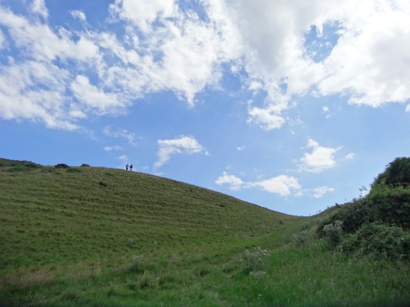
I get a bus to Ogmore. A number of friendly local people are waiting with me; while waiting for the bus and while on the bus they exchange stories of late buses, the bus company’s over-ambitious timetables meaning that even the fastest drivers are bound to be late, good drivers who stop for you even though it is not an official stop, and jobs-worth drivers who you would not even dare to ask for such a thing.
The bus timetable at the ‘bus station’ in Llantwit Major (read bus stop outside the train station), shows routes for each bus, but instead of showing the full description of the bus stops, as they are in the copy of the printed timetable that I got at Bridgend Bus Station, simply says things like ‘Farmers Arms’, ‘Post Office’ (or to be precise ‘Post Office’ twice on the same route). If I hadn’t had the printed timetable I would not have any idea whether there was a bus to Ogmore at all. In addition, the timetable listed the times of the 303 on the route from Barry to Bridgend, but not the ones going in the opposite direction even though they also stopped here. The confused visitor would stand no chance.
However, the buses are regular, once an hour. One of the local ladies was shocked when I told her that in other areas I had found buses two or three times a day where there were buses at all. She was comparing the service here with that in Cardiff and thinking it was fairly poor, whereas I was comparing it with the Borders or the walkers’ buses in Pembroke.
At Ogmore I just notice in time that I have left my glasses on the bench where I was putting on sun cream. As I took them off I thought, “I mustn’t forget these,” but did anyway. Happily, I tried to look at the map only a few hundred yards down the road and realised they were not hanging in my T-shirt neck.
The day before I had scouted the route while driving to the campsite to check where was open for breakfasts. The Pelican Inn at Ogmore doesn’t open until twelve and the cafe at Ogmore-by-Sea doesn’t open Mon-Wed, but I drove down to the burger van in the car park at Ogmore-by-Sea and he said he opened at 10am.
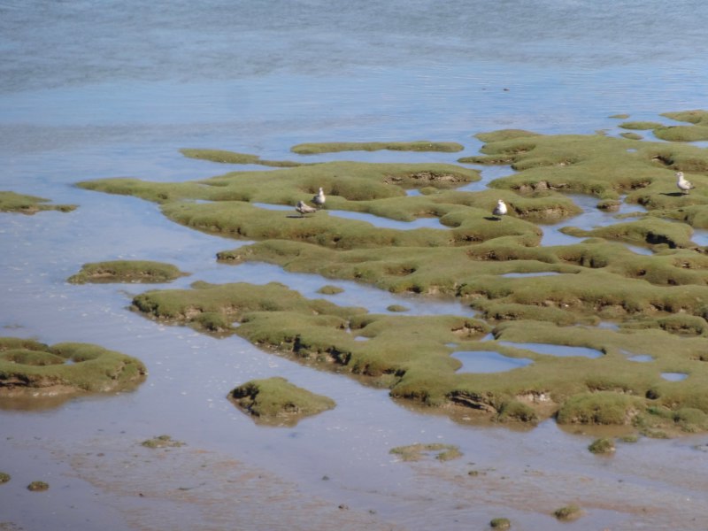 After a few hundred yards beside the road, the path from Ogmore passes the river bridge to the sewerage farm, and then runs across a ‘grassy’ path beside the river. I write ‘grassy’ in quotes, as it would be grassy except the dry weather has left path and land around more like straw crunching beneath my feet. However, the remaining high-tide mud flats cut in exotic curves of pools and channels is a dull algae green and white-grey seagulls and gull-coloured ducks explore alongside a canoe lazily making its way upriver with the last push of tide.
 The river would not be waded without a wet suit this morning, and the sandy point across the water that I had wandered around two days before at low tide was now a thin line of shingle. With the foot bridge only maybe half an hour upstream, it is the obvious route, but thinking back to earlier days so many of these points would have necessitated a half day wait, just as I had to wait for the tide at the stepping stones near Milford Haven. The sea makes its own pace of life.
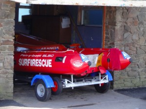
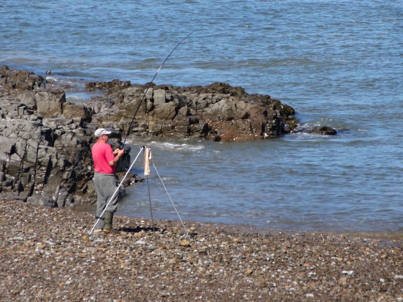
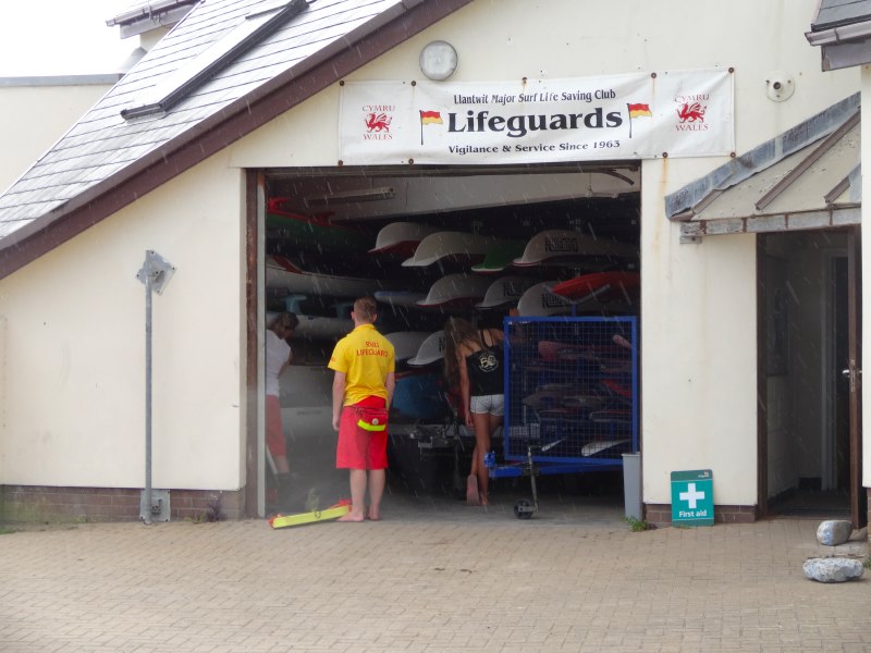
On the Ogmore side, the long sandy beach is also a thin stony strip and instead of sandcastles and shouting children, a few fishermen stand silent, casting and reeling in lines. The surf-rescue craft stands ready for those coming later, but I doubt whether the waves today will attract more than simple paddling.
But, oh dear, where is the burger van? It is quarter past ten and there is no sign of the van. I ask one group sitting looking at the sea, I think from a camper van, if they know what time the van usually comes, but they have only been there one day, and I get the impression that they are not frequenters of burger vans.
I wonder if this is destined to be a Snickers day, but with no Snickers, which have been melting for the last few weeks, and instead lots of peanuts, raisins and Baby Bel cheeses.
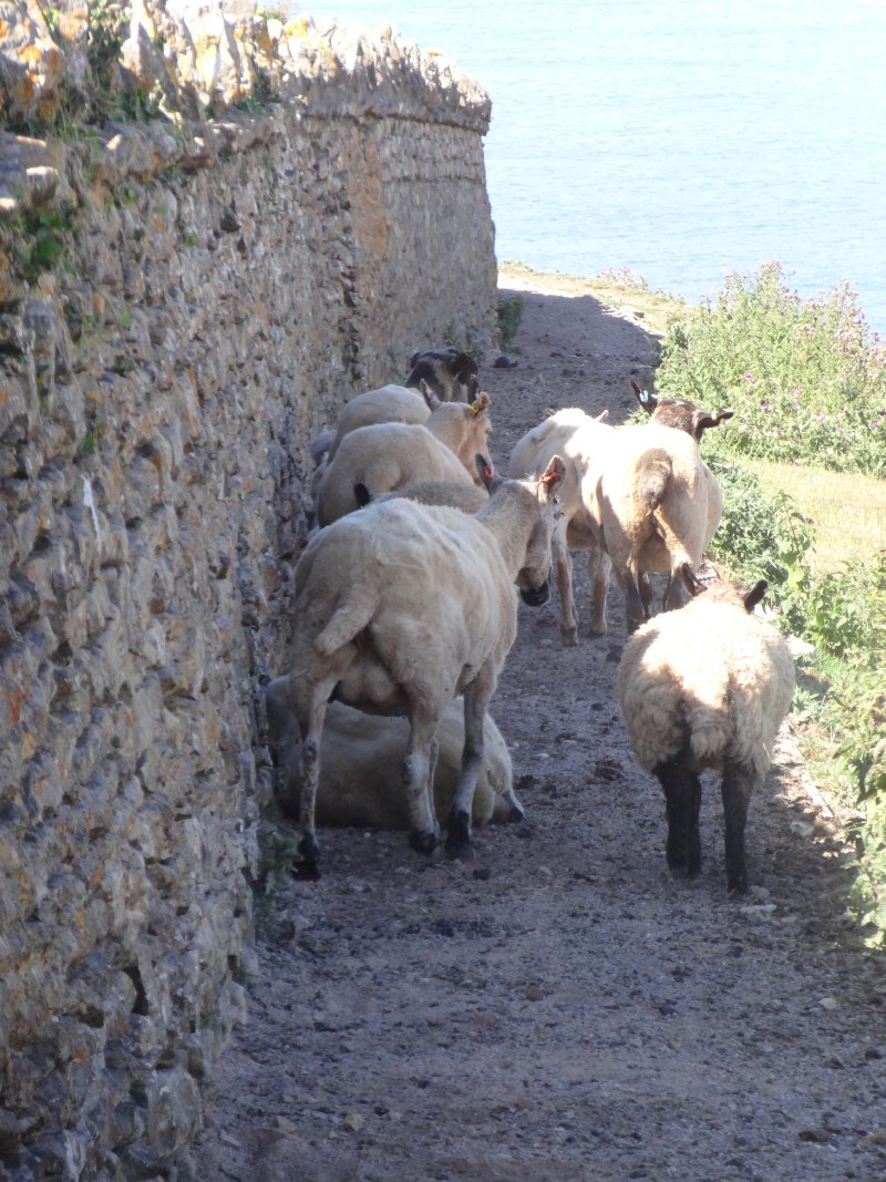 It is still quite early, but already hot. A mountain bicycle passes, but then the cyclist dismounts as the path rises and dog walkers wander past. At one point the path runs beside a wall, but the way is full of sheep sheltering from the morning sun.
Beyond Ogmore-by-Sea is Southerndown and I had noticed the Barn at West Farm. I know they didn’t do breakfasts, but it is open, and so I go in and ask whether they are serving food yet.
“We’re just opening up the kitchen, would a plain bacon baguette do?”
Wonderful!
I drink seeming endless cups of tea and, with the phone propped near the window where it can find a weak signal, book the Premier Inn at Barry for my penultimate nights.
The Barn used to be a venue for special occasions, weddings and parties, but has just started to open as a daytime café this season. The staff there couldn’t be more friendly and the director of the Barn, Jill James, is keen to hear when I get the book of the walk written. She seems to have her ear on the pulse of tourism in the area, and clearly is in touch with VisitWales.
My accommodation now booked for the rest of the walk, and with a solid breakfast inside me, I brave the heat again.
Not far beyond, a short walk over broad grassy cliff tops, is Dunraven Bay and Castle. There is a kiosk here that does serve sausage rolls and pies, as well as ice cream, so the Barn is not the only place to eat on the coast, between Ogmore and Llantwit Major, but it is the only place for a proper meal.
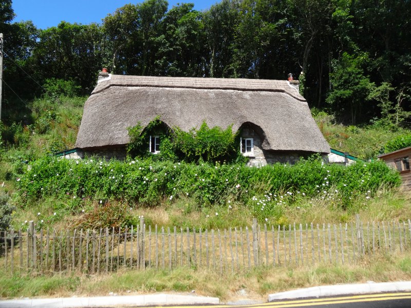
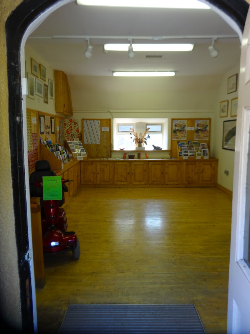
This is also the site of the Heritage Coast Centre, set beside some idyllic thatched cottages. It is a small exhibition, but with lots of information boards about the wildlife, geology and history of the coast and Dunraven Castle. As well as an old castle, there had been a major house here, set on the hill overlooking the sea, with an extensive walled garden. It was used as a hospital/convalescent home during both World Wars, but, like so many other large houses, fell into financial problems and was eventually demolished in the early 1960s. However, the walled garden remains.
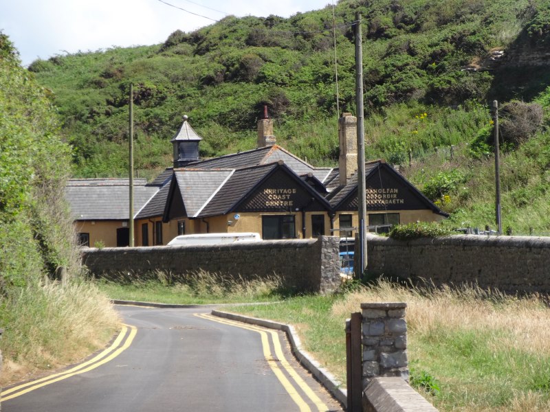
The thirteen mile stretch of the Glamorgan Heritage Coast was designated as a special area in the 1970s with efforts since to improve access for tourists and locals, so an easy stretch to become part of the Wales Coast Path.
As well as picking up various leaflets, I also buy some small booklets about the geology of the coast, some history and a small book (aimed at children!) about pirates. There is a young man and a woman serving, and the man says he has walked the North-South coast-to-coast path across Wales, but would love to do the full coast if he could work out how to get time off work!
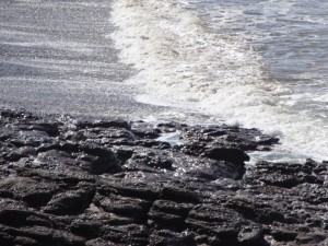
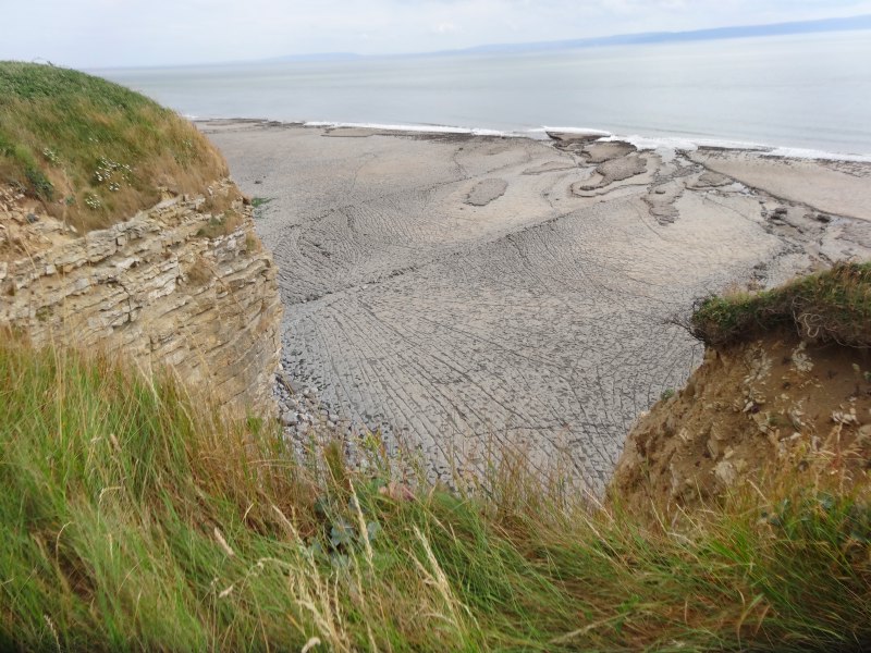
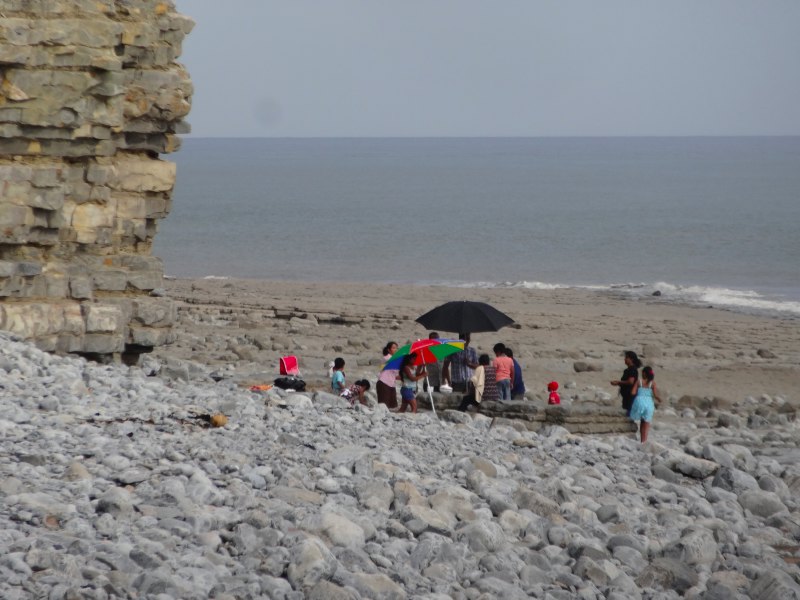
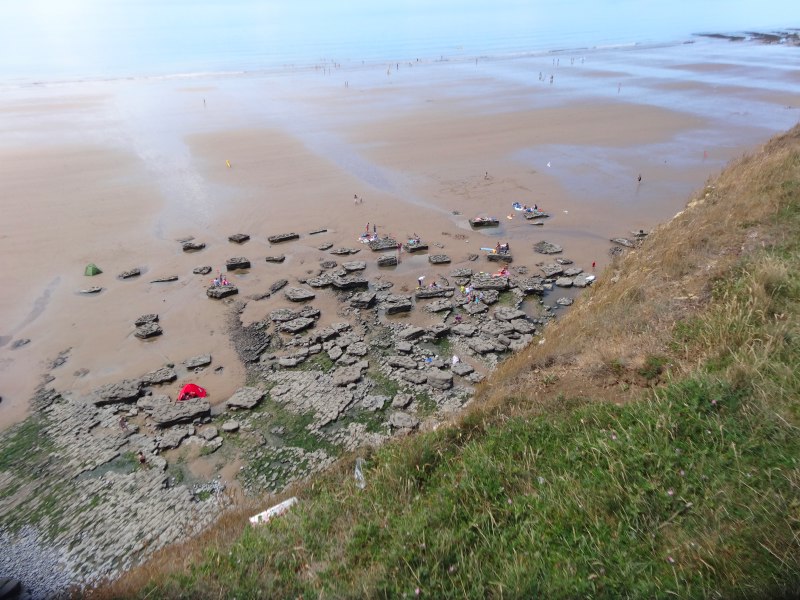 The beach immediately by the Heritage Coast Centre is backed by a large car park, and, by this time, full of children and sunbathers. It has rocks near the shore, but also large sandy stretches. Going over the cliff and looking down into the next bay, it is almost empty, with large slabs of limestone, like giant stepping-stones across the sand. I realise that these slabs, I guess at least ten tons in weight, will have fallen from the cliff and then been dragged, inch-by-inch, down the beach by the waves. The idea of these enormous blocks of stone being moved by the water emphasises again the sheer power of the oceans.
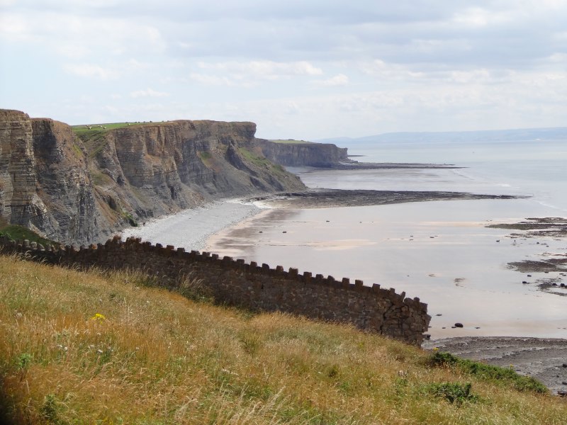
Further on there are similar beaches, with tables of limestone, in shifting patterns, interspersed with sand. As the tide is dropping it is likely that you could walk almost the entire coast at sea level, but the cliffs are high and not stable, so you would need to know what you were doing and where it is possible to get off the beach, otherwise you could easily get stuck by the sea in a sheer-cliff backed cove.
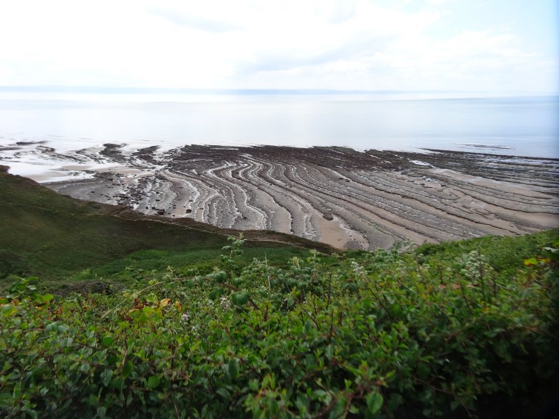
In some ways the scenery along this coast is the same, grassy flat cliff tops above sheer limestone cliffs, looking down on flat limestone beaches with sand towards the sea.
 However, that does not do justice to the constantly differing patterns and flowing curves of the flat limestone sea shelves. It is a bit like looking at the wood grain on a cupboard door or polished table. Each square inch has its own patterning built from secret stories of summers past, long-lost branches and straining winds. The limestone’s stories are older, each layer not a summer, but an age where creatures lived then died and fell to a tropical seabed, miniscule shell upon miniscule shell; the layers we see are tales of varying climate over hundreds of thousands of years, until the buried rock is thrown and twisted and then sliced flat by the current sea, like those buttons made by twisting and chopping coloured clays.
Some of the time, when the path cuts across the suspended cwms or valleys, it is shaded by woods for a short time, a relief from the welcome, but relentless sun.
Every so often I spot square burnt patches, as if someone had foolishly lit a disposable barbecue on the bare grass, but often set in pairs, or larger groups close to one another, and just a little too square for a barbecue. I wonder if they are maybe markings where the posts of future information displays are to be placed, or some other sort of surveying.
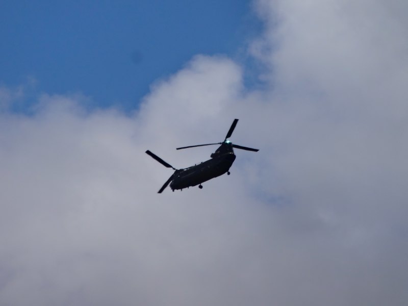 Helicopters occasionally fly overhead, a single rotor one with a radar mushroom protruding above the rotors, and a larger twin-rotor Chinook; RAF St Athens is only a few miles away. I photograph a lone walker below on the beach, and examining it afterwards, I see rucksack and flesh; I initially assumed he was wearing just small shorts, but no, stark naked, maybe the ‘naked rambler’ who keeps getting arrested?
Far out to sea there is the long sandbar running from Nash Point (not yet visible). In the sunshine the line of just visible sand and white breakers looks picturesque, but, in the days before the lighthouse was built, this would have been a deadly hazard. The crew of a ship running aground far out to sea would have stood little chance with the combination of tide, stormy seas and, even if they made it to shore, virtually unclimbable cliffs.
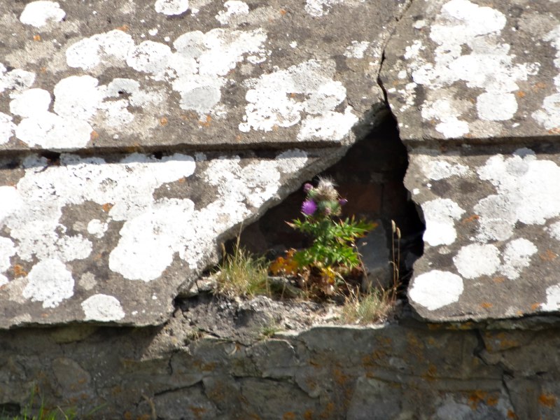 Every so often a cwm, some with a cliff-top car park, gives access to the beach, and a few, more intrepid families play with kites and splash alone by the sea. Above one is what appears to be a curved topped Celtic church, but turns out to be a small concrete roofed shed, a thistle nestling in a crack between the lichen spotted slabs. At the same cwm, the small stream runs down across a wide lichen-green slab, falling off in tiny yard-high waterfalls at odd places. But after heavy rain the whole slab must become a sheet of water, like a miniature Victoria Falls, spreading its waters wide.
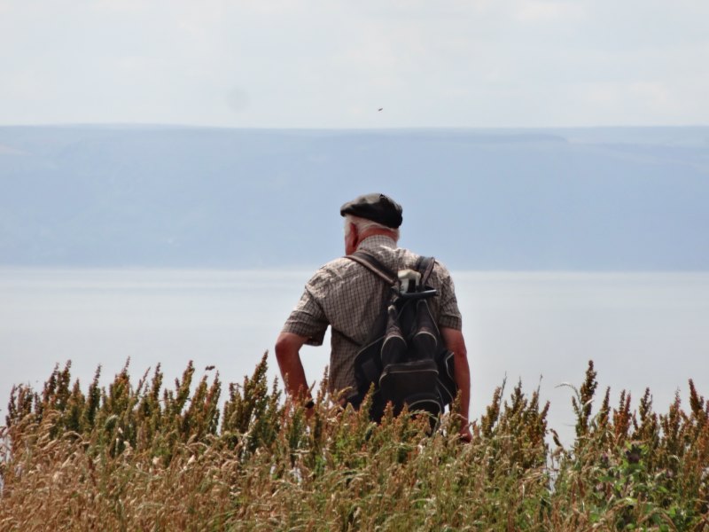
 I meet a couple Vic and Cheri. Vic is a seasoned walker and member of Tiger Bay Ramblers, but it is Cheri‘s first walk. We chat briefly about the coast, Vic has done parts of the Coast Path as well as regular walking elsewhere. We talk a bit about the importance for new walkers of clear signage, and good paths so that those, like Cheri, who dip their toes into walking, are not put off. Of course, for Cheri‘s first walk, Vic has chosen a stretch that is both beautiful and also suitable for her. I worry most about those who are reliant on signs, or maybe leaflets downloaded from the Wales Coast Path web site. It is crucial, both for safety and future walking, that they are clear for those who are not expert map-readers.
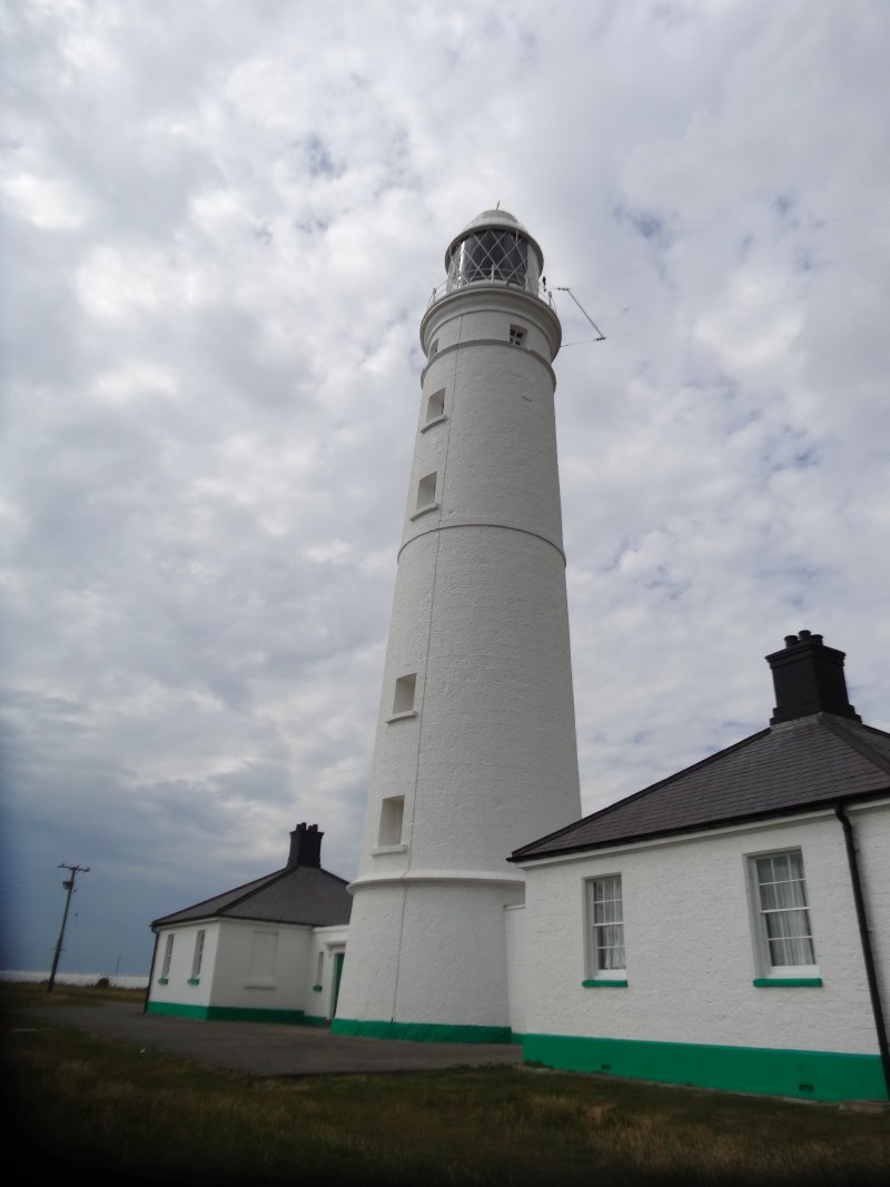
Every so often I get a glimpse of South Nash Lighthouse. It is sited at the landward end of the treacherous sandbar stretching out to sea. The navigator knows to avoid the line going ESE from it. Normally a lighthouse is there to warn or inform about the land itself, so is positioned precisely at the tip of a promontory, but as the South Nash point is for the sandbar it is very slightly round to the eastward side of the point: if you are so close to the land that you cannot see it, then you are already lost!
Of course for the coast walker, this means that it is only visible glimpsed over the top of the headland itself.
 Gradually it becomes closer, and the glimpses are more frequent, before finally the car park and small kiosk at Nash Point come into view. The people at the kiosk sell car park tickets, but also serve tea, coffee, ice creams, cakes and I think some sandwiches as well.
I take a hot tea (because it is the Nectar of Welsh life), and a cold shandy (because it is a vey hot day), as well as a Welsh cake (Ambrosia to tea’s Nectar). The people serving there are very friendly and I sit at one of the tables and chairs most in the shade. I think there is some sort of fee to visit the lighthouse itself, which, if I recall, was one of the last to be swopped to be automatic, I guess because a shore lighthouse is not as expensive to man as an offshore one.
An American family are buying drinks. The man selling the car parking tickets is telling them the way to go for a walk, but is having a hard time explaining that they are allowed to walk through the lighthouse grounds without paying as it is a public footpath. I think the idea of a public right of way through private land is very alien to the American mind.
Of course the feudal centrality of ownership of land was itself a European import, and probably nowhere more developed than in England and Wales after the Norman Conquest, when it was William‘s almost Thatcherite policy of giving land to his lords that enabled him to conquer the nations without having to invade it all himself, a sort of public-private partnership in subjugation.
I recall also being told by someone who had lived through the unification process in eastern Germany, that in the communist days it was possible to walk anywhere and that all the children in the school had an annual race around the lake. After unification the idea of so much public land was either anathema to the German Government, or simply too lucrative to miss, and now the land is all privately owned with fences everywhere and the school lake race is no more as lakefront properties extend to the water’s edge.
 Paradoxically these deeply feudal ideas of private ownership became a central part of the newly ‘democratic’ American mindset. In “Bury my Heart at Wounded Knee“, making sure that each native North American Indian owned a (small) patch of land was a key aspect of ‘civilising’ them as well as meaning that the rest of the, already shrunken, Indian lands could be taken by white settlers.
Eventually, the ticket selling man was able to overcome 200 years of conditioning and culture and convince the American lady that it was OK to walk out along the cliff paths.
Then someone from the next table said, “hello”. It was Cheri. I’d sort of noticed that I recognised her, but with so many new faces, they are all becoming a blur, although given we’d talked just half an hour or an hour earlier, I was a little embarrassed. Also I think that when I meet people going in the opposite direction I sort of assume I will not meet them again, but have forgotten about circular or there-and-back walks and cars. She and Vic are having a quick drink at the kiosk before driving home. Most important, she has had a good day’s walking.

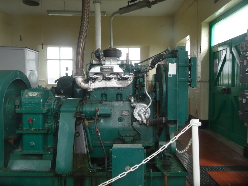
There are two lighthouses, a shorter older one that is the one you can visit, and a taller newer one. Between the two is a building, standing on its own, with two enormous foghorns on its flat roof. The gate does have some sort of ‘no entry’ sign as well as the footpath sign, although I think aimed more at cars, so maybe it was this that had put off the American lady. On the side of the stubby old light is a Trinity House crest, “Trinitas in Unitate”, and on the window of the foghorn house, a sign appealing for volunteers to be tour guides. The vast machinery of air movement inside for foghorn house makes it seem that, almost like the bag of winds that Odysseus was given by Aeolus, this contraption makes the north east winds, blowing ships out to sea, away from the sandbar and out into the west.
 Beyond the new lighthouse are stepping stones through the grass to a stone stile – maybe it gets boggy in winter – and the beach beyond that is even more sculptured, its flat rock cut and cut again by fissures in the base rock itself, and fault lines. Here it is not the layers we are seeing, maybe the strata here are so level they are parallel to the sea, but structure within a single layer of limestone, though I cannot tell which is maybe some structure trapped in time from the laying down of these rocks, and which, like the fault lines, are more about the pressures and movements they have experienced since.
 A little further on is St Donats, which consists of a little village well back from the sea and a large school, Atlantic College, which I heard about a lot as a child, but have only a hazy idea of what it is. I think it is simply a private school, but with a mission to unite people from different nations and with an emphasis on outdoor education. It has been using the International Baccalaureate for at least 40 years before recent governments started to think about baccalaureates.
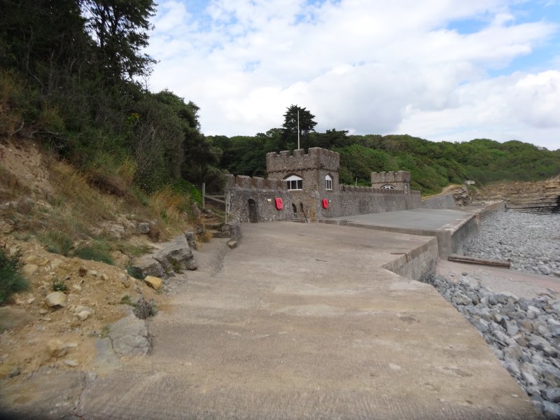
From the coast all you see of either is a castellated wall at the end of a cwm with a slipway, I assume for sailing, but also for the College‘s own lifeboat. Looking at the map, it looks like the walled area, which includes (peeking over the wall from the hill!) a swimming pool, is an old cavalry barracks, I assume to keep the troublesome Glamorgan folk in check as much as defend the coasts from the French.
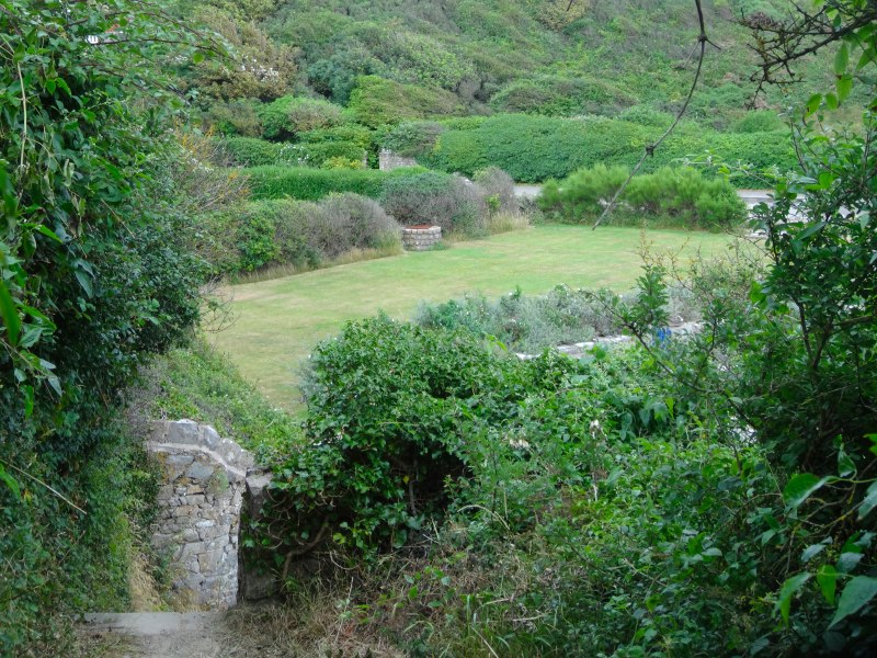 After this, it is only a short step, past another cwm fronted by a small lawned private garden and flanked by war-time pill boxes, almost blending into the beach rocks, to Llantwit Major, or to be precise Cwm Col-huw, as Llantwit Major is set back about a mile from the coast.
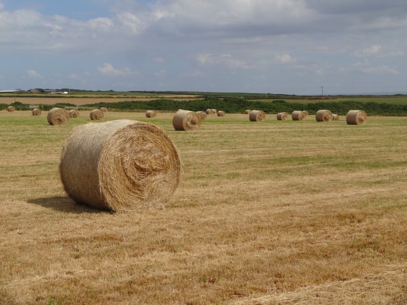
Cwm Col-huw beach is a classic pebble bar at the end of the Afon Col-Huw valley, but, unlike many of the valleys that flow to the sea, it is deep and wide going back deep into the countryside, and only slowly rising. It has a substantial car park, lifeguard station and a beach cafe selling meals (including full breakfasts from 9am) as well as ice cream. The car park has a small gravelled area with no height barrier and a larger field with a car-sized height barrier. So, if you have a campervan, you need to get there early or maybe even the night before; the gravelled car park is both free and seems to have no ‘sleeping overnight’ restrictions.
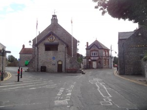
Llantwit Major, or in Welsh Llanilltud Mawr (the large parish/place of St Illtud), is an old settlement and once the most important ecclesiastical centre in Wales. St David studied here before heading off to found his own church and monastery in Pembroke.
So far, driving to the campsite and walking to the bus stop at the station, I had seen little of age, the oldest things being 1920s local authority and private housing estates, and on the map there are virtually no antiquity signs, so I assume it has been continuously populated and therefore the signs of earlier settlement destroyed or buried. However, coming up the mile long walk through Cwm Col-huw, you come to the old part of the village with cottages that date back at least hundreds of years if not to the Celtic origins.