Day 48 – Tudweiliog to Aberdaron

round the end of Lleyn: fishing, orchids, ham and eggs and a pilgrimage

miles walked: 17
miles completed: 495.3
miles to go: 565

2013-06-04 08.54.15I make an early start, leaving the Gerwen B&B by 8:30, as I am uncertain how difficult the terrain will be coming round the end of Llŷn. (In fact it turns out easy, so I will arrive at Aberdaron at 5:30 after a relatively uneventful day.)  Gwenda, the landlady at Gerwen, tells me that there is a beach café at Whispering Sands, so that is my target, about halfway along, for lunch.

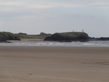
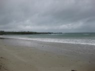
I walk the short way from Tudweiliog to the coast at Towyn, where the path leads for a short way across the sands.  It is good to feel sand beneath your feet.

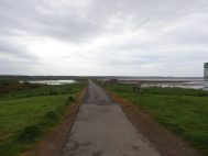
The path from Tudweiliog to Whispering Sands is almost all exactly along the clifftop except for a short excursion inland just before getting to Whispering Sands.

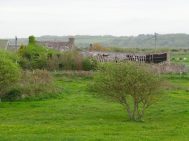
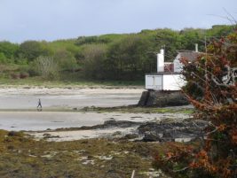
On a headland I spot a small shack, but as I approach I realise it is one among several shacks above a small sheltered cove, Porth Llydan, where some fishing boats are moored. On the opposite side of the small headland a sandy cove, Porth Ysgaden, has a slipway, where more boats are launched and, from the tractor and trailer on the slipway, one just recently.  The gabled end ruin of a once substantial house suggests this has been a port for many years.

2013-06-04 09.11.16

The boats that go out are small craft, I think mainly dropping creels, very like the fishing boats from Tiree.  The previous night Caroline, the landlady of The Lion told me about the proposals to turn the coasts around Llŷn into a ‘highly protected’ area, I guess range like the proposals for Barra.  This would have ended the traditional fishing industry around Llŷn as well as some tourist activities.  Caroline showed me the noticeboard with copies of protest letters and official responses. Although the number of fishermen is small, they are part of the culture of Llŷn, as well as each having families to look after.

“It seems to have passed,” she says, but that also means the rich ecosystem is unprotected. We wonder why it seems beyond the wit of Whitehall bureaucrats to create conservation plans that prevent large-scale trawling (by boats from far away), but allow small-scale fishing to continue.

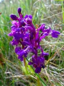
2013-06-04 10.28.25Further on, along an orchid-fringed cliff path, I come to another small cove, where an old lady sits stitching outside a postcard cottage, ‘Glan y Mor‘.  Out to sea two men in a small boat are having problems.  From the shore a man wearing a baseball cap proclaiming ‘skipper’ shouts instructions.  He thinks they have forgotten to loosen the cap on the petrol tank for the outboard, which lets air in as the fuel is pumped out.

“Remote debugging”, I suggest, as he shouts again.   “Yes,” he replies, “I don’t know whether to dial 999 or 111 for them.”  “Well, at least they have oars”, I say, and as I continue I see the men at sea rowing for shore, where I’m sure skipper will relish their discomfort.

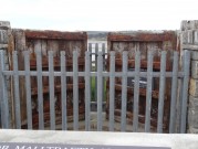
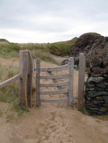
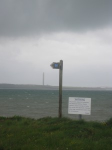
On a stile a scallop shell is fixed.  As I stop to photograph it I see a notice, posted by the Penrallt Coastal Campsite:

Pilgrims are Welcome
to camp here or
use our  facilities.

One bright spot (or at least less dim spot) of the road detour I had taken at the end of the Caernarfon to Nefyn day, was that I passed another holy well, the well of St Aelhaiarn, in Llanaelhaearn.  I say “less dim” rather than “bright” as the well was roofed in 1900 and this included adding a lockable, and locked door.

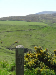
However, the well and the welcome at the campsite are reminders that, as I go down Llŷn, this is a not just a coast path, but also a pilgrim route.  Later I also notice a post with a simple cross carved in it.

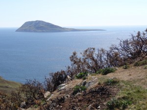
2013-06-04 11.42.11In some ways the Coast Path is pointless, or destination-less, compared to the pilgrim routes, such as this one, taking you to Bardsey Island.  I started at Cardiff and will end up in Cardiff.  Am I going nowhere?

Of course, this journey is a sort of pilgrimage as the spatial endpoint may be where I began, but the point of pilgrimage is not the spot on earth where you end, but the change within.

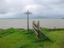
Eventually the path takes its inland detour, happily well signposted, and drops back just at the end of the whispering sands … and they do whisper, or almost sing, as you step on the dry sand, or rub your feet with a high-pitched squeak.

And the beach café is indeed open and so, stocked up on ham and eggs, and my feet bathed with a quick paddle, I proceed on the second part of the day towards the end of Llŷn.

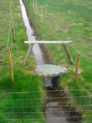
After some more clifftop walking, the path leads up toward Mount Pleasant, a name that always makes me think of a funeral parlour, but is a small farm huddled under the slopes on Mynydd Anelog.  The path does not go over Mynydd Anelog itself, but skirts its coastal edge until, having crossed a small bridge over one of many small streams leading to rock coves, the path fragments into numerous criss-crossing sheep paths that cover the sloping cliff slides like a spider’s web, or maybe a labyrinth.  Some look more well trodden than others and I wander sometimes higher, sometimes lower until ahead I see a last bridge and spot a marker post.  I realise I should have been following the uppermost path, beside the fence, rather than wandering aimlessly below.

It would have been better to have followed the right path, but, in the end, all the paths, both the right path and the others, lead to The Bridge, and after The Bridge there is but one path, and it may be hard, but it leads ever upwards.

These are almost the words I spoke into my voice recorder and as I heard myself it seemed they were a parable for the pilgrimage route.

2013-06-04 13.25.32Often I have heard the metaphor of the cross as bridge between humankind and God, and this seems not a bad model for the journeys we take.  There are many paths we take on our own pilgrimage through life.  Not all are equal, but when we cross the bridge, whatever path we have taken is forgotten; the way onward may not be easy, but it leads upward.

Well, it sounds good, but in my experience of footpaths and Christian life the criss-crossing sheep paths do return.  Maybe I should take my moral compass out of my pocket more often?

Well maybe this is different as on the pilgrimage route this is the final ascent, with just the boat journey to Bardsey on the other side of the last mountain.  I hear the strains of Cwm Rhondda in the bass and tenor voices of a valleys male voice choir: “Land me safe on Canaan’s side“.  Checking the words on Wikipedia, I see a ‘verbatim translation’ (transliteration?) that translates the Welsh “Fi, bererin gwael ei wedd” into “Me, a pilgrim of poor appearance“. Amen to that!

At the top of Mynydd Mawr, the ‘big mountain’ (less than 200m, but big for the end of Llŷn), is a coastguard station, which was also a defensive lookout during the war.  Dropping down the far side I see the concrete bases of further wartime buildings, with a family having a picnic beside.  I’m reminded of the playground in the killing field of Beaumaris Castle, and the demolished WWII concrete that holds the dunes together on Tiree.  Although when we see conflicts today it seems impossible that the pain will heal, the land does eventually forgive and the heart forget.

2013-06-04 15.40.46Bardsey itself is a strange island with a large hill facing the Welsh coast and the low, flat, habitable land facing west into the Irish Sea.  You can understand the hermits’ logic, shunning the world as they sought God in the open horizon; and subduing their bodies as they faced the January gales.  But it is perhaps also significant that it faces West, the place of magic in the Celtic soul.  I do not understand, but I cannot resist the drag of the western ocean: Tir-na-nÓg, the lost cantrefs, cry out. Celtic Christianity seemed to be able to take hold of the best of the old ways and old knowings and then flood them with the new wine of the kingdom.

On the way back I pass the ruins of an old cottage, huddled between pathway and rock face.  A ruin, like many other ruins, except one of the walls contains a six foot slab of rock that I assume was already in place and the rest of the walls built around.  I feel there is another parable there, but it is late, so a parable for another day.

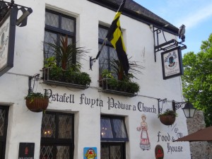
Finally into Aberdaron where the solid stone church sands firm against the elements and a sign says:

A Parish Church
A Pilgrim Place
A House of Prayer for all People
CROESO – WELCOME

It is locked.

Happily the lovely pub on the quay next door is not locked.  I resolve to go in, drink a cool pint below the falling sun and get directions to my accommodation for the night and wishing that it were this lovely place by the sea.  And then I see the sign, ‘Gwesty Ty Newydd‘ – it is my accommodation for the night.

Day 47 – Nefyn to Tudweilog

a leisurely day, bread pudding and marine biology, seaplanes and wild boar pate

miles walked: 9
miles completed: 478.3
miles to go: 582

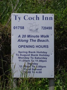
2013-06-03 11.01.00This was going to be a short day’s walk and there was WiFi at the Caeau Capel, so I took a leisurely breakfast catching up on email and some urgent work, before setting off around 10:30.  So leisurely, in fact, that I forgot to start my GPS devices and only noticed at lunchtime at Ty Coch.

The Coast Path goes right across the end of the road, yards from the entrance to Caeau Capel, so I could have come down it the previous night, rather than into the centre to ask directions at the Indian restaurant.  However, last night I was not following Coast Path signs anywhere!

This morning was a new day, bright and sunny … indeed more sunny than I’d anticipated and I realised later in the day that I should have renewed the factor 50 on my arms.

The path runs straight down to the cliff, and you have to follow it as there is a fence on one side and a bank on the other, and yet half-way down there is a finger post pointing Coast Path in both directions.  I wonder why there can be a Coast Path post where there can be no choice, let alone confusion, and yet yesterday nothing on the dyke near Caernarfon … ours is not to reason why.

Nefyn Beach is down a steep road from the town, and many years ago, before we moved to Tiree, Fiona and I had looked at a small plot of land for sale beside the sea. It was in the middle of a number of beach-chalet-style properties, but was only accessible by walking past one of the other properties’ front door.  We decided that facing due north with the cliff straight behind may be lovely on a day like this, but depressing in winter … and the van only just managed to drive back up the road. Looking down from above I notice the plot is still empty.

2013-06-03 11.50.59With a very short diversion inland, where, I guess, the cliff is too eroded, the path follows the top of the cliff all the way round the headland to Morfa Nefyn, where instead of continuing along the cliff I cut across the sand to Porth Dinllaen where I was hoping to hole up for an hour or two at Ty Coch, ‘the pub on the beach’, and write.  However, it was still early, barely noon, so I decided to go round the headland and come back across. It wasn’t very obvious where the path comes out of the hamlet to go anti-clockwise round the headland, so I went up to the golf course on top and went the other way round. I was going to cross my own path; would I need to spin round when I got back to Cardiff to make up?

Unlike the Trefor farmer, the golf course seemed very helpful to the walker and one of the people looking after the greens told me where I should go. I guess the golf course is part of the tourist industry and can see the advantages of the Coast Path whereas the hill farmer has no direct benefit.

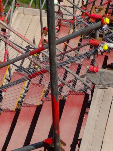
2013-06-03 12.23.11I guess all coast guard stations are picturesque, but the one on the headland stands on wildflower-draped rock, and must rank high. Further round, back on the eastern side, a new lifeboat station is in the process of being built and the cliff path is diverted down a staircase constructed in a scaffolding tower.  Well, I should say ‘down’ in my direction, but the somewhat well-built lady coming up said "my body was never made for that".

Back on the shoreline, two young women in wetsuits were standing in a tiny cove and packing snorkels into net bags. At first I thought they were coasteering, until I saw them hold up a plastic bag with something brown inside and overheard one say ‘specimen’. They turn out to be marine biologists from Swansea, looking at the undersea ecosystem. Evidently this small area has very rich marine biodiversity, probably due to the east-facing direction sheltering it from the prevailing westerly winds, just the same reasons that it was used as a fishing port and, I later discovered, was once considered, at the beginning of the 19th century, as a possible site for the packet to IrelandPorth Dinllaen could have been Holyhead.

The Swansea biologists were also working on a project to lay out a trail for snorkelers.  This requires having good things to look at, but also includes finding access points; when you have only a thin layer of rubber under your feet, you need smooth steps down, and also areas you are not likely to get in the way of passing boats.

2013-06-03 11.38.50Ty Coch is lovely. Today, most people are sitting outside, so there is plenty of room inside for me to spread out computer and papers sheltered from the noon sun.  Amongst the pies on the menu are two that are described as ‘bread pudding’; I’m advised the duck one is particularly good. I initially imagine something like a lasagne with bread slices between, like a fruit bread pudding, but instead it is more like a normal pie, except formed with bread instead of pastry. They are served with a little jug of sauce as the filling is almost dry so that the bread ends up crisp, almost rusk-like.  It is a simple thing, just sliced bread pushed into a mould, and yet very special. And they have WiFi 🙂

Around the walls are photos of old Nefyn, including the high seas of 1983 and an image from 50 years earlier, when on another stormy night, a seaplane anchored in the bay was blown ashore, its wings wedged against the pub roof. Another seaplane, also anchored in the bay, managed to manoeuvre onto the beach. Happily there were no serious injuries, although one of the pilots had to be rescued by a lifeboat man, swimming out with a line, but both seaplanes were destroyed.

Stuart the landlord recalls meeting Will on his way round a few weeks earlier, and gives me my lunch for free.  He is clearly a central figure in the community; while I sat, one person came in to ask if he could attend a meeting and another to ask if he’d be part of a new committee for something. I think about people on Tiree, such as Dr John, who are social pivots, connecting many organisations and activities. Sadly, we cannot talk longer, as the sunshine makes it a very busy day for him and I need to make my way to Tudweiliog, but I feel this is a place I’d like to come back to if I can manage a ‘revisit’ tour next year (motorised!).

The rest of the day is uneventful, but very lovely, the path running along clifftop the whole way, sometimes the cliff side of a fence, sometimes with open pastureland.  One such open field has a car driven right to the cliff top. A lady is sitting sunbathing on the clifftop, her husband tending fishing rods behind the car. "I’m like a mountain goat," he says as he goes up and down to the sea to fish and back up where the lines have got tangled with sheep’s wool.  They were able to drive to the clifftop because the farmer also runs the campsite where they are staying. If more famers could see positive benefits from tourism, like this one, then maybe they would be more friendly to walkers.

2013-06-03 17.42.48Tudweiliog is about half a mile inland down a footpath between two sandy coves, and I wondered with many coves and many footpaths how I would work out which one to take. Happily I met a family coming up from the beach, who are staying at the campsite where the path meets the sea, and in fact when you come to it, the large beach ahead is very clear.  However, for the walker going past there would be nothing to say that this is the way to somewhere where they might take a break for lunch at The Lion (I am eating wild boar liver, rum and ginger paté as I write!).

Day 46 – Caernarfon to Nefyn

starting the Lleyn Peninsular, race for life, a wrong turn on the dyke, the road goes ever on, I need a knife and glimpse a half-understood fragment of local life

miles walked: 26
miles completed: 469.3
miles to go: 591

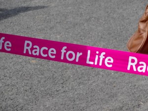
2013-06-02 11.27.26Paul drove me into Caernarfon and he and his children waved me on my way, sandwiches and banana to sustain me.  Our route into Caernarfon had been interrupted by closed roads as today was the Caernarfon Race for Life.  The route of the run lay along the same riverside road as the Coast Path, and as I passed the race end point, the first few runners were crossing the line. Then, for the next mile or two, I was walking against a tide of pink: pink t-shirts, pink tutus, pink fairy wings on adults, children and dogs, pink ribbons, pink rabbit ears and even pink hula skirts. One girl had a black t-shirt with ‘This is for you, Nan’.

The runners become walkers, and the fast walkers slow walkers, until eventually the tail-end marshal passes, behind four women who had been space-hopping their way round; two had found it too much and were carrying their space hoppers, but the other two were still bouncing slowly along.

Heart Radio were packing up sound equipment where they had been playing music to encourage the runners, and the first aid car was preparing to drive off.  It was wonderful to see so many women and girls of all ages working together for a good cause and so many supporting them from the sidelines.

The road mainly follows lanes and roads, except where it meanders a little to go round the end of an estuary. I follow a signposted path that shrinks from green lane to narrow track and eventually over a bridge and onto a dyke. There was no sign, so I turned left along the dyke and eventually, through a few parts reached the road again. It was only some time later that I realised the route could not be correct and I should have turned right onto the dyke. At leisure I later looked at the 25000 OS map and it is ‘obvious’ which way to go on that, if not from the Coast Path map or (lack of) signage.   Whilst gaining me some soggy feet, it did cut off a mile or so of walking, so not an ultimate disaster, but it did cost me the only actual moments beside the sea in the day.

2013-06-02 16.31.58For maybe 10 miles, maybe more, the Coast Path runs along the main CaernarfonNefyn road, sometimes in separate footpath beside the road, sometimes taking the old path of the road through the villages along the way. I have often found the discipline of walking places you would not walk if it were a holiday in some ways giving me insights that the obvious pretty holiday destinations have not. There were a few interesting points, a glass and bent steel garden mermaid, Beuno’s Well (not as mystical as the one amongst the moorland on Anglesey), and the small solid abandoned building of the ‘Enderby, Stoney and Stanton Granite Co.‘ (I assume an old quarry office). However, to be honest, this is just a road march, but a quick way to eat up miles.

This slow walk really gives one a sense of distance as The Rivals, the high hills/small mountains that separate Llŷn from the rest of Caernarfonshire approach. Indeed it was almost a surprise when I realised that some of the hills that had been ahead for so long were actually beside me.

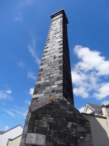
Eventually, the path turns in towards Trefor, where it skirts the village, drops to the small working harbour and goes round the headland, before coming round to the south-west side of the village ready to ascend the hill pass. The hill above Trefor is heavily quarried and the reason for the current village. The old engine houses and maybe quarry offices sit Tolkien-like high on the hillside as if they were a castle with keep and outer walled courtyard, all suspended precipitously above the crumbling slate slopes.  As you look up towards it, you pass the site of the old hotel (there is now nowhere to stay in Trefor), and then a private club, men drinking outside, that appears to be the old working mens’ club from the days of the quarry.

It will be my first proper ascent since Offa’s Dyke, but one I need to do quickly as it is already six o’clock.  Initially you go up a small lane, so narrow that when an old Ford Escort comes up the lane behind me it has to stop and I squeeze back round it before it can continue. At the top, as the road turns sharp left, the (for once) well marked coastal path sign sends you straight onwards, directly up the hill, where barely 50 yards on, the farmer has blocked the path with a small fence of wooden pallet and metal fencing all tied together with baler twine.

At first I think that maybe the baler twine loops off in some way to swing the pallet awkwardly open, but on closer examination the only way to get through would be to cut the baler twine.  I have no knife with me to cut my way through, and the blockage is too rickety to climb without pulling down the fence posts on either side. Even though the farmer had clearly blocked the path deliberately, I couldn’t bring myself to deliberately cause this damage, albeit justified to keep the path open. Maybe if I had come down the pass I would have forced my way through no matter the damage.

Another public footpath leads off directly to the left along a green lane, but it too is blocked another 50 yards on with barbed wire. So reluctantly I backtrack and go round the hills on the road. If it had been a shorter day (I had already walked nearly 20 miles before encountering this), and less late, I would have persevered, but if it was blocked here I realised it might well be blocked again later and I foresaw myself being stuck on the hillside as dusk came down.

As I rejoined the main road barely two miles from where I left it and skirted the hills, I felt doubly cheated, as Paul had suggested an alternative path to go along this road and then branch off up Tre’r Ceiri fort, round Yr Eifl and rejoin the Coast Path above Nant Gwrtheyrn, the hidden valley.  I passed the end of the path up to Tre’r Ceiri, but it was by now far too late to attempt this.  Instead, even when the road rejoined the path I ignored the meandering of the Coast Path signs either side of the road and simply marched on, getting to Caeau Capel Hotel in Nefyn just in time to eat.

However, the road detour did open a glimpse into a local story, which I’ll never fully know.

Just as the road approached its highest point skirting Yr Eifl, a man appeared coming down over the high spot with a dark holdall in his hand. I thought again, just as I had earlier in the day when I met someone not far out of Caernarfon, that there are clearly people on the road for whom walking is a necessity, not a choice.

When I came into the next village, [{Llithfaen}}, I paused for a moment to get some water and phone Caeau Capel to say I was on my way. A few moments later I passed a group of women and men on the roadside looking down the road from which I was approaching. "Have you seen a young lad", one of the ladies asks.  I think for a moment, as a boy may have passed me while I was rooting in my rucksack; as I pause, she says, "with a rucksack", "no a carry bag", another pipes in. "Yes, I saw him back on the road", I reply. They quiz me further, how far back? ten minutes? half an hour?

Various thoughts go through my mind.  Is this a husband or son who has had an argument and gone off and they are worried?  Was he going on a known journey, and they were checking on progress? They did not seem worried, however, and seemed uncertain as to which direction he was going.

So, when eventually they were satisfied that they understood where he was and which direction he was going, I ask "is he a relative?", but, "no just someone we’re interested in", they say.

Various other thoughts flash through my mind, maybe an internecine feud and the young man is fleeing retribution for an insult or crime. However, they all seem in a good mood, so more likely simple benevolent interest … but deep into the margins you can never tell.

Day 45 – a day in Caernarfon

radical roots in the North West of Wales

2013-06-01 16.12.55As I write I am sat in the Black Boy Inn within the walled town of Caernarfon.  The name does not seem very ‘PC‘, but the story is quite radical.  The pub is named after Jack Black, who was captured in Africa in the 1700s and brought to Wales.  He eventually married a Welsh girl, fathered seven children and is buried near Criccieth.  He is believed to be the first black man in Wales, and maybe would be forgotten if not for his eponymous inn.

It is a traditional pub, rich dark oak settles, the majority of voices speaking Welsh, and tempting smells drifting from the kitchen. Earlier, I went to the ‘Wal‘ to eat one of the fish finger sandwiches that Paul had recommended.  I must admit I was imagining white sliced bread and Birds Eye (which I would have also enjoyed), but this was definitely a different kind of fish finger sarnie!  So, even a few hours later, still replete, I simply savour the smells here at the ‘Black Boy‘.

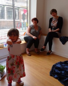
In between I have been at Bocs where Alana, one of the artists exhibiting as part of the Spatial Threads exhibition, had been doing a workshop followed by a Q&A session. Rebecca, the Bocs arts centre coordinator acts as interviewer and MC for the Q&A session, enlivened by Eva, Rebecca‘s three-year-old daughter, while Yvonne records it all, her camera propped on a pile of books and India rubber as a makeshift tripod.

2013-06-01 15.10.41 2013-06-01 15.10.48 bocs-2013-06-01 15.11.10-cropped

Alana‘s work involves manipulated fabric spreading into the space of the room.  Repetition is integral to her work, the structure being the result of innumerable basic stitches, and she is about to start a nine-month period experimenting with ceramics.  As she spoke in the Q&A and earlier, she talked several times about the creative power of encountering resistance of setting and material, and of establishing her own boundaries.

Alana‘s work spreads across the walls and the floor of the gallery space, and a small alcove is completely hung with rich boudoir-like drapes, which are inspired partly by the interior of the body.  Some viewers stroke the voluptuous folds, or brush their whole bodies, cat-like, against the alcove walls; others find the organic shapes threatening.  "I quite like the idea of them being spooked", she says, but also welcomes the warmer response.  I wonder whether it is the very fact that it sits on the emotional cusp between comfort and caution that gives it its edge.  The boudoir aesthetic is both sensuous and perhaps also touches on the erotic, where raw flesh meets raw flesh.

When not in the studio, Alana works at the Mostyn in Llandudno.  The Mostyn family owned large parts of the town, as well as, I assume, Mostyn Dock.  The Mostyn gallery was established in 1901 by Lady Mostyn to exhibit women’s work, as female artists were being refused entry to the established art circles.  I had not heard of this before, but it seems a really critical shrine of the development of women’s rights in the early 20th century.

Both Mostyn and the Black Boy Inn are reminders of a past that we would like to forget, but also that people can rise above their times.

Day 44 – Menai Bridge to Caernarfon

in which I encounter a scarecrow at the docks and a giant rubics cube, visit a nurturing place for aspiring artists and designers and the home of advanced geo information in Wales

miles walked: 9
miles completed: 443.3
miles to go: 617

The walking this day is easy, albeit not exciting, but after a day of interminable forest, trackless dunes, and penitential shingle, not exciting is good.

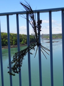
2013-05-31 11.07.07Out of Menai Bridge you cross back across the suspension bridge that you crossed 130 miles earlier.  Parway across a withered bunch of flowers is tied to the railings, a poignant marker; given its location I assume a memorial after a suicide rather than accidental drowning.

The path drops down towards the waterside through the Botanical Gardens.  I loved the labels in the gardens; instead of the normal metal or plastic labels, the specimen trees have a half log of wood in front with the names carved into the cut face.

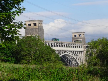
At the Britannia Bridge the path comes up and turns inland to follow a cycle path beside the main BangorCaernarfon road.  While the suspension bridge is Telford, this bridge is Robert Stevenson.  The original ‘tubular’ bridge carried the LondonHolyhead railway through two rectangular tunnels; a section of the tunnels is preserved partway up the track as you climb from below the bridge. It is well labelled, but would be easy to miss, as it lies in a rough area that looks like a lorry turning circle, but the lady with the black spaniel the day before had warned me to look out for it. The quality of Stevenson‘s engineering was such that the original supports could be adapted so that it now takes not only modern trains, but also a roadway above as a double-decker construction.

For a few miles the path stays close to the A road, passing an interesting Welsh café on one roundabout, but sadly a little soon after breakfast to stop.  After a while it drops along an old railway line following the existing Lon Las Menai trail,  on the whole clear to follow, but at one point branching with an upper and lower path. The upper well-metalled path is well signposted as a cycle route, but the lower, unsigned, more tree-sheltered one is the footpath route.  However, both run close together with steps between halfway to recover if you take the wrong one and both will get you in to Y Felinheli at different points.

2013-05-31 12.56.33The lower route comes out at the Felinheli marina, where a lovely swing bridge crosses the old docks. Coming to the promenade, small dinghies were meandering in the sunshine and a family of cygnets paddled in a puddle while their parents looked on.  I had passed the Halfway House on the way down, which I assume was half way between Bangor and Caernarfon on the old turnpike, but did stop for lunch at the Garddfon, which, I was later told, used to be the haunt of "just a few heavy drinkers", but is now serving the more prosperous marina folk, but without feeling gentrified.  I had the soup of the day, Thai chicken soup.

After cutting round the small industrial area at the west end of Y Felinheli, the path follows along a well-made and wheelchair-friendly route along further old railway tracks to Caernarfon.  At one point there is a large abandoned house up to the left and towards the shore what at first appears to be a line of small lived-in Victorian cottages until I realise that they too have gaps in their slates.  Given their location I am amazed that they have not been snapped up by a developer, but perhaps access is difficult.

At around the same point is another abandoned dwelling, but this time a simple railway worker’s shelter, maybe for a pointsman, or simply where maintenance workers would shelter. A solid construction of vertical sleepers that will not decay easily, the smell of creosote still strong after a hundred years. I imagine a group of two or three Victorian workers huddled around the small fireplace while the rain falls outside.

The path enters Caernarfon past a new waterside apartment complex, Morrisons, the ‘Celtica‘ shopping complex, the Galeri arts centre and old docks, now a yacht-filled marina.  On the dockside a series of ceramic mosaics celebrate the ‘New Europe‘, each contributed by a different local school, Cheska Rebublika, Cyprus (in Greek lettering), Polska, and more.

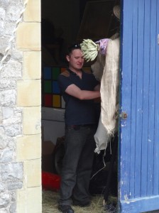
2013-05-31 15.32.53At the end of the docks old anchors and ships’ metalwork are gathered outside a small shed-like building, which, I am told, was once the Maritime Museum.  Now, from the side door I see the arm of a scarecrow; drawing closer, through the open door I see a giant Rubik’s cube.  At first I take this to be something to do with children’s play, but then a man comes out to work on the scarecrow and he explains that he is a TV prop maker.  His workshop includes a large green-screen area for photographing the props. The scarecrow, its siblings and what appears to be a plastic lamb, which are scattered around the workshop, are part of a popular farm game show.

Caernarfon is famous for the extensive Norman castle where Prince Charles was invested as Prince of Wales in 1969.  The title is problematic.  It is now given to the heir to the throne, a tradition starting when Edward the First, after a bloody campaign in Wales, said to the people gathered, "do you want a Prince of Wales", "yes" they answered, thinking of a prince in the line of Llewelyn the Great, but instead Edward said, "I give you a Prince of Wales", and held up his new baby son. So from being a title representing the independence of a nation, it became a symbol of oppression.

Maybe Prince William‘s time serving on Anglesey and warming the hearts of the people may make him a more acceptable when eventually Prince Charles becomes king, and he inherits the title, and maybe, he or his child, will be constitutional prince of a once more independent Wales.

Around the castle is a walled town, although the main shopping area is in the square (which is roughly triangular) in front of the castle gates.

I see the back of a solid building, now decaying slightly with foliage sprouting from its upper brickwork, and a for sale notice.  It is the Conservative Club.

The area within the walls is still called ‘High Street‘, although nowadays many of the shops, like the decaying Conservative Club, are shut down.  But ahead, on the corner, is a white-painted welcoming shop front, and through the door, in large letters I see:

Spatial Threads

Are they are talking about walking?

2013-05-31 16.56.47It is a small gallery, and looks empty as I wander in, rich purple fabric ruffling across the wall.  I approach the desk where leaflets are spread, intending to take one and depart, in true guerrilla tourist fashion.  I start to reach and then, like a scene from The Wizard of Oz, a face pops up, jack-in-the-box-like.  Yvonne is a graphic designer and one of the directors of Bocs, the gallery I was in.  Yvonne is not tall and sitting behind the podium desk was completely invisible, as I guess I was, until she stood.

The title ‘Spatial Threads‘ was a brief given to two artists, to use the space of the gallery.  The manipulated fabrics of the first room are Alana Tyson‘s work, rich and organic.

Yvonne invites me to look around the second room of the gallery, where Bernadette Rippon has taken the theme in a different direction, where multiple white threads, inspired by wool-wisps on barbed wire, stretch almost invisibly across the room, stretched tight in semi-geometric curves and lines, the ends scattered carelessly like wind-blown wool on the ground.  Slight shadows play across the window light, making fresh lines on the wall.

The idea of the walk as a thread has been a recurring image, but whereas the lines of path and road are clear and permanent, the lines of the walker are ephemeral and passing like the shadows that play and fade.  For a while the foot-trodden grass or sandy footprint lies testament to the steps, yet is soon blown in the wind or washed with the tide, leaving only half-remembered shapes in the mind.

Solnit talks of the walk like thread connecting the land, and the manipulated fabric both reminds me of the rugged tectonic-plate crumpled and ice-scoured Snowdonian landscape that rises behind Caernarfon, but also of the way the threads of road and railway change the nature of distance in the land, just as the threads bring fabric closer.  Once Anglesey was an island, now sewn to the land through Telford’s and Stevenson‘s bridges.

Later Paul says, "I can get to London in four and half hours and Manchester airport in two, but it takes me five and half hours to get to Cardiff, the same as Edinburgh".  The fast North Wales expressway and the Holyhead to London line shrink distance, crumpling the UK map, yet limited eventually by the physical limitations of land, like fabric, although maybe also the political and economic limitations that say movement to England is more important than movement within Wales.

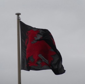
black-welsh-flag-2013-05-31 15.10.10-croppedThe mountain-fragmented topography of Wales is the reason it took the English so long to defeat, and never fully subjugate, the land, but also, together with the naturally fractious character of the Celts, why it was so hard to unite the British against the Saxon and Norman invaders. The former is still evident today, no longer in terms of swords and horsemen, but in the permeation of English culture and language, where the mountain-backed fringes have been where Welsh language and culture were preserved.  The latter, the fragmentation of the Welsh people, is still also sadly a problem, with the North Wales folk hardly, and often not, restraining their distrust of central administration in Cardiff.

Yvonne takes me for a tour of Bocs, which is still ‘under construction’, half-painted stairways and boxes of sound insulation foam. It was formed in 2005 in the cellar of an estate agent, a space to nurture young artists who often feel isolated and far from the centres of culture.  As recession hit, the estate agent needed the space, and so they found the current premises and are in the processes of making a space that includes exhibition space, an incubation area for graphic designers, a music practice, recording and media-editing suite, and a large space for workshops and additional exhibitions.

When we finish the tour Yvonne introduces me to Glenys, another friend of Bocs, and Dyfan, who is a computer/technology person and, happily, knows Paul Sandham and Geosho who I am visiting.   I say ‘happily’, as my main contact with Paul has been through Twitter and I find my phone number for him is wrong. Dyfan marks Geosho on the map, and also gives me directions, which, like all directions in my head, instantly vaporise.  After returning to Bocs once flummoxed, I eventually find Paul, not helped by (i) my inability to recall directions, (ii) the Welsh versions of street names on the map are not the same as the ones used on street signs, and (iii) Geosho‘s office does not say ‘Geosho‘, but simply ‘6’ (the number in the street) on frosted glass, "we don’t expect passing trade,”" Paul explains.

Geosho create map-based tourist trails and other geographic systems, but most critically have created an infrastructure for the creation of these. In other words, this is a start-up with a big idea and real technology " and not based in a silicon cwm near the centres of power in South Wales, but Caernarfon in the forgotten corners of the North West.

Paul divides his time between project management, chasing up potential customers, and smooching with the big-wigs of government in Cardiff, but still does hands-on prototype tweaking and is clearly the core information architect.  His house is largely his own design and his initial training was in urban planning; it is interesting how good design skills seem to be common whether technological or material.

And yet, with all this busyness, he is one of the most friendly and hospitable people I have ever met.  We knew each other only through Twitter contact and when Paul came to find me to chat in Kington, and yet he invited me to stay at his house, fed me (very well, he is a great cook), helped me plan my onward journey, and on the day I left even made me sandwiches to help me on my way.

The day ended at 2am, after Paul and I had each nursed three glasses of Bruichladdich organic whisky and talked about everything from walking/cycling abrasion injuries to the local government that can afford to subsidise daily flights to Cardiff, used mainly by political functionaries, but is closing village schools willy-nilly.

Day 43 – Malltraeth to Menai Bridge

missed beach, trackless dunes, stoney ground, chaste cupid, and salacious gossip

miles walked: 22
miles completed: 434.3
miles to go: 626

I left the Rhosneigr campsite and drove to Malltraeth. I’d hoped to get some breakfast there, but couldn’t find anything open so made do with what I had and set off. The path crosses Afon Cefni on a stone bridge and then progresses along a causeway above the wide estuary mud and sand. In the distant past this once cut nearly all the way across Anglesey, almost a second straits, but filled with silt and now is merely the mud choked estuary of Malltraeth Sands.

On the far side of the estuary is Newborough Forest, an area of mainly coniferous managed woods several miles in each direction.  For about two miles the path follows that of the Lôn Las Cefni cycle trail through the edge of the woods near the estuary side, but often out of sight of the water through the thick trees. However, then the path has two routes marked on the map. The main path leads along the long sandy dune-backed Traeth Penrhos, while the alternate path cuts through the woods never touching the sea before it heads back inland. I assume the latter is for times of storm tides. But I intend to take the former path as these long beach sections were one of the things I was looking forward to during the walk.

The walk through the woods was pleasant and quick along the well-made cycle path. After some time I saw that the path divided ahead. The right smaller path led towards the water and the larger path towards the sea. At first I thought that this was where the Coast Path diverged, but when I got there, there was only a Coast Path symbol on the left fork. As this is a major leisure destination, the marking had been clear so far, so the separation of the Coast Path must come later. Still, I almost took the rightward path as it led closer to the water, but I assumed it would simply lead to impassable mud flats, and also wanted to take the ‘proper’ path.

So I followed the leftward fork on through the forests. For some time I kept thinking that I soon would come to the proper fork in the path until I realised it was never coming; the fork I had been at had been the right one all along and had simply not been marked.

The woods to the right were thick and it wasn’t clear whether I could simply cut through them, so I kept on going, assuming that sooner or later there would be some sort of path to the right, but after what felt like many miles, but in reality only a little over one mile, I saw a small track leading off into the woods, and after only a few hundred yards came to a line of sand dune. The one good reason I could think of for not marking the seaward path was that it could be tidal, but all along between the dunes and the trees was an easy way to go should the sea be high.

I crossed over the dune and at last came to the sea, but looking back had missed almost all the beach, with just another hundred yards or so to the end. I screamed curses upon the Wales Coast Path for its inconsistent and incoherent signage. It had been a patch of beach I had been looking forward to and felt cheated.

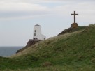
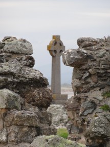
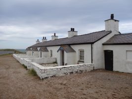
By now the weather’s early moodiness had begun to break, with sunshine creeping in across the sea, even though my own mood had travelled an opposite arc. However, my own mood was lifted by spending time walking onto the tip of Ynys Llanddwyn, a tidal island with ruined church, standing cross, and a stubby white lighthouse complete with iron cannon (I think simply to make a noise to warn off ships) and tiny terrace of white and black lighthouse keepers’ cottages. This is the church of Saint Dwynwen, the Welsh version of Saint Valentine.

The story is that she was in love but, for some reason, was unable to marry the man of her heart, so instead fled to the church and a life of chastity. I don’t quite get why this story led future generations of lovers to the holy well on the island for blessing, it doesn’t feel that portentous, but that is the story.

I lingered amongst the old stones and sun-drenched rocks for some time, and whether it was the presence of Dwynwen still suffused amongst the ruins, or simply the effect of sea breeze and sunshine, but my annoyance at the Wales Coast Path faded and I felt a sense of calm return. It was with regret I did not stay longer, but eventually I had to press on.

Coming off the island a signboard explains the pillow lava found in the area, and in the nooks around a line of wooden steps down the sandy slope tiny miniature roses bloom – maybe the roses understand Dwynwen‘s story better than I.

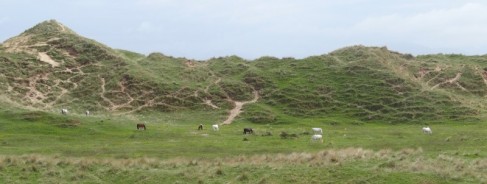
By now the sunshine was strong and hot off the sand of Newborough Beach.   Families were gathered, territory marked by towels spread on the sand and the occasional windbreak.  The access to this side of the beach is via a footpath along the south eastern fringe of Newborough Forest, or by bumpy car along a forest road. Rosie had warned me that this path had been very muddy in places when she had walked it a day or so before, and I had had enough of forest tracks, so decided to walk further along the beach and try to skirt around the end of ‘The Warren‘, an area of dunes over a mile square leading down to a long spit guarding the western end of the Menai Straits.

I guessed that the path was avoiding the nature reserve, but there were paths marked across it on the map, and no sign to say not to enter, so I set off along the long dune-backed beach. I knew it was important not to walk too far before cutting back across the dune, about a mile, as I didn’t want to walk right to the end of the spit. This would have been pleasant to do, but would also have added several miles to the path and I didn’t want to get to Menai Bridge too late, as Rosie, who was also staying at Menai Bridge that night, had offered to drive me to pick up my van from Malltraeth.

The dunes behind the beach got higher and higher, and after what felt like well over a mile I climbed to the top, thinking I might see sea the other side, but all I could see were more dunes. I tried walking along the dune ridge for a while, but it was hard going through the marram grass, and I couldn’t get enough height to see how close I was to the sea on the other side. In the end I decided to cut inland to get onto a higher dune top. The spit is several hundred yards wide, so it was quite possible that I simply could not see across.

In fact, as I later realised, I was well short of the spit at the end and simply walking into the heart of The Warren.

From the high dune I could see no better and so started cutting across the dune land going nearly due east in the hope that this would get me to the sea the far side, whether I was crossing the bar or simply near it.

It is surprisingly hard work walking across this sort of land, especially when the marram grass gave way to brambles, and I began to wonder if I had done the right thing cutting across this terrain when I came over the top of yet another dune top and saw in front, not the sea, but a small grassy plain, with horses running free.

A fence kept the horses from the seaward sand, so I skirted this to the south, hoping that I would find a pathway, and then crossed over another fence at a corner post. I decided that I would not easily reach the sea, but on the map two footpaths led from the sea on the south-east side of The Warren to Pen Lon on the north corner. If I set off due north I was bound to cross them.

Happily the ground was easier, flatter with many horse tracks, but also slightly boggy sections to avoid. I was glad of the compass as it would be hard to keep in a straight line – how many past wanderers were still walking forever in circles?

I seemed to have been walking far too far again (but probably hadn’t) and there was no sign of sea or footpath. However, I realised that a public footpath on the map was merely a public right of way, and did not in any way mean there was a track on the ground, so I started to veer closer to due north, or even a little east of north so that I would find myself close to Pen Lon whether or not I found one of the paths.

Still there was no sign until I suddenly spotted a group of people, several dunes away. I hurried towards them and eventually came to them near the top of another dune.

They were a guided group with a Ranger at their lead. He showed me a post where they were and on another dune another post. These otherwise unmarked posts, which I would have taken as simply stray fence posts, were the marker of the route of the footpath.

I had obviously found myself much of the way back as, following the posts, I quickly found myself at the main metalled pathway that led beside the woodland towards the car park at Pen Lon.

It was strange finding myself amongst many people making their way to and from the beach after an hour or so alone with only horses for company.

Pen Lon itself is simply a scattering of houses along the road, although there are signs to a model village. There is also a very full café, the White Lodge Café, attached to a campsite. I took a look and while it looked good for a full lunch it was a little more expensive for a quick sandwich, so I kept on.

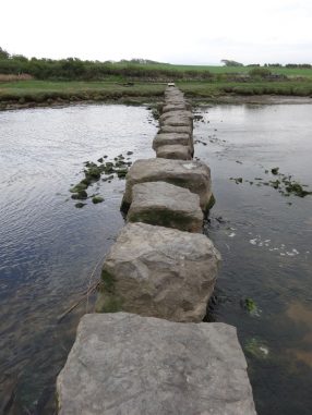
The rest of the way from Pen Lon to Menai Bridge is relatively uneventful. The Coast Path cuts inland across the southern corner of Anglesey. The first part of this goes along a small road and ends at some stepping stones over the Afon Braint. The ‘stones’ are large concrete slabs, sometimes a small step across, sometimes a bit of a hop … I think a toddler would need a little help. It then zig-zags across fields and sometimes along small lanes. Towards the end I recall walking parallel to the Menai Straits, looking down across fields towards the water, but struggling slightly to work out which path to take down, however eventually finding myself by the waterside and for a mile or so walking along the shingle beside the Menai Straits.

At one point the path cuts again slightly inland running a few hundred yards inland parallel to the Straits. Although I was on the lookout for this point, somehow I missed it, and only as the way across the shingle became more difficult I realised I’d missed it. By this time the banks were high leading up to private ground, so it was impossible to find an alternative way, so my choice was to go back or press on.

Now, when I say ‘shingle’ I should explain that this means fist-sized stones that are sharp edged as if they had just been quarried. I assume this is because the Straits are relatively protected from sea storms, and here, where it is wide, the tidal surge is not so strong, so the stones are not tumbled and smoothed. I was wearing sandals and walking on the sharp stones became more and more painful. In fact I must have bruised the bone of one of my toes during this time as it was painful for weeks after.

After what seemed like an interminable time, the line of shingle between bank and water started to narrow, until it was clear I would soon be unable to proceed. I had another choice, go back a mile over the sharp stones or climb the walled bank. I managed to clamber up and found myself in parkland, presumably the grounds of Plas Trefarth. The Coast Path clearly goes through these parklands, but slightly further up the hill. I found a path, which I think was the right one, and followed it and certainly eventually came out where the path was supposed to by the church at Llanidan.

There is a choice here, an inland route, perhaps for times of very high tide, and a route along the waterside. As I always do I took the waterside route … yet more shingle walking, but happily now rounded stones, which were still slightly painful given my bruised feet, but so much better, then after just half a mile by the water, back inland, mainly along small roads, crossing the main road at the tiny hamlet of Plas Cefn Mawr, then taking a detour past a chambered cairn at Bryncelli Ddu. This detour adds a mile or so to the path, and I think is there to avoid walking along the busy main roads rather than for the historic visit.

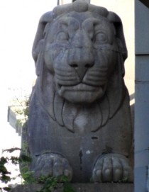
When the path does rejoin the main road there is a footpath alongside, sometimes separated by a small fence, until, on the approach to Menai Bridge, the path does cut back towards the water again for the small waterside walk underneath the Menai Bridge with its giant lion supports.

Finally I got to the hotel in Menai Bridge and found Rosie waiting at the bar. While she drove me to pick up the campervan and then later over a kebab on a bench, she told me all about the local politics of Menai Bridge, the scandals and affairs, and about the landlord of one of the pubs who was taking part in Walk on Wales later in the year … all picked up from a few hours chatting to locals.

Day 42 – Rhosneigr to Malltraeth

a simple coast walk involving bovine encounters, an ancient burial, a church in the sea, and the seat of princes, and, although we miss on the path, picnic dinner with a fellow coast walker

miles walked: 14
miles completed: 412.3
miles to go: 648

After the penetrating rain of the last night, the morning could not be more different; glorious sunshine awoke me. The forecast was to turn less good later, so as soon as I could make my way round the sodden clothes from the previous day I set off.  A sandal day, as my boots were still soaked through.

It is interesting the way Rhosneigr feels as much a village as seaside, whilst Trearddur (Arthur Town ?) felt purely holiday resort. Happily, being a village, there is a Spar, where I buy some pork pies and chocolate bars to feed me through the day if needed.

Walking along the beach I first record some long audio logs about the previous day, when I could not record or photograph because of the rain.  However, this morning I am soon unzipping the bottom of my trouser legs, and only keeping the jacket on because of the wind.

The path runs along the beach for nearly a mile, and on the headland overlooking the south end of the beach, Porth Nobia, there is a grassy mound with a large rectangular entrance.  This is a Neolithic chambered cairn, built to bury the dead, and, according to the information boards, brew strange Macbeth witches-like stews.  The Coast Path runs very close, and it is possible to see right inside, although the very inner part has a railing door.  Anglesey has many archaeological sites, but few close to the Coast Path, so I was very glad to see this one. The mound itself is a reconstruction, a grass-buried concrete dome, preserving the shape of the stones as they would have been exposed on the clifftop, whilst giving some of the sense of enclosure, albeit without bending double to get in.

The tiny horseshoe-shaped bay beyond the cairn is called Porth Trecastell. ‘Trecastell‘ means ‘castle town‘, so I wonder if in days gone by, the remains of the cairn looked like the remains an old forgotten fortress from the days of the Mabinogion, or maybe the substantial farm, ‘Trecastell‘ itself was the site of a long buried fortified farmstead?

Beyond this, the path is on grassy clifftop, where, from the muddy tracks, the cows walk as close to the edge as possible, just like the coast-path-er.  Although the hoof prints make the way hummocky, I take heart in knowing that if the cliff path can take the weight of a herd of cows, it can take me.

Just a short while on I find the cows, only not cows, but a herd of bullocks.  Bullocks are more flighty than cows, and either gather trying to stare me down, or, if I move, skit off along the clifftop field.  One bullock, with long curved horns, seems to stare particularly intently as if taking exception to my invasion of their field, in general, and taking photos of them, in particular.

Worried, that, like Gabriel‘s sheep in Far from the Madding Crowd, they may end up lemming-like flowing over the cliff top, maybe with me caught in the flood, I try to keep well below them, but a Coast Path arrow (yes, they do exist), points vaguely up towards the fence.  I can see a gateway there, but it is where the herd has gathered; fifty bullocks gathered for safety, ready to make a bolt for it should the frightening walker get too close.  I give them a wide berth, and notice a stile at the end of the clifftop field, maybe it is that … but no, no sign on it and definitely entering the MOD danger area if I go over; it is definitely the bullock-jammed gate.

I approach along the fence line, hoping they will part, and as I get closer, they start to push and shove each other to get through the gate.  A brave few, including one beautiful white beast with curved horns, ideal for the Minoan circus, try to stare me out, but they too either push back into the cliff field, or follow the last of their brethren through the gate.

As the bullocks move, I see that indeed there is a labelled pedestrian gate beside the large farm gate, and negotiate this rather than the mud churned gateway, entering the large field where they continue to pour across in front of me, the stragglers in the cliff field making their way through the, now safe, walker-less, gateway behind.  It is almost as if they are deliberately taking my direction, as if I were a drover of old herding them on their way across Wales. However, as I get towards the end of the field, I see them pouring though a gate at the far end into another large field on the left, so they are simply following a standard daily migration prompted by my passing.  Happily I do not have to push past them and wade through the field-entrance mud as the path arrows (more!) take me to a stile at the opposite corner.

Later, when I meet a few fellow walkers at the chip shop in Malltraeth, I ask whether they encountered the bullocks on the clifftop.  "Bullocks, no the fields were empty," they said, "wait, there was a herd we saw, but in the field to the left."  They had obviously come after the drover.

The path continues inland, after a while joining a road, then branching down a lane.  After passing a bluebell-filled cottage garden, the lane is edged with high barbed wire fence; I spot danger signs and what looks like klaxons … more of the rifle range, I think, but then see a notice declaring the Anglesey Circuit, and catch a glimpse of a car roaring past on a test drive.

Soon after, the path rejoins the sea, and as it does, Avalon-like, in the bay a tiny rocky outcrop atop which stand a manmade walled, grassy, level-topped mound and a white church, St Cwyfan’s Church also known as the ‘Church in the Sea‘.  The island is reached by a tidal causeway, and as I cross I wonder how many hermits were drowned clinging to its sea-washed rocks before they built the mound1.  For the hermit, I can see that there is something special about being on the island as the sea comes in, shutting you off from all but GodKeith said just the same about Holy Island, Lindisfarne, in Northumbria, larger, but likewise a tidal causeway where the tide that strands, traps, or maybe cuts you free, is part of the experience of visiting.

If you approach from the south it is easy to miss, simply looking as if it is a church or even farm building on the opposite shore, and it is here that I think I missed Rosie going in the opposite direction on the path; while I was on the island looking at the church, she, coming from the south, had not noticed it at all.  The church itself is small, although nothing on the scale of St Trillo’s and somehow, despite its location, did not capture me in the same way, maybe because it is locked so I could merely peek through its whitewash splattered windows.

The way to Aberfraw is then straightforward, along the rocky shore and then estuary edge.  It is about a mile inland along a small river estuary, with its beach backed by huge, windswept and marram-grass-fringed dunes.  Maybe it was once on the sea edge and the sand has gradually taken it inland, albeit the opposite of the general movement in the area.

Aberfraw was the seat of kings, the palace of the princes of Gwynedd including Llewelyn the Great, until their defeat by Edward and the end of true Welsh freedom except the brief rebellion of Owain Glyndŵr in the fifteenth century.

However, forget the history, all I wanted at that stage was some lunch.  From the river side I see ‘The Goran‘, a ‘Free House’, and head up.  As I approach I see a sign mentioning menus, this looks promising, but the door is closed, the lights are out.  I ask a local, "ah, he opens when he likes," I’m told.  However, I am then directed to the Llewelyn Fawr heritage centre, craft shop and café.

The heritage centre has exhibitions.  Some boards tell the old history of the kings of Wales, although none mention Glyndŵr; maybe they feel he was a borders upstart, and that the true line of Wales died with Llewelyn?  Some are about more modern times, fragments of documents, old photographs, but sadly no booklets to take away. I realise just how special Tiree‘s An Iodhlann is in terms of its level of archiving and Dr John‘s annual exhibition booklets.

I chat to the lady in the craft shop for a while, but unfortunately, the man who knows most about the heritage is away.  She asks me about the walk and recalls Christian Nook, when he came round the previous summer, but I emphasise I’m just doing Wales!  "Why Wales," she asks.  "Because I’m Welsh," I answer, "born and raised in Cardiff."  "Sorry," she says, I think for assuming I was English, and then repeats in Welsh, an invitation to continue in Welsh, if I could, and the first time I have been addressed directly in Welsh, I just wish I could say more than "diolch", as I left.

The café is also good and does an all day breakfast 🙂

From Aberffraw there is a landward and seaward route.  The former is more direct, the latter the best part of two miles longer taking me down the sandy south side of the river estuary, onto a glorious beach, which reminded me of Tiree, and then back along the edge of the dunes.  As is evident I took the longer route, but after this the only way does cut inland across to Malltraeth, I assume access problems with property on the coast.

Not far inland is an abandoned farmhouse, a substantial rendered property, but only reachable by tracks over fields, I guess the reason it has not been snapped up as a second home. Even the round straw bales in its yard seem abandoned, each growing its own crop of grass, and behind the ranks of straw bales, deep piles of scallop shells. They must have been dumped here by the lorryload from a seafood factory, but I couldn’t work out why.  Maybe to be crushed as calcareous fertiliser for the land, but now also abandoned, monument of forgotten plans.

The final way into Malltraeth is uneventful: my first encounter with a massive bull, although he ignored me and I realised after I should have exited the previous field a hundred yards to the left and not passed him at all; a portion of path along the riverside that cuts through the end of people’s gardens, some have put plants or fences to separate themselves from the right of way, some mow open to the water edge, whether to lay claim or show welcome was not clear; and in the final alleyway between houses, one homeowner made it very clear with not just barbed wire wrapped along the top of their fence, but a rusting iron garden gate with tiny thorn-like barbs paint-softened on the top rail.

And so into Malltraeth, its pubs also closed – does no pub open in Anglesey?  But happily its tiny fish and chip shop welcoming, where I meet a few walkers doing a managed tour around the island, baggage and taxi pickups managed for them.  The rain started, so remembering the van still filled with drying clothes, I rang for a taxi, and only then saw texts from Rosie saying she had got to Rhosneigr and had her car.

So eventually Rosie and I meet by the seafront at Rhosneigr and have a picnic dinner of the bits and pieces we have between us.  Rosie is planning her own memoirs of the trip, indeed has already arranged a publisher (so organised!), and has so many stories, she seems to have an art of meeting unusual people, or getting herself into unexpected scrapes.

When I first encountered Rosie through her Twitter feed, I thought she was a naive young walker with her 34-kilo pack.  Then, through the landlady at Nash, I found she was anything but, a seasoned trekker from Brazil, used to surviving in the jungle where, if it wasn’t in your backpack, you would die; and furthermore, now in the UK with a family of five grown-up children.  However, since those early walking days (a month or more ago!), she has decided that she can dispense with some of her pack, although her camping knife with its fire flint is never far from her side.

Rosie is walking for Water Aid, and spends all her time charity fundraising.  Before she left she had curated an exhibition of donated art back in Folkestone, where her gift of being able to gently, but persuasively, ask for contributions had allowed her to gather work of several major artists.

I also find that she was very early in producing websites based on user-contributed content, a Web 2.0 forerunner … I guess after she spent two years living by an airfield in the Amazonian forests listening to rain on the corrugated iron roof, the monkeys’ dawn chorus and leopard cries in the night.

  1. Later I found out that St Cwyfan’s Church was originally on the mainland, but the cliffs and land around have been eroded, rather than being built up out of the sea, it is an extreme example of coastal defences at work.[back]

Day 41 – Holyhead to Rhosneigr

in which the intrepid walker meets other intrepid walkers and cyclists, extends his vocabulary, learns mastery of cattle , and conquers weather and distance

miles walked: 26
miles completed: 398.3
miles to go: 662

The first part of the day is a tale of two beach huts.
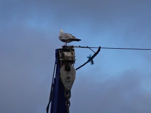
2013-05-28 09.18.36I get the first train to Holyhead (9:02 am, not exactly early!) and head for a café I recall visiting once some years ago, facing the docks.  Although far from the promenade and beach, it is called ‘The Beach Hut‘ and has a ‘caf’-by-the-sea feel, fresh and basic, serving mainly breakfasts and lunch, but also, I discover, B&B with WiFi … if I had realised the night before …

With a solid breakfast inside me I set off in stronger heart than the previous day when I think I let my food intake go down.
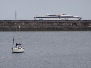
2013-05-28 10.24.47Once clear of the docks, the path leads along the promenade, past beautifully tended allotments, upright slate sculptures like the sentinel in 2001, and the Maritime Museum (with seafront café).  If I’d had time I would have liked to walk the length of the Holyhead breakwater, which snakes like a sea serpent protecting her brood of docks, wharves, ferries and yachts.  The latter are mostly clustered near the marina at the far end of the promenade.

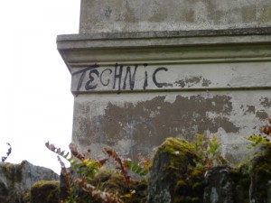
The foundations of the breakwater were quarried out of the hillside behind the marina, and the path leads up past this.  On the way you pass two abandoned buildings. The first is solid, white, late Victorian, with four windows along its side, I’d guess at least 6 or 8 bedroomed in its prime, now fenced off with danger signs, overgrown and the word ‘technic’ spray-painted on its corner.  The second is a castellated mansion, I’d guess Victorian mock-Gothic, maybe the quarry owner looking down on his creation.
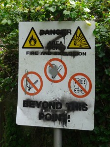
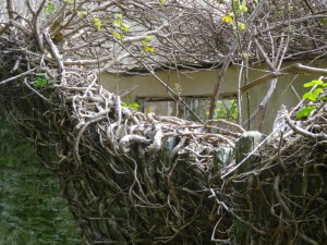
2013-05-28 10.40.17  2013-05-28 10.40.32  2013-05-28 10.41.08

While the enigmatic ‘technic’, is unofficial (read illegal) graffiti, other official wooden sculptures and mosaics line the path before it cuts up the first slopes of Holyhead Mountain.

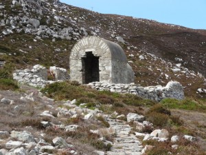
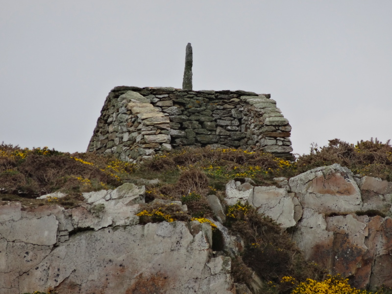
Round the first point, a hermit’s cell or tiny chapel ahead, which on closer approach appears to be the explosive store for the quarry, far enough away not to risk sparks, but close enough to bring supplies when needed.
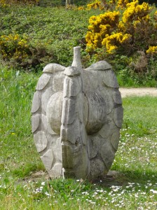
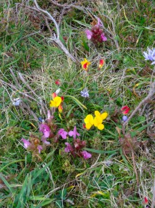
2013-05-28 11.11.09   2013-05-28 10.54.51   2013-05-28 11.24.32

Further on you get to North Stack, a small rock with an old building, perhaps a coastguard station, on the cliff beside.  The building is now for sale as a studio, an ideal location, but you’d need a very high-wheelbase vehicle to get to it over the near vertical ‘roadway’.  An outhouse has ‘magazine’ carved above its door, so perhaps the building did duty as coastal defence.  There is no lighthouse at North Stack, but a little out to sea are the skerries, with  their own light.
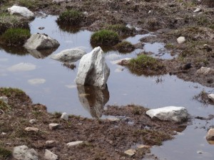
2013-05-28 12.20.35It would be possible to do a detour over the top of Holyhead Mountain, but I decide to stick to the coastal path as it skirts the mountain towards South Stack lighthouse, and, as I drop down, I am called by name. It is the young man who served at the Llanfairfechan ‘Beach Hut’, out for a walk with his family who were visiting.  If I’ve not confused people in the day, I believe the older man said he had walked from Land’s End to John O’Groats.

Again, with more time I might have dropped down to see the lighthouse, but decided to just look from a distance.  However, I do pop up to see the stone hut circles just off the path. Inside one, flowers and votive wreath have been placed, although these were never religious places, just basic homes for those scraping a life.

The coast after this becomes a succession of beautiful rocky coves and inlets, which merge into one another in my memory.  A helicopter often hovered over the sea, or swung over the cliff-tops, doing exercises, I assume, out of RAF Valley.  Ahead on the path I see two people wearing helmets and life-vests, I think they must be to do with the helicopter exercise, and then notice that, in the cove they are looking down into, three further helmeted and life-vested figures are making their way out of the sea.
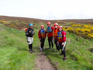
2013-05-28 14.10.45Convinced this is a live ‘out of the sea’ life-saving exercise, I approach them.  "We are coasteering," they say, "we make our way at shoreline, sometimes swimming, sometimes rock climbing, going into every inlet and sea cave." I had never heard of this before and they explain that it can take an hour to cover 100 yards.  At that rate, staying in the sea all day and every day, winter and summer, it would take four and half years to get round the Wales coast.  Walking, I took the easy option.

Later on I spot another larger coasteering group, from their high-pitched squeals a group of schoolchildren on an activity day.  It is a bit like learning the name of a plant or bird and suddenly beginning to spot it everywhere; language influences perception.
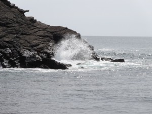
2013-05-28 15.09.48And then more rocky coves, and one small surfing beach, Porth Dafarch, which had an ice cream van in it, and a small car park and public toilets … for this area of coast development on a grand scale.  On the far side of the beach as you return to the headland, a bench has a sad wreath of weathered battered plastic flowers tied to it. There is no dedication on the bench, so I assume the flowers are for someone who drowned here, one of several such memorials I’ve seen along the coast.
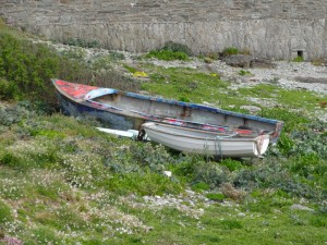
2013-05-28 15.27.19Trearddur is on the opposite side of Holy Island from Holyhead.  Although we’d stayed a night at the campsite on the headland south of Trearddur, we had never visited the town itself.  The scattered outskirts start around a mile before the main town, tantalising, as I intended to stop at a pub or café for a snack before continuing.  I had originally thought of stopping for the night at Trearddur as it was the biggest place between Holyhead and Rhosneigr, but it was still mid-afternoon and I wanted to press on further and hoped to either find a B&B later, or go as far as Four Mile Bridge, the old crossing between Anglesey mainland and Holy Island, and either catch the train at Valley if early enough, or stop at a pub there and order a taxi back.

At one of these nearly there but not quite places, I see a shipping container with ‘beics-cybi-bikes‘  on the side and a couple, trying out hire bikes.  I’d spotted one of these somewhere earlier on Anglesey, and realise it is a tiny ‘chain’ of cycle hire around the island, business in a box.  There is a painted van also there, so maybe each one is permanently manned during busy periods, or perhaps they simply drive round the island to open up on demand.

Trearddur is ‘Tre Arddur‘, so, maybe the town of Arthur.  However, unlike Bwrdd Arthur on the far north east of Anglesey, there is no sign of ancient settlements or forts that might give it its name.  So, maybe ‘arddur‘ is not a name – something to look up when I have both time and internet … neither of which is in good supply at present1.

While I had thought that Rhosneigr was the seaside resort of Anglesey, in fact it is Trearddur that really catches the prom atmosphere, with two ice cream vans (yes, two!), a hot dog van, and even a small cannon outside the RNLI shop.  The RNLI shop proudly bears a plaque to say that Prince William and the then ‘Miss Catherine Middleton‘ carried out their very first public engagement together to name the Trearddur Bay lifeboat in 2011.
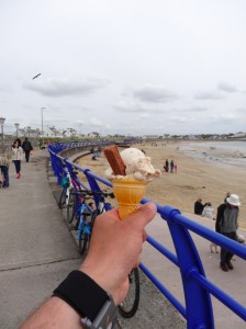
2013-05-28 15.44.26One of the vans is local Anglesey ice cream, so I have a cone of toffee fudge to enter into the full seaside experience.  However, with great self-control I pass by the hot dog van as I intend to have a snack at one of the seaside cafés or village pubs.  Well, that was my intention.  I walk the blue-railed prom eating my ice cream, children playing on the sands, waiting for the first inviting looking premises.  But there is none.  Maybe I missed one that was the other side of the road, but scan as I could up and down the road I saw nothing.

The only eating place is beyond the end of the prom as the road leaves the sea, and is a Crossroads Motel style building that announces it won pub of the year and has five star accommodation.  Sounds a little posh for me.
2013-05-28 16.08.12I guess Trearddur grew up as a seaside town after the Holyhead railway made it easy to get here from Liverpool and even London and the Midlands.  Looking at the map there is a substantial built-up area about half a mile behind the prom front, which is probably the original village and perhaps where you’d find a pub or village shop. The prom is just that, a prom, with seaside properties behind.

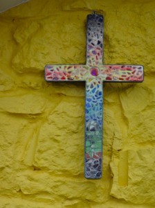
The road cuts off a tiny headland and then meets the sea again at a small beach before leaving the last of the houses, one of which, a part-yellow painted bungalow, has the most lovely rainbow-coloured mosaic cross hanging in its gable.  Then through a caravan site you come again to the clifftops, which continue on to Rhoscolyn, the next little port three miles or so further on.

The coast here is less spectacular than near South Stack, and the cliffs very much lower, but has several natural arches.  However, the high spot is near the end.
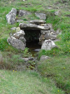
2013-05-28 16.39.31At one point, where the path crosses a tiny stream along a causeway, there is a side stream coming straight from a spring in the hillside, the water head enclosed in a small dolmen-style stone enclosure, less than a yard across, so that the waters come bubbling fresh from a dark manmade cave.  I wonder if it is a holy well of some sort, but there is nothing marked on the map.

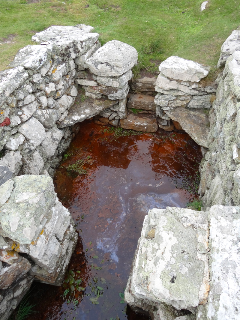
Eventually, a coastguard station appears on the high spot of the cliffs ahead, but crossing the last stream before it there is another, semi-sunken, stone structure, this time the size of a garden shed.  There are two parts, one like a small open-topped room, perhaps six foot square; steps lead down into it with a whatnot-style triangular stone across each corner to form rough seating for four.  The base is filled with water; not the clear water of the previous well, but rich red-orange, like stagnant water in an old rusting oil barrel.  It did not look inviting, but I guess is good for joints, or, as was suggested to me later, for pregnant women needing iron.  On the downstream side steps lead to a smaller area with two small benches facing one another over the water.
2013-05-28 17.00.43   2013-05-28 17.05.47

At first, from the state of repair, I assumed it was a few hundred years old, but then noticed, up the hill, what looked like a small but ancient-looking church or hermit cell.  On the map I later realise the well is marked as St Gwenfaen’s Well, but not the church on the hill.  ‘Well Hopper‘ gives a detailed description of the well, and also of St Gwenfaen‘s life.  The website for the church of St Gwenfaen at Rhoscolyn also has information and evidently Rhoscolyn used to be called Llanwenfaen.  A description in Sacred Springs says:

‘… Ffynnon Wenfaen was particularly renowned for curing depression and mental illness. Two white quartz pebbles used to be thrown in as an offering after drinking the water, a custom surely derived from the saint’s name – wen fain = white stone.’

So, not joints or rheumatism, but drinking the water – yuck!

The coastguard station on the cliff top is no longer in regular use; I guess mobile phones have reduced the need for human lookouts, although not entirely, given (i) the level of phone signal available and (ii) your ability to phone when your boat has just capsized.  I read on the side of the building that there are plans to reopen it with volunteer staffing – David Cameron, here is Big Society for you.

A couple with their children are also looking and have come from the campsite at Rhoscolyn where they have a caravan.  Unlike some of the semi-retired people who spend large proportions of their time, they can only spend the odd weekend, and are finding the combination of rising site fees and also fuel costs a problem.  When you can come for weeks at a time, both seem reasonable, but with the trip from Liverpool costing them £50 in petrol, they are wondering how long they can afford to keep the caravan going.

A week or so later I hear a similar story from Caroline, the landlady at The Lion in Tudweiliog.  The caravan sites nearby are a major source of custom, but due to fuel costs people are coming less often, and when they do come, as at the club house in Monmouth, they eat out less. "Some families have come for years and used to have three or more meals here in a week, but now maybe once, if that", she tells me.
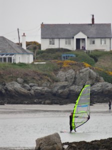
2013-05-28 17.32.12The path leads onto the beach at Rhoscolyn, and at the far side should end up back on the cliff, but there are lots of notices below houses on the cliff tops saying ‘Private’.  Now it seems so obvious that if the path leads onto a beach you need especially bold notices to say how to get off, as there is no beaten path across the sands taking you unerringly to the next waypoint.

Happily, a family, grandfather, daughter and grandchildren, are making a spectacular dam on the beach, and point me to where the Coast Path sign is.  It turns out that the man has cycled John O’Groats to Land’s End with his other daughter in his 60s and would love to do the return trip in his 70s.  Earlier that day I’d met another man who had walked it some years earlier.

I find the sign, but it is very confusing.  One Coast Path arrow points along the road behind the beach. That is reasonable: the map shows this as an alternative route if the tide is high.  Another arrow points back to the beach from where I have come.  A third finger has a footpath symbol, but no Coast Path roundel, and points along a path through a small painted gate. So, I took the fourth way, the one with no arrow at all.

Now, I know it sounds foolish, but along the way it is not unusual to find the coastal path signs only pointing in a single direction around the coast, sometimes a single arrow post, usually pointing the way I have come as the clockwise signposting seems slightly better than the anti-clockwise.  In some cases, if you scan you can see a matching sign for the other direction, perhaps a little along a road; in some cases they expect the other way to be obvious, and in some cases it’s plain oversight.  In the latter two cases, you can sometimes work out the right way to go by assuming the sign is designed for the people coming the other way, and guessing where they are expected to come from.

I still do not know which of these was the case, whether they were in fact directing you onto the beach and there was another way off beyond the private notices (although at high tide I can’t work out how), or whether you were supposed to follow the footpath that didn’t have the Coast Path roundel. But anyway the choice I made was, it turns out, wrong.  I’d hoped that very soon there would have been a side path, taking you behind the private properties and back onto the cliff path, but it became evident that this was not going to happen, so I simply looked out for the first roads to the right and took them.
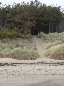
2013-05-28 18.09.55I ended up in a road leading only into the Silver Bay Caravan Site, but, rightly, assumed there would be beach access and was helpfully guided in the right direction by one of the residents, and so ended up on Silver Bay.  It is now cloudy and has been spotting rain since I met the family on the sands. I can see from the map that the path leaves the beach partway along as there is no route round the final headland of Holy Island, and the path cuts across the tip, but can I see a clear bold sign? … of course not.  However, in this case it is not simply subtle, or hidden, but absent.  I notice a set of steps climbing the dunes to the left, and go to explore, but there are no Coast Path arrows, so I turn to go on, the correct way must be further.  However, looking at the map again, and the position of the woodland that partially edges the bay, in fact these steps are precisely the way.

The rain has started properly now, so I am glad of the tree shelter and glad also that the path is fenced on both sides, so no decisions to be made and no chance of going wrong!
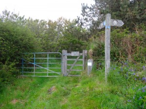
2013-05-28 18.34.17The woodland gives way to farm track and then that to a small lane, which would have been pleasant if not for the rain.  I’d not brought my waterproof overtrousers, so soon my trousers were soaked through, but my top half was dry.  After a while, a sign points to the right, where a sign says it is a permissive path not open in the winter, but there is still a heavy chain across the kissing gate.  I almost continue along the road way, but then look harder and realise the chain with padlock is simply looped over a post, as bailer twine is sometimes, to stop the gate swinging open … so if you are ever walking this way and see a chain, do not give up!

And I was glad I had persisted, as it leads through an idyllic area of scrub woodland and wetland (the latter pretty well boarded in the muddiest areas), I assume some sort of nature reserve.  At the far end the gate has no chain (!) and you are back on the road for a short while, before turning off down a farm track round the back of a farmhouse, across a farmyard through a narrow gap between buildings (breath in), along a field, where I almost miss the path arrow half lost amongst the hedgerow, and finally onto the (soggy) edge of the estuary/strait between Holy Island and Anglesey mainland.

As the Telford causeway and newer dual carriageway largely block the flow of water through the strait it is very estuary-like in terms of the salt marsh and mud, but given how narrow the strait is at Four Mile Bridge, perhaps this would have always been so.   And, although I had a few miles of wet walking to go, I was on the home stretch to Four Mile Bridge where I would go into the warm, hopefully not soak the place too much in the process, and sup a half pint while waiting for a taxi.

Well, that was the plan …

As I draw near to Four Mile Bridge, there are a number of boats on the banks, but no obvious sign of a pub.  I was sure I had driven across this once and seen a pub, but it must be a different bridge elsewhere.  My waterproof jacket was keeping my top half dry, but below the waist my trousers were soaked and dribbles had run off into my boots, so that each step squelched.   I really wanted to just get back.

It looked like the main body of the village was on the Holy Island side of the bridge, so I walked a hundred yards or so in that direction until I came to a triangular village green.  Surely this is where the pub would be.  There is a hairdresser and a sign for another shop, but no sign of a pub.  If there is no pub here, then there must surely be no pub at all.

Walking back to the bridge I look up the road in the other direction, and it is clearly just scattered housing.  A mile or so on is Valley, but I have no idea what I will find there; I have driven through it and seen restaurants and shops, but have no idea if there is anything that would be open now.  Certainly I would be too late for the last train.

The idea of waiting somewhere, whether here or Valley, maybe half an hour or more, in the rain for a taxi was not inviting.

The alternative is to continue to walk the six or so miles to Rhosneigr.  It is after seven, but I will not be taking photographs in the rain and there is a substantial amount of beach walking that will be quick.

I get what shelter I can under the wall of the bridge, put the camera in the waterproof bag inside the rucksack, swap maps over inside their plastic case, with only the odd soggy corner and rain drop smudge as I try to protect them with my body from the persistent rain, and set off.

Later during the walk I discover that if I had walked a couple of hundred yards or so beyond the green in Four Mile End, I would have come to the Anchorage Hotel, situated towards the western edge of the village.  As I have found elsewhere in the walk it is so hard to know what lies within walking distance of the path.

Although I’d peeked at the map, it was hard to read under the rain-dark sky and my mental model was a short walk along the riverside and then a long beach walk past Valley airfield to Rhosneigr. I think the fact that the Coast Path cuts off the south-west corner of Holy Island had shrunk the distance along the water’s edge.  In fact the largest part of the journey is the riverside part, with just the last two miles on sand.

I am writing the last part of this day some time later, and have no photographs to remind me, so am struggling to recover the details from a morass of grey-skied, rain-soaked memories.  Happily it is one of the better signed parts of the Anglesey coast path, as reading the map in the rain was not easy.

From the bridge you walk a short distance up the road on the mainland (as in mainland Anglesey) side of the bridge, then turn right, I can’t recall if it is initially a lane or instantly a farm track, but certainly quite soon you go through a gate into cattle fields, where the cattle are not visible in the fields, but their traces are very obvious underfoot.

After a while I came to a field where the path is signed towards a more bushy corner where bushes and fence converge into a short, three-foot wide, maybe six-foot long pathway ending in a stile. Except that wedged into the pathway were two cows. One backed out as I approached, but the other had its head by the stile and its whole body on the pathway, and could only get out by careful reversing, which it was either unwilling or maybe unable to do. Furthermore I was at the end I wanted it to move in, so it was hard to encourage it to move.

I pondered the situation for a while.  Serious, including fatal, injuries, are more common from cows, but these are usually farmers suffering crush injuries.  In general it is not a good idea to be between a cow and anything solid.  I could see no other way round, so sized up the options and decided that the thick bushes looked a safer option than the barbed wire fence (images of cheese-wire-chopped Alan in the next field), and started to see if I could squeeze past.  However, as soon as I started, although before I was fully in the gap, the cow moved backward a half pace. I backed off and waited, hoping she would continue to move backwards, but no, she stopped as soon as I backed off.

In the most gentle yet commanding voice I could muster I gave her a slap on her side and said, "come along now" …

… and she did.

I was Alan, braver of rain, master of cows, invincible.

But still wet.

For a while the memories are simply rain-soaked fields, and then the path came out into a ford over a small river.  I can’t recall if there were stepping stones for pedestrians, or simply a damp paddling crossing; my feet were so wet I would not be able to tell.

Opposite the ford I continued through the open gate, along a track, and eventually passed a house that was in the process of renovation, into another field, and the path ran out.  After scouting about I started to backtrack, looking for signs along the way, until I got to the riverside, and saw that indeed there was an arrow telling you to turn right along the water’s edge, which I had missed in the combination of half-light and the clarity of the open gate ahead.

Walking sometimes nearer, sometimes further, from the water, it was unclear whether I was seeing across the water, Holy Island, or twists of my own bank; certainly it seemed to go on for ever. In fact this part, moving mainly cross-country following the side of the estuary/river, was about four miles (without the wrong turning, which probably added a half-mile or so). However, these were not the fast beach miles in my mind as I’d set off.  So the hours passed and the sky was getting darker with sinking sun as well as grey clouds.

Eventually, with a feeling of relief I came to the edge of Valley airfield, from which Prince William flies.

There was no sign of the Prince, nor indeed any plane or person foolish enough to be out in this weather.  Along the perimeter fence signs warning you not to loiter, as if I was likely to spend time contemplating the view, with rain soaking my underpants.

After maybe a mile, or maybe a little less, of blissfully fast and easy walking along concrete and gravel, it was with joy that the path came out onto sand and I saw the sea.

It would be a lovely walk in the sun, but in the falling dark, I trudged it as fast as I could, knowing that at the other end I had to negotiate the meandering marshy estuary to cross to Rhosneigr.  I had seen a bridge, somewhat inland, but how you got from beach to there was uncertain.

So, with the rain still falling, I came to the end of the beach, with Rhosneigr literally a few hundred yards away, but with the river between.  According to the map, the path should cut across the last spit of sand, but in the dim light I had seen no sign, so I ended up making my way round the steep sandy banks of the river until eventually the small meandering estuary narrowed and I spotted the path. Then blissfully it was an easy walk to the footbridge, which comes out just below the campsite.

At twenty to ten, I opened the campervan doors, reached in to the shower area, and one by one stripped off layers while still standing at the doorway, depositing the dripping boots, trousers and waterproof anorak into the wet room (I should note that I closed the caravan doors before depositing the dripping underpants).

Under my (also waterproof) under coat, I was amazingly dry, with just the odd damp ingress around neck and wrist.

I was soaked, I was exhausted, my feet hurt, it had been the longest day I had walked so far, and indeed would walk on the journey, twenty-nine miles2, and probably the wettest, but I was not down.  I was elated; I had challenged distance, I had challenged rain, I had even challenged a recalcitrant cow, and I had won.
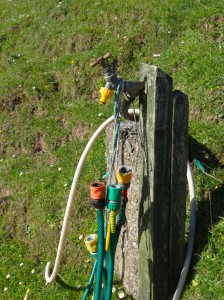
  1. Later Paul Sandham suggests it may simply be the town of the gardeners.[back]
  2. The official Coast Path distance is 26 miles, but ViewRanger said 29 miles; if anything, GPS devices underestimate as they cut off the curves, so I’m going with 29![back]

Day 40 – Church Bay to Holyhead

wet and windy, puddles and a new bridge, crabs in the grass and cockle pickers beneath the chimney

miles walked: 14
miles completed: 372.3
miles to go: 688

I woke to the sound of wind-buffeted rain hitting the campervan.  I put off starting as long as possible, but eventually could think of no more excuses not to start.

2013-05-27 14.28.04It was wet, hard, driving rain that stung your face, but to be fair, this is the first really wet day since I started, and even today the rain cleared towards the afternoon, with the sun breaking some setting light below the clouds.

Because of the rain, few photographs, and only one, belated, audio blog, and in many ways an uneventful day, in fact possibly the most interesting part was the taxi drive to Church Bay.

As we drove along the taxi driver said he was hoping for fine weather the following weekend as he and some friends were planning a golfing trip to Bethesda, but he couldn’t play in the rain as he didn’t have waterproof golfing clothes.  He explained how difficult it was to get clothes, but in particular waterproof clothes, when you are a large size.  The major outdoors shops stock up to 2X, but not the 4X or 5X that the taxi driver needed.

2013-05-27 15.00.01During the walk I have complained, especially on audio blog, about parts that are wet, muddy or hard to navigate.  For the hardened hiker these are normal things to expect, but the aspiration of the Wales Coast Path is, I believe, wider, to get ordinary people walking.  Imagine you are not used to walking, and then, with your family, you decide to follow a part of the Coast Path, but then you get lost or sink to your knees in mud; you may never venture out again.

Equally, if you are overweight, then walking is an excellent way to burn off some pounds and make you generally more healthy. The taxi driver wanted to do precisely that, but could not get clothes in a suitable size, so, if the day looks wet, will not walk or play golf.

In many ways the Coast Path just south of Church Bay is similar to the path north, narrow cliff-edge pathways interspersed with green trodden routes over grassy clifftops.  However, the cliffs are lower, maybe 30 feet at most, and successively lower the further south you get. Also the luxuriant tumbling flowers are less evident, maybe because the brambles are covering the cliff edges.

I was glad I’d worn boots, but the puddles were more from the rainfall, the path itself did not seem intrinsically muddy, and the cliff-edge parts of the path are high-edged with bramble and gorse, so all in all it feels a good part for a family walk, although I’d keep a hand on small children anywhere on the Coast Path.

The map says there is a fort at the southern end of Porth Trefadog, but I didn’t notice that; however, at the north end of Porth Trefadog, up dry on the headland, is the hulk of an old wide-keeled timber ship.

boat-and-tractor-2013-05-27 13.11.47-cropped

A little further on, at Tywyn Hir, there is a massive caravan site.  Those near the sea have timber decking, with glass sheets on the seaward side, so that they can sit and watch the sea, but protected from the worst of the elements.  I spot a chiminea on one of these timber patios.  As I walk by one caravan, a woman comes out with the most wonderful cascade of dark glistening dreadlocks, starting at a sort of top-knot and then falling down her whole back.  She goes round to the side of the caravan, opens a small timber garden store and inside, instead of a lawnmower or garden chairs, are a washing machine and tumble drier. "We call it home from home", she says.  I wonder again about these caravan communities, and recall a friend at junior school who always went on about ‘Swanage‘ where his family had a caravan. Roads were slower then, and Swanage a long way from Cardiff, so I guess they spent less time there than the modern caravan dweller, but I guess not so different 40 years on1.

South of the caravan site, the path runs for a while on roads and lanes, with occasional stretches on the beach, albeit, with wind driven waves, at times perilously close to getting my feet wet.  At one point there is a small bouquet on the road side. There is no message, but I assume someone drowned here once and is still remembered.

In one stretch along the top of the beach at Traeth y Gribin, I walked on the sand and must have missed a crucial sign.  The path cuts round a point to follow the edge of the estuary of the Afon Alaw.  I thought the going was maybe a little tough over shingle and river mud, but it was when I realised I was, first, the wrong side of a salt marsh with muddy rivulets running through it, and then the river side of a barbed wire fence, that I became certain I should be on the landward side.

Happily I was able to get onto the path proper not too far upstream and without any serious foot wetting.  This was close to the point where the river is still tidal, but clearly more fresh than salt water as the tideline was thick with decaying grass, with very little seaweed. However, I then noticed that what I had taken for foam, or small stones amongst the sandy damp grass, was in fact thousands of small dead crabs, most barely an inch across, like pirate doubloons cast along the shore.

On the map it marks two possible routes, one crossing the Afon Alaw, and the other going inland to Llanfachraeth as, at the time the map was made, the intended river bridge had not yet been constructed.  As I came along the river, the new bridge was there, a green arc across the waters, a flock of swans having a tête-à-tecirc;te at the far side.  However, the bridge was also full of bright orange building barriers, and evidently still under construction.

2013-05-27 15.38.09Happily, as I came to it, I found the bridge was indeed open, albeit with barriers covering parts of the bridge where the safety railings had not yet been installed.  One had been blown adrift but I was able to do my Bob-the-Builder good deed of the day and put it back in position.

I was glad of the extra mile or two that the bridge saved, but a little disappointed that I didn’t get to Llanfachraeth and a short rest, food and a pint!

On the south side of the river there is no danger of getting the wrong path as it is mostly fenced on both sides, with timber staging over the (most) muddy parts. This, like the bridge, is all new and still under construction. While I complain sometimes at Anglesey‘s path signage, it is clear they are investing in the path. At one point I see a sign, ‘use it or lose it’, warning of the council’s intention to close a footpath. It may be that the path being closed is because the coastal path is creating an alternative access, or maybe a deal with the landowner, "you let us have the coastal path, and we’ll get rid of this awkward path".  The tenor of the community notice suggests the latter. Certainly the council’s own notice advertising the closure is well off the line of the path and can only be approached by clambering over old wire netting … open government?

After clearing the river estuary there is a short stretch on the beach, at the end of which a Coast Path sign points you up some steps and onto the road. If the tide is low ignore it.  Having missed the signposting before, I followed the signs, but these take you on the alternative, high-tide route along roads on the south east of the Newlands Park estate, rather than along the water’s edge.  However, both take you to the causeway linking Holy Island to the mainland of Anglesey. The causeway, like the Menai suspension bridge, is another of Telford‘s engineering achievements.

At the beginning of the causeway a sign points you to the left, across the railway and under the second (later) causeway, but this is an alternative coast route that bypasses Holyhead and Holy Island.  So if you want to ‘do’ Holy Island, ignore this and head over towards the chimney of the aluminium works.

Part way across the causeway a sluice gate allows the tidal water to flood through, and I wonder at the sheer power of tides and imagine a turbine spinning in the rushing waters.

From the causeway and further along towards Holyhead, I occasionally spot what I take to be cockle pickers, out with bucket, fork and hook, turning over seaweed, digging into the soft mud.

Beyond the causeway, the path takes you through the coastal park, set up on the unused land owned by the aluminium works.  I see notices describing a new leisure village to be constructed between the coastal path and the works.  The latter is now closed, its chimney stack no longer spewing white smoke, and a sorely missed employer in the area.  You follow along the water edge, past a memorial to a soldier, who used to be a volunteer warden, lost in the Falklands, through flower-filled woods and a tranquil pet cemetery, then across grassy fields until Holyhead port draws close.

The last landmark before getting into the port and railway station is the Skinner monument.  Climbing up some steps and a small slope gives you a panoramic view over Holyhead.  Then back at the bottom you can read about the story of John MacGregor Skinner, Captain of the Holyhead Mail packet and benefactor of the town.  He was born in New Jersey, where his father organised the Royalist militia when the American War of ‘Independence’ broke out in 1776.  His family, being on the losing side, scattered, some to Canada, and some to Britain.

It is a reminder that the American wars are somewhat misnamed.  The first war was as much a civil war between different factions within the (now) US as a war of secession from Britain.  The ‘Casus Belli‘ was partly tax avoidance, but also about preserving slavery, which Britain was moving against, and the British government‘s annoying habit of blocking the seizing of native American lands.  The second, misnamed ‘Civil War‘, was in fact the actual war of independence when the southern states attempted to leave the ostensible free federation of states and were crushed.

As I finally drew into Holyhead railway station, I was very glad of that bridge over the Afon Alaw as I arrived just half an hour before the last train back to Rhosneigr where I was camped.

  1. Later in the walk I realised this must have been ‘Swanbridge‘ a camp site just a few miles west of Cardiff.[back]

Day 39 – back to the path

Back to the trail after the wedding, but pondering the life of the village shop and the glory of the penny post en route.

2013-05-26 10.27.45The wedding reception had been held at Low Bradfield Village Hall, a few miles west of SheffieldSheffield is an amazing town, the steep-sided valleys, which were once the powerhouse of countless mills that created the city, are inhospitable to housing, so, within a mile of the city centre you are in wooded nature conservation areas that extend out to the moors, and villages like Low Bradfield that feel as though you are deep in the heart of the country.  Nestled amongst hills, the only sound is the odd passing tractor, and the crack of leather on willow on the busy village cricket ground.

After the reception, we stayed at a small cottage, just behind the village store and post office, and yards from the village hall.

Village shops are often the heart of a community, and for those without cars, essential for day-to-day life, and yet over many years, they have been closing down.

One reason is that those with cars do most of their shopping in supermarkets, only using the shop for ’emergencies’.  So, while they would regard the shop as important, this is not reflected in the money spent there.  Of course the shop cannot compete in terms of price, but more importantly in the range of goods supplied.

This is precisely why, more than twenty years ago now, I began to articulate the notion of the electronic village shop, where a combination of regional picking lines and electronic stock control could enable just-in-time ordering, both of staples (just six tins of beans in the store rather than a box), but also of individual customer orders. I imagined a customer walking in in the morning, saying, "I’m cooking lasagne for dinner", and when they arrive back after work, there at the shop are all the ingredients ready for them. At the time, pre-web, pre-online ordering, this would have been complex, needing new logistics; now it would be straightforward.
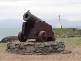
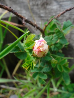
Another threat has been the gradual demise of Post Office business.  The shop was often also a small post office, but the number of small post offices, both in the country and city, has declined as the overall Post Office business has shrunk.

Part of this has been the deregulation of posts, including the separation of post office counter business from Royal Mail, who deliver the mail, and also the opening up of the delivery business to other players.  This has meant that a large proportion of business posts, the posts that were easy and cheap to collect and deliver, are now sent by independent companies, whereas Royal Mail picks up the rump of individual letters from post boxes and small parcels, more complex and costly to collect and deliver.  Add to this the decline of letters with the rise of email and both Royal Mail and the Post Office are constantly under pressure.

Living on an island, the glory of the post office and Royal Mail are evident.

When we go off island we tell the post office, which is also the Royal Mail sorting office, or the postman notices, and instead of a pile of mail crammed untidily through the letter box on our return, we simply collect a neatly rubber-banded package as we come off the ferry.

When we order things through the internet, whenever possible we order from suppliers who deliver by Royal Mail.  This is because a First Class Royal Mail letter that is posted by 4pm pretty much anywhere in the UK will arrive on the noon plane on Tiree and be with us by early afternoon.  In contrast, DHL, or any of the other ‘express’ delivery methods, will end up waiting in a warehouse in Oban for days, and it may be up to a week or 10 days before we see an ‘overnight delivery’.

Furthermore, and given the extra costs and complexity from a business point of view, quite justifiably, many carriers charge extra for the privilege of delivering your week-late parcel.  The Royal Mail must lose money on every letter and parcel it delivers on Tiree, but it does so, because it is providing a universal service.

It is impossible to overstate the revolutionary importance of the Penny Post.  Before its introduction, when you sent a letter the cost was dependent on the route taken.  Each carrier along the way charged, which either had to be estimated and paid upfront, or paid by the recipient, before they knew the contents!  It was complex for the sender and receiver, but made perfect business sense, given the need for each carrier along the way to make a living.

The Penny Post did away with this, a letter cost the same no matter if it was going round the corner, to the other end of the country, the mountainous heart of mid-Wales, or even a tiny Scottish island.  But for users this meant you no longer had to worry about where your letter was going, you just posted it.  The Penny Post made communication effortless and with it simplified everyday life and, critically, commerce.

Think about the web, what it would be like if you had to separately work out the cost of each web site you visit depending on the route across national and international cables.  The Penny Post was an information revolution, which was copied across the world, but, in the UK, one we are in danger of losing.

As well as the (shrinking) postal business, one of the mainstays of small post offices was that they functioned as the ‘bank’ of the nation, where pensions and other benefits were paid.  Not only was the local post office paid for doing this service, but also it meant it brought people to the premises just when they had money, so would be likely to shop as well.

However, as a cost-saving measure, benefits and pensions have increasingly been paid directly to bank accounts. For the village shop, this is a loss of crucial business, and for the individual on a low income this means it is far harder to manage money, as it becomes ‘just numbers’, rather than physical notes in your purse.

Some years ago, on the morning radio, there were two successive government ministers talking, following two government department reports issued on the same day. One was talking about the Post Office and the ‘modernisation’ and ‘efficiency’ programme; the other about the problems of rural areas and in particular the loss of village shops.  Somehow the two never spoke to one another.

The Low Bradfield shop and post office is suffering all the problems of shrinking business, so has diversified.  As well as being a shop it is now a small café.  Along the way round Wales I have noticed a few village post offices with a table in a corner, but the Low Bradfield one has developed more into a fully fledged, but tiny, café, the ‘Postcard Café‘, and the day before, while waiting between stages of getting the hall ready for the reception, we had sat and had tea, coffee and buttered crumpet.  I recall on the far side of Lewis a community-run shop and post office that was also a café, and I think also even had petrol pumps.

The village shop and post office often acts as a social hub of rural life, and no less the corner shop in residential areas of cities. So the loss of the shop is not only a disaster for the pensioners or farm labourers who may not have their own transport, but also tends to contribute to a loss of community identity. The web of informal community connections, facilitated by the local shop, is not only important for the social life of the village, but also critical for many vulnerable people, making it possible to survive independently, instead of becoming an expensive drain on the state.

The dual function as small café is economically sensible as those who come in to buy a loaf of bread may stay for a coffee, or vice versa. However, it also strengthens the social role of the shop, not just chatting whilst collecting your pension, but staying on to continue to chat over a cup of tea.