Day 67 – Fishguard to Strumble Head

an unexpectedly glorious day, Fairyland and choral evensong

23rd June 2013

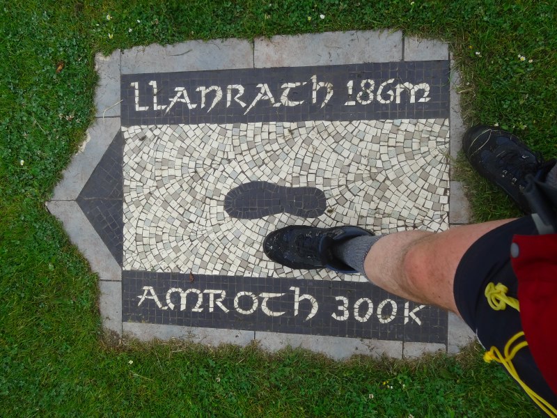
miles completed: 723
miles to go: 335

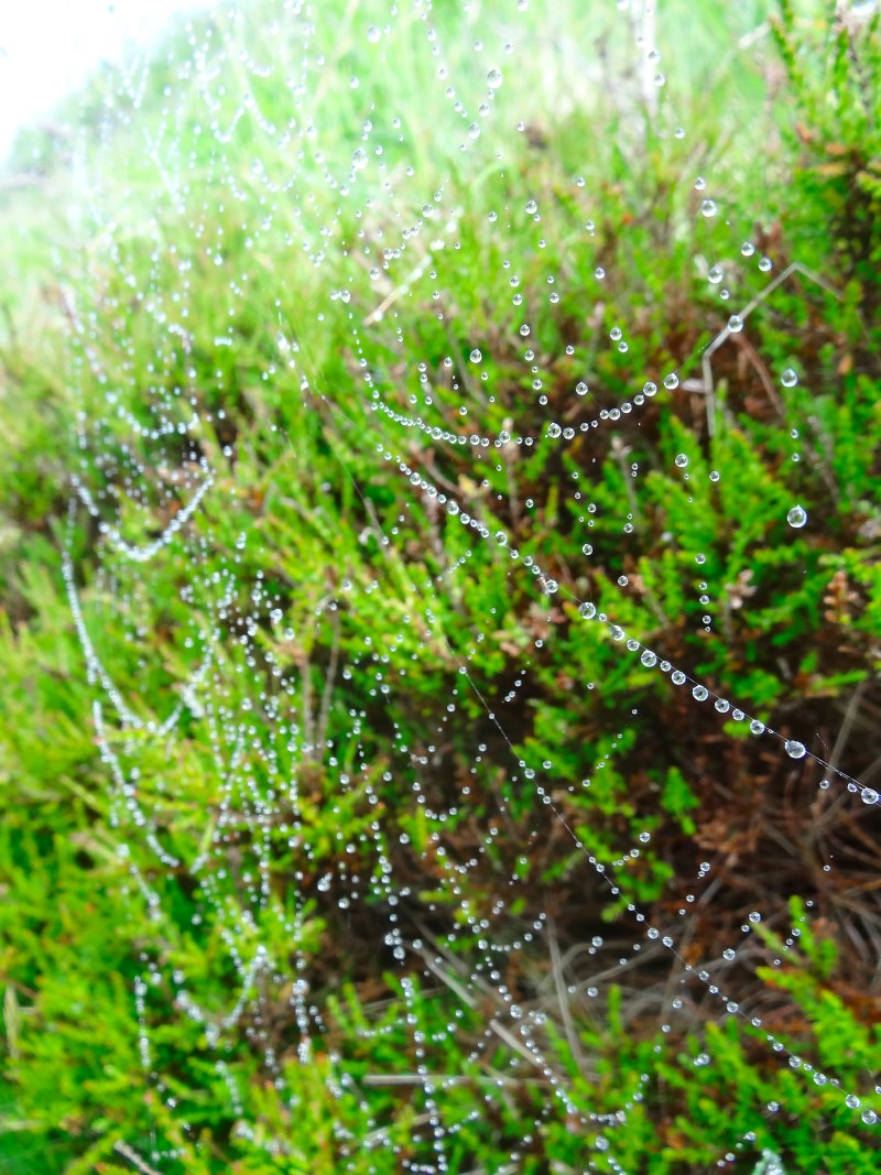
This was a day that I expected to be beautiful in terms of scenery, without much happening.

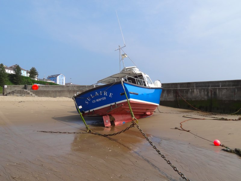
It was time to leave the sea-edge campsite at Parrog, Newport.  It had a reel of garden hose at the water standpipe, which made refilling the van water easy. So, with toilet emptied, rubbish in the various recycling bins and water filled, I set off.

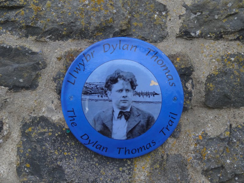
Today was only going to be a short walk from Goodwick, where I had stopped the previous day, to Strumble Head. This broke up the otherwise very long stretch of coast without a village, but was short enough to do and still get to St Davids in time for the choral evensong at the Cathedral.

I was aiming to park at Strumble Head, then catch the ‘Strumble Shuttle‘ coastal and walkers’ bus back to Goodwick. I was at Goodwick not long after 9am and the bus did not pass Strumble Head until 10:28, so I had time to stop at the Beaches Diner at Goodwick, opposite the bus stop. I had spotted this the day before, although it was closed when I got to Goodwick.

2013-06-23 11.01.06Happily it was open and did a wonderful breakfast, two eggs, two thick rashers of bacon, two sausages, beans, hash brown, toast and tea all for a fiver. I called in for a second cup later when the bus brought me back, and only at that point noticed that on the back of the menu it said that all breakfast items were sourced in Pembrokeshire within 15 miles of the café. For the bacon it told you the butcher and for the free range eggs the farm they were produced.

I love ‘caf’-style cafés, with Formica tables and basic food, but these often use freezer-pack sausage, etc.  Here is a ‘caf’-style place, with a ‘caf’ level of prices, but with restaurant-quality ingredients.

I typed a little while, eating my breakfast (and it was good to taste even before I realised it was also good for me and the environment!), and then drove off to Strumble Head to park the van and get my boots on.

When the bus arrived I hurried from the van in case it left without me, but need not have as there were a lot of people getting out. Amongst the first was an old gentleman with a wooden walking stick. Although I have seen many quite elderly people walking along the Coast Path, I thought he didn’t look quite up to this, but in fact he got back on the bus, he had just got off to stretch his legs.

Initially we were the only people on the bus and as we travelled he told me about the things along the way.

He pointed out the road to the church where he once, on a very clear day, saw across to Ireland; he said the Mountains of Morne, but I think from here it would be different mountains. He showed me a house where the yard in front was filled with old Morris Minors. I mentioned the old Chevrolet, he of course knew it, and as we went past he pointed out that on the other side of the lane was a collection of American cars of the space-age wings and drive-in movie variety. There is evidently an antique car rally at which both exhibit.

He also pointed out the house of the chair of the county show, who, I am told with the faintest hint of disapproval, "does not take the bus".

"How long are you staying?" he asks, "You must see the Invasion Tapestry."

I tell him I have seen it already, when I first came to Fishguard when the girls were little, but also that I had been disappointed not to see the Cardigan cardigan.  This was a cause of sorrow for him, he seemed to know people connected with it, and I think had already been telling them it should be on display.

"It is as high as this bus," he said, "with coracles and villages around."

He thought it should go in Cardigan Castle, and I told him to feel free to use my own disappointment to bring pressure on the powers that be.

The path from Goodwick heads initially up small steep roads past a memorial to those who have worked on the Goodwick railway, a building with ‘Wincarnis, The great restorative, Sold Here’, painted on its side, a street with an inordinate number of pubs, including one tiny one (The Rose and Crown) and the Theatr Fforwn Cymru, once a community centre, but now apparently disused.

The houses on the north side of the street will have spectacular rear views over Goodwick bay and the coast beyond, although I guess the closest thing is the ferry terminal.  There are evidently plans to create a marina within the breakwater here.

I take a little excursion to see the Garn Wen cromlechs, the remains of five-thousand-year-old burial chambers, but the hill is very overgrown, so I only manage to see the closest one. On top of the hill is a cross on some form of obelisk, but again I cannot get close enough to find out its story.

Continuing up the street, I see a house with a satellite dish, not unusual, but the satellite dish is painted in the Irish tricolour! Next door is a house with a small, but exuberant collection of garden statues. The biggest is of two boys playing leapfrog. Neither subtle nor designerly, indeed I’m sure both over the top and kitsch, but, so what, they are fun and brighten up an otherwise quite drab road.

As the road runs out there is a beacon and yet another cannon, and the real path begins.

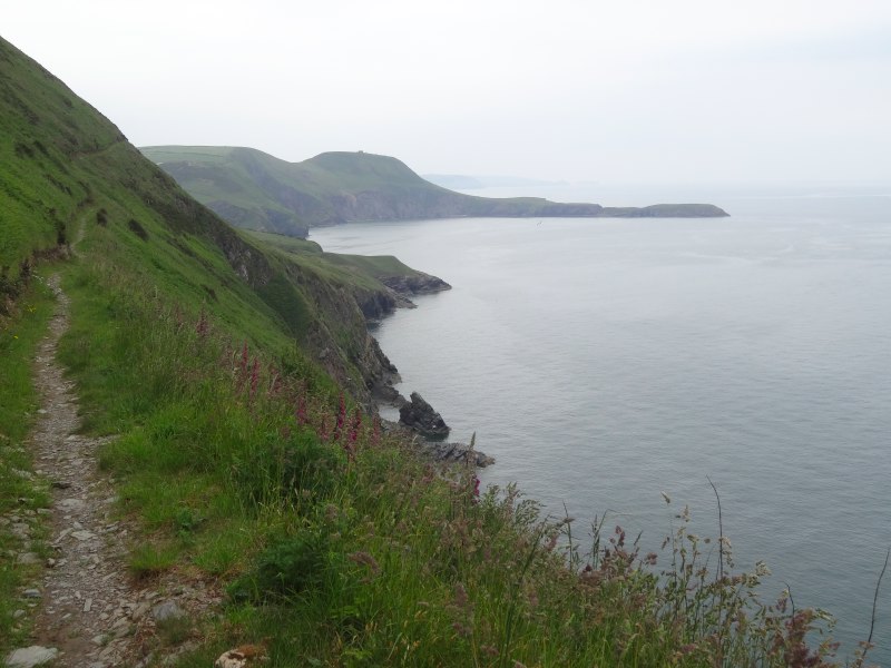
This whole stretch of the footpath is easy in terms of the path, with the odd slightly precipitous cliff, but only for a short distance, and with firm footing. It is especially wide and well trodden near the Goodwick end, but fine for the whole length, which was welcome, as I wanted to be back at St Davids in time to park up the van and go to the choral evensong at the Cathedral.

So I walked along expecting the next stop to be back at the van at Strumble Head.

How do you capture an almost unbearably lovely place in words?

There was a sign on the path:

TEA & COOL DRINKS
FAIRYLAND 0,5 MILES
unofficial *
Home tea stop!
Dirty boots walkers and dog’s welcome
THE GUARDIAN ANGEL PROJECT as seen on TV and radio 4 coverage …
*Please note Home GALLERY unofficial* tea
stop!  Voluntary donations.  Restrictions apply sign
book as our Friends.  No bureaucrats!  We are
uninsured and this cottage does not comply with
current health & safety

This sounded just what I’d been saying was needed since almost the beginning of the walk, small informal places to stop for just a cup of tea, and maybe a cake, biscuit or other snack. There had been the churches up Offa’s Dyke that had offered free tea and coffee (although I think I always left a donation larger than if it had been in a shop!), but this was the first private example, except one farm selling ice cream near Oswestry.

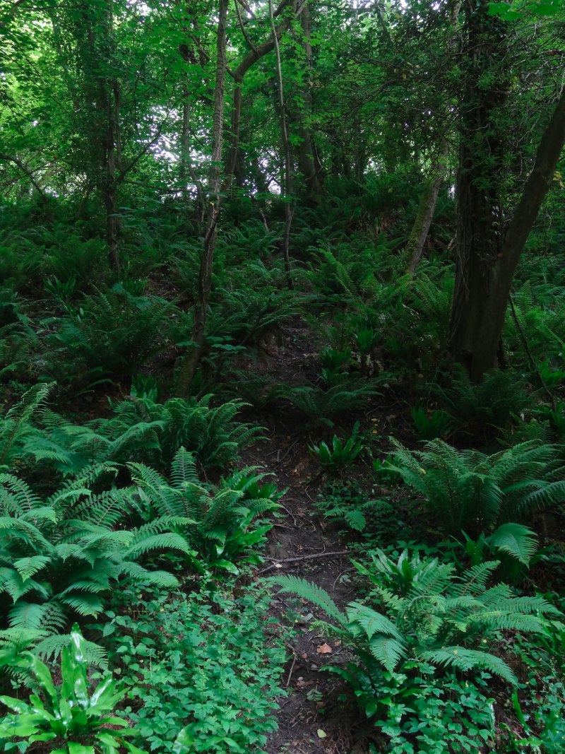
Half a mile off the track meant a mile round trip, but this was so perfect and I was not in a hurry, so I set off up the footpath inland, just hoping that it wouldn’t be shut!

The path was easy, and clear to follow, with just a very slight slope, and led to a small group of houses and a church, St Gwydaf’s, Llanwnda, which I think might have been the one where the gentleman from the bus had seen Ireland.

I think the first thing I saw was the rainbow-coloured wind generator, and then, as I turned the bend into the hamlet, the boat, the Sea-Fury, brightly coloured, and, it turned out, originally built in 1860 but now with an engine converted to run off old chip fat. Then there was the garden, a glorious clutter of plant pots, bicycles, old cupboard drawers and a garden chair. I couldn’t see the teas and wondered if it was closed, but then I saw the sign.

OPEN HOME organic

and another:

TEA COFFEE

and yet another shaped like, a cross between a duck and dog:

DOGS WELCOME
OPEN
NEW METHANE GAS
P.V. Wind

I followed the signs, and then found old road signs modified, lots of STOP signs: “STOP at Fairyland“, “STOP TOXIC”, “STOP & THINK”.

I stopped and entered Fairyland.

It was the other end of the gloriously messy garden, but, while equally cluttered, not cluttered with the paraphernalia of life, more cluttered with a cornucopia of everyday and found objects turned into magic. Brightly painted plant pots, a shed with bright red drain pipe, a bell saying ‘Please Ring’, like Alice in Wonderland‘s bottle, a sort of gate to the open door made of old broom handle and car hub cap with a plastic rat on it.

I rang and entered. Maybe it would have been useful if I had had Alice in Wonderland‘s bottle as the entrance is very low.

2013-06-23 12.49.23
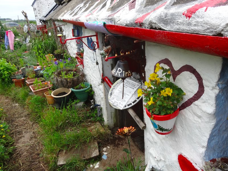
And inside, there is a worktop with kettles and a collection of mugs, tea bags, a fridge with milk inside, and small plate for donations. But everywhere else, anywhere your eye rested, another discovery, new paper cuttings, paintings, old china cups and jugs, a collection of snails made from seashells and clay and lots about energy and the environment. In the corner is an old solid fuel cooker, maybe a Rayburn, and on the far wall a wishing well, a stone trough inside the room with water bubbling into it.

I sign the book.

I am a Friend.

Sadly no one answered the bell, my wonderful hosts must be away for the day. Maybe in their zero CO2 car that is shown in pictures in one corner of the room.

As I leave I realise I am a little breathless and tears are in my eyes.

Fairyland at Llanwnda will go down with St Trillo’s at Rhos-on-Sea, the Duke of Lancaster near Mostyn, and the little well in Anglesey as one of the wonders of Wales.

I note that two of these are holy sites, and I think that this Fairyland is also holy, because it is founded in love and giving and that is the sole criterion Christ gave for recognising his disciples.

As I walked on I reflected. I’ve found myself getting quite depressed over periods when I felt nothing was ‘happening’; this included some very lovely areas. I am not a patient person, and the ‘mission’ of the walk is to learn (scholarship?), so if I don’t feel I’m ‘learning’ in some way or other, I then feel I’m not doing my ‘job’.

However, I have to learn that the long fallow periods are just as much part of the journey as the periods of intense harvest.

The point is not that something happens every mile that I walk, but that, by walking every mile, something happens.

As I get back to the path four people are at the point where the sign says about the teas, two are from Southern France, and two from Brittany (Wales in France!).  At first I think they are looking at the sign and enthusiastically tell them they must go up, but in fact they had already been as they were on a circular walk and had passed it earlier.  I am trying to remember the word the man used to describe it, perhaps ‘singular’.  In fact they are just waiting for the teenager in their party.

"He is more courageous," they say, "and has gone on. To the invasion rock."

As I go on I meet him, running back along the track and greet him as he is briefly in earshot.

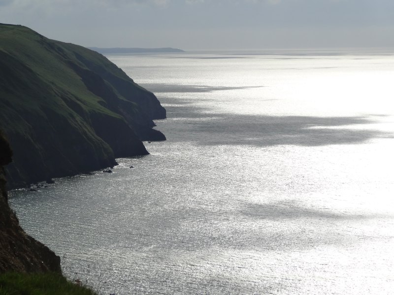
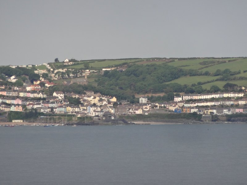
This is the very bay the French ships landed. It does not look hospitable. I can see that on a good day it is not a bad place to weigh anchor, and there is a small shingle beach to bring long boats ashore, but then those 1,400 men in heavy uniforms, carrying guns and goodness knows what other stores, would have had to climb the cliffs. They are mostly just very steep slopes, so not rock climbing, more very hard scrambling. I guess any better port would have people in it and maybe guns, like Fishguard Bay. No wonder they all got drunk after.

At the memorial stone is another couple, and I tell them too about the teas.

"Is it still there?", the lady asks.

"Yes," I say, "it is wonderful."

So she and her husband set off for him to see what all the fuss is about.

A while later, closer to Strumble Head I pass two young men, huge rucksacks on their back, and tell them.  They are excited, not by the place, just the idea of a cup of tea. I am guessing they have come all the way from Abercastle since their last place to get anything.

2013-06-23 14.53.50
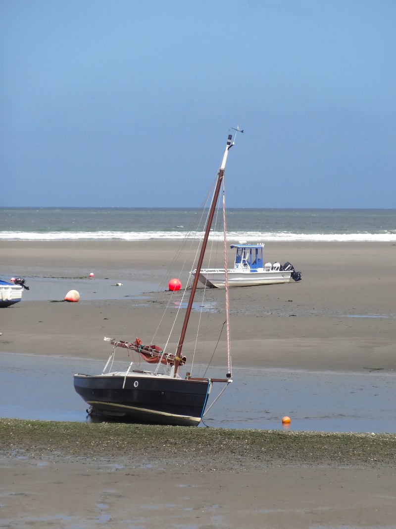
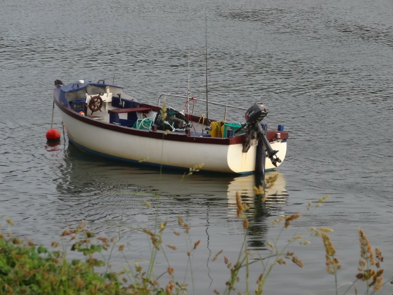
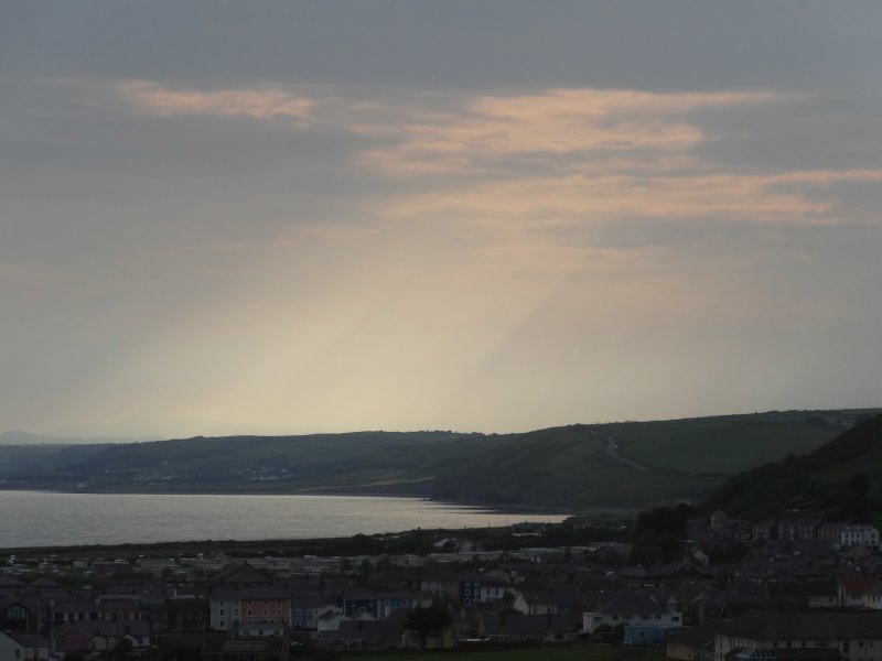
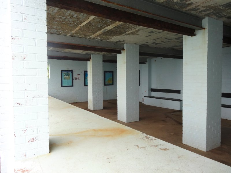
And so I get back to Strumble Head, taking time to look across at the lighthouse, the lamp periodically flashing, bright even in the daylight, and I go down to an old wartime lookout post, which, in my pictures, appears to be painted white, but I recall being very slightly off-white! It is now a Bird Observatory that Bill Oddie came to visit.

If I had walked here to wait for a bus back, then the Observatory would have been a good place to shelter, as even with the sun out, the wind makes it chilly to stand around. I am glad I have the van to get into.

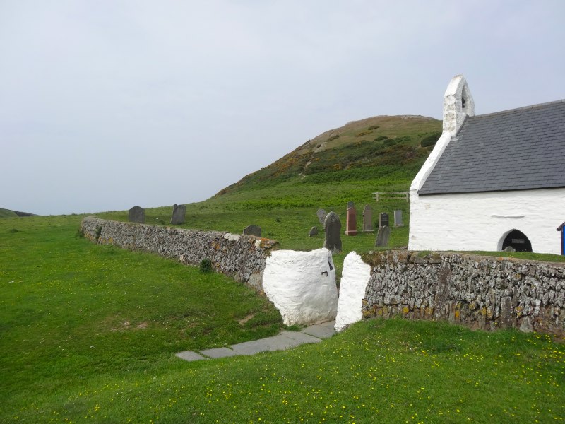
Having parked up at a campsite in St Davids, I make my way to the Cathedral, the smallest in the UK. The Cathedral is set in a dip so you initially look down on it from above. When Viking raiders were out to sea, there were advantages to dips.  I stand looking down on it beside a gatehouse, or what I had always assumed was a gatehouse … until the bells started. In fact the ‘gatehouse’ is really the bell tower for the Cathedral, which happens to have a thoroughfare running under it. Although most British churches had bells in a tower within the church, separate bell towers are common; I can think of one in Cumbria where the bell tower is built on a hillside above the church to allow the bells to be heard more widely, and of course the Leaning Tower of Pisa is just the bell tower for the Duomo.

In days gone by, the soprano section of a Cathedral Choir would have been all young boys before their voices broke. Now, the choir sopranos are all teenage girls. I guess that even if you are a boy who likes singing, doing so wearing a dress every Sunday will not be good for street cred.

The service itself was good, but after Fairyland it had a lot to live up to. The singing was wonderful, but why is the Anglican preaching voice so soporific?

2013-06-23 19.28.32The service was focused around the feast of the nativity of John the Baptist (basically when the Anglican church celebrates his birth), and the readings were parallel texts: one from the Old Testament about the birth of Samson, the other from the New Testament on the birth of John the Baptist. Both were born under Nazarite vows: ‘no razor shall be used on his head and he shall not have any strong drink’; well, I could manage the first of these.

Both Samson and John were wild charismatic figures, and John is fascinating: born within the establishment, and yet working outside it; a man with a great personal following, and yet always pointing away from himself to another. The facts came out, but I just wished that some of that charisma and excitement could break through the preacher’s calm soft voice; if not for me, for the sake of the choristers whom I could see struggling to keep their attention.

I was brought up in the Methodist Church, the founder of which, John Wesley, was condemned by his Anglican peers as being ‘too enthusiastic’; they could think of no more damning indictment.  So maybe the Anglican voice dates back a long way.

After the service I head for the fish and chip shop, but alas it is closed :-(. However, the small hotel/restaurant opposite is open and has free WiFi. Except that it is a Sunday evening and so the WiFi doesn’t work; no Sabbath observance here, just that it is out of school hours, when the children start connecting to games, or downloading music and videos – I see the same in Tiree. But the food is good.

The TV in the bar has been on S4C, the Welsh language channel, but evidently only because the rugby was on earlier.

The landlady tells me about the area.

"They call it ‘little England beyond Wales‘," she says, "go a little way out of St Davids into the villages and they speak Welsh, but not here."

I ask if this is due to people moving here for retirement and things like that, but she says no, it goes back far longer, but she doesn’t know why or when.

I wonder if the presence of the Cathedral has any bearing. Nowadays the Anglican Church in Wales has autonomy, but for many years it was controlled directly from Canterbury; so maybe the succession of English appointees shaped the town.

I notice later on the back cover of the book ‘Candle in the Darkness: Celtic spirituality from Wales‘, that, at the time it was written, the author, Patrick Thomas, worked at St Davids. and amongst his responsibilities was ‘assisting monoglot clergy to learn Welsh‘.

Day 66 – Newport to Goodwick

an easier day, along a coast like a half-eaten sandwich, green and black beetles, the last invasion of Britain, and the final voyage of the Lusitania

22nd June 2013

miles completed: 717
miles to go: 341

Based on the official mileage tables, Newport is exactly 704 miles, and two-thirds the total distance is 705 miles, so, depending on exactly where they count as ‘Newport1, today, or even maybe yesterday I pass another milestone.

2013-06-22 11.45.45I had originally thought of setting off early and walking to Strumble Head and then getting the Strumble Shuttle bus back to Newport. However, I had been warned the night before that Newport to Fishguard was sufficient for one day, so instead I had a more relaxed morning and long breakfast at the Morawelon Café beside the campsite.  It is obviously catering slightly more upmarket with wicker chairs and breakfast at £8.75 (tea/coffee extra), as opposed to the Fronlas Café the day before at £6.75 (tea/coffee included).

The path south of Newport is nothing like the CardiganNewport stretch.  I think this is partly because it is close to multiple access points and therefore more heavily trodden. Also the fact that it is used more will undoubtedly lead to higher investment; certainly there are places where steps have been cut here that would have been left as a muddy slope on the more remote stretch.

In one place, I note that the path below my feet has been cut flat from solid rock, not unlike the Roman Steps, except using more modern machinery. I recall the small bulldozer I was told about, but here there was obviously some heavy rock cutting also. In another place the cliff had eroded, leaving the path literally clinging to the remaining rock, but it was diverted. A few yards inland, a small section was taken and re-fenced from the farmer’s field. These are a reminder of both the initial cost and ongoing maintenance cost of the Path as a whole.

In some places, especially around Dinas Head, the cliff is as precipitous as the day before; indeed I was told that Dinas Head has the highest cliffs on the Pembrokeshire Coast Path.  However, here the path is trodden wider, and where the grass and bracken might have threatened, they have been strimmed back.

I realise that the strimming may well be partly why the path is wider; if the grass is strimmed, walkers may walk on the short-cropped grass, wearing the path more evenly. Of course, on the CardiganNewport section, maintenance would involve at least a three-mile journey with a strimmer, and the more inaccessible parts may well breach health and safety rules.

I wonder about letting a herd of feral goats loose on the cliff side of the field fences to keep the grass cropped, as it was in the pony section, but then imagine meeting a feral goat on one of the narrow path sections … well, may not be my best idea.

2013-06-22 12.17.09A green iridescent beetle basks on a stone, and a bit further on a large black beetle trundles across the dusty path. Its deep black shows up clearly against the fawn earth and I realise that it is in danger crossing this open ground, just like a soldier in Afghanistan crossing a sniper’s kill zone.

In some ways the thick carapaced beetle is more like a tank, so maybe in the open it is more like the Libyan column, withdrawing from Benghazi in line with UN resolutions, then massacred from the skies, tanks torn apart like sardine cans in a rubbish tip. This brings to mind also the retreating column of Iraqi soldiers, fleeing Kuwait during the first Gulf War, tens of thousands shot in the back as they ran. It is no new thing to slaughter a defeated army; a dead enemy cannot fight again. It is the same perverted logic as Srebrenica.  Maybe the medieval solution was more humane, simply cut off the bow finger.

I am not regularly hearing or reading news while walking, but when I do, the events in Syria form a backdrop. The earlier war in Libya has exacerbated things there so much: first, for a crucial year, taking attention away from a real crushing of dissent; second, telling dictatorial powers that there is no room for compromise or diplomacy, and so giving hard-liners the upper hand; and finally, by twisting a resolution for humanitarian protection into a pretext for regime change, making future humanitarian resolutions far more difficult.

Cwm-yr-Eglwys (valley of the church) nestles on the protected east side of Dinas Island. Of the church, there is but one end wall remaining, its empty doorway looking out to sea amongst the graves. This sounds vaguely Gothic, but in fact, on a sunny day, is more picturesque, and I take quite a few photographs. A man comes into the churchyard and approaches.

"Do you want me to take one with you in?", he asks, "Sue thought you might."

2013-06-22 13.15.37He takes a photo of me with my rucksack beside me and the church remains behind.

His name is David, and he and his wife run a campsite, Greenore, at Tremain, near Aberporth.  They invite me to stay there for free, but unfortunately I’ve already passed there a day or two previously.

This is their first time at Cwm-yr-Eglwys. They sail and have spotted it from the sea and wanted to take a closer look. We talk about the coast. I realised yesterday that the coast there was only visible when walking or from the sea, no quick bus trip to a viewpoint.

As I mentioned, I was told that Dinas Head is the highest point of the Pembrokeshire Coast Path, and from the map the trig point at the peak is at 142 metres (470 feet).  The views there are spectacular, thirty miles of coast open out in either direction.

The far side of Dinas Island is Pwllgwaelod, where there is a beach, a car park and a small restaurant, and I was told was a good place to stop for a beer. Behind Pwllgwaelod is a shallow-bottomed valley-like area with steep slopes towards land on the south and towards Dinas Island on the north. However, this is no simple stream making its escape: rather than rising up to the hills, at the other end of the ‘valley’ is Cwm-yr-Eglwys. Indeed whilst Dinas ‘Island’ is attached to the mainland, the connecting land is barely 5 metres above sea level. So maybe it once was an island and then the channel between it and the mainland gradually filled with the remains of crumbling cliffs or choked with tide-driven sand until it is the land we see today.

From Dinas Head the coastline towards Fishguard looked like a discarded half-eaten sandwich, each cove a tooth mark. However, up close it is the rocks that are the teeth. The vertical strata are cut and cross-cut by fissures and fault lines, so that battered by wave and rain, they shard and stand from the sea like filed incisors or a scene from Jaws, dragon teeth gnashing rabid, but ineffectual, against wave and air.

It is less well trodden than the stretch between Newport and Cwm-yr-Eglwys or around Dinas Island, and not without precipitous cliffs, but still nothing like the CardiganNewport stretch.

The landscape is lovely, but I find it a little monotonous, into one cove, round it, round the next little headland, into the next cove. Each one is lovely, and yet I found myself counting down the miles.

On the final headland before turning in towards Fishguard, a small gun battery sits on a rocky outcrop where four cannons point to sea. I don’t know when these were installed, but they certainly act as a reminder that Fishguard was the site of the last invasion of Britain.

It is one of those things I feel I should have learnt about in school, especially in Wales, but is largely forgotten. I first learnt the story when my own children were little and we were touring in the VW campervan, probably the same year we first visited AberaeronFiona had heard about a tapestry at Fishguard, produced on the 200th anniversary of the invasion, and we went to see it.

In 1797 a force of 1,400 French soldiers were landed on the coast near Fishguard.  Their intention was to initially take Fishguard itself and then move on to Bristol. In times past the Welsh and the French had taken common cause against the English, so it may be that the French hoped that they might find sympathisers when they landed, but this was not the case, and widespread looting did not help.

In the end the somewhat shambolic French army, many drunk on wine looted from Welsh farms (it was evidently still difficult to get good food and wine in France in those days as well as today), surrendered to a force of local militia a fraction of their size.

Amongst many small skirmishes with locals, a group of Welsh women led by Jemima Nicholas, a cobbler, and armed only with pitchforks had already captured a dozen Frenchmen.  They set out again looking for more, dressed in the traditional dress of a tall black hat and red dress that you still see in picture postcards.

The story is that the French mistook them for approaching red coats, hence contributing to the surrender. However, I think it more likely that they were recognised for what they were and the French laid down their arms in fear. No man, whether French, English, or Welsh for that matter, can stand up to a Welsh woman when her anger is raised.

This lesson was not forgotten during the Rebecca Riots, one of the earliest examples of grassroots social unrest in Britain (well, Robin Hood excepted).  In order to attack the hated Toll Houses, the men dressed as women, it is said to protect their identities, but I think because they were more frightening that way.

The tolls were charged on lime, the essential fertiliser on the acid soils of Pembroke, and on cattle being driven to market, a double whammy. They underline that, whether in Wales in the distant past, or more recently in the Arab Spring or London riots, it tends to be economic, not ideological, reasons that bring people to the streets in popular uprisings. These can be uprisings towards greater freedom and democracy, or towards more authoritarian and repressive regimes that promise certainty in times of trouble. The latter is especially important to remember as some of the historically most volatile parts of Europe are mired in the deepest economic recession since the war.

The Coast Path goes through the little village of Fishguard Lower Town, once a bustling herring port, then skirts to the headland on which Fishguard is built; I only see Fishguard centre later from the bus.  I had decided to go on to Goodwick, the port a mile or so on from Fishguard centre, but if I had decided otherwise, I would have been stuck, as it is not clear when and where to branch off the path to get to the bus stops.  Looking at the OS map, I think it’s probably best to follow the main road up the hill out of Lower Town, but, as elsewhere along the path, the signage offers no help.

2013-06-22 18.21.03Goodwick is a large port from which ferries go to the Irish Republic, but in its heyday, in the early years of the 20th century, it was a main port for transatlantic ferries, the Mauritania and Lusitania forming a regular service to the USA. However, after the First World War Cunard shifted its main operations to Southampton, leaving only the Ireland run. The last transatlantic sailing to leave from Fishguard was the ill-fated Lusitania a few months before it was sunk by German torpedoes.

And so, back on the bus to Newport for the night; I am the only person on the bus and the bus driver tells me things have been very quiet. I ask him if things get busier once the school holidays start.

"They used to," he said, "but not in the last couple of years, people can’t afford holidays."

Once in Newport, I carry a takeaway from the China Inn back down the hill to the campsite, and get an early night.

  1. Strictly, the path actually misses Newport itself, but goes through Parrog, but the two run into one another.[back]

Day 65 – Cardigan to Newport

“It’s hard, very hard”, arduous vertiginous path and rural life for the incomer, not to mention twenty dancing virgins

miles walked: 18
miles completed: 706.3
miles to go: 354

"It’s hard, very hard."

I was slowly nursing a half pint at the Webley Arms, between St Dogmaels and Poppit Sands, knowing that when it was finished I had to go back into the rain with no more places to stop until I got to Newport, when I overheard these words.

I had started walking late as I’d moved the van from Aberaeron to Newport and then had to wait for the bus. The bus routes form ‘watersheds’ along the coast and effectively make Fishguard to Cardigan a separate section of the coast, with an hourly bus service and no changes.

By the time I had parked the van, paid the site and walked the half mile up the road to the centre of Newport, I had just missed one bus so had time for a breakfast at the Fronlas Café before getting the noon bus. So it was nearly 1pm by the time I was on my way out of Cardigan.

2013-06-21 12.27.41The coast route pretty much misses Cardigan, although it is only a five-minute walk into the town centre where I’d caught the bus to Aberaeron the previous day. The route does take you under the town walls and to the quayside, with its statue of an otterOtters have been reintroduced into the Teifi, and I notice signs the previous day warning boat owners to keep away from the shores to protect the otters‘ habitat.

In one of the maps at Lampeter there was a remark on one river that it was the last place that an otter, or maybe it was a beaver, was seen in Wales, and it may even have been the Teifi.

The otter statue is close to the footbridge over the river that runs parallel to the old stone bridge, still used by traffic, but effectively single file for modern vehicles.

My OS map shows the Ceredigion Coast Path following the Teifi very closely, but the Wales Coast Path zig-zags through lanes and fields a short way from the shore.  Maybe there have been access problems on the old route, or maybe the Wales Coast Path planners thought the shore route too easy.

2013-06-21 13.13.53Both routes take you to St Dogmaels, where you can see the ruins of a Norman Abbey, itself built on the set of a fifth century monastery.  While Cardigan, a mile away, was the administrative and military centre with its castle, St Dogmaels was the religious centre of the area.

Beyond St Dogmaels, the path follows along beside the river passing the ‘Answer Stone‘ or ‘Blessing Stone‘, believed to be the capstone of a dolmen, where fishing boats were blessed by the Abbot of St Dogmaels.

Also at St Dogmaels, just past a flag-draped mermaid, is the plaque and plinth declaring the official start of the Pembroke Coast Path. The plaque has a footstep marked on it, and I place my booted foot beside it.

2013-06-21 13.27.30And it had started to rain, not hard but slow dampening drizzle.

Getting increasingly damp, I decided to take a half pint at the Webley Arms, which I thought the last point of refreshment before Newport, although I later realised there is a café, maybe half a mile further, before the road climbs away from the river and sea.

When I came in, the bar was empty, but then three young men came in and this was when I overheard the words. He was talking abut the problems of having recently moved to the area, and his colleagues sympathised, and also talked about winter employment, and going away for the winter to do seasonal work in ski resorts.

It seems transhumance is not uncommon in West Wales, both the ‘summer by the sea and winter inland’ of the retirees in New Quay and this seasonal search for employment. Four thousand years previously, Neolithic tribes would have moved camps depending on when different foodstuffs became available, and the seasonal movements of the animals they hunted, and in West Wales not so much has changed.

The landlord tells me later that it can be very hard for incomers, unless they have some personal connection such as marrying a local. There is no underlying animosity or intention to exclude, but communities are tight and existing relationships strong. In addition, it is hard for those used to the bustle of the city, the winters are very quiet and even the summers depend critically on weather.

2013-06-21 13.25.57Furthermore, the natural language of the area is Welsh. When we talked about experiences in Anglesey, Rosie complained of the rudeness when at a bar, two people she had been talking to in English would suddenly say a few words to each other in Welsh.  Because she knew they could speak English, it felt impolite to be excluded. My guess is they were not even aware of the language switch, just like you change the vocabulary you use when switching between talking to a child and to its parent.

That morning I’d been asking the lady at the reception at the campsite whether there was a hose fill point for the campervan. She said there wasn’t, but maybe there was something about.

"I’ll ask one of the boys," she said, referring to the ground staff.

Going out of the building she saw one in the distance, and instantly called out in Welsh.

I think it is hard for English speakers to realise that while everyone *can* speak English, and indeed will do so without apparent effort, it is more like going to Spain or Italy to live.  You can get away with speaking English and most people will understand and respond, but when rapid communication is needed, you should not expect to be able to understand what is said. I recall many evenings in Italy with groups of Italians, who would start the evening talking in English for my benefit, but would then lapse into Italian as they got tired, after a while notice, apologise, maybe have a short English conversation, before once more lapsing into their native tongue.

The landlord also talked about jobs, or rather the lack of them.

I have seen some Eastern European staff at cafés and hotels, but far fewer than, say, in London. I guess the very fact that they are here would be seen as some a sign of British fecklessness; why aren’t all those unemployed out there taking these jobs? Of course the truth is that they are no more so than the Austrian or Swiss youth, when young folk like those in the bar go abroad for the winter, or the Spanish or Greek youth, when Mediterranean resorts fill with British tour guides and bartenders seeking summer sun and fun.

Transhumance is fine for the retired or young couples, but not the best basis for starting a family. I spent a significant portion of my own children’s young years working away from home, although that was more about family choices of where to live and I was fortunate in mostly only having to be away for part of the week. For many professional couples the need to maintain two careers can involve travelling across countries or even continents.

2013-06-21 14.29.06The route past Poppit Sands leads along small roads or paths beside them, past the final café and signs warning ‘the aliens have landed’ (Himalayan Balsam), until eventually it comes to an end and there is a stark sign warning you that you are about to enter a ‘remote, rugged and challenging stretch’ of the Pembrokeshire Coast Path, 13 miles with ‘numerous very steep hills’ and few exit points.

Although the landlord of the Webley Arms had also warned me that this was the hardest part of the Pembroke path, I had seen signs like this on the Ceredigion Coast Path, so was not terribly daunted,

This is not Ceredigion.

I was about to start what will be the most arduous day of the walk so far (and I hope the whole walk).

Later that day I spoke to Paul, a local who recalled the creation of the Pembrokeshire Coast Path, I think 20–25 years ago. They drove a small bulldozer along it, he recalls.  It would have once been wide and flat like the stretches of the Ceredigion path that had equal dire warnings. But 20 years of feet, rain and erosion have taken their toll. The path itself is heavily rutted, in places down to around 10 inches wide, but an equal depth. You have to place your feet one behind the other, like walking a tight rope, and at each step risk catching one foot against the other or against the sides of the foot rut.

There are glorious views, and, happily, soon after I started the path, the mists and drizzle passed and so most of the afternoon was spent in sunshine, so, in a way, I had it as good as it could be. However, looking up to the view always led to a trip on a stone, or tussock, so was better reserved for occasional poses between staring several steps ahead attempting, but not always avoiding ‘trip hazards’.

The fine dusty soil had become oil-slick-like in the light drizzle, but happily dried quickly where the sun could get at it. I can’t imagine what it would be like in real rain.

2013-06-21 15.18.45Beside the narrow rutted path, the grass and bracken had encroached, and varied between knee and waist height. Straight after the drizzle, it was still wet and quickly soaked my bare legs, which then drained down into soggy socks and eventually water-filled boots. I squelched on each step and water squeezed out of the seams as if I had a small spring with running water emerging from between my toes.

And of course the high grass made it hard to see the stones, tussocks and occasional rabbit holes, meaning that even lifting my feet, tramping-style, at each step, I would still trip occasionally.

As well as being hard work, tripping is not pleasant when you are aware of 300-foot cliffs close to the side.

Around Scout campfires we would sometimes sing (to the tune of the Battle Hymn of the Republic)

He jumped from twenty thousand feet and forgot to pull the cord (x3)
and he ain’t gonna jump no more
refrain:  Glory, Glory Alleluia (x3), and he ain’t gonna jump no more

They scraped him off the pavement like a lump of strawberry jam (x3)
and he ain’t gonna jump no more
refrain

They packed him in a matchbox and they sent him home to mum (x3)
and he ain’t gonna jump no more
refrain

At first I had thought that these cliffs were of the scratched arms, bruises and broken limb variety rather than a strawberry jam class as the grass and bracken seemed to slope away, albeit steeply at 75é80 degrees to the horizontal. However, looking forward and back I realised that this steep grassy slope ended between 10 and thirty foot below at a vertical drop down a rocky cliff.

Paul, who told me about the mini-bulldozer, said that he always told walkers that they had not had any fatalities from the cliffs, "it is the farmers you have to worry about".  Walkers who want to give up on the cliff path have no official exit, so they climb and break down fences, understandably angering the farmers, although the bodies of tourists full of shotgun pellets, Paul admitted, was hyperbole.

Certainly the pig-netting fences between walker and fields were topped with two strands of barbed wire; I have never seen this elsewhere. I was uncertain whether this was to keep the walkers on the cliff side of the fence, where they belonged, or as an extra mechanism to keep the cattle and sheep inland, since the cliffs are too dangerous for any animal, barring walkers.

About halfway is last of the exit points at Cwm Trewyddel, where the village of Moylgrove nestles about a mile inland.

Another sign threatens more challenging walking for the final, and totally inescapable, seven miles.

I press on.

2013-06-21 16.21.28I said the soil was largely sun dried. There were exceptions, where the grass was too long for the heat to penetrate, or when shadowed by the land.

There was one such steep slope, that began as steep step-like footmarks in sloping grass, but degenerated into a slithery mud slide.

I recall the old maths puzzle:

A snail climbs up a wall two feet a day, then as it sleeps overnight slips back one foot. How many days will it take to climb a six-foot wall?1

This slope is just like that. Eventually, on the steepest section, I am virtually on hands and knees, holding on to the grass at the side, but trying to avoid putting my hands on the gorse seedlings spaced sporadically to catch the unwary.

And this was simply after drizzle.

A short while after Cwm Trewyddel the path becomes wider, more grassy, and I think it will be easier going now.  The reason is that there are ponies grazing on the cliff side of the fence in this area, which is also more open with a slightly less steep slope down to the sea.

However, the hopes of an easy run back to Newport are soon dashed, as the area with the ponies are is left behind and the path once more narrows to a single, rutted, overgrown track.

In high school we used to have ‘comprehension’ lessons in English.  We had a small book with passages of maybe half a page, and then a series of questions to answer about the passage, some factual, some more interpretative. One passage was Edmund Hillary‘s account of the last part of the ascent of Everest. He and Sherpa Tensing are making their way up the ridge and again and again a tantalising peak ahead makes them think that at last they will be at the summit, but again and again, as they reach the peak, they see the sun-sharp, snow ridge still stretch away ahead to another, higher peak.

2013-06-21 18.01.32Since rounding Cemaes Head, it seemed a lifetime ago, but barely four hours, a large peaked headland had dominated the coast; looking now on the map, the peak is Foel Goch. Throughout the afternoon it slowly, too slowly, got closer, until eventually I was on the final stretch.  By this time the path had again degenerated, and I had reached that "just wish I was at the end" point, but I was nearly there, and the time was not too bad, I might get to Newport earlier than I’d expected, and certainly in plenty of time for a meal at one of the Newport pubs which serve until 9pm.

Looking now at the map, spread out, the lie of the land is obvious, but it was less so looking at a small segment of a folded-over map. I rounded the ‘final’ corner and ahead was another, smaller headland, I rounded that and another appeared. Ahead Dinas Island appeared, and I began to fear that maybe it too, albeit far distant, was yet another headland before Newport. Happily, eventually, Newport town appeared far across the bay, and with great relief I began the slow descent towards Newport Sands.

It was only then that I realised the tension in my body, my breathing was shallow, and I’m sure my heart rate high. In some stretches of the path there may be a short place where one has to step carefully, but here for nearly six hours the ground underfoot had been difficult, threatening to trip one if a foot was placed badly, and there was nearly always a precipitous slope beside.

Now I should say, there is a small element of hyperbole of my own in the account. There have been fatalities along the coastal path, but I think where people have strayed off the path, and as Paul told me, "no one has been killed on the cliffs" in this section (although, I note, he didn’t say "no one has fallen").  And, compared with Alpine passes, or, I am sure, with many other coastal and mountain paths in the UK, this is an afternoon stroll. However, it is an area where you cannot afford to be careless. Maintaining that concentration for six hours is exhausting in itself.

As on other occasions when the going has been tough for various reasons, I think again of Arry *running* the coast path and my admiration of her achievement grows.

As I drop down to Newport Sands there is what appears to be a game of beach rugby in progress. The path heads off the beach itself and cuts across a golf course. I might have been tempted to walk around the beach and rejoin the path the other side of the golf course, but it was late and I was worried I would be too late for food; I had a tin of Heinz sausage and beans in the van, but I felt more solid sustenance was in order.

The landlord of the Webley Arms had told me that I should call in on the Golf Club, as it serves the best beer in Newport and the Coast Path passes within a few hundred yards across the greens, but, alas, time was short.

From Newport Sands to Newport itself is three miles by road, but happily a little closer by foot up one side of the estuary, then down the other. At one point I think I can hear the sound of drumming, maybe some kind of African or native American rhythms, but then decide it must be distorted echoes of distant rock music from a parked car.

2013-06-21 20.15.09Yay, at last, I see the boats ahead, pass the boat club building (a working place, no public bar or food), and trudge the half mile up the hill to arrive at the Royal Oak with just fifteen minutes to spare before the kitchen closes.

As I order someone calls me by name; I have got used to that: "Alan, what does it say on your back?".

However, this time it is not my rucksack banner, but my t-shirt.  I am wearing one of the HCI course t-shirts that I took in order to wear to CHI. On the front is a rather nice logo, but on the back a slightly embarrassing slogan advertising the online course, added by Arunn, who has a marketing background. I usually try to hide the back by wearing a rucksack, but had taken it off and left it at my table.

I explain to the group of three men about the online course and also the walk. I had mentioned Ramblers at one point, and the one who originally called me pointed to another and said, "he’s a rambler".

"No, I’m a walker," he responded.

Clearly there is a whole set of subtleties I’m missing here, does he mean long-distance rather than afternoon walking, or maybe to do with Ramblers as an organisation?  I decide best not to dig.

It turns out he has done various long-distance walks including the Pennine Way. He described how he would get lifts:

"I’d be in the bar and say loudly, ‘anyone going to Hebden Bridge tomorrow’, and usually someone would say, ‘yes’ and offer a lift."

I explained that while I was not good at declaring myself so forthrightly, the banner on the rucksack helped as it then prompted other people to ask me about what I was doing.

As we talked the men explained they all came from Moylegrove, the village inland from the last ‘exit point’ of the stretch today. Moylegrove no longer has a shop, post office or pub, so they come to Newport.

They also say I should go back down the path to see the Carreg Coetan Burial Chamber, as this night is Midsummer and there will be twenty naked dancing virgins. This does explain the drumming I heard, but I’m not convinced about the dancing; I think twenty naked virgins will be hard to come upon nowadays, and it is not the nudity that is problematic.

Later as I sit eating my food, the walker (not rambler) comes over and offers me a pint. He tells me how kind people were when he was walking up in the Pennines, how people would not accept anything when they gave him lifts, except maybe a pint. In turn I told him about some of the moments of hospitality and kindness along the way, including the hard day ending at Harlech and the lovely folk at the Lion Hotel.

This day had been a different kind of hard: physically and mentally, yet not so emotionally demanding; but the friendliness and kindness here was equally welcome.

It was only the following morning, as I planned the next day and reworked out mileages, for the first time for a week or more, that I realised that Newport was 704 miles, two-thirds of the way round. The challenging day a fitting point to reach a milestone.

Addendum: The spelling corrector recognises ‘vertiginous’, so it must be in the dictionary, and I hope means what I hoped it would mean when I wrote it, but with no dictionary and no internet to hand as I write, here is my definition:

vertiginous (adj) – the property of engendering vertigo

.

  1. In case you don’t know this one, the answer is five days, not six. The mathematician might think "it goes up a foot a day in total, so will take six days", but the last day it will just get to the top so not slip back. It is one of those examples used to emphasise that both mathematics and common sense are needed to solve ‘real’ problems … although no snail I’ve seen is really *that* slow.[back]

Day 64 – Aberporth to Cardigan

the oily fingered philosopher and the suspicious photographer of an MOD facility, dolphins and aborigines, a church by a hill and the ministry of hospitality, not to mention Willy Wonka

miles walked: 13
miles completed: 688.3
miles to go: 372

On a Saturday there is an early bus from Aberaeron to Aberporth, but it is not Saturday. On a Thursday the earliest bus arrives at Aberporth at 11:16, and the last bus from Cardigan, 12 miles away, is at half past six – doable, but rather tight. So, with the help of the tourist board the day before, who were so helpful, I took an earlier bus to Gogerddan Arms and walked two miles down the road to Aberporth.

2013-06-20 09.03.27

I notice on the bus that while the timetable spells it the Welsh way, the ticket machine and ticket say it in EnglishGogerthan‘.

Walking two miles along a road with no turnings and just three photos (it was not Coast Path, but I couldn’t help it), I averaged four miles an hour, rather than the two miles an hour I seem to make on the path itself.

Next door to the Ship Inn, where they had been so welcoming two days before, is ‘Caffi Sgadan‘, fish and chip take away and café. They serve breakfast. Roll forward an hour and I finish, to be fair quite a bit of reading and writing amongst the bacon and fried bread.

2013-06-20 10.17.59Sated, I pass a lovely community history mosaic and a carved dolphin overlooking the sea, before taking the steep lane up to Parcllyn, the top part of which seems to be public housing for the military base. Partway up I stop to photograph an old sports car, I think maybe an MG, with its bonnet a different colour to the rest of the car, when its owner emerges from the shed, a rusty engine part in his hands.

"Lovely car," I say, "looks well used".

"No good having a posh car just for show," he replied, "if you have a fun car you might as well use it."

Probably not a bad philosophy of life.

The path takes an inland route through Parcllyn because of the MOD base on the headland. They must do live firing from here, as a danger area extends out to sea in a wide arc with the base at its apex.  At the entrance to the base is a QinetiQ sign and a missile (I assume not live!), just like the missile in the community mosaic on the seafront. Notices on the fence say:

Images of Trespassers
May be Recorded

Which, to be honest, is far less daunting than some of the bulls along the path.

2013-06-20 10.23.42The path skirts the base and as I go around I take photographs, both of the radar tower on the base and also the houses opposite, the missile at the entrance and a disused public toilet that is up for sale as a building plot. I wonder what the CCTV cameras make of this long-haired itinerant alternately marching at high speed along the road and then taking photos of the base.

A short while after I go through one field gate I hear the metallic clank of another person heading into the field behind me. So unused to seeing people on the path, I do for a moment imagine that perhaps this is the plain clothes officer ready to take me in for questioning!

I am in the middle of reading two books at present: one is ‘The Lost Art of Walking‘, a combination of literature, history and general philosophising about walking, the other is ‘To Dream of Freedom‘, a history of the Free Wales Army and other armed Welsh nationalist groups in the 1960s. I’m quite glad it is the former I have in my rucksack today.

In fact, the path this day is busier than I have ever seen it, which is not saying a lot, but in the stretch south of Aberporth I pass three other people going in my direction and several going the opposite way. As I stop to take photos, the man overtakes me, and certainly does not look the military type, and later we walk together for a short while.

He turns out to be a local from Aberporth, but a frequent walker. Living on the coast, he said he more frequently walks inland now, but had clearly been walking the coast in recent days. One of the ladies I’d passed by this stage was on a walking holiday and said she had seen many dolphins on this trip, both around Aberystwyth and near New Quay, indeed dolphins weere the reason we had first visited New Quay many years ago.

However, the local man said of his recent walking in the area, "forty miles along the coast and I don’t see any dolphins, but looking out of my living room window …"

We wonder whether this is just the fact that when clifftop walking you have to keep at least half an eye on the path to avoid joining the dolphins.

2013-06-20 11.36.12He tells me a bit about the area: first that this had been a major area for Free Wales Army support, although he had never seen the curious flag of the red Welsh dragon on black background that I’d seen a few times on Llŷn.

I remark that Aberporth still seems to be a village as well as a seaside town and how I love the railway carriages. He tells me that a little inland where a disused railway line runs, there is an even bigger concentration of railway carriage homes. He also tells me about the general nature of the town.

"It’s an unusual sort of seaside place, mostly repeat tourists who find it and then keep coming, but it is not well known. They don’t advertise it because of the base."

Clearly the presence of a military base is not a hindrance to advertising other seaside resorts, I think of Rhosneigr overlooking Valley airfield, where Prince William operates from. Maybe this is just a complaint by local businesses about tourist board priorities that are really driven by other reasons, or maybe the fact that this is an R&D facility really does impact on tourist policy.

Then we spot some dolphins out to sea and while he stops to watch them play, I continue along the path.

I walk briskly past the small, unmanned radar installation beside the path that says ‘Danger Non Ionising Radiation’ (although not enough to warm the water bottles) and after a while find myself looking down on Mwnt.

2013-06-20 12.05.22Mwnt is named after the conical rocky hill (mount/mwnt) that rises 250 feet from an otherwise low and flat river valley that cuts a wide swathe through the low cliffs north and south. In the lee of the hill is a small white church dedicated to the Cross, ‘Eglwys y Gros‘. Evidently the rare dedication to the Cross suggests that its origins are even older then the building there today, dating back to the seventh or even fifth century. Certainly it was a major stopping point on pilgrim routes.

On the top of the hill itself, Steve and Cindy sit watching the sea. They have an itinerant life, "we’ve been everywhere," they say, and their son is still in Australia where they lived for some time on a huge sandbar near Melbourne. They do not like cities, and after Australia find Britain so crowded. However, they did not like the rampant materialism of Australian culture and grieved at the impact this had on the natural world.

They also had been shocked at the general level of racism there, both towards general immigrants, but in particular to the aborigines. I recall, albeit a few years ago, my shock when, in the run-up to the Commonwealth Games, the Governor of the State the games were to be held in said that it was no good any of the jobs or money from the Games going to the aborigines, "they would just drink it away," he said.

"They do encourage them to drink," said Cindy, talking of the big corporations, "and then take their lands, as they have lots of minerals in. They (the aborigines) know so much about the land, but are treated so badly."

I recalled the film ‘Bury my Heart at Wounded Knee‘, and the parallels there, the original Sioux reservation cut up to enable access to the gold in the mountains.

Steve and Cindy are Jehovah’s Witnesses, and immediately after this break were heading up to Livingston where a new Kingdom Hall is being built. Steve is an electrician and gives his services for free in return only for board and lodging. He remarks on the way they are often welcomed into people’s homes, people who they have never met before, and I recall some of the hospitality on this journey, not least the way Paul and his family welcomed me in Caernarfon.

2013-06-20 13.39.02Carrying a takeaway tea from the small shop and kiosk at Mwnt, I continue along the cliff at, but soon turn inland. The original Ceredigion Coast Path along the cliff has been closed because, according to a notice, it is ‘illegally close to the cliff edge’. However, I am later told that this is more due to a landowner who doesn’t really want the path and uses safety as an excuse. However, cliff paths can be dangerous, or as the frequent notices say ‘Cliffs can Kill’, as only recently a woman fell to her death near Mwnt. I didn’t notice any particularly dangerous parts on the main path, but the rocks around are sloping and many smaller paths cut close to the edge. Over much of this coast there is a layer of soft, probably glacial moraine material, overlaying the harder rock below. The layer of soil and soft rock can easily break, and the edges, which may look secure, can easily shear off, like the snowy overhanging edges that form on mountain arêtes.

The ‘away from the coast’ section follows a combination of fields and farm tracks, and eventually joins the small road leading down into Gwbert. A lady, Sheila, asks if I am on the Coast Path and tells me about an alternative route through the golf course instead of following the road through Gwbert. This is all on public footpaths and bridleways, and is slightly further from the sea and estuary, but has views right the way across to Poppit Sands. She said the path had recently been moved to avoid badger setts, although she notes several badger holes as we go along the current path. Maybe this is why they haven’t used this path; Sheila is connected to the golf club and didn’t know of any objections from there.

2013-06-20 14.20.51The last section between Gwbert and Cardigan is back to fields and farm tracks, passing fields of leeks, some under thin plastic covers and already big enough to eat, others planted in the open ground and much smaller. I recall just a few days ago, on a more exposed piece of coast, seeing a field of leeks under plastic, but it was far less developed, maybe just the more exposed location, or maybe to do with planting time. When I say plastic, I mean the kind that rises with the crop and then decays in the sun. I recall, when I worked at the agricultural engineering institute at Silsoe, that this use of plastics was just beginning, I think at that stage more with opaque black plastics to act as a weed suppressing mulch and to warm the ground for crops like potatoes. For the leeks, you could see on the less developed field that the leek seeds or plantlets had been directly sown through the plastic, above each leek a small slit, some with the leek already pushing through.

The path reaches the river edge near Old Castle Farm. Was there an ‘old castle’ here before the current castle was built in Pembroke itself? It then follows along the lightly wooded river bank until you pass a fence separating you from something vaguely industrial/chemical. I realise it is the sewerage works, although unusually not from the smell. Each part carries a label, sometimes enigmatic.  The ‘sludge batching plant’ is fairly obvious, but what about the ‘cake pump room’? I imagine Willy Wonka pulling a lever and cupcakes pouring out of a bright pink pipe.

2013-06-20 15.49.01It seems Johnny Depp inhabits this landscape: just a short way further I expect him to appear, charming and just a little dangerous looking, as a junk-like river-boat appears. I feel I have been transported into ‘Chocolat‘. It is an Indian restaurant; what an evening out.

Day 63 – Off path visit to Lampeter

lovely people at Lampeter, imagining the future and peeking into the past

I am writing at the end of a wonderful afternoon visiting University of Wales Trinity St David at Lampeter.

The initial connection was with one of the members of Software Alliance Wales who attended my pre-walk lecture and is based in Lampeter. Software Alliance is a multi-million project to help support and promote ICT in Welsh industry.

In the taxi to Lampeter I had to admit that I hadn’t the faintest idea of what was going to happen and what i was going to see. I knew I would be seeing part of the Roderick Bowen Archives, but hadn’t had sufficient time or connectivity to even find out what these were! However, I trusted that if the person behind the SoftwareAllianceTSD Twitter account thought it would be interesting, then I was happy to see why.

In fact, whatever expectations I might have had if I had had any, would have been surpassed.


We started off chatting over a late sandwich lunch. I had been forewarned to forego any Snickers to leave room. One of the activities of Software Alliance is to arrange projects for IT students in local industry and this grew into a broader discussion of the problems of initiating, and even more difficult, sustaining IT use. However, West Wales industry does recognise the importance of IT and they have had significant demand for social media skills in particular. Technology is often problematic at the edges, and indeed one of the academics there still had no broadband access at home. However, it is more important when you are far from the geographic centres of power, influence and market to be able to promote yourself virtually.

2013-06-19 19.05.39We then moved over to see some items that had been selected for my visit from the Roderic Bowen Archives, which is basically the University‘s archive of historical documents.

I felt like royalty. A huge table was laid out with open books and manuscripts, one dating back to the 12th century; I’ve never touched a book so old before. But it had all been gathered and labelled thinking about the walk, some were focused on walking in Wales, some on maps and walking in general.

We went around the table anticlockwise, as I was travelling anticlockwise round Wales, going roughly from the older to the more recent sources. There were maps, including a copy of a John Speed atlas; I have referred to Speed’s atlas so often, but never seen, let alone touched, one before. There were diaries and accounts of travels in Wales including Gerald of Wales‘ travels and one writer who complained that the beds of Wales were uncomfortable.  There was an interactive 19th century book for learning navigation including pull out sections and a spinning dial … and in case I needed it one reference to 17th century blister first aid.

The 12th century manuscript was not at the beginning, because it was there not so much for its own content, but because of a reference to Lampeter in George Borrow‘s account of his travels in Wild Wales:

… On arriving at Lampeter I took a slight refreshment at the inn, and then went to see the college which stands a little way to the north of the town.  … The grand curiosity is a manuscript Codex containing a Latin synopsis of Scripture which once belonged to the monks of Bangor Is Coed. It bears marks of blood with which it was sprinkled when the monks were massacred by the heathen Saxons, at the instigation of Austin the Pope’s missionary in Britain.
George Borrow, Wild Wales, Chapter XCV (see at Project Gutenberg)

It turns out that the manuscript is really 12th century and the wine marks probably spilt claret, but for me to touch the pages that George Barrow poured over was very special.

I have been promised that they will be putting this all online as an online exhibition and cannot wait to see it.

2013-06-19 19.06.13Finally, I saw a very early ‘geographic information system’ (from before the term existed) … and made in Hypercard. To demonstrate it an old 1990s Mac had been dusted off. It was for showing beach quality and other indicators, and used drilldown into areas, and the sort of thing that is now common in geographic visualisation, but was not so in the early 1990s.

Lampeter is the oldest university institution in Wales, and was originally a theological college where my own uncle studied. It somehow manages to hold together its strengths in the most traditional areas of academia, such as theology and the classics, with strong vocational elements in technology and the arts.

In an age of increasing cynicism and sheer exhaustion within higher education, it was truly wonderful to meet with such enthusiasm.

Day 62 – Aberaeron to Aberporth

breakfast on the quay, a precipitous path and new-look Urdd camp, 3G but only in Cardiff, and a warm welcome at The Ship.

miles walked: 19
miles completed: 675.3
miles to go: 385

2013-06-18 07.25.48This was a very straightforward walking day along cliff paths, what I envisaged the Coast Path would be like. The Ceredigion Coast Path opened in 2008, well before the Wales Coast Path was conceived, and has been very well planned, laid out and signposted.  I’m sure the Pembrokeshire Coast Path will be equally good, so I am expecting, not necessarily the very last time I will get lost en route, but certainly a long respite from that "will it be there or won’t it" feeling about the path that was so dispiriting on earlier stretches.

The path goes over the lovely wooden arch footbridge across the river and upper harbour, then skirts the harbour along the back of brightly painted cottages and in front of the classic Georgian Terrace, until it hits the sea at the Harbourmaster’s office and Yacht Club, very much a low-key and working building, no Pimms, just a small beach café.

Then along a pebbly beach and up the first climb of the day, to the top of the cliff where the undulating coast opens up ahead, New Quay, where I was looking forward to a breakfast at a café on the quayside, clearly ahead.

2013-06-18 07.47.41From a distance, it looks like someone has pushed a thumb down in the middle of New Quay; it is nestled in the north side of a headland, and the rows of houses all slope down at angles towards the harbour in the centre, as if they had once been parallel streets running along the hillside and then gradually slid or been tugged down rather like the ruffles in an evening gown.

However, while looking close across the sea, it was still six hours distant.

The path leads over several streams, each with a small wooden bridge (courtesy Ceredigion Coast Path), and often the sound or sight of the waters tumbling down the cliff side to the sea below.

Approaching New Quay there is a very small inland detour to go round a caravan site, before cutting back down a wooded path to the beach. You pass the footpath leading to St Ina’s Church.  As it was a nearly 20-mile day and breakfast at New Quay beckoned, I did not visit, but did see a notice asking visitors to go to the church and paint a bird. The pictures are then going to be curated by a local artist, Philippa Sibert, into an exhibition for the Ceredigion Art Trail in August.

2013-06-18 08.13.24At low water you can then walk all the way across the beach to New Quay, but as the tide was half in I needed to take the steps up to the road. I asked some local dog walkers on the beach, they told me about the two sets of steps to avoid going through the caravan site, but I mistook what they said and took the first sets of steps up (which looks as though it is skirting round the site), rather than the second set (which looks as if it is going into the heart of the site). In fact, it is the other way round! However, after seeking directions from one of the caravan owners, I managed to find my way out of the labyrinthine site.

Following the road down into New Quay there is a small community wood where the path I should have taken joins the road, and then an alley cuts down towards the sea. There are various steps that then lead down to the sea itself, I took one that runs beside the lifeboat station, but this and others might not connect at high tide, so the formal path stays higher.

And then breakfast at the Old Watch House Restaurant on the quay.

2013-06-18 09.47.45I recall visiting New Quay twice with the girls. Esther loved dolphins and on our first visit to New Quay we walked up the cliff road and then stood for half an hour watching them frolic in the bay. It was a hot day and, when the dolphins eventually moved away, we had ice cream on the quay. However, the other time was colder and with no immediate sign of activity, we retired to this same café to watch through its windows looking over the sea.

I spotted no dolphins, but had a good ‘big breakfast’ to set me up for the day – no Snickers this day.

In the tourist office the girl serving had walked the Ceredigion Coast Path and also the Pembrokeshire Coast Path. She warned me that while well signposted, she had occasionally become confused in Pembroke by the numerous circular walks based around the Coast Path.  Remembering the time when I accidentally followed such a circular walk on Offa’s Dyke, went a mile off track downhill, and then had to climb back up again, I make a mental note to be more vigilant in Pembroke.

The cliff road south out of New Quay leads only to the fish factory, out of sight beyond the headland. The houses that line it, overlooking the sea and town, each front onto the small road, and then have a garden opposite the road on the top of the cliff. Some have been paved as parking, but some have decking, half glazed panels, deck chairs and barbecues, to enjoy the views. At the very last house there is a substantial barbecue and in a sort of half hut, sheltered on one side, but on the other open, looking out along the road and towards the town, a couple eating breakfast. Patrick and Brenda tell me that they live part of the year here and part in their other home in the borders. When here they clearly make the most of the morning sun and sea views.

Out of New Quay, the path cuts up a quarry behind the fish factory. Mostly it is climbing on broken stone, but partway up where smooth rock breaks to the surface, a short run of four steps have been cut out of the rock. Then on up, more steps between the different layers of streets until, a last flight of earthy steps takes you to the cliff tops.

I meet a couple on their way to Bird Rock (as it says, a rock that the birds nest on), about a mile along the clifftop, where you can watch the birds from a clifftop observation hut. They ask about flatter routes back into New Quay and we look out alternatives on the map. The lady is overweight but of the healthy and certainly up-for-a-walk kind, however the steps are a little much for them both. She is precisely the sort of person that the government would like to encourage outdoors. Clearly the Coast Path in this area will, by the nature of the ground, be challenging, and every route out of New Quay is quite steep, but there is certainly a need for routes and labelling of routes that allows the not so intrepid to walk with confidence.

The way then is relaxed until it drops into Cwmtydu where a small river, the Afon Fynnon Ddewi, joins the sea at a small sandy beach with a car park and lime kiln. I knew it was common to find lime kilns near the sea, but hadn’t realised that this was because the lime was landed on the beach and then burned there to make fertiliser to take further inland.

There is the Terrace Café, which sells ice creams, cakes and teas. Even though I had not long had breakfast, it seemed churlish to pass by. There was a closed restaurant and bar next door, which everyone seems to remember from when it sold carpets before it was a bar. Evidently it needs complete gutting, as there is asbestos throughout its construction.

This is exactly the kind of small teashop that I had expected to see along the coast. I asked about regulations and the owner said this hadn’t been a problem. There is a picture of her and her husband on the wall, somewhat younger than now, and in chef’s clothes. I ask her husband and he says that they have worked together in the catering industry virtually all their lives. So, maybe, used to the rules and regulations governing larger premises, they do not find those of a small place as difficult as a novice would.

After Cmtydu the Coast Path has two alternative routes, one inland and one along the cliffs.  A notice at the branch (and yes, compared to parts of the route earlier they sign BOTH alternatives) shows a map and warns that the four and half miles to Llangrannog are steep, exposed and deeply cut into cliffs, with few escape routes should the going get tough.  Rosie had mentioned this part to me.

2013-06-18 14.02.27I decide to risk the steep and exposed route, but it is actually not at all scary. Well, let me retract a little. In rock climbing, they rate routes independently by (a) the technical difficulty of the climb, and (b) the danger involved – how large a matchbox you need to scrape the remains into should you fall.

The section of the path cut into the cliffs is never narrower than four or five feet, with a rocky path to walk on and about two feet of grass before the edge.  However, the land below slopes at something between 75 and 80 degrees before it goes over vertical rocky cliffs.  In some places this is gorse and bramble covered, so a fall would leave you prickled and cut, but would be broken well before you were in serious danger. However, there is a short stretch with just a short, steep, grassy slope before the cliff and so only the possibility of grasping at grass stalks before a hundred feet or two to rocks below.

You would need to work really hard to trip so badly to take you over the cliff, but if you did, you would be unlikely to survive. I wonder if Arry slowed as she ran this part.

So difficulty score low, but danger score very high.

urdd-logoThe path eases as it passes the Urdd centreUrdd Gobaith Cymru is the Welsh youth society for promoting Welsh language and culture and I went to a camp here when I was eleven. In those days we slept in tents, but of a superior permanent camp variety with bunks inside. Now there are posh residential blocks, a dry ski slope and kart track. As I pass by, a group of children are on a green artificial slope beside the ski slope dampened by water jets, where they are climbing up and then tobogganing down, screaming all the way, on what appear to be giant, round, plastic tea-trays.

2013-06-18 15.02.37Just before Llangrannog is a long headland jutting out to sea, clearly good fishing grounds from the cluster around it. At the land-end of this is a large rounded and flat-topped hill, which was both a Neolithic and Bronze Age hill fort. Together, the rounded flat-topped hill and long thin headland are also known as Pen y Badell, the ‘upturned saucepan’

Dropping down the last path into Llangrannog I meet two ladies sitting on a bench.

"As you are travelling," one of the women asks me, "have you met many people who will not use technology at all?"

"A few", I reply.

"Well, I’m thinking of one woman in my village," she continues. The woman in question is a bastion of the community, the sort of person you need to have supporting you if you want things done, and who gets things done. Only she will not have computers in the village hall.

"She says that like slow food, the old ways are coming back, and it will be the same with the internet," I am told, "She doesn’t even have duvets in the house, just old blankets."

I have some sympathy for the technophobe lady, and guess that being the person who is the fixer, the prime mover, the one who is always in charge, she is nervous of things that she doesn’t understand and might make her look less capable. I wonder how to address someone like this, to make the technology less frightening, as it is these core people who make things happen.

The lady I’m talking to, although, I’d guess, in her later sixties (she described the techophobe as "she’s 65, still young"), has no such worries and we talked about mobile phones.

"Orange is best here," she said, and as if to prove it her phone rang twice during the short conversation. "My daughter’s phone is different, works in Cardiff, but not here, when she is here I have to email her, that works but not voice."

Looking at her own superior Orange phone I ask, "do you have 3G here?"

"Oh no," she answers, "only in Cardiff."

A few yards further on I meet another couple walking up and chat to the man until he too is interrupted by his telephone ringing.

By this time, it is four o’clock, so no longer time for a drink at Llangrannog.  I add it to my ‘must visit again’ list and press on.

The portion of Offa’s Dyke Path north of Knighton is known as ‘The Switchback‘, but I can think of no better title for the Coast Path between Llangrannog and Penbryn. The path keeps dropping steeply down one little valley only to climb just as steeply up the next. The last climb is up a grassy slope and at the top a couple are sitting with their dog between them.

"A bit bumpy", I say.

"They add those specially for the Tourist," the man replies, what I at first took to be his cigarette smoking between his fingers.

Now I don’t know my smoking substances, but the ‘cigarette’ was like none I’d seen before. It started the width of a normal cigarette and then had a wider stubby cylindrical section, the size of a party popper, before shrinking once more to normal cigarette dimensions.

Is this some sort of device for filtering out some of the noxious elements in the cigarette smoke?  Or was he smoking something that was not tobacco?

2013-06-18 17.03.59The path at Penbryn cuts inland slightly in order to cut a better path back up the hill opposite (the switchback does not stop entirely at Penbryn!).  The small river that has cut the valley is set in a wood that feels like as if it is from the set of a Tarzan movie: huge ferns carpet the floor of a damp valley deeply shaded by moss-drenched trees and surrounded by birdsong. The path cuts steeply up the Amazonian hillside and eventually breaks out into the cliffside; I emerge blinking like coming out through the cinema doors and finding it is still daylight outside.

From then on it is just a short and relatively flat cliff walk until the path drops into Tresaith, with a small sandy beach and then back up to low cliffs with caravan parks behind.

2013-06-18 17.45.08This last stretch of cliff between Tresaith and Aberporth is the land of the forgotten railway, with at least three converted railway carriages along the way. My favourite is the least converted one, in colours of dull cream and muddy red-brown.

And into Aberporth, where we once looked at houses before our move to Tiree.  It seemed a lovely place then, with small sandy beaches and just a homely air. Today I went to the Ship Inn, to enquire about buses and take a pint while I waited. One of the regulars noticed my banner and when he read the leaflet said "well, if you want to know stories, you’ll need to stay longer". Sadly the last bus was in fifteen minutes, but it was one of those places where you feel instantly welcome.

Day 61 – writing and WiFi at Aberaeron

a day writing, admin and checking mail, yuppie-free yachts and Georgian terraces, a market town and £1.20 shop

2013-06-18 07.09.41Really, as it says on the can, a day spent at Aberaeron trying to catch up a bit, and make the most of the WiFi and the Monachty, the pub overlooking the footbridge over the harbour. I did some writing, but about half the day I spent sorting receipts and failing to find them all, as I urgently need to do claims for CHI and other work trips back in April.

It is harder to see Aberaeron than some places because I already know it well. We never spent any protracted period here, but several times visited with children in our old VW campervan, and, after they had grown up, I stayed here with Fiona in our Transit-based campervan.  In recent years, when I’ve been staying at Birmingham over a weekend, I have occasionally ‘popped’ over for a night or two at a weekend – living on Tiree, a day and a half’s travel from Birmingham, the three and a half hour drive over the Welsh mountains feels like an evening jaunt.

We have always stayed at the Aeron Coast Caravan Park, which is just at the edge of the town, though never more than two or three nights, so it is familiar: the walk along the prom and quayside from campsite to town; the wonderful New Celtic Restaurant – fish and chip shop, ice cream, breakfasts and meals as well; the Hive on the Quay – fishmonger, restaurant and seller of honey ice cream; and the little craft village on the edge of town.

Aberaeron‘s beaches are all stony, the only real sand is the silt river sand in the harbour at low tide. So this is not bucket and spade seaside, but is a popular tourist site, not least because of the picture postcard lines of Georgian houses overlooking the harbour.  A peek at the prices in the local estate agents will tell you that when one of these prime properties comes on the market, the price is not aimed at local fishermen.

The harbour that was once a major 19th century port is now filled with yachts and pleasure craft, mixed amongst the small fishing boats. From the size of the boats I assume the fishing is mostly shellfish, lobster, crabs, maybe shrimp, rather as on Tiree. However, the yachts are not overwhelming, or as densely packed as in some places, I guess the combination of the drive over the mountains, and the port opening directly into the Irish Sea does not attract the casual yuppie weekend yachtsman in the way the Solent or even the Menai Straits do.  Instead, the yachts are often homely, slightly weatherbeaten, not cocktail bars on water straight from the boat show, but real craft that have seen the sea.

2013-06-18 07.01.04The visitors are clearly expected to be cultured as one of the major signpostings in the town is the Dylan Thomas Trail around the town, as he used to regularly visit Aberaeron, which he described as ‘the most precious place in the world‘. I hadn’t been expecting to see much about Dylan Thomas until I got to Laugharne.  In fact, I have learnt there are Dylan Thomas Trails across South and West Wales, although the Aberaeron part has not yet made it to the official Dylan Thomas web site’s West Wales Trail 🙁

However, neither tourists nor yachtsmen dominate the town. Even in mid-summer, you are as likely to hear Welsh as English, albeit with the odd Eastern European accent serving you.

This is still, as it was in days gone by, a market town. No out of town supermarket, or New Look, but a mix of food shops and bit-of-everything for home and farm, serving local villages of a small catchment area. It is only half an hour to Aberystwyth and Morrisons (labelled like a town of its own on the bus timetables), so probably not the place for a monthly stock-up, nor the ‘pop in for a tin of beans’ of the village shop, but more a weekly shopping and natter with friends in a tea shop place.

But inflation has hit Aberaeron, the pound shop is now a £1.20 shop.

Day 60 – Aberystwyth to Aberaeron

memorials to Welsh nationalism and red kites hunting, lost sheep and first poetry

miles walked: 18
miles completed: 656.3
miles to go: 404

2013-06-16 07.19.37I had ‘wild camped’ in Aberystwyth to get an early start. By ‘wild camped’, I mean there is a stretch of the seafront where campervans are tolerated to stay overnight, indeed some have levelling chocks under their wheels. Sitting under the castle, the wild camp is actually on the Coast Path.

The Coast Path leads past the quayside, and up a narrow alley and steps behind the ‘Rumours’ bar.  Beware, these are slippery when wet; I slid down on my way to collect the van at the end of the day, painful enough, but probably would have been worse without the rucksack to break my fall.

The path then leads to the bridge over Afon Rheidol, and partway across is a plaque commemorating one of the early events of the Welsh language movement:

On this Bridge Cymdeith Yr Iaith Gymraig
held its first non violent protest for equality
for the Welsh language,
Saturday 2nd February 1963.

I had driven this way many times before, but never seen the plaque until now, walking across.  However, walking the Coast Path I will miss the more famous sign of Welsh nationalism.  Driving out of Aberystwyth, a few miles along the road towards Llanrhystud, there is a red painted rock bearing the words:

Cofiwch Dryweryn

I had seen this many times, but only realised a few years ago that this was a memorial to the drowning of the village of Capel Celyn and then Trweryn Valley to provide water for Liverpool‘s growing 1960s industry. The words on the rock translate, ‘Remember Trweryn‘.  Reading Roy Clews‘ ‘To Dream of Freedom, I’m learning a little more of the events of the time, some sad, some amusing. There were major protests at the official opening ceremony of the Trweryn Dam in 1965, but one group of hardcore nationalists did not take part, not for ideological reasons, nor because they were intercepted by Special Branch, but because they missed the bus.

Back to the bridge and the Welsh language movement.  Nowadays every road sign in Wales is bilingual, but it was not always that way. As a child in the 1960s everything official was in English only, despite the fact that Welsh was the majority language in many counties of Wales.  Indeed, from Llŷn down the Gwynedd coast, in every pub, café or shop, if you listen to the locals speaking it is nearly always in Welsh.

There were already some changes, even by that point, and in school I had token Welsh lessons, but if I had been in many schools 50 years earlier, I would have been punished for speaking Welsh at all.

2013-06-16 07.35.44However, it was the non-violent protests of the Welsh language movement, given extra impetus by the common anger at Treweryn, that changed the typographic landscape of Wales as dramatically as the dam changed the topographic landscape of Treweryn.

Back to the sea, Afon Ystwyth, after which the town is named (Aberystwyth = ‘Mouth of the Ystwyth‘), comes into the harbour, just behind the southern harbour wall. It runs parallel to the sea for a while, separated by a spit of large fist- to football-sized pebbles.  It looks, as a notice admits, a barren and lifeless environment, but is in fact a rich ecosystem and SSSI (Site of Special Scientific Interest) where {{ringed plovers nest and there is a prostrate blackthorn believed to be 200 years old.

At the end of the shingle beach the path cuts steeply up as the cliffs rise and start their long undulating journey south. The land of long sand beaches is giving way to a coast of cliffs and rocky coves.

Over the clifftop ahead I see two birds of prey, split-tailed, a brown fleck on their breasts and wings hooked back like Stukas poised to strike. They wheel and glide, their wing edges split shaggily to catch each breath of air, then, perhaps because they sense my presence, fly off inland.

2013-06-16 09.24.18A short while later I find a trail of feathers leading under a gorse bush, softer down on the far side. Was this the last struggle of a gull chick, torn from its cliff nest, then dragged in talons, like meat on a hook, to the waiting raptor brood. I imagine the parent gulls, returning to find their season’s effort squandered, their choking gullets filled with now unneeded fish, which were themselves once spawned, each another fish’s child.

Later in the day I saw another similar wheeling bird and realised the Stuka-like wings were due to a white bar under each wing, which against the sky, gave them their hooked appearance.  So, I think red kites hunting along the shore … and the red kite is a symbol of the Welsh language, so fitting.

Feeding on a cereal bar and later a Snickers, I was hoping to get a breakfast at Llanrhystud, the first village the path goes through south of Aberystwyth, although it is a good ten miles distant. However, much closer the cliffs drop down into a wide valley and a large caravan site. I can see a substantial building and wonder if the clubhouse serves non-residents; perhaps I can get my breakfast earlier than midday. But the path gives the caravan site a wide berth to the landward side; clearly the caravan site does not want walkers anywhere near their land. This does seem short-sighted; either there will be so few walkers that they will not cause any nuisance, or sufficient that there is a business opportunity.

2013-06-16 10.14.18In fact, when I get to Llanrhystud, the path up to the village runs through a caravan site and past its clubhouse, which very clearly said ‘All Welcome’. However, I’d already asked a lady walking her dog, and she had told me there was a pub in the village where I could get food, so I headed on to that. I never did get to the pub, as where the path meets the main road there is a garage, shop and café, of the all day breakfast kind, where I stopped to write about the birds of prey and wrote my first poetry of the journey, “Rock“.

As the path rejoins the sea out of Llanrhystud, it meets a pebbly beach, where the deep rumble of wave on stone sounds like a heavy train passing in a distant tunnel. I am guessing the pebbles were transported here as sea defence to protect the low-lying farmland behind.

Anglers huddle down against the light rain, and anglers’ families huddle down beside them.

After a while the land rises once more, but only slightly, an earthy sea cliff rising a mere twenty feet or so above the waves. I see signs of sea defences, piles driven into the gravelly beach below. I understand the reason to put dykes around farmland, but here, to slow the erosion of the cliff edge, it seemed futile, and nowadays the eventual loss of land is accepted. Maybe one day the once drained low-lying farmland will also need to be ceded to the sea like the Lost Cantrefs of old.

Coming into Llansangffraid, where the church has a slate tiled wall on its east side, there are two alternatives for the Coast Path: one along the beach, and the other inland through Llannon. The notice says that the former may be impassable after wet weather, and the impassable point is where the river meets the sea at the far end from me. It also mentions shops and food in Llannon. I opt for the lower risk strategy and head inland; it is all on roads, so albeit a little longer in distance, it will probably be no longer in time.

2013-06-16 13.30.28Going through the village I spot only a butcher and music teacher. To get to the food and shops you need to go into the village and then turn back along the road in the Aberystwyth direction. Having eaten a little earlier, it didn’t matter to me, but if I had needed food, I would have had to backtrack when I got to the end of the village.

There is a small estate being built where I expect the path to lie, but just before the estate is a footpath. In fact if I had waited there is a Coast Path signpost at the entrance of the road into the estate, but unsure whether the new estate has disrupted the coastal path route I follow the footpath, down beside the stream and behind the estate.

The fences of the new houses back onto the stream and I notice one of them has sacking hung down the banks. The banks of the stream are simply earth, and the fence is built on the outside of a bend, it will eventually erode, the sacking a vain attempt to hold back the inevitable. Sooner or later earth bank, garden fence and flower bed will fall into the waters. Thinking about the large tracts of housing on floodplains around the UK, now at risk with a changing climate, maybe some basic hydrology would be worthwhile in architecture courses.

The estate itself consists of pastel-coloured houses with what the estate agent described as ‘Georgian style windows and decorative bandings’; the former meant lots of square glass panels, and the latter mock stonework around windows and doorways. However, the dimensions for the windows were anything but Georgian: instead of the tall airy windows, these were short and squat, more like cottage windows than the Georgian townhouses the buildings were meant to emulate.

I thought the designers clearly knew as much about architecture as they did about river flows.

However, my judgement was, perhaps, a little premature. Later, on the approach into Aberaeron, the first terrace of houses are classic Georgian, similar colourings, and the characteristic tall windows of the period, but down the back streets, near the quay, there is a run of smaller cottages, which are Georgian in general appearance, but have squat cottage-style windows almost identical to the Llannon estate.  Then as now, glass was probably more expensive than brickwork, so, at the risk of mixing a metaphor, you cut your cloth.

2013-06-16 15.03.19Returning to the coast, I see that the river would have been passable, it cuts a path through the pebbles, but has stepping-stones over it. However, I think the path literally cuts around the pebble beach, so would have been heavy going. Later, at the second-hand bookshop in Aberaeron, I hear what I think is the story for this stretch of the path. There had been a path on the top of the small grassy bank above the sea, but it was eroding and parts of the path falling into the sea. The owner of the land, a hotelkeeper, asked the council to share the costs of repairing the path, but they refused. Later when the Ceridigion Coast Path and later the Wales Coast Path sought to take more of the hotel’s land to reinstate the grassy path, the owner, not unreasonably, said "no".

After this the path rises over another hilly section, but simply higher earthy rock, not like the hard black, up-ended strata around Aberystwyth. These cliffs are unstable, and every so often you can see where a fence has had to be remade, extending in a rough inland arc around a crumbled gulley, sometimes with the remains of old posts and barbed wire dangling down into the abyss.

Along the way there are frequent signs that say ‘cliffs can kill’, and remind you to stay on the path.  They are dangerous both above, where the cliff edge is often unstable, and even more so below. I recall a year or so back a girl was killed by the South Coast Path when, after heavy rain, a portion of cliff, not unlike this, collapsed, burying her.

Turning a bend I could see down the cliffside and about six feet down, on a ledge barely the size of a table, were a sheep and a lamb. The sheep was lying down and at first I thought injured or dead, but later stood up. On the clifftop a lamb grazed on the cliff side of the fence and too late I realised I should have taken a wider path around as, on seeing me, it too jumped down the cliff to join its mother and sibling.

Although I have many photos of cliffs and sheep, I note I have none of this sheep, I guess I was too worried about it; clearly I lack the journalist’s instinct.

The only thing I could think of was to find a pub or shop in the next village, Aberarth, which was just a half mile on, and pass on a message for the farmer; I was worried that the sheep would not be noticed as it was not making any noise and only noticeable from particular angles. I couldn’t imagine how the farmer would get it up without the sheep panicking and leaping down to its death, most probably taking the farmer with it.

2013-06-16 09.38.16In Aberarth, I passed by the footbridge and went on to the main road and the road bridge, thinking I would find something there, but, whether there is a pub out of sight or Aberarth is too close to Aberaeron so doesn’t have one of its own, I certainly couldn’t spot one.  With nothing else I could do I set off down the street towards the sea and then spotted a man coming out of a house.

"Are you a knowledgeable man?", I said.

"I am," he replied (they don’t normally say that!).

I told him about the sheep.

"Oh, they are always doing that, its a mystery how they get there, it is fenced off and blocked at each end, maybe they get up from the beach, winter and summer. The farmer knows about it."

What had seemed to me a major rescue operation requiring at least the Fire Service, if not Mountain Rescue and Prince William in a Sea King helicopter, turns out to be everyday routine for the Welsh sheep farmer.

2013-06-16 15.46.42The final walk into Aberaeron is uneventful and eventually I am walking along streets I know well and not least the Bookworm bookshop, where I buy a map and learn about the hotelkeeper’s struggles with the council over the Coast Path, and am warned to take care on the Aberaeron to New Quay section, as it is slippery after rain.

I talk with the shopkeeper about the problems of having the Coast Path through your land. Most walkers will be careful with gates, but of course it is the small proportion who aren’t who cause problems. She has a friend who has valuable horses, but finds that the gates through the land are sometimes left ajar, or dangerous litter dropped in the fields.

I wonder whether it would be possible to in some way compensate those who have footpaths through their land. Actual payments would not be possible in straitened times, but as the presence of public footpaths effectively reduces the amenity of the ownership of the land, it would seem fair to have some sort of formulaic reduction in the rateable value of the land, reducing the council taxes paid. By not being taxed and then paid, this would not increase headline public spending …, although of course would be effectively the same. It is crazy, but a part of current politics and economics, that key metrics are more important than the real underlying economy. If a privatised company borrows, it is financing growth, but if a nationally owned body does exactly the same it contributes to government deficit. The impact on the economy is, in real terms, equal, but by changing the key indicators it may affect exchange rates, and credit ratings. As I said, crazy.

And, for this day, it only remained to wait for the infrequent Sunday bus to Aberystwyth, slip down the steps there on the way back to the van, and then sore-bottomed, drive the van back to the Aeron Coast Caravan Park to spend the night.

Day 59 – Machynlleth to Aberystwyth

from centre of power to centre of learning, up and down the hills and valleys, far from the sea, Roman Steps and old ways, a wild walk along beach and cliff and, no, don’t break the window

miles walked: 21
miles completed: 638.3
miles to go: 422

2013-06-15 10.48.29The path out of Machynlleth goes up the Roman Steps.  Given the ‘Roman Road‘ out of Aberdyfi is actually an early 19th century failed turnpike, I reserve judgement. The first section has concrete steps, reinforcing my scepticism, but then it turns into stone steps cut from the raw rock, but smoothed over many, many years. As I climb higher and the path flattens, it is still rock underfoot, and along the side, where tree roots leave a gap in the vegetation beside the path, it is clear that the grain of the rock lies upwards, the flat path and worn steps have been hewn with great effort.

Just as the day before, the road cuts directly along the estuary-side to the sea, but the coastal path has to cut inland over hills and up and down the valleys that feed into the Dyfi. However, it is clearly marked and mostly leads along lanes or forest paths, so is easy to follow.

2013-06-15 11.42.53As the path leads down the Llyfnant Valley, I follow what at first seems to be a rough leaf- and mud-floored forest track.  However, as I look over the edge towards the river breaking in small cataracts below, I realise that there is a retaining wall, and that under the layer of leaves it is, in fact, like the Roman Steps, cut from the solid rock. Maybe this was a major route in the days before agricultural drainage and engineering advances made the current riverside road possible.  Or maybe it is a far older route.

The last section before the path heads towards the coast is from above Furnace to Tre’r-ddol.  This is mostly not marked as footpath on my 25,000 map, so must have been agreed and marked out specially for the Coast Path. There are many new kissing gates, and also – hushed silence – quite a few tall white-topped poles to help you find your way. Again, I saw no sign of the world ending or civilisation falling into ruin.

2013-06-15 15.05.37At Tre’r-ddol I was hoping to find a pub or café, and indeed found Siop Cynfelyn, a community shop and café. It has only been open six weeks, I feel so privileged to eat there :-).

At the next table a man has a t-shirt saying “Urban Saints” I wondered if it was a pop group or something, but he said that it is the new name for what used to be called ‘Crusaders‘.  I think the Crusades will maybe be reviewed more positively in the future, but for the time being I can see that ‘Crusader‘ is not the best image.

He tells me about the village where he lives, near Bala. The shop, post office and pub had closed and it seemed the heart had been taken away from the community.  However, they applied for funding from the Welsh Assembly and other bodies for a new community hall. Now many new activities are starting because there is now place to meet.

However, I also recall Eban saying that in his village, near Caernarfon I think, there was a similar story, people got together around creating a new village hall, which is hardly used.

The difference may be because the Urban Saints‘ village is more isolated, whereas Eban‘s village has easy links to Bangor and Caernarfon, where many people also work, and so their focus is elsewhere and not the village.

And I almost forgot to say, the shop has a small secondhand book shelf, so my pack was made heavier by:

Tony Hawks, Round Ireland with a Fridge, Ebury Press, 1998

Simon Winchester, The Map that Changed the World, Penguin, 2001

Alise Warrender, An Accidental Jubilee, Stone Trough Books, 2012

Alan Jenkins, The Drift, Chatto Poetry, 2000

2013-06-15 16.13.53The Coast Path from Tre’r-ddol to Borth follows the main road for about half a mile and then goes along a dyke, emerging in the middle of Borth. However, this misses nearly two miles of beach. So instead I take the car route to Borth out of Tre’r-ddol. This leads along a B-road, which may be more busy in mid-season, but is certainly not so now. This is a longer route than the official path as it swings further north, but hits the coast nearly two miles north. The road itself swings round and follows the coast with a golf course between, but at the point at which it swings round to track the coast there is a bridleway leading to the beach.

2013-06-15 17.04.17At high tide one would either have to (a) balance on the sea wall, (b) walk over the piled pebbles at the top of the beach, (c) walk along the edge of the golf course and risk being told off, or (d) go back to the road. Happily, the tide is low, so I walk along the beach, stepping over groynes periodically.

It is glorious, the wind is beginning to pick up, so it has that excited wildness of winter sea, but not so cold!

I recall the first time I visited Borth, thinking it was nice enough, but very run down.  Nowadays, there seems to be a slightly bohemian side with the odd gallery alongside the fish and chip shops and amusement arcade, not to mention  kite surfers.  Incidentally, the official Coast Path emerges from an alley beside the amusement arcade. I feel there is some sort of message there.

2013-06-15 17.56.05The housing is quaint without being whimsical, tiny cottages cheek by jowl with still small, but more substantial houses.  At the north end of the prom there is a terrace of three-storey Victorian houses painted in those nursery colours and in the road leading to the station a glorious terrace of rainbow-painted houses, with tiny pillars supporting their upper bays.

The wind picks up further as I continue the five miles on to Aberystwyth. The path runs along the clifftop the entire way. Being a cliff path it goes up and down a lot as it descends and then climbs back out of various coves or where streams cut tiny valleys, but it is easy ‘Sunday afternoon’ walking. The wind lashes the waves in the rocks below.

The rock strata are almost vertical with one cliff face riven almost completely along the strata line, leaving it sheer and smooth like a giant child’s slide.  Where the vertical strata have been sliced off by the sea, the black parallel lines poking through the sand are like the carbonised pages of a burnt book.

Just a mile or so before Aberystwyth is the caravan settlement of Clarach Bay, complete with its own mini-funfair. The dodgems are still and the hot dog stand closed, as the wind whips sand and dust off the beach, stinging eyes and legs.

2013-06-15 20.00.55Another short cliff stretch takes you above Aberystwyth, but, oh, how are the mighty fallen. The pride of Aberystwyth, maybe slightly behind the University, which was created from public subscriptions, is the Camera Obscura, reached by the funicular railway, but the first glimpse of the octagonal building says ‘Camera Obscura‘ on one side, and ‘Frizbee Golf‘ on another. However, earlier along the path an empty can was taped into a post with a notice, ‘pinhole camera, please do not touch’; the love of optics has not died.

On the train back to Machynlleth to pick up the van, I sit opposite a woman and her grown-up daughter. They will miss the last train on to Newtown, where they live, as, in the words of the daughter over the phone as she tried to arrange a lift, "My mum was pissed and forgot her bag so we had to go back for it. When we got back to the station the train was just pulling out".

To be fair on the mother she didn’t seem that inebriated, but the most amusing phone conversation was to someone, I’d guess her son, who had arrived at the home to find them away and it locked. "Go to your dad’s", she said, "don’t break the window," and then a few moments later, "no, don’t break the window."  Later in the journey, the daughter takes a call and three times in as many minutes she says, "don’t break the window."

I will never know whether the house was intact when they returned.

Day 58 – Aberdyfi to Machynlleth

another coast path day without the sea, a life boat and a crocodile, a Royal church welcoming all faiths, and growing poverty in a grieving town

miles walked: 12
miles completed: 617.3
miles to go: 443

As I walked the extra mile yesterday (well four extra miles) to Aberdyfi, this is a short day, just twelve miles. It is also an inland day, as the path wends its way up the Dyfi valley to the first road bridge at Machynlleth.

As I got off the train in Aberdyfi, a crowd of young children, maybe 5-year-olds, with parents, disembark and crocodile file towards the town.  They have come all the way from Telford, a long journey for little children. It is looking pretty dismal at present, "I hope you get some good weather during the day," I say to one of the mothers, "although the children will like it whatever, I’m sure."  "At least it will be a quiet journey back," she says, and I wonder what the journey out has been like.

2013-06-14 11.29.50Wandering along the promenade I see the Lifeboat Station open, and a portion of a huge caterpillar track tractor for dragging the inshore boat in and out of the water. One of the lifeboatmen standing around invites me in to see closer. He and all the lifeboat crews are volunteers, regularly risking their lives, for no reward beyond knowing they have done something for others.

With the lifeboat and tractor, the lifeboat station has hardly room to move. However, it is soon to be extended so that the tractor will sit in the new half and the boat in this half. As well as giving the crew more room to move it will mean they have more room for visitors. I mention the new station at Moelfre, with its planned visitor gallery. Obviously Anglesey is far enough from here that news does not travel, as he didn’t know about the rebuilding at Moelfre, but had seen similar stations elsewhere.

While we chat, another lifeboatman gets in the tractor and drags the lifeboat towards the entrance, making a large area behind, into which a caterpillar of bedraggled Telford children trail to eat their packed sandwiches in the dry. While I was inside the heavens have opened, as if all the seas have been sucked up and dropped in one go.

At the tourist board I chat to the young man who had directed me to the bus the day before. He has the most enormous Welsh dictionary, but sadly no copies for sale! However, I do buy ‘To Dream of Freedom‘, a book about the Free Wales Army, as I only have a sketchy idea of the events of the 1960s when Welsh and Scottish armed resistance grew alongside the peaceful protest movements and political parties.

I had also briefly thumbed through a short booklet about the Aberdyfi Literary Institute, and had almost forgotten, until a few hundred yards on from the Tourist Information Centre I see the Literary Institute itself. The reading room is open. It is lovely, a huge window overlooking the bay, pictures of old Aberdyfi on the walls and local newspapers laid out on the table. The rest of the books are on a bring and buy basis: pay a 50p or more donation to take a book and drop off your unwanted ones; so maybe not the highbrow collection one might expect.

The rain had now passed with even the hint of sun, so I set off properly.

The road from Aberdyfi to Machynlleth skirts the river Dyfi for most of the way, but, like so many other roads, it has no separate footpath and is unsafe for the pedestrian. The valley is wide, and the deep track of the Dyfi meanders across it, but the tidal sands of the estuary cut right to the edge of solid rock. It would be a wonderful walk, but of course far too dangerous, narrow, winding and with no footpath or verge, rock on one side, wall on the other.

So, the ‘coast’ path once more heads inland up a series of steep but well-made paths. It is the last time for two days when I will be close to, indeed usually even in sight of, the sea.

In stark contrast to the paths above Fairbourne the previous day, this is a well-signed path along a combination of clear paths and small country roads where I only once encounter a vehicle.  A couple of times I realised how easy it would be to go wrong on even a well-marked path, when the rain is pelting in your face and eyes focused on the ground a few yards ahead.

2013-06-14 13.32.37On an early (and rare) field-cut there was an open gate that was in a line with the last arrow, but it had no Coast Path roundel.  In some stretches this would be normal, but given the well-signed-ness of earlier stretches, I looked again and found another gate further up the field, but it was only within about 20 yards when the Coast Path badge became clear.

On another occasion the signage was very apparent (two roundels and a finger post), but it was just off to the right on a lane that cut back in a switchback.

The latter could have been made unmissable by a roundel beside the track, but was definitely in the "kick myself, how could I miss that?" category, but the former because of the strange rectilinearity of Coast Path signage. At one point, at the top of the first slope above Aberdyfi, the Coast Path arrow points sharp right, but what it means is bear very slightly right of straight ahead.

The ordinary footpath symbols of yellow arrow on green background are placed at all sorts of angles, to attempt to point you in the right direction, maybe it is the writing on the Coast Path notices that discourages angles other than 90 degrees.

2013-06-14 14.27.07I should say also that on this day, and indeed on the HarlechTywyn stretch also, I spotted a few footpath posts with … wait for it, don’t be too shocked … their tops painted bright yellow. And, amazingly, the world did not collapse, there were not hordes of disgusted-from-Tunbridge-Wells-ers with placards protesting at the chromal despoliation of the countryside.

As well as being easy to follow, the route does have some amazing views both of the estuary and the green valleys behind. However, for a coast path it would be so much nicer to follow closer to the water.

The route finally drops through a Macdonald ‘Resort’, Plas Talgarth ‘Health and Leisure Club’, and indeed before walking through the chalets (sorry ‘luxury self-catering lodges’) and bungalows, there was a short section through the woods on a ‘Trim Trail‘, where every so often amongst the trees there would be a fitness station with heavy wooden equipment and instructions of how to do sit-ups or a pole climb.

Finally, you approach Pennal passing a small tree-ringed grassy knoll, which looks artificial, maybe a burial chamber.  The map names ‘Comen Las‘ although it is hard to make out the capitals in the OS antiquities font.

As I arrived into Pennal I was photographing a wonderful number snake on the school wall, when a man called from across the road, "you should be taking that," and pointed to the words in the gable end of the school:

Gwell Dysc na Golud

"What does it say," I asked, and he answered, "Better Learning than Wealth".

Across the short narrow bridge from the school is the church of St Peter ad Vincula (St Peter in Chains), which has a prominent sign saying:

EGLWYS A GARDD AGOR POB DYDD
Church and Garden Open Daily

St Peter’s was a Chapel Royal of Owain Glyndŵr, and of the Princes of Gwynedd, Llewellyn the Great and others before him.  The gardens, funded by Council and European grants, are a celebration of the Princes of both dynasties, a combination of well-planned plantings, upright stones, carved paving slabs, and a statue of Owain Glyndŵr. I didn’t notice when I was looking at the gardens, but this is an oval churchyard, which is rare, and evidently suggests an earlier pre-Christian site.

The church is indeed open and welcoming, with a basket of wrapped sweets saying: "Please help yourself to a sweetie."

There is an upper area and this includes a number of symbols of other faiths, a seven-headed candelabrum for Judaism, a seated Buddha, a Hindu god, and, for want of a ‘standard image’ a decorated leaf for Islam.  By each is a notice in English and Welsh:

With this symbol, we offer a warm Christian welcome
to all those of the Buddhist (Islamic, etc.) faith who visit our Church.

Gyda’r symbol hwn rydym yn cynnig croeso cynnes
Chrstnogol i bawb o’r ffydd Fwdhaidd sy’n ymweld a’n
Heglwys

On the one hand I feel this open hand to others is wonderful; and yet also I feel a little discomfort, especially at the statue of Buddha and the Hindu deity.

2013-06-14 15.39.58Personally I felt I would have instead looked for things in the Bible or Christian tradition that are held in common and emphasised these, rather than bringing these other symbols into the church.

While there, and after whilst walking, I tried to make sense of this discomfort.

I think there are two separate feelings.

One is related to the sort of syncretism that was common in RE in schools in the 1970s, and indeed by some ‘liberal’ Christians then and today. This effectively says, all religions are the same in the end, it doesn’t matter what you believe, what matters are the universal principles and that you have faith in something.

I don’t think this is the intention of the symbols in St Peter’s.  Indeed this kind of syncretism would be unwelcome to many of other faiths, certainly to most Muslims.  However, I guess the possibility of it being construed or appearing to be like that worried me. But fear of misconstrual is a reason to think, to be careful in one’s choice of words, but not a governor of action, certainly not for a follower of Christ.

Arguably my own ‘finding things in common’ has more danger of syncretism than an upfront display, that says, "these are *your* symbols; we do not believe the same things, and indeed believe that there is only one truth, one way, but still offer these for your own prayers and contemplation."  The leaflet for the church says

Ty Gweddi i’r Holl Bobledd

A house of prayer for all people

The other reason for my discomfort is probably some more vague sense that the non-Christian symbols in some way harm the purity or holiness of the place. Whereas fear of appearance of syncretism seems a valid, though not overriding worry, this fear of contagion, of unholiness, is pure superstition. We even have a word for it, desecration, things or acts that make a place less ‘holy’, as if holiness were a thing that could be so easily sullied.

Jesus said, "it is not what comes from the outside that is unclean, but what comes from within."

Jesus, who touched the ‘unclean’ lepers, who ate with tax collectors and with prostitutes, and did not recoil, as ‘holy’ people of the day would, from the woman with a ‘discharge of blood’.

Given it is the church of St Peter I am reminded too of the vision he had of the sheet with all the forbidden foods, where he is told to eat freely.

To make way for the community garden outside, the old gravestones have been moved aside, in some places lining the walls of the churchyard, in others laid flat on the ground lining the gravel paths.  In one place a collection of gravestones, so old they look like natural riven stone on a riverbed, are set around an upright cross.

The cross looks as if it is shattering a single huge tombstone, like resurrection day itself; a fitting image of the Lord of Life, who died on a cross, sunk into hell, preached to the dead and then tore apart the very maws of death itself on Easter morning.

The holiness of Jesus is not like pristine clothing that must be kept free from dust and grime, but like free-flowing waters that cleanse all. The contagion of Christ‘s holiness is positive, it is not threatened by the unholy, but sanctifies all by walking alongside all.

After visiting the church, I look at the restaurant/bar opposite, hoping for something light to eat as it is nearly four and a long time since breakfast, but it is only open for lunch and dinner, so I pop into the shop to renew my ’emergency’ supplies and ask if there is another pub or café in the village that would be open. There is none. "He’ll open at ten to six," says the shopkeeper, referring to the restaurant.

She asks me about my route onwards to Machynlleth, and when I say I’m taking the Coast Path she says, "ah, they take you up around, it is only four miles by road."  I say I guess it is not safe for walking, "yes, these roads were designed for horse and carriage, not cars."

I have become increasingly ‘radicalised’ about the lack of footpaths and cycleways alongside roads. Sometimes I can see it would be very expensive, as along the initial part of the route out of Aberdyfi, but even there if they decided the road should be an extra 10 foot wider for lorries, they would manage, either by cutting into the hillside or building out into the roads.  However, for the stretch between Pennal and Machylleth it is different. When driving Pennal is perhaps two-thirds of the way to Machylleth, but feels nearly there, as the valley sides are wider and the rest of the way is an easy drive with wider roads beside farmland.

Given the costs of a road, it would add only a small amount to lay a footpath beside when they are periodically upgraded. For fitness and also energy use, we are encouraged to use bikes more, and yet this is not part of road policy. Roads are public rights of way, and yet effectively barred to the pedestrian. I have begun to imagine mass action, like the Kinder Scout Trespass in the 1920s, where large groups of walkers invade a major arterial road, blocking it, like the farmers with their cattle in French protests, or the lorry drivers when fuel prices rise.

The lady at the shop thinks this is a wonderful idea and thought on a far grander scale than I, "you could block the A1," she suggests.  I was soon to begin to think that maybe her scale was the right one.

I had thought I was nearly at Machynlleth, but the Coast Path had one last sting in the tail of the day.

It is still largely very well signposted (with one exception), and runs along (largely) easy to follow major forest roads, but rises inexorably. The road is virtually flat, but the path mounts hills of around 200m or 700 feet. "Why?", I wonder, surely there is an easier route. Indeed if it had been the end of a longer day I might have been cursing the Wales Coast Path again.

I should say there are high points of this part of the route, a few bubbling brooks beside the grey gravel forest path, a broken safety glass windowpane, its plastic laminated inner layer bent and sun-browned like an over-ripe banana skin, and a big JCB-like machine, with tracks and what looks like an enormous hook for pulling out tree roots.

Looking later at the map, it is almost possible to get from Pennal to Machynlleth along existing public footpaths by the riverside; not coast, but at least next to the water running to the coast.  However, there is a short stretch, of perhaps a third of a mile, where you would have to follow the road. However, it is in one of the road’s wider stages with open ground on the riverside. Maybe they will lay path there at some point.

The path is almost all along these major forest tracks and eventually a small lane, except once, when it cuts off a portion of a track–road triangle, by heading straight up a bracken-covered hillside. The point to do this is well marked, but if you missed it, it would not matter greatly as you would come to the lane anyway another third of a mile along the track. The path through the bracken is fairly obvious as it has been beaten down by previous walkers, and is marked periodically, although the painted bamboos that have been added by some previous walkers again help give confidence.

Over the top the path cuts down a field, and there is a small marker on a fence post where the arrow points straight onwards, but which ‘straight’?  Across the open grassland beaten tracks spread uniformly, although whether laid by human feet and or by sheep is not clear. I take the most straight-ahead and well-trodden track, but try to keep an eye to the right where another well-trodden path runs close to the field fence and eventually the other side of a small wooded stream. Gradually the path gets less and less clear, and it becomes simply a thickly grassed hillside as any traces of trackway bifurcate and bifurcate into a maze of indistinct, almost windblown lines.

But at least I can now see Machynlleth, tantalisingly close, down (a long way down) in the valley below.  If I keep going down I can’t go far wrong.

But at the bottom, there is a fence and no apparent way through; to the right I can see the corner of the field, with fencing rising back up the way I came. Maybe I should have taken the path that ended up the far side of the stream and there was some sort of stile or gate there, hidden by the trees. I almost turn to go back up the field and try again, but the thought of climbing back up a few hundred feet is daunting, so I decide to scout to the left along the fence at the field bottom away from the fenced-off field corner. "It is bound to meet the road," I say to myself, "and there may be a way through."

Indeed it does meet the road, and there is a way through, and there is even a Wales Coast Path fingerpost, pointing exactly along the way I came. They obviously intend you to skirt close to the field edges, but why, oh why, not add a few markers along the fence so that you know you are on the right track?

The rest of the way is down a lovely lane, at one stage passing a tiny waterfall, its back shining black as if running over jet. The blackness was some sort of slime, but I have never seen this deep black rather than the more common vivid greens. This is one of the lanes, I am told, where Led Zeppelin, who stayed at a house nearby, used to drive their bikes, annoying the locals.

Crossing the river bridge I can see clearly why they keep you clear of the road, it is a breathe hard and walk confident moment. "I have walked across Piazza Venezia in Rome, I can cross a river bridge at Machynlleth," I say to myself.

Machynlleth was home to the last Welsh Parliament, that is the parliament of a completely independent Wales under Owain Glyndŵr, rather than simply a ‘devolved assembly’.

2013-06-14 17.34.21It is also the home of CAT, the Centre for Alternative Technology, in the vanguard of sustainable living, wind and solar power, recycling and conservation. Sadly, I hear and see in the press that parts of CAT are struggling and they have recently sold the Quarry café in the centre of Machynlleth.

However, the presence of CAT runs deep, attracting individuals and businesses with similar ideals.  At the edge of Machynlleth is the Dyfi Eco Park.  I didn’t go in to explore, but the business closest to the road is a home energy company with a mural covering their entire end-wall.  A man, dressed a little like an American Amish, sits fully clothed in a bath tub playing his violin and attracting what I think is meant to be solar power from the face of a beneficent sun, but looks rather more like a golden Medusa, her snake-like hair reaching out to get him.

2013-06-14 18.05.21Of course Machynlleth is now best known for the abduction and murder of April Jones, and bedraggled pink ribbons can still be seen scattered around the town and its environs. The Radio Wales reporter who interviewed me in Conwy said that he had been involved in the reporting of the trial of her killer. The guilty verdict and the knowledge that he is behind bars for life will not ease the pain for her family, but maybe help to draw some sort of line and allow new life to grow in this community.

However, new life is difficult for other reasons.

On the way into town I passed an open bookshop, and spotted a copy of ‘The Planet‘ in the window. I had been told about this by Jane Whittle; it describes itself as ‘The Welsh Internationalist‘, and I could see it also had an article about Machynlleth itself. There was also a copy of Robert Macfarlane‘s The Old Ways, which I’d been planning to get, and thought better I buy it from a small bookshop than tax-dodging, supplier-screwing, global monopoly Amazon.

So I went in, and, on the shelves, found many books I had in my campervan library, as well as many I did not.

You can fill out the details.

I can say there at least several thousand books in that bookshop that I did not buy, but now in my campervan library there are:

The Planet: The Welsh Internationalist. Volume 210, Summer 2013.

Robert Macfarlane, The Old Ways, Penguin, 2012

Ross Bradshaw (ed), Maps, Five Leaves, 2011

David Evans (ed), The Art of Walking{{, {{Black Dog Publishing[/sem], 2012

The article in The Planet is entitled ‘Closed/Ar Gau, sorry’, from a shop sign in Machynlleth, one of many. CAT has reduced its staff by a third, and most of the rest are on zero-hour contracts, that is, paid only when there is work; other local employers have closed down or reduced staffing. In a local newspaper I saw that across Wales unemployment has stayed static or gone down, a sign of recovery according to the government, but *employment* has dropped far more significantly. For some reason (emigration, giving up), there are fewer people in the job market, but the actual number of people working is still reducing, and at an alarming rate.

The ‘closed’ signs have been common across all of Wales, and indeed much of England and Scotland as well. While prosperity may be returning in a limited way to the South East, it is not for those in the already poorer areas of the country. It is noticeable also that the prices of holiday-home-worthy houses did not dip significantly during the recession and of course luxury car sales have boomed whilst mass-market car factories have closed or cut production.

The plentiful years of the ‘noughties‘ were not shared equally, with the well-off benefiting from the ready credit of a deregulated banking sector, whilst the poor struggled with the corner loan shark, and the buy-and-sell-back versions of the old pawn brokers proliferated. And it is no surprise that the years of recession, brought on by that easy credit, are not felt equally.