Day 19 – Newcastle to Forden

The day from Newcastle to Forden started with a 'switch back' over hills and valleys, which give way to long flat stretches of the Severn Flood plain, with an unexpected meeting on the way, images of imagination and feet that ran across Jura.

miles walked: 13.2
miles completed: 147.4
miles to go: 912.9

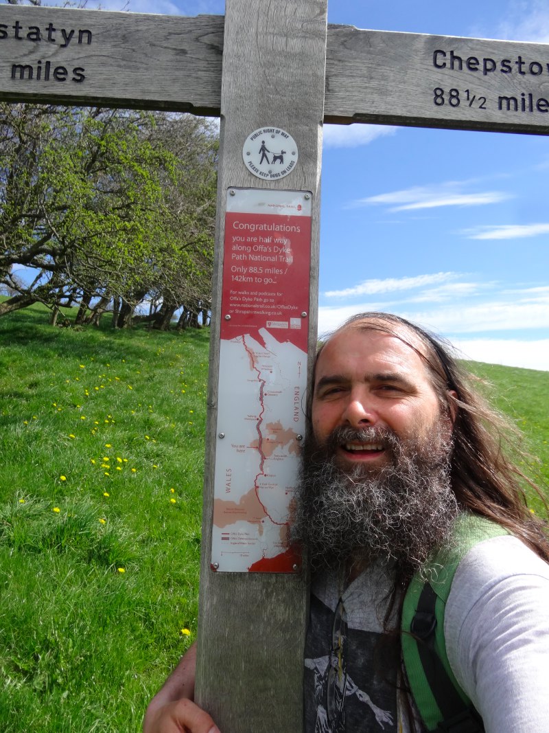
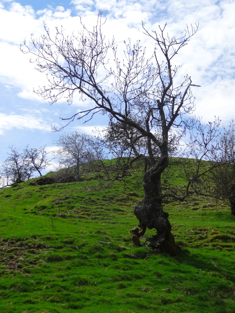
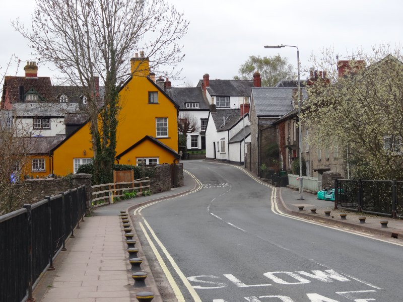
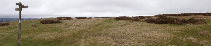
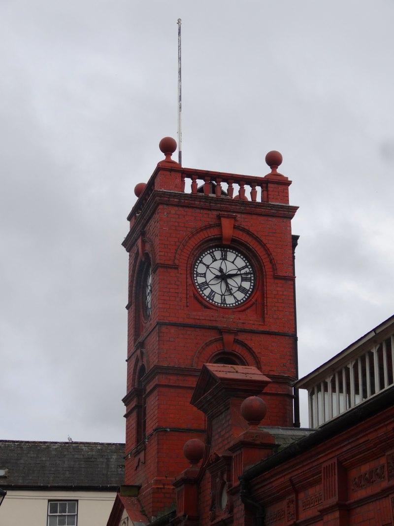
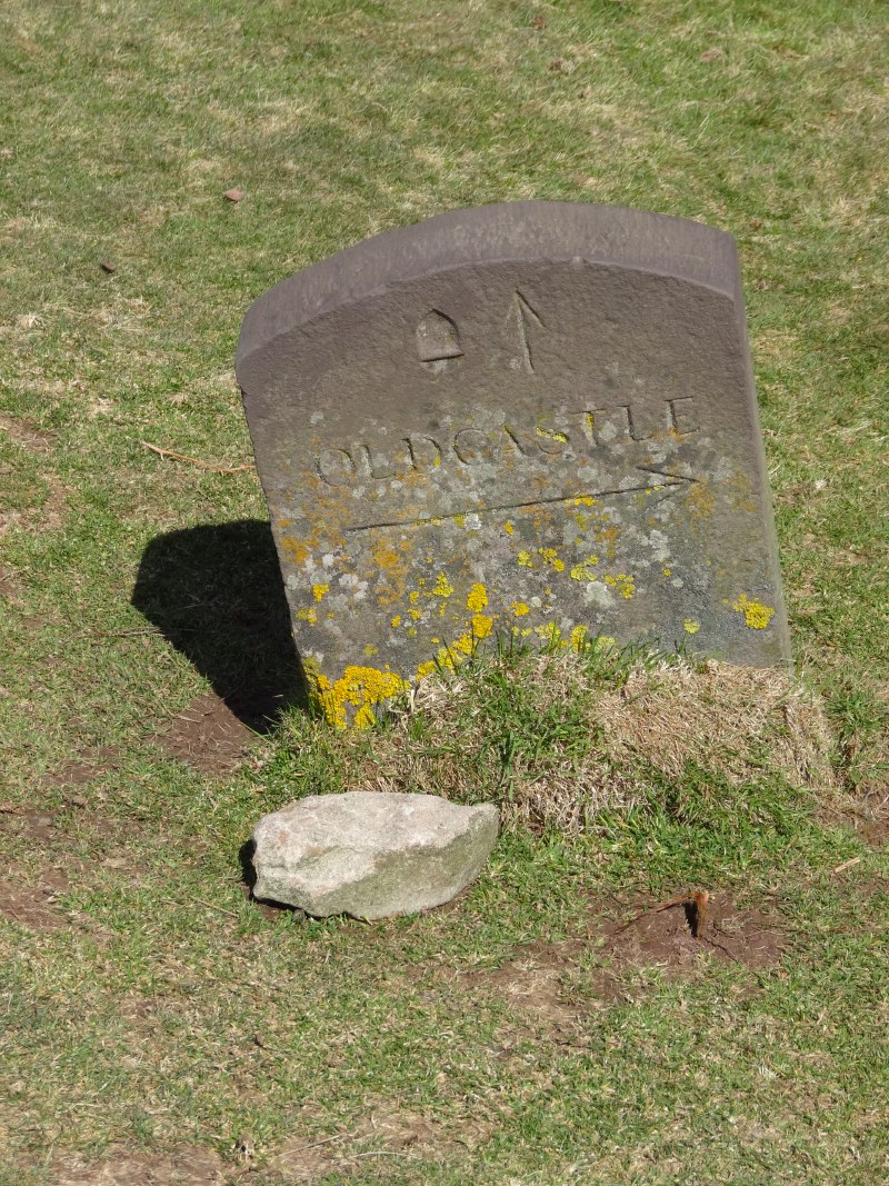
Knighton has the Offa’s Dyke Visitor Centre and describes itself as the mid-point of the long-distance path.  However, Michelle has told me that Newcastle was the real mid-point.  Sure enough, as I walked up the hill (the first of many), looking back occasionally at the glorious morning views over Newcastle and a fish pond that nestled at the foot of the hill, there was a wooden sign post declaring in one direction:

Prestatyn
88 1/2 miles

and in the other:

Chepstow
88 1/2 miles

I was half-way.

2013-05-06 10.56.09 2013-05-06 11.00.45 2013-05-06 11.02.14

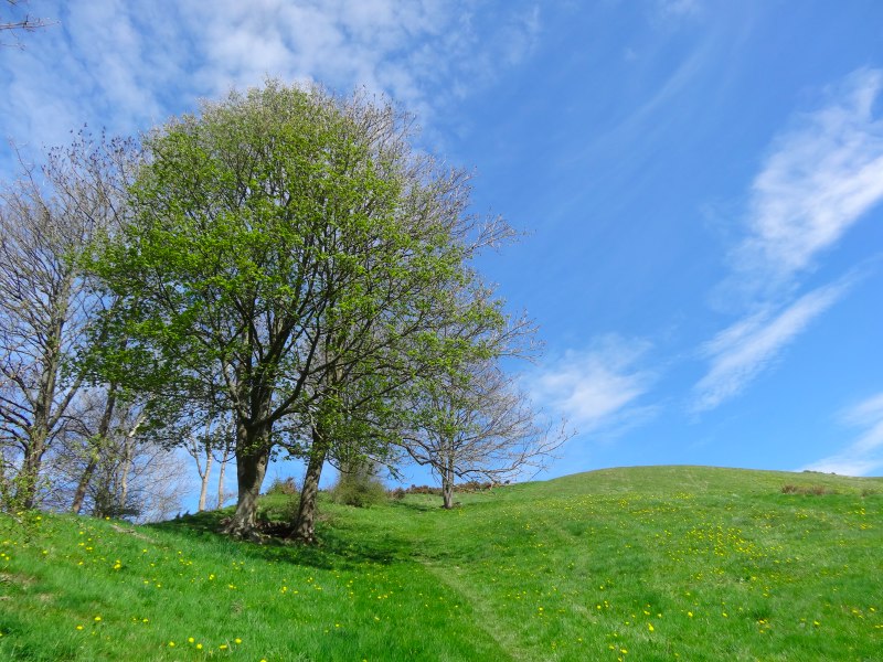
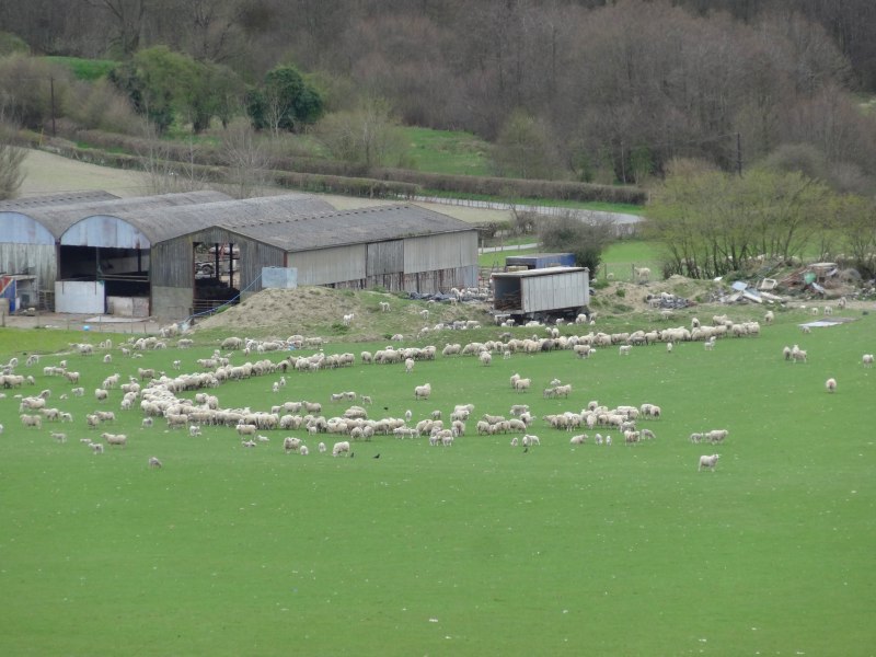
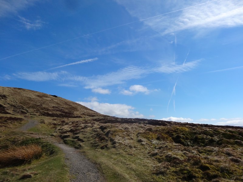
As Jacob had told me, the first part of the day the Offa’s Dyke Path rises and falls as it cuts across valleys and hills between.  Early in the day’s walk I met a young woman and an older gentleman, I think her grandfather, a retired sheep farmer from Oswestry.  They called this section ‘the switchback‘. They were doing the Dyke in parts, the odd day’s walk at a time. something the gentleman could not contemplate when working full-time in his youth; unlike the 9–5 of the city, farming really is a full time job.

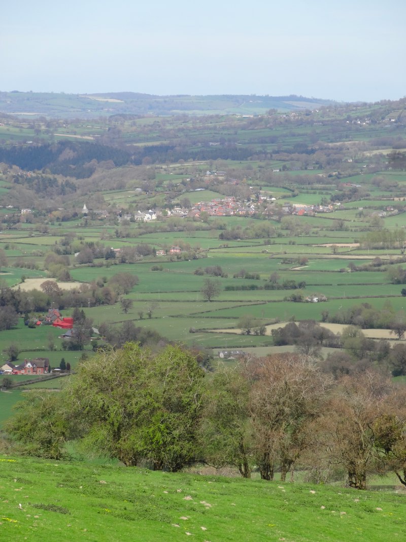
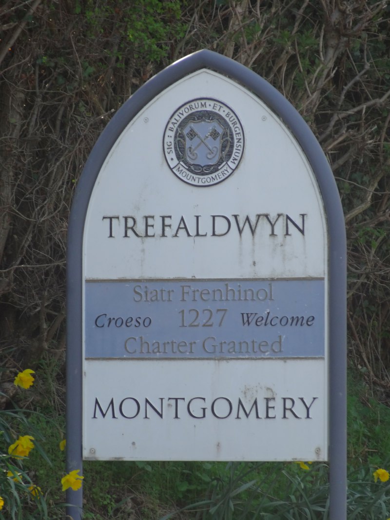
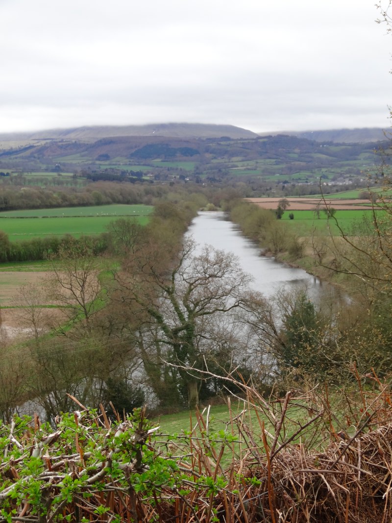
I have written before about the way open plains, with no natural boundaries, become contested, and problematic; wars are fought and lives lost. This land is not level, but the natural drainage patterns fall west to east and hence the natural boundaries separate north–south, whereas the political differences, between Saxon and Welsh ({{British}) lay east–west.  So, while not level, still the natural boundaries do not help settle the political boundaries, hence centuries of strife. Indeed, even in the seventeenth century Montgomery, which I visited later in the day, was the site of one of the Civil War‘s bloodiest battles with 500 Royalists killed, and although this would have still meant I walked north–south across the borders, I would

In America, the 52nd parallel and the boundaries between the mid-west US states, were drawn with a line on a map. Here, Offa wrote directly on the land, a bold stroke, separating Saxon and Briton, English and Welsh, a line that still defines this country today.

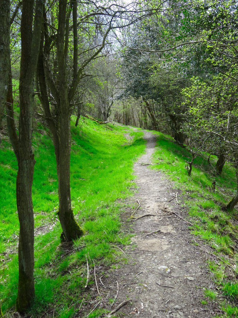
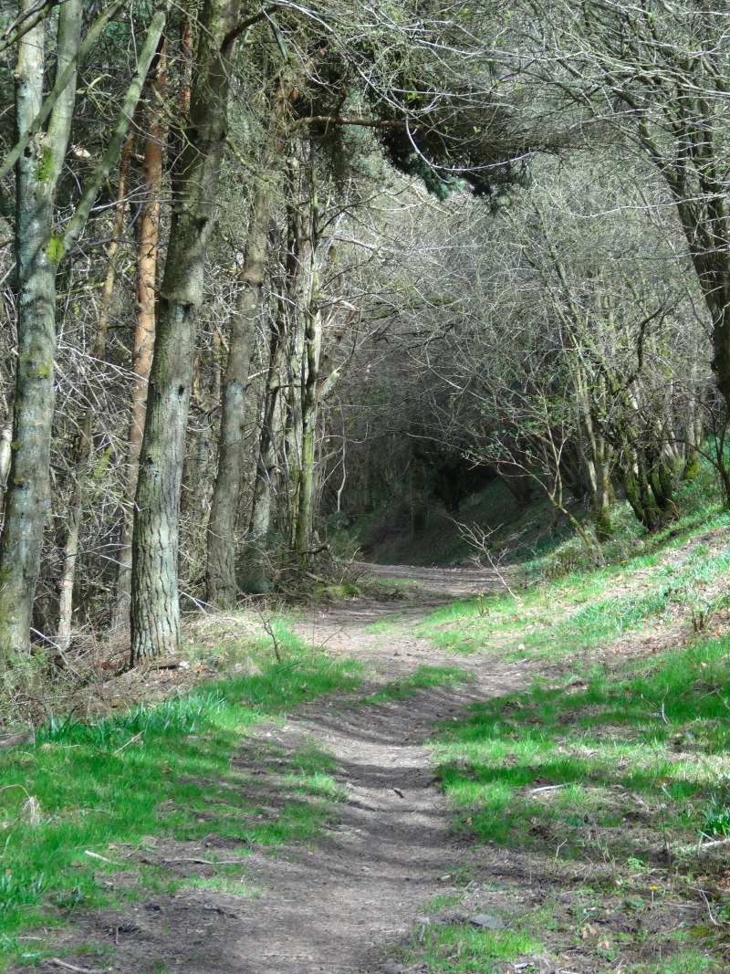
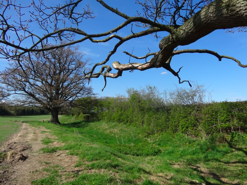
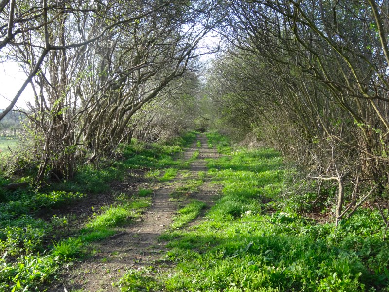
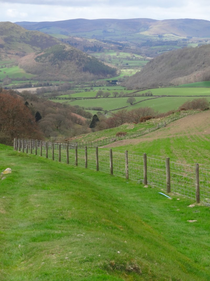
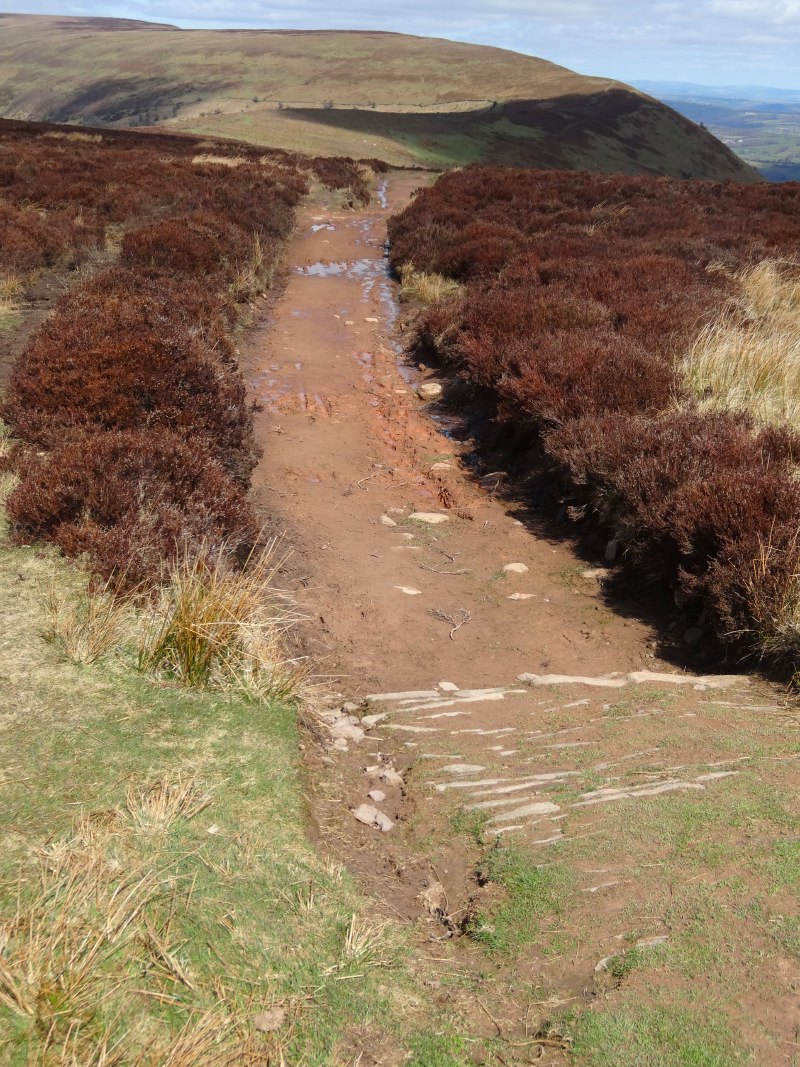
The path climbs one hillside, then drops into a valley, then climbs again, but often with the dyke very clearly visible.  It really makes a difference knowing you are actually following the dyke, rather some guessed line for it with nothing on the land.  I would find the same later in the walk on the coast, it would always be the diversions inland that I found hardest.

2013-05-06 11.27.43 2013-05-06 11.33.43 2013-05-06 11.41.33

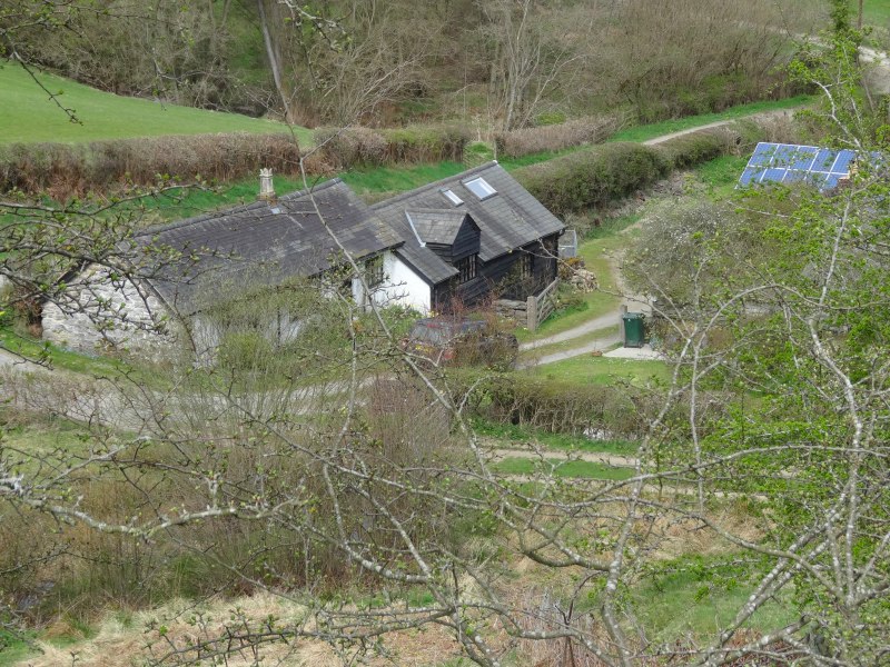
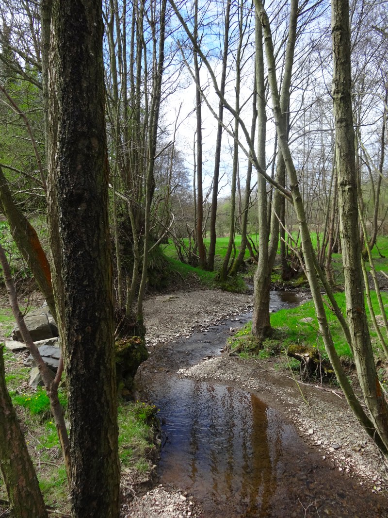
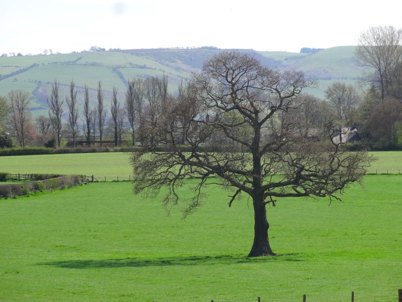
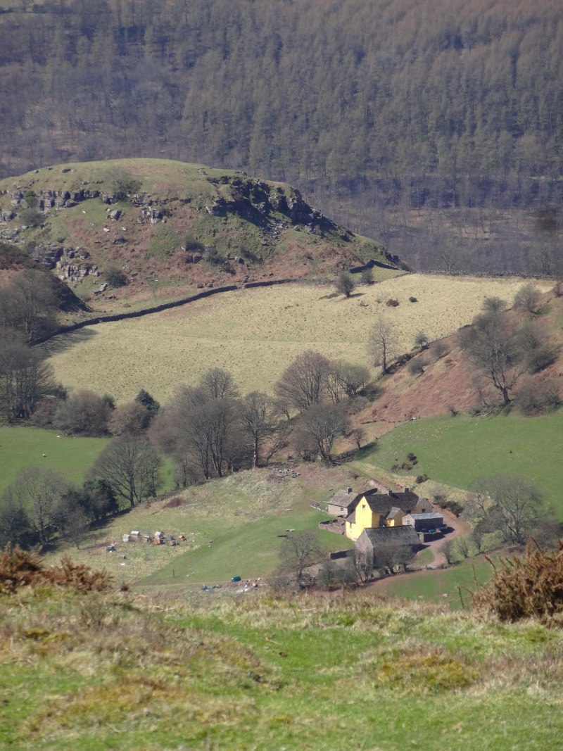
Nestled in the first of these valleys north of Newcastle, was a farmhouse with another near-rectangular fishing pond.  I wondered whether this was medieval in origin, but next to it, definitely not medieval, was a bank of solar panels.  Self-sufficiency in food, and self-sufficiency in energy linked, albeit 500 years apart.

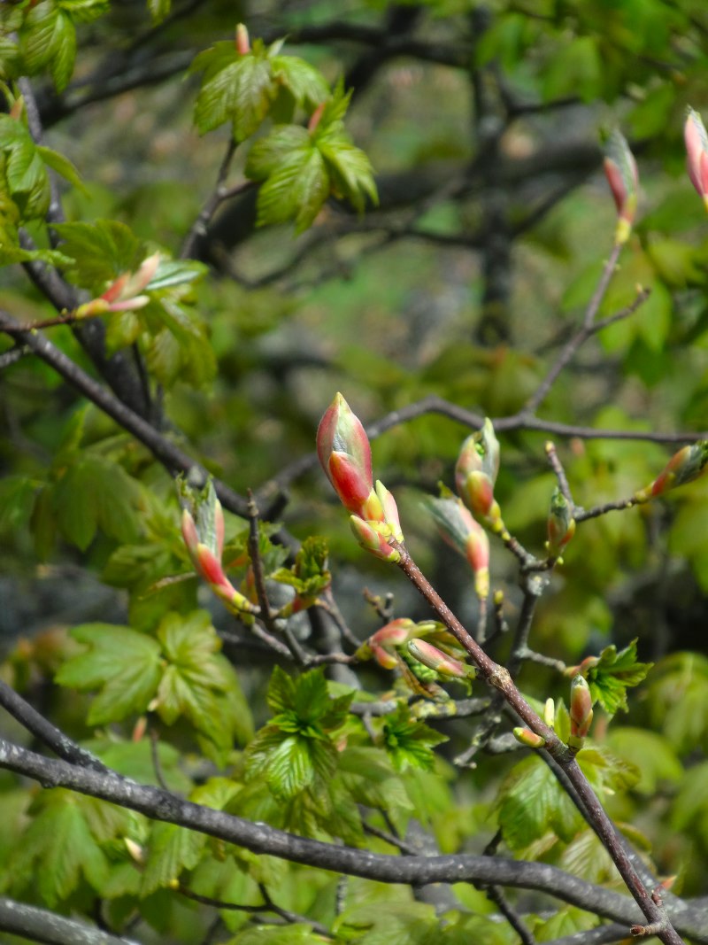
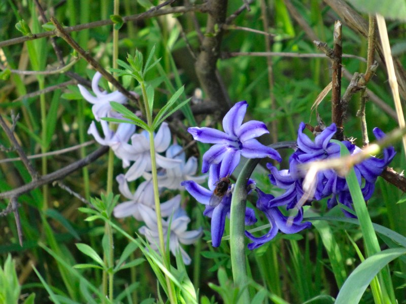
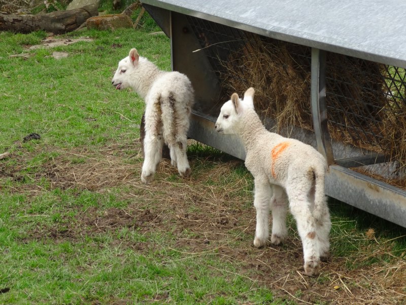
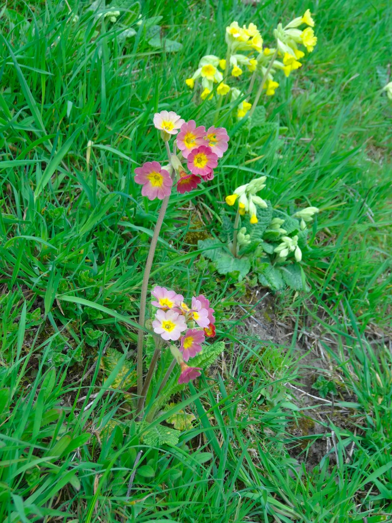
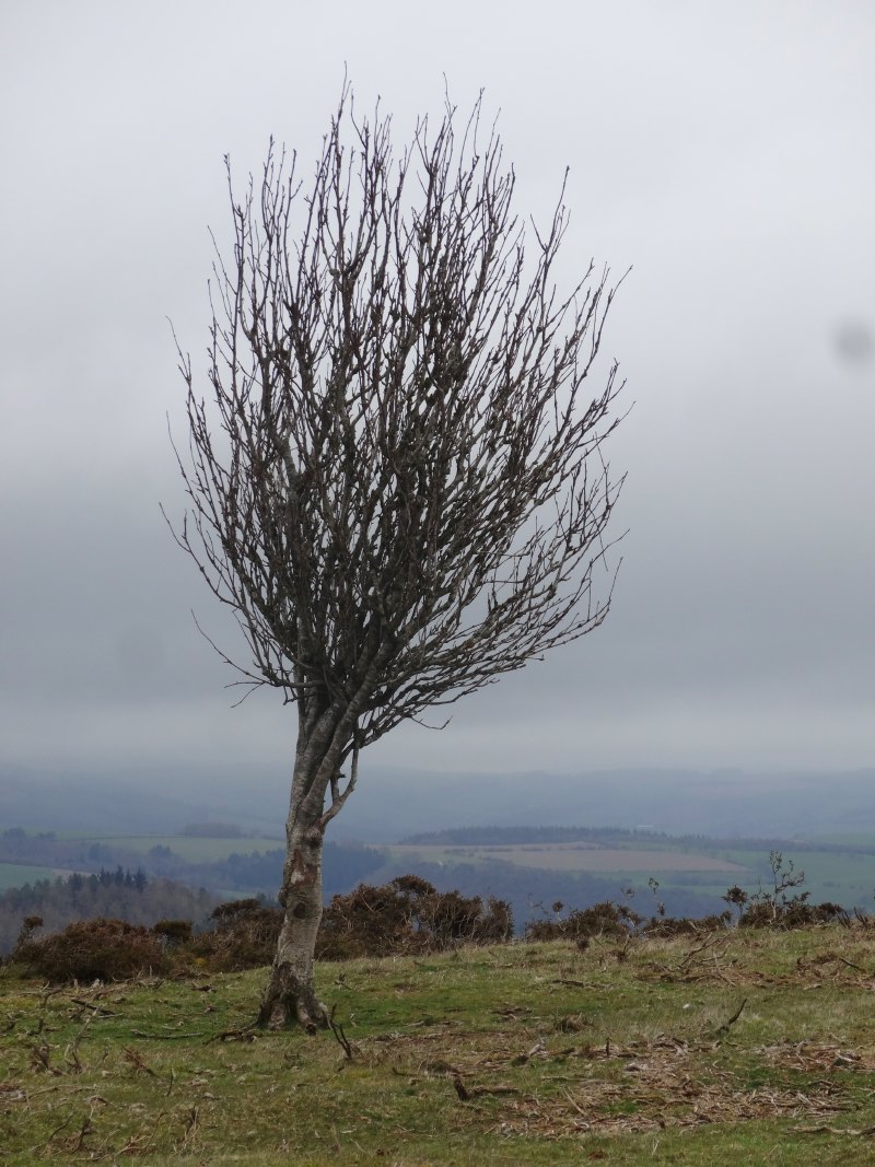
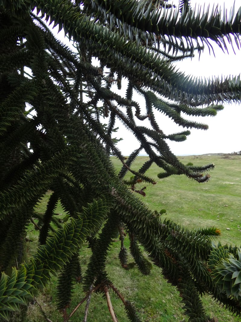
Signs of spring were everywhere: budding tree branch tips and primrose carpeted woodland, albeit with the occasional bleached sheep skeleton to remind us of the harsh lash this last winter gave in its tail.

2013-05-06 11.50.54 2013-05-06 12.05.32 2013-05-06 12.05.51

Another hill, another valley, another hill … I was still suffering from a cold that I’d caught in Paris and I’d noticed the day before that my legs were more sluggish and my breath more strained when I climbed than they had been in the days before I left the trail.  If my schedule had been more relaxed, I should have taken a day off at some stage.

But despite that, I didn’t find the going as hard as I’d expected from Jacob‘s account; however the difference is that I was doing this at the beginning of the day, not the end.  Indeed everyone seems to say that the south–north direction is a lot easier than walking north to south.

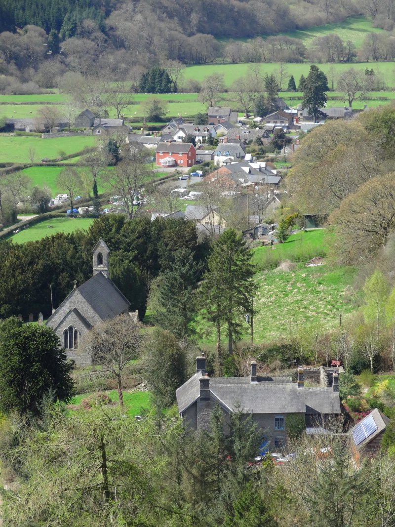
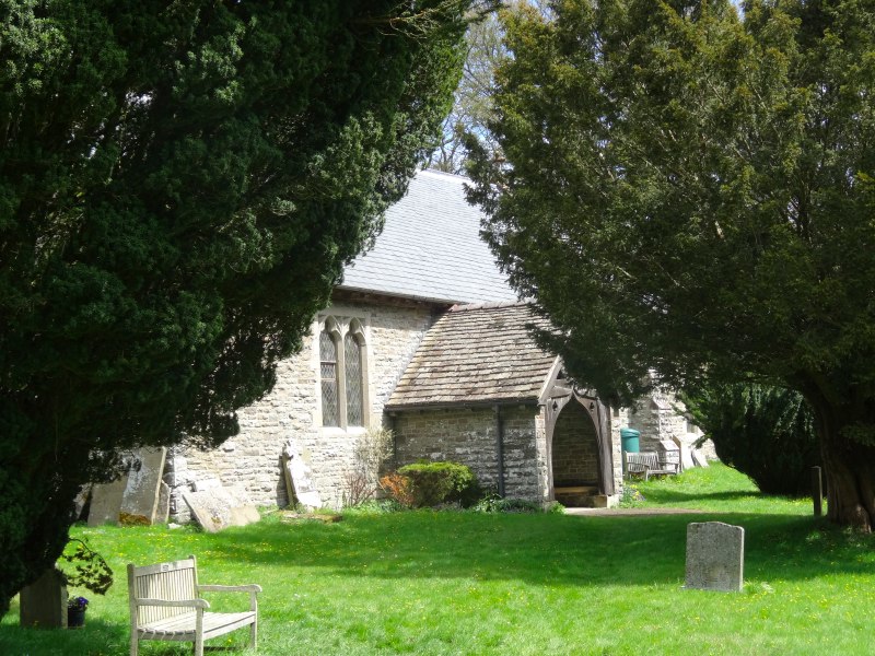
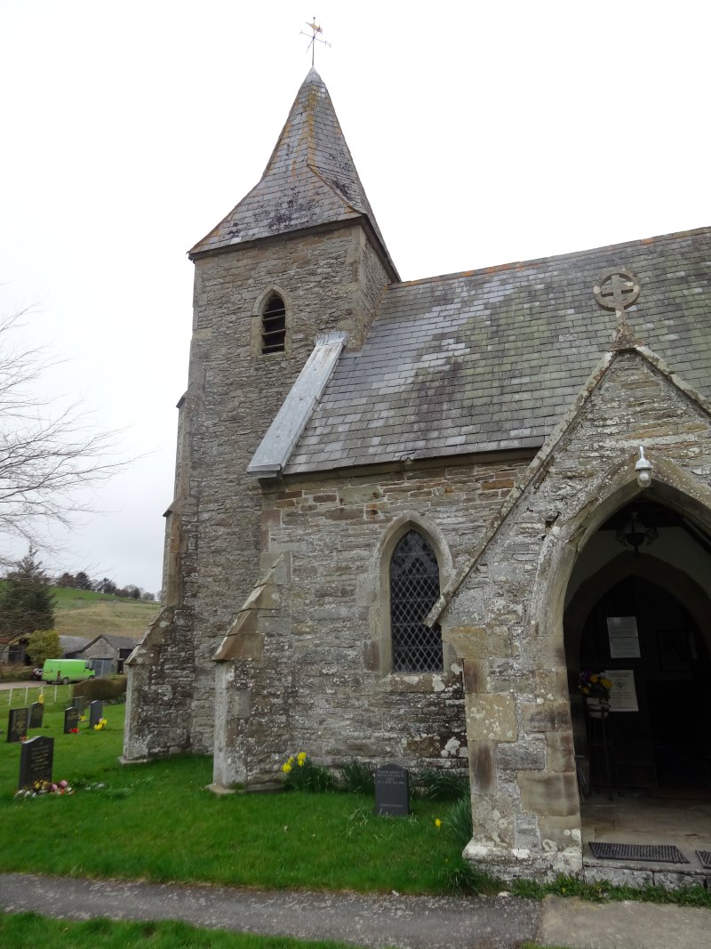
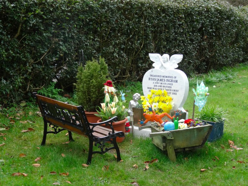
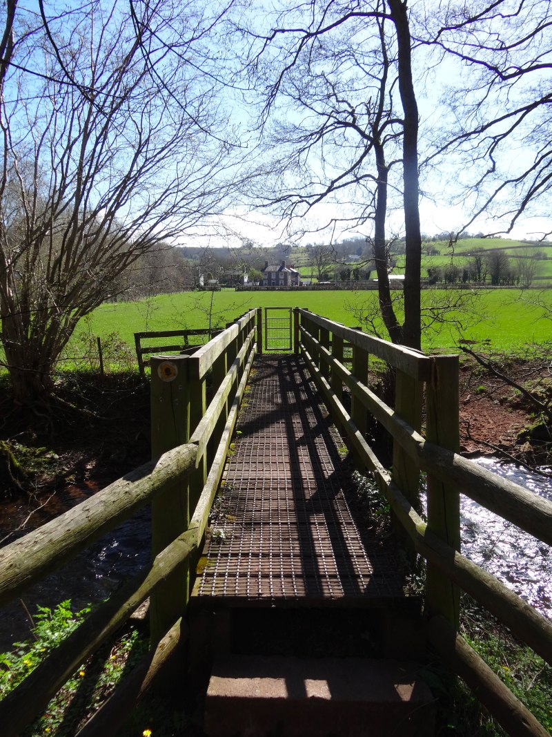
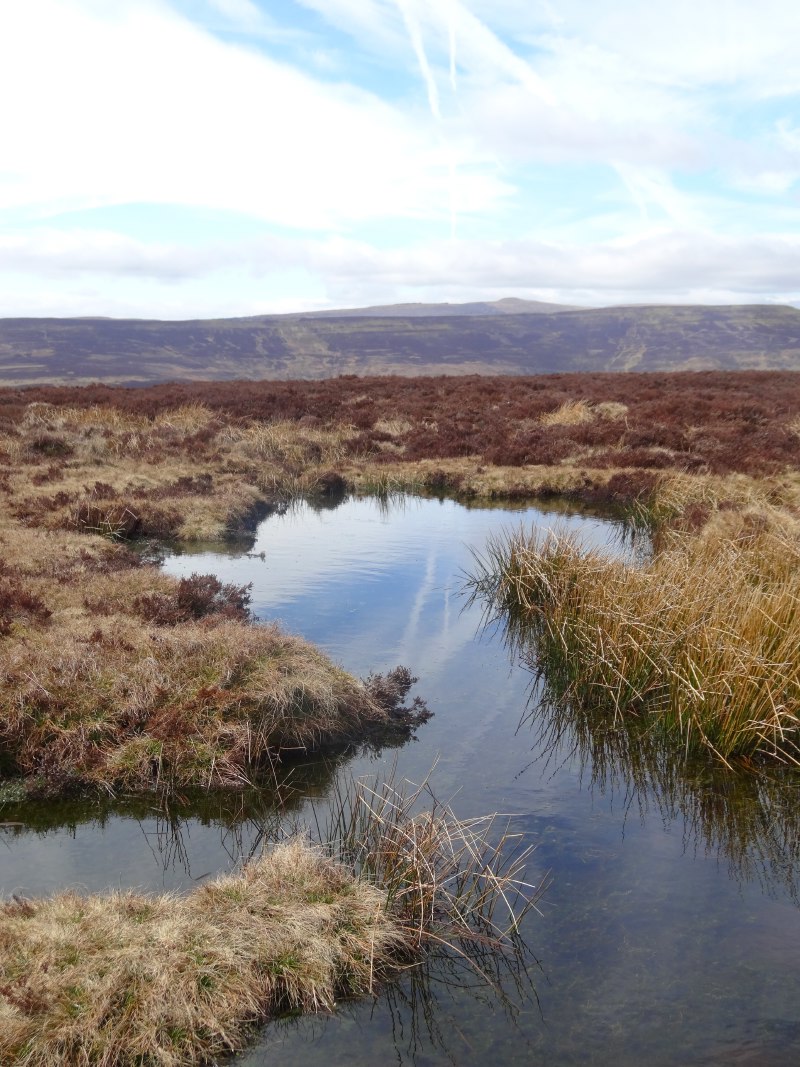
I dropped down into the wooded valley of Cwm Ffrydd.  At the bottom is the church of St John the Baptist, Mainstone.  The current village of Mainstone is about 3/4 mile down the valley, but the church is in what is now called (logically) ‘Churchtown‘.  I’m not sure of the history of this, maybe the centre of gravity of the population moved over time.

2013-05-06 12.17.00 2013-05-06 12.32.12 2013-05-06 12.44.54

I met a man who told me a little of the area. I would be cutting north up over the top to the next valley, but if instead I were to follow Cwm Ffrydd upstream I would find a pack of wolves in the valley head1.  At night, even here in Churchtown, you can hear them howl.

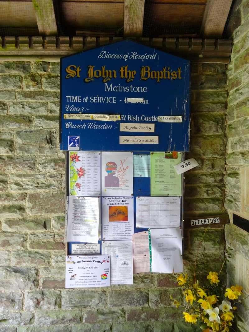
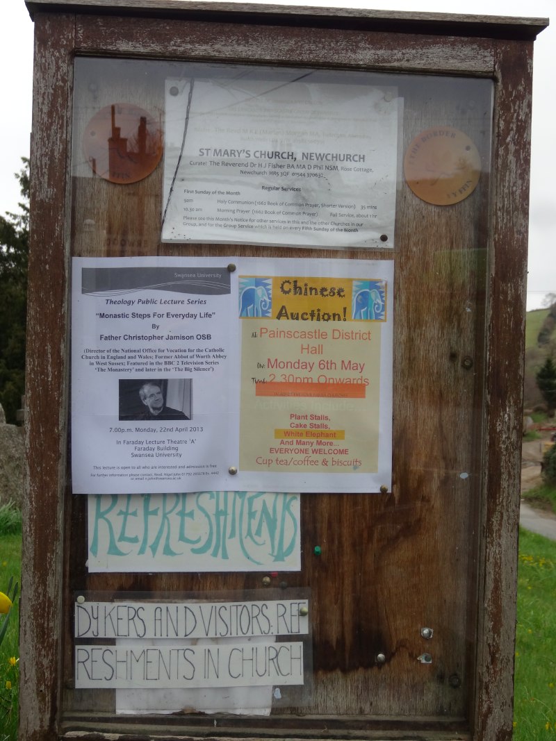
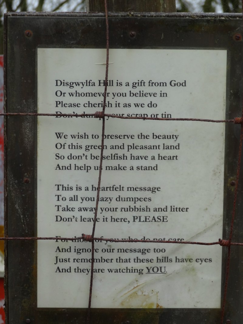
It is not only wolves that are made welcome in this valley. In the church porch, as well as a lively noticeboard offering activities for human spiritual refreshment, and a big photo of Reverend Stephanie, there is a notice that reads:

The churchyard is a living sanctuary for plants and animals.

… but no wolves in it.

2013-05-06 12.45.24 2013-05-06 12.47.00 2013-05-06 12.47.34

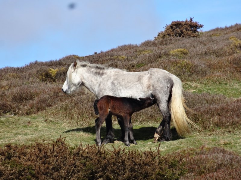
I had in fact met a wolf not long before.  The Talis offices in Birmingham were on the third floor of a small office building.  As I went down the stairs one day a man came out of the offices on the second floor.  With him was a large grey-white dog, a beautiful animal.  It reminded me a little of Janet‘s Maremmas, but more ‘rangy’, I thought maybe a Husky.

I dropped down to a squat and it came up to me and touched noses, I gave its short velvet years a small cuddle.

Now I should explain that I am the dog hater amongst a family of dog lovers.  I tolerated our own, because they were part of our family, and tolerate Janet‘s because she is family. So when I talk to random dogs I meet along the way, it should not to be taken to represent any deep significance. I would hate to destroy my reputation.

So, with the understanding that this was merely me greeting a fellow animal, not representing any affection; I squatted there nose to nose, eye to eye, admiring the two-tone coat, slightly coarser hairs of silvery grey intermingled with fine hairs of almost pure white, I looked up to the owner and asked.

“Is it a Husky?”, I asked.  He said something about “a wolf”, which I at first took to mean it was a primitive breed like a wolf, as indeed I might describe Maremmas.  This was not what he meant.  He was an animal psychologist and this was a tame male wolf.  If I had known that at the start I might not have squatted nose to nose, my face inches from its teeth,

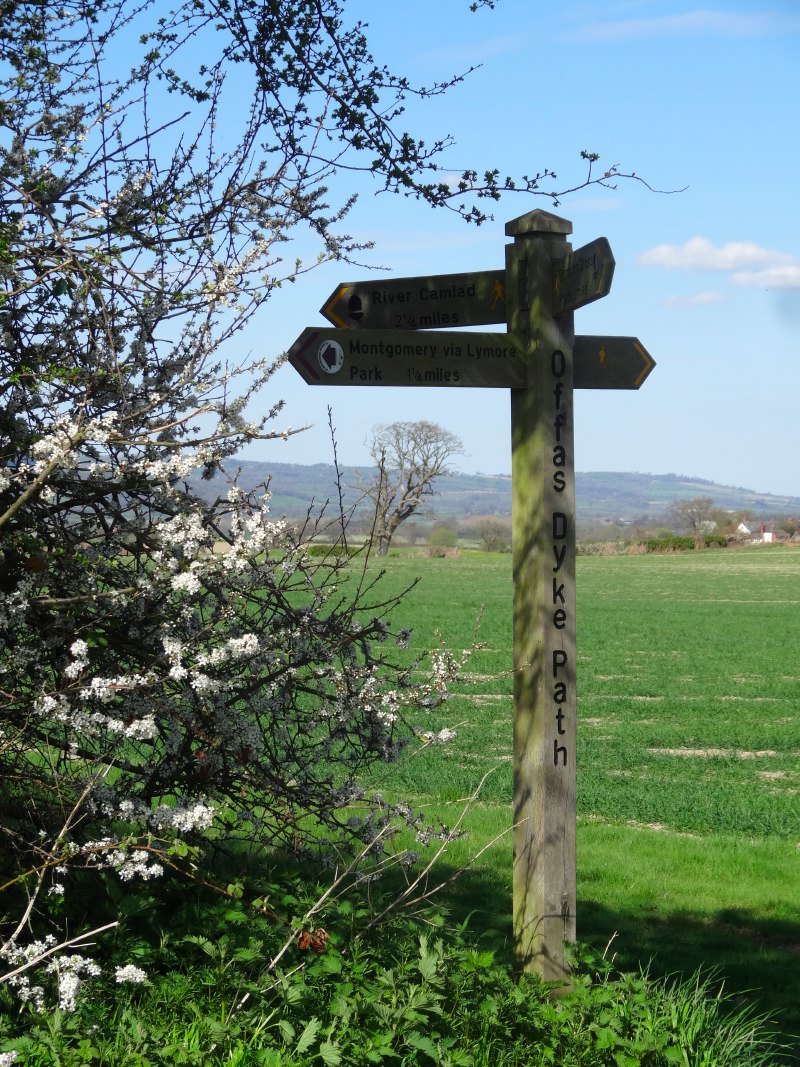
The Shropshire Way meets Offa’s Dyke Path at Churchtown, and other paths as well.  I should have known better from the day before, but again I went slightly wrong as I came out of Churchtown, following the wrong footpath arrows.  However, I noticed quite quickly and the wrong direction had merely been skirting the contour round the bottom of a hill rather than going up and over it. I retraced my steps and set off again steeply uphill clearly following the course of the dyke itself.

2013-05-06 13.24.09 2013-05-06 13.46.48 2013-05-06 14.00.23 2013-05-06 14.01.40

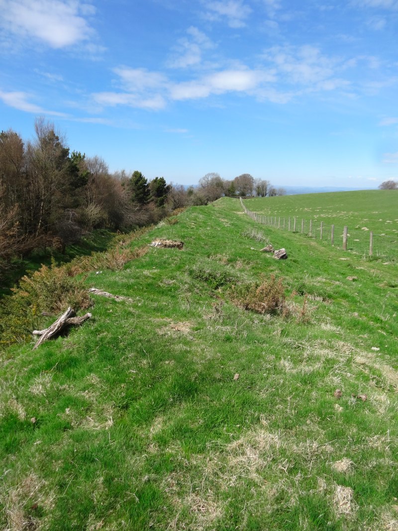
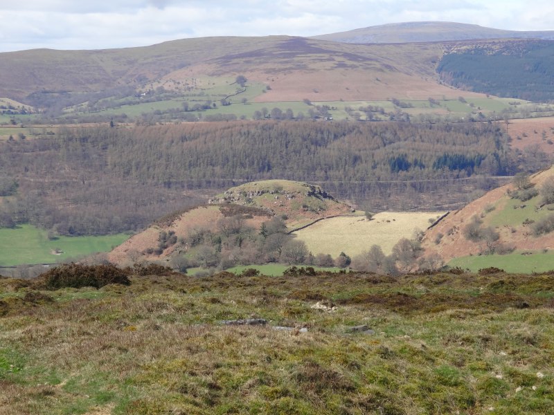
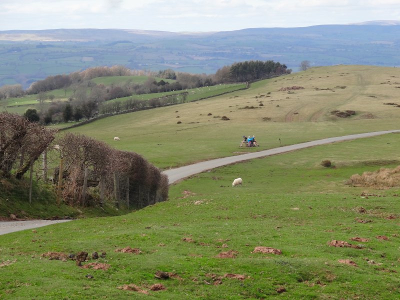
Another valley, another hill and the countryside opens up ahead, I can see the rest of the day’s route ahead: lower lying land and gently undulating open farmland between the Caebitra and Camlad rivers.

The path joins a small road for a while through the hamlet of Cwm.  On the side of a pebbledash bungalow is a small sign that says, “1026“, beneath three lion faces, neither the house number nor its date, maybe the date of the founding of the family, or the number of cats inside.  In Cwm also is a small converted chapel, its date stone says “1897“, I think more accurate.

2013-05-06 14.15.461026-sign-2013-05-06 14.18.23-cropped2013-05-06 14.26.40

After this the road hits a T-junction, but the dyke continues straight on, its rabbit-hole-punctured and root-twisted top, dry red earth beneath the cover of trees, past a static caravan site and Mellington Hall.  I notice this in other places.  My guess is that the current footpath was once a more substantial foot route and Cwm lay on a crossroads, but as patterns of movement and settlement changed, only some of these routes became modern roads, so the once crossroads became a T-junction, with only the footpath revealing its past … well that’s my story.

Mellington Hall appears to have a mixed approach to walkers.  Near where the path entered its estates, there was an old sign, its paint near worn away with age, but the words "no public right of way" still visible.  I think this may have been simply to say "not through the caravan site".  Further on, though there is another sign saying:

WALKERS WELCOME
For
Accommodation
Morning Coffee
Lunches
Evening Meals

It was very tempting and one of the few times in all my journeys that I saw explicit signs for ‘off path destinations’.  I was certainly in need of food as it was after half past two, but it sounded as if it might be a little upmarket and also I really wanted to pop into Montgomery, and although this would have still meant I walked north-south across the borders, I would as I passed.

2013-05-06 14.30.33 2013-05-06 14.33.56 2013-05-06 14.37.59

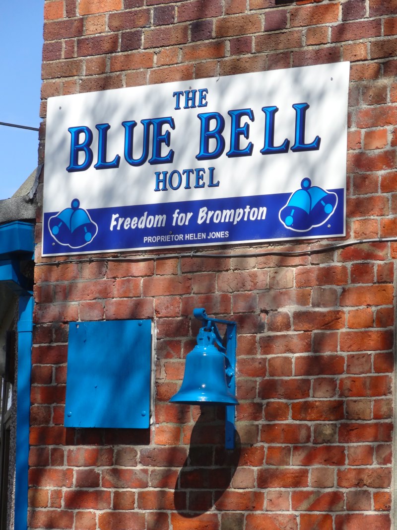
The path rejoins the road, or maybe the road rejoins the path, for the bridge across the Caebrita.  The far side of the bridge the route crosses the A489, this time at a modern crossroads, with the road crossing towards Montgomery, and although this would have still meant I walked north-south across the borders, I would.  On the corner is the Blue Bell Hotel, its blue bell prominent outside.  The sign proclaims "Freedom for Brompton".  I’ve not been able to find any ‘Brompton liberation army’ posts on the web, but maybe this is connected to the fact that Brompton is almost an enclave.  The Welsh–English border meanders back and forth here, driven this way and that by the east–west topography.

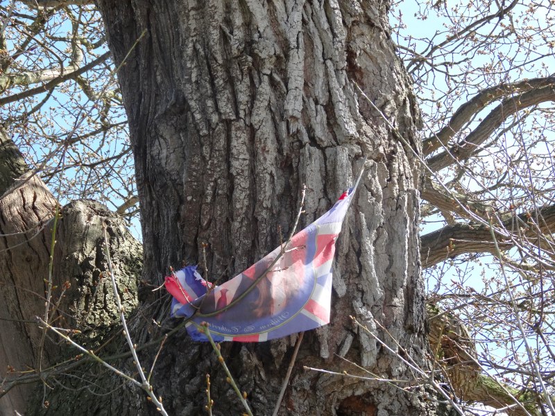
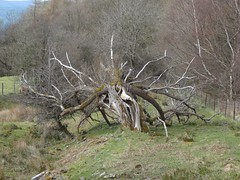
An old, gnarled, half hollow tree, one of its hollows half filled with stones as if to shore it up for anther hundred years, stands beside the Blue Bell. High on its trunk the faded remains of red, white and blue recall the wedding of William and Kate two years before.

2013-05-06 14.59.45 2013-05-06 15.00.01 2013-05-06 15.01.13

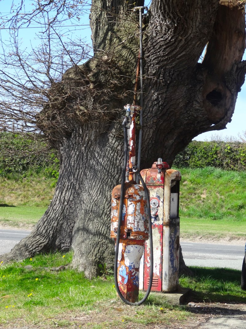
Under the tree are two rusty petrol pumps, looking almost as ancient as the tree itself.  At the crossroads it is an obvious site, and clearly also the reason for an inn.  But I wonder if this goes back further, was there a blacksmith’s anvil once set here also beneath the tree so that the inn’s farrier could re-shoe the horses of guests.

old-car-2013-05-06 14.47.25-cropped 2013-05-06 15.01.30 2013-05-06 15.01.54


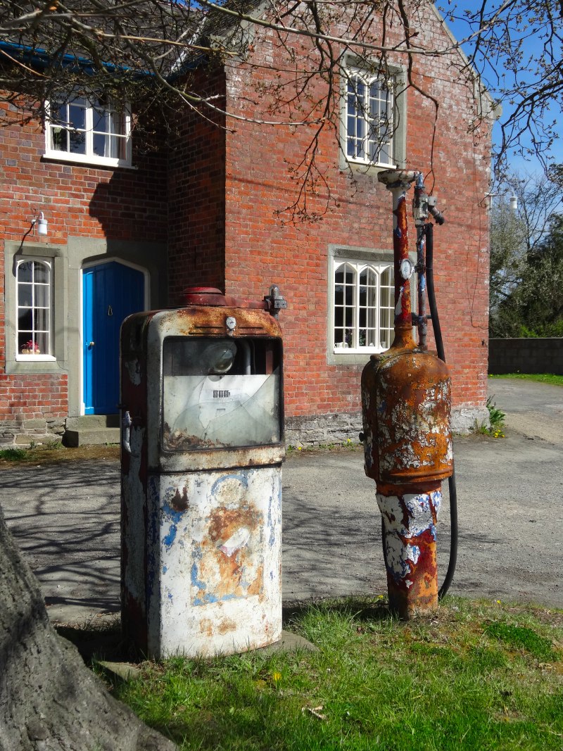
By this time I was hungry and thirsty, and a pint and sandwich would have been most welcome, but the {{Blue Bell} sadly was closed ((It does not look shut down, but I found a mention of it on another Offa’s Dyke walker’s blog, who also found it closed.)).

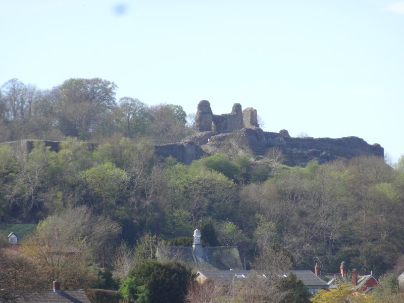
While the road goes more north&en-dash;west to Montgomery, and although this would have still meant I walked north&en-dash;south across the borders, I would, the dyke continues nearly due north cutting across the little tongue of Shropshire that includes Brompton, before the border and dyke join, and modern and past boundaries follow one another for several miles straight across the rich flattish farmland guarded by Montgomery Castle.

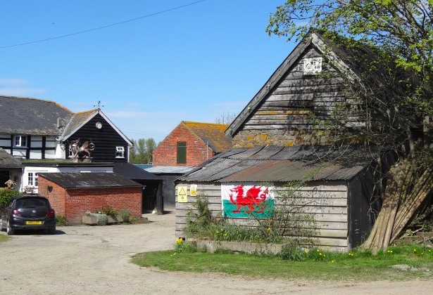
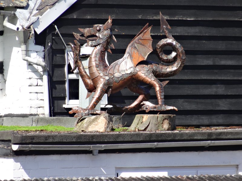
After a while the path passes (indeed passes through the garden of) a substantial farmhouse called ‘The Ditches‘, I guess after the dyke.  On the timbered barn is a ragged Welsh flag, and above a flat roof on the house itself a metal sculpture of a Welsh dragon.  When I checked my map, I realised that this was still on the English side of the border, indeed in the centre of the little tongue of Shropshire.  Whilst in the US it is common to see the Stars and Stripes flying everywhere, in general in Britain we are less strident, indeed I recall no other house in Wales with such a prominent display of Welsh nationality.  I am guessing it is precisely because we are in the borderlands, where the natural boundaries of the land are less strong, that people feel it important to assert their identity.

welsh-farm-in-england-2013-05-06 15.14.09-cropped2013-05-06 15.14.192013-05-06 15.15.34

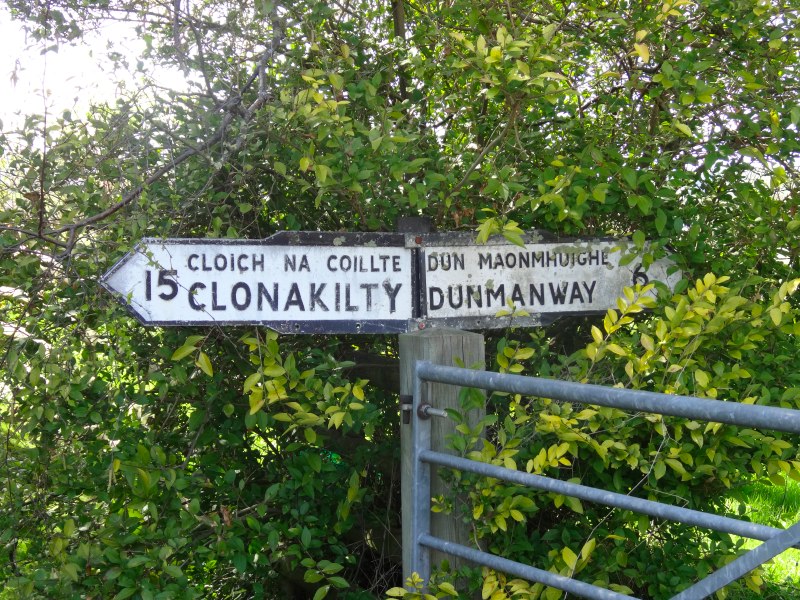
Whether it is Celtic camaraderie, or simply whimsy, where the path crossed the track to the farm a sign post said “Clonakilty“.

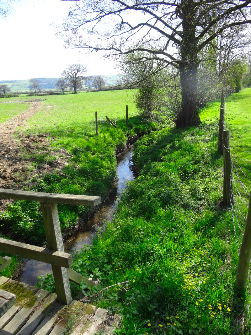
Soon after, I actually crossed the tiny stream that took me into Wales, or at least along the line of the border.  I met a small family group, mother and I think son and daughter-in-law.  Like the gentleman and his grand-daughter earlier in the day, she too had been walking Offa’s Dyke in parts over a number of years.  She had in fact walked this section some years before, but had been tired, so she had stayed in Montgomery drinking tea while her husband and a companion walked the few miles from Montgomery to Brompton.  Although it was just a short section, the fact that she had missed it had preyed on her.  She and her husband were due to do the final sections of Offa’s Dyke down the Wye Valley to Chepstow, but she felt she needed to fill in this section, to do it properly, not to cheat.

2013-05-06 15.22.09 2013-05-06 15.44.30 2013-05-06 15.47.13

I had very nearly taken the road directly into Montgomery, and although this would have still meant I walked north&endash;south across the borders, I would not have followed the ‘proper’ path, so would also have felt I cheated.  Here the path does follow the actual route of Offa’s Dyke closely, so there was good reason for it to pass Montgomery by.

However, I wanted to visit it, and also get some food!  I can’t recall what I had that day, but very little since (a very good) breakfast as there were no shops, so it will have only been what I had in my rucksack already.

Offa’s Dyke misses Montgomery by about a mile, but there is a footpath into the centre where a driveway to a country house crosses the dyke.  A finger post gives all four directions, and I turn left into Montgomery.  The drive passes the local football club, and also a walled farm.  The walls seems incredibly thick, and I wondered if they had once been a minor fortification.

2013-05-06 15.54.39 2013-05-06 16.01.58 2013-05-06 16.10.34

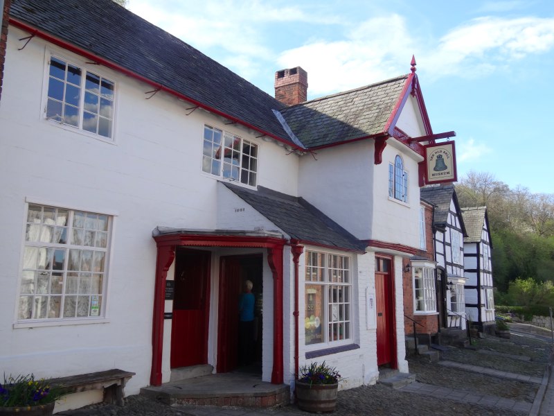
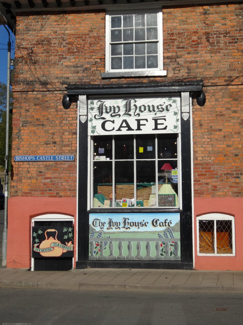
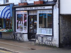
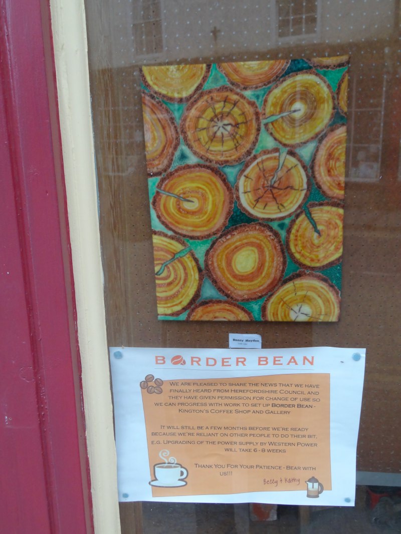
Coming into the the town centre, one of those crossroads that come out into a market square, I noticed Ivy House Café, which had Welsh language books in its window. But it looked as if it might only do cake, so I went for a small wander first to scout.  There is a small hotel, but peeking at the menu I realised it was very posh indeed, definitely not bar meals for walkers.  Across the road I saw a sign for an exhibition in a tiny gallery, with various art and gift items downstairs and gallery space above.  Leaving my rucksack, I went up to an exhibition inspired by myth and folklore.

The lady in the gallery said I really should visit the Old Bell Museum, which is small, but has an excellent selection of both ‘folk museum’ reconstruction and local archival items.  I asked about the farm I had passed.  She thought it had always been a farm, but said that nearby had been the old house of the landed gentry of the area, but that it had burnt down in a fire. However it is not unlikely that there are castle stones in the farmyard walls as the castle has been ‘quarried’ extensively over the years for local building.

2013-05-06 16.16.32 2013-05-06 16.20.21 2013-05-06 16.59.56

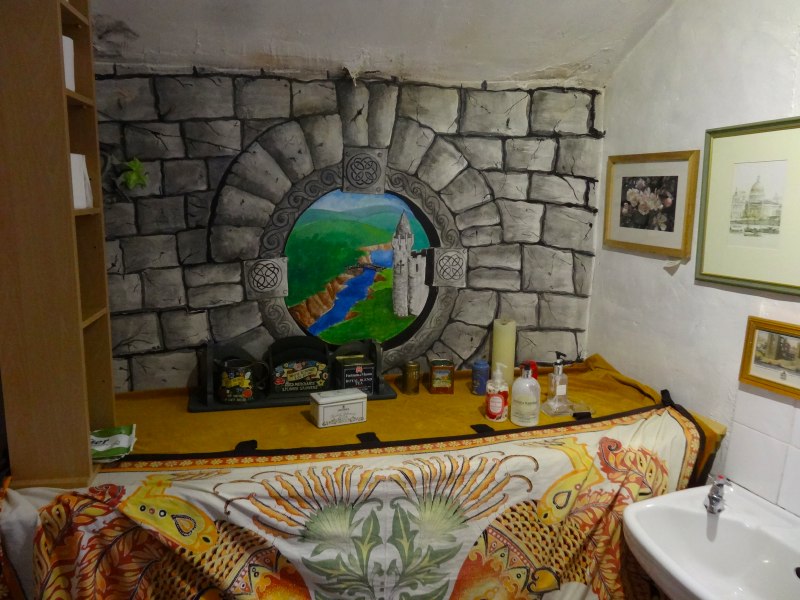
By now I was hungry enough for anything, so went back to the Ivy House, which was as lovely inside as it looked from without, including, as I discover later, the most amazingly decorated toilet.  At first I thought it was too full, but the lady there said there was room upstairs, so I ordered a cup of tea, cake and ice cream … and went up.  There was no-one else there except one other man, so I sat on an enormous table on my own.

We got talking.

2013-05-06 17.34.43 2013-05-06 17.36.59 2013-05-06 17.45.19

His name was Rupert and he lived locally, driving for a local agricultural haulage business.  I told him about the walk, and then mentioned I was from Tiree.  Normally, this leads either to a blank look, or "oh yes, like on the shipping news", but Rupert did neither of these, "I used to go there regularly nine years ago", he said.

It turned out Rupert had fallen for a Tiree girl.  I wasn’t sure whether she felt the same way, but certainly he returned there frequently until for some reason, nine years ago, his visits stopped.  I had a feeling that something had happened to the young woman, as it sounded as if Rupert had continued to visit for a while after she was no longer there, but I did not like to pry.

While Rupert clearly had a life here in Montgomery, as we talked he asked about the best ways to get there now by sea and air, and clearly hearing about Tiree had awakened many memories.  It felt such a special moment to make a connection that seemed so unlikely, so random and yet so meant.

Rupert offered me a lift back to where I’d left the path, and so went to get his car.  I finished my food and then went outside to wait in the last afternoon sunshine.  When he came he’d been asking someone about the driveway and evidently the owner did not take kindly to people driving up it, so instead he had to drop me where Offa’s Dyke crossed the B-road leading east out of Montgomery.

I could have started from that point, but, like the lady earlier, I did not want to ‘cheat’, so had to go back a mile or so southwards along the course of Offa’s Dyke until I got to the place where I’d turned into Montgomery,  I walked as quickly as I could and then turned round again and set off back north at near marching pace across the flat farmland as the time was now getting late and I would still need to find my B&B and somewhere to eat.

2013-05-06 18.07.072013-05-06 18.20.142013-05-06 18.40.53

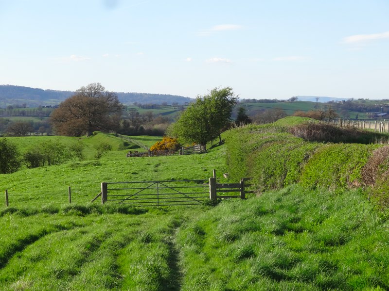
It was a lovely evening, and the few miles across the flatlands fell away quickly, but I also saw ahead that I had one last small rise to climb, ominously called ‘The Bank‘.  I cross the Camlad and pass bluebell woods and a sign that tells of the bloody battle fought here during the Civil War, before climbing The Bank, happily not too steep or long, and onto the straight path running along or parallel to the road for the last couple of miles.

I was staying at Heath Cottage a small B&B at ‘Forden‘.  Mary, the proprietor, had given me instructions, "The path goes behind the village and our back garden opens straight onto the path, you can’t miss it."

2013-05-06 19.05.45
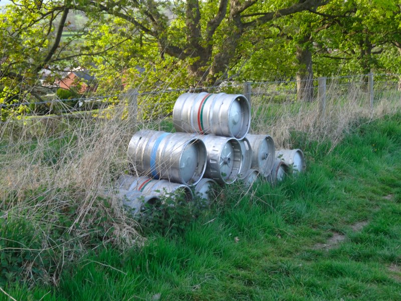
I could see that Forden is clearly marked on the Harvey Offa’s Dyke map, and sure enough the path does run behind what looked like a small clump of houses on the map, but when I got to the top of The Bank, there was no sign of anything that looked as Mary had described.  In fact the only thing of note was that, still in the middle of farmland, beside the path, there was a pile of metal beer barrels. I went on and cut onto the road through Forden to make sure I didn’t miss it.  I passed the turn-off to the school, and still no sign, I looked back and was sure I’d not missed it, so went on, thinking perhaps it was on its own out of the village proper.

After a while the path was on the roadside anyway and although I was sure I’d not passed it, still there were no houses for a long way ahead.  The next place on the path was marked ‘Kingswood‘ about a mile or so beyond Forden.  I was already half-way there and there was a pub marked on the map, so I thought I might as well go on there and ask directions.

As I drew within sight of Kingswood there was a sign beside the road, "Forden", it said.

heath-cottage-2013-05-07 11.28.33-cropped
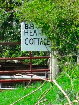
Somewhat encouraged by this I then saw things that corresponded to the instructions I was given. I took the path that is bypassing the village, and sure enough, a little gate and a sign saying, "Heath Cottage".

It was now eight o’clock, so after being shown to my room, I quickly went across the road to The Cock Hotel.  They were not serving food properly, but they said they could do something ‘from the freezer’, I can’t recall what it was, but I didn’t really care so long as it was food.  So I sat, ate, and drank a pint of the local beer.  After a bit a group of local men came in, who proceeded to call me ‘Jesus‘ for the rest of the evening.  It was Bank Holiday Monday and they had been on a tour of local golf clubs, or at least this was the story they told their wives, most critically it transpired was that the golf clubs had club houses and the club houses had bars.

I can’t recall now whether it was one of them, the barman, or John and Mary at Heath Cottage who explained the mystery of ‘Forden‘ to me.  Evidently Forden is the complete parish consisting of  number of several smaller settlements, principally the ones called ‘Forden‘ and ‘Kingswood‘ on the map, and the small village of Fron further along the A490 to the north west.  If you ask a local, and clearly the person who puts up the road signs, ‘Forden‘ is what is called ‘Kingswood‘ on the maps.  I hope that makes everything clear :-/

  1. I cannot find any direct information about this wolf sanctuary, but I found a photo of one of the wolves, Madadh in a blog about someone’s Christmas holiday in Cwm Ffrydd.[back]

day 18 – Knighton to Newcastle

No, not Newcastle upon Tyne (that would be a long day), but Newcastle upon Clun, only a short seven and a half mile walk over low hills and farmland, nearly due north from Knighton, wth Offa’s Dyke clearly running beside the path for nearly all of the day and my first red kite.

miles walked: 7.2
miles completed: 134.2
miles to go: 926.1

I had, at one stage, thought of taking a whole day in Knighton, but the combination of having just had a long break at the CHI conference and trying to avoid excessive days in some of the future sections made me opt for a half day.

However, this did mean a relaxed morning, starting with a long breakfast at the George and Dragon.  I knew that this weekend was the AGM of the Offa’s Dyke Association, but it was only after the other guests had left their tables and I was chatting to Justin, the landlord, about my plans for the day, that I found that two of the guests had been stalwarts of the association, living in the Barbican in London, but coming up every year for this weekend. He also told me that he had known another chap like me a few years ago, his laptop out at dinner and breakfast. Justin had asked him what he was doing, "writing Tony Blair‘s memoirs", he answered.  So, not sure if that puts me in good company?

Knighton‘s architecture is more varied than Kington‘s, with a lot of Victorian as well as Tudor buildings, including numerous chapels, I guess a result of the greater access due to the through train line, compared to Kington, which, even when its railway was open, was very much the end of the line.  There is a clock tower in the centre of the town at a Y-junction with ‘Broad Street‘ running away from it and one arm up the ‘narrows’, a definitely medieval-width street.  At the top end had been the old ‘Butter Cross‘ and open sided market hall where local farmers sold their produce, mostly butter, and I assume heavily salted to preserve it for long journeys in the days before refrigerators.

I looked around for an old market cross wondering if there was any reason for the name ‘Weeping Cross‘, which, Fiona informs me, is what Mary Webb calls Knighton in her books about Shropshire and the Marches.  However, if there was once a cross, the Victorian clock tower probably replaced it.  Neither Justin the Landlord, nor Janet at the Offa’s Dyke Centre knew the reason for the name. I was told that the town crier might know, but I still don’t have the nerve to just knock on his door to ask, maybe by the end of this journey …

My plan was to visit the Offa’s Dyke Centre, run by the Offa’s Dyke Association, before taking a cup of tea at one of the cafés and then setting off, although by the time I had finished my (very) leisurely breakfast and got going it was almost eleven o’clock.  The Offa’s Dyke Centre lies at the upper end of the town, the path exiting the town through the park to its back.

I sauntered up the hill, photographing occasional interesting buildings, dodging traffic as I swapped back and forth across the road to get better views. Almost at the Centre, you pass a building that looks as if it might have once been a schoolhouse, and there in the yard, half hidden behind an old bus, for all the world as if Gerry Anderson‘s Supercar had landed, a silver painted, metal and glass-sided, bulbous aerial-nosed vehicle.  The four wheels below looked terrestrial, but everything else suggested it would take off at any moment, and not necessarily stay within the atmosphere.  Not being sufficiently surreal in itself, jammed between van, Supercar and schoolhouse wall was another smaller, white bullet-shaped vehicle with the teeth of a shark panted on its pointed nose.

Janet, who shares the running of the Offa’s Dyke Centre and is a fount of knowledge, said that I shouldn’t expect space-suit clad figures to come out of the schoolhouse, nor Thunderbirds-like puppets bouncing their way up the street, this was the work of an installation artist Andy Hazel. The non-terrestrial appearance of his creations was no accident, the silver Supercar was actually made from the body of an old military helicopter, which he had bought online, and then attached to the chassis of an old DAF van.  It would take part in light parades, when its silvered body would shine with  hundreds of embedded LEDs.  When Andy Hazel went to collect his helicopter (sans engine, air-to-air missiles, etc.), the vendor said, "and do you have any use for these?"  So, he came away not only with a helicopter cockpit, but also four sonar-buoys, which are dragged behind a war ship as practice targets during live-firing exercises. One of these, fixed to a golf buggy, had become the shark-faced vehicle on top of which Andy would attach a horse saddle and ride, space-cowboy style.

Greeting you at the door of the Offa’s Dyke Centre is Offa himself, sat thinker-style, contemplating cutting nearly 200 miles of dyke, ditch and palisade across the countryside, and treading in the footsteps of Hadrian, Alexander and the Emperor of China.  In an age of massive civil engineering exercises, and the reshaping of the Dubai coastline, still this seems a massive undertaking, this is not building-scale, nor even city-scale, but a country-scale endeavour.  In the couple of years before moving to Tiree, I had shifted, by hand, approximately ten cubic metres of soil up the back garden of our house in Kendal (originally intended to be a narrow channel to stop damp in the garden shed, but it grew!).  I spent nearly every spare moment doing this, in early mornings before work and weekends, and still it took me two years. I would guess nearly one thousand times this would be needed for each mile of the Dyke.  To cap it all, I heard at some point that the whole exercise was completed in just four years.

I asked Janet at the Centre about the post-war growth of the town, but there was no substantial local industry, or other reason of which she was aware.  The most likely explanation for the estates to the south of the town seemed to be simply commuting to neighbouring areas.  Newtown to the west has local government offices, and there are good communications to the east to Hereford, Shrewsbury, etc.  In the early days this would, I imagine, have been based around the railway, and later more car-based.

As well as chatting to Janet, I perused the various display stands and slowly built a pile of leaflets and books, limited only by the knowledge that anything I purchased, I had to carry on my back all day.  Amongst these were ‘Special Offa‘ (ouch) a travelogue of the path by Bob Bibby, and ‘Earth Works‘ an anthology published by the Anglo~Welsh Poetry Society, but sadly I had to forego the glorious photographic journey along the Dyke written by Janet‘s fellow manager to accompany a BBC series some years ago.

In Earth Works, Kevin Bamford‘s ‘Offa’s Dyke’ begins:

He scrawled
his message of power
across the uneven landscape.

Later that day, while recording, I accidentally found myself saying ‘typography’ rather than ‘topography’, but then thinking, just like Bamford, that the Dyke was precisely a work of massive calligraphy, written by earth and sweat upon the land rather than pen and ink upon paper.

Having made my choices and about to leave, Janet went to fill my water bottles and in those few moments I noticed another title, and so added yet another small booklet to my load for the day, ‘Gwenllan: The Welsh Warrior Princess‘ by Peter Newton.  Born in the early days after the Norman Conquest, she was a critical part of the Welsh resistance to the massive Norman military machine.  I had never even heard of her, but also had been mortified when I listened to the BBC series ‘Story of Wales‘, at how little I knew of Welsh history. Newton talks about:

the dark days of history education in Wales when children and young people were taught little more than the lives of countless English, Russian, Prussian and French kings and queens as well as a prime minister and president or two, without mention of the proud history of their own country (Gwenllan, p.13)

Although happily escaping the ‘Russian, Prussian and French‘, in my own Cardiff education I recall a little about Llewelyn and the story of Gelert (albeit that I misnamed him ‘Rover’ when re-writing the story from memory), but of other kings and heroes nothing, merely the names of the houses in my primary school: Glyndwr, Howell, Powel.  This can only have got worse in the early days of the National Curriculum, but I believe has now improved as has Welsh language education.  It is still a great regret that I was not allowed to continue learning Welsh beyond 13, being forced instead to take French O’ level … which I went on to fail three times, before eventually passing with the help of a retired teacher who came in especially to give me additional, free tuition.

As I’ve said, the Offa’s Dyke Path cuts out the back of the Offa’s Dyke Centre, and then crosses the single track railway line, before a long slow ascent of the hillside beyond.  The trail follows closely the line of the old dyke for much of the day, this being one of the areas where it has survived the years.  I had learnt from Janet that while the path followed the actual dyke where it was still extant (about 70 miles in total), in other parts the reasons for the placement of the path were not always about closeness to the supposed dyke route.  The criteria to be a ‘National Trail‘ include maximising off-road stretches and taking in views (although clearly not historical centres, or places to catch a cup of tea).  Indeed, in the north, the stretch over the Clwyddian hills near Ruthin has nothing to do with the actual route of the dyke, which instead is thought to have cut nearer Wrexham and Chester … and would have connected much better with the northern start of the Wales Coast Path.

The area north of Knighton is criss-crossed with numerous footpaths and waymarked trails.  Offa’s Dyke is a mini-industry in Knighton and although few walk its full length, they are encouraging visitors to take short circular walks including parts of the dyke.  There are small yellow signs with a kings head saying “walk with Offa“, which I took to be informal, child friendly, versions of the Offa’s Dyke Path signs, as there have certainly been a number of variants over the years before the current acorn symbol.

I felt some unease as the path took a turn eastward that was not marked on the map, but took it first for a small dog-leg before returning to a northerly route, and then maybe a permanent path change since the map’s last reprint.  I was reassured by further “walk with Offa” signs I passed, but as the route took me further and further west, and down the far side of the hill along which the dyke passed, I came the realisation that I had done something seriously wrong.  I met a family on a circular walk at the bottom of the valley coming in my direction, and asked them if they knew where we were. They asked the youngest member of the group, and she showed me on their OS map and it confirmed my fears. Oh, why didn’t I take up Ramblers Cymru‘s offer to lend me the 2 1/2 inch OS maps along the path!  So, nearly a mile off course, I had to re-climb the hillside I had just come down and found that at the point I had been confused, there was a ‘cross roads’ finger post …. only coming straight along the path towards it only the left and right arms would have been visible.  I should have learnt by now, if at all uncertain, look twice!

When I got to The Quarry House later that evening, Michelle and Simon told me this was a frequent mistake, that they had reported the year before and had been promised would be clarified in signage … but this year I was already the third walker who had been led astray by those jolly and appealing king faces.  As with previous problematic decision points, it would be so useful to have small signs a short way along potentially incorrect routes saying "NOT Offa’s Dyke"!

During this section of the walk the meandering River Teme and railway viaduct at Knucklas are constant companions, opening in slightly different vistas on each turn of the path, and a reminder of the Victorian engineering feats that were often, just like Offa’s Dyke, worked mainly by human labour rather than JCBs as nowadays.  I don’t know the statistics for these railway lines, but I know that the Settle Line through the Pennines cost many lives for every mile of its length.

A few miles along I saw my first red kite, and for the next hour it would periodically appear, soaring over the hillside and above the tree line, occasionally swooping to the ground in search of prey.  White blazes clearly shot across the rich red-brown plumage, it was magnificent to see, and later joined by a companion, they would sweep first together, then separate and rejoin.

The rest of the way was uneventful, the dyke-line swooping down a valley side beneath a crow’s nest in a low tree, which must have little crow-lets within by the density of guano (I stepped under quickly for fear of being similarly bespattered), then back up and after a few more relatively gentle undulations joining the road for a while below Llanfair Hill, before coming to the valley overlooking Newcastle-upon-Clun.  The path passes about half a mile from Newcastle, but my accommodation for the night, The Quarry House, lies across the valley, less than ten yards from the path, tucked behind a half-timbered farmhouse.  On the southern valley side the path cuts down from outside Springhill Farm, where an old three-legged dog barks at me, and which sports an inviting bed and breakfast sign, which I later learn is inaccurate.

2013-05-05 17.11.24Both Springhill Farm on the south side of the valley and the half-timbered house on the far side are exactly on the line of the dyke.  According to Michelle and Simon this is not uncommon.  Although making a building near the dyke has some advantages as a source of pre-cut stone, actually having it inline means more work levelling the dyke and ditch, so this seems an odd choice of location. I recall that in the Offa’s Dyke Centre it says that they have found no remains of any entrance ways to allow access through the dyke, but part of me wonders whether these farms are precisely the sites of such entrance-ways, perhaps small fortlets as on Hadrian’s Wall, which have then transmuted over the intervening millennium, burying or destroying any remains.

Having arrived at The Quarry House (a very superior B&B with walk-in shower) I sat down to eat one of Michelle‘s deservedly well-known meals. After a starter of a salad and tartlet with a red pepper dip, Simon joined me for the main course of chicken breast wrapped in Parma ham, in a creamy white wine sauce.  Part way through he noticed another walker coming towards the house, a few moments later Michelle came in with Jacob, an Israeli walker, who could hardly speak from exhaustion.

That evening and in the morning over breakfast, when he had got his breath back, I learnt that he had walked much over the years, including the long distance trail that runs 500 miles north–south, the length of Israel, the path shifting over time for ‘security reasons’ (I assume sniper and rocket fire).  The trail ends up in the southern desert, where he was used to sleeping and where the only things around, he said, were "snakes and scorpions".  The day before he had taken the opposite route to my next day’s travel, which for him started flat, but then in the latter part of the day was "ups and downs".  He had contemplated sleeping in a field, but had pressed on "while it is light" and come to The Quarry House.

I likened him to his namesake sleeping with a rock for a pillow. "Ah, the ladder", said Jacob, but no visions of angels ascending and descending from heaven, "I do not dream", he said.  Later he described how he was not religious and deliberately described himself as Israeli rather than Jewish (although he knew the story of his namesake), bemoaning the attitudes of the religious in his country.  I later considered his dreamless sleep, curse or blessing?  Why is it that when the religious dream it is more often daemons rather than angels that speak to them?

Jacob was lucky this night, Michelle and Simon had one room free, which Michelle rapidly made up for him.  This was the weekend of the Clun Green Man Festival when thousands descend on the small town for a weekend of flowers and frivolity with roots in pre-Christian times ritual.  When booking before Easter, I had first rung the pub in Newcastle itself, which was full then, before contacting Quarry House (although the latter was very definitely a happy destination).  If the room had been full at Quarry House, the next accommodation would have been in Knighton seven and half miles away; Jacob would have slept under the stars.

There used to be four B&Bs at Newcastle, one proprietor died, and the owner of the Springhill Farm had been ill, leaving just two in the valley.  This reminded me of similar fragility on Tiree where illness or someone moving can radically cut or entirely lose some service.  For those walking the length of the Dyke, there are often few obvious stopping places.  The strength of a chain depends on its weakest link, and the ability to traverse the entire Offa’s Dyke National Trail depends crucially on a small number of strategic B&Bs like this.

day 17 – Kington to Knighton

A day that starts and ends with two cafes and two golf courses, with rolling sheep-filled hillsides between. Flock art, unexplained turkey legs and a monument to a Victorian railway baron.

miles walked: 13.5
miles completed: 127
miles to go: 933.3

The day began at the Regency Café for another one of their magnificent breakfasts. By the time I’ve finished eating and a little writing as I eat, it is already almost 10 o’clock, but as I resolve to make some progress for the day, I spot footprints on the wall in the old covered market.  Going in I found a display for the Kington Walking Festival, and also there is another wall display of development plans for the town, starting with a risk assessment of the High Street (narrow pavements and dangerous crossing points), with a series of options from one-way streets to complete pedestrianisation.  If they opt for the latter I sincerely hope that they do not end up with those soulless ersatz red flooring bricks, but something in keeping with the area … it could even end up even more like a 16th century street, although possibly dispensing with dodging slop buckets from overhanging upper storeys.

There is also a stall for the Kington Historical Society including maps for sale – copies of beautiful hand-drawn maps of Kington and a number of nearby places.  I cannot resist, although it breaks my heart, and that of the lady selling them, to fold them to put them in my rucksack for the day.  However, the other one of the two ladies at the stall gives me a tip: put them between sheets of greaseproof paper she says, then iron them.  It is a trick she has used herself when re-using old Christmas wrapping paper.

I buy a number of their booklets, including one about the old tramways that I’d heard about the night before at The Tavern.  Later in the day I find some tram tracks crossing the road outside Old Byrfa – apparently coming from nowhere, leading nowhere.  One of the booklets is about Kington people, each vignette written by a different person.  I notice the authors sometimes share surnames with the historical figure they write about; families of the area, undoubtedly a few going back as far as the wood-framed buildings in the town.

The path cuts north past the old town cross. I see a woman cradling a baby; a building, now a house, with ‘National School’ in faded lettering cut into its gable; a different woman searching for her lost black Labrador; and, as the way begins to cut across grass paths between the scattered outlying houses of Kington, a small ivy covered shed window with two old lamps as if they were there to light travellers along the way.

Leaving the last straggling houses behind I see a warning sign ahead, at first I wonder whether some part of the Brecon firing ranges extends out to here, but then realise it is the Kington golf course and the danger is from flying golf balls, not incoming missiles. However, as I cross the golf course there is a black metal sign with a large yellow circle painted on it, pock marked by air-gun pellets … I try to work out whether this is its purpose, or whether it is for something else entirely and the shooting practice the result of a drunken night out by local youths.

Offa’s Dyke is more evident this day than many others, a lot of the time either following along its top, or beside it, taking a meandering path, usually passing just below hilltops, except once, towards the end of the day, marching straight across the top of the impressively named hillock "Pen Offa" (Offa‘s head or Offa‘s hill top).

2013-05-04 11.32.45 2013-05-04 11.14.38 2013-05-04 11.18.49 violet-2013-05-04 12.02.04-cropped

During the day it was also clear that spring has belatedly come!  As well as the ubiquitous Welsh daffodil, I see the grey-blue new growth on tips of fir trees as if spray-painted on the dull dark green of their old growth, beneath one tree I hear the hum of bees, and, later, spot a sole bee drunkenly drinking at a celandine.  In Llandogo the landlady regretted that I had not seen the Wye Valley woods filled with bluebells, but now, two weeks later the bluebells are out along the path-side, and although most of the deciduous trees are still bare, the odd bronze-brown leaf is breaking through.  I will see the flow of the seasons in a way I have probably never done before.

2013-05-04 12.23.31Not all nature was perspicuous, from a distant hillside I saw a flock of sheep in a field form a perfect ‘C’ shape. It seemed like they were forming messages for extra-terrestrials, or perhaps a sheep deity, but I guess more likely that the farmer had driven in a rough semi-circle when distributing food. More confusing were two turkey feet, entirely stripped of flesh, a few yards apart.  I know that chickens can sometimes run around after their head has been severed, so I wondered if this were an extreme example, two disembodied (as in chopped off from their body!) turkey legs running across the fields, until, over a mile from the nearest farm, the toes suddenly realise there is no body or blood and finally keel over.  More prosaically, I guess a carrion bird could have been raiding a kitchen bin.

It was also a day of old farm machinery or at least my photographs are full of them: abandoned harrows with their repeating geometry, the near final remains of a broken and rotted wooden cart, its wheels barely more than hubs with a few radiating spokes, a Fergie tractor in a shed, with oil-shiny engine, and clearly still in use, and an abandoned X-reg Renault, its paint still shining in a dark turquoise green, although its glass is broken and tyres decayed.  Also old buildings, some classic picturesque stone barns, but also ramshackle corrugated iron sheds that look as if they would crash down in the next puff of wind, and one that clearly had already.


So, the picturesque stone barn and 1950s harrow would be seen universally as beautiful, possibly the ramshackle barn, but probably not the old Renault.  But the rusty harrows were once shiny painted, maybe an eyesore when first abandoned.  The countryside is by its nature untidy, feed sacks and oily engines as much as bracken and bird song. And, on the stony path at the edge of Kington Golf Club, an old rubber gasket lies in the shape of a heart.

Perhaps there is a difference though. In the past a harrow would have done far more years’ service than the now rusting Renault, the weight of waste of modern life is far heavier than in days gone by.  In the Antarctic, expeditions have to carefully pack up all their waste and return it by boat when the sea-lanes are open.  Maybe we should do the same, maybe fill our graves with all the things abandoned during our lives, rather like the ship burials where they took goods for the life to come in Valhalla, the life we have left should follow us.

The Tavern in Kington was the old railway tavern, but before that served the tramways, and further back simply an inn.  The things that seem solid of iron and steel, the icons of their day, pass so quickly.  Just before the final approach into Knighton, perhaps 30 yards from the path, is a small obelisk on the hillside.  Drawing closer I see it is a memorial to Richard Green Price, a Victorian railway baron (indeed actually made a Baronet), who built the railway to Knighton amongst others. I later learnt that this was predominantly about getting agricultural produce to the Midlands markets, and that Price had launched and managed a public subscription to get the railway built for the benefit of local business.

Unlike Kington, Knighton Station survived Beecham, and is a lifeline for the town, with trains to Craven Arms and links to the mainline in one direction and all the way down to Swansea in the other.  The Kington station is sorely missed, buses are infrequent in this part of the world, if you have no car you have few options. Even in Knighton, I was told that villages just outside the town may have only one bus a week, rather like when my family and I lived in Skirwith on the edge of the Cumbrian Pennines.  We had a car, but for those that did not there was a once-weekly bus that gave you two hours in Penrith, or a three-mile walk to the next village.

Mirroring the start of the day, the last stretch takes you between woods to the left and the Knighton golf club to the right, the greens built improbably level against the sloping hillside with high railway sleeper retaining walls.  Then, through the woods, you catch the first glimpse of Knighton through the trees.

Whereas entering Kington takes you back 500 years, the edges of Knighton are more like green suburbs of any city, post-war and recent estate housing.  As a town it must have grown substantially in recent years, but it is not clear what industry drove this, maybe commuter belt to larger towns to the east.  However, beyond the modern estates the old church and market clock are visible and beyond them the steep wooded hillside (tomorrow’s journey) rises dark and somewhat forbidding beyond, like a dark dream, held back by the stone bastion of the old town, but reminding the modern semis that they, like the railways and tramways before, are ephemeral.

I thought the day was nearly over as I came into Knighton town centre, through the back of the Knighton Hotel, under its old coach archway into the main street.  The George and Dragon, where I was staying, was only fifty yards to the left, but, as I walked up the street, I glanced into a passing tea shop window and saw walls piled high with books, higgledy piggledy, on shelves, in piles. I had to go in.

Barclay’s Coffee House and Gifts is run by Jo, originally from the Philippines, and Richard from South Africa (at least I think he is Richard, there were so many jokes about names and family, I lost track).  It turned out Richard is an ex-chef, and when they first came to the area they had worked together for a local dame (I forget her name, which is just as well), who faulted everything they did.  The job included accommodation, which was good, but after a while the constant criticism got too much and so around a year ago they started the café.

The stories of life sort of ‘below stairs’ reminded me of Elizabeth West‘s ‘Garden in the Hills‘, follow on to ‘Hovel in the Hills‘, which tells about a couple who left their jobs in Bristol to buy a tiny Welsh hill cottage.  At one stage money got tight and so, for a period, they would answer ads for live-in cooking, cleaning and handyman duties, even though that took them away from their beloved cottage and garden. They are books I have read and re-read as I longed to do the same, but have not read for some years now … however, they are in my camper van library!

The premises had once been a caf&eacute, but then, for some years, it had been a charity shop until Richard and Jo took it over.  The decoration is eclectic, hops hung over the windows and archway, fairylights and bric-a-brac … and of course second-hand books.  The books are mostly popular novels, sold on a buy it, but sell back for half price, a sort of library model.  There were ones that caught my eye, but I loved just sitting and drinking a pot of tea with so many books around.

When I first went into the shop, I started talking to a lady on the next table about walking, and then onto my walk.  I could see another lady on the table beyond half leaning to hear, so when the first lady left, a fresh conversation started with the next lady, who it turned out is a close friend of the youth hostel manager at Kington. Finally I ended up chatting to Richard, Jo and a number of regulars in what became a sort of evening soirée.  The café isn’t licensed, but every so often someone popped across to the supermarket for a four pack.  After a while Jo disappeared into the café kitchen, there was a sizzling sound and a short while after she re-emerged with sort of open-toasted-sandwich-cheese-burgers … delicious.

After two hours of discussion ranging from the local domino circle to Philippino IT education, and three cans of beer, I eventually finished my 20-yard journey to the George and Dragon.

day 16 – return to the trail

No walking this day, just a drive from Manchester Airport back to Kington, where I eventually visit the Tavern and muse on the future for a town in a time warp.

As I first came into Kington a week ago, Yvonne, the lady who did not regard herself as ‘local’ living a mere 20 years in the town, told me that ‘The Tavern‘ was the place to go. The youth hostel warden said the same, a small CAMRA pub, and a place to get a sense of real locals.

2013-05-03 20.44.13The Tavern is right at the edge of town, and looks more like a small late Victorian, or maybe 1920s villa, with double bay windows in brick. The sign declares it is a pub, but without it, I would have thought it a genteel residence.

In fact The Tavern‘s bays were added in 1899 and the original builder’s bill is framed inside. The original building dates back to 1765, and is one of the oldest of the many pubs and inns in the town. I was told there were once twenty-seven, I guess as many per head of population as coffee shops in Italy or churches in a Greek village.

When the bays were added it was known as ‘The Railway Tavern‘, serving the railway that once led on to the quarries in the hillside to the south west. One of the locals (lived there all his life!) said that there had been a horse- drawn tramway before the railway, taking limestone away and bringing loads of coal up from South Wales. The railway was closed in 1963 as part of the Beeching cuts.

I noticed that The Tavern had won best small pub from CAMRA and clearly had its own sense of community, with ‘outings’ including a recent green bowling day.

Kington seems caught between two worlds; there is the sense that things have hardly changed since the 1950s, with small bric-a-brac shops and shop fronts that feel they belong to a sepia photograph, but also signs of the new century: a delicatessen, a sign announcing the coming of a new arts café. Just opposite is the Regency (aka "Dot’s") where I had two amazing breakfasts, but which has a ‘For Sale’ sign hung outside. I asked Dot the next morning and found she is retiring, and hoping that it will be bought as an ongoing business, but it’s a reminder that even local institutions can change.

2013-05-03 19.54.42  woodcraft-2013-04-25 08.57.14-cropped  foot-2013-05-03 20.01.41-cropped

day 11 – in Paris and wishing I were in Wales

Yesterday had a great day at the GeoHCI workshop, lots about mobile maps, and sense of place. I talked a bit about Frasan, the mobile app in Tiree and a bit about the Wales walk including the Monmouth campsite community, which I wrote about in previous posts (days 4, 8, 9), and which is interesting in being local and yet not local, permanent and yet transient.

This morning Clare Hooper shared a link on Twitter to an Atlantic Monthly article "How the Internet Reinforces Inequality in the Real World", which discusses how both Google and Wikipedia, whilst ‘open’, effectively reinforce the strength of voices of countries who have traditionally held power, while the poor and marginal are digitally silent and unseen.  So different from the facile article in Friday’s Times "Maps are no longer controlled by the mighty", which saw Iran‘s intention to create an alternative to Google maps, an "Islamic Google Earth", as reactionary compared to the ‘neutral’ nature of Google. While not decrying Google‘s attempts to maintain a level of neutrality, the idea that any representation is without bias and viewpoint is at best naïve and at worst dangerous from someone who is a regular Times columnist.

Eiffel Tower from hotel window

Despite feeling buoyed by the workshop yesterday, this morning I woke feeling miserable.  I’d kept waking in the night (maybe a phone is beeping occasionally, I thought I’d turned them off), and this morning realised I couldn’t find the fine tipped pen I use for writing in my new Moleskine. The pen is not expensive, just an ordinary roller ball, but was just right for writing in the small notebook.  I must have left it in the workshop room yesterday.  It added to my general dislike of being in a big conference hotel, and having five more days of conference.  I wished I had a flight back tomorrow after award dinner this evening, and could get back on the road walking.

Going down for breakfast, I sat down to read Rachel Joyce‘s "The Unlikely Pilgrimage of Harold Fry".  I had heard an extract from it on the radio some time ago, and then someone recommended I read it. Only a short while in, reading Joyce‘s accounts of ordinary yet poignant lives, I suddenly felt the stupidity of feeling sorry for myself for being in Paris (where everyone else wants to be), and an overwhelming urge to pray for all those with deep pains and regrets, that are often invisible and yet so mar lives.  I found myself with head bowed over my bowl of half-eaten fruit in the midst of a crowded breakfast room. We notice disasters and wars, illness and death, but can forget the day-to-day misery that lies behind so many people’s eyes.

Harold Fry is about an unexpected walk, literally setting off to post a letter and then simply keeping going. It makes me feel positively well prepared! However, whilst better shod, I recognised the blisters and stinging nettle burns, and sudden realisation of thirst and hunger.

I was struck particularly by a sentence on page 107, "As a passer-by, he was in a place where everything, not only the land, was open."  While in a way the Monmouth campsite community is interstitial, in the gaps, as walker and traveller I am much more so, whether walking along the chain-fenced path between industrial buildings and quarry side on the approach to Chepstow, the alleyway between estate houses, or the green lane level behind gardens, and bitumen-blackend rooftops.  And no less in the meetings with people, slipping not so much between their lives, but touching them briefly.

At Monmouth they asked whether I would be back, and I did not know.  And so many times already people have said they were jealous of me, or how they wished that they could do or had done something similar. I am struck by the privilege of this journey, and also the strangeness that people now look at me as one of those people that "do something", whereas I always thought that was others.

day 9 – leaving Monmouth and flying to Paris

It is with real sadness that I leave Monmouth campsite; a sadness that is, I think, the lot of a traveller. Not the debilitating sadness of regret, of life unlived, but the positive, rich sadness of a joyous time complete; if life were always filled with such sadness we would be so much happier.

Although the van has been camped here for over a week, I have had just two nights, and yet in that time felt such a warm welcome, that I feel there are real friends here.

I am sure there are terms in sociology for communities such as this. These are people with homes elsewhere, but who live large parts of their time here, in ‘touring’ caravans that have gardens and lights set round them. Pat lives in Staffordshire and feels she has to go home (or maybe make a trip home) as washing is building up and her washing machine back there is cheaper than the launderette. Yet clearly, this is her life, her ‘home’ too.

Offa’s Dyke takes us back to the Dark Ages where Saxon and Celtic British were still vying for the land. Yet this community takes me back to earlier times, 10,000 years ago, when only a few thousand Neolithic tribes roamed the lands. They must have gathered periodically, meeting and re-meeting old friends, spending time together around cockle beds, or hunting grounds, before separating for periods each in their own territories, scavenging the land.

As I set off to CHI I realise that the academic community too has many of the same features, although shorter periods together than those staying semi-permanently in caravans, a periodic meeting and re-meeting over years, like seasonal hunting camps.  Indeed many of my own closest friends are those I have met in such a way. Often the total time spent together is short, but the moments are intense and over long periods. Haliyana and I write about ‘extended episodic experience’ and the way these moments build to give an overall experience that is far more than its parts.

So let there be more such sadnesses as this, the sadness of the passing of moments of joy, rather than the absence of joy. The death that is always in life, not the death that is the end of life, but the death of the passing moment, the death of the leaf falling to give fresh life to the forest, the death that is the resurrection death, that makes each moment the beginning of new life.

day 8 – travel day from Kington back to Monmouth

a milestone - the first phase of the walk complete; a vetran walker on the bus, a 90 year old dancer, and the haunted house of Watery Lane

2013-04-25 08.48.11I wake up in Kington Youth Hostel with a feeling of accomplishment. The first phase of the walk is complete and I now have a week at CHI in Paris before I recommence back here at Kington in a week’s time. Originally I planned to start after CHI, which would have given a lot more time to prepare after Miriam‘s wedding, but then decided timing was a little tight and it would be good to get some miles ‘under my belt’. Despite the near panic packing in two days, this was a good decision.

Today I will travel by bus and train to Monmouth. I must admit I avoid public transport as much as possible, so the walk is also re-introducing me to this. Travel along Offa’s Dyke is especially difficult as the main transport lines seem to cut east-west across the north-south line of the dyke. However Kington is relatively well served by buses and I can take a bus to Hereford and from there to Monmouth.

I have breakfast at The Regency Café, £4.50 all in and huge … the sign by the kitchen hatch reads:

Annoying the Cook will result in smaller portions!

I have evidently not annoyed her.

2013-04-25 09.37.03  2013-04-25 08.54.59  2013-04-25 09.37.18

Later in the morning I am in Hereford Bus Station with a real rambler, Margaret whom I met on the bus from Kington, where she too was staying at the YHA and the source of the lovely bacon smell in the kitchen this morning. Margaret now takes more leisurely walks, but in the past has walked the South West Coast Path, West Highland Way, Hadrian’s Wall and others.

Margaret is a veteran of Youth Hostels and talked about the way many had closed over the years. For me this was my first YHA, but I recall the many red triangles I used to see on OS maps compared to what looks a sparse scattering on the map of Wales today. Margaret said that modern health and safety regulations had been a major problem as it was too expensive to upgrade some of the smaller hostels. Her son had been an environmental health officer, and had often felt constrained by rules and unable to use his discretion and, in cases like this, or Elephant’s End on Tiree, plain common sense.

After finishing our cups of tea and coffee at a great bus station ‘caf’, and a quick trip to slightly space age unisex public loos, complete with round frosted porthole in the door, to the bus stands where Margaret found that she had another half hour to wait as she’s missed the footnote that said the bus she’d hoped to catch stopped short of Worcester. So we took our leave, she with three more buses to catch to Worcester, Birmingham and then Dudley, whilst I stepped on the bus for my simpler journey on to Monmouth. However, Margaret had been pleased to point out that her journeys were free with her senior citizen bus pass. Together with staying at YHA, this makes a very affordable holiday on a pension.

2013-04-25 11.55.23On the bus through Hereford‘s black and white timber-framed streets, I hear the elderly ladies behind talk about borrowing eBooks from the local library to download to their iPads. I had never thought of this! I have an aversion to eBooks. I sometimes say that this is simply because the word eBook is an oxymoron, but actually I could imagine reading a novel on a pad-size screen. It is really issues of ownership that worry me. I have nearly all the books I’ve ever owned, but how long will an eBook be readable?

The rolling fields around Hereford give way to narrow lanes through wooded valleys and the bus squeezes towards the holly-edged bank, leaves pressed tight against the windows, as a JCB passes in the opposite direction.

Into Monmouth and a quick trip to Waitrose (there’s posh) for a pint of milk. I still have my rucksack with banner on the back and when I mention technology to the cashier she says, "you know Monmouth is the first Wikipedia town", but then, “"I heard about it, but not got the app yet." To be fair I don’t have a QR code app, I keep meaning to, but never get round to it, and wonder just how many people have a QR reader; the codes look impressive, but do they actually help people connect?

2013-04-25 12.43.58I recall one of the meetings of the Nesta-managed Arts and Culture R&D Fund. I think it was the National Galleries project who said that they had originally intended to use QR codes for their mobile app. However, after surveying their visitors, in the end they opted for simple numerical codes to type into the app as few visitors were able to scan QR codes. Why UK phones aren’t supplied with QR code scanning as standard like Japanese phones, I don’t know, but until they are QR codes will remain more an icon to say "we are tech savvy", but not a practical way to access information.

Of course, even if you can read QR codes, you need internet connectivity. I found no O2 coverage in the town, and Vodafone just has some ‘Edge‘ connection. Although there is a scheme to provide town-wide WiFi the practicalities of mobile technology outside major urban centre are not easy.

2013-04-25 14.38.01Later with laundry left at Rub-a-Dub, I visit Daybridge House, home of the Bridges Community Centre that hosts around a dozen different community events a day from French and the Floral Society, to Nordic walking and Zumba. Ann, one of the staff, introduced me to Georgie and Gilly, who organise the weekly tea dance. Happily for my feet the tea dance has ended, so they just pour me a cup of tea and chat. Georgie started the tea dances seven years ago bringing together all ages, from a 94-year-old who dances solidly for an hour to four-year-olds.

There are a number of small units in a courtyard. In one is the local provider of mobility scooters, packed together like a quarter-sized car park. The man there tells me that as I set off out of town on Offa’s Dyke earlier in the week I will have passed Bailey Pit Farm at the end of Watery Lane which he informed me was haunted.  Happily, the caravan site I’m staying in is not.

2013-04-25 14.50.24    2013-04-25 14.52.10

In Monmouth, the Wikipedia town, I now want to find a café where I can get WiFi connection to upload blog and pictures.  The first place I try has none, and the lady there suggests another.  If I stand outside the Shire Hall there is the free open WiFi, but with it threatening to spot a little rain not the most sensible thing to do with a laptop.  In the end I find a café close enough to the Shire Hall that a little of the Monmouth WiFi sneaks in and I end up chatting camper vans with some other customers and the lady on the till.

Back at the campsite I have another wonderful evening at the caravan site club house.  I discuss quantitative easing with Malcolm, discover that Pat can trace her ancestors back to Llewelyn and learn how John had the opportunity to take a small recording contract back in the 1960s, but backed out to stay in a secure job with safe money.  Part of him always asks, "what if?" But look at me walking now; it was a childhood dream.  Maybe it is never too late.

day 7 – Hay-on-Wye to Kington

This was a relatively relaxed day’s walking through farmland and low mountain moorland. It started with a discovery and ended with a meeting, with the odd monkey puzzle tree between.

miles walked: 14.5
miles completed: 113.5
miles to go: 946.8

First, the discovery. As I began to pack my bags for the day I gathered together things from the floor around the rucksack, and there, just under a t-shirt, was a small black device, too fat for a phone … the lost Garmin! We had searched at the beginning of the walk, I had emptied the rucksack at Nash, and yet here it was. It must have slipped down somewhere in the rucksack and evaded my search, I have no idea how.

This was good news as it was no long lost, the bad news was that a replacement had already been ordered. However, the lost Garmin belonged to the university, so it means I now have one of my own.

It booted enough to tell me its battery was low, but had clearly managed to record the first day and most of the second day before its battery ran out.

After my breakfast at ‘Rest for the Tired‘, I left my large rucksack with the proprietors to take on to Kington, set my day pack upon my back and went up the road to the small electrical store I’d noticed the day before, in search of batteries.

[continued below April 2014]

At first I thought the shop was empty, but then from the back of the shop the proprietor emerged.  I already had lots of rechargeable batteries, but they were in the van, so I just asked the shopkeeper for two batteries.  He broke open a 4-pack and then, while I paid for them, he noticed my pack and asked about the walk.  I mentioned that I was interested in community issues in places along the way.

"Funny you should say that", he said, "just as you came in I was in the middle of typing last night’s minutes."

It turned out he was chair of a group trying to buy the local fishing rights for the community.  The idea was to make it easier for local businesses to offer hire of rods and short-term permits to make the most of the river as a tourist amenity. Having no web presence then (nor yet as I write), they were digitally invisible, and I felt thankful for this ‘happy accident’ that led me to his door at this very moment.  In support of the walk he threw in the other two batteries from the 4-pack, and I set off on my way.

2013-04-24 11.02.16  2013-04-24 10.18.19  2013-04-24 11.02.56

The path out of Hay-on-Wye leads over the river bridge and then along the west bank of the river for a mile or so, before cutting up the hillside beyond.  The way goes through woodland, but after a short while there was a diversion sign due to forestry operations, and sure enough some way ahead I could see large yellow vehicles at work and the sound of engines and saws.

Unlike the diversion between Brockweir and Llandogo, this was clearly marked with small paper notices in plastic bags.  The diversion led through fields at the edge of the woods to the left-hand (southern) side of the normal path, but eventually had to cross over to the far side as the path struck a more northerly direction.

For the first few days of the walk, as far as Monmouth, I had worn training shoes, as I wasn’t expecting hard going, but happily had changed to boots at Monmouth.  Where you had to cross the forest track it was rutted with caterpillar tracks at least a foot deep.  I look at it and wish I had gaiters as well as boots.  Happily the weather had been very dry, and what looks like deep mud is nearly solid, although I did need to take high steps to get my feet from rut to rut.

2013-04-24 11.24.26I was crossing the rutted forest path at a junction, and so almost followed the path opposite the way I’d approached, but then noticed orange arrows blazed on a tree trunk leading up into the woods, only then I also saw one of the plastic coated signs.  Further arrows were painted on the ground.

I have no idea whether this was the forest contractors marking the way or other ramblers doing it.  However, I did recall an email I had had just a few days ago from the LDWA (Long Distance Walkers Association) about arrow painting in the Peak District.  The email reported that there had been incidents where bright arrows had been illicitly painted by ramblers, and reminded LDWA members that this was criminal damage, and that the LDWA would cooperate fully in any investigations.

While I am sure this is strictly true, I can imagine that in difficult places additional signage would be most helpful, particularly at dusk.  It is surely in no one’s interest to have people go astray, whether this is simply inconvenience, leads to accidental damage to fences as people try to find their way after getting lost, or even have to call out rescue services.

I don’t know whether the arrows I followed were official or illegal, but I was grateful for them.

After the muddy patch I was quite glad as the path went first up a grassy field and then on to some road walking along a little country lane.  For a few miles the way alternates between tiny roads, green lane and open field, running around the slopes of Little Mountain.  Eventually I came to the little village of Newchurch/Radnorshire.

2013-04-24 12.10.08 2013-04-24 12.33.43 2013-04-24 13.12.30

As you enter the village from the south, the church of St Mary is pretty much the first thing you see, and, before you enter the churchyard itself, a notice board.  On the notice board was an announcement of a theology lecture at Swansea University and beneath that the words:

"Refreshments"

and

"Dykers and visitors refreshments in church"

What more can you ask, except there was more …

As I came into the churchyard through an old iron gate, I found amongst the gravestones a wooden picnic table, against which were leant a number of walking poles and rucksacks, and inside the church lounging on the pews, of course, the Three Dykers.

2013-04-24 12.47.47  2013-04-24 12.48.53  2013-04-24 12.55.05

They had, once more, set off a couple of hours earlier than me, and had stopped here for lunch; I had caught them just before they set off again.  They were hoping to get to Gladestry before pub closing time in order to get sustenance for the last pull over the Hergest Ridge into Kington.

I too needed to get on as I was due to meet Paul Sandham at Kington, but was worried that I wasn’t making sufficient time – I still had not quite come to terms with my real walking pace when I had made the plans to meet, and was worried I would be late.

So I stayed long enough to look round the church while drinking a cup of tea and then set off.  There was a small poster about Kilvert’s Diaries.  He didn’t have any particular connection with this church, but this area was his stomping ground.

At the other side of the village is a small Methodist Chapel.  On the notice board a single message:

I was glad when they said unto me
Let us go into the house of the Lord today
Psalm 122 v.1

Unfortunately the door was locked.


Going over Disgwyllfa Hill I soon caught site of the Three Dykers ahead, and caught up as they stopped to take in the view at the top.  I was worried about missing Paul, so hurried on down.

2013-04-24 13.18.56  2013-04-24 13.19.34  2013-04-24 13.30.27

More haste less speed.

2013-04-24 13.45.31I stopped to take photographs of a particularly distressed signpost, and then continued down the hill where there seemed to be a series of large Neolithic market stones, but closer up turned out to be bags of animal feed.  I was at the bottom trying to make sense of the map and what I could see on the ground when I heard a whistle from high up the hill.  It was Paul gesturing to me.  When I had stopped to photograph the signpost it would have also been sensible to look where it said to go.

After getting back up the hill and then back down the right way, it was less than two miles into Gladestry, but by the time I got there it was less than half an hour before I was due to meet Paul Sandham in Kington, with the whole of the Hergest Ridge between.

With some difficulty I managed to find phone signal, but got through to Paul‘s voice mail.  I said I was only at Gladestry and suggested he come there instead and that I’d wait at the church.

It didn’t take me long to realise this was a silly thing to say as I had no idea whether he would have got the message, so rang again to leave a second message to say to ignore the first … but then still didn’t know whether he had picked up the first before I sent the second.

So I waited for a while at the Norman church in Gladestry.   It was another St Mary’s and it too had tea 🙂

In the churchyard was the most beautiful miniature garden with a child’s seat, flowers and small toys.  As I was drinking my cup of tea a lady came in to pick up a flower vase.  She told me that a child had died tragically some years ago.  The family maintained this garden as a memorial.

2013-04-24 14.36.59 2013-04-24 14.39.39 2013-04-24 14.43.12

Eventually I decided that the best thing was to assume Paul never got my message and go on to Kington and hope that Paul had not waited too long for me.

As I left the village I peeked at the pub, but it was now long closed so the Three Dykers must be well on their way to Kington.

The way out of the village starts off on a small lane that runs steeply up the first slopes of Hergest Ridge. Just before the lane gave way to open ground there was a house to the side of the lane.  The slope of the land was such that the lane ran at eaves level where a small basketwork bird ‘box’ was placed, like a miniature bee skep.  I was puffed climbing it once, but the people who lived there would be up and down this hill every time they went out.

2013-04-24 15.26.08  2013-04-24 15.31.16  2013-04-24 15.50.53

The Hergest Ridge is about three miles from end to end. Unfortunately, I did not have my glasses on, which was fine from a navigation point of view, but meant that in all my audio recordings I referred to it as "Hengest Ridge".

Towards the top of the ridge there was a rectangle area with raised grass around it edges. At first I thought this was the remains of an ancient chapel or moorland farmhouse, until I found an exposed corner of what appeared to be reinforced concrete, so I thought instead a wartime construction.  I have later learnt (Wikipedia page on Hergest Ridge!) that there was once a race course on top of this hill in the early and mid 19th century, so now I wonder whether it was something to do with that.

2013-04-24 16.05.18

Looking north a large quarry dominates the landscape, digging what I guessed to be limestone, from lesser hills, but the rock of the higher ridge is either not suitable, or too difficult to get out, as it is free of quarries, and the home of grass, horses and sheep.

The path skirts the north west side of the main peak following the line of the old race course, passing close to the Whet Stone, a large erratic boulder dropped there during the last ice age.  However, it does pass directly over the lesser peak before the descent into Kington.  This smaller peak is topped with a small stand of trees, which I initially took to be firs, like the six pine trees in the Hundred Acre Wood.

2013-04-24 16.18.57  

As I got closer they looked less and less like firs or pines, until I realised they were in fact monkey puzzle trees.

I have always loved monkey puzzle trees since the days when we would drive up to Brecon to visit Mum‘s old wartime landlady.  On the way into Brecon, on the left hand side of the road, was a monkey puzzle tree as high as the house.

These were good sized trees, so had been there some years.  There was a plaque, which I hoped would tell the story of the trees, but was instead for a seat that had been placed there just a few years earlier.

2013-04-24 16.13.12 2013-04-24 16.15.18 2013-04-24 16.16.32

Puzzled myself, I made my way down the slope on the last mile and a half before Kington, passing a lady out running … about to run up the slope I’d just walked down.  They are made of tough stuff in this part of the world.

And of course, it will be no surprise, that as I walked down these last few lanes before Kington, I caught up again with the Three Dykers.  Their bed and breakfast was just behind the church as we entered Kington proper, so we parted company after only a few minutes. This would be our last meeting as I was taking a break from the trail to go to the CHI conference in Paris while they would continue up north and finish a week or more ahead of me.

2013-04-24 16.50.43  2013-04-24 16.54.05  kington-2013-04-24 16.41.28-cropped-2

Less than fifty yards further, the wall of the churchyard bulged out where an old piece of tree trunk broke through with the stones surrounding it.  I touched it, stroked it; it was so smooth where everyone who passed was tempted to similarly touch it polishing it by finger tip.

2013-04-24 17.07.09An elderly lady comes along accompanied by what looked like the smallest Irish wolfhound imaginable, not a small dog by any means, but just small for its kind, maybe a cross with a greyhound.  He was called Amadeus.  I wonder if she knows anything about the monkey puzzle trees.

"Are you a local?", I ask.

"No", she instantly replied, "I’ve only been here 20 years".

Unlike many towns and villages where the flows of population mean there are no longer roots, Kington, perhaps because it is a backwater, poorly connected, still has a number of old families, and it is hard for an incomer to become really part of the community without marrying into one of these families.  I guess this is not so different from Tiree; the doctor has been here over 30 years, and is certainly a part of the community, but still definitely an incomer.  But I notice a subtle difference, if I asked him, or if you asked me, we would say we are "local", just not native to Tiree.

Maybe I am making too much of a word (and the speed of response), but I wonder if the divide here between incomer and native is deeper.  However, I also wonder if this is another example of permeable boundaries making borders more contentious.  On Tiree those who come to live make a big commitment to the geographic space, it is bounded by sea and you can’t simply have a house there.  On the mainland many smaller towns and villages become just that, dormitories, places where people have a house but maybe have their lives elsewhere.  While this particular lady was clearly not in this category, still I wonder if the ease of transport that blurs its geographic boundaries can make a community more insular, whereas the clarity of an actual island community breeds a sense of cohesion.  On Tiree, ten miles of open sea is a clear indication of who is and is not local.

Yvonne does not know the origins of the monkey puzzle trees, and after few minutes chat we part our ways, but as I turn to go towards the town, someone calls my name.  Coming towards me is Paul.  We have never met, but I guess not many people are wandering into town with a banner on their back.

He has been waiting for some time.  He had never got my messages, but had been catching up with emails on a different phone (which did have signal).  He has a small company that creates map- and trail-based software for mobile phones, so tends to have a selection.

We make our way to a tiny pub he had spotted earlier, the Wine Vaults, which has its own microbrewery, and incidentally the most gloriously painted toilet, albeit at the back of the yard, so best not viewed in a thunderstorm.

2013-05-03 19.55.11   2013-04-24 17.17.20  2013-04-24 18.04.08

The locals were very helpful trying to find someone who knew the history of the monkey puzzle trees. The best answer seemed to be that the head of a local well-to-do family, the Banks of Hergest Croft, had been a bit of a plant collector;  many years ago, I’d guess towards the turn of the 20th century, he had placed them there, not as any sort of memorial, but just because it was a good place to plant some specimen trees.

Paul didn’t have long as he needed to get back home to Caernarfon, pretty much diagonally across the whole of Wales.  However we did have time to share a pint of Arrows Beer, to talk about mobile maps, GPS traces, and mobile content creation, and to arrange for me to visit when I got to Caernarfon in a month or so’s time.

I was staying at the Youth Hostel, the first time I had done so.  In years gone by you needed to take your own inner sheet sleeping bag, but now you have clean linen, can hire towels and even, for a supplement, have a room of your own.  As it was quiet I ended up with a small two bunk-bed dorm with en suite bathroom all to myself.

I ended the day eating a bar meal at the Oxford Arms, to the occasional sound of whoops from the function room where the Young Farmers were having a games evening.

2013-04-24 17.14.00 2013-04-24 18.52.47 2013-04-24 18.54.15 2013-04-24 20.24.25

day 6 – Tom Bombadil country

Dropping down from the moorland toward Hay-on-Wye, the countryside opens up like the Shire in The Hobbit, rolling green farmland, hedgerows and the river winding gently through. To reinforce this, coming down the hill the woodland to the right and hedge-line to the left converge, but seem to lead nowhere; instead, apparently filling the way ahead, a gnarled Tom Bombadil tree, maw open, tempting you to rest within, and then swallow you in darkness, your only hope that Tom himself comes to sing you free. I sidestep the inviting hollowness and realise there is a gate at the bottom, leading to a path that is not sure whether it is a stream. And then, walking up the path towards me, it is no other than Tom Bombadil himself: green felted jerkin, balding head and sharp pointed goatee beard. We nod our heads and speak a word of greeting, but no more; what do you say to a character of legend?

I am reminded of the landlady in Nash, who said she lived in a little bubble and sometimes preferred not to think of or even know the things happening around. This was in the days after the Boston Marathon bombings. In Lord of the Rings, the Shire is a bubble; the folk of the Shire do not believe the things of the outside world are or should be their concern. Of course, it is not just Bilbo, Frodo and companions who go out from the Shire who make an impact on the greater world, but the dark and good forces from without make their own impact on the Shire.

Can some of the bubbles, stuck out of time, in the places through which I pass remain in a hyper-connected world? Should they, even? The folk in these bubbles vote for governments who can make or break the lives of many in our own country and overseas. Even in a bubble the outside can be seen, if only through a rainbow film.

However, it is precisely the innocence of the Shire that Gandalf values, a place worth fighting for.  And it is the one born in that innocence who can save the world.

So, I hope some of these bubbles can survive, wafted and gently billowing in the wind, so that when we look to the sky, we may all see it through that rainbow haze.

day 6 – Pandy to Hay-on-Wye

This day runs almost all along a ridgeway with only the odd walker along the way. So more a day of wide panoramas ( both real and photographic) with little in the way of human settlement, let alone technology.

miles walked: 17.8
miles completed: 99
miles to go: 961.3

I was walking in glorious weather, sunshine, a light breeze (but still enough to nearly drown out the audio recordings I made during the day); indeed at the end of the day the top of my head is feeling very slightly tender, so I’ve bought sun factor 50 spray for the next step.

Way finding is straightforward, after the first few lanes and fields, you simply go uphill to the ridge that slowly rises ahead to the north east.

2013-04-23 10.18.58  2013-04-23 10.21.52  2013-04-23 10.37.29

The previous day had been dominated by the changing face of Skirrid, and today the gradually receding Skirrid still was a large part of the early day. As the ridge rises gradually, it is the view behind, to the south, that is uninterrupted. This reminded me a little of the way the approaching Severn Bridges were the fixed goal of my second day of travel, but were still the initial, albeit brief, view from Offa’s Dyke.

2013-04-23 11.01.07

One of the things that struck home to me (although it is hardly a major revelation) is just how much navigation depends on following foot-beaten paths when signs are slightly ambiguous. When you come to a major decision point, it is good to have both "you’re on the right track" markers and also "not Offa’s Dyke" about 50 yards down the wrong path! Confirmation and dis-confirmation are equally true for real world navigation and digital interactions. Feedback is one of the core UI concepts, and even more critical, as many recent systems do a lot more ‘for you’ without you meaning to do anything!

2013-04-23 11.30.43  2013-04-23 11.31.03  2013-04-23 11.54.32

Way finding is easy when there are long horizons, more difficult in woodlands, or criss-crossing fields and stiles. I simply follow the long trodden pathway north, with occasional boggy patches, but largely sun-dried mud with stepping stones where sections of stone have not already been laid down. How different this would be on a rainy day, perhaps with low cloud. Arry (dragonrun1027) warned me about this section, "watch the weather forecast", she said, "take the road route if it is bad". The ridge is flat in places (hence boggy), and it would be so easy to take the wrong path if the long line of it were not visible.

2013-04-23 11.24.45Looking out westwards there is a line of ridges, many with sharp escarpments. The lay of the land either side of my own ridge line is not so clear, strangely it is often the things closest to us that are invisible. Occasionally as the ridge bends a gentle meander, I catch a glimpse of deep, near vertical, slopes in places, I guess ice cut, by the southern fringes of glaciation. It made me think again of how this countryside, just a few miles from towns, could be so dangerous when the weather closes in.

Paul, who had been at the Lancaster Arms the night before and whom I met again later in the day on the approach to Hay-on-Wye, is a volunteer ranger for the North York Moors National Park and also has worked with Duke of Edinburgh’s Award training. He told me how hard it is to impress upon those coming up from the south of England, just how extreme conditions can be in the Yorkshire Moors.

Apart from the semi-wild horses with their bandy-legged foals, and the near constant skylark song, there was little company along the track, I met just five walkers going in the opposite direction.

First was a lone walker with gaiters and a white bushy tailed dog so that, at a distance, it looked almost as if he had a fox as companion. In his soft country-squire-like voice, he said that he had come up from Llanthony Abbey. This is one of the few points of access to the ridgeway along its length, but a stiff climb up/down the escarpment, 1000 feet in just half a mile, and adding two tough miles for the day, so despite the promise of cream teas down below, I stuck to the ridge and my packed lunch!

2013-04-23 11.18.29  2013-04-23 11.23.06  2013-04-23 12.12.23

From the erosion on the path, I assume this stretch does get busier in the summer, but a couple I met on the way said that it was one of the quietest patches. Although spectacular, on any less perfect day, it would not be the ground for an unpracticed walker. Ray and Lynn, the night before in Pandy, had spoken about the pilgrim trail across northern Spain, how every few kilometres there was a small cafe. While it is obvious from the map that this stretch has no refreshment (other than clean air and clear horizon), they, like me, were amazed at the lack of tea shops, or kiosks along the Offa’s Dyke pathway.

2013-04-23 13.15.062013-04-23 12.51.102013-04-23 14.07.51

Partly it is about numbers; if there are not sufficient walkers, then there will not be facilities, but if there are no facilities it is hard to attract any but the more committed walkers. With public policy emphasising the importance of exercise, it seems this needs a central push to break the commercial impasse.

However, it is in fact the opposite. It would require little investment, for the occasional farm to put a sign up "teas and cakes" and simply serve a cuppa round the kitchen table. This would have happened years ago. However, nowadays planning regulations make this impossible. I told Paul, Ray and Lynn about the way Elephant’s End had had to close in Tiree as the living and commercial premises were not ‘sufficiently separated’. Rules that may make sense in a crowded city, with large throughputs of people, are a nonsense in rural areas with scanty out-of-season custom and where each person will often have two or three jobs.

[completed below April 2014]

2013-04-23 11.55.56At one of the peaks along the way, there is an area of rough broken rock.  I’m not sure if it is  natural, or small scale quarrying at some distant time.  The pieces are flat, and someone has constructed a round shelter, like a half-formed beehive hut.  The sun is beating down and there is little shelter on this exposed ridge.  After getting a little burn on my head and ear on day 3, I did buy factor 50 sunblock in Monmouth, and I am wearing a cap, but still it is good to take some shelter from the sun while I eat the packed lunch prepared by the Lancaster Arms.  I can imagine that in different weather it would be even more important to get some shelter; only a few weeks earlier there was six foot of snow on these hills.

I recall in school reading a short passage written by Sir Edmund Hillary about the final ascent of Everest.  It was in one of the comprehension books, with lots of short passages, maybe a couple of hundred words each, that you had to answer questions about and summarise.

Hillary wrote about the last hour or so, the tantalising skyline ahead that kept looking as if it were the summit, only to find when they got there that it was just a shoulder of the ridge line and another apparent peak behind.

The long ridge is a little like that. The combination of the gradual ascent and the curve of the ridge meant that at the beginning I saw what I thought was the final peak of Pen y Beacon, not so far ahead.  In fact what I saw turned out to be no more than the half way point.

The day is clear and here are views all around, and I had discovered the panorama mode on my camera, so I have panoramas at each minor peak along the way.  However, it is the line going forward and back that constantly holds my attention.

2013-04-23 12.31.16 2013-04-23 12.31.27 2013-04-23 12.31.37

The modern border between Wales and England follows the ridgeline precisely, and there is no visible sign of Offa’s Dyke here, there was no need to construct a barrier, when the land did it for itself.  Indeed this is the perfect example of the way a natural barrier makes an uncontentious boundary – it is exactly the same line one now as it was 1300 years ago.

At the low points between peaks the peaty ground becomes bog-like, with dark rainbow-slicked pools between, rank like the marsh lands that Frodo and Sam travel through in Lord of the Rings, guided by Gollum as faces of the dead stare up from beneath the miry depths; but beautiful also, iridescent in the sunshine.  Where the land was soft there were often small clapper bridges, chippings, or stepping stones.  At one point there was a stash of those yard-square tonne packs of gravel, clearly lifted by helicopter for summer path maintenance.

2013-04-23 11.36.29   2013-04-23 12.45.50    2013-04-23 13.06.18

2013-04-23 14.24.58   2013-04-23 15.07.34

I come to the highest spot, just short of Pen y Beacon, the northerly tip where, I assume, beacons would have burnt at times of national celebration, invasion or national disaster.  It seems to have no name of its own.

Suddenly there are people who have come up for the day, either from Hay-on-Wye, or from one of the car parks only a mile away down the hillside.  This will be a common experience of the walk, days meeting hardly anyone at all except within a mile of the end points.

The path does not go all the way to the end of Pen y Beacon, where the way down looks tortuously steep, but instead cuts obliquely down its north east flank.  The Vale of Eglwys is sandwiched between this ridge and a parallel ridge to the south west, and as the sides of these had closed together for the last few miles of ridge walking, I had seen patches of white on the opposite slopes.  I hadn’t been sure whether this was snow or simply patches of bare rock, but here, on the north east, in gullies protected from the sun, I could see the remaining snow at close hand.  It was so hard to imagine, in the burning sunshine, that this had been a snowfield just a few weeks previously.

2013-04-23 15.12.33  2013-04-23 15.16.20  2013-04-23 15.25.49

The path descends to the road and after a short period running beside it, across onto a small gentle grass-topped hill.  The map has ‘Dan-y-capel‘ marked by the hill, but I think this is the small hamlet which was out of sight below the western edge.

Sitting on a bench, boots off, rubbing feet and taking a rest were the Three DykersPaul, Ray and Lynn.  They had left a couple of hours earlier than me, straight after breakfast, while I had been making the most of the Lancaster Arms‘ excellent WiFi, and even doing some coding.  However, they took a more relaxed (sensible) pace than I, and also were seasoned walkers so knew to take care of their feet on the way.  We chatted for a bit before I set off again.

2013-04-23 15.59.33  2013-04-23 16.51.49  2013-04-23 16.15.48

We were still reasonably high (401 metres on the map), but had dropped over a thousand feet from the ridge top, and here were clearly in rich pastureland not moorland, the grass, the flowers, the feel of the air, so very different.

The path descends the hill in a sort of funnel between hedgerow and woodland, and I have written about the next part of the descent in a separate post ‘Tom Bombadil Country‘.

At some point after meeting Tom Bombadil, I met again with the Three Dykers, I’m not sure whether I stopped for a bit, or whether they were simply walking this part faster, but we stayed together for the last descent into Hay-on-Wye.

2013-04-23 17.18.31We were almost in the town crossing a large humped field (always a problem to see the signage on the opposite side), but had seen the stile with a marker on, and were climbing over when a man on the far side said, “the path doesn’t come through here”.

My instant, uncharitable, thought was that he simply did not like people coming past his property, but in fact, while there was a path down here, the main Offa’s Dyke Path stayed along the field for a little longer and we had simply followed the wrong arrow.

Finally we made our way into Hay-on-Wye and departed for our separate B&Bs.  Mine, Rest for the Tired (aka ‘Rest for the Tyred‘ for bicyclists), is set above a second-hand bookshop, not that that is a defining feature in Hay-on-Wye, the book capital of the UK, not to mention sometimes declared an independent state.

After settling down in my room and ‘tending technology’ for (quite) a while, I set off to find dinner.  As I went into the Blue Boar, who should come out but the Three Dykers again, they had eaten and were on their way back to bed!

2013-04-23 17.36.16  2013-04-23 17.35.59 2013-04-23 19.28.34