roots – how do we see ourselves spatially

I was looking through my blog and came upon the following post from 2011, which I’d forgotten about.  It seemed particularly relevant given my focus on both local maps and more personal maps such as Esther’s map in “maps of the imagination“. So I’ve reproduced it here.

Copy of “roots – how we see ourselves spatially” original post on my personal blog 2/11/2013

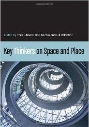
I was just reading the chapter on Benedict Anderson in “Key Thinkers on Space and Place1. Anderson forged the concept of a national imagination, the way nations are as much, or more, a construct of socio-cultural imaginings than physical topography or legal/political sovereignty.

However, this made me wonder whether this conception itself was very culturally specific, to what extent do people relate to nation as opposed to other areas.

I was reminded particularly of a conversation with, the much missed, Pierro Mussio. He explained to me the distinct nature of Italian cultural identity, which tends to focus on regional and local identity before national identity, partly because Italy itself is quite young as a nation state (a mere 150 years in a country which sees itself in terms of millennia). There is even a word “campanilismo”, which is literally relating to the “bell tower” (campanile) in a town, meaning one’s primary loyalties lie to that bell tower, that town, that community.

How do you see yourself? Are you British or Geordie, French or Parisian, American or New Yorker?

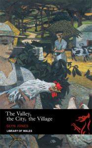
I know I see myself as ‘Welsh’. Wales is part of Britain, but my Britishness is secondary to Welshness. I was born and brought up in Bangor Street, Roath Park, Cardiff, but again while the street, area and city are foci of nostalgia, it is the Welshness which seems central. For Fiona she is Cumbrian (rather than Wetheral, English or British), Steve who is visiting is British, but says his brother would say Scottish, despite both having spent equal amounts of time in Scotland whilst growing up and since.

I asked people on Twitter and got a variety of answers2, most quite broad:

“I always think English rather than British but I don’t have a more specific area to identify with.”

“I think I primarily think of myself as both “Brit” & “northerner”. Lancastrian when differentiating myself from Yorkshire lot!”

“in decreasing granularity I’m a Devoner (south, of course!), west country-er, English, British, European, World-ean.”

Some less clear:

“I’m confused specially. I am Coloradan and American by birth, but feel more at home in England, and miss Scotland.”

“ooh, complicated. I’m British but not English. that’s as specific as I get.”

The last perhaps particularly interesting in its focus on what he is not!

Obviously the way we see ourselves varies.

The choice of a ‘level of granularity’ for location reminds me a little of the way in which we have some sort of typical level in a classification hierarchy (I think Lakoff writes about this); for example you can say “look at that bird”, but not “look at that mammal”, you have to say “look at that dog” or “look at that cat”. This also varies culturally including subcultures such as dog breeders – saying “look at that dog” in Crufts would hardy sound natural.

Some cities have specific words to refer to their natives: Glaswegian, Geordie, Londoner; others do not – I was brought up in Cardiff, but Cardiffian sounds odd. Does the presence of a word (Cumbrian, Welsh) make you more likely to see yourselves in those terms, or is it more that it is that, where cities have forged a strong sense of belonging, words naturally emerge … I sense a Sapir-Whorf moment!

Now-a-days this is even more contested as loyalties and identities can be part of networked communities that cut across national and topographical boundaries. In some way these new patterns of connection reinforce those focusing on human relations rather than physical space as defining countries and communities, but of course in far newer ways.

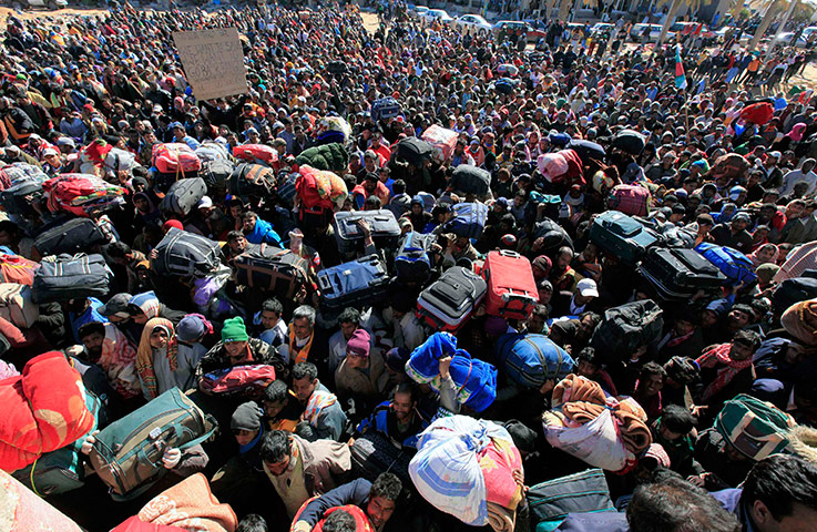
However, it also made me think of those parts of the world where there are large numbers of people with problematic statehood. There is how we see ourselves and how states see us. We tend to define democracy in terms of citizenship, and laud attempts, such as the Arab Spring, that give power to the people … but where ‘people’ means citizens. In Bahrain the Shite majority are citizens and therefore their views should be considered in terms of democracy, whereas the migrant workers in Libya fleeing the rebels in the early days of the recent Libyan war, or the Palestinians in Kuwait during the first Gulf War were not citizens and therefore marginalised.

Defining citizenship then becomes one of the most powerful methods of control. This has been used to powerful effect in Estonia leaving some who had lived the country for fifty years effectively stateless, and, while not leaving people stateless, in the UK new rules for electoral registration could leave up to 10 million, principally the young and the poor, voteless.

In the days of the nation state those with loyalties not tied to geography have always been problematic: Gypsies, Jews before the establishment of Israel, the various Saharan nomad trades. Many of these have been persecuted and continue to suffer across the world, and yet paradoxically in a networked world it seems possible that pan-national identity may one day become the norm.

  1. I’ve got 1st edition, but 2nd edition recently come out.[back]
  2. Many thanks for those who Tweeted responses.[back]

Maps in Textiles

Fiona pointed me to the wonderful web site of Valerie S. Goodwin, who creates quilts based on maps of real places and cartographic themes – stunning.


She also has a page listing other map-inspired artists, I visited a few and they were a joy too.  It is interesting that just as anodyne Google mapping is taking over the web, artists are reclaiming the medium and creating vibrant and individual images of real and imagined places.

Workflowy as CMS

Although this is a WordPress blog, the bookshelf section I added last week is generated from a Workflowy list that Fiona created. Now Workflowy is a collaborative list-making web application, not a CMS or database, and yet effectively we are using it as exactly that.

While at first this seems odd, in fact it is:

  1. practically useful – we now have an automated workflow
  2. good from an interaction design perspective – Fiona is using an interface of her choice and with which she is familiar
  3. interesting academically – as an example of semi-structured data integration

With a gathering library of both existing books relevant to the walk and new presents at Christmas, I had been meaning for some time to share them on-line; not difficult, just needing time to collate details, scan covers, etc..  So, a few weeks ago I gathered together a pile of books, and then Fiona went through them scanning the covers and typing up details.  We had been using Workflowy to share a to-do list for the walk as Fiona has become a great Workflowy fan1. It was quite natural therefore for Fiona to simply type the book details into the shared Workflowy list as sub-items under the ‘list’ task.

Having gathered these details, the next steps on the to do list were:

  • design web page (together)
  • populate web page (Fiona)

However, I realised that once the information had been copied into a web page if there were new books or edits, then either Fiona would have to do everything new straight into the web page, or try to keep her list and the web page in sync by hand. Perhaps we could use a more dedicated bibliographic tool such as Mendeley, Zotero or LibraryThing, but why use another interface when Fiona was already using one she was clearly comfortable with?

So, no new interface, no re-editing of data into a different system, no keeping web page and list views consistent by hand, instead the relevant portion of the Workflowy list is exported, copied into a Dropbox text file and then a web-based processor picks up the data from the Dropbox file and transforms it live into the bookshelf web page on this site.  Fiona only ever edits the list and has to do the initial copying into the Dropbox file, and then everything else is automatic.

In fact one of the research agendas I have during the walk is data integration; trying wherever possible to link together existing data sources, or where I am creating new data or new applications, to make them linkable, reusable, etc.  I have noted with interest existing applications that follow these principles, for example, Social Hiking for linking together social media as a record of expeditions, and PlaceBooks that allow the collection of different sources to make mini mobile guides to areas.


I am also interested in the use of semi-structured data, using data the ways people naturally enter it rather than force them to use some sort of standard format. For example, the HCI Book 3rd edition site is generated by using hidden web pages edited using Dreamweaver templates, but then stripping the data back out of those templates to be remixed in different ways on the site (e.g. showing exercises collected in a section of their own, but also under each chapter).

In the last few years I’ve also looked at extracting structured data from CSV and spreadsheet files and point and click ways to create semantic ‘screen scrapers’ for web pages.  Indeed the BookNotes mini-app that I will be using to share book reviews and personal page-by-page notes is also based on lightly annotated plain text files placed in Dropbox2.

Traditionally computing has created interfaces and asked people to use them, effectively adapting themselves to the system.  User-centred design tries to ensure that these interfaces are designed around the users’ understanding and often based on their existing work practices.  Where there is semi-structured data already, we have the ultimate end-point of this, to simply use the existing formats that people have evolved for themselves and let the computer do the work to transform them into formats useful for automatic processing.

So, this was an opportunity to practice what I preach (!), if Fiona chose to put data into Workflowy, than that should be the ‘golden data’ and everything else flow from that.

So … a couple of hundred lines of code later, it works!

There was one small change to the raw data format to make it parsable: Fiona had used commas to separate title, author, publisher, etc., perfectly human readable, but some titles and publishers had commas in them, so this was changed to ‘;’.  Also ‘blank’ fields were denoted by using ‘;;’  Otherwise everything was parsed exactly as Fiona had originally entered it, giving the page as it appears now.  If more books are added, or edits made, all that is needed is to re-export the list to the Dropbox file and everything else is automatic.

Basically there are four stages:

stage 1 parse workflowy

Workflow allows lists to be exported either as formatted HTML or plain text.  The plain text format was sufficient, and this is pasted into the shared Dropbox file.

A share URL can be obtained for the file and this is used to configure the first stage. This is then parsed (approx 100 lines of code) to generate an internal data structure, shown below formatted as JSON.

[{
    "title": "list (Fiona)",
    "note": [],
    "children": [{
        "title": "set 1 walking philosophical",
        "note": [],
        "children": [{
            "title": "A Field Guide to Getting Lost; Rebecca Solnit; 
Canongate; 2006; 9781841957456",
            "note": []
        }, {
            "title": "The Wild Places; Robert Macfarlane; Granta Books; 
2008; 9781847080189",
        ...

stage 2 parse book list

Stage 1 is completely generic, books and sections are just items.  The next stage further parses this to create lists of books. The presence of ‘children’ (sub-items) is used to decide the difference between a section and a book, and then the title line of each book entry is split on the semi-colons.  There is a little tidying of the title for items with ‘(DVD)’ (i.e. media is not a book!) and to split the main title from subtitles (before and after the first ‘:’, ‘-‘ or ‘(‘), and a ‘slug’ is obtained from the main title to match with the image file names.

The code for this is approximately another 100 lines.  The result of this phase is a book specific data structure:

{
  "books": [],
  "sections": [{
    "title": "walking philosophical",
    "note": [],
    "books": [{
      "title": "A Field Guide to Getting Lost",
      "format": "book",
      "author": "Rebecca Solnit",
      "publisher": "Canongate",
      "date": "2006",
      "isbn": "9781841957456",
      "slug": "afieldguidetogettinglost",
      "slugpath": "set_1_walkingphilosophical\/afieldguidetogettinglost",
      "isbn13": "9781841957456",
      "isbn10": "1841957453",
      "note": []
    }, {
      "title": "The Wild Places",
      "format": "book",
      "author": "Robert Macfarlane",

stage 3 format book list

It is then a simple matter to format the book data structure as HTML:

stage 4 embed book list

Finally the HTML is embedded into the WordPress post using a shortcode:

[embedurl url='https://alandix.com/exec/alanwalkswales/parse-workflowy.php?
url={dropbox url}&format=innerhtml' class='embedbooklist' /]

bells and whistles

There are a few extra elements.  If a 13 digit ISBN is provided an equivalent 10 character form is created where it exists; this is in order to be able to generate Amazon links.

Also books can have notes added (see “She Won’t Get Far Her Bag’s Too Heavy” on the bookshelf) using Workflowy’s standard feature to add notes to any item.  If any of the lines in the note have a special code (:tag:), then this is added to the fields in the book’s JSON data structure.  This means that extra bits of structured data can be added as required (for example, if we wanted to point to an external cover image).  In particular the Workflowy note for “She wont get far …” is as follows:

Wonderful romp of a book … although at 1 mile an hour in the early stages, not necessarily a physical romp! A plain speaking northern lass, sets out on the South West Path, never intending to travel the whole way round – makes me feel well planned.
:booknotes: http://www.meandeviation.com/booknotes/note/ewv5OlmRBfKgMjaLX7exsA
:isbn10: 1466219416

Note as well as the text of the note the extra tag with the url of my BookNotes for the book.

and now …

It probably didn’t take longer to code this up than it would have to copy the data into a web page and edit it, but even if it did take a little longer3, now I know that the book list data can be manipulated any way I like 🙂  In addition, the first stage will work if there are any other kinds of information that fits nicely into Workflowy’s hierarchical structure; I am sure we will reuse it. And the Workflowy folk say that an API will happen sometime, so maybe everything will be a list!

But of course I’m already looking at the stage 2 and 3 code and thinking, that is basically JSON transformation and formatting, surely that could be made more declarative and generic, maybe the whole pipeline could be made reusable as a tool.

Certainly I’ll make the stage 1 Workflowy to JSON part available if anyone else would like to use Workflowy as CMS … watch this space

  1. Workflowy is a ‘just’ an outliner / list editor, and yet does this simple job remarkably well.  I wasn’t a PC user at the time, but I’m pretty sure one of the successful features of Norton Sidekick in the late 1980s was exactly a mini-outliner, but can’t find anything on the web about it — obviously too long ago![back]
  2. See “Designing APIs and Designing Value for an Education Graph” for more on the design of BookNotes[back]
  3. Yea, and I guess it probably it did, but that’s what geeks do![back]

British Library georeferencing old maps

The British Library are asking the public to geo-reference their collection of maps.  Just as I’ve described about local maps in maps of the imagination and in the maps section of this site, even maps designed to be ‘accurate’ in their time differ from modern mapping.  This project asks members of the public to geo-reference these maps aligning control points on the old map with points in Google Earth.

Henry Graber of The Atlantic had a go, and describes the experience, and more about the project in his piece “Good Deed of the Day: Help Geo-Reference the British Library’s Map Collection“.  This is his alignment of an 1857 map of Alexandria:

Alexandria – old map from British Library collection superimposed on Google map

Even if you don’t do any geo-referencing of your own, while you are at the British Library site, take a peek at their Magnificent Maps exhibition, which most definitely lives up to its name.  It includes the Fra Mauro mappa mundii that is described in James Cowan’s “A Mapmaker’s Dream“, which I have referred to so much over the years.

Epiphany

As part of my preparation and I am sure while walking Wales I am thinking about all aspects of walking and journeys.  One aspect of this will be pilgrimages and the many journeys of the Bible.

This Sunday, Epiphany, January 6th, the twelfth day of Christmas, is traditionally when people think about the visit of the Three Wise Men to the stable in Bethlehem, with their gifts of gold, frankincense and myrrh.  I was on the rota to preach this Sunday, and so the journey of those seekers from the East, the Magi, one of four long journeys in the Christmas story, seemed the obvious topic.

I’ve fleshed out my notes “The Journey of the Magi“, and it is, I suppose, my first real writing as part of the Wales walk.   I am sure there are themes in there to which I will return, not least the idea of returning itself, of coming round full circle and yet not so much defined by where you have been as what you have become.

a walking Wales Christmas

I’ve already blogged about the hand-drawn map that Esther gave me for Christmas, and said that many of my Christmas presents were connected with the Wales walk … well here are the rest!

Most are books, some about walking, journeys and the coast, some about Wales and some to help me learn Welsh (I did some in school and even went to Urdd camp in Llangrannog one year, but really only a smattering).  I’ve not read any of them yet, except “The Valley, The City, The Village“, which is missing from the photo above as I am part way through reading to and it is by my bedside!  So hopefully I’ll have more to say about each when I get beyond their covers and flicking through.

Here and There: A Curious Collection from the Hand Drawn Maps Association. Kris Harzinkski.  A book about individual maps, like Esther’s, from back of the napkin sketches to works of art.

She Won’t Get Far Her Bag’s Too Heavy. Marie Stamp.  A woman’s walk around the South West Coast Path, with just her dog and a (heavy) rucksack.

Y Dylluan Oedd yn Ofni’r Tywyllwch. Jill Tomlinson (trans. Meinir Wyn Edwards).  A Welsh translation of “The Owl Who Was Afraid of the Dark“, which we read endlessly to the girls when they were little — hoping I can get my Welsh good enough to read this!

O! Tyn Y Gorchudd / The Life of Rebecca Jones. Angharad Price (trans. Lloyd Jones).  A prize winning short novel with parallel text in Welsh and English … somewhat more advanced language than “Y Dylluan Oedd yn Ofni’r Tywyllwch”!

The Island of Lost Maps: A True Story of Cartographic Crime. Miles Harvey.  The true story of a map thief.

The Girl Who Circumnavigated Fairyland in a Ship of Her Own Making. Catherynne M. Valente.  Well apart from being fairyland in a ship rather than Wales by foot … just like me.

Land’s Edge: A Coastal Memoir. Tim Winton.  A celebration of the shoreline.

Field Of Stars: A Story of the Road to Santiago. Susie Tarver.  This ancient pilgrim’s route from the South of France and across the North of Spain is one of the world’s great walks and a personal and spiritual journey as well as a physical challenge.

Gerald of Wales : The Journey Through Wales and the Description of Wales. L. Thorpe (trans.) The journal of Giraldus Cambrensis’ missionary journey through Wales in 1188.

The Lost Art of Walking: The History, Science, Philosophy, Literature, Theory and Practice of Pedestrianism. Geoff Nicholson.  A broad sweep through the idea of the walk.  In some way’s covering similar ground to Solnit’s “Wanderlust“, but I think Nicholson will be a little more down to earth and certainly a different perspective.

The Walk: Notes on a Romantic Image. Jeffrey C Robinson. A literary criticism of the literature of walking.  The book includes an afterword by Roger Gilbert, which describes how he was initially dismayed on hearing about Robinson’s book as it was a topic he was working on himself, but then was enchanted by the book when it arrived.  I looked up Gilbert’s web page and found that not only had he gone on to write about the literature of walking, but had co-edited a book “The Walker’s Literary Companion” with Robinson.

Clawdd Offa / Offa’s Dyke. Alun Wyn Bevan.  My own walk will start by going up Offa’s Dyke.  This short dual language booklet relates Bevan’s own walk along Offa’s Dyke and for me both a guide and more help with my Welsh.

Famous Songs of Wales: 1 / Caneuon Enwog Cymru. arr. John Hywel.   Famous Songs of Wales: 2 / Caneuon Enwog Cymru. arr. Sioned Webb.  To be Welsh is to sing!

Living Wild: The Ultimate Guide to Scouting and Fieldcraft. Bear Grylls. In case I find myself without a B&B in the wilds of Colwyn Bay and need a makeshift shelter of old fish and chip packets.  This book has already proved its worth, as I quoted from it at a church service last Sunday; as well as being an ex-SAS serviceman and Chief Scout, Grylls includes a short but direct account of the importance of spirituality to his life.

The Valley, The City, The Village. Glyn Jones.  A story of growing up into adulthood set in the Welsh valleys and through university in ‘the city’ (I think based on Aberystwyth).  Sometimes almost Dickensian in the detail of description, but with more the eye of a poet or indeed almost the artists eye of the protagonist. … and I needed to keep OED to hand as occasionally the English vocabulary is stretching 🙂

As well as these books and Esther’s map, I had some walking socks, a Cardiff Bay teacloth, a DVD of the BBC/OU series “The Story of Wales“, which we missed when it was on, and a little black iPod shuffle.  The iPod is for my training walks during the winter and Fiona also downloaded the lessons at Say Something in Welsh for me to listen to whilst walking 🙂