Day 94 – Port Talbot to Porthcawl

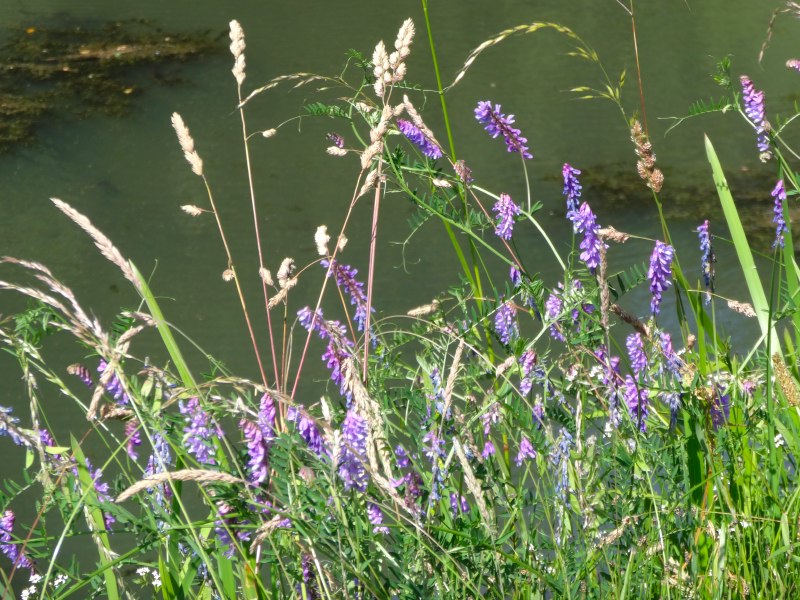
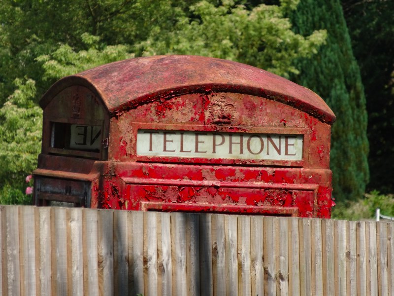
a beach under threat and childhood memories

20th July 2013

miles completed: 1011
miles to go:  47

2013-07-20 13.41.46
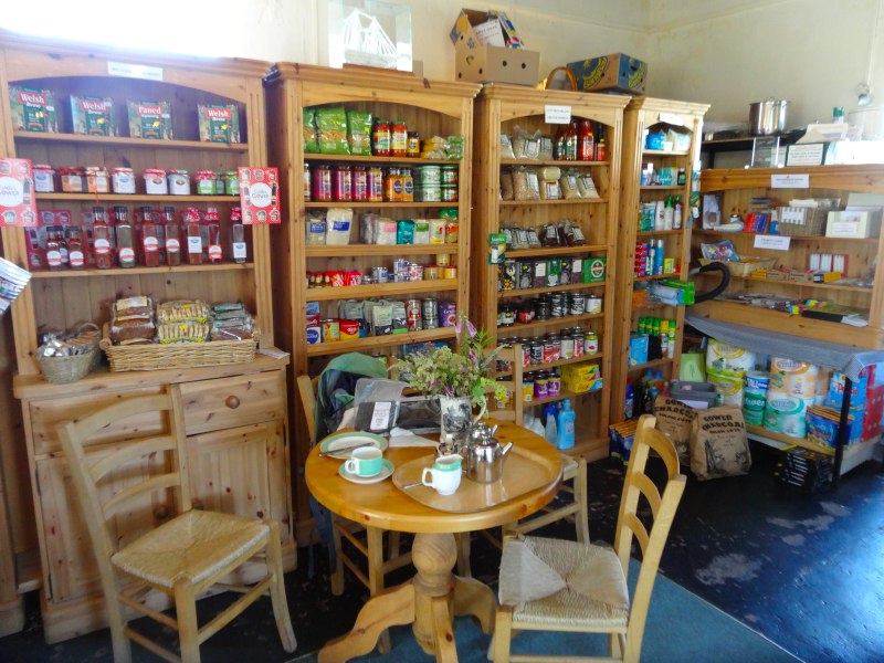
I start the day at Aberavon and the Best Western Beach Hotel. I have never managed to get the WiFi to work, but they do a good breakfast. The man on the table next door asks about laverbread. The waitress, I think Trixie, is a German lady who has been married to a Welshman for eighteen years and lived in Wales for eight, and so speaks in a curious mixture, where some phrases come out solidly German, some Welsh, but nothing in between. She goes to the kitchen, but there is none. She explains that they used to keep it in regularly, but that few people ate it and so it was always wasted.

From Aberavon, I drive through Port Talbot past the station where I finished the night before, and then am directed up the most unlikely side street to join the M4, which takes me to Porthcawl.

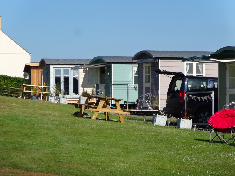
The ‘cawl’ in Porthcawl is Welsh for soup, referring to the appearance of the sea, boiling soup on a stormy night. However, there is no sign of that, nor of foam, when I arrive at the Foam Edge Guest House. I don’t suppose there is much surfing either at Rest Bay, just ten minutes’ walk further along the sea front, although the land in front of the car park is evidently a Gypsy camp now according to Helen, the Foam Edge landlady.

{{Helen} also tells me the way to the bus station. I would have walked back along the sea front and then up the high street, but in fact the main streets of Porthcawl, forced by the sea, form a triangle, and I walk there, through the Porthcawl suburbs, along the third side of the triangle.

I pass a large house with construction work in progress, a lady is peeking through the windows, and we discuss it.

"Maybe it is going to be a bed and breakfast," I suggest.

"No, this area’s too posh for that," she replies, "out of my league."

It is 1930s-semi posh, not Kensington posh, but it would be fascinating to compare house prices here, with similar semis on the main street of Margam, where I will walk later, or in the Gower.

In the gutter I spot half a pair of false teeth and the day suddenly takes on a surreal air, but, down to earth, someone is going to be very unhappy when they realise they are missing.

I have half an hour to wait for the bus and, while I wait in the shade of a tree, Kathy, one of the Save Morfa Beach campaigners, rings me and we arrange where to meet in Margam.

On the bus I learn that today is the day of the Porthcawl carnival, the buses later in the day will be diverted as the procession goes up the high street and ends up at a playing field where a fair has already been set up. I’m sorry to have missed the carnival, if Id realised I could have taken this day as my writing day and walked on Sunday; however, I think that maybe I could visit the fair that evening and eat fair food for tea.

The bus goes inland through various small villages, and then joins the main road through Margam to Port Talbot, where I will be walking in a few hours.

The houses of Margam start off as 1930s semis and I spot the Twelve Knights, where I am to meet Kathy and Nigel. I note where it is as the official Coast Path route passes slightly behind the main street and so I’ll need to make sure I come up on to the main street at the right point.

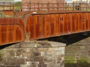
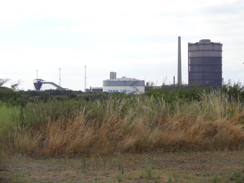
Margam is a ribbon development, a few streets either side of the main road. The normal reason for ribbon development is the road itself, but here I think it is more that there is only a narrow strip of land between the massive Margam Steel Works and the hills rising behind.

As we travel further west though Margam, towards Port Talbot, the semis give way to Victorian terraces, reminding me that the industry has been here for a long time. South Wales was the powerhouse of industrial development for hundreds of years. The Swansea area was ‘Copperopolis‘, when copper, to line ships’ hulls, was one of the crucial materials, making international trade, conquest and colonisation possible. Later tin and steel production became more crucial for railways and for war.

The terrace looks so familiar with its small bay windows and vestigial front yards.  My own street in Cardiff, Bangor Street, had clearly been slightly superior in Victorian times, as the houses were slightly bigger, but this looked just like all the other streets clustered around Roath Park when I was little, and indeed across much of Wales. There is a very slightly green-grey gritstone that was used as a cladding, which you can find elsewhere in the UK, but is particularly ubiquitous in Wales, even as far north as Harlech. I am sure I heard something about its origins, but can’t recall.

However, there are also local variations, due, I guess, to different architects, and different constraints of sites.  The bus passes an old lady standing outside her house, and through the open door I see a china-covered dresser, almost as if I were looking in on a cottage from centuries back.  As I pass more houses I see that the gap between front door and the start of the bay is slightly larger than I am used to, allowing a wider hallway, wide enough for a dresser.

Although I have been in houses with wide hallways, I don’t recall any Cardiff terraces with halls wide enough for furniture, even those with more substantial houses, like Bangor Street, or the three-storey houses facing the parks of Roath Park. I wonder if this was a whim of the architect, or whether it reflected a local concern of the time. Maybe the people would have preferred a slightly more spacious front room.

Thinking of those front rooms, I recall that we used our front room as a living room, with the settee and television. This may have been because we used the house for half-board guests and so used the back room as a dining room, albeit with small armchairs by the fire as well. However, in many of the houses I visited, especially those of older folk, the front room was reserved for special occasions. Traditionally this would have had the best furniture, the best pictures and ornaments, and be kept spotlessly cleaned, but only used a few times a year for weddings, funerals, or very special guests.

I recall especially Mrs Jefferies‘ house, on one of the smaller terraces, but still, like these Margam houses, one with a vestigial front yard, not one of those opening directly onto the street. Over time, and as lives changed, the front room became slightly less pristine, and filled with her husband’s post-retirement artwork, initially painting-by-numbers, but later his own compositions. However, we never used it for sitting in when we visited, instead going into the tiny back room that housed armchairs as well as the dining table and acted as thoroughfare between hallway and back-kitchen.

Thinking about it, I see the same pattern today when I have visited Nadeem‘s mother’s house in Birmingham, part of the Kashmiri community there. I think the very first time I visited, Nad and I were given a meal in the front room, served by the women of the household, as I was the visiting professor. But later, as I became more familiar, I have always gone straight to the back room.

The driver gave me directions to Bath Street as I got off the bus, and I set off there to visit Margaret, the aunt of my Canadian nieces. I hadn’t worked out the exact relationship before and only talked on the phone when Janet and Sian (two of the nieces) had visited. It turns out Margaret is the sister of Glenda, my half-brother Robert‘s wife; Glenda and Robert both died some years back. Robert was from my Dad‘s first marriage and more than 20 years older than me. Glenda had her first child only a year or so after Mum had Jackie and me, and she and Mum were close friends until the family emigrated to Canada when I was five. I recall being heartbroken at their leaving, which in those days was far more complete separation than today with budget airlines, cheap phone calls and Skype.

Margaret‘s house is another terrace, of the opening onto the street kind, but relatively substantial inside, with an unusual curved corner wall to prevent a sharp corner where the passage goes round the stairs. We go into the back room (of course) and Margaret gives me a mug of tea and a chocolate biscuit and we talk partly about family, and how she can remember seeing me as a small boy (almost certainly four or five years old). She also starts to give me the background on Morfa Beach.  The beach is part of the childhood of everyone from Port Talbot and Margam, in days past.

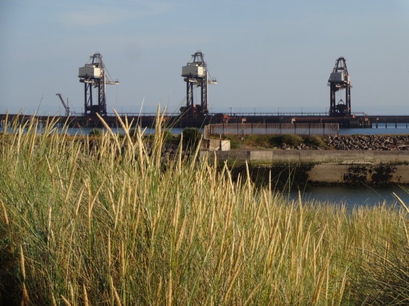
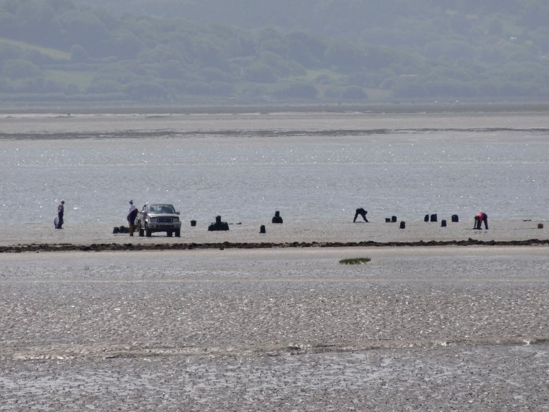
The plant would have originally been in private hands, until it was nationalised when the steel industry collapsed, I think in the 1960s, then privatised by Thatcher in the 1980s, because she didn’t like any government including her own, and then was taken over by Tata, the Indian steel giant, a few years ago. As a multinational, Tata is seeking to make the most of its assets, and, so it is rumoured, would like this to include open mining the exposed coal seam below the dunes behind the beach. Restricting access to the beach by seeking to close a public footpath is one step towards this.

We could have gone on talking for ages, but I have arranged to meet Kathy and Nigel at 2pm, and not too long after 1pm I leave.

2013-07-20 13.34.15
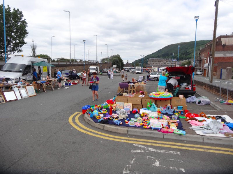
Port Talbot high street on  a Saturday lunchtime is not heaving with shoppers. I pass the Gateway Bookshop, and notice a booklet about the Aberavon 1893 ship disaster, so nip in to add to my piles of books and pamphlets to read. I also nip to walk through the car park behind the high street as there had been a street market, but clearly just a morning market as only a few stalls still open.

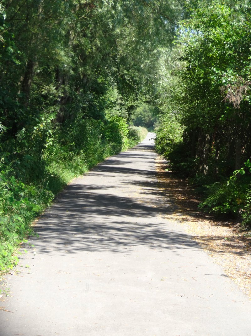
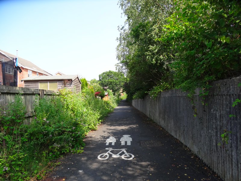
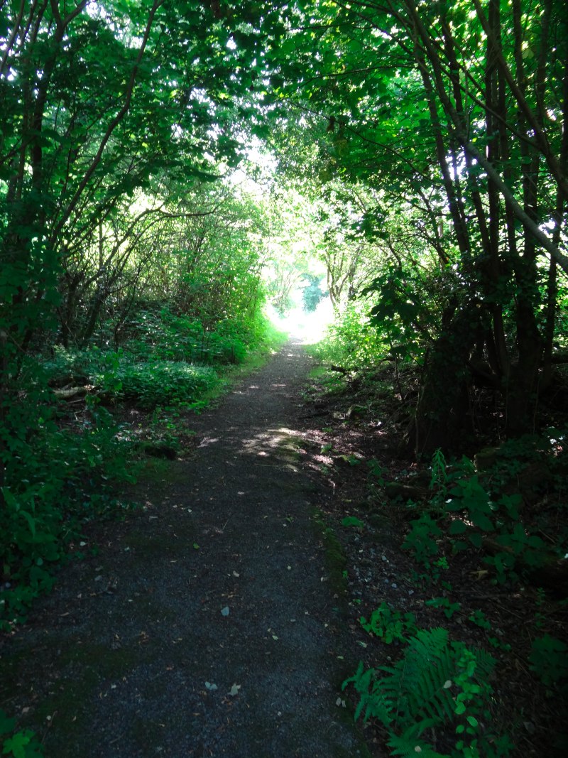
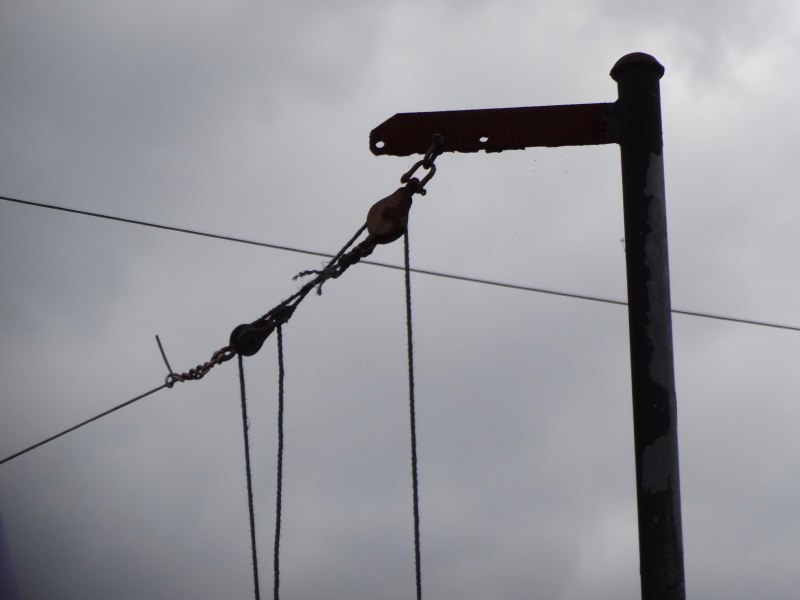
Port Talbot high street continues along the main road, which eventually stops being Port Talbot‘s main road and becomes Taibach and then Margam. The Coast Path is signposted along alleyways and lanes behind the main road and I swap back and forth. On one hand the main road gives a sense of progression, the different styles of housing. But the alleyways have their own interest, just as you can see people’s washing hanging colourfully from metal posts with pulley systems, that I recall so well from my own backyard on Bangor Street, in some way it is as if all the dirty laundry of life is exposed in the backyards.

2013-07-20 13.42.46They remind me of the lanes I used to walk with Jackie every day through infant and junior school. In the first years we walked with Mum. I still recall the day I got confused and left school at the afternoon break with a long, long wait by the gates. However, at an age that would seem negligent nowadays, Jackie and I walked together through the lanes that could be dim even at four o’clock on a winter afternoon, across three roads to school, with only a lollypop lady on the very last crossing.

I pass Port Talbot Arts Centre, which does not look very active, the substantial parish church, the memorial gardens and a vast disused chapel that looks perfect for a horror movie film set. I ignore the large painted words ‘snack bar’ with arrows along the walls; is this vestigial signage, or is the snack bar still there serving sausage sarnies? Maybe if I wasn’t late for a meeting …

Then a car pulls up and a lady says, "Alan?".

It is Kathy, she had guessed Margaret and I would have chatted on a bit, so was just taking a quick spin down to Taibach where she had been brought up: "a trip down memory lane," she says.

Into Margam I pass a motorcycle shop, with toddlers’ push bikes in one side of the window, the Catholic church, houses with wonderfully Italianate porches, the police speed camera van and two extremely battered four-by-fours. As I photograph an interesting patch of wall (well it had little ferns growing out of it), a man sees my backpack and asks about the walk. I tell him that I’m about to meet the Save Morfa Beach people.

"I used to be in that," he said, "but it was all talk and no action."

I will learn more later, but I guess the slow grinding process of public enquiries must be frustrating. However, he does care about it as he tells me about how he used to go down when he was little, and how much it is part of his life.

2013-07-20 14.13.28

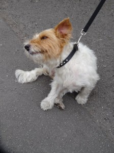
He also tells me about another local issue that I had heard mentioned before, pollution from Tata. As a child I recall the stench passing Port Talbot.  Nowadays the sulphur and other smells have been greatly reduced, but since Tata have taken over, the residents feel that sooty emissions have grown. He points out an air monitor across the road. It is a nondescript grey metal box and I would have passed it by without noticing.

The man points to his dog’s off-white feet.

"I wash them every day and within a few hours they are grey," he tells me.

I take a photograph of a small dog’s paws as evidence.

2013-07-20 14.18.55
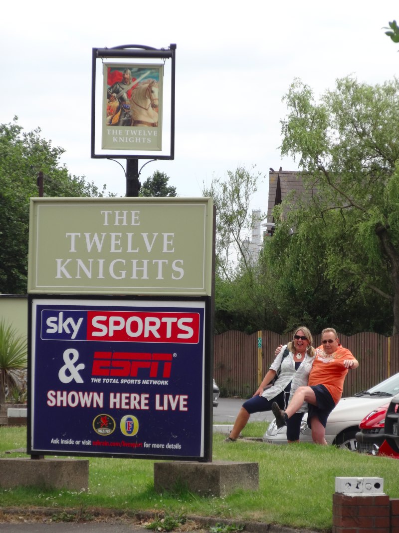
A few minutes later I spot the sign of the Twelve Knights and below it Kathy and Nigel waiting, their boots pushed forward as if to take a large step as I photograph them, the pub sign above and steelworks in the background.

Nigel suggests a Welsh liquid lunch and I do not disagree, so we sit a while in the Twelve Knights as they tell me about the history of the campaign to save the beach. Evidently Tata can be heavy handed with employees as well as the local community, but are a large local employer, well really the local employer, so have a lot of leverage with the council and government.

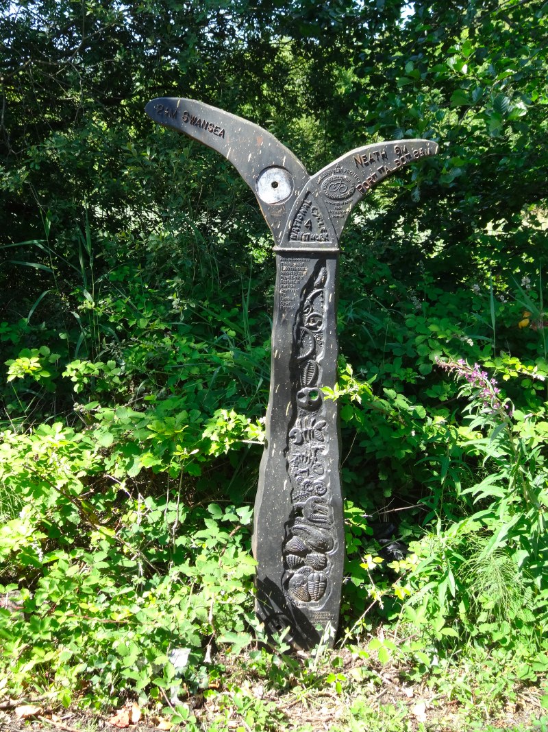
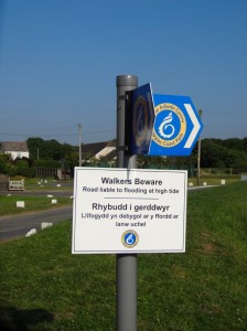
The footpath in question cuts for a mile directly from the main road to the beach, and is not only an official public right of way, but is also well used, and has been for generations, as I’ve already found, a part of the childhood and adult memory of every one I speak to.

However, it is not just the footpath itself, but Tata would like all access to the beach below the plant to be restricted. Indeed, the Tata security patrols often intercept people walking down the path, and have been known to ‘bring people in’, which is strictly kidnap, but evidently many of the security guards are not licensed and do not wear name badges, and so are either not aware or don’t care about the niceties of the law.

At a time when the Wales Coast Path is being promoted as the USP of Welsh tourism, it seems unbelievable that shutting off two miles of beach could even be considered. Yet, due I guess to Tata‘s economic leverage, it is. There is a public enquiry soon. Of course Tata‘s legal muscle will far exceed that of the campaign group and, for that matter the council, so the unbelievable may not be impossible, and yet I hope sense will prevail.

After a while Kathy goes to pick up her husband Rob, who has been walking that morning, and he joins us for a while. It turns out that Rob worked for CCW until two years ago, and was responsible for implementing the Wales Coast Path.  Now he works for a charity to promote the coast, from what I can gather, enjoying working wholeheartedly for the good of walkers, community and local business, outside the politics of government.

While we are talking one of the bar staff, Amber, approaches. When we’d first come in the lad behind the bar had heard us talking or seen the bag and I’d given him a leaflet. Amber asked if she could take a few more. It turned out her mother used to be a director of Tenovus and is now a director of a charity in Merthyr Tydfil promoting literature and poetry.

Nigel has to leave to pick up his daughter, so Kathy, Rob and I set off to follow the path down to the sea.

2013-07-20 15.22.56
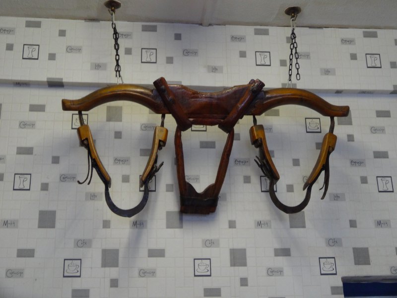
However, first of all I need a little non-liquid lunch to eat along the way and so pop into Tambini’s Express Café. I choose a pie, from a local butcher, which the proprietor, I assume Mr Tambini, does not let me pay for when he learns about the walk. As I wait for it to warm I see a yoke hung on the wall, which looks unusual; I ask if it is an ox yoke.

"Yes," he says, "it was my grandfather’s, he brought it with him from Italy".

Many Italian ex-POWs stayed in Wales after the war, but Tambini‘s grandfather came over far earlier than that, maybe simply for economic reasons, or maybe after the rise of Mussolini.

As I start to eat my pie, we pass a church. It is evidently from a small village that was flattened during the building of the M4, but the church was preserved and taken brick by brick and reconstructed here.

A short way further is a roundabout, and the Wales Coast Path is signposted towards the sea, initially following the same route as the disputed footpath. We cross the railway. I have crossed railways many times during the walk, and have got used to the ‘stop look, listen’ signs on unmanned and ungated crossings, but then realise that this is the main line, with high speed trains.

2013-07-20 16.10.01One of the arguments that Tata raise for the abolition of the footpath is safety. However, this crossing, the dangerous part, would not be shut off and indeed is part of the Wales Coast Path. As I have seen, the WCP route is extremely risk averse, keeping off even minor roads whenever possible. Back at the Twelve Knights, Nigel told me that there have never been any serious accidents at this crossing in all the years that people have walked it and, in the past, even driven cars down the path to the beach.

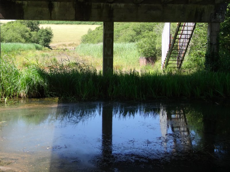
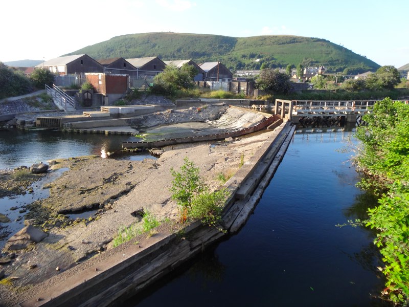
Just after the rail crossing, the Wales Coast Path route turns left to skirt around the back of an area used by Tata for industrial landfill, and Nigel leaves us to follow this as his car is in that direction from his previous walk.   Kathy and I continue to the beach.

Just before the beach the path goes round a small building, which was built directly in its line. Evidently Tata did obtain permission to divert the path around it, but this may have been retrospective. Given there are large tracts of land either side of the path, the site seems a little perverse to say the least.

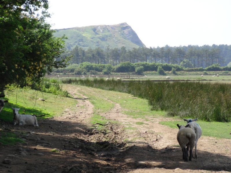
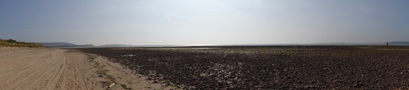
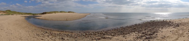
The beach stretches for two miles to the north-west below the plant and for another mile, the route I will follow, to the south-east until it meets the SSI of Kenfig Burrows.

At this point Kathy tells me more stories and reminiscences about the path, but then has to turn back herself, leaving me to walk the coast.

2013-07-20 16.43.06
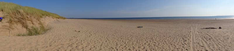
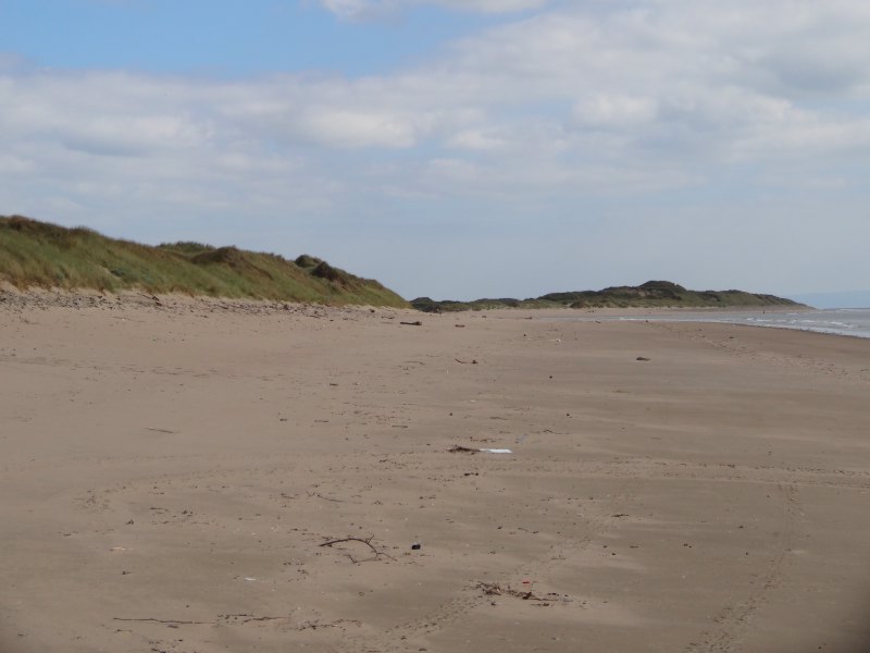
For the first few hundred yards south-east of the footpath, Morfa beach is backed by sea defences, huge boulders placed there in British Steel time, to protect the land behind, but beyond that there is just dune and sand.

Again, I cannot believe that closing three miles of long sandy beach is even considered.

2013-07-20 16.45.41The sand high on the beach is very dry, only the very highest storm tides sweep right up the beach, but I guess to run the Coast Path along here would have needed permission from Tata for a path just above the sea defences and high water mark, which of course they wouldn’t have given. However, in other places there are high and low water routes, so I wonder if the local council, who are responsible for the Coast Path in the area, simply positioned it to avoid conflict.

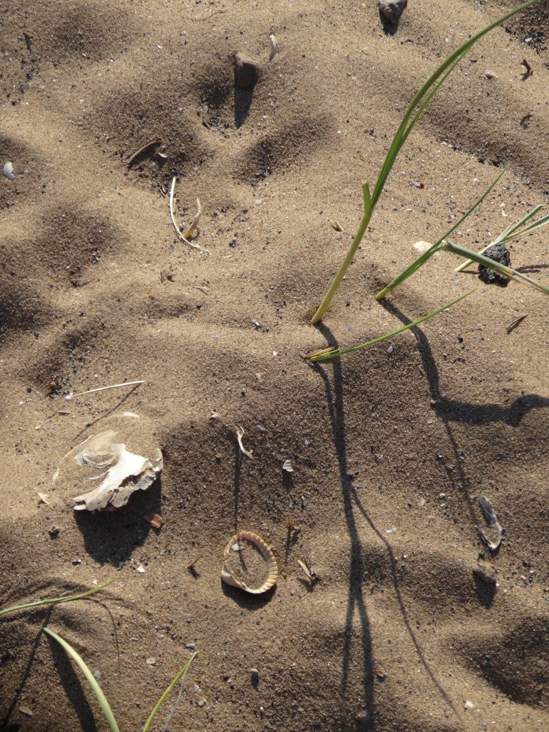
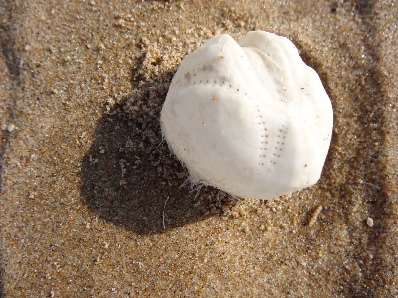
The previous day, on Aberavon beach, I had seen my first washed up cuttlefish bone. I had seen them before, but never actually found one in the sand. On Morfa beach it is almost as if a cuttlefish fish bone boat had been lost at sea spilling its cargo along the waterline.

2013-07-20 16.55.12
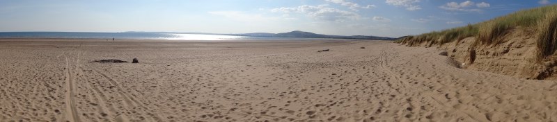
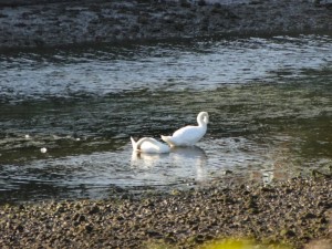
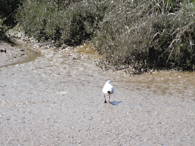
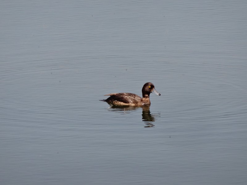
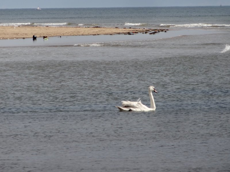
At the river between Morfa Beach and Kenfig, a family are camped on the beach, mother and father, or maybe grandparents, simply taking in sun and a boy in a makeshift tent of driftwood and flotsam covered in towels. On the river itself a lone swan swims downstream and out to sea; I have never seen a swan at sea before.

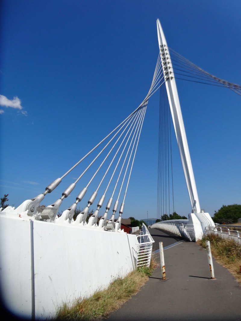
I could wade the small river where spreads not the sea, even now at high tide, but instead head along the riverside, to find where the official Coast Path route meets the river and crosses it at the newly made footbridge.

2013-07-20 16.56.32

2013-07-20 16.56.42

Going upriver I catch glimpses of the large area of churned sand where there is industrial landfill from the plant, but then see this much more clearly as I meet the Coast Path as it has been taking its scenic route skirting the landfill on its north-eastern edge.

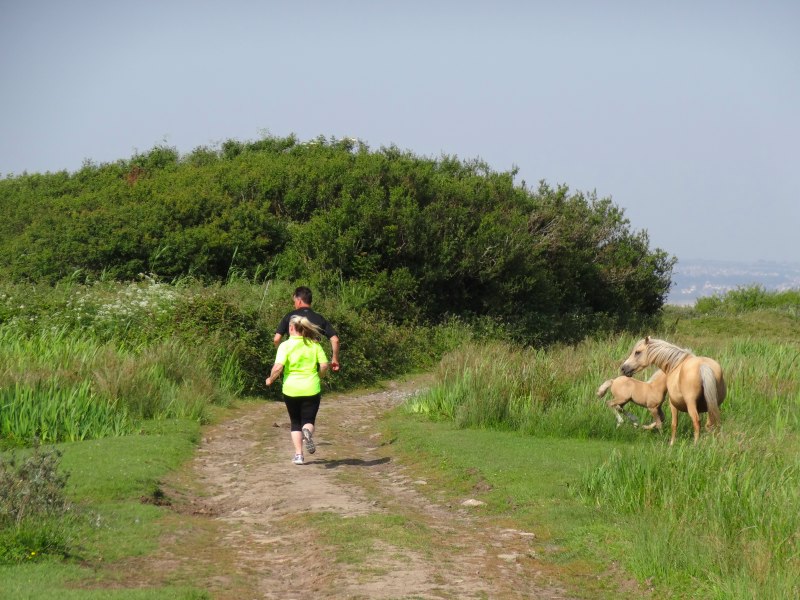
Once over the bridge, the path follows behind the dunes along a well-used track.  However, I cut across the dunes to the sea from where you can walk virtually the whole way to Porthcawl on the beach.

2013-07-20 17.42.26I see my first nudists, or maybe just skinny dippers, of the trip, despite walking at least two nudist beaches that I know of. They are two men, in their 60s, one, facing me, had been putting on shorts as I approached, the other, with his back to me, stood bare cheeked.

A bit further on, (far enough not to be in clear sight!) two teenage girls are manhandling vast inflated rings in dayglo colours. The beach here is backed by the dunes of Kenfig Burrows, but then, before the sand, shelves of storm-tossed stones. It is this pebble assault course that they are negotiating, but by the time I get to them they are sitting on the edge of the pebbles. I wonder if the rings are for swimming or as seats if the stones get too uncomfortable. They say that they are for swimming later, and I am tempted to warn them of dangers of currents, offshore wind, etc., but realise that out here, they must be locals and well used to the sea. However, as I write I also realise it is the kind of thing my Dad would have said.

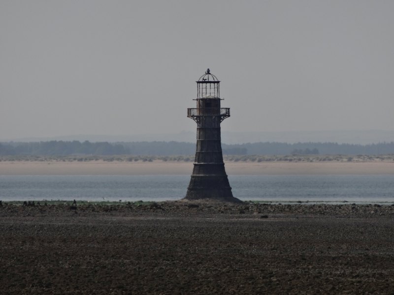
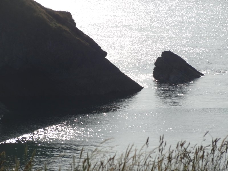
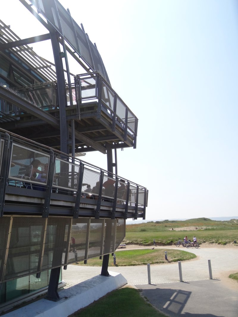
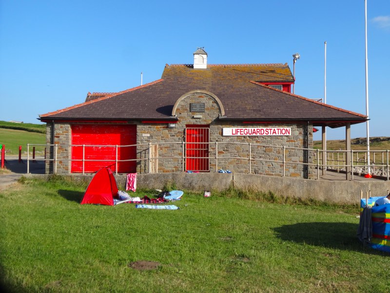
As the steelworks recedes behind me the first signs of Rest Bay, the western end of Porthcawl, appear, a scatter of houses, the large building, ‘The Rest‘, that I thought was the golf club house, and before that a low rocky headland.

2013-07-20 17.55.07
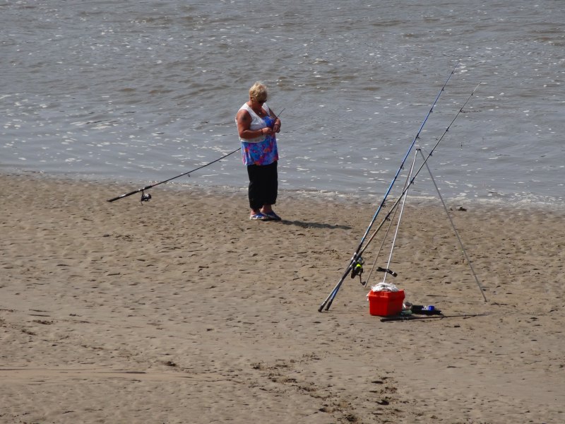
Gradually they become closer and as I get to the beach close to the headland, Sker Beach, more people appear, sunbathing, splashing in the water and, some, positioned at a distance from the splashers, with rods on the sand, lines cast out to sea.

The path then runs across flat grassy headland, with the Royal Porthcawl Golf Course in the dunes behind. I see yellow painted Sker House and its sister ruinous house nearby and ‘The Rest‘ about a mile away ahead. I chat to an angler who tells me Sker Beach is his favourite place for fishing, but he hadn’t been lucky this day. He also tells me about Rob Bowen who runs kenfig.org, a local history site. I double check the name as it was Rob Owen who I had been with earlier in the day, but clearly different people.

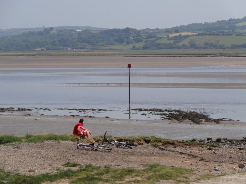
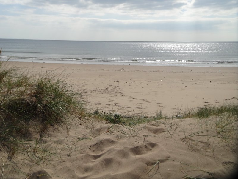
As I get closer to Rest Bay, the path becomes more constructed, with decking to prevent erosion on a sandy part and tarmaced closer still, until eventually I come to it, scene of so many childhood memories, except it is so much smaller than I recall. I think this is partly because the tide is in, so that its boundaries are set by the rocky outcrops below the golf club house, a substantial wooden structure, but not the vast edifice of The Rest. However, while I have visited Rest Bay once or twice since, my main memories will be as a small child. I recall, when cycling the coast to coast with Miriam, when we passed a familiar place from her childhood, her main remark was how small it was now.

2013-07-20 18.51.01Rest Bay is all waves and rock pools and on the far flung edge of Porthcawl. There was always a large grassy car park behind the beach, and we would park and often picnic near the car where Dad would bring out a little Gaz stove with a tin box that acted as windbreak, and brew tea to go with chicken drumsticks and bananas (both treats). If the day was not as warm or dry as expected, there was a plank that fitted on brackets he had made either side of the back seat so that Jackie and I would sit with our own private table at the back of the car, while Dad and Mum ate in the front.

I recall one day, on the other side of the channel, I guess having visited Burnham, when Dad suddenly remembered he hadn’t put the plank away. He had taken it out, popped it temporarily on the top of the car, and then driven off.  Presumably somewhere along the way it had flown off onto the road. He had been wondering why people had been flashing their headlights at him. The Gaz stove went a similar way, we had been having a picnic on the way back from a holiday in St Ives, and he had made tea as usual; it was only at the next tea stop he realised that the stove had been left at the previous car park.

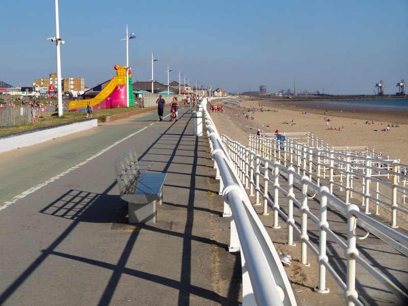
The final part of the Coast Path leads into Porthcawl proper along the cycle route beside the road to the prom. However, there are multiple sandy paths along the grass-covered limestone heath and rocky sea edge. For once, I was not in a hurry, so took the most meandering route to Foam Edge and then on into town where I had an Indian meal (the only thing open for food). On the way into town I passed four young tourists taking photographs, jumping up with arms outstretched, then on the way back, somewhat darker, at the same spot, the same group, doing similar hands stretched photos. I asked if they had been there all along. They were foreign, maybe even Latin American, so it took a while to communicate, but when they understood I left them laughing loudly at the idea.

Day 93 – Swansea to Port Talbot

surprised by nature behind the busy streets and Stallone on the waterside, faint childhood memories and grand hotels

19th July 2013

miles completed: 1002
miles to go:  56

2013-07-19 09.16.41I get going early, but final moving on preparations always take a little longer than I plan: emptying the toilet, throwing out the rubbish, turning off electricity and gas, driving off and retrieving the levelling blocks, and generally putting things places they won’t fly off the first time the van turns a corner.

I had planned to be waiting outside the Three Cliffs Café at West Cliff at the stroke of nine, but it was in fact half past, not too badly delayed, when I got there, parked in the National Trust car park and went in for another breakfast.

I thought I’d asked for no cockle and laverbread parcels, but when the plate came they were there. The waitress helpfully got me a second plate, and I resolved to eat them first. The waitress suggested eating them with tomato ketchup. "That’s how I first learnt to eat them," she said.

I did one better and ate them with the cooked tomato, which is never my favourite item anyway, and I only say yes to as I know they are good for me. I was expecting some intense sea-food flavour, but in fact it was much more subtle, although not something I could eat quickly, especially with a fork in one hand and  a computer in the other.

When I had been in the other day, the waiter had said that they had WiFi, and that it was fast. He had been true to his word: in all my journeys, I have never seen Flickr suck up photos so quickly. I was probably there an hour and half in the end, slowly eating my breakfast whilst uploading photos and blog entries, and in that time all my backlog of seven or eight days photos had been uploaded.

And so on, to Aberavon and the Best Western Beach Hotel, which appears to be the only beach-front accommodation. The TripAdvisor reports were almost all very positive, but all said, "better on the inside than it looked from the outside." The outside is a motley collection of rectangular 1970s yellow brick, lumps stuck together, with even the sign somewhat apologetically placed at a far corner of the property as if it were too ashamed to be placed closer.

Men in suits, women of sizeable proportions, in bright coloured dresses of various lengths and cuts, and a small girl in a long white lacy bridesmaid dress, rendered the signs saying ‘wedding breakfast’ almost redundant. The reception was also to be held in the hotel, and a sign warned that there may be some delays in service later due to a major function.

In fact, when I did get food there later, I noticed no delay, maybe because they had moved from eating to party mode by then. In general, the TripAdvisor reports are absolutely right, everyone in the hotel was very friendly and the service and food were good.

2013-07-19 12.57.03I asked about buses to Swansea and was directed down the road to the Labour club, or to give it it’s full name ‘Seaside Social & Labour Club‘. The receptionist described it as a "big grey building", and I had imagined concrete, like a miniature version of the Swansea Civic Centre, but instead it is clad with grey coloured, sheet metal section that I would expect to see on the roof of an industrial warehouse. In a different location I would imagine it was a converted commercial building, but here, in the middle of a residential area, it must have been purpose built; I assume it was just the cheapest material at the time, or maybe even some sort of modernist cachet.

2013-07-19 14.38.13

Going back from the seafront towards the Labour club one is instantly in the land of budget supermarkets and council house estates, built to house the steel workers in the 1960s and 1970s. I’d guess many are privately owned nowadays.

The bus goes into the heart of Swansea, but has a stop virtually beside the Waterfront Premier Inn and its bar where I had stopped on Tuesday. Hot and sticky from the bus ride, I stop in the shade of the bar long enough to drink a half pint and iced water, and set off; it’s already 2:30 by this time.

2013-07-19 14.50.16From the map, I was expecting a long walk through back streets and along the side of the main road, and indeed it started that way, before turning slightly away from the road (not well signed) past the park-and-ride car park (day parking only, otherwise it would have been a good place for walking from) and port area, with a McDonald’s and Ibis visible through the trees, then over the main road on a new (millennium?) footbridge, and then a few hundred yards of back streets, before setting off along a footpath that I assume may have once been some sort of small industrial roadway.

The vegetation is initially that wildlife rich scrubland, typical of mature waste ground, maybe cleared industrial ground or simply in-between.

There is the tree-muffled sound of traffic and the occasional faint, sweet yet acrid odour from the landfill, though the latter I would probably not have recognised if not for the large sign before I entered the path. But apart from these you could be anywhere deep in the countryside, and as the path progressed, moved further north from the road and no longer downwind of the landfill, even these faint traces disappear; so at first you are wandering through a woodland path, and then past wetlands, and then on an old canal-side path, but all on wide, well-made-up tarmac or gravel cycle paths. The occasional bicycle does pass me, but no other walkers.

2013-07-19 15.11.45 2013-07-19 15.12.02 2013-07-19 15.12.35 2013-07-19 15.19.12

At one point the canal is covered by a wide concrete structure, more like a 1970s veranda than a bridge, with only metal steps on the far side of the canal, and on my side, no access, simply continuing to my right until it joins a bank, and I assume continues as a wide concrete road on the higher ground beyond. Maybe this was some sort of loading/unloading point for the canal. A few pieces of broken brickwork litter the ground, I assume part of a long collapsed wall, but if so most of it has long since gone. On one piece, the size of a small table, is a blackened, fire-burnt patch as if it were an altar to the god of lost places.

2013-07-19 15.36.12 2013-07-19 15.36.39 2013-07-19 15.37.14 2013-07-19 15.37.26

Soon after this the path does join the road, first a minor road for a mile, past a hotel called ‘The Towers‘ with a red brick windowed tower in its grounds. Without the windows I would have thought it a Victorian water tower, but as it is, maybe simply a folly.

2013-07-19 15.49.47At the end of this road is a large roundabout and you follow the footpath along the main A48. Almost instantly there is a road sign telling the cars that the turnoff for the M4 is in 1/2 mile, and I know the bridge I will cross is only a  little further, but it is a long half mile and then perhaps another half mile beyond that to the bridge itself.

Before getting to the turnoff there is a layby and in it a solar powered rubbish bin. Yes, really. The power of ‘BigBelly Solar‘ is used to compact the rubbish, a perfect use of solar power, heavily geared (whether physical or electronic I don’t know) to generate high pressure but very slowly, meaning the bin does not have to be emptied as often, saving energy in driving a van to collect it. But I guess there is an alternative narrative, of technology replacing the labour of the bin-men.

2013-07-19 16.12.33As the M4 turn-off approaches, there are the usual countdown signs, but for some reason just ‘III’ and ‘I’, the two-hundred-yard sign is missing. Just before I would need to cross the slip lane there is an underpass taking me to the other side of the road with spectacular views of the underside of the flyovers leading to the motorway bridge, a forest of concrete trunks, and a sign to the 6th and 14th Tee of a golf course that is divided by the A48.

Passing under the motorway bridge is wonderful, a few moments’ shade from the sun.

2013-07-19 16.22.01The A48 bridge is not in the same league as the Severn Bridge, but does give views over the River Neath both upstream towards the hills of the Neath Valley and downstream past industrial buildings, power station, recycling centre and the old, disused docks. The docks were evidently another creation of Brunel and included a ‘floating lock’ with an unusual hydraulic mechanism that you pass further towards the sea. There are attempts to preserve and restore this unique piece of industrial heritage.

The turn-off to go along the river is at a roundabout, where there is a choice, either to go along the river to the sea and Aberavon prom, or a ‘high level route’ that bypasses Aberavon and Port Talbot. The latter is the ‘scenic’ route, but I have found that I learn more as the Coast Path travels close to people, with all the industrial and residential messiness that this brings with it. The signposting at the roundabout shows both routes, but is very confusing; I am glad of the map, as I turn past the industrial area towards the river bank.

2013-07-19 16.27.48  2013-07-19 16.28.18 2013-07-19 16.31.31 2013-07-19 16.31.43

I pass a Stallone-like figure, bare torso and chest like steel plates, with a dark dog, like an Alsatian, but more snub-nosed. As I go on the dog follows me and comes round. I offer it the backs of my fist-clenched hands to smell. I should note that the fists are there not to hit the dog, but because you don’t want to offer fingers anywhere near the teeth of a dog you don’t know. I talk to him and his eyes look inquisitive and friendly. The man vainly calls the dog back, and eventually it responds. He explains that it is an Alsatian/Rottweiler cross and some people find it frightening, but it is really very gentle. This was clear, although maybe the fear is not totally misplaced, as it turns out it is also a guard dog, and is a very different creature if an intruder tries to come into its guarded territory after dark.

2013-07-19 17.15.51I keep getting ahead a bit, and then stop to take a photograph, and the dog follows me again, so eventually it seems easier to keep pace with them and chat.

Every so often the man stretches one side of his square jawed head, just like that gesture fighters make in films when they have taken a punch and are about to hit back, and again just like a mannerism I am sure I have seen Stallone use in films … does Stallone have a brother?

He also has two Japanese dogs, I forget the breed, but of a kind that are more frightening than an Alsatian/Rottweiler cross. They have been left behind at the site where he is working. He is taking the chance to walk the dog as from Friday when people leave work until they arrive back on Monday morning he is alone on the site and cannot leave.

2013-07-19 17.34.09I assume you need to be a little tough to do this sort of work, but I didn’t know how tough. He said he had been firebombed and had dangerous dogs thrown over the fence into the compound with him, in an attempt to drive away security and leave the area unprotected. And yet, he also said that the reason he had taken this job was that he had been in corporate sales and was looking for something less stressful.

2013-07-19 17.35.02After a while he turns round to go back, and I realise that in walking along the riverside with him, I’d missed the place where I have to turn off to go closer to the power station and skirt the marshes. My guess is that I could have continued along the nicely laid out River Path, and made my way round the point at the end onto the beach, but I wasn’t sure, so I backtracked and followed the Coast Path directions, past the power point, under the long runs of pipes to and from the river that had ‘Live Water’ written on them. It sounds like some Marvel comics character, or maybe a horror film, where the very water rises up into animate shapes.

As the path heads towards the sea, there is an empty area to the left that is heavily fenced, including a barbed wire roll on the inside. At first it almost seems as if they are trying to keep something in, but I guess this is just to discourage people from climbing over and jumping down. I spot a place further on where one of the top strands of barbed wire on top of the fence has been cut, so the security here, just like the site Stallone is protecting, is clearly very necessary.

2013-07-19 17.47.06After this the path reaches the sand, which is thick with broken shells that prick if they find their way under my toes. I am glad that I am not barefoot, the exposed sand has absorbed the full day’s sun, so that, even with sandals on, the soft dry sand splashes over my bare toes, like covering a jacket potato with fire embers. But it was just one storm-blown dune, and then dropped into the wide beach beyond.

The beach stretches, dune backed and virtually deserted, for about two miles and then there is another mile of promenade before the breakwater of Port Talbot docks.  However, there’s a slight curve, near the mouth of the Neath, so the first views are simply endless sea and sky ahead with Swansea and the Gower stretched out behind.

2013-07-19 17.51.05 2013-07-19 17.51.15

After a while the three huge cranes of Port Talbot dock appear, and also the smaller cranes working on improvements to the Avon Lido.

I had expected Aberavon to feel like one of those run-down seaside resorts that I had seen on the north coast. However, there has been a regeneration project. Brand new white railings line the promenade and there are new playgrounds and soft red brick ice cream shops, as well as sunken gardens and more substantial entertainment buildings.

2013-07-19 18.25.43 2013-07-19 18.15.18 2013-07-19 18.09.47

However, the Beach Hotel, where I am staying, appears to be the only accommodation on the sea front. Behind the promenade there is a sea of council housing, none of the Georgian spa or Victorian railway destination villas that characterise so many seaside towns. This has always been a day trip resort, for the steel workers and maybe Neath Valley miners, and I guess was maybe simply open dunes until the estates were built in the 1960s or 1970s.

2013-07-19 18.41.02I recall once or maybe twice going as a child to Aberavon, past the sulphurous towers of Port Talbot, but I recall nothing of the beach itself. When I see signs for Aberavon Lido, the ‘Lido’ is familiar, so maybe it was here that we went, I am guessing a vast paddling pool with seating beside. I also recall that we asked to go back, but rarely, if ever returned.

Maybe the lack of 19th century seaside boarding houses has been a blessing, otherwise Aberavon could have become the B&B overspill for ‘problem families’ from Swansea and Cardiff as Rhyl has become for Liverpool.

2013-07-19 18.50.43I pass the Beach Hotel and am wondering whether to stop there, my original plan, or to push on to Port Talbot station, which I assume will be easiest to come back to from Porthcawl the next day. I am about to go in to have a quick break, but then realise that if I do so I will definitely not go further, so press on along the rest of the seafront.

Towards the river and breakwater there is seafront residential development. In some ways similar to Llanelli‘s coast park ‘executive’ estates, or Swansea‘s marina-side quarter, but under the shadow of Tata‘s smoking stacks, this will never be a gentrified area; instead these seem to be family homes, with stair gates over open front doors, and front garden barbecues, very un-middle class.

2013-07-19 19.04.40In front of the new housing is a smaller beach, between the breakwater and the river, with just a gravel bar separating the dredged river mouth and harbour entrance from the beach.

The Coast Path follows the riverbank upstream, past the harbour mouth with old wooden structures that I assume were once wharfs, naked in the stream. In fact I am unsure whether the old docks are active at all, as the steelworks cranes are on a pontoon in a new harbour between larger breakwaters south of the river.

2013-07-19 19.11.51In the low-tide mud of the river bank are brightly coloured fishing boats, and one that is clearly no longer watertight and has taken on the green and grey of the mud, camouflaged against the wooden wharf side.

Stepping over a desiccated rat on the path and passing a wooden weir I come to a lovely old bridge, red rusted and perforated, almost lace-like, in places. A stone declares that it was erected by the Aberavon Corporation in 1903 and would once have been busy with traffic, but now is a quiet footbridge with views downstream to the old dockyard lock and upstream to the hills beside the Afan Valley.

I guess in crossing the bridge I move from Aberavon to Port Talbot.

2013-07-19 19.20.12  2013-07-19 19.25.39

Slightly further upstream, walking along the southern bank of the Afan, there is a roundabout crossed by a footbridge, and then a further walk along the river bank past a concrete weir with a high-level canal-like channel, which I guess fills the docks, and maybe did act as a canal for barges going upriver into the town.

While not as rural feeling as the path between Swansea and the Neath bridges, still the lush vegetation, wild flowers and water give this in-between place a touch of magic.

2013-07-19 19.38.02 2013-07-19 19.40.20 2013-07-19 19.46.34

An underpass takes the path into a lane running behind the railway line. On the right a taxi is dropping someone at a fitness club, and if I were closer I would probably get a number, as it is getting late now and I am suddenly tired, not to mention hungry, so hoping I don’t have to walk back to Aberavon beach, albeit, when I check afterwards on the map, little more than a mile away. As I get to the far side of Port Talbot station, a train pulls up, and I hurry along as I expect that taxis may come to meet the train. The railway staff club is on this side of the tracks, but I have to cross on a level crossing just beyond the station and come back to it from the far side.

2013-07-19 19.49.38A taxi is just leaving and when I ask tells me that more will come soon, so I join a short queue, and can start to contemplate Port Talbot itself, a town I have driven past many times, and I guess as a child I will have driven through in the days before the M4, but certainly never before, to my memory, stopped at.   It is certainly down at heel, but in a well-used way, not the sense of dangerousness of Connah’s Quay in the North. I guess here the steelworks are still a big employer, so this is still a live industrial town, not prosperous, but surviving. It is no wonder that Tata have a strong hold on the local council.

2013-07-20 13.37.07Opposite the station is the Grand Hotel. I can’t help myself hearing Greta Garbo‘s voice, "I want to be alone", in the 1932 film Grand Hotel.  This Grand Hotel was never as grand as the one in Berlin, but clearly would have had its day when South Wales was the heart of world commerce.

Back at the Aberavon Best Western Beach Hotel, it is clearly no Grand Hotel, and I can hear the wedding party in full swing. I was going to pop round the corner for fish and chips and maybe sneak them in my rucksack in case they didn’t like you to bring takeaways into the hotel. However, I look at the bar menu and the fish and chips are hardly more than takeaway prices, so I order there to take back to my room and lazily watch television while I upload from my camera and attempt, but fail, to use the WiFi during the breaks. Here the WiFi has a strong signal, and gives me an IP address, but never gets fully through to the internet. I could ring and ask them to fix it, probably a router needs rebooting somewhere, but I will be in Swansea University on Monday, so it doesn’t seem worth it, and instead I fitfully fall asleep as the day’s heat very slowly subsides and the sound of revelry continues late into the night.

Day 92 – day at Three Cliffs

writing and laundry, foam floods and laundry vans

18th July 2013

Oh, luxury of luxury, another day in the same place, simply stationary. I have slightly front-loaded so that these last two weeks are much more relaxed, only averaging around twelve miles a day and days off as well – indeed just the pace Andrew Morgan had said was more sensible before I started. Of course then I would have still been walking in September.

So I have a day to write and do my last laundry … as I only have ten days of walking left and a week or so after that before going back to Tiree, I will probably not need to do any more washing. However, that heavy word ‘last’ haunts me again, yet another reminder that I am nearing the end.

I manage to catch up with the last few days’ writing, including one day that ends up at four and half thousand words, I think because I am now in ‘home territory’, so I have more reminiscence.

After putting the washing in the machine, I return for some breakfast and mean to go straight back to the washing after eating, as I expect it will take about 45 minutes.  However, as I eat I first read, and then start to write, and the next thing I know it is four hours later.

On the way back to the laundry, I have a few words with Mark‘s wife, who is doing a ‘changeover’ in one of the shepherd’s huts, pushing the new bedding down the road in a sort of wheelbarrow-like trolley. She explains that Mondays are the busy days when all the huts usually need to be changed over after long weekends, but other days it is usually just a few.

I do not trust myself to return to the campervan, so sit in the laundry and read. I am reading Alice Warrender‘s An Accidental Jubilee, which I had bought in the community shop, far north in Tre’r-ddol. It is about her decision to walk the pilgrimage route across Europe to Rome following a near-fatal bicycle accident.

Part way through, Mark‘s wife drops a large bag into the laundry with ‘scamperholidays’ written on it, and later a van comes, picks up this bag and drops off two more. It is a laundry van, I guess principally serving hotels and guesthouses; I think I have seen the odd one outside very large hotels, but the sight of one at this more modest location reminded me of the laundry van when I was little.

We had a large double-fronted Victorian terrace, and had sufficient spare rooms to take a small number of long-term half-board guests. When I was very little these were mostly female physiotherapy students, followed by backstage theatre people, then after Dad died a short period of Irish navvies who paid well, but, after a day digging the road, could not help tramping that thick orange Cardiff clay through the house, and finally young male students from the local FE college.

In later years Mum washed the sheets herself, but in the early days, the sheets were all packed into linen bags and the laundry van would call to pick them up. In those days fewer people had washing machines, and anyway drying in small terraced house gardens was not easy. I can’t recall when it stopped, maybe when we got the new front-loading automatic washing machine. Before that we had a top loader with built-in mangle, which I don’t really recall that well, but the front loader I do.

One of the objections to front loaders was, "what happens when I find the dropped sock on the floor?" With a top loader you simply lift the lid and drop it in (no safety interlock in those days), but you can’t do that with a front loader with a drum full of soapy water. The solution was a round screw-on cap in the middle of the round glass door. You could simply unscrew the cap and stuff in the sock. You don’t see that nowadays. They had obviously thought about small children, and the button to open the door could be unscrewed to prevent it being accidentally opened while full, but I have visions of mothers coming into the kitchen to find their child spinning like a windmill after unscrewing the little cap and sticking their arm inside.

They had also not worked out the right washing powder formula for front loaders and you had to keep an eye out for excess foam. If you didn’t get the quantity right, the foam would fill the drum and then start to flow out through an overflow hole on the top left of the machine. Dad, in true 1960s style, had knocked through the wall between the front sitting room and the back living/dining room and then beyond that was a large glass door to the conservatory-style kitchen, also built by him. So you could see right the way through from where you sat to watch television to the kitchen. Every so often someone would glance towards the kitchen and if the foam began to flow there was a shout and a wild dash to get a bucket under it, before the kitchen floor was flooded with bubbles.

So, certainly this front loader was part of the demise of our use of the laundry van, although maybe the true death knell was the dreaded fast-dry nylon sheets. The thin slippy nylon I could just about stand, but I never again want to sleep on one of those slightly flocky cottonette-style ones that catch on your toe nails or work-rough hands.

I almost find myself humming ‘nylon killed the laundry van’ to the tune of ‘video killed the radio star’.

While waiting for the laundry I pop back and forth into the shop to get drinks and chat a little to one of the sons serving there about their use of social media. He had told me about using the @Swansea_Bay Twitter tag when I arrived and he realised I was doing a lot of blogging and tweeting. He said they are finding tweeting really useful to do things like let people know about full periods. Last weekend they had been full, he tweeted this and it halved the telephone calls. Although this is the first year they have been thinking seriously about social media, he said that 30% of their new bookings were coming through Facebook.

Returning to the van, a bag bursting with fresh dry t-shirts and underpants, I chat to the couple in the next pitch, who have only just got their campervan. They live Worcester way and have hired campers before for going abroad, but never owned one. This is their first trip and they are getting to know what equipment they need, etc. Their next stops are Tenby and St Davids and so I am able to give them some tips about camping places. I realise after I must have sounded like a walking encyclopaedia.

Day 91 – filming at Three Cliffs

slumming it executive-style and an interview in the sun, pilgrimage and walking music

17th July 2013

Despite, or I guess because of, my worries about getting sufficient mileage in the earlier stages of the walk, I am now massively ahead of myself, with barely seventy miles to go and still over a week and half. This was probably also aided by trying to ‘get to’ Tenby in time to meet Fiona there. It would have been possible to stay with her for a few days in Tenby, even if I was a few days short, but it seemed nicer to be there so that she could really join me in the walk proper.

So, for nearly the first time in the walk, I can take proper rest days; before this I had managed only two full rest days at Caernarfon and Aberaeron, and two part days at Llanfairfechan before driving to the MorphPOD in Knighton, and at Aberaeron before visiting Lampeter.

This was particularly fortunate as on Monday, when I was in the camp shop paying for my stay, Mark overhead me talking about the walk. Mark runs Scamperholidays, a campervan and shepherd’s hut hire service that operates from Three Cliffs. He said that VisitWales filming unit were coming on Wednesday and thought it would be great if I met them. Earlier in the trip I would have struggled much more to fit this in, but with my newfound time freedom, I was able to clear the day.

I wasn’t due to meet them until after twelve, so didn’t set any alarm and shut every blind, so that I didn’t wake until after eight in the morning – unheard of. I instantly started writing and the next thing I knew it was eleven o’clock and I had neither washed nor eaten, nor even drunk more than one cup of tea. As I stepped out of the shower, there was a knock on the campervan door from Mark who wanted a quick word to tell me about some of the questions VisitWales had sent him to prepare for the interview and filming.

So there was a very quick dressing and I found I even had just time to make a bacon butty before first Andrew Morgan arrived, whom I was going to walk with again once the filming was finished, and then the VisitWales filming team. They first filmed the hire vans and a shepherd’s hut.

Mark had told me a bit about his vision for these. They were camping, in the sense that you still needed to fill your own water, and use some communal facilities, but they were deliberately targeted (and priced!) upmarket. Visitors had included directors of large multinationals, who not only got to experience a more basic sort of lifestyle than they were used to, but also spent time closer to their families than they would in a typical luxury holiday hotel.

From a health and getting people walking perspective, I have been worrying about the cost of walking, and how it could be made cheaper and more accessible. Andrew Morgan echoed this concern. He had put leaflets in a local doctor’s surgery about Ramblers and walking. The take up was very low. When he asked the doctor about it, he said that the cost of boots, clothing, and even bus fares put people off.

The latter resonated with me as, when I was in school and walked more, I could never afford buses and so had to walk through the city streets, often for many miles, before getting into the countryside.

However, from a tourist income point of view, it is the small number of high earners who are likely to spend money in the local shops and restaurants, especially, as with the shepherd huts, when they come for relatively short breaks and there is a constant churn of new visitors, and hence new spenders.

While waiting for the film crew, Andrew and I talk with David North, who is camping and in the process of cycling round Wales looking to produce guides to pilgrimage routes and visiting Cistercian abbeys. I tell him about St Gwenfaen’s Well on Anglesey and the oval enclosure around St Peter ad Vincula near Machynlleth. He tells us a story about visiting an old Cistercian abbey, which is now occupied by an order of nuns. The mother superior told him that she welcomed the decay of organised religion, looking forward to the day when there would be a single simpler faith. This was not a new message, but not one he expected from a sixty-year-old nun.

When it came to my turn to be filmed, I stood with the backdrop of Three Cliffs Bay and was asked a few questions about favourite places, high spots, and hidden gems on the Wales Coast Path. For favourite spots, I think I would have a different list every time I was asked, but standing in front of Three Cliffs I could hardly think of a better view in all of Wales. I also mentioned the ease of walking in Ceredigion and the long beaches of North West Wales. As a high spot I said crossing the Severn Bridge, even if strictly not on the coast, and for the hidden gem, St Trillo’s in Rhos-on-Sea. For the last I half wanted to say Fairyland, but thought it would take too long to explain. The man who was interviewing had said to be concise but passionate – concise, me!

So, somewhat belatedly, Zetta joined us and then Andrew, Zetta and I set off for a very short walk, driving up to the top of the ridge that forms the spine of Gower, looking at Arthur’s Stone, a Neolithic burial chamber, and the magnificent views all over Gower and indeed up the Carmarthenshire coast. On a clearer day we would have been able to see as far as Tenby and up into the Beacons.

At the end of the day, whilst writing and watching the sunset I peek at a Welsh dictionary to find the translation of ‘Maen Ceti‘, the Welsh name of ‘Arthur’s Stone‘. ‘Maen’ means rock, or stone, and so I look up ‘Ceti’, but cannot find anything. Maybe I need a larger dictionary, or maybe it is a proper name: ‘Ceti’s Stone’.

Although I cannot find ‘Ceti’, I look at other words on the page: ‘cenedlaetholwr, a nationalist; ‘cerdded’, which I know well, ‘to walk’; and then a short word that I did not know at all, ‘cerdd’ which means ‘music, song, poem’. Is the linguistic connection purely an accident, or does it reflect that link, which I have written about for many years, between the natural swing of the leg and our ability to keep rhythm?

Conductors say that forty beats a minute, a little slower than once a second, is the slowest they can keep time without ‘counting’ between beats. I believe this is because it is walking that gave us the need and hence means to keep regular rhythms and so the lower limit of walking pace, about one step a second, is also the lower limit of our ability to keep rhythm. We don’t dance to music, we music to dance.

I think too of marching songs and of Wordsworth beating out iambic pentameter in his twelve-pace-wide room: five left-right steps, one for each two-beat iamb, and then a final step and turn during line-end pause. If Wordsworth‘s study had been smaller, would he have written haikus or merely taken shorter steps?

So, I am a ‘cerddwr’, a walker, but also maybe a ‘cerddor’, a musician, drumming out the song of my journey with my footfalls.


After note …

Here is the short promotional film about the Wales Coast Path

Day 90 – Three Cliffs to Swansea

meeting a new friend, and eating with old ones, tank tracks and snake tracks, the first female industrialist and the slow emancipation of women

16th July 2013

miles completed: 989
miles to go:  69

I have set myself a fixed agenda for the day in case anyone from Swansea can join me along the way, but set off a little late having stopped in the shop to book another day at Three Cliffs to be a writing and laundry day.

The path leads down past the upmarket shanty town of Notthill, down with snatched views through the gorse and bramble that line the path of the three rocky peaks of Three Cliffs Bay, which make it probably the most instantly memorable part of the entire Welsh coast, down along earthy track to the beach, stepping stones ahead to take you over the small Pennard Pill, that winds snake-like, hugging first this side, then the other side of the wide-mouthed bay.

A grass and gorse tipped, sandy, pebbly bar on the opposite bank forces the first, sharp, westward meander, almost at right angles to the sea, and separates the more grassy dune- and saltmarsh-filled valley to the north from the open sandy bay to the south. I had first seen this bay, coming down the path through the woods from scout camp at Parkmill, more than forty years ago. Coming across those grassy dunes we had unintentionally surprised a couple lying in one of the sandy hollows. We moved on, hurried by the look of intense annoyance on the man’s face, but the topic of just what and how much they had been doing in that sandy hollow was the subject of intense adolescent speculation in late-night tent conversations for the rest of the week.

On the far side of the stepping stones a large simple spiral labyrinth has been laid out on the small area of flat grass atop the bar. It reminds me of the slightly smaller, but more complex, labyrinth in North Wales, near Llanfairfechan.  However, this one seems less permanent and I do not feel the same compelling desire to walk its winding path, and instead step carefully between its curving stone lines to cross it.

The path then follows the river back on itself eastward, the other side of the bar, and then cuts steeply up the dunes, feet sinking in moving sand as you climb, in some places step ladders of rope and wood laid loose upon the sand create makeshift steps, in others old wooden decking is visible, but lost amongst the marram grass.  Construction amongst the shifting dunes is never a completed thing, like the Roman Steps out of Machynlleth. The ruins of Pennard Castle, high on the clifftop, only survive because they are where the underlying rock has eventually pushed through the sand.

At the high point, before Three Cliffs Bay drops out of view, there is a simple bench, placed there to enjoy either your last or first view of the bay. Except the sand has clearly eroded around it, so that the bench seat is at chest height, and to sit on it you need to clamber up and sit feet dangling, like a child, or Ronnie Corbett in his giant armchair; unless this is intentional, that you should feel child-like gazing with fresh eyes ever upon these landscapes all to easily reduced to postcard images.

It is not far to West Cliff, my first stopping point, where I hope to have breakfast at the café, and the signage on the beach at Three Cliffs is exemplary; however, I did something wrong at the tiny valley that leads down into Pobbles Beach, just beyond the ‘Three Cliffs’ of the bay. I was trying to follow the Coast Path strictly, as I thought that would be fastest (oh, when will I ever learn), so even though I could see a post across the little dry valley, barely 100 yards away, I followed the arrow pointing me up the valley, thinking they had a better place to cross it. Evidently there was, but I missed it and ended up going nearly half a mile skirting the golf course and almost to the clubhouse, and then another half a mile all the way back down again.

In the soft dune sand there are marks like tiny tank tracks; I imagine armies of uni-tracked vehicles doing military manoeuvres through the night. My less fanciful nature at first thought them snake tracks, largely I think because their zig-zag impressions reminded me of the adder’s back. Looking more closely at the better-marked ones, they are tiny overlapping prints, like a bird taking tiny steps, some with a tail mark between them, so maybe a lizard.

Despite the delay, it was only 10 or 15 minutes later than I intended when I drew into West Cliff at the edges of Southgate.

Many, many years ago, when I was, I think, fourteen or so, we spent a weekend with an old friend of Mum‘s, who had retired to Southgate. She and Mum had worked together in the Inland Revenue, until Mum got married. In those days women had to leave when they got married, which included losing all pension rights. Mum had worked in the Civil Service since her late teens, and left when she was 38, but Mary, with barely ten years’ more service, was able to take early retirement at 50. It is hard to believe nowadays with equality legislation, maternity leave, etc., although I do recall, even in the early 1980s, I was not allowed to take even one day’s unpaid leave to stay at the hospital with Fiona the day after Esther was born.

On that visit, a few years after the Parkmill scout camp, we had walked very much the paths I had today, across the golf course, dropping down into Three Cliffs Bay, taking the gap between the cliffs onto Pobbles Beach, and making a barbedue there. We used driftwood and cooked sausages that Mary had brought. I recall the best place to make the fire was in a nook in the rocks, but it had a small pool in front, so that I stood with feet in the water, making a waist-height fire, and carefully ferrying raw, then cooked sausages across to Mary, Mum and Jacqui sitting on the dry sand beneath the cliffs.

Behind them, in the cliffs, was a small blow-hole, and I recall partially climbing up it, but stopping when it got too narrow and I was scared of getting stuck. Some years later, I came here with my best friend Martin; I cannot recall how we got here, I guess train plus bus, and he, of course, ever the daredevil, pushed further up and I followed, but I do not recall if we ever managed to peek our heads through the top.

With Mary, Mum and Jacqui, we had then gone back up to the Golf Course, I think maybe the by the path up from Pobbles, probably joining the same clifftop route into West Cliff that I am walking this day. At one point, with the neat bungalows and houses of Southgate already visible over the open, grassy, cow-speckled clifftop ahead, four walkers appear striding, side by side, but spread out, every bit like the Magnificent Seven approaching to spread havoc in this most un-havoc-like area.

At West Cliff is the Three Cliffs café, naturally. It says that it is the first coffee shop in the Gower, established 15 years ago, and rebuilt twice as it has grown over the years. Of course, I was last here in the 1970s, a bit longer than 15 years. However, the shop was here then and I bought one of my first maps here, a purple tourist map of the Gower.

They still sell maps, and most importantly, also a full breakfast. The breakfast ingredients start with cockles wrapped in laverbread. I am not a great seafood person: I might have been tempted to try these at another time of day, but not breakfast. So, a bit wimpish, I ask for a breakfast without the signature item, the poor cook will have held up his hands in consternation; I’m surprised he did not come out, brûlée blow-torch in one hand, cleaver in the other, to remonstrate.

It reminds me of another holiday, this time in Paignton, when on a trip to Torquay, we went to a Golden Egg restaurant (a long vanished chain). I guess to make logistics easier with large numbers of people at breakfast, Mum cooked boiled, scrambled and poached eggs, but never fried. As today, still slightly wary of the culinary unknown, I ordered a ‘Golden Egg Special’, but without the egg.

I wait for the breakfast to arrive. It is a good food not a fast food café. I imagine the chef skipping down the cliffside to gather cockles and laverbread fresh for each breakfast, or in my case nip to a local farm to slaughter the pig for the susbstitute bacon.

Slowly drinking my tea, laptop before me, I hear a voice, "Are you Alan?"

I look up. I have got used to people addressing me by name having seen the banner on my rucksack, but there was something about the definitive nature of this that suggested more than a few moments’ familiarity.

It was Zetta, a friend of Parisa and Andrew Morgan, and fellow rambler.  Indeed, she, like Andrew, had been involved in the early mapping out of the Coast Path in this area. She heard about the walk from Andrew and has been following the intermittent blog.

We talk about the walk and the gradually decaying feet. When she asks me about best bits, it turns out that she has also walked the Severn Bridge. However, in terms of simple scenery I say there is little that can compare with Three Cliffs. She agrees, and tells me how her sons, one in Malaysia, one in the US, when they come home to visit, as soon as they arrive want first to visit Three Cliffs Bay.

When the waiter arrives Zetta tells him I am famous, but, not having seen me on X-Factor, or the cover of Hello magazine, it is clear he is sceptical. As she leaves so that I can enjoy my cockle-free breakfast, she says that she hopes to join me in the walk at some point and clearly intends to text the news of the meeting at once to Andrew.

The path follows close to the road out of West Cliff past East Cliff and on to Slade, after which it once again follows the clifftop, sometimes wider, sometimes quite narrow between bracken and bramble, and at one point a sole sock hung forlornly, I guess tied to dry on the back of a rucksack. I was told by an experienced walker, "carry three pairs of socks, two on your feet and one to dry." One walker now has two and half pairs.

At Pwll Du Bay, the Bishopston Valley cuts many miles inland, so the path has to drop down to the beach and back up the far side. The route drops down initially between the fields, and later bare cliffside, but with a narrow ribbon of woodland virtually hiding them from the path that is itself sliced deeply into the soil. How many years of feet treading this same route will it have taken to wear down the earth to, now, shoulder height below the surrounding land? Beside the deep path birches rise at intervals, like flowering cherries in a suburban street, or an honour guard at a wedding, swarth swords held overhead.

It is a magical place, full of unfamiliar birdsong.

I fear my imagination has run away with me as every so often the birdsong and slight breeze breathing through the branches seem to form into motifs and melody. Surely I hear the humming of a few bars, distant, snatched notes.

Then, round the bend ahead, I spot a flash of colour. The murmured melody is a humming voice. I half expect to find a herb gatherer, healer, wise woman, singing out the goodness of plants as she stoops beside the path, but instead a young woman comes into view dragging a buggy up the path, which in its steepest point has been laid with stone steps.

I offer to help, but she says she is over the worst, and is clearly familiar with the path. When I mention the hints of music through the trees, she says she has been trying to pacify her little boy, who does not like the bumps over the steps. I offer my help again, but she explains that an unfamiliar face lifting up the wheels in front of her baby would probably not be wise. Anyway, today she is feeling better, having recovered from a marathon on Sunday.

Young mums perforce become athletes of sorts, hoisting toddlers onto shoulders, holding babies in one arm whilst doing all the tasks that normally take two hands with one, or, as in this case, hauling buggies up and down a world made for two feet not three wheels. I have spotted few parts of the path that I would term wheelchair or even buggy friendly. And this would not have reached my list.

I am impressed.

I tell her about Arry‘s epic run, and we talk for a few minutes about running and walking and bodies recovering. Some of the other runners in Tenby on Sunday had been in a bad way, she said, after the marathon, especially those who had not drunk sufficiently. I think about the soldier who had just died after training in the Beacons, it appears through heatstroke.

After warning me not to touch the poisonous Monkshood flowers that I may see at the bottom of the slope, she resumes her step-by-step bumping up the slope and I head down to the horse ford and footbridge below.

On the far side of Pwll Du, another pebble-barred bay, the route up follows quite a wide lane, which seems particularly rocky below, but in a way that makes me think it has been, in the past, well cut, maybe a crucial roadway in days long gone by.

After a while the old track cuts inland, and I am following again a plain grassed or earthy cliff path. Ahead of me I catch a movement on the track and stop. It is an adder. It too has spotted me and quickly winds its way into the grass beside the path. I look at its track: it is smooth, with just a sinuous impression like the levees of an aged river, nothing like the tiny tank-tracks I had spotted earlier in the day.

The cliffscape here has an almost Mediterranean air, with arid limestone, rocky hillsides covered patchily with sun-browned grass and the odd scrubby bush, and clear, clear blue seas. In a small, rocky cove, swimmers move leisurely through the clear waters.

Even the first glimpses of Caswell Bay have a Mediterranean appearance, a body-spread seashore, with some sort of beach café set right on the foreshore.  It is just like Italy, where nature is always something to be controlled, subjugated and manufactured.

But despite its initial appearance, Caswell Bay is more a microcosm of society as a whole.

On the sands and in the beach takeaways are the plebeian hosts: beach-towel-draped corpulent bodies, young lanky men trying to look cool and soak up enough sun to camouflage their bony, white, freckled torsos, young women oiling themselves and adjusting bikinis to catch every ray of flowing sunshine, and several large groups of mums with toddlers, some in the sea corralling their offspring in the shallows, like cowboys on the range, and others on the beach standing guard around scatterings of sand-grubbing fingers, holding bright plastic spades as if they were sentries, although whether they are keeping the small feet from wandering out of an invisible compound, or keeping others from wandering in, is unclear.

Then above the sands rise apartments, piled, a thin flat structure, like the United Nations Building in New York, almost like the bikini-adjusting women, catching every sea-viewed ray of light. Homes for the retired, second homes for the affluent middle classes, a few hundred thousand for your jigsaw piece of postcard view.

And finally, scattered up the hillside beyond, expansive houses with spreading tree-filled gardens, the homes of the wealthy.

I settle for the beach café, a pot of tea and a Welsh cake.

Walking out from Caswell I overhear a snatch of a woman’s conversation on a phone, "I’ve got some issues with our Yurt, so can’t …"

Around the next headland Langland feels more like a seaside from a slightly different time, lined with cloned turquoise-green beach huts and busy, but somehow less crowded feeling than Caswell Bay.

The mix of people is not so different from Caswell Bay, and in general, although the elderly or younger retired are not absent, especially sitting outside the beach huts, the demographic is definitely younger than further round the coast. I’m not sure whether this is simply because it is now closer to full holiday season, or because of the proximity of a large city and the population of university students whose terms have ended, and simply the young people with days off or (most likely in these times) no job have gravitated to the sea.

I buy a hot dog and fizzy drink, soaking in the full seaside experience, and continue round the last mile of cliff path before Mumbles Head. I pass more people than on most parts of the Coast Path, but still it is relatively quiet and excepting the well-made-up, wheelchair-friendly path beneath my feet, it is amazing that this apparently quite wild cliffside is simply over the hill from the densely populated streets of Mumbles.

The first sign of civilisation is the large coastguard station, looking every bit like something from Tracy Island. There is a path that leads up towards it, but evidently does not skirt the headland, and is just for access. So I cross the large car park where a vintage double-decker bus sits stationary, its passengers relaxing in the open top, while an open tool chest suggests it may be a while before they complete their excursion.

I pass a Joe’s ice cream kiosk, in a giant apple. Why ice cream in a giant apple I don’t know, but it reminds me of Torchy, the little boy powered by a battery who used to travel to the town on the moon where the battered toys who had been abandoned by their owners lived out their lives in homes of hollowed out fruits. Only recently I learned, I wonder whether it was John Mariani who told me, that Torchy was in fact early Gerry Anderson, before Supercar, Fireball XL5, Stingray, and then the summit of his achievement, Thunderbirds – the Tracy Island connection again.

After the coastguard station is Mumbles Head proper and below it the pier and lifeboat station. I guess because of the lifeboat station, the pier is in good repair, unlike so many Victorian piers, and despite being at the far end of the prom, way away from the centre of Mumbles.

Just beyond Verdis, a popular wine-bar style coffee shop, a chalkboard on the quay advertises ‘The Pilot‘, a small pub across the road, facing the sea, which brews its own ‘Mumbles‘ beer as well as stocking other local beers and ciders. I tried the ‘Xperimentale‘, or ‘Lifesaver‘; as the name suggests, a new beer and very good. Although it is so close to the sea, it seems very quiet, almost as if it is hidden in plain view, but a real gem for real ale collectors.

However, the thing I had been told not to miss was Joe’s. I was told to ignore the Joe’s kiosks, although they too are good, but for the full Joe’s experience to head for the ice cream parlour on the high street opposite the prom. So I had skipped the Big Apple, and waited, and now I was there. It is a little beyond the crazy golf and a Methodist church that doubles as tourist information centre. At the parlour they make the ice cream and it is brought out in fresh churns every half hour to replenish the stock, so if you get it from the shop it has never been long-term frozen and has a more creamy texture.

Having been brought up on Thayers, it is hard for other ice creams to compete, but, for a vanilla ice cream, it was exceedingly good. As a measure of how good, I had bought a ‘99‘ with a chocolate flake sticking out, as I like chocolate with my ice cream (though not so much chocolate flavour ice cream), but once I had tasted the ice cream I ate the flake first so that I could enjoy the ice cream on its own.

Eating my cone I wandered on along the prom. There is a small sign about Amy Dillwyn, the ‘worlds first female industrialist’, who saved the ailing family zinc business at the end of the 19th century and lived out her days in Mumbles.  Amongst other epitaphs, she is described as ‘author’, ‘water polo player’ (yes Steve), and ‘cigar smoker’. I wonder why I haven’t heard of her before, and think I would quite like to read what she has written.

Further along I pass two young men tightening one of those lorry load straps between trees, I assume to tight rope walk; a sad bunch of fading flowers tied to a sapling, maybe planted in remembrance, or maybe simply near the site of an accident; some strange metal sculptures; a tin can perched on a stick; and a gloriously multi-coloured graphic signpost.

After a long period walking on the prom, the sand looks easier to walk on so I cut down onto the long Swansea Beach. Talking to Zetta the next day, she told me that many people live in Swansea all their life and never venture onto this beach just a few streets from where they live. The part closer to Mumbles is more mud-like, but as you get closer to Swansea the sandy beach above the shingle and then mud line gets wider and wider, until, it is simply a broad beach running for several miles.

Although the main road runs just behind it, for much of its length there is a small dune that blocks the view and noise of the cars. I am amazed it is not more busy and that Swansea has never developed as an actual seaside town. Maybe it is the sight of Port Talbot‘s smoking towers far across the bay, or maybe because Swansea Port and industry used to mean the beach was less clean than it is today.

I pass the University, but it is getting later in the day, so I decide not to pop in ‘on spec’, but press on past the railway-bridge-like supports either side of the road that look as if they were once simply a very substantial pedestrian bridge. Past the clock tower above the concrete library, and then past the squat, grey, square-edged, stub-legged-star-fish-shaped, 1970s, modernist civic centre, with the towering, slender, oval-edged, nautical, glass and steel, modern apartment building beyond. The last is the megalithic entry marker for the dockside residential developments beyond, which fill a large triangle of space between old town and dockside, but seem devoid of any coffee house, corner shop, or newsagent, indeed anything that stands any chance of turning this housing complex into a community.

Although devoid of shops, this development does seem replete with all sorts of sculptures, including what looks as if it could have been an old water fountain, but now has incised stone panels with definitions of ‘net’, and opposite this, a brick tower called ‘The Tower of the Ecliptic‘. I have been trying to work out if the latter is a play on words, or simply a typo for ‘elliptic’.

You cross the Tawe over the Trafalgar Bridge, a pedestrian and cycle bridge over the weir and lock that separates the water-filled marina and old docks from the tidal river below. The part of the bridge over the lock can swing to let larger boats through, and a small boat is waiting in the lock, perhaps they do not bother to fill it until there is a critical mass. On the far side, past a boatyard and with views of the working dock, you approach the Prince of Wales Dock (maybe Edward VII rather than Charles), which has become a pleasure lake, with children leaping into the waters in various stages of undress, and waterside bars and restaurants.

That evening I shared a barbecue with Harold and Prue. Prue had worked at Laugharne on a community arts project and Harold is responsible for the talking prisoner there. In addition another old friend, Michael Harrison, came as he was in town for a meeting. We talked family and I caught up with some news, including the appalling oil train crash in Canada, but also human issues in the safety of medical devices, as Harold, Michael, and Chris, another guest at the barbecue, are all part of the CHIMED project.

When Harold drove me back to the campsite, we sat for so long chatting in the car, Prue will have been wondering how he could take so long to drive a short distance, or on second thoughts she knows Harold, and she knows me, so she will have probably guessed.

Day 89 – Port Eynon to Three Cliffs

starting with an unexpected meeting; journeying past limestone, limewash and wind-flung sand dunes; stories of trauma: broken toe nails, bites, bruises and brain tumours, and intimations of consciousness; ending with a cornucopia of kindness and a sumptuous feast

15th July 2013

miles completed: 974
miles to go:  84

This was a relaxed day. I had not been sure whether I would make it all the way back from Nottingham on Sunday, so had not planned any walking. Having got all the way here on Sunday night, I was ahead of myself. I decided I would do the short walk from Port Eynon to Three Cliffs, just eight miles, which I had planned for Tuesday, giving me Tuesday off.

So I sat in bed for ages writing up the previous day’s blog before going to the campsite shop to pay and buy some bacon and rolls. At the shop were two young men, the sons of the farmer who runs the campsite. They said that the bacon, from a local farm, was thick, almost between bacon and gammon, and, true to their word, a truly tasty and substantial bacon butty was the result.

I had forgotten to check the exact bus times from Penmaen to Port Eynon, but could see they were about once an hour, so after my late breakfast, I spent more time writing a short chapter abstract about the research methodology issues of the walk for a collection on ‘Research in the Wild‘ … of course having written the abstract means I must write the chapter itself sometime soon, but happily after the walk is finished.

Still very relaxed and now nearly one o’clock, I wandered back up to the shop, looked at the timetable, and saw that indeed the buses were nearly hourly, until the one I had just missed, and then a two hour gap. Still not too terrible, there is a tea shop at a farm up the road and I could wait for the bus there, maybe write a bit, until I glanced again at the timetable. 14:40: ‘change at Scurlage for Port Eynon‘: ETA at Port Eynon was nearly five o’clock. I guess the buses cater for people going to and from places in the mornings and then return in the late afternoon, not really for lazy stay-a-beds.

So, once again, I phoned Mike’s Taxis and, after a wild dash back down the lane to the campsite as I’d forgotten to fill my water bottles, was picked up at Penmaen and was at Port Eynon before 2pm. I realised again just what a godsend Mike’s Taxis are. Earlier that morning the couple in the campervan next door had told me about some campers who had walked to the next village, had a meal, been too tired to walk back, but had to pay £25 for a taxi callout from Swansea to take them just a few miles back to the campsite.

At Port Eynon, I plan to walk across the sands as far as Horton and then follow the Coast Path, which appears to run along the edge of an old raised beach around the headland to Oxwich. I set off across the beach, heading down towards the solid sands near the water’s edge, and then heard, from out of the sea, a voice shouting, "Alan!"  Part of me thought, "Oh, that must be another Alan," but no, emerging from the sea were Yvonne and Ted, her husband.

I had met Yvonne in Southampton, when I talked there in February. She is working on open educational repositories, part of the larger open data and semantic web thrust of much of Southampton‘s work.

Yvonne had tweeted on Saturday that she had just missed me at Port Eynon, but I had assumed that this meant they had just been there for the day, and they had assumed this meant I was long passed and further down the coastline. In fact, they were staying in a caravan at Port Eynon, and the Gower is almost a second home for them, travelling frequently up from the New Forest where they live.

Yvonne had been tracking me using ViewRanger‘s buddy beacon, which I had not realised works even when I am not asking it to track my route for my own records.  On the Saturday, she had tracked me as far as Port Eynon, where the signal stopped because of lack of phone signal, and then knew I was at Three Cliffs, but had assumed she would not meet up, until she saw a familiar figure cutting across the beach in front of her.

Although not so good for a bank robber, being recognisable at a distance has advantages.

Yvonne and Ted invited me to join them for lunch and we talked for nearly two hours.  They have an almost encyclopaedic knowledge of the area, from ancient history to the local tales of smugglers, who, it is said, used the old Salt House across on the point, cutting arrow slits to fire on the Revenue men, if they were discovered. I also learnt of the old pleasure boat that plied along the coast until one day, led astray by a drunken pilot, it foundered on the rocky shoals that are scattered around the Gower, and was beached in Oxwich Bay just below Horton. All were saved from the boat, but there was one casualty; at the Seabeach Hotel in Horton, an elderly man was so excited by the events that he passed away from a heart attack.

This reminded me of the PembrokeshireWhisky Galore‘ boat that I learnt about at Angle. I told Yvonne and Ted about this, a story they had not heard, how the only casualties there from the sinking of the whisky boat were two fishermen who were lost trying to retrieve a whisky barrel (and maybe the worse for wear when they did so), and someone on land who literally drank himself to death.

They had been coming to this bay for many years and had seen it change. These were not the more obvious changes of shop fronts (Andy and I had chosen the wrong fish and chip shop when we stopped the day before), but a steady movement in the sands and dunes, a shifting beneath our feet. The shapes change each year with different patterns of winter storms, just like they do on the wide Tiree beaches, and especially Balevullin beach, which varies from storm-tossed steps to smooth slope, from pure unsullied sands, to occasional scar-like patches of pebble or shells. However, on top of this seasonal redecorating, there are longer-term trends, a gradual stripping of sand and retreat of the dunes.

"Out there is the remains of a forest," Yvonne said.

I could imagine this, like in Aberdovey or between Conwy and Anglesey, but this was not a mere two-thousand-year-old forest, but more ancient than that.

"It stretched between here and Devon, and was drowned when sea levels changed 60,000 years ago. But the sand is going and you can find pieces of 60,000-year-old wood, sometimes whole blackened tree trunks. In a few years they will be gone forever."

This is partly a natural process, but partly, Yvonne believes, due to continued dredging out to sea.

"They say it doesn’t affect the beaches," she says, "but it is obvious," and she demonstrates in the sand, drawing sand from far away from the towel on which I sat and then watching the sand slide to find its own level, refilling the dredged part and stripping the sand to far away, undermining my sitting place.

It is four o’clock and we’ve been chatting for two hours and I still have the short, but still eight mile, walk to Three Cliffs Bay. Reluctantly, I set off and Yvonne wanders down the street for another swim amongst the forests of old.

I walk along the beach to Horton, where the Seabeach Hotel is now converted to houses, and I cannot work out how to get up from the beach as all of the many stairways down seem to belong to one property or other. I ask a family on the beach, but they had walked there from the Port Eynon end. Seeing no obvious way up I clambered the rocks just past the end of the village and up to the cliff path that way.

To be fair on the Wales Coast Path, they have you up on a higher path behind the dunes between Port Eynon and Horton, so no beach walking, but also no rock scrambling.  However, the latter was not hard, so I think I got the better route.

A short way further is Slade. The village is at the top of the hill of the headland, out of sight from the path that is following the line of the old raised beach, maybe twenty to thirty feet above the current sea level. I come to the place Yvonne and Ted had told me about, where the old coast path is closed off and a new route set goes further inland. However, they say that with a clamber, you can simply cross the small beach and come up the other side.

A helpful local has tied a rope to the railings, blocking the eroded route, making the descent to the beach easier, and on the far side I see an earthy route up and find a similar rope there. Partway up I realise I am putting a lot of confidence in this rope. For the descent I had simply kept my hand on it for occasional balance, but here, going up, I sometimes was leaning back with my whole weight suspended from it. For the way down I had seen the rope was securely tied to a thick metal railing, here I knew nothing. Happily, my trust was not misplaced, and at the top it is tied around a thick loop of gorse root, protruding from the soil.

A little further down the path, I see an easier way up, if you are prepared to clamber the rocks a bit further along the seashore.

Along the headland, the rocks stretch out in shelves seaward as if fluid like the sea, then frozen, sometimes in lunar-like landscapes, tufts of rocks, like pie-crust edge or thick cream topping, sometimes in cracked layers like dried mud. It is limestone, but varies in texture and shape, partly, I would guess, because of subtle changes in the composition, sometimes because of differences of height, or sea currents that create differing patterns of erosion and weathering. On the rocks slightly further from the sea, only washed by the highest tides, bright orange lichens flourish and plants grow from the cracks.

In places the rock is an almost chalk white where layers that must have formed under different conditions break to the surface, leaving patches of white pebbles along the beach. I notice that a patch of sea shore is called ‘Holy’s Wash‘, and wonder if this is a white stained patch of beach, but cannot recall the exact location.

Above, a classic limestone escarpment rises, rather like Cheddar Gorge, just one side, formed by sea not a river valley. The old settlements, Slade, Oxwich Green and the old part of Horton are up there where the farmland is; only Port Eynon stretches close to the water for fish and trade rather than agriculture.

As you turn the point the landscape changes abruptly from a grassy or earth track across an open almost stark hillside, to scrubby mixed woodland, with just about every kind of tree I know from oak to birch. Initially this was like a tunnel through the short but thick trees, but later is more open and mature woods, with steps where the path cuts up, and then down the slopes.

Eventually, coming down a long flight of steps, Oxwich Beach appears through the trees, but preceded by a soundscape of whoops and laughter. However, while the beach is still seen in brief glimpses through trees, you find St Illtyd’s church, nestling in the trees.

The churchyard wall is curved at one end, a reminder of the oval churchyard garden at St Peter ad Vincula near Machynlleth, making me wonder whether this too occupies an ancient sacred site, but then it is straight-edged where the gate is at the front, facing the land. Maybe the churchyard is a parable for much of coastal Wales, struggling between a deep and meaningful past and the hard-edged, but often shallow, realities of modern life. Further on I see an information board that says it dates back to the 6th or 7th century, and a couple of days later either Zetta or Andrew tells me it is the oldest church in Wales.

St Illtyd’s is whitewashed, but evidently this was only renewed recently, and for a while made it stand out incongruously amongst the green of Oxwich Wood. This reminds me of the whitewashed church in Manorbier, standing guard opposite Manorbier Castle. The whitewash is a weatherproofing, but also makes it a beacon, a landmark, in the case of Manorbier, maybe helping sailors find their way along the coast and in another way a parallel of the church, a landmark, helping spiritual sailors find their own way home.

And, as I write I wonder about the Holy’s Wash across the headland, is this maybe the source of the whitest limestone, and symbol of purity?

In the 6th century did they limewash? Maybe the Irish and other sea raiders did not come this far, but if they did, would the locals instead have sought to keep the church hidden from sight, camouflaged? I think of the church today, whitewashed beacon on a hill, or camouflaged, keeping its head low, blending in with the world so that it becomes hardly noticeable.

The old Oxwich Green is above the woods, above the castle; down by the sea is a scattering of toilets and lifeguard huts, with a holiday park beyond, and the Oxwich Bay Hotel, with parasol-shaded benches outside, posh-looking restaurant within, and half amongst the trees a large white marquee for weddings and parties. I am later told that this marquee was a bit of an eyesore when it was first installed, but has now weathered, and from a distance does not stand out unless you look for it. I cannot vouch for the quality of the food, a beer and packet of crisps cost "5.25, so I never even look at the menu.

Between Oxwich and Three Cliffs Bay is a long dune-backed beach, first Oxwich Burrows and then Nicholaston Burrows, and beyond the beach a headland topped by Penmaen Burrows, more sandy dunes, but this time sand blown to the top of the cliffs, an inverting of natural order. I almost expect to see a small patch of sea sitting in a giant globule of water, perched on the highest dune.

The formal Coast Path is a high-tide-safe route, taking you along the edge of the Oxwich Burrows dunes and then almost all the way to Nicholaston, before cutting a slow ascent of the cliffs above Nicholaston Burrows. As the tide is low, I can instead walk nearly two miles of beach, virtually deserted apart from Oxwich itself, soon behind me. At the far side, it is a steeper ascent between Low Tor and High Tor, but there are sandy tracks cutting up the cliffside.

On Penmaen Burrows, the map says there is a burial chamber, ruined church, earthwork and ‘pillow mound’ (whatever that is), but I just saw gorse, sand and my first view of Three Cliffs proper. From far away the three ‘cliffs’ of Three Cliffs Bay align, so that it looks like a single triangular flat-ended headland, rather like the end of Penmaen Burrows on which I stand. However, as the angles shift, the triple pyramids of the headland become clear, their angular forms complemented by the curvaceous sands carved by the sinuous waters of Pennard Pill, flowing lavishly from side to side across the bay.

Three Cliffs ‘Holiday Park’, where I am staying, is not one of those villages of static caravans that the name suggests, but more a campsite and touring caravan site, with a few ‘shepherd’s huts’ to rent. It sits overlooking Three Cliffs Bay, but is opposite the three cliffs themselves, which stand … well it would sound nice to say ‘inaccessible’, but I think probably all easily climbable in flip flops … so, shall we say at least free of caravans opposite.

Indeed as I write this, I think about the time when a group of Cambridge students disassembled a mini and reassembled it on the roof of King’s College Chapel (maybe they left the engine behind?). It would make a fine piece of installation art to do the same and perch a caravan on the tip of the highest of the peaks of Three Cliffs. Anyone for a bit of guerrilla art?

Looking across the bay the fields of the Three Cliffs campsite can be seen perched high on the flat clifftops, and just below and to the left is the hamlet of Notthill, a handful of houses and then a tumble of shack / shed / holiday huts, scattered and tumbling down the hillside to nearly shore level. It is almost as if someone had emptied a box of giant Lego bricks, then righted them where they fell. Notthill reminds me of the Ferry Point near Llansteffan, but appears slightly more ‘up market’, as befits, I guess, the Gower.

I have seen nearly every inch of the Welsh Coast, except for  a few stretches where farmers, or more often holiday park owners, will not allow access. Of these, few could compare to the view of Three Cliffs Bay, and indeed my concept of the ideal landscape is drawn from a few intermittent childhood visits to the Gower and Rest Bay, which I will visit in a few days’ time.

However, my warm feelings towards Three Cliffs are perverse given it is wrapped with memories of trauma: broken toe nails, bites, bruises and brain tumours, albeit happily none too terrible in retrospect.

My first visit to Three Cliffs was when staying at Scout camp in the small valley beyond Parkmill.  We arrived on Saturday and set up camp, and on Sunday made our first venture to the beach. It was glorious, the tide was out so we could go through the gap into Pobbles Beach beyond. So wrapt in the joy of sea and sand, it was only when I glanced down at my feet in the warm flowing waters where Pennard Pill meets the sea, that I saw the clear water turning red. Somewhere along the way I must have caught my toe on a rock, and never noticed that it had knocked one of my toe nails clean off. However, once I saw the flowing blood, it suddenly began to hurt.

I was carried back through the woodland path to Parkmill where one of the leaders drove me to A&E in Swansea and my toe was cleaned and bandaged and I was given one of those far more painful tetanus jabs in my leg. There is something so weird about a muscular injection, the way you can feel the volume of fluid pushing through your flesh, the dull pain of it stiffening and hardening the muscle almost as if being embalmed alive.

For the rest of the week I could not fit any shoes over the bandaged toe, so instead wore my wash bag as a makeshift shoe on my left (I think) foot. However, that did not stop me making my first bivouac, finding and then sadly losing (or maybe someone else appropriating) an old rusting air pistol, and in general feeling alive in a way I could not remember feeling ever before.

For various reasons, I only ever managed to go to four or five Scout camps, but it was as if all of life between was simply an intermission for those periods of fire, axe, and wind-whipped canvas. I recall in the final camp I had just turned sixteen and was about to leave, but attended one last time. I had already relinquished my role as Patrol Leader, but neither was I one of the adult leaders. I was an in-between figure, liminal, I think the way I always function best, and for the Scouts a sort of demi-god, who could apparently simply look at a bundle of sticks for it to magically burst into flame, who woke before the camp, and had tea brewing and my kit neatly stacked outside my solo tent already before they had even noticed the dawn.

Indeed it was after the return from an earlier Scout camp that I had one of those defining experiences that has coloured my understanding of the mind and consciousness ever since. I had just got back and was walking down Bangor Street, where I was born and had always lived, I had turned the bend in the street towards the church, treading familiar, too familiar, ground, having returned from fresh air, pebble-tumbled streams and earth-floored woods to brick, dressed stone, tarmac and the ever present heat-risen tang of dried dog shit.

And as I walked, on auto-pilot, not needing to think where my feet fell on these childhood streets, it was as if I was not walking at all, but watching myself walk. I do not mean in an out of body experience seeing myself there in front of me, but watching from within, as if I were sitting on a couch in front of the TV, except the TV was my own eye view. I realised that it was not clear whether the I that watched had any control at all, or whether I was simply observing the decisions, memories and actions of another automaton Alan. Although I felt I was making decisions, calling things to mind, in fact I might simply be watching these pass and there might be no more connection between the two than between me sitting in my living room and Angela Rippon reading the news.

I think at heart I was too practical for my ponderings to cause more than intellectual angst.  However, it was only many years later, when talking about these issues in Cambridge, that I realised that the very act of talking about this couch-potato self, who it feels is the real self, showed that at very least the acting Alan knew about the aware Alan. So, my singular identity once more integrated after maybe five years of dislocation, albeit making little difference to my enjoyment of marmalade sandwiches and sausages from Woolworths.

It was only thirty years later again that I found neuroscientists and philosophers of consciousness talking abut roles of the conscious mind that sound so familiar to my 14-year-old self; yet also, to my mind, sometimes falling over themselves, confusing the me of action, which as a computer scientist I can very well imagine automating in silicon, with the me of perception, the couch-potato, which is an altogether more stolidly numinous entity.

The bites, bruises and brain tumours all came some twenty years after that first Scout camp. Fiona and I were camping here, in the same, albeit smaller, campsite with Esther and Miriam (then called Ruth) in our VW Type II campervan.  We had gone for a walk around the cliffside past Parkmill and on to the headland towards the castle, when Miriam found she had some sort of large insect bite. It was swollen and red, and we realised she could not walk all the way back. We pondered alternatives, carrying her all the way back would be possible, but uncomfortable for her. We were not far from Parkmill, so she, Fiona and Esther started to make their way there at Miriam‘s pace, while I ran back to the campsite, quickly put things away sufficient to drive the van round to Parkmill, where they had just arrived, and then drove Miriam back to camp.

By the morning the bite was less dramatic, but on my shin was an enormous black, yellow and green bruise. Like the lost nail all those years before I had no memory of striking my shin, and can only imagine that in my adrenalin-fuelled rush the evening before I had thumped it on the edge of the van as I got in. Over the coming week it slumped, travelling down my leg and eventually spreading, leaving a grey-blue stain across my ankle. Alun, my brother-in-law and a GP, who we occasionally used as a sort of NHS-direct phone-a-doctor, said this sinking under gravity was not unusual for large bruises on shallow-fleshed areas like the shin.

No sooner had we decided I was not in danger of imminent demise, I noticed Fiona‘s eyes were asymmetric, one pupil large, the other small. In fact after a period they equalised, but one was laggardly, only very slowly changing when she went from bright light to shadow and back again.  Maybe they had been like this for some time, but in the campervan where there were sharp and rapid contrasts in light it was more evident.

Another phone call for Alun, early but busy days for my mobile phone. He was reassuring … I guess brain bleeds or other most immediate reasons for blown pupils would have already rendered her unconscious … but told us to visit A&E as soon as we were passing a hospital. So, on our way towards West Wales, we called in at Haverfordwest hospital, where, after a worrying delay, they pronounced Fiona not requiring admission for immediate brain surgery, and simply to call on her GP on her return, who in turn referred her to a specialist in Carlisle hospital. The appointment with the specialist was short, he tapped the opposite knee to the laggardly eye, and there was no knee jerk response. It was a syndrome whose name I always forget, which causes no long-term harm, but slows the autonomic reflexes of opposite eye and knee.

So Three Cliffs is replete with memories of trauma, but I guess none have been too terrible, so maybe it is the drama not the trauma that I recall.

On my return to the campsite at Three Cliffs, I find under my van the spare food that Yvonne and Ted have left on their way home. Only it is not bare leftovers, but a veritable cornucopia. In a large flat grocer’s fruit box are fresh carrots with their green leaves spread making a carpet for cherry tomatoes, a red onion, fresh peas in their shells, chocolate biscuits, eggs, and a large rump steak. It is clear they have not just left the things that would go off whilst driving back, but thought through the things to make a meal, even down to a bottle of beer to drink with it.

So, that evening, I toast Yvonne and Ted‘s kindness as I feast.

Day 88 – off path – a wedding in Nottingham

a wedding in the east and a plumber who likes a challenge, suits, tents and paper boats

14th July 2013

Genovefa, an ex-student, and a lovely friend, is getting married. So I get up early for the long drive to Nottingham, leaving the campsite at 7:30am, late enough that the campsite is starting to wake, so I don’t disturb anyone, but early enough, I think, to get to Nottingham with an hour or so to spare to find the venue, find somewhere to park a campervan, and moreover get changed into a suit " yes, me in a suit.

On the way I am dropping camping equipment off at Steve Gill‘s house in Cardiff. I had intended to camp in some sections, but the time pressure earlier in the walk meant I never did this … maybe another trip.

I know where his house is, in the valleys just north of Cardiff, but roadworks lead to a diversion, and I take the wrong road leading down ever narrower lanes, some barely wider than the van itself, with potholes that threaten to send you careering into the high, earthy, hedge-topped sides. As I bounce over yet another pothole, I am glad that the exhaust fixings have been fixed.

I should simply throw the camping equipment through the door and set off, but of course spend longer chatting, not having seen Steve since I set off three months earlier. We are writing a book, Touch IT, about physicality and digital devices, and could do with talking more about that too, but put that off to a Skype call when I am back on Tiree.

Arriving nearly the same time as me at Steve‘s is the plumber who is also a water polo friend of Steve‘s. I guess being a plumber may be like being a fisherman, if you ever need to swim it is probably so bad it won’t help. Anyway, for whatever reason, the plumber had not been able to swim, so took up water polo, where you spend the whole game snorkelling inches from the bottom with a small metal puck flying towards legs, arms and head, as a way to learn to swim.

To make this small challenge a little more intense, down there for the first time, in that muffled deep resonant noisy silence of water, surrounded by flailing flippers, endless arms and shifting bodies, he discovered that he was also claustrophobic. I assume when I next meet him he will have taken to going to pop concerts in potholes.

As I drive away from Steve‘s I realise I now have only just enough time to drive to Nottingham, with nothing spare and also, from my turning tummy, that I had not yet had any breakfast. An hour later, where the M50 joins the M5, I stop at the heat-packed services to grab a pie, and then move on, taking bites as I drive.

I have looked up the venue, the Greek Orthodox Church of the Virgin Mary Eleousa, on the web, so I know it is on Derby Road, but Derby Road is a long road, running nearly from the motorway to the centre of Nottingham. I know from the area that it is closer to the latter, probably within the western ring road. A short way after crossing the ring road roundabout, I spot people gathered outside one church, but it turns out to be a Vineyard Church afternoon service, meeting in Linton Methodist church. Then, nearly at the centre of Nottingham, I pass the right church, suited men, dressed-for-a-wedding women and the sign ‘Greek Orthodox‘; this is it. I turn the van round and spotting guests arriving ask if they know where I can park a campervan.

"Turn first right after the church; it is narrow but then widens."

Of course they meant turn the first sensible right, not immediately after the church down a tiny no-through road, too narrow and car lined to turn the van, but where, thankfully, there is one, long place and I managed to park, with less than 15 minutes to go. In five minutes I change from shorts and T-shirt to full suit, tie and shirt, and join the family and friends gathering outside the church.

Of course, my timing was not as tight as I had thought, no wedding is on time, let alone a Greek wedding, and let alone Genovefa‘s.

Indeed, Alex is still waiting for his parents to arrive with the wedding bouquet; Genovefa and her father are in contact and holding off until they arrive. There is that lovely sense of vaguely organised chaos. In fact, it seems that Alex is the one point of order in the proceedings, on the phone synchronising the different parties, explaining, to the best of his knowledge, what we should do. No nervous groom sitting foot shuffling at the front of an echoing church, but master of ceremonies of a sun-drenched garden party.

While waiting for Genovefa to arrive, I recall the many times she waited for me when I was her master’s thesis supervisor (twice, two master’s degrees, but that is another story). I was always late, with people queued up, and Genovefa would make little paper boats, each with its own Greek name, and each no more than the size of my little finger. She would present them to me, when we eventually met, the longer the wait the bigger the flotilla, until the convoys and navies on bookshelf, windowsill and desktop were a constant reminder of my own tardiness.

I join a group that had started to wander into the church, but then we were asked to go back out as the Greek Orthodox tradition is for the guests to greet the bride outside and then enter after she has met the groom.

As I go back out Genovefa‘s mother is in the porch and greets me with smiles and hugs. Although Fiona had scanned and mailed me the formal invitation, it had slipped though my organisational net whilst walking (not difficult); so I had never RSVP-ed and neither Genovefa nor her mother knew I was coming. We share not one word of common language, but for some reason I am sure I don’t deserve, I have always been a favourite of Genovefa‘s mother, and she would often send a bottle of Metaxa for me when Genovefa had been home to Greece for Christmas or Easter from Lancaster.

I have never been to a Greek Orthodox wedding before, indeed I have never been to any sort of Greek Orthodox service. Fiona is a little jealous as she has read a substantial amount of orthodox writings and often listens to podcasts of AFR (Ancient Faith Radio), but yet another trip down from Tiree would have been too much this summer, which seemed full of weddings. After the Great Schism, the East kept closer to traditions going back to the first few centuries of the church, a point that Orthodox writers frequently emphasise and, albeit gently and ever so subtly, the priest reminded us of this when explaining how the ceremony would be different from any we might be used to in an Anglican or Catholic church.

It turns out the Greek priest has a Liverpudlian wife, who has lived many years in Greece (a sort of Shirley Valentine with icons), and is sometimes called upon to translate at the surgery where she works. I suggest she should do a Scouse translation of the Greek service, like there are Scouse translations of the Gospels.

The service is in three parts: first a civil marriage with the standard vows, and signing of the register with a lady, who I assume is an official Registrar, then a betrothal and finally a ‘crowning’. I assume the betrothal stage would have once been at a different time, maybe even as children promised to one another in days of arranged marriages, but now the two are printed as a single service in the English translations of the service.

Some parts are spoken twice, in English and Greek, some just in Greek, and some of the latter I recognise, such as the ‘Kyrie Eleison‘. The service is full of symbolism, and both betrothal rings and the crowns, simple bands tied together with white ribbons, are swapped back and forth between the couple as if binding them together, like a Celtic knot threading through time.

As one of the guests remarked, the words of the service seem to have taken just about every reference to weddings or married couples in the Bible and thrown them together in an apparently random order. However, knowing a little of the Orthodox tradition, I am fairly certain each word will have been considered and its full theological significance pondered endlessly and at length over the last two thousand years.

Sadly I could not stay for the reception, so, clutching little wedding favours, for me and the whole family, I ask someone to help me reverse out of the tiny alley, but then find several of the cars have gone so I can swing myself round.

I set off, discarding layers of wedding clothing along the way, the jacket, tie and shoes, cast into the back of the van as I first got in, the shirt and trousers following soon after when I found a leafy suburban road to pause in. By the time I get to a garage to fill up with diesel (in a three-ton campervan, always a wallet-challenging experience), I am once more a sandal footed, T-shirt and short dressed walker, the suit neatly in the van’s ‘wardrobe’, and signs of wedding-ness fading with the miles down the M1, M42, M5 and finally M4 back to the Gower.

As I pass into South Wales, I start to see familiar places: a sign for the Monmouth campsite, where the van had stayed for the beginning of the journey; the Transporter Bridge at Newport. It is just three months ago, but seems like a lifetime; indeed it is hard to even envisage a life before walking.

Driving round the M4 north of Cardiff I pass a bright red, vintage vehicle, which looks a bit like a fire engine, but has ‘breakdown tender’ written on the side. A ‘breakdown tender’ sounds like the RAC, but it looks more like Fireman Sam. Then the characteristic smell of Port Talbot, I have hours of that to come later in the week, and the narrow lanes of the Gower.

And so, eventually, to Three Cliffs Bay Campsite, where we had stayed once before as a family, maybe twenty years ago. It was 8:30pm, thirteen hours since I set off barely 15 miles away this morning – a mile an hour, I can walk faster.

Day 87 – Hillend to Port Eynon

encounters with a snake and a horsefly, an unexpected fellow traveller, eastern and western meditations, and two acts of kindness

13th July 2013

miles completed: 966
miles to go:  92

The original plan for today had been for me to meet Parisa and anyone else from Swansea at Rhossili at 9:30 in time for breakfast at the café there that starts serving breakfast at 9:45 (I had scouted out the day before). However, Parisa had texted the night before to say that her washing machine had died and the new one was being delivered, so she couldn’t make it. So I was assuming I’d be on my own and spent several hours writing after I woke, not washing until after nine.

Phone reception down here is, well, let’s say ‘patchy’, but as I started to pack for the day and programme up the ActiWave ECG device, I noticed there was a missed call on the phone from when I was in the shower and there was even sufficient signal to ring back. It was Andy Gimblett from Swansea and he was going to join me at Rhossili.

So, somewhat later than my original plan, but probably a bit earlier than if I’d been continuing my very relaxed (better word than lazy) morning, I set off out of the campsite which the Coast Path literally cuts through. I saw groups of people heading straight up the slopes of Rhossili Down, and Andy later told me that this was a very scenic route, the highest point of the Gower Peninsula. However, I followed the official Coast Path route, which follows along the contours partway up the hillside.

It is only a short walk from Hillside to Rhossili, maybe one and half or two miles, but along fast easy paths. The path was a mixture of foot-beaten orange-red soil and grassy sections and I almost simply stepped over what I thought was a dead bracken stalk, when I realised it was an adder, lying right across the path. I had no stick to frighten it into the undergrowth, and it wasn’t making any movement itself, except its head was cautiously raised, so I had to step carefully round its tail, assuming this would make it run rather than strike. It continued to ignore me, even when I took a photograph, but then when I started to take another it decided it had had enough of my staring and made off into the long grass. The sound of it passing I at first thought was it hissing, but was merely the whispering scrape of it gliding through the undergrowth.

So, I had escaped a snake bite, but the path was also a bridleway, and with partial shade from the already hot sun, ideal conditions for flies, which landed on me if I stopped to take a photograph, or did not walk at full marching pace. I got my first two insect bites of the trip, one on the back of my right calf, the other, a fair inflorescence of bites as if the insect, I assume a horsefly, had been having a seven-course banquet. I wonder how it can have been there so long without me noticing, and assume they initially inject some sort of anaesthetic to numb the area while they feed.

I have had areas with substantial numbers of flies before, including what looked like horseflies, so wonder why only today I get multiple bites. I didn’t put the sun block on until Rhossili, so maybe it acts as an insect repellent. I really could do with some Avon ‘Skin so Soft’, which is the normal solution to midges in Scotland, and even used by the army.

Nearly at Rhossili I saw a cyclist set off up ahead along the path, I assumed after a rest, but then a few moments later he was cycling in the opposite direction towards me. I was confused; was it just another cyclist who looked similar? But then I noticed the video camera on a small tripod beside the path. He explained that he was filming himself for a short video, then he asked me to take still shots of him riding first away and then towards me up the path.

At Rhossili, Andy and I meet at the café and we chat. I slowly eat a full breakfast, while he sips a coffee (to be fair I think he had already had breakfast). We start to talk a bit about the walk and also about his thesis, which is nearing completion. He has been looking at the ways you can build models of interactive applications by driving them automatically, just as if you tried every possible combination of keystrokes and mouse clicks … indeed not so different from the way a child learns how to use a new computer game.

Near the till of the cafe there is a notice about a public meeting. There are proposals for an offshore wind farm out to sea. Visuals compare the 220 metres of the turbines that dwarf the 56 metres of Worm’s Head. They are perhaps a little over dramatised. The Tiree Array is due to start 3 miles out to sea, but that is very close (I think because we are an island and are not fully classified as shore), and I think the minimum around Wales is 12 miles.  Worm’s Head is about two miles from the café, so visually they will be about 2/3 its height, albeit a little higher towards the horizon. However, even without exaggeration, they will make a dramatic difference to the open seascape.

A few days ago, I mentioned that Les had spoken in Welsh at a Monmouth Council meeting. This was at the planning application for a large solar array in the farmland there, which he told me about and which was ultimately rejected.

I am again torn; it always seems that renewable energy, which is essential for the nation and the world, threatens the ‘unspoilt’ areas, often with fragile communities and dependent on tourism. Maybe if the horizon of every seascape is turbine filled, if there is no open sea, then the effects on tourism will be neutral.

And if there are no turbines, no solar collectors and the energy future is not managed, then the salt marsh of North Gower and maybe the dune systems below Rhossili will be under threat anyway.

In fact, having met various people at Swansea and with zero ability to hold on to names, and even lower ability to keep track of which name is associated with each face, I was expecting Andy to be one of the solid, obvious rambler, types.

In fact Andy is lithe, and narrow faced, his hair tied in a topknot with a feather stuck through it. I was not surprised to learn he was interested in Eastern meditation and practices, and was due to go to the same Buddhist conference in London that Parisa is going to the following week. It is amazing how quickly we make assessments – and I complain that people always put me down as a vegetarian just because I have long hair, a beard and wear sandals.

Andy is also wearing those ‘barefoot’ shoes/socks, I don’t know the proper word, those things like toed socks made out of rubbery material, that protect your feet a little, but try to be as close as possible to walking barefoot. They make my sandals seem positively overdressed.

I tell him about my conversations with mc about barefoot walking, my own experiences with boots in North Wales, and my gradual metamorphosis during the journey from Berghaus man when I set off to my normal, everyday clothing of zip-offs, sandals, T-shirt and Australian hat.

For most of the way Andy actually takes off even his minimal footwear and walks barefoot.  He likes to walk barefoot, and I recall how as a child and at Cambridge I too used to often run through the streets, dodging broken glass and dog poo, with feet calloused and dog-pad hard (maybe the tanning effect of the dog poo), the skin peeling painfully occasionally in the winter. To be fair, the painfulness was because I tended to worry at it and end up pulling thin strips of raw flesh off with the dry leathered skin.

The most dramatic view from Rhossili to Port Eynon is at Rhossili itself, along the headland to Worm’s Head. Once, in my teens, I was in a church youth group and we visited the Gower for a weekend away, sleeping on a Methodist Church Hall floor. I recall we led some sort of service on the Sunday morning, but the four things I remember most are (1) the pain of stomach gas from too much dried soup, (2) because of that the fear of farting at night with so many sleeping bags pressed close together, (3) the distress of one of the older leaders of the group who burst into tears during an evening word game because she couldn’t read, and (4) the walk along the sharp dragon-back of Worm’s Head.

Given it was a short walk, we would probably have been tempted to walk it again today, but the tide was in and the rocky flats between it and the shore are only exposed at low tide.

I had been warned by the couple from Abergavenny that there was a precipitous section of the path, and Andy said that he too had found himself tottering on the edge of steep cliffs last time he had walked this from the other direction, but afterwards he realised he had been walking a closed section of the path. Sure enough, we virtually at once came to a fork where one track led rightwards close to the cliff edge and the left path further up. By the lower path there was a small post in the ground with a smaller notice on it. In large letters, or at least as large as you can write in four inches, it said ‘Danger’, ‘Pergyl’, with the slipping of a cliff icon I had seen so often, and even a no camping sign – read, ‘don’t camp on falling cliffs.’  It is common to see such warning signs along the path, and we almost went down this path until, remembering Andy‘s previous experience, we looked more carefully, and in smaller letters below ‘Danger’, it read ‘Path closed please use alternative route’.

I can’t help but think ‘CLOSED’ would have been clearer signage.

Having successfully avoided the closed section of path, the way is easy underfoot and lovely to see, with various rocky bays and hidden beaches. I only recall one incident of note and one incident that failed to happen.

The first was simply when glancing back down a small cove, I saw a group of young people down by the sea, and then one of them draw a large bow. I would have loved to take a photograph, but it was over in an instant, or so I thought.

The other is that we intended to visit the Paviland Cave, where the oldest buried human bones in Britain were found. Andy had come across a more direct footpath before, but it had been high tide when the only access is a dangerous clamber from above, whereas today, with the tide dropping we should be able to access it from below. After a while Andy checked his GPS as he thought it should be soon, but realised we had missed it entirely and it was nearly a mile back. It was a very hot day, and we decided that the extra two miles to double back were too much, so we both left Paviland for another visit.

So, there was not much that caught my eye, except a general feeling of beautiful cliffs and coves, but that might partly be because we were so often locked in deep conversation. Feet were a not insignificant part of this conversation, especially as Andy was walking barefoot for most of the way and I felt for him on rocky patches, but even more so when there was recently strimmed patch of gorse with dead gorse and the odd tiny green seedling carpeting the way.

I had been thinking over recent weeks about the issue of feet, pain and the way it forces a connection to the ground and to the earth. I had also thought abut the difference between the Western Judeo-Christian and Eastern traditions. In the former God in Genesis creates the earth and declares it ‘good’ (indeed Genesis says ‘it was good’ about once in every verse in its opening chapter), and then (in Christian tradition only) God himself becomes part of the world, sharing in flesh, born bathed in blood from a woman’s womb. In contrast, Eastern traditions seem to use ascetic practices to separate from the world.

However, Andy explained that there are two kinds of practices in different forms of Buddhism. One was as I described, but the other, in particular Yoga and mindfulness (such a keyword of late), emphasises connection and concentration with the body. He talks about mindful walking techniques, which move from a step-by-step focus to an awareness of each tiny movement of sole and heel.

I realise too that there are large tracts of Christian theology that have their roots in either Greek dualism, or simply the difficulty of holding on to epistemic tensions, and have sought to establish just such a sharp separation of flesh and spirit, from the early saint who lived out his life on the top of a column, to Evangelical theology which often focuses exclusively on the wretchedness of the human heart in direct contradiction to God‘s declaration ‘it was good’.

Andy asks about my own confidence in the inherent sense of a good God and good creation, when there is so much in nature and the universe that seems at best uncaring if not cruel.

For me, my Christian faith is not unlike my academic work, based on its truth, not on more personal feelings or spiritual sense; by which I do not mean I never feel anything, but that these are secondary to what is true. However, this is not to say, of course, that I know all that is true!

This question of the goodness of God in an apparently hostile universe has been the subject of debate for two thousand years and before that in the Old Testament also (especially Job).

Often when we seek to intellectually deal with complex things that are apparent contradictions, whether in physics or theology we want to opt for one thing or another. However, I often come back to Paul (the arch Biblical intellectual!), trying to make sense of the role of Jesus and the crucifixion in the grand scheme of creation. He lays out the inherent conflict between God‘s justice and purity that should wipe away a broken world, and his love and mercy that cares for each person and would lose none. He paints this as a tearing in half of the heart of God, persisting through the ages. However, rather than opting for one or the other, God acts in the birth of the baby Jesus and the Crucifixion.

This option of action over reflection seems sadly missing in so much of our intellectual and spiritual practice, and is epitomised in scenes I witness later in the day.

Eventually, we get to Port Eynon. For a moment we toy with going on to Oxwich, but it is Andy‘s first day walking barefoot this summer and he is developing a blister, so we go instead for a cup of tea and a bite to eat at one of the seaside cafés, then, when I realise I have no phone signal, a pint in the pub, then, when we discover that their phone is not working either, I run back down the waterfront where I am told there is a payphone, which, unlike the payphone in Llansteffan, does accept my money, and phone Mike’s Taxis to take us back to Rhossili.

Once back, we divide our ways, Andy to drive back to Swansea, and I to walk across the beach back to the campsite.

As I drop down to the beach there is something pointing out of the sand.  At first I think it is a rock, and then maybe just a large beach umbrella, but as I get closer I see it is very old, weathered wood, with smaller pieces of wood sticking out of the sand. Further up the coast I would have thought it was abandoned groynes, or on a river bank wooden jetties, but here it could only be a wrecked ship.

A woman was standing beside it, having just taken some photographs herself.  Her partner was on his way down to the sea rescuing a crab that they had found marooned far up the wooden structure, baking in the sun.

The wood itself was deeply cracked, covered in green algae and studded with long rusted metal pieces that looked like curved, tearing teeth. It reminded me a little of the snout of the dead porpoise I had seen on the beach the day before.

As well as the line of smaller pieces of wood I had seen at once, there was a second line, even more deeply buried. These must have been the ribs of the boat. They will have spread over time, but still it was a substantial structure, and the size of the large piece of wood, which is clearly the keel, suggests a large vessel.

Later I learn that this is the wreck of the Helvita, and a well-known landmark.

Further along the beach I pass my second lady angler (I almost want to write ‘fisherman’, but that would seem strange). Unsure whether it is politically correct to mention such a thing, I say hello and remark on the unusualness of seeing a woman with a rod. She agreed that she was unusual and knew few others. She was competing with her husband, who was fishing about fifty yards further down the beach, and was winning. Taking advantage of my presence, she asked me to bear witness to a 20cm flat fish and tell her husband the dimensions as I walked past.

"Don’t rub it in," he said, when I passed on the news.

Slogging through the sandy foot-beaten gorge through the dunes to the campsite, I catch up with a group. At the back is a lady with two dogs, and after I say something about the dogs and the heat, she says about a third dog, maybe a golden retriever, "she’s old and struggles with the sand". I realise that the dog in question has been hefted onto a body board and is being carried by five young people, I assume her family.

When we get to the solid ground of the car park, they exchange some words with her, she says "I’ll be alright from here". Clearly they had simply been passers-by who had either noticed her difficulties, or been asked to help.

Simple acts of kindness, to a crab, to a dog.

Thinking back to the conversation with Andy earlier, the man on the beach could have looked at the crab stranded high on the prow of the Helvita. He could have pondered the cruelty of nature that left it there baking in the harsh sun. But instead he acted and carried the crab to the sea. Action resolving contradiction, and, like a spot of light from a stained glass window, a small Christ-like image of the life-affirming action played large in the Easter story.

Day 86 – Llanrhidian to Hillend

fellow walkers and runners, a community shop and search for childhood cave

12th July 2013

miles completed: 957
miles to go: 101

I’m staying for the next two nights at Hillend campsite, at the far western tip of the Gower, so I leave Parisa‘s after breakfast and drive down. On the radio there is a news item about a survey that found that 50% of primary schools said poor internet access was hindering IT education. I’m sure this will be a problem in many rural and remote areas across the UK, but in Wales a particular problem as a larger proportion of the population are at the edges.

After setting up at Hillend, and then a taxi to Llanrhidian (with Mike’s Taxis, a Gower-based firm), it is nearly 12:30 by the time I set out.

2013-07-12 12.48.22The next day there is due to be a fˆte or show with a salt marsh lamb, donated by a local butcher, as one of the prizes. I’d seen a sign for salt marsh lamb the other day; clearly the locals here appreciate the special flavour. There was bright coloured bunting round the village in preparation.

The way leads down out of Llanrhidian, first along roads, then a smaller track and then a variety of wooded and field crossings. As I’ve found in this area, the signage is reasonably good, but you do need to keep your eyes peeled. In a wooded lane, there was a branch to the right, so I went straight on, though uncertain as it was immediately after a gate with no sign on it, but when I got to the end it was the right way. Similarly, crossing a field, there were a few gates; one looked most in the direction of the arrow (not a solid indicator), but it had no marker, however I went closer and could see a post 30 yards or so further along the way beyond the gate.

2013-07-12 13.37.32In one of the fields a stile stands in the middle, long grass where the mower has to go round it, a reminder of a past field edge, fence or hedge. In another the stripped leg of what looks like a calf lies, a reminder that life too can be short. Every so often I catch a glimpse of Weobley Castle in the distance, but never get close.

On a wooded section just beyond Landimore village, I meet Paul and Liz. They are walking around the Welsh Coast, and, depending on when they get to the north, Offa’s Dyke as well, either this year or next. They have large packs with full camping gear, and I feel I’m having it easy with my tiny day-pack, especially when they describe the cliff sections near Port Eynon, where Liz‘s thirty-four pound pack will significantly lift her centre of gravity.

2013-07-12 14.42.42They live in Abergavenny, so the last stretch down Offa’s Dyke will feel like ‘going home’ for them, a bit like this last stretch through Gower, Porthcawl, Barry and Penarth seems like ‘going home’ for me, not just because they are on the way to Cardiff, but because they are the stamping grounds of my youth. I am still in the unknown territory of North Gower, but once I turn the end, later today, I will be stepping back into my past.

Very like my own experience, when Liz heard about the Wales Coast Path opening last year, she thought, "we should do that", and, I gather, Paul does occasionally remind her that it was her idea! They are clearly experienced walkers and Paul has done the Hadrian’s Wall path in the past. Indeed, a few years ago they had booked two weeks’ holiday to walk Offa’s Dyke, but had then moved house, so spent the two weeks packing. Now, they are making up for that missed walk and more so.

I assume that they have now taken early retirement, as Paul says, "we can do other things like cruises later", but this was something to do when they were both in full fitness.

2013-07-12 14.45.56They have not long come through Llanmadoc. They warn me not to take the middle footpath, as they did, as it led through a tiny overgrown lane, which was full of bullocks, which meant that the floor was muddy with dung, but also that they had to negotiate past a small herd of bullocks in a nine-foot wide lane. Squeezing past skittish bullocks was not fun.

2013-07-12 14.50.33After a while the path rejoins the edge of the salt marsh past a cottage called ‘The Saltings‘, suggesting there were salt pans here in the past, and then along a gravelled path, with, like the day before, signs every so often warning you that this was once a firing range and that handling any military fragments could kill you.

Eventually the path makes a small loop where a stream joins the marsh, and at the far side a wooded hill rises. Between wood and marsh the path leads in two directions, one is marked ‘coast path’, the other ‘alternative high tide route’, which leads up through Llanmadoc " but not along the dreaded bullock lane.

2013-07-12 14.55.08At the top of this I would have turned left towards the pub marked on the map, and then retraced my steps to go round the low tide route (incidentally the only route marked on the map from here, the high tide route must be new). However, Paul and Liz had told me about a community shop in Llanmadoc. It was something not to be missed, they said, with teas and homemade cakes. I was after something a little more substantial than cakes, but I had a sandwich and sausage roll in my rucksack as backup, and definitely wanted to see this, both as an interesting community development in its own right, but also because Fiona had just joined the feasibility committee for a community shop on Tiree.

2013-07-12 15.07.28As I got to the centre of the village a sign with an arrow said ‘Old Shop, still open for range of famous cakes’. I did not understand the significance of this at first, thinking it meant that the ‘old shop’ had been going to close and was now a community one. Another sign read ‘Our Shop, just around the corner’, ‘welcome to our shop’,  and ‘croeso i’r shop yr pobl’; the latter I think literally, ‘welcome to the shop of the people’.

Llanmadoc Community Shop, or ‘Our Shop’, was everything Paul and Liz had said, a charming shop, with volunteers serving, tables outside in the sun for those who wanted, and also, thankfully, inside in the shade on this baking day.

The shop had been running for eight years in a barn that was once a garage, at the back of the house of one of the original founders, but is about to move into purpose-built premises, hence the ‘old shop’, meaning this, as opposed to the ‘new shop’; both were the community shop. It is café, grocery store and post office, although the post office part has already moved to the new premises. The lady I spoke to was a little wistful about the move as the place they are now has character and, I am sure, many memories.

They have a volunteer pool of around forty, and I recall Richard at Brandy House Farm, where I stayed in the MorphPOD, telling me that he thought thirty was the minimum for the community pub they were planning. However, there is a smaller group of four who are the main bakers of cakes. I had evidently just missed one of the trustees who might have been able to tell me more about the issues around the establishment and running of the shop, but clearly it is a resource for both visitors (others came while I was there), and, most important, locals, who popped in for a ‘quick cup of tea’ and then stayed all afternoon.

Underground coal gasification process (from [sem ]Wikipedia[/sem])

On the notice board in the shop there is an announcement of a meeting about the proposed undersea coal gasification project under the Loughor Estuary between Llanelli and Gower. I’d not come across this process before, although it was something that I recall wondering about as a child, especially when pits were being closed because of difficulties in mining. Basically you crack open a coal seam, a bit like fracking, and then set fire to it, managing a steam-based partial burn that produces what used to be called ‘coal gas’ or ‘town gas’, a mix between carbon monoxide and hydrogen.

In the UK all gas used to be made this way; not underground but in plants that took mined coal and heated it under controlled circumstances. When natural gas (methane) became cheaply available from the North Sea, there was an extensive programme switching the country to use the new gas. This involved modifying every gas appliance, as natural gas burnt at different pressures and temperatures to coal gas.

I recall the conversion team coming to our house and upgrading the gas cooker burners. It was one of those enamelled cookers standing on legs, with a plate drying rack above the hob. Now you only see them in museums. They also converted our old gas fridge, but it never coped well with the new gas, the flame kept going out and I’d need to reach behind to a tiny hole to relight it. Eventually, after a few years, we replaced it with an electric fridge.

Gas fridges used to be virtually silent, unlike the intermittent whirr of the compressor of an electric fridge, and gas fridges had no moving parts, so lasted virtually forever. I also always found it fascinating that you could cool something with a flame! Strangely they have all but disappeared. Our campervan fridge can operate on gas, but that is bottled gas propane or butane, maybe there is something about the burn qualities of natural gas that is unsuitable.

Anyway, back from fridges to fracking or at least underground gasification. There are concerns both about the industrial plant that needs to be built on the surface, but also about problems underground if the burn is not properly controlled, if by-products such as phenol leach into the ground water, or if the sea floor collapses as the coal is replaced in situ by ash.

Later I found a report of the meeting in the Llanelli local papers. Virtually all previous attempts at underground gasification have failed due to environmental failures, and only one plant in Uzbekistan operated for any length of time. Not surprisingly local people are worried about the impact on an area of outstanding natural beauty, where even minor modifications to their own houses are subject to intense planning scrutiny, and yet permission has been given to test drill in the estuary. The company doing the drilling is called ‘Clean Coal Ltd‘, although the process is anything but clean, and appears to have a worse carbon footprint than conventional coal burning. This PR-naming reminds me of the company proposing the vast windmill array near Tiree, ‘Scottish Power Renewables‘, which is, in fact, Spanish ;-).

2013-07-12 15.56.59I would have liked to stay longer at ‘Our Shop’ both to soak up the atmosphere, but also to stay in the shade, although by this stage it was four o’clock so the hottest part of the day had passed. I hope to revisit as part of my reprise travels next year, and by then it will be in the new premises.

I was directed the best way out of the village towards the Coast Path and set off on my way to go round the end of Whiteford Burrows. The way leads out of the village and past some sort of ranger station with a large truck and digger outside. The vehicles are painted dark green, I assume to blend into the green of the forest and not be conspicuous, but given the warning signs everywhere about unexploded ordnance, it has a vaguely military feeling.

As I approach the long path behind the sandy headland I spot two runners, or to be precise one day-glo runner, approaching from the right, along what I guess would have been the low tide route that I would have taken if I’d not detoured through Llanmadoc.

We arrived at the junction of the paths at almost exactly the same moment. They are Gerald and Julia.

Gerald said, "I passed you yesterday near Penclawdd, you were taking a photograph." He had seen me and thought I looked ‘interesting’ … I think in a good sense :-/

We talk a bit about the walk, and when he says about fitness I describe the way the first few weeks I seemed to get fitter and fitter, but then about halfway round seemed to hit both physical and mental limits.

"Ah, ‘the wall’," he says, "with her," pointing to Julia, "it is 18 miles".

I realise these are serious runners.

Julia has run a marathon for a breast cancer charity, and they have also done the 50-mile, overnight, endurance walk in Shropshire. So many times during the walk I have thought "never again", but this long single walk does attract me as I’ve now run further than I ever did as an eighteen-year-old, can lift heavier weights than as an eighteen-year-old, and have certainly walked further … but I did once walk a thirty-four-mile circuit from Cardiff when I was 17 … oh, how sad, a definite sign of ageing when you are competing with your younger self.

2013-07-12 16.35.54Gerald and Julia set off running again and the wild ponies look on, vaguely interested but not alarmed; they have seen it all before.

More ponies and sheep roam the woodland and sand dunes of Whiteford Burrows and the path is easy along the mile and half to its end. Somewhere to my left, in the heart of the burrows, are shell mounds. These are the places where the early post-glacial Neolithic settlers would discard cockle and other seafood shells, building large waste piles. Over the years these get covered in sand and are often only are found when rabbit burrows cast shells out. I learnt about these in Steven Mithin‘s ‘To The Islands‘, where he talks about his excavations in various Scottish islands.  To Dr John‘s great sadness the lack of rabbits on Tiree make it a poor site to search for shell mounds.

It would be lovely to see one of these, but finding a sand-covered pile of shells amongst a square mile of sand dunes sounds as if it would need an expert guide.

I notice on the map that the end of the long spit of Whiteford Burrows is also called ‘Berges Island‘, with the area towards the middle being ‘Great Plain‘. I wonder if there were times when the area in the middle was under water at high tide. As I approach the end, the salt marsh to the right gives way to open sand and a Landrover drives past at some speed.  As I go down to the sand to walk I keep near the tyre tracks on the principle that (1) the driver probably knew where the firm sand is and (2) if not it will sink before I do.

Beyond the end of the spit is a flat rocky area spreading out to sea, at the end of which is a disused lighthouse.  As well as protecting from these shoals, it also marks the south-eastern side of the channel between the mud banks either side of the channel towards Burry Port and (the now disused) Llanelli Docks.

2013-07-12 17.07.57The lighthouse is a quarter of a mile out towards the sea and it wasn’t clear whether it was reachable, nor whether it was advisable to walk across the tidal rocks. A few days later Yvonne told me about the lighthouse, which is evidently impressive up close, being entirely constructed of cast iron; an unusual, maybe unique, example of Victorian engineering, still standing despite the exposed position and lack of maintenance.

Turning my back to the lighthouse, there is ahead three miles of uninterrupted sand, the entire length of Whiteford Burrows and Broughton Bay beyond. At low tide you need to take a path at the end of the Burrows up the steep cliffs, and past, according to the OS map, ‘bone caves’. However, the joy of beach walking trumped the potential for seeing the empty sites of archaeological remains.

And also, I was a man with a mission, with my own cave to find.

2013-07-12 17.11.03

When I was about four or five years old, we went on holiday to Gower. The couple who lived next door were clearly somewhat upwardly mobile, owning both a telephone (in the house, not in a red box outside) and a caravan in the Gower. That year we went and stayed in their caravan.  This was the only time we stayed there. As we did half-board for students and theatre back-stage folk at home, Mum relished not having to cook while on holiday, so staying in a caravan was not quite the holiday for her that it was for us.

2013-07-12 17.55.09

Jacqui also remembers that it rained most of the time, but I have blotted that out except that I do recall being read to, fairy stories (I think Jacqui‘s book) and also a cautionary tale. The latter was about a boy who had tomato ketchup on everything, until one day he insisted on having it on his ice cream, despite the protestations of his parents; of course it was horrible and so he learnt (a) ketchup is good in its place and (b) to take notice of his parents. I don’t know whether I learnt the lessons, but I certainly recall the story!

It was only one holiday on the Gower when I was very small, and I did not visit again until I was at Scout camp at eleven; however, I think this was critical for my seaside ideal of dune and cliff.

In particular we found a cave.

2013-07-12 18.03.07On the first day Jacqui and I were clambering over rocks with Mum and Dad walking on the sand to our right. We were at around their head height (or it felt like it), and then came across an opening in the rocks. It was a long slit, wide enough to go through, or at least for a child to get through, but too far down to drop into without getting stuck. I can’t recall, but I would guess Mum may have been concerned when we said what we had found.  About halfway along the fissure was a rock bridge that would have been perfect to tie a rope round to let oneself down. It was a perfect Famous Five setting, although this was years before I read the Famous Five stories.

For years afterwards I dreamt of returning with rope to explore.

I had no rope with me, but I realised that either (a) the fissure would be too small for an adult anyway, but (b) if not the drop would be one I could manage now.

2013-07-12 17.56.44From OS maps and Google maps I had long ago decided that the caravan site we were at was the one at the south end of Broughton Bay with the rocks we explored at the base of the clifftop of Broughton Burrows.

As I got closer to Broughton Bay I began to see the first people for several hours, bathing, making sand castles, or simply lying in the sun, but I was not interested in the people, just the approaching cliffs at the end of the Bay.

The rocks here are limestone, rising steeply in places above the sands, with several sea-cut caves at beach level. Higher up would be the elusive bone caves.

2013-07-12 18.20.30At the far end I walked as far as the water would let me, but the tide was very low, so certainly further than we would have walked that first evening when I was five. Then I made my way back slowly along the shoreline, where possible clambering up the rocks and searching for the long-lost cave. I found one fissure very early. It was filled with sand nearly to the top, but, of course, the level of filling would change over time; however, it was also right against the cliffside, you could only stand one side of it, whereas the fissure we found could be walked past on either side. But after that nothing that even faintly resembled my memories.

I could not understand, it was so clear in my mind and yet there was nothing that corresponded on the ground. I know I was small at the time, but my childhood memories are good and this is particularly vivid.

Gradually the realisation dawned. I had been here the best part of fifty years ago, and this is limestone. The place I was looking at then had already been heavily eroded, and in the intervening time the rock to the sea side of the fissure could well have fallen in and broken into boulders.

I have lived geological time.

That is scary.

2013-07-12 18.40.16Disappointed and feeling very old, I climbed up the cliff to walk across the clifftop burrows and then back down near the place called ‘Spanish Rocks‘, with a small island opposite, that, belatedly looking at the OS map, would have been worth a visit as it has various signs of old settlements including a ruined church. However, by now I was tired and so made my way along another mile of beach and up through the dunes to the Llangennith campsite, too late for food at the café there, so simply eating from a tin amid the sounds of the now full site with new vehicles still drawing in.

Day 85 – Llanelli to Llanrhidian

we don’t do Swansea, the jungles of North Gower and a fortuitous meeting

11th July 2013

miles completed: 945
miles to go: 113

Parisa dropped me off at the Discovery Centre and then I walked back along the path to where we had branched off to the Sandpiper the day before. I am still amazed that the parking at the Discovery Centre is for four hours maximum, given they are promoting six-mile linear walks starting there.

2013-07-11 10.52.40Over breakfast Parisa and I talked about her roots in an Azerbaijani part of Iran. Her grandparents left Azerbaijan after the October Revolution, and after that time the languages of those in the USSR and those in Iran diverged, not least because of different scripts, and also the presence of different dominant languages, Russian in Azerbaijan and Parsi in Iran. This even affects basic grammatical constructs such as noun–verb order. As a child she spoke Azeri at home, but never saw it written until she learnt to read the Cyrillic script as an adult.

Language is such a core part of identity, especially for the ex-pat, but can be complex. I’m thinking about a news item on the SaySomethingInWelsh list about Les, who walked with me from Monmouth to PandyLes has just been the first person ever to present to Monmouthshire Council in Welsh. This would be remarkable anyway, but he is by birth a Lancastrian, only having learnt Welsh in the last few years.

I do not come from a Welsh-speaking family; in fact, in Cardiff I only knew one family who spoke Welsh at home. I had hoped to learn more Welsh while walking, but the time pressure has meant that has gone onto the back burner, like so many things. However, over the last few days, except when I was walking with Parisa, I have been plugging in my iPod shuffle and listening to random SaySomethingInWelsh lessons as I walk.

The SaySomethingInWelsh lessons really intend you to speak back on every line, and progress through them in order. However, (1) I don’t know how to get the shuffle to play in a particular order, nor even if it can, (2) I get bored too easily, and (3) I don’t think that learning style suits me as I struggle to repeat sounds back, especially if I don’t see them spelled out. The purely oral method works for a lot of people, and in particular Les found it wonderful, but I find that if someone says a name or word to me I am unable to repeat it back even straight away. I think I just have some sort of specific problem in my auditory loop, or maybe I just don’t listen hard enough!

As I put on my rucksack for the day, and Parisa prepared to drive off, I remarked how odd it was that for the first mile as I walk back down the Coast Path to the start point, I will be simply walking, not ‘on the walk’. Indeed as I walked I kept finding I had to tell myself, "No, I’ll photograph that on the way back,” and tried to simply walk!

Turning round I climb a small knoll and look along the length of the lake that we walked beside to get to the Sandpiper and then at the grass-covered railway tunnel that was Parisa‘s landmark. There is a stone sculpture that has a notice on it about the history of the Llanelli Water Park. It is on the site of an old steel works, originally built on reclaimed land in 1897, and now a large recreational area that is heavily used by the local community. Although not the most spectacular, it is one of the few parts of the Coast Path that is easily accessible by wheelchair.

2013-07-11 10.59.35The Discovery Centre is an impressive construction of concrete and glass that could easily be a modern art gallery, or sailing club, with a curved sun-shade projecting to the south of the building that looks like it could just catch the wind and send the whole structure sailing out towards Cornwall.

Inside there is a café where I get a quick cuppa, the normal round of tourist leaflets and one of those glass-boxed scale models showing the development plans for the area. A lady is putting out leafets, so I ask her about the likelihood of finding somewhere to eat between here and Pen-clawdd on North Gower.

"Ah, that is Swansea, we only have information about Carmarthenshire," she said, "Although I think there is more likely to be something to eat over there than here."

It was not that she was being unhelpful, she seemed genuinely to have no idea about anything more than five miles east, although she presumably could have given me information about Laugharne, 30 miles in the other direction, as it is in Carmarthenshire.

2013-07-11 11.42.18This would be shocking enough if it were any sort of tourist information; the centre may well be in Llanelli, but tourists coming here will presumably spend time in the Gower, and effectively they were being told to go there and find a tourist office to ask. However, I was not even asking about general information, but specifically about the Wales Coast Path, supposedly a pan-Wales initiative and one intended to be bringing in tourists from around the world, who are then being told "we don’t do Swansea". Unbelievable!

East from the Discovery Centre, the coast path leads you along the landward side of a wetland area, where sea birds dabble in the tidal mud. The beach stretches along the other side, but there is no way across the river mouth that feeds the marsh.

2013-07-11 11.57.27Beyond the wetlands builders are at work, and beyond that new housing and beyond that housing that is already occupied, the residential area is being developed as a wave of brick, tile and concrete moving westward.

The sign says, ‘Beachfront Executive Homes’ and although the pricing here will not be the same as, say, that on Cardiff Bay, still I would expect the homes to be out of reach of the majority of Llanelli‘s residents. However, it is clear that the Water Park as a whole is seen as something for the whole community, even if the residential development will be more exclusive.

2013-07-11 12.28.06

I assume that many of the residents will either be commuters to Swansea or retirees, and indeed I chat to a couple, walking their dog, who have retired and moved into one of the flats in the last few weeks. I cannot recall the whole conversation, but I guess as I was talking about the walk in North Wales I mentioned Rhyl. The lady had been brought up near there and she said that Rhyl had been a depressed area even then, 50 years ago. She lived a bit further along the coast, but occasionally visited cousins in Rhyl to go to the swimming pool there. However, they were only allowed to go to the leisure centre and not any other part of Rhyl.

I had wondered whether I would find some sort of small waterside café or bar amongst the new housing, but I found nothing. Maybe housing is more lucrative per metre of seafront than restaurants. I wondered how the area would develop any sense of community when from the start everyone was being forced to go elsewhere for everything from a newspaper to a meal out. Indeed the only way you would be likely to meet a neighbour would be walking on the waterfront path.

2013-07-11 12.43.28

Beyond the housing is a plaque about Machynys, ‘Monk’s Island‘ where the 6th Century St Piro is said to have had a monastery. According to the BBC‘s ‘Weatherman Walking‘, this ‘even had its own tunnel running from below a cellar underneath the estuary and was used by the monks to cross over to north Gower.’  Far be it from me to contradict the BBC, but the idea of a 6th century tunnel beneath the sea that stays dry without constant pumping does sound very much like the Famous Five.

Further still is another plaque to the ‘lost’ village of Bwlch y Gwynt, ‘circa 18801973‘. There is even a bench nearby donated by the ‘Lost Communities Group‘. If this were a medieval village I would understand it, but losing a village in 1973 sounds like pure carelessness (although to be fair there is more info on the BBC and Abandoned Communities websites).

2013-07-11 12.35.21

Out to sea there is a line of cars on a sand bar. At first I think these are more sea anglers, but then realise they are cockle pickers. Happily these are only a short way out, as I remember still the news of the Chinese cockle pickers drowned in Morecambe Bay when we lived in Kendal.

Cockle picking is a bit like general coastal fishing. Once it would have been the preserve of locals who knew the waters, but then, like foreign boats, people came from further afield. I think about the Special Area of Conservation recently established around Barra despite local opposition. It seems crazy that it appears impossible to establish rules that prevent large-scale despoliation of the environment and yet still allow limited local exploitation.

2013-07-11 13.51.39

Further on I meet a lady and her daughter out walking a dog. Away from major towns, it is easy to greet and often chat to any other walker, but in towns and busy areas it tends to be dogs that allow one to make contact. Indeed, a bit like mothers and babies, if you first admire and greet the dog and then say hello to the owner, you are almost always sure of a warm reply.

When I told them about the walk, they told me about their son and brother who has done various major challenges in support of cystic fibrosis charities. This included a Lands End to John O’Groats cycle and running Offa’s Dyke in four days. Think about it, that is 45 miles running every day. As they said, "the harder it is the more he raises". Maybe I need to hurt more.

2013-07-11 12.53.35Although I am still close to Llanelli and I am still in the Water Park, which is a major tourist attraction, I am passing by a busy golf club, and it is a sunny day in July, and yet for several miles I meet no one on the path. It is amazing how easy it is to find solitude even close to major urban centres.

Beyond the wetlands is more well-paved pathway passing the Gateway Caravan Park. Across the water Pen-clawdd seems no distance away, and I know that with the right guide the sands and mud flats can be forded at low tide, but I will keep to the path and cross the bridge at Loughor. The path passes the ‘National Wetland Centre Wales‘. This seems more like Fort Knox than a nature conservation with high fences. Are there crocodiles inside? The reserve stretches either side of the path which goes in a sort of alleyway between high fences and then I spot a group of (paying) visitors overhead, on a raised walkway, not only above the path, but high above wetlands, allowing them to see without disturbing the wildlife.

I am getting hungry. On the map there is a ‘beer glass’ symbol that looks as if it might have been the caravan site clubhouse … I have seen those marked before, but they are rarely open to the public. Further on there is one marked just by the path, near the Loughor Bridge, but is it real?

2013-07-11 14.03.44Getting closer to the Loughor Bridge, the path soars above the railway and dual carriageway on a new footbridge. A short distance on the other side is a notice ‘The Lewis Arms, For Great Food, Only a 1 min cycle ride away’. It is real and a rare example of signage telling you about potential food or other things on or off the path. As a walker I would have just pressed on anyway, but I assume they have put the sign here in case a cyclist decides to detour into Bynea.

A short way on, I guess more like 5 mins for the walker, is the Lewis Arms " and it is still serving food 🙂  Their house special beef burger is home made and tastes it.

2013-07-11 14.04.32In the Lewis Arms is a party of elderly ladies. I don’t know if it was a birthday, or just a girls’ lunch out, but seeing them reminded me so much of the trips my Mum used to organise, sometimes local, but often further afield. I spent much of my young life amongst pensioners. At their peak, Mum would sometimes hire two coaches to take parties to places like Weston Super Mare, or the American Museum at Claverton. Often the lunch would be at a church hall somewhere along the way, sandwiches and homemade cakes in aid of the church funds. I was especially proud when I had responsibility for the second coach, ticking people off and making sure everyone was happy.

Outside the Lewis Arms I chat to a lady and her daughter. The lady spots my rucksack and asks where I am walking to.  When I say Cardiff, she almost falls off her chair, and even more so when she realises how far I have come.

I say, "less than 150 miles to go", and she says, "I don’t drive 150 miles".

2013-07-11 14.12.03She tells me that the thermometer in her garden said 40 degrees yesterday, a sun trap, which would be wonderful in a normal summer’s day, but more like a death trap in the heatwave we are having.

As we talk about mobile signal on the way, I mention that email works best and at this the daughter chimes in. She has found exactly the same – 1970s technology wins every time with low bandwidth.

2013-07-11 15.33.21The path then leads past a small factory and out over the Loughor Bridge. A heron stands by what looks like the remnants of an old ferry landing stage, or maybe an old wooden bridge, and as I go to the other side to look along the line of it, I notice that the angler standing below is a woman. This is the first female angler that I have seen in the whole trip.

Looking across I see a line of either stones or remains of wooden posts in the mud. Rather than a bridge I think they are simply marking the route of an old ford across the river. Indeed I later learn that the ford was of strategic importance in Norman times and guarded by Loughor Castle.

Once the road would have run right through the village of Loughor, but now this has a bypass. I’m sure the residents will have been very pleased, but the Hurrens stands empty; once, I am sure, a bustling pub and restaurant with passing trade, but now starved of business and boarded up.

2013-07-11 15.36.57    2013-07-11 15.42.34
2013-07-11 15.44.50    2013-07-11 15.46.43

The path continues alongside the bypass, but on the village side of the fence, beside a playing field and behind houses, until it crosses under and heads along small roads and over a few narrow bridges towards the outskirts of Gowerton.

These roads are quite narrow, but narrowed further by cycle and walking lanes either side, so the road is effectively single track even though the overall width is two cars’ worth. Cars can pass easily when there are no pedestrians or cyclists, as there is ample width, but are otherwise giving them a wide berth. This seems a very good compromise between car flow and pedestrian and bicycle access. The bridges are a bit of a challenge, however, as they are little more than a car’s width anyway. I chose to cross when cars were flowing in the opposite direction to me as then it is easier to see each other.

2013-07-11 15.58.10   2013-07-11 15.50.06   2013-07-11 16.02.26

In general I found signposting in the south better than that in the north of Wales.  However, some of this is due to the fact that the path in the south follows the coast more closely, and it is easy to signpost the coast itself.

The section after Gowerton tracks the main B-road down the coast to Pen-clawdd, through lanes and fields, about a quarter to half a mile inland of the road. It was certainly better signed than some of the places in Llŷn or north Gwynedd, but still left me guessing occasionally. So long as I followed pretty much straight ahead I seemed to stay on the right path, but occasional additional signage would have helped.

2013-07-11 16.09.54At Gowerton itself I could see that the path diverged from the road, but I almost missed it as it is signed down an alleyway using a conventional footpath sign that says ‘Coast Path’ but without one of the yellow and blue Coast Path symbols. The alleyway is followed by a patch of scrubland that is approaching small woodland height. I’m still not sure whether I happened to follow the right path through, or whether all the maze of pathways led to the same place out. However, beyond that it was along a long tree-lined lane, with the occasional side route until eventually the lane ended at a gate nearly blocked by a large trailer, opposite a house or small farm with a small tarmac road leading out of it and turning back on itself down the hill.

I was unsure what to do. The roundel on the far side of the gate did point straight ahead, but I knew that these directions could be a bit vague, so maybe it meant go down the road to rejoin the B-road here, rather than go through the house’s back yard. In the end I scouted ahead past the house, which had an Arabic sign and in EnglishTahir Square‘ beside its door.   Sure enough at the far end of the yard, half hidden behind old machinery, was a stile.

2013-07-11 16.37.43I have a feeling that of the few walkers who follow this section of the path, most have gone down the roadway and never found this stile. Certainly there is no sign of a well-trodden path on the fields beyond. I think it is just two fields, though I may be losing track, but certainly the last field was large, had an arrow vaguely pointing along its length, but had two gates towards the end, neither of which had a Coast Path sign, nor indeed any path markers on them.

The one closest to the road was most obvious, but the other was slightly closer and I looked more closely at that first and, after going right to the gate and peering beyond I happily … or maybe not … spotted a sign about twenty yards down the small earthy lane beyond. I followed the small lane that ended at a stile, which this time did have a Coast Path arrow … and beyond which appeared to be total jungle. I recalled having met someone earlier in the walk who warned me of a section with head high vegetation, but I had assumed he was exaggerating. He was not.

2013-07-11 16.40.00The bracken came to the top of my chest and within the bracken, cutting back and forth across the path, were brambles and stinging nettles. At first I tried to stamp down the nettles and brambles ahead, but they were too high and also virtually invisible beneath the bracken; all I could do was simply push through, ignoring the thorns tearing at my clothes and flesh. I had no idea how long it would go on like this, a hundred yards, a mile, but once I was committed I pressed on, brambles tearing at my legs. Happily, barely ten yards further I saw a tarmac lane to the right and realised the route was joining it. Exhausted, cut, and my legs throbbing from the nettles I emerged.

In the end the overgrown section was barely thirty yards long, but that evening my legs still stung from the nettles and it took several days for all the tiny bramble cuts to heal.

2013-07-11 17.06.03I have had two tests in mind as I walk the Coast Path. One is the three-year old test: is it safe to walk this section with a (well-controlled!) three-year-old child. The other is the twelve-year-old test: if I had asked my daughters to walk this path with me when they were twelve would they have hated walking (and me) for the rest of their lives? I guess this section of the path would just about have passed the three-year-old test as I’d have put a three-year-old on my shoulders, but would have been utterly disastrous with six- or eight-year-olds for whom the undergrowth would have been above their heads. I cannot even begin to imagine what my daughters would have said to me at twelve.

This patch worried me particularly because it wasn’t in a hard-to-reach part of the Coast Path where only seasoned ramblers might be expected to go, but near a built-up area and in the Gower, which is a major tourist area where inexperienced walkers are likely to go, and maybe never walk again.

2013-07-11 17.00.24Furthermore it is just a small path right by a small road, so access is easy. Later I learnt from Andrew that the Swansea Ramblers had reported this section to the council and cleared it themselves on one occasion. I assume the council are simply reducing the frequency of roadside cutting; this is certainly evident in roadside hedges and the poor campervan has extensive scratching along its side to prove it.

Anyway, down the little road to join the main B-road at the Sea Garden Chinese Restaurant.  From here to Pen-clawdd the Coast Path follows the road, which has a footpath, and I find myself letting out my breath in relief. Happily the rest of Gower turns out to be adequately signed and easy to walk.

On a lamppost there is one of the bunches of fading flowers that I have often spotted along the way. Clearly someone was knocked down here in the past, so the planners are probably right to avoid sending walkers on it where there are alternative footpaths.

After a few hundred yards along the road I realise there is a second footpath a few yards off the road, and soon after I find a way onto it. This is the new ‘North Gower Trail‘. It also has a Coast Path marker on one of the notices and Andrew says there is an access point by the Chinese restaurant, which I must have missed, but he says it is not well signed at that point, so I have an excuse.

2013-07-11 17.18.33Penclawdd starts as a ribbon development alongside the B-road leading to pleasant small village along the ‘water side’ (read estuary mud at low tide). There are small local shops including a traditional butcher offering ‘Salt Marsh Lamb’; it is not only the foreigners who appreciate it! I pop into the post office to post a USB stick with photos on to Fiona.  I have the photos on two portable hard disks in the van, but sending a copy to Fiona is a final backup. By the end of the trip I will have taken nearly 20,000 photos, so it would be a pity to lose them.

I tell the man behind the counter what I am doing.

"I swear by Dropbox," he says, and when I say that the total size might be a little large, he advises me that, "there’s an open source version you can install on your own computer."

We get on to talking about internet access in general, and I notice my phone says it has 3G.

"That’ll be over there", says a lady in the post office, pointing across to Llanelli.

2013-07-11 17.41.26The waterfront walk continues beyond the post office, but rather than the metal railings common on sea fronts, here there is a concrete wall, with strong wooden gates where access is required. The high-tide line is clearly very close to front-door level for the houses near the estuary. Out on the mud a few abandoned boats sit, one with its prow pointing upwards as if it were frozen, about to sink beneath the thick grey ooze.

Further on, the path cuts through a small industrial estate, which contains the sea food factory that processes the local cockles. It is an eclectic mix of businesses with a traditional slate cutter next door to a unit providing ‘computer forms’. I guess the latter means pre-printed computer paper rather than online forms, although when I first saw it I imagined 3D printed digital art.

At the end of the industrial estate a rough path cuts onwards along the sea edge while a small lane leads off to the left. I assumed the seaward path was correct, although it is hard to work out given the spread of salt marsh exactly how close to the water’s edge the path should be.

2013-07-11 18.15.38

Some parts are quite rough, but underneath there is obviously a well-made stony roadway, I assume the original coast road before the inland routes were made. From the occasional dry seaweed I assume this is occasionally flooded, although I’d guess not deeply so.

The waterside path leads round the end of a small headland before coming to the children’s playground of the village of Crofty and the small unclassified road to Llanrhidian that continues along the tide line. At some stage I need to ring a taxi and go back to Swansea where I am staying another night at Parisa‘s flat, but it is not far to Llanrhidian and so I decide to press on.

About half way along is the hamlet of Wernffrwd, but this appears to be mainly away from the water’s edge (where it is less likely to be flooded). Where the side road that leads up to Wernffrwd meets the shore road, there is the small church of St David’s facing the estuary and a sign warning of unexploded ordnance as the mud flats used to be an MOD firing range. Nearby there is a large concrete block about the size of a bus shelter. I thought at first it was a pillbox, but there were no openings whatsoever and so I wonder whether it was once simply a target for shooting at.

2013-07-11 18.16.01Eventually, the church and houses of Llanrhidian appear across the marsh and the road leads in and up to the Dolphin Inn.

I check my phone and have no signal, so inside I ask, in order of urgency, for a pint and a phone for the taxi. The pint was easy, but their landline phone was not working. The man behind the bar suggested going outside and just up the street as he said I’d probably get some O2 signal there. Then as I was going out he suddenly called me back.

"I almost forgot," he said, "Mike will do you a taxi."

Mike used to have a taxi in Swansea and saw that people in the Gower always had to pay for a call-out fee for a Swansea taxi to come all the way down. He saw that there was a gap in the market for a Gower-based taxi and soon had as much work as he can manage and more, recently buying a people carrier and employing a second driver.

This was a very fortuitous meeting as I needed several taxis over the coming days going back and forth to Gower campsites and it would have cost me around £25 a time for the Swansea call-out before paying for the actual miles travelled.

So Mike called for his driver and I had just time to leisurely finish my pint before he arrived to take me back to Swansea.