the deserted path of the first Carmarthenshire estuary, a glimpse of Dylan Thomas’ boathouse, no rest at the Pilgrim’s Rest, but water from a mythical queen
7th July 2013
miles completed: 892
miles to go: 166
The Stables is a scene of feverish activity in preparation for a local riding competition today. Jackie takes time out, leaving her ‘girls’ (the stable hands) to do the feverishness, while she shares a cup of tea over breakfast with me. Yesterday had been a day of crisis and excitement, as her daughter had gone to pick up a new horse and realised the clutch was going on the van, happily before she picked up the horse. As well as meaning a trip to pick her up and collect the horse with a trailer, Jackie needed to work out how to take five horses to the event today.
They all seem successfully on their way by soon after nine, and I make my final preparations for the day, before striding off down the mile to the centre of Laugharne where I finished the previous day.
The way passes a small bridge where the houses nearby have sandbags piled outside. I chat to one of the house owners. He tells me that the bridge has recently been rebuilt, but he didn’t think it would help with the flooding, maybe make it worse as places upstream have clearer paths for their water, meaning more will get here even more quickly.
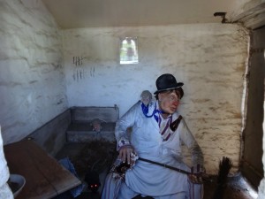
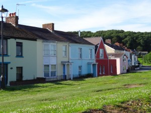
Down the main street leading into Laugharne there is a fascinating range of housing, from the imposing church high on the hilltop, to the ‘Tin Shed‘ car repair garage, that I think may have once been a museum, and some old cottages, some Georgian, and one amazing house for sale, complete with gated porch. I also see the interactive town gaol where the dummy imprisoned inside says things when you approach.
I buy food for the day as I know there will be nowhere to get food or drink except maybe St Clears, until I get to Llansteffan in around seven hours’ time. I also get an additional bottle of ’emergency supply’ water to pop in my rucksack in addition to the two 75cl bottles I always carry strapped to my rucksack. It is not yet ten o’clock and it is clearly going to be a very hot day.
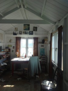 The path leads around the Norman castle, guarding the approach to the Taf, past Dylan Thomas’ boathouse, both the garage for the boathouse where he composed a lot of his later poetry and also the boathouse itself, where he lived for some years with his family. The old garage has a semi-glazed door, so you can look in at the desk laid out almost as if he had just got up and left for his birthday walk. The boathouse is now a small museum of Dylan Thomas memorabilia.
The path rises on through a wooded area, with glimpses of the river below, before passing through fields. Eventually it reaches a lovely kitchen garden, a lady at work amongst the neat rows of vegetables, and then through the yard of what I assume is her house, and on to the road, and then the turn in the road that signals I have completed almost a full circle in the first hour and half of the day and am less than a mile from where I started.
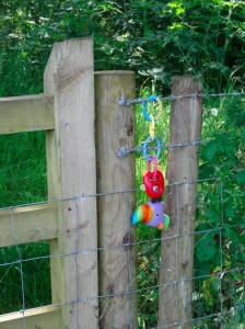 The path cuts through green lanes, fields and woodland paths, with occasional glimpses of water, but drawing inland around the marshes and numerous tiny rivulets that feed the Taf. Eventually it joins the main Laugharne – St Clears road, and I had thought I would have a period of fast road walking, but it is narrow and fast and so they take you along mown and strimmed field boundaries.
Eventually I pass behind a few caravans and a cottage, washing hanging in the baking sun, and come to a stile with an arrow pointing forwards into a huge hill-humped field of knee-high unmown grass, pylons striding in line across its rise.
I set off as near straight as I can, when a man from the back of the cottage shouts to me, "are you looking for the path?".
"Yes," I reply.
"Up to the right. Can you see the post?"
"No," I say and climb higher towards the pylons.
"A bit more to the right," he says, and then I see it and thank him, following almost the line of the pylons towards a lone tree in the field, and then a second post (visible once I found the first), pointing diagonally across the field to where I find another stile.
 The route across the field has been an odd zig-zag, and I assume it follows an old field boundary, maybe the tree stood at the corner where several fields met. However, given there were path markers in the middle of the field, I wish they could have been made a little taller so they were easier to see over the curve of the field and the height of the crop, and I would guess this would also make them easier to avoid when the farmer mows the field.
The path swings once more, rejoining the road and actually following it for fifty yards where, by the big signs saying ‘NO Trespassing’ and ‘KEEP OUT’, I assume the footpath officer did not manage to negotiate access from the landowner. It then tracks the road on the other side until the approach to St Clears where the road has a pavement (hallelujah).
The path just skirts the lower end of St Clears, crossing the river bridge, but not going on to the heart of the town. I had wondered whether there might be a pub or café at this end of St Clears, but when, after crossing the bridge, I looked up the road, there was nothing to be seen. Here is where a sign to say ‘food, half a mile’ would be so useful. In fact, later, I discover that I would have had to go a long way up the road to find anything; there really is nothing to eat between Laugharne and Llansteffan. However, I don’t know that for certain at this point. There is a wonderful house with completely over-the-top garden decorations, but no sign of any people, just a driver from a passing car who shouted "great work", or something like that, having obviously seen the banner on the rucksack back.
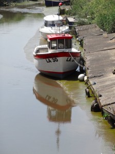
So, without the hoped-for break, I followed the path alongside another small river with a launch point and the St Clears Boating Club (closed, but probably not open to non-members anyway). From an information board I learn that St Clears was once a substantial seaport, with ships up to 250 tons coming upriver, but now it is a sleepy town, especially the southern edge that I pass through.
The path then crosses this rivulet and goes along a concrete road through fields. The road swings first to the left and then, as it approaches a hedge, to the right, and I follow it along until I get to a chained gate and an electricity substation. Retracing my steps I realise I’ve missed a small stile near the last bend in the road, the stile just visible, but the Coast Path symbol completely hidden by the hedge.
My mind goes back over the morning’s walking, the heat and the dry grass that constantly shed seeds into my shoes (this day I wore trainers as I was expecting significant road walking); I write a short poem ‘Heat.‘.
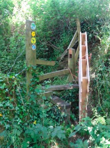 Soon after, the path heads through a wooded section in the middle of which the signed stile is blocked by a wooden pallet tied tightly on with baler twine. This was only the second time a path appears to have been deliberately blocked after the obstruction in Trefor.
So many times before and since I have been told, "they are funny in Trefor". I take this to mean Cold Comfort Farm funny rather than Lenny Henry funny. (Sorry if you come from Trefor, it is what people say! Maybe you have an alternative story? Also, if they say folk from Trefor are ‘funny’, what will they say about a man walking round Wales?) Anyway, I wonder whether folk from St Clears (sorry again) are also ‘funny’, or just this farmer, and wish that I had learnt my lesson and had been carrying a knife to cut the baler twine.
Happily, I manage to unhook one corner of the baler twine and open the pallet like a doorway, before climbing over the stile itself.
Beyond that the way runs through more woods, then out onto a farm track and over a few fields before nearly doubling back on itself onto a road at Poxhole. I recall that one of the fields was slightly confusing as there is a hedge running into the middle of the field that then stops. It was only after finding no way out that I realised the hedge was in fact double line with a lane running between them. I assume that the path and lane followed old field boundaries where some of the hedges have since been grubbed out.
After Poxhole the Coast Path follows roads for a couple of miles. Again this may be confusing as the OS map for the area (Explorer 177) and the original PDF download maps from the Wales Coast Path web site both had the Coast Path following public footpaths that skirt close to the meandering Afon Cywyn, only going on the road to cross the river at Pont-ddu. However, the newer PDF maps from the web site and the signage on the ground is on the road from Poxhole (I keep wanting to misspell it!) to (and I love the name) Pilgrim’s Rest. I assume there was some legal or physical problem with access to the original route, even though it was along existing public footpaths. I am not unhappy, though, as the road walking will eat up the miles quickly and I am still hoping that if I can make up a little time maybe I could get a little further than Llansteffan.
At Pilgrim’s Rest the map shows some buildings and the remains of St Teilo’s Church, which I later learn is a stop on the Cistercian Way long distance walk. I was getting hungry, but decided to wait until I got to Pilgrim’s Rest and, as it says, take a rest there, shaded by the ruined walls of St Teilo’s Church. How perfect.
Unfortunately, when I get to the end of the long farm road, the way ahead is closed and the path leads to the left, bypassing the farm and St Teilo’s Church 🙁
So, I have to eat my sandwich on the hoof with the sun beating down.
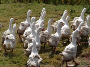 Munching, I walk along a path through woods, out onto the edge of the marsh, over a stile with a baseball bat beside it, through a farm with a field of dirty-white Jemima puddleducks and then back onto road for three-quarters of a mile. The road goes round the head of the marshes, over tiny streams that together seem to feed a wide wetland, then partway up the side of a small hill, which seems so much higher in the heat, and into a field skirting the contour of the hill.
As I follow the field boundary I must have missed a sign, as I realise at the far end that I am the wrong side of a hedge and fence. However, I am clearly not the first person to do so given the well-trodden path and the corner of the fence where past walkers have clearly climbed. I follow over, and then through a few yards of thick undergrowth, before the path opens out slightly again.
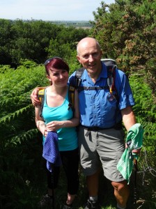 I meet my first and only walkers of the day since I left the Dylan Thomas boathouse and until I get within a mile of Llansteffan. They are Lionel and his daughter Rhiannon.
"That’s a very mythical name," I say to Rhiannon (Rhiannon is one of the major characters in the Mabinogion).
Lionel explains that he only later in life realised that his own name is an English form of Llewelyn, which had been his grandfather’s name. So he had named his own son Llewelyn and given his daughters Welsh names as well, Rhiannon and Meghan. It turns out that Lionel had studied human communication at Aston University, some years ago.
As my water is running a little short Rhiannon shares some of hers with me as Lionel has a large hydration bladder in his rucksack. We talk walking and feet, including the advantages of walking poles in encounters with nettles. They seem to be experienced walkers, more so than I before the walk. Problems with signage seem to be endemic, even in this area, where there seems to be an attempt at comprehensive signage. The footpath officers are often not walkers themselves, so do not realise the issues about being able to see a sign from a distance when walking across a field, nor that hedges and crops will grow, so that a sign that is readable when put up may not be so even a couple of months later.
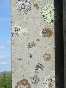
When I told them about my use of audio and photo records, Lionel wondered whether I would remember different kinds of things from image or audio prompts.
I recall research some years ago, in the early days of multimedia, on pure audio vs audio-visual material. The same material was presented in both forms and the subjects tested. Those who had audio-visual did better than those with pure audio. Not so surprising, we know how important vision is. What had been less expected was that, when they did a re-test to the same subjects two weeks later, the results were reversed. The video was good for immediate recall, but didn’t ‘stick’. Of course, there may be different results again two years later.
What Lionel was suggesting was slightly different, more the prompting effect. Audio tends to make you work more in bringing things into your imagination, and yet can be more vivid, more all absorbing, because of this. I don’t know of any experiments on this, but it seems a very interesting topic.
 We take some photographs and say good-bye, I warn them about the upcoming nettles, and they tell me that the path on to Llansteffan is good.
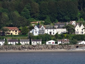
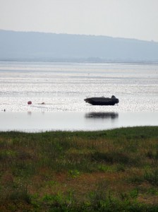
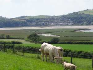
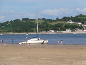
In fact, quite soon after I leave them the path joins the road for a while, until it skirts the final headland into Llansteffan. Ferryside looks so close across the estuary, but is a day’s walk away via Carmarthen. From a distance the small cottages that line the shore of Ferryside look like child’s playhouses compared to the larger, I assume Georgian or Victorian, houses behind. I wonder if this is just the effect of distance, or whether it will feel like this as I pass through.
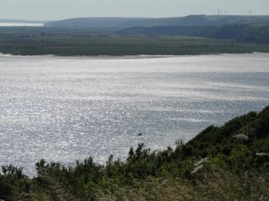 The views from this headland between the Taf and Tyfi, are wonderful, with Laugharne on one side and overlapping headlands on the other all the way out to the Gower and Worm’s Head.
Eventually the wooded headland path leads down steps to a small bay, where a car is stuck at the sand just below the access road, its bonnet open. Happily there are no other cars on the beach stuck behind it.
There is then just a short rise and down to Llansteffan itself, the beach still full at five-thirty and the fish and chip kiosk that says opening times are 10–5:30 is clearly still much at work and is so until I leave … but no, I know what you are thinking, I did not have chips, as I didn’t want to spoil my appetite.
I had been unsure whether to call for a taxi from Llansteffan, or to go on to Llangain, the next obvious place along. However, even making good time, it would be 8pm or 8:30 before I would get to Llangain, which would make it tight to get food back at Laugharne.
The decision was almost taken from my hands as neither of my phones had signal at Llansteffan (does Vodafone ever have signal?) and the phone box (they do still exist) would not accept any money. However, the pub (I think it must be The Sticks) does have a phone and a beer to have while I wait. The walls have old photographs, including coracles, which are still occasionally used in these waters.
It is the same taxi and driver as yesterday. When I tell him I’m going to eat at Culture Café again, he tells me about the sister café and kebab house in Whitland and, like me, has nothing but praise for Amir.
So another night of lovely food, and Amir does not let me pay, "it is my small contribution to your walk," he tells me. He also says that if anyone goes to eat there and says it is because of the walk, he will put all the proceeds to the charities I am supporting. More than this, it is his warmth, which I cannot express in words, and is so deeply encouraging.
And so, back a little earlier to the Stables, and down the lane before it is dark this night. Jackie and Melissa are still up watching the end of, as Jackie put it, "some trashy historical thing", I think charting the Wars of the Roses and rise of the Tudors, quite apt as the journey down the west of Wales has tracked the fortunes of Henry VII. Jackie tells me that the day went somewhat easier than the one before, with all horses delivered safely in both directions, and a couple of second places and other places in different categories, including a second place for one of their riders who had never competed before.


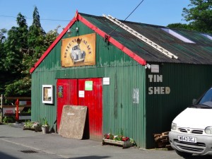

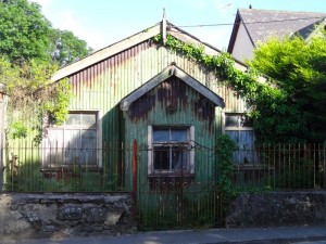
Have you published Day 80? I can’t find it. The Tin Shed at Laugharne, by the way, is now a museum (was a garage) and very interesting too. Thanks for the blog, I am walking stretches myself.
Ah, there was a museum notice, but it was not up, so i thought it was the other way round!
I am doing the day 80 blog – it was almost finished, so have just finished the text and will get it put up later this evening or tomorrow morning … I am ever so slowly working my way back through the gaps!
Hi Alan
I have just walked from Amroth to Laugharne yesterday and it was a little tougher than I expected and the 13km took 5 hours to walk – longer than I had planned!
With the clocks going back last night I am trying to work out how long will Laugharne to Llanstephan take if we walk about 2 and 1/2 miles and hour on average.
The other thing that worries me is how wet the ground will be with all the rain we have had of late?
I have completed Ceredigion and Pembrokeshire coast path so now on my 3rd County!
Thanks for any tips you care to offer.
Hilary
I’m really sorry Hilary, I’ve not been keeping up with blog comments over last couple of months 🙁
So probably a bit late … however, I found it took me a pretty full day, I forget the exact time I started, maybe 9-9:30, but certainly after 5pm when I arrived in Llanstefan. I took a lot of photographs, so that slowed me down, but also didn’t stop for lunch, just ate on the hoof.
If you have already done it, how long did it take you?
Hi Alan sorry for the delay of 2 years getting back to you that must be a record! I actually walked with a friend to St Clears and back then on to St Cleats to Llandtephan which was great. Another friend has caught the bug and she is trying to catch me up and asks me to accompany her so tomorrow we may try doing Laugharne to Llanstephan in one day but it sounds like a very long day and an early start. What is your mph generally on average when you walk as it may be a little to far as we try and get back for 6pm at latest to have a pub meal. Any help or advice will be greatly received? Have you finish the Wales coastal path yet?
Thanks Hilary