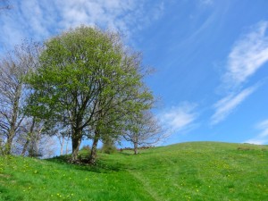
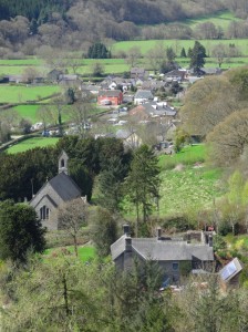
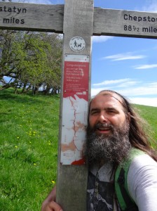
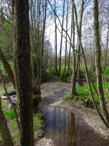
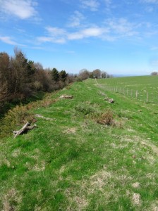
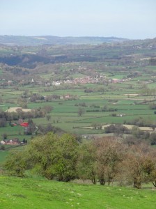
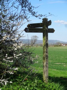
Knighton has the Offa’s Dyke Visitor Centre and describes itself as the mid-point of the long-distance path. However, Michelle has told me that Newcastle was the real mid-point. Sure enough, as I walked up the hill (the first of many), looking back occasionally at the glorious morning views over Newcastle and a fish pond that nestled at the foot of the hill, there was a wooden sign post declaring in one direction:
Prestatyn
88 1/2 miles
and in the other:
Chepstow
88 1/2 miles
I was half-way.
As Jacob had told me, the first part of the day the Offa’s Dyke Path rises and falls as it cuts across valleys and hills between. Early in the day’s walk I met a young woman and an older gentleman, I think her grandfather, a retired sheep farmer from Oswestry. They called this section ‘the switchback‘. They were doing the Dyke in parts, the odd day’s walk at a time. something the gentleman could not contemplate when working full-time in his youth; unlike the 9–5 of the city, farming really is a full time job.
I have written before about the way open plains, with no natural boundaries, become contested, and problematic; wars are fought and lives lost. This land is not level, but the natural drainage patterns fall west to east and hence the natural boundaries separate north–south, whereas the political differences, between Saxon and Welsh ({{British}) lay east–west. So, while not level, still the natural boundaries do not help settle the political boundaries, hence centuries of strife. Indeed, even in the seventeenth century Montgomery, which I visited later in the day, was the site of one of the Civil War‘s bloodiest battles with 500 Royalists killed, and although this would have still meant I walked north–south across the borders, I would
In America, the 52nd parallel and the boundaries between the mid-west US states, were drawn with a line on a map. Here, Offa wrote directly on the land, a bold stroke, separating Saxon and Briton, English and Welsh, a line that still defines this country today.
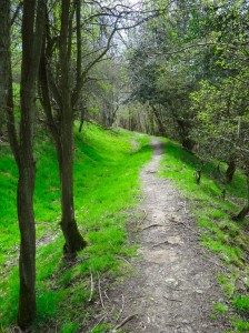
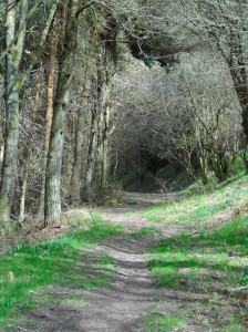
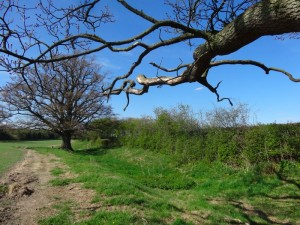
The path climbs one hillside, then drops into a valley, then climbs again, but often with the dyke very clearly visible. It really makes a difference knowing you are actually following the dyke, rather some guessed line for it with nothing on the land. I would find the same later in the walk on the coast, it would always be the diversions inland that I found hardest.
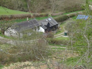
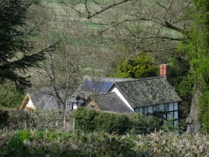
Nestled in the first of these valleys north of Newcastle, was a farmhouse with another near-rectangular fishing pond. I wondered whether this was medieval in origin, but next to it, definitely not medieval, was a bank of solar panels. Self-sufficiency in food, and self-sufficiency in energy linked, albeit 500 years apart.
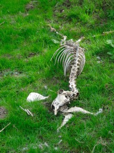
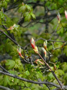
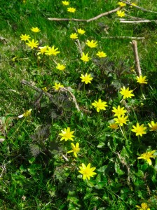
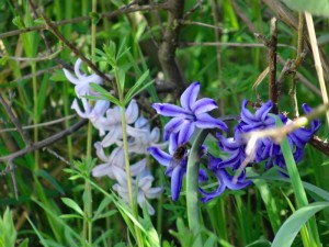
Signs of spring were everywhere: budding tree branch tips and primrose carpeted woodland, albeit with the occasional bleached sheep skeleton to remind us of the harsh lash this last winter gave in its tail.
Another hill, another valley, another hill … I was still suffering from a cold that I’d caught in Paris and I’d noticed the day before that my legs were more sluggish and my breath more strained when I climbed than they had been in the days before I left the trail. If my schedule had been more relaxed, I should have taken a day off at some stage.
But despite that, I didn’t find the going as hard as I’d expected from Jacob‘s account; however the difference is that I was doing this at the beginning of the day, not the end. Indeed everyone seems to say that the south–north direction is a lot easier than walking north to south.
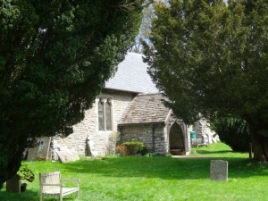
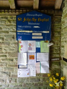
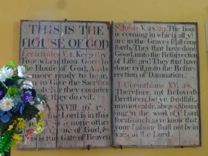
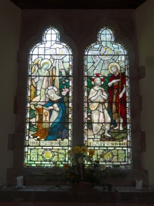
I dropped down into the wooded valley of Cwm Ffrydd. At the bottom is the church of St John the Baptist, Mainstone. The current village of Mainstone is about 3/4 mile down the valley, but the church is in what is now called (logically) ‘Churchtown‘. I’m not sure of the history of this, maybe the centre of gravity of the population moved over time.
I met a man who told me a little of the area. I would be cutting north up over the top to the next valley, but if instead I were to follow Cwm Ffrydd upstream I would find a pack of wolves in the valley head1. At night, even here in Churchtown, you can hear them howl.
It is not only wolves that are made welcome in this valley. In the church porch, as well as a lively noticeboard offering activities for human spiritual refreshment, and a big photo of Reverend Stephanie, there is a notice that reads:
The churchyard is a living sanctuary for plants and animals.
… but no wolves in it.
I had in fact met a wolf not long before. The Talis offices in Birmingham were on the third floor of a small office building. As I went down the stairs one day a man came out of the offices on the second floor. With him was a large grey-white dog, a beautiful animal. It reminded me a little of Janet‘s Maremmas, but more ‘rangy’, I thought maybe a Husky.
I dropped down to a squat and it came up to me and touched noses, I gave its short velvet years a small cuddle.
Now I should explain that I am the dog hater amongst a family of dog lovers. I tolerated our own, because they were part of our family, and tolerate Janet‘s because she is family. So when I talk to random dogs I meet along the way, it should not to be taken to represent any deep significance. I would hate to destroy my reputation.
So, with the understanding that this was merely me greeting a fellow animal, not representing any affection; I squatted there nose to nose, eye to eye, admiring the two-tone coat, slightly coarser hairs of silvery grey intermingled with fine hairs of almost pure white, I looked up to the owner and asked.
“Is it a Husky?”, I asked. He said something about “a wolf”, which I at first took to mean it was a primitive breed like a wolf, as indeed I might describe Maremmas. This was not what he meant. He was an animal psychologist and this was a tame male wolf. If I had known that at the start I might not have squatted nose to nose, my face inches from its teeth,
The Shropshire Way meets Offa’s Dyke Path at Churchtown, and other paths as well. I should have known better from the day before, but again I went slightly wrong as I came out of Churchtown, following the wrong footpath arrows. However, I noticed quite quickly and the wrong direction had merely been skirting the contour round the bottom of a hill rather than going up and over it. I retraced my steps and set off again steeply uphill clearly following the course of the dyke itself.
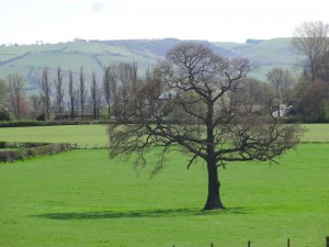
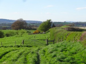
Another valley, another hill and the countryside opens up ahead, I can see the rest of the day’s route ahead: lower lying land and gently undulating open farmland between the Caebitra and Camlad rivers.
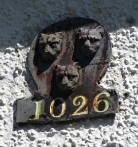
The path joins a small road for a while through the hamlet of Cwm. On the side of a pebbledash bungalow is a small sign that says, “1026“, beneath three lion faces, neither the house number nor its date, maybe the date of the founding of the family, or the number of cats inside. In Cwm also is a small converted chapel, its date stone says “1897“, I think more accurate.
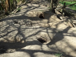
After this the road hits a T-junction, but the dyke continues straight on, its rabbit-hole-punctured and root-twisted top, dry red earth beneath the cover of trees, past a static caravan site and Mellington Hall. I notice this in other places. My guess is that the current footpath was once a more substantial foot route and Cwm lay on a crossroads, but as patterns of movement and settlement changed, only some of these routes became modern roads, so the once crossroads became a T-junction, with only the footpath revealing its past … well that’s my story.
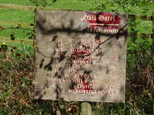
Mellington Hall appears to have a mixed approach to walkers. Near where the path entered its estates, there was an old sign, its paint near worn away with age, but the words "no public right of way" still visible. I think this may have been simply to say "not through the caravan site". Further on, though there is another sign saying:
WALKERS WELCOME
For
Accommodation
Morning Coffee
Lunches
Evening Meals
It was very tempting and one of the few times in all my journeys that I saw explicit signs for ‘off path destinations’. I was certainly in need of food as it was after half past two, but it sounded as if it might be a little upmarket and also I really wanted to pop into Montgomery, and although this would have still meant I walked north-south across the borders, I would as I passed.
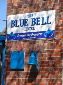
The path rejoins the road, or maybe the road rejoins the path, for the bridge across the Caebrita. The far side of the bridge the route crosses the A489, this time at a modern crossroads, with the road crossing towards Montgomery, and although this would have still meant I walked north-south across the borders, I would. On the corner is the Blue Bell Hotel, its blue bell prominent outside. The sign proclaims "Freedom for Brompton". I’ve not been able to find any ‘Brompton liberation army’ posts on the web, but maybe this is connected to the fact that Brompton is almost an enclave. The Welsh–English border meanders back and forth here, driven this way and that by the east–west topography.
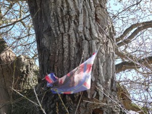
An old, gnarled, half hollow tree, one of its hollows half filled with stones as if to shore it up for anther hundred years, stands beside the Blue Bell. High on its trunk the faded remains of red, white and blue recall the wedding of William and Kate two years before.
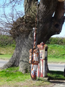
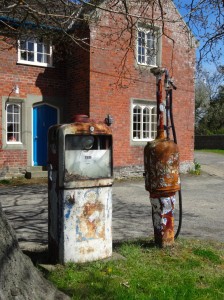
Under the tree are two rusty petrol pumps, looking almost as ancient as the tree itself. At the crossroads it is an obvious site, and clearly also the reason for an inn. But I wonder if this goes back further, was there a blacksmith’s anvil once set here also beneath the tree so that the inn’s farrier could re-shoe the horses of guests.
By this time I was hungry and thirsty, and a pint and sandwich would have been most welcome, but the {{Blue Bell} sadly was closed ((It does not look shut down, but I found a mention of it on another Offa’s Dyke walker’s blog, who also found it closed.)).
While the road goes more north&en-dash;west to Montgomery, and although this would have still meant I walked north&en-dash;south across the borders, I would, the dyke continues nearly due north cutting across the little tongue of Shropshire that includes Brompton, before the border and dyke join, and modern and past boundaries follow one another for several miles straight across the rich flattish farmland guarded by Montgomery Castle.
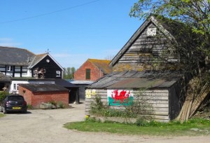
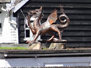
After a while the path passes (indeed passes through the garden of) a substantial farmhouse called ‘The Ditches‘, I guess after the dyke. On the timbered barn is a ragged Welsh flag, and above a flat roof on the house itself a metal sculpture of a Welsh dragon. When I checked my map, I realised that this was still on the English side of the border, indeed in the centre of the little tongue of Shropshire. Whilst in the US it is common to see the Stars and Stripes flying everywhere, in general in Britain we are less strident, indeed I recall no other house in Wales with such a prominent display of Welsh nationality. I am guessing it is precisely because we are in the borderlands, where the natural boundaries of the land are less strong, that people feel it important to assert their identity.
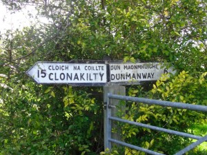
Whether it is Celtic camaraderie, or simply whimsy, where the path crossed the track to the farm a sign post said “Clonakilty“.
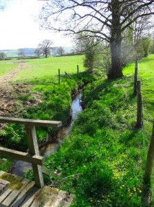
Soon after, I actually crossed the tiny stream that took me into Wales, or at least along the line of the border. I met a small family group, mother and I think son and daughter-in-law. Like the gentleman and his grand-daughter earlier in the day, she too had been walking Offa’s Dyke in parts over a number of years. She had in fact walked this section some years before, but had been tired, so she had stayed in Montgomery drinking tea while her husband and a companion walked the few miles from Montgomery to Brompton. Although it was just a short section, the fact that she had missed it had preyed on her. She and her husband were due to do the final sections of Offa’s Dyke down the Wye Valley to Chepstow, but she felt she needed to fill in this section, to do it properly, not to cheat.
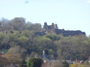
I had very nearly taken the road directly into Montgomery, and although this would have still meant I walked north&endash;south across the borders, I would not have followed the ‘proper’ path, so would also have felt I cheated. Here the path does follow the actual route of Offa’s Dyke closely, so there was good reason for it to pass Montgomery by.
However, I wanted to visit it, and also get some food! I can’t recall what I had that day, but very little since (a very good) breakfast as there were no shops, so it will have only been what I had in my rucksack already.
Offa’s Dyke misses Montgomery by about a mile, but there is a footpath into the centre where a driveway to a country house crosses the dyke. A finger post gives all four directions, and I turn left into Montgomery. The drive passes the local football club, and also a walled farm. The walls seems incredibly thick, and I wondered if they had once been a minor fortification.
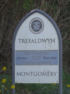
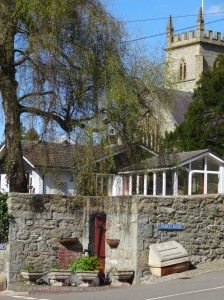
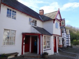
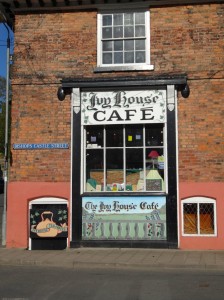
Coming into the the town centre, one of those crossroads that come out into a market square, I noticed Ivy House Café, which had Welsh language books in its window. But it looked as if it might only do cake, so I went for a small wander first to scout. There is a small hotel, but peeking at the menu I realised it was very posh indeed, definitely not bar meals for walkers. Across the road I saw a sign for an exhibition in a tiny gallery, with various art and gift items downstairs and gallery space above. Leaving my rucksack, I went up to an exhibition inspired by myth and folklore.
The lady in the gallery said I really should visit the Old Bell Museum, which is small, but has an excellent selection of both ‘folk museum’ reconstruction and local archival items. I asked about the farm I had passed. She thought it had always been a farm, but said that nearby had been the old house of the landed gentry of the area, but that it had burnt down in a fire. However it is not unlikely that there are castle stones in the farmyard walls as the castle has been ‘quarried’ extensively over the years for local building.
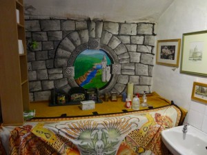
By now I was hungry enough for anything, so went back to the Ivy House, which was as lovely inside as it looked from without, including, as I discover later, the most amazingly decorated toilet. At first I thought it was too full, but the lady there said there was room upstairs, so I ordered a cup of tea, cake and ice cream … and went up. There was no-one else there except one other man, so I sat on an enormous table on my own.
We got talking.
His name was Rupert and he lived locally, driving for a local agricultural haulage business. I told him about the walk, and then mentioned I was from Tiree. Normally, this leads either to a blank look, or "oh yes, like on the shipping news", but Rupert did neither of these, "I used to go there regularly nine years ago", he said.
It turned out Rupert had fallen for a Tiree girl. I wasn’t sure whether she felt the same way, but certainly he returned there frequently until for some reason, nine years ago, his visits stopped. I had a feeling that something had happened to the young woman, as it sounded as if Rupert had continued to visit for a while after she was no longer there, but I did not like to pry.
While Rupert clearly had a life here in Montgomery, as we talked he asked about the best ways to get there now by sea and air, and clearly hearing about Tiree had awakened many memories. It felt such a special moment to make a connection that seemed so unlikely, so random and yet so meant.
Rupert offered me a lift back to where I’d left the path, and so went to get his car. I finished my food and then went outside to wait in the last afternoon sunshine. When he came he’d been asking someone about the driveway and evidently the owner did not take kindly to people driving up it, so instead he had to drop me where Offa’s Dyke crossed the B-road leading east out of Montgomery.
I could have started from that point, but, like the lady earlier, I did not want to ‘cheat’, so had to go back a mile or so southwards along the course of Offa’s Dyke until I got to the place where I’d turned into Montgomery, I walked as quickly as I could and then turned round again and set off back north at near marching pace across the flat farmland as the time was now getting late and I would still need to find my B&B and somewhere to eat.
It was a lovely evening, and the few miles across the flatlands fell away quickly, but I also saw ahead that I had one last small rise to climb, ominously called ‘The Bank‘. I cross the Camlad and pass bluebell woods and a sign that tells of the bloody battle fought here during the Civil War, before climbing The Bank, happily not too steep or long, and onto the straight path running along or parallel to the road for the last couple of miles.
I was staying at Heath Cottage a small B&B at ‘Forden‘. Mary, the proprietor, had given me instructions, "The path goes behind the village and our back garden opens straight onto the path, you can’t miss it."
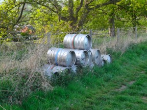 I could see that Forden is clearly marked on the Harvey Offa’s Dyke map, and sure enough the path does run behind what looked like a small clump of houses on the map, but when I got to the top of The Bank, there was no sign of anything that looked as Mary had described. In fact the only thing of note was that, still in the middle of farmland, beside the path, there was a pile of metal beer barrels. I went on and cut onto the road through Forden to make sure I didn’t miss it. I passed the turn-off to the school, and still no sign, I looked back and was sure I’d not missed it, so went on, thinking perhaps it was on its own out of the village proper.
After a while the path was on the roadside anyway and although I was sure I’d not passed it, still there were no houses for a long way ahead. The next place on the path was marked ‘Kingswood‘ about a mile or so beyond Forden. I was already half-way there and there was a pub marked on the map, so I thought I might as well go on there and ask directions.
As I drew within sight of Kingswood there was a sign beside the road, "Forden", it said.
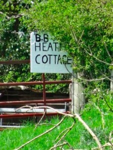 Somewhat encouraged by this I then saw things that corresponded to the instructions I was given. I took the path that is bypassing the village, and sure enough, a little gate and a sign saying, "Heath Cottage".
It was now eight o’clock, so after being shown to my room, I quickly went across the road to The Cock Hotel. They were not serving food properly, but they said they could do something ‘from the freezer’, I can’t recall what it was, but I didn’t really care so long as it was food. So I sat, ate, and drank a pint of the local beer. After a bit a group of local men came in, who proceeded to call me ‘Jesus‘ for the rest of the evening. It was Bank Holiday Monday and they had been on a tour of local golf clubs, or at least this was the story they told their wives, most critically it transpired was that the golf clubs had club houses and the club houses had bars.
I can’t recall now whether it was one of them, the barman, or John and Mary at Heath Cottage who explained the mystery of ‘Forden‘ to me. Evidently Forden is the complete parish consisting of number of several smaller settlements, principally the ones called ‘Forden‘ and ‘Kingswood‘ on the map, and the small village of Fron further along the A490 to the north west. If you ask a local, and clearly the person who puts up the road signs, ‘Forden‘ is what is called ‘Kingswood‘ on the maps. I hope that makes everything clear :-/
- I cannot find any direct information about this wolf sanctuary, but I found a photo of one of the wolves, Madadh in a blog about someone’s Christmas holiday in Cwm Ffrydd.[back]

