
GPX data (from Garmin):
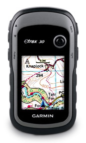 I carried a Garmin eTrex 30, but clearly the version now has a colour screen (mine is black and white!)
One line per data file, the early ones were multi-day, but later ones one GPX per day.
fields:
name — filename
url — dropbox url
ignore — blank field (coding error!) please ignore
url — dropbox url
ignore — blank field (coding error!) please ignore
start_date – \ ___ when recording starts
start_time – /
start_ts — full date-time stamp of first recorded point
end_ts — full date-time stamp of last recorded point
start_lat — latitude of first point
start_lon — longitude of first point
end_lat — latitude of last point
end_lon — longitude of last point
number_of_tracks — number of tracks in the file
The includes start and end time for each file and also start and end lat-lon
url is dropbox address of the file, it is in public area, so should be readable
Same but with information about each track and track segment including byte offsets into GPX file for random access. The offsets are in tow parts: start/end include the relevant track/trackseg tags, data_start/data_end is the data within the tags.
GPX (from ViewRanger)
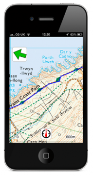 I also used ViewRanger software on my iPhone. This can be used for navigation and Rosie Unsworth, who was going round the WalesCoast at the same time as me, but in the other direction, used this almost exclusively to navigate with no paper maps.
Same format as the equivalent Garmin files. However, all the ViewRanger date is in a single GPX file with mostly one track per day.
Extract of CSV file
name,url,sampling_rate,start_date,start_time,start_ts,end_ts,start_lat,start_lon,end_lat,end_lon,number_of_tracks
2013-04-18 09.27.00 Auto.gpx,https://dl.dropboxusercontent.com/u/5863079/AlanWalksWales/gpx-garmin/2013-04-18 09.27.00 Auto.gpx,,2013-04-18,08:27:00,2013-04-18T08:27:00Z,2013-04-19T15:21:55Z,51.4631031454,-3.1627476308,51.5714089014,-2.7798374835,1
2013-04-24 08.23.05 Auto.gpx,https://dl.dropboxusercontent.com/u/5863079/AlanWalksWales/gpx-garmin/2013-04-24 08.23.05 Auto.gpx,,2013-04-24,07:23:05,2013-04-24T07:23:05Z,2013-04-24T19:17:01Z,51.5714063868,-2.7797980048,52.2052584775,-3.0251678266,1
.....
2013-07-28 10.49.18 Day.gpx,https://dl.dropboxusercontent.com/u/5863079/AlanWalksWales/gpx-garmin/2013-07-28 10.49.18 Day.gpx,,2013-07-28,09:49:18,2013-07-28T09:49:18Z,2013-07-28T13:15:43Z,51.4358690009,-3.1760643795,51.4614504017,-3.1621474028,1
Extract of JSON file
[{
	"name": "2013-04-18 09.27.00 Auto.gpx",
	"url": "https:\/\/dl.dropboxusercontent.com\/u\/5863079\/AlanWalksWales\/gpx-garmin\/2013-04-18 09.27.00 Auto.gpx",
	"number_of_tracks": 1,
	"tracks": [{
		"start": 949,
		"data_start": 952,
		"data_end": 503365,
		"end": 503369,
		"trksegs": [{
			"start": 1102,
			"data_start": 1108,
			"data_end": 238876,
			"end": 238883,
			"start_ts": "2013-04-18T08:27:00Z",
			"end_ts": "2013-04-18T18:10:06Z",
			"start_lat": "51.4631031454",
			"start_lon": "-3.1627476308",
			"end_lat": "51.5484641958",
			"end_lon": "-2.9492143728"
		},
                   ...
                   ...
		}],
		"start_ts": "2013-04-18T08:27:00Z",
		"end_ts": "2013-04-19T15:21:55Z",
		"start_lat": "51.4631031454",
		"start_lon": "-3.1627476308",
		"end_lat": "51.5714089014",
		"end_lon": "-2.7798374835"
	}],
	"start_ts": "2013-04-18T08:27:00Z",
	"end_ts": "2013-04-19T15:21:55Z",
	"start_date": "2013-04-18",
	"start_time": "08:27:00",
	"start_lat": "51.4631031454",
	"start_lon": "-3.1627476308",
	"end_lat": "51.5714089014",
	"end_lon": "-2.7798374835"
}, {
	"name": "2013-04-24 08.23.05 Auto.gpx",
	"url": "https:\/\/dl.dropboxusercontent.com\/u\/5863079\/AlanWalksWales\/gpx-garmin\/2013-04-24 08.23.05 Auto.gpx",
	"number_of_tracks": 1,
	"tracks": [{
		"start": 949,
		"data_start": 952,
		"data_end": 344880,
		"end": 344884,
		"trksegs": [{
			"start": 1102,
			"data_start": 1108,
			"data_end": 4954,
			"end": 4961,
    ...    ...