
a short damp day starting with a steep hill, walking an embroidered landscape, a change of rock means a change of scene, and hubris: a walled cliff top surrounding a demolished mansion
2nd July 2013
miles completed: 848
miles to go: 210
I’m starting to write at y Ty Cychod (the Boathouse) National Trust café at Stackpole Quay.
The path from St Govan’s to here is easy going, Sunday afternoon stroll territory. The short stretch from St Govan’s to the end of the firing range is along tarmac track with grass down the middle, and thereafter the flat-topped cliffs have wide grassy paths clear along them, you can take the straighter path or divert along each headland as you wish. The only ascents are where you have dropped onto beaches to walk on the sand, which seems a good reason to climb.
However, the day starts with a more substantial and less reasonable climb.
I had slept the night at Freshwater West where the car park has no ‘no overnight sleeping’ rule, and it is wonderful going to sleep and waking to the sound of rushing surf. I drove to Freshwater East, saw a bus stop in the village itself, and then went down the long hill to the beach car park. It was only then I looked at the bus timetable and saw a time for the ‘crossroads’ in Freshwater East (really a T-junction!), but no mention of the car park or beach. I looked and couldn’t see any sign of a bus stop. The coastal buses will stop anywhere on request, but, of course, only if they are driving past. So, with not long before the bus was due, I ran all the way up the steep winding hill to the village.
The bus arrived, I paid my fare, and then … the bus turned down the beach road, down the hill, and down the hill, past bend after bend until it passed my neatly parked campervan and, 30 yards further on, the bus stop.
I was the only passenger. He expects to pick up more local passengers later in the journey going into Pembroke. In the mornings the locals want to go into the centres of population for shopping, dental appointments and hairdressers; it is only walkers who are going out to the margins, and on a dismal morning like this, with rain forecasts, precious few walkers.
We meet a car in the narrow lanes, and then a little later the driver stops at a wide spot, "just waiting for the other bus to pass", he says, while popping out of the bus for a quick fag. The bus comes earlier than he expected, and so the half-smoked cigarette is neatly extinguished between finger and thumb, and saved for later. This strikes me as a man expert in the art of the smoke in the gaps.
We start to talk about reversing.
Having seen the closely timed passing point, I ask, "what do you do if you do meet another bus on these roads?"
"Panic," he replies.
Often I find that in the campervan, when I meet a small car, they freeze, like a rabbit in headlamps, and I have to do the reversing even though it would be easier for them. I ask him if he has found this.
"No," he says, "they have to reverse or we are going nowhere."
He tells me that with a PSV (public service vehicle) you are not allowed to reverse while carrying passengers. There are clearly some exceptions to this, such as the reversing areas to turn round, or when you do meet another bus, but he says he certainly wouldn’t reverse down one of these lanes with passengers aboard, even if he is close to a passing place.
He tells me about one time when he met a car, and the car pulled over, but without sufficient space to pass.
He said, "I shrugged, and he shrugged, and we stayed there for ten minutes."
Eventually other cars clogged up behind and one of the drivers came and asked the bus driver why he was not moving.
"Ask him," said the driver pointing to the car.
The go-between went to the car and asked why they weren’t moving.
"Because he’s an idiot," said the car driver, and maybe more, but that was what the diplomatic go-between passed back to the bus driver.
Eventually the car did reverse, just 20 yards to a wider spot.
As the bus passed, the bus driver stopped, wound down his window and asked the car driver why he hadn’t moved. He said something similar to his response to the go-between, and so the bus driver told him the legal position and suggested he should read the Highway Code, which says car drivers should always give way to buses and lorries.
Public Transport: one; Car Driver: nil
However, the bus driver is not always right. This one told me about a new bus driver, who didn’t last very long. Quite early on the new driver was driving down a narrow one-way street, with cars parked either side despite the double yellow lines along one side. By the time he exited the street, there were twenty broken wing mirrors hanging from cars or on the street.
"Why did you do it?" he was asked.
"Because they weren’t supposed to be parked there," he correctly, but undiplomatically, replied.
We had got on to the topic of campers and caravans and the second-hand Shogun he
was about to pick up next week to tow his caravan, when we got to St Govan’s Chapel. I think maybe I would learn more taking buses round Wales than walking.
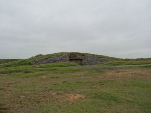
So, I start to walk from the car park at St Govan’s Chapel, where I met Mark and Liana yesterday. While still on the firing range I pass a series of grassy bunkers, each with an entrance facing the sea (and away from the way the shells would be coming); they look like burial barrows scattered across the landscape.
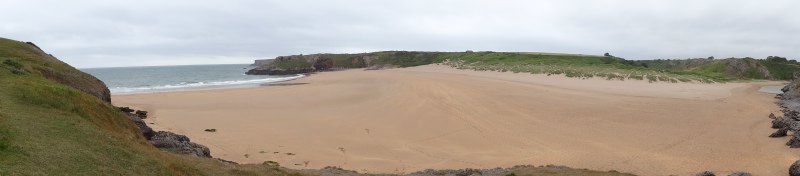
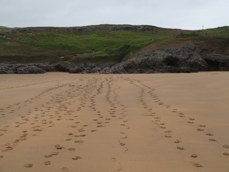 Just beyond is Broad Haven (not the first ‘Broad Haven‘), a wide beach with a car park and what appears to be a campsite (unless people camp at the car park) above it. As the day was forecast to be wet I had put boots on, so could not paddle as I walked, but it is still lovely to feel the sand beneath my feet if not between my toes. From the (slightly confusing) path options on the map, it looks as if there is an alternative route for very high tides, but this morning multiple lines of footsteps across the sands lead to the small rocky scramble back on to the cliff top at the far side. I wonder if these are there from the day before, as I meet few people along the way.
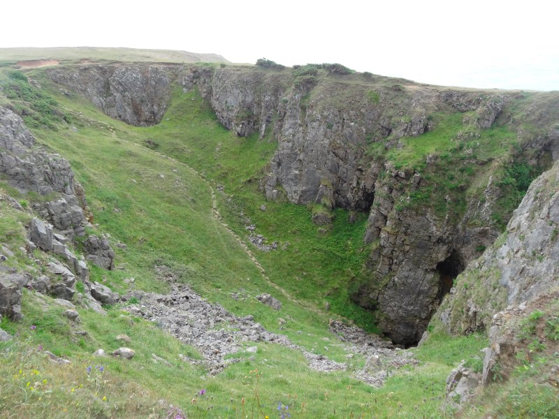
Just a short way on is an enormous gorge in the flat grass, a rocky depression maybe 50 yards in length and almost as broad, dropping down to near sea level. I assume it is a giant blowhole from one of the sea cliffs beyond, but I cannot see the gap to the water.
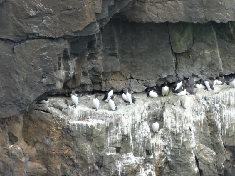

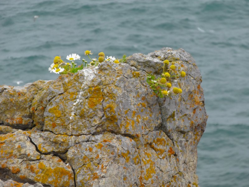
Sea stacks, caves, natural arches and blow holes litter the cliff-scape. The names say it all: ‘Stack Rocks‘, ‘Stackpole Quay‘, ‘Stackpole Head‘. Many of the sea stacks are sharp pointed as if they wanted to prick the sky. The cliffs themselves are sheer, sometimes overhanging, with beaches and coves inaccessible except by serious rock climber or brave boat. However, the ledges and fissures in the vertical cliffs and stacks are perfect for many birds. Stackpole Head is full of morning-suited birds with white shirtfronts and black heads, backs and even beaks, I think maybe guillemots.
Sometimes it is clear that the grass is only a thin layer above solid rock, but elsewhere the cliff is topped with soft sandy earth, pock-marked with rabbit holes. It is worth keeping your distance from this clifftop; the grass-bound earth often makes shelves with no solid rock beneath to support them. As if to emphasise the harshness of nature, the path is suddenly snow-strewn with down, where some young gull chick found its place in the food chain.
A few yards from the cliff edge, metal stakes have been driven into the ground, around 20 yards apart. If they had been taller, I would have thought them abandoned fencing posts, but they sit barely a foot above the ground. Then I see a slightly larger post, but this time round section with a larger circular top, like a giant nail or pin. Suddenly, it becomes obvious.
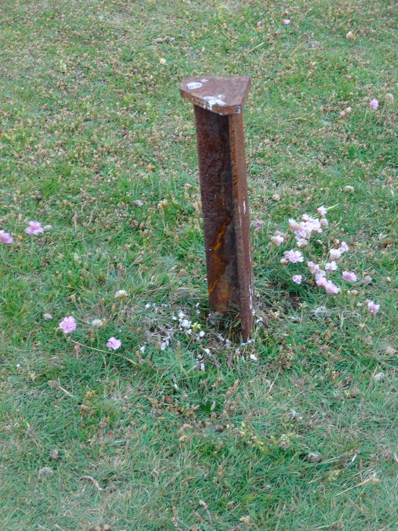
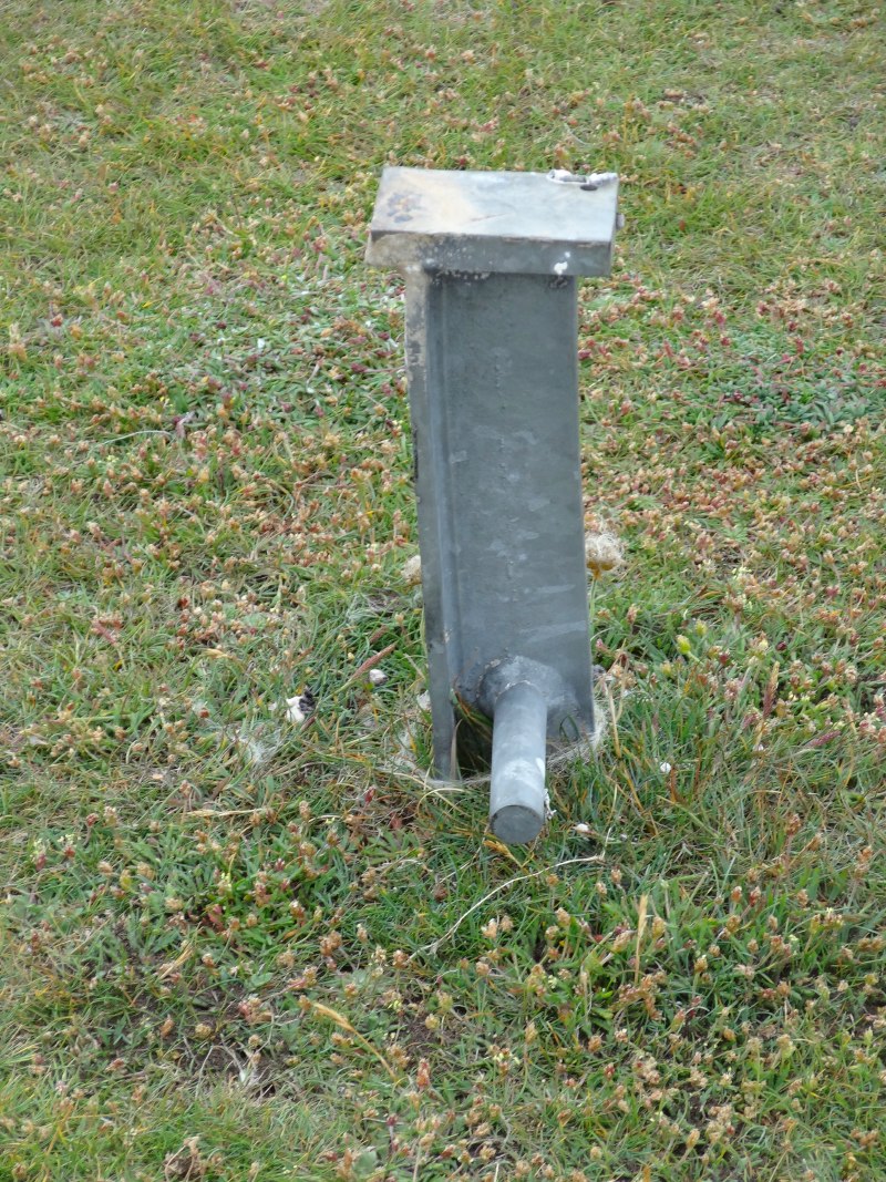

I recall the Dysynni map, the intricacy of the work, and realise that there is a larger Pembrokeshire, and I am merely walking a miniature landscape, sewn by giants. The stakes are the pins holding together the as yet unfinished work. What seems like rock beneath my feet is but giant polystyrene foam, shaped and painted to resemble the real landscape.
 Occasionally amongst the stakes are what look like upturned flowerpots; in fact I think they may be concrete moulded inside flowerpots. They have obscure markings, two say ’15’ with arrows on them pointing to each other.
I am reminded of a library lavatory I once saw. Have you noticed that library toilet graffiti is a step above the norm of football and sex? In this loo on the right-hand wall was a black dot and the words, "look left for toilet tennis". I duly looked left and on the left wall was an identical black dot and the words "look right for toilet tennis".
I wonder if the upturned flowerpots and stakes are something to do with mapping the coast, perhaps for wildlife purposes. Maybe the giant embroidered Pembroke Coast is but a figment of my imagination, but then again I look at the flowerpots and think, ‘map pins’. (I have since been told about the true purpose of the flowerpots. This is what I was told: "Many years ago I worked for the National Trust and had the pleasure to repaint the flowerpots – a lovely spot for such work but quite exposed and it looks like they have been redone since my tenure. The relevance of them is in relation to climbing routes, specifically, which sections must not be climbed during nesting season. I can understand that they seem a bit odd to the layperson with no explanatory info but this is a technical climbing coast and known for its conservation requirements so route guides explain where to find the relevant corresponding dates/info, etc." Well, that may be the true story, but I still believe in the giant embroiderers.)
You can take a shortcut option that bypasses the full length of Stackpole Head, but I follow the track around its perimeter including along the narrow neck of Mowing Word, which looks precipitous, but is in fact broad and safe to walk.
Turning the head, the beach of Barfundle Bay appears. You have entered civilisation: the sandy path downwards ends in stone steps and the north side of the beach is framed with a cliff-top wall and walled steps cutting diagonally across its face. It is a solid stone wall, a work of serious engineering that suggests a story of serious landownership.
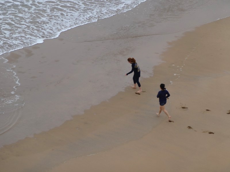 As I come to the steps, three girls, I guess maybe university students on holiday, come down to enjoy their day by the sea, no matter how dismal. As I get to the top I hear whoops and shrieks as they run down the sand to paddle in the waters.
Rounding the final head towards Stackpole Quay, there is an almost magic transformation, from bare grassed clifftop to a bramble and honeysuckle lined path through rich scrubby woodland, and steps leading down with a handrail. Later I read that a fault line ("like the San Andreas, but less dangerous") runs through the bay, displacing rocks 100 metres. So maybe the dramatic change in vegetation reflects a change in underlying rock.
 There is a little disappointment as the National Trust café does not do all day breakfasts, but they do serve breakfast baps with bacon, sausage or mushroom, and also, my choice, a sausage and onion bap with salad, nourishment and a few vitamins to boot.
About 50 yards up the hill behind the café is the car park with a small National Trust information booth. The girl there tells me that the wall at Barfundle Bay is the edge of the large estate of the Cawdor family, who also had property in Scotland (I am thinking of Macbeth connections).
In its heyday Stackpole Court was an imposing mansion, dating from the 18th and early 19th centuries. From a contemporary painting in the leaflet she gave me, I count ten windows across and three storeys high in one wing alone. However, its fortunes waned in the 20th century. First large tracts of its farmland were taken for the CastleMartin firing range, reducing the viability of the estate, then the house itself was requisitioned for soldiers, during which time its lead roofing was removed. Its fabric decaying with damp and Cawdor‘s interests increasingly lying elsewhere, it fell into ruin and was demolished in 1963. However, remains of the extensive lakes, the lily ponds and grounds are still there to walk around, as are woodland and, of course, coastal walks.
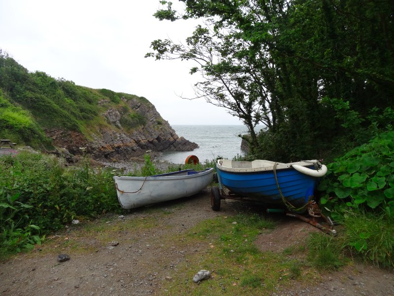
 It is only as I start to climb the steps out of Stackpole Quay that I see the quay itself, nestling under the southern cliff side, a small breakwater making space for at most half a dozen small fishing boats, although just one sits there today.
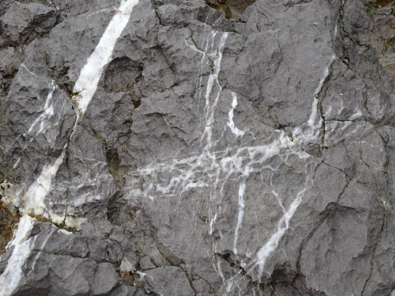
Beyond Stackpole Quay is another small sandy bay, and then beyond that again a rocky cove which on one side has the grey limestone (I think) that characterised the flat, grassy-topped cliffs of the CastleMartin firing range, but on its northern side is old red sandstone, with smoother edged, rounded cliffs that I am expecting to be more ‘textured’ (read up and down a lot in little valleys). I wonder if the flat table-like grassland both on the cliffs to the south and far inland is simply the flat strata of the tough limestone, or whether it is an old sea level. There is still the odd sea stack in the red sandstone to the north, but instead of the needle-sharp or vertical pillars of the limestone, these are thin, flat-topped, sheet-like structures, as if they were fancy biscuits in the ice cream of a posh restaurant.
The ground does ascend slowly but steadily as the sandstone cliffs are higher than their limestone neighbours, but only undulates gently as, with one exception, the path manages to skirt the heads of valleys and depressions rather than cut straight across them.
 The wind has picked up, partly, I guess, with height, but partly a sign of changing weather, and the overcast day turns to the forecast drizzle. I had been trying to decide whether to end the day at Freshwater East, or go on to Manorbier, but the weather is deciding it, the visibility is reducing and even the approaching beach and houses of Freshwater East are soft focused by the drizzle haze. At least the approach into Freshwater East is easy, the path looking as if it has freshly had that little bulldozer come down it, wide flat earth path, with still fresh, crumbled rock along its sides.
I know there is a beach café, so I think that maybe if I go there for a cup of tea, the weather may clear while I drink it. However, the café, part of a ‘holiday village’ or Alpine-lodge-like apartments, is clearly still operating on ‘winter times’ as it is only open for Friday and Saturday evenings and Sunday lunch. This does not help with my increasingly negative feelings about the place. These are totally unfair: the campsite was understandably closed, late arrivals disturb others (although many sites do have a late-arrivals area: life is not always neatly finished at 8pm for campers); the bus actually did stop at the bottom of the hill, I needn’t have run up it; the café probably does not do much business on weekdays until the school holidays start (there are only two other cars in the beach car park); and certainly it cannot help the drizzle. However, thus are impressions formed and it remains a dismal place for me.
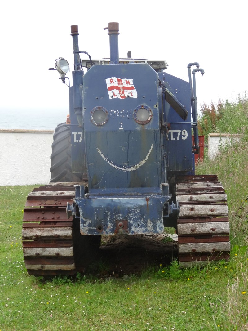 To be fair, Freshwater East did have one positive feature. As I came down the path towards the bay, I passed an RNLI caterpillar-tracked tractor, with a smile painted on front, just like Thomas the Tank Engine, or the characters in ‘Tootles the Taxi‘, one of my favourite Ladybird books when I was little.
Really enjoyed reading this and it has inspired me to try that walk next time we stay at Trewent cottage at Freshwater east.
At least i onow i will get a cuppa at the end of it.